SlideShare une entreprise Scribd logo
1  sur  35
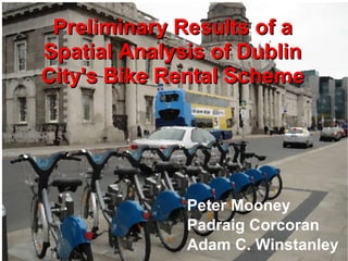
Preliminary Results of a Spatial Analysis of Dublin City's Bike Rental Scheme Peter Mooney Padraig Corcoran Adam C. Winstanley
Contact Details [email_address] [email_address]
DublinBikes (DB) is a recently  introduced (Sept, 2009) bike rental scheme for Dublin city, Ireland  Commercial company (JCDecaux) and city council partnership Approximately 50,000  subscribers Commercial company (JCDecaux) and city council partnership 95% of rentals are free - under 30 minutes
Project Motivation ,[object Object],[object Object],[object Object]
Ireland's First National Cycle Policy ,[object Object],[object Object],[object Object],[object Object]
Doherty (2009) reported on bike usage as a means of commuting Only 1.9% of workers commute by bike in Ireland Bike usage as a means of work transport down  33% since 1986 Poor continuity of cycle lanes and integration with other transportation systems
Other studies reveal more obvious reasons why cycling has become less popular as a mode of transport “ 16% of people said DISTANCE  was the biggest factor preventing them cycling to work” Keegan and Galbrait (2005) “ The streets are too dangerous” “ Cars use the bike lane” Keegan and Galbrait (2005) Irish Times (2007)
DB Terminals are clustered around the city center - approx 400 meter separation between stations
DublinBikes (DB) website shows current status of every terminal
By examining the DB javascript we found the web services providing terminal information
Yahoo Weather RSS are downloaded, parsed, and stored Each 30 minutes
Data capture is handled by a set of scheduled PHP scripts CRON Task 4 minute intervals All 40 Stations PHP GET HTTP Scrip t April 13 th  (2,078,366) rows
Data Constraints ,[object Object],[object Object]
OpenStreetMap contains all 40 DublinBike locations
We built a web application to monitor data capturing
Froehlich et al (2009) studied Barcelona's BICING system 390 STATIONS 6,000 BIKES 150,000 Subscribers Data Capture:  Web  Page Scraping
Froechlich et al (2009) reveal some interesting patterns about bike usage in Barcelona ,[object Object],[object Object],[object Object],"demonstrate the potential of using shared bikes as a data source to  gain insights into the city dynamics and aggregated human behaviour" "explore the relationship between spatiotemporal patterns of bike  usage and underlying city behaviour and geography"
Some DB stations are integrated with LUAS TRAM stops
Almost 95% of DB terminals are more than 400 meters from suburban train stations Marteens et al (2004) - “best integration of bikes – 400 meters from train stations”
Dublin's extensive bus network integrates well with DB terminals Currie (2009) – high service level bus stops
Including all modes – there is reasonably good integration North-west inner city DB terminals are somewhat isolated.
Analysis of checkout statistics for Weekdays and Weekends
Availability of bikes at the three busiest stations on the network
Looking at the periods of inactivity at a station gives an indication of how “busy” the terminal is  Mean number of minutes during weekdays where no checkout or  return occurs at this station
Normalised checkouts - weekdays
Normalised Checkouts - Weekends
Weekends vrs Weekday – busy station patterns City center cluster is always busy
Total number of bikes available in the network – September - April Christmas period No Data Daily – maximum usage
Usage patterns during the Dublin Marathon 2009 Spectators using Dublin Bikes to “follow” the race
Last Sunday..... “First day of Spring” Heavy demand on bikes in mid-afternoon – steady flow of return
“ Typical” Weekday Rush hour pattern – bikes out – and bike returns to other stations
Wettest November (2009) days on record  60 bikes MAX Little or no usage – until a massive rush for bikes in the late evening
We have loosely confirmed some behavioural patterns with the spatio-temporal data collected ,[object Object],[object Object],[object Object]
There are a number of issues for future Work Gain access to the trips database – model flows of  bike trips etc Prediction of Station Usage Integrate population models - see areas of the city where  large numbers of people are working/etc Compare with other similiar sized free bike rental schemes
Overall there are lots of patterns which could be investigated ,[object Object],[object Object],[object Object],Questions and Comments

Contenu connexe

Tendances

Chattanooga Passenger Rail Public Meeting 10/22/15
Chattanooga Passenger Rail Public Meeting 10/22/15  Chattanooga Passenger Rail Public Meeting 10/22/15
Chattanooga Passenger Rail Public Meeting 10/22/15 Tyler Yount
 
Chattanooga Passenger Rail Public Meeting 1/21/16
Chattanooga Passenger Rail Public Meeting 1/21/16Chattanooga Passenger Rail Public Meeting 1/21/16
Chattanooga Passenger Rail Public Meeting 1/21/16Tyler Yount
 
Challenging urban sprawl: public transit access point optimization
Challenging urban sprawl: public transit access point optimizationChallenging urban sprawl: public transit access point optimization
Challenging urban sprawl: public transit access point optimizationJoseph Chow
 
Building an evidence base (almost) from scratch: what to do when you don't ha...
Building an evidence base (almost) from scratch: what to do when you don't ha...Building an evidence base (almost) from scratch: what to do when you don't ha...
Building an evidence base (almost) from scratch: what to do when you don't ha...Institute for Transport Studies (ITS)
 
TransLoc + GoTriangle Smart Cities Summit 2016
TransLoc + GoTriangle Smart Cities Summit 2016TransLoc + GoTriangle Smart Cities Summit 2016
TransLoc + GoTriangle Smart Cities Summit 2016TransLoc
 
Delivering a quality rapid transit system in a challenging environment
Delivering a quality rapid transit system in a challenging environmentDelivering a quality rapid transit system in a challenging environment
Delivering a quality rapid transit system in a challenging environmentInstitute for Transport Studies (ITS)
 
The Land Use and Transport Relationship in Peripheral Areas: Policy Integrati...
The Land Use and Transport Relationship in Peripheral Areas: Policy Integrati...The Land Use and Transport Relationship in Peripheral Areas: Policy Integrati...
The Land Use and Transport Relationship in Peripheral Areas: Policy Integrati...Henar Salas-Olmedo
 
Vision plan spur 11.30 presentation - hires
Vision plan   spur 11.30 presentation - hiresVision plan   spur 11.30 presentation - hires
Vision plan spur 11.30 presentation - hiresAdina Levin
 
An independent view of transport
An independent view of transportAn independent view of transport
An independent view of transportSKM Colin Buchanan
 
Real time path planning based on hybrid-vanet-enhanced transportation system
Real time path planning based on hybrid-vanet-enhanced transportation systemReal time path planning based on hybrid-vanet-enhanced transportation system
Real time path planning based on hybrid-vanet-enhanced transportation systemShakas Technologies
 
Workshop Innovation in Africa - BRT, Minibus System and Innovation in African...
Workshop Innovation in Africa - BRT, Minibus System and Innovation in African...Workshop Innovation in Africa - BRT, Minibus System and Innovation in African...
Workshop Innovation in Africa - BRT, Minibus System and Innovation in African...BRTCoE
 
China’s brt development in the last decade
China’s brt development in the last decadeChina’s brt development in the last decade
China’s brt development in the last decadeBRTCoE
 
NLTP slides
NLTP slidesNLTP slides
NLTP slidesErnst Z
 
20_Alvarez_Masroor_Sharma
20_Alvarez_Masroor_Sharma20_Alvarez_Masroor_Sharma
20_Alvarez_Masroor_SharmaEmad Masroor
 

Tendances (20)

Miami DDA Board SMART Plan Update presentation
Miami DDA Board SMART Plan Update presentationMiami DDA Board SMART Plan Update presentation
Miami DDA Board SMART Plan Update presentation
 
Greater Miami Chamber of Commerce SMART Plan update presentation.
Greater Miami Chamber of Commerce SMART Plan update presentation.Greater Miami Chamber of Commerce SMART Plan update presentation.
Greater Miami Chamber of Commerce SMART Plan update presentation.
 
Chattanooga Passenger Rail Public Meeting 10/22/15
Chattanooga Passenger Rail Public Meeting 10/22/15  Chattanooga Passenger Rail Public Meeting 10/22/15
Chattanooga Passenger Rail Public Meeting 10/22/15
 
Chattanooga Passenger Rail Public Meeting 1/21/16
Chattanooga Passenger Rail Public Meeting 1/21/16Chattanooga Passenger Rail Public Meeting 1/21/16
Chattanooga Passenger Rail Public Meeting 1/21/16
 
Challenging urban sprawl: public transit access point optimization
Challenging urban sprawl: public transit access point optimizationChallenging urban sprawl: public transit access point optimization
Challenging urban sprawl: public transit access point optimization
 
Building an evidence base (almost) from scratch: what to do when you don't ha...
Building an evidence base (almost) from scratch: what to do when you don't ha...Building an evidence base (almost) from scratch: what to do when you don't ha...
Building an evidence base (almost) from scratch: what to do when you don't ha...
 
TransLoc + GoTriangle Smart Cities Summit 2016
TransLoc + GoTriangle Smart Cities Summit 2016TransLoc + GoTriangle Smart Cities Summit 2016
TransLoc + GoTriangle Smart Cities Summit 2016
 
Delivering a quality rapid transit system in a challenging environment
Delivering a quality rapid transit system in a challenging environmentDelivering a quality rapid transit system in a challenging environment
Delivering a quality rapid transit system in a challenging environment
 
The Land Use and Transport Relationship in Peripheral Areas: Policy Integrati...
The Land Use and Transport Relationship in Peripheral Areas: Policy Integrati...The Land Use and Transport Relationship in Peripheral Areas: Policy Integrati...
The Land Use and Transport Relationship in Peripheral Areas: Policy Integrati...
 
Vision plan spur 11.30 presentation - hires
Vision plan   spur 11.30 presentation - hiresVision plan   spur 11.30 presentation - hires
Vision plan spur 11.30 presentation - hires
 
ASPA 2017 Best Practices Conference presentation
ASPA 2017 Best Practices Conference presentationASPA 2017 Best Practices Conference presentation
ASPA 2017 Best Practices Conference presentation
 
An independent view of transport
An independent view of transportAn independent view of transport
An independent view of transport
 
Bus Karo: Developing Supporting Ecosystems (Session VII)
Bus Karo: Developing Supporting Ecosystems (Session VII)Bus Karo: Developing Supporting Ecosystems (Session VII)
Bus Karo: Developing Supporting Ecosystems (Session VII)
 
Real time path planning based on hybrid-vanet-enhanced transportation system
Real time path planning based on hybrid-vanet-enhanced transportation systemReal time path planning based on hybrid-vanet-enhanced transportation system
Real time path planning based on hybrid-vanet-enhanced transportation system
 
Workshop Innovation in Africa - BRT, Minibus System and Innovation in African...
Workshop Innovation in Africa - BRT, Minibus System and Innovation in African...Workshop Innovation in Africa - BRT, Minibus System and Innovation in African...
Workshop Innovation in Africa - BRT, Minibus System and Innovation in African...
 
China’s brt development in the last decade
China’s brt development in the last decadeChina’s brt development in the last decade
China’s brt development in the last decade
 
NLTP slides
NLTP slidesNLTP slides
NLTP slides
 
Impacts of Urban Congestion in Supply Chains
Impacts of Urban Congestion in Supply ChainsImpacts of Urban Congestion in Supply Chains
Impacts of Urban Congestion in Supply Chains
 
Masters Dissertation Posters 2016
Masters Dissertation Posters 2016Masters Dissertation Posters 2016
Masters Dissertation Posters 2016
 
20_Alvarez_Masroor_Sharma
20_Alvarez_Masroor_Sharma20_Alvarez_Masroor_Sharma
20_Alvarez_Masroor_Sharma
 

En vedette

Comprehensive Bicycle Plan for Pune
Comprehensive Bicycle Plan for PuneComprehensive Bicycle Plan for Pune
Comprehensive Bicycle Plan for PuneRanjit Gadgil
 
2010 Cycling Australia Annual Report
2010 Cycling Australia Annual Report2010 Cycling Australia Annual Report
2010 Cycling Australia Annual Reportcyclingaust
 
Cyclothon presentation
Cyclothon presentationCyclothon presentation
Cyclothon presentationBrajesh Sharma
 
Public Bicycle Scheme - Proposal for Pune
Public Bicycle Scheme - Proposal for PunePublic Bicycle Scheme - Proposal for Pune
Public Bicycle Scheme - Proposal for PuneRanjit Gadgil
 
Parkiteer - Secure bicycle access at Public Transport nodes
Parkiteer - Secure bicycle access at Public Transport nodesParkiteer - Secure bicycle access at Public Transport nodes
Parkiteer - Secure bicycle access at Public Transport nodesScott Martin, CMILT
 
GreenBIKE - Cycle Sharing Concept in India
GreenBIKE - Cycle Sharing Concept in IndiaGreenBIKE - Cycle Sharing Concept in India
GreenBIKE - Cycle Sharing Concept in IndiaJaspal Singh
 

En vedette (7)

Comprehensive Bicycle Plan for Pune
Comprehensive Bicycle Plan for PuneComprehensive Bicycle Plan for Pune
Comprehensive Bicycle Plan for Pune
 
Cycle chalao presentation
Cycle chalao presentationCycle chalao presentation
Cycle chalao presentation
 
2010 Cycling Australia Annual Report
2010 Cycling Australia Annual Report2010 Cycling Australia Annual Report
2010 Cycling Australia Annual Report
 
Cyclothon presentation
Cyclothon presentationCyclothon presentation
Cyclothon presentation
 
Public Bicycle Scheme - Proposal for Pune
Public Bicycle Scheme - Proposal for PunePublic Bicycle Scheme - Proposal for Pune
Public Bicycle Scheme - Proposal for Pune
 
Parkiteer - Secure bicycle access at Public Transport nodes
Parkiteer - Secure bicycle access at Public Transport nodesParkiteer - Secure bicycle access at Public Transport nodes
Parkiteer - Secure bicycle access at Public Transport nodes
 
GreenBIKE - Cycle Sharing Concept in India
GreenBIKE - Cycle Sharing Concept in IndiaGreenBIKE - Cycle Sharing Concept in India
GreenBIKE - Cycle Sharing Concept in India
 

Similaire à 7A_2_Preliminary results of a spatial analysis of dublin citys bike rental scheme

Using ArcGIS to Propose an On-Street Bicycle Network
Using ArcGIS to Propose an On-Street Bicycle NetworkUsing ArcGIS to Propose an On-Street Bicycle Network
Using ArcGIS to Propose an On-Street Bicycle NetworkBryan Townley
 
Developing a Regional Bike Sharing Program
Developing a Regional Bike Sharing ProgramDeveloping a Regional Bike Sharing Program
Developing a Regional Bike Sharing ProgramHarvard Campus Services
 
Bikes on Buses - Rollout Auckland 17 March
Bikes on Buses -  Rollout Auckland 17 MarchBikes on Buses -  Rollout Auckland 17 March
Bikes on Buses - Rollout Auckland 17 MarchJonathan Slason
 
Smart remoteness and world-class non-motorised transport in Alice Springs
Smart remoteness and world-class non-motorised transport in Alice SpringsSmart remoteness and world-class non-motorised transport in Alice Springs
Smart remoteness and world-class non-motorised transport in Alice SpringsNinti_One
 
CycleStreets: Our Story - presentation to Net2Camb event
CycleStreets: Our Story - presentation to Net2Camb eventCycleStreets: Our Story - presentation to Net2Camb event
CycleStreets: Our Story - presentation to Net2Camb eventCycleStreets
 
Data Driven Tranportation Analytics
Data Driven Tranportation Analytics Data Driven Tranportation Analytics
Data Driven Tranportation Analytics Dublinked .
 
GI-Forum 2014: Assessing bicycle safety in road networks
GI-Forum 2014: Assessing bicycle safety in road networksGI-Forum 2014: Assessing bicycle safety in road networks
GI-Forum 2014: Assessing bicycle safety in road networksMartin L
 
Big data week l'impact du big data sur l'intelligence urbaine ibm research ...
Big data week   l'impact du big data sur l'intelligence urbaine ibm research ...Big data week   l'impact du big data sur l'intelligence urbaine ibm research ...
Big data week l'impact du big data sur l'intelligence urbaine ibm research ...Julie Roger
 
Visualising Bike Share (#geomob 21 October 2010)
Visualising Bike Share (#geomob 21 October 2010)Visualising Bike Share (#geomob 21 October 2010)
Visualising Bike Share (#geomob 21 October 2010)CASA, UCL
 
Data Science for Campus Accessibility - Addressing Access Barriers Caused by ...
Data Science for Campus Accessibility - Addressing Access Barriers Caused by ...Data Science for Campus Accessibility - Addressing Access Barriers Caused by ...
Data Science for Campus Accessibility - Addressing Access Barriers Caused by ...Lily Zimmerman
 
ATS14- Transit and active transportation- Jeff Owen
ATS14- Transit and active transportation- Jeff OwenATS14- Transit and active transportation- Jeff Owen
ATS14- Transit and active transportation- Jeff OwenBTAOregon
 
CycleStreets: Past, present and future
CycleStreets: Past, present and futureCycleStreets: Past, present and future
CycleStreets: Past, present and futureCycleStreets
 
Bike sharing published papers
Bike sharing published papersBike sharing published papers
Bike sharing published papersSuraj Sawant
 
Capital Bikeshare Presentation
Capital Bikeshare PresentationCapital Bikeshare Presentation
Capital Bikeshare Presentationdonahuerm
 
CHOReVOLUTION WP4 UTC Use case
CHOReVOLUTION WP4 UTC Use caseCHOReVOLUTION WP4 UTC Use case
CHOReVOLUTION WP4 UTC Use caseCHOReVOLUTION
 
201113 Hyeshin Chu
201113 Hyeshin Chu201113 Hyeshin Chu
201113 Hyeshin Chuivaderivader
 
SimCap Louisiana Educational Meeting #1 Slides
SimCap Louisiana Educational Meeting #1 SlidesSimCap Louisiana Educational Meeting #1 Slides
SimCap Louisiana Educational Meeting #1 SlidesChristopher Melson
 

Similaire à 7A_2_Preliminary results of a spatial analysis of dublin citys bike rental scheme (20)

Using ArcGIS to Propose an On-Street Bicycle Network
Using ArcGIS to Propose an On-Street Bicycle NetworkUsing ArcGIS to Propose an On-Street Bicycle Network
Using ArcGIS to Propose an On-Street Bicycle Network
 
Developing a Regional Bike Sharing Program
Developing a Regional Bike Sharing ProgramDeveloping a Regional Bike Sharing Program
Developing a Regional Bike Sharing Program
 
Bikes on Buses - Rollout Auckland 17 March
Bikes on Buses -  Rollout Auckland 17 MarchBikes on Buses -  Rollout Auckland 17 March
Bikes on Buses - Rollout Auckland 17 March
 
Smart remoteness and world-class non-motorised transport in Alice Springs
Smart remoteness and world-class non-motorised transport in Alice SpringsSmart remoteness and world-class non-motorised transport in Alice Springs
Smart remoteness and world-class non-motorised transport in Alice Springs
 
CycleStreets: Our Story - presentation to Net2Camb event
CycleStreets: Our Story - presentation to Net2Camb eventCycleStreets: Our Story - presentation to Net2Camb event
CycleStreets: Our Story - presentation to Net2Camb event
 
Data Driven Tranportation Analytics
Data Driven Tranportation Analytics Data Driven Tranportation Analytics
Data Driven Tranportation Analytics
 
GI-Forum 2014: Assessing bicycle safety in road networks
GI-Forum 2014: Assessing bicycle safety in road networksGI-Forum 2014: Assessing bicycle safety in road networks
GI-Forum 2014: Assessing bicycle safety in road networks
 
New Tools for Estimating Walking and Bicycling Demand
New Tools for Estimating Walking and Bicycling DemandNew Tools for Estimating Walking and Bicycling Demand
New Tools for Estimating Walking and Bicycling Demand
 
Maximizing Biking and Walking Access to Transit
Maximizing Biking and Walking Access to TransitMaximizing Biking and Walking Access to Transit
Maximizing Biking and Walking Access to Transit
 
Big data week l'impact du big data sur l'intelligence urbaine ibm research ...
Big data week   l'impact du big data sur l'intelligence urbaine ibm research ...Big data week   l'impact du big data sur l'intelligence urbaine ibm research ...
Big data week l'impact du big data sur l'intelligence urbaine ibm research ...
 
Visualising Bike Share (#geomob 21 October 2010)
Visualising Bike Share (#geomob 21 October 2010)Visualising Bike Share (#geomob 21 October 2010)
Visualising Bike Share (#geomob 21 October 2010)
 
Data Science for Campus Accessibility - Addressing Access Barriers Caused by ...
Data Science for Campus Accessibility - Addressing Access Barriers Caused by ...Data Science for Campus Accessibility - Addressing Access Barriers Caused by ...
Data Science for Campus Accessibility - Addressing Access Barriers Caused by ...
 
ATS14- Transit and active transportation- Jeff Owen
ATS14- Transit and active transportation- Jeff OwenATS14- Transit and active transportation- Jeff Owen
ATS14- Transit and active transportation- Jeff Owen
 
CycleStreets: Past, present and future
CycleStreets: Past, present and futureCycleStreets: Past, present and future
CycleStreets: Past, present and future
 
Taking Pedestrian and Bicycle Counting Programs to the Next Level
Taking Pedestrian and Bicycle Counting Programs to the Next Level Taking Pedestrian and Bicycle Counting Programs to the Next Level
Taking Pedestrian and Bicycle Counting Programs to the Next Level
 
Bike sharing published papers
Bike sharing published papersBike sharing published papers
Bike sharing published papers
 
Capital Bikeshare Presentation
Capital Bikeshare PresentationCapital Bikeshare Presentation
Capital Bikeshare Presentation
 
CHOReVOLUTION WP4 UTC Use case
CHOReVOLUTION WP4 UTC Use caseCHOReVOLUTION WP4 UTC Use case
CHOReVOLUTION WP4 UTC Use case
 
201113 Hyeshin Chu
201113 Hyeshin Chu201113 Hyeshin Chu
201113 Hyeshin Chu
 
SimCap Louisiana Educational Meeting #1 Slides
SimCap Louisiana Educational Meeting #1 SlidesSimCap Louisiana Educational Meeting #1 Slides
SimCap Louisiana Educational Meeting #1 Slides
 

Plus de GISRUK conference

7B_3_Matterhorn on the horizon
7B_3_Matterhorn on the horizon7B_3_Matterhorn on the horizon
7B_3_Matterhorn on the horizonGISRUK conference
 
7B_2_Topological consistent generalization of openstreetmap
7B_2_Topological consistent generalization of openstreetmap7B_2_Topological consistent generalization of openstreetmap
7B_2_Topological consistent generalization of openstreetmapGISRUK conference
 
7A_4_Gps data collection setting for pedestrian activity modelling
7A_4_Gps data collection setting for pedestrian activity modelling7A_4_Gps data collection setting for pedestrian activity modelling
7A_4_Gps data collection setting for pedestrian activity modellingGISRUK conference
 
5A_3_GIS based spatial modelling for improving the sustainability of aggregat...
5A_3_GIS based spatial modelling for improving the sustainability of aggregat...5A_3_GIS based spatial modelling for improving the sustainability of aggregat...
5A_3_GIS based spatial modelling for improving the sustainability of aggregat...GISRUK conference
 
5A_1_Land evaluation techniques comparing fuzzy ahp with ideal point methods
5A_1_Land evaluation techniques comparing fuzzy ahp with ideal point methods5A_1_Land evaluation techniques comparing fuzzy ahp with ideal point methods
5A_1_Land evaluation techniques comparing fuzzy ahp with ideal point methodsGISRUK conference
 
4B_3_Automatically generating keywods for georeferenced imaged
4B_3_Automatically generating keywods for georeferenced imaged4B_3_Automatically generating keywods for georeferenced imaged
4B_3_Automatically generating keywods for georeferenced imagedGISRUK conference
 
4B_1_How many volunteers does it take to map an area well
4B_1_How many volunteers does it take to map an area well4B_1_How many volunteers does it take to map an area well
4B_1_How many volunteers does it take to map an area wellGISRUK conference
 
4A_1_Uncertainty in the 2001 output area classification for the census of eng...
4A_1_Uncertainty in the 2001 output area classification for the census of eng...4A_1_Uncertainty in the 2001 output area classification for the census of eng...
4A_1_Uncertainty in the 2001 output area classification for the census of eng...GISRUK conference
 
3A_4_Applying network analysis to quantify accessibility to urban greenspace ...
3A_4_Applying network analysis to quantify accessibility to urban greenspace ...3A_4_Applying network analysis to quantify accessibility to urban greenspace ...
3A_4_Applying network analysis to quantify accessibility to urban greenspace ...GISRUK conference
 
3A_2_Modelling health-harming behaviours in a socially ranked geographic space
3A_2_Modelling health-harming behaviours in a socially ranked geographic space3A_2_Modelling health-harming behaviours in a socially ranked geographic space
3A_2_Modelling health-harming behaviours in a socially ranked geographic spaceGISRUK conference
 
1A_3_A geodemographic classification of london primary schools
1A_3_A geodemographic classification of london primary schools1A_3_A geodemographic classification of london primary schools
1A_3_A geodemographic classification of london primary schoolsGISRUK conference
 
UK Map Challenge Aidan Slingsby
UK Map Challenge   Aidan SlingsbyUK Map Challenge   Aidan Slingsby
UK Map Challenge Aidan SlingsbyGISRUK conference
 
SP_4 Supporting spatial negotiations in land use planning
SP_4 Supporting spatial negotiations in land use planningSP_4 Supporting spatial negotiations in land use planning
SP_4 Supporting spatial negotiations in land use planningGISRUK conference
 
SP_3 Automatic identification of high streets and classification of urban lan...
SP_3 Automatic identification of high streets and classification of urban lan...SP_3 Automatic identification of high streets and classification of urban lan...
SP_3 Automatic identification of high streets and classification of urban lan...GISRUK conference
 
9B_1_Trust in web gis a preliminary investigation of the environment agencys ...
9B_1_Trust in web gis a preliminary investigation of the environment agencys ...9B_1_Trust in web gis a preliminary investigation of the environment agencys ...
9B_1_Trust in web gis a preliminary investigation of the environment agencys ...GISRUK conference
 
9A_2_Automatic classification of retail spaces from a large scale topographc ...
9A_2_Automatic classification of retail spaces from a large scale topographc ...9A_2_Automatic classification of retail spaces from a large scale topographc ...
9A_2_Automatic classification of retail spaces from a large scale topographc ...GISRUK conference
 
9A_1_On automatic mapping of environmental data using adaptive general regres...
9A_1_On automatic mapping of environmental data using adaptive general regres...9A_1_On automatic mapping of environmental data using adaptive general regres...
9A_1_On automatic mapping of environmental data using adaptive general regres...GISRUK conference
 
8B_4_Exploring the usability of geographic information
8B_4_Exploring the usability of geographic information8B_4_Exploring the usability of geographic information
8B_4_Exploring the usability of geographic informationGISRUK conference
 
8B_2_Using sound to represent uncertainty in address locations
8B_2_Using sound to represent uncertainty in address locations8B_2_Using sound to represent uncertainty in address locations
8B_2_Using sound to represent uncertainty in address locationsGISRUK conference
 

Plus de GISRUK conference (20)

8A_1_To vote or not to vote
8A_1_To vote or not to vote8A_1_To vote or not to vote
8A_1_To vote or not to vote
 
7B_3_Matterhorn on the horizon
7B_3_Matterhorn on the horizon7B_3_Matterhorn on the horizon
7B_3_Matterhorn on the horizon
 
7B_2_Topological consistent generalization of openstreetmap
7B_2_Topological consistent generalization of openstreetmap7B_2_Topological consistent generalization of openstreetmap
7B_2_Topological consistent generalization of openstreetmap
 
7A_4_Gps data collection setting for pedestrian activity modelling
7A_4_Gps data collection setting for pedestrian activity modelling7A_4_Gps data collection setting for pedestrian activity modelling
7A_4_Gps data collection setting for pedestrian activity modelling
 
5A_3_GIS based spatial modelling for improving the sustainability of aggregat...
5A_3_GIS based spatial modelling for improving the sustainability of aggregat...5A_3_GIS based spatial modelling for improving the sustainability of aggregat...
5A_3_GIS based spatial modelling for improving the sustainability of aggregat...
 
5A_1_Land evaluation techniques comparing fuzzy ahp with ideal point methods
5A_1_Land evaluation techniques comparing fuzzy ahp with ideal point methods5A_1_Land evaluation techniques comparing fuzzy ahp with ideal point methods
5A_1_Land evaluation techniques comparing fuzzy ahp with ideal point methods
 
4B_3_Automatically generating keywods for georeferenced imaged
4B_3_Automatically generating keywods for georeferenced imaged4B_3_Automatically generating keywods for georeferenced imaged
4B_3_Automatically generating keywods for georeferenced imaged
 
4B_1_How many volunteers does it take to map an area well
4B_1_How many volunteers does it take to map an area well4B_1_How many volunteers does it take to map an area well
4B_1_How many volunteers does it take to map an area well
 
4A_1_Uncertainty in the 2001 output area classification for the census of eng...
4A_1_Uncertainty in the 2001 output area classification for the census of eng...4A_1_Uncertainty in the 2001 output area classification for the census of eng...
4A_1_Uncertainty in the 2001 output area classification for the census of eng...
 
3A_4_Applying network analysis to quantify accessibility to urban greenspace ...
3A_4_Applying network analysis to quantify accessibility to urban greenspace ...3A_4_Applying network analysis to quantify accessibility to urban greenspace ...
3A_4_Applying network analysis to quantify accessibility to urban greenspace ...
 
3A_2_Modelling health-harming behaviours in a socially ranked geographic space
3A_2_Modelling health-harming behaviours in a socially ranked geographic space3A_2_Modelling health-harming behaviours in a socially ranked geographic space
3A_2_Modelling health-harming behaviours in a socially ranked geographic space
 
1A_3_A geodemographic classification of london primary schools
1A_3_A geodemographic classification of london primary schools1A_3_A geodemographic classification of london primary schools
1A_3_A geodemographic classification of london primary schools
 
UK Map Challenge Aidan Slingsby
UK Map Challenge   Aidan SlingsbyUK Map Challenge   Aidan Slingsby
UK Map Challenge Aidan Slingsby
 
SP_4 Supporting spatial negotiations in land use planning
SP_4 Supporting spatial negotiations in land use planningSP_4 Supporting spatial negotiations in land use planning
SP_4 Supporting spatial negotiations in land use planning
 
SP_3 Automatic identification of high streets and classification of urban lan...
SP_3 Automatic identification of high streets and classification of urban lan...SP_3 Automatic identification of high streets and classification of urban lan...
SP_3 Automatic identification of high streets and classification of urban lan...
 
9B_1_Trust in web gis a preliminary investigation of the environment agencys ...
9B_1_Trust in web gis a preliminary investigation of the environment agencys ...9B_1_Trust in web gis a preliminary investigation of the environment agencys ...
9B_1_Trust in web gis a preliminary investigation of the environment agencys ...
 
9A_2_Automatic classification of retail spaces from a large scale topographc ...
9A_2_Automatic classification of retail spaces from a large scale topographc ...9A_2_Automatic classification of retail spaces from a large scale topographc ...
9A_2_Automatic classification of retail spaces from a large scale topographc ...
 
9A_1_On automatic mapping of environmental data using adaptive general regres...
9A_1_On automatic mapping of environmental data using adaptive general regres...9A_1_On automatic mapping of environmental data using adaptive general regres...
9A_1_On automatic mapping of environmental data using adaptive general regres...
 
8B_4_Exploring the usability of geographic information
8B_4_Exploring the usability of geographic information8B_4_Exploring the usability of geographic information
8B_4_Exploring the usability of geographic information
 
8B_2_Using sound to represent uncertainty in address locations
8B_2_Using sound to represent uncertainty in address locations8B_2_Using sound to represent uncertainty in address locations
8B_2_Using sound to represent uncertainty in address locations
 

7A_2_Preliminary results of a spatial analysis of dublin citys bike rental scheme

  • 1. Preliminary Results of a Spatial Analysis of Dublin City's Bike Rental Scheme Peter Mooney Padraig Corcoran Adam C. Winstanley
  • 3. DublinBikes (DB) is a recently introduced (Sept, 2009) bike rental scheme for Dublin city, Ireland Commercial company (JCDecaux) and city council partnership Approximately 50,000 subscribers Commercial company (JCDecaux) and city council partnership 95% of rentals are free - under 30 minutes
  • 4.
  • 5.
  • 6. Doherty (2009) reported on bike usage as a means of commuting Only 1.9% of workers commute by bike in Ireland Bike usage as a means of work transport down 33% since 1986 Poor continuity of cycle lanes and integration with other transportation systems
  • 7. Other studies reveal more obvious reasons why cycling has become less popular as a mode of transport “ 16% of people said DISTANCE was the biggest factor preventing them cycling to work” Keegan and Galbrait (2005) “ The streets are too dangerous” “ Cars use the bike lane” Keegan and Galbrait (2005) Irish Times (2007)
  • 8. DB Terminals are clustered around the city center - approx 400 meter separation between stations
  • 9. DublinBikes (DB) website shows current status of every terminal
  • 10. By examining the DB javascript we found the web services providing terminal information
  • 11. Yahoo Weather RSS are downloaded, parsed, and stored Each 30 minutes
  • 12. Data capture is handled by a set of scheduled PHP scripts CRON Task 4 minute intervals All 40 Stations PHP GET HTTP Scrip t April 13 th (2,078,366) rows
  • 13.
  • 14. OpenStreetMap contains all 40 DublinBike locations
  • 15. We built a web application to monitor data capturing
  • 16. Froehlich et al (2009) studied Barcelona's BICING system 390 STATIONS 6,000 BIKES 150,000 Subscribers Data Capture: Web Page Scraping
  • 17.
  • 18. Some DB stations are integrated with LUAS TRAM stops
  • 19. Almost 95% of DB terminals are more than 400 meters from suburban train stations Marteens et al (2004) - “best integration of bikes – 400 meters from train stations”
  • 20. Dublin's extensive bus network integrates well with DB terminals Currie (2009) – high service level bus stops
  • 21. Including all modes – there is reasonably good integration North-west inner city DB terminals are somewhat isolated.
  • 22. Analysis of checkout statistics for Weekdays and Weekends
  • 23. Availability of bikes at the three busiest stations on the network
  • 24. Looking at the periods of inactivity at a station gives an indication of how “busy” the terminal is Mean number of minutes during weekdays where no checkout or return occurs at this station
  • 27. Weekends vrs Weekday – busy station patterns City center cluster is always busy
  • 28. Total number of bikes available in the network – September - April Christmas period No Data Daily – maximum usage
  • 29. Usage patterns during the Dublin Marathon 2009 Spectators using Dublin Bikes to “follow” the race
  • 30. Last Sunday..... “First day of Spring” Heavy demand on bikes in mid-afternoon – steady flow of return
  • 31. “ Typical” Weekday Rush hour pattern – bikes out – and bike returns to other stations
  • 32. Wettest November (2009) days on record 60 bikes MAX Little or no usage – until a massive rush for bikes in the late evening
  • 33.
  • 34. There are a number of issues for future Work Gain access to the trips database – model flows of bike trips etc Prediction of Station Usage Integrate population models - see areas of the city where large numbers of people are working/etc Compare with other similiar sized free bike rental schemes
  • 35.