SlideShare une entreprise Scribd logo
1  sur  25
DigitalBeamformingSynthetic ApertureRadar For Biomass Estimation Rafael F. Rincon, Guoqing Sun,                               TemilolaFatoyinbo, Jon Ranson and Paul Montesano  NASA/Goddard Space Flight Center, Greenbelt, MD 20771, USA rafael.rincon@nasa.gov Phone: (301) 614-5725.  Fax: (301) 286-1810  July  26,  2010
Outline ,[object Object]
 The DBSAR Concept
 System Architecture
 Operational Modes
 Biomass Retrieval Efforts
Concluding Remarks,[object Object]
The amount of carbon in above ground vegetation, especially forests, is poorly understood because of the difficulty in acquiring sufficient on-ground measurements of biomass across the diversity of vegetated ecosystems. 
Improved remote sensing measurement methodologies are required to understand the relationships between the biosphere and atmosphere with respect to greenhouse gases and close the current deficiencies in modeling the Earth’s carbon budget.,[object Object]
DBSAR combines digital beamforming, reconfigurable waveform generation,  and real-time processing in order to enable multi-mode radar techniques not possible with conventional SARs.
DBSAR's highly innovative architecture provide the means to implement and demonstrate advanced SAR techniques that can provide the needed data for biomass studies.
Work is currently underway at GSFC to implement robust SAR image formation algorithms for the processing of the DBSAR data in order to retrieve key biomass parameters,[object Object]
Transmit modules feature digital phase steering and amplitude taper
Phased array antenna has 64 active microstrip patch elements
DBSAR was designed for operation on board of the NASA P3 aircraft Waveform  Generator / Digital Beamformer Processor A/D A/D A/D A/D A/D A/D A/D A/D REU T/R T/R  T/R T/R T/R T/R T/R T/R Antenna
System Architecture The Real-time Processor ,[object Object]
 Custom design
 Three Stratix II FPGAs
 Eight A/D converters
 Six SRAMs
 ARM microcontroller
 1-Gb Ethernet interface
Size (cm): 17 x 24 x 4
Power: 94 W maxMixed signal board Digital signal board
System Architecture Main Parameters  R A D A R A N T E N N A M  I S C DBSAR Calibration in Anechoic Chamber

Contenu connexe

Tendances

Current & Future Spaceborne Sar Systems
Current & Future Spaceborne Sar SystemsCurrent & Future Spaceborne Sar Systems
Current & Future Spaceborne Sar Systemsgpetrie
 
TU2.L09 - POTENTIALS OF A COMPACT POLARIMETRIC SAR SYSTEM
TU2.L09 - POTENTIALS OF A COMPACT POLARIMETRIC SAR SYSTEMTU2.L09 - POTENTIALS OF A COMPACT POLARIMETRIC SAR SYSTEM
TU2.L09 - POTENTIALS OF A COMPACT POLARIMETRIC SAR SYSTEMgrssieee
 
Underground utility detection
Underground utility detectionUnderground utility detection
Underground utility detectionptsbsurveyor
 
WE3.L10.3: THE FUTURE OF SPACEBORNE SYNTHETIC APERTURE RADAR
WE3.L10.3: THE FUTURE OF SPACEBORNE SYNTHETIC APERTURE RADARWE3.L10.3: THE FUTURE OF SPACEBORNE SYNTHETIC APERTURE RADAR
WE3.L10.3: THE FUTURE OF SPACEBORNE SYNTHETIC APERTURE RADARgrssieee
 
TH1.L09 - ACCURATE FOCUSING OF SINGLE-PASS AIRBORNE INSAR DATA AT L-BAND
TH1.L09 - ACCURATE FOCUSING OF SINGLE-PASS AIRBORNE INSAR DATA AT L-BANDTH1.L09 - ACCURATE FOCUSING OF SINGLE-PASS AIRBORNE INSAR DATA AT L-BAND
TH1.L09 - ACCURATE FOCUSING OF SINGLE-PASS AIRBORNE INSAR DATA AT L-BANDgrssieee
 
Modern Land Recording- Systems
Modern Land Recording- SystemsModern Land Recording- Systems
Modern Land Recording- SystemsAli Osman Öncel
 
A REVIEW ON SYNTHETIC APERTURE RADAR
A REVIEW ON SYNTHETIC APERTURE RADARA REVIEW ON SYNTHETIC APERTURE RADAR
A REVIEW ON SYNTHETIC APERTURE RADARAM Publications
 
Introduction to sar-marjolaine_rouault
Introduction to sar-marjolaine_rouaultIntroduction to sar-marjolaine_rouault
Introduction to sar-marjolaine_rouaultNaivedya Mishra
 
Presentation on the background theory of InSAR
Presentation on the background theory of InSARPresentation on the background theory of InSAR
Presentation on the background theory of InSARSERC at Carleton College
 
Synthetic aperture radar
Synthetic aperture radarSynthetic aperture radar
Synthetic aperture radarMahesh pawar
 
IGARSS11_takaku_dsm_report.ppt
IGARSS11_takaku_dsm_report.pptIGARSS11_takaku_dsm_report.ppt
IGARSS11_takaku_dsm_report.pptgrssieee
 
Utility Detection & Mapping
Utility Detection & MappingUtility Detection & Mapping
Utility Detection & MappingGiorgio Barsacchi
 
Solid State Phased Array Weather Radar
Solid State Phased Array Weather RadarSolid State Phased Array Weather Radar
Solid State Phased Array Weather RadarDavid Kane
 
GROUND PENETRATING RADAR(GPR) ppt
GROUND PENETRATING RADAR(GPR) ppt GROUND PENETRATING RADAR(GPR) ppt
GROUND PENETRATING RADAR(GPR) ppt Himanshu Yadav
 
SAR image interpretation
SAR image interpretationSAR image interpretation
SAR image interpretationElise Colin
 
Fujimura_Presen.ppt
Fujimura_Presen.pptFujimura_Presen.ppt
Fujimura_Presen.pptgrssieee
 
MO4.L09.3 - A NEW SAR SENSOR DESIGNED FOR MICRO-SATELLITES
MO4.L09.3 - A NEW SAR SENSOR DESIGNED FOR MICRO-SATELLITESMO4.L09.3 - A NEW SAR SENSOR DESIGNED FOR MICRO-SATELLITES
MO4.L09.3 - A NEW SAR SENSOR DESIGNED FOR MICRO-SATELLITESgrssieee
 
Application of Ground Penetrating Radar in Subsurface mapping
Application of Ground Penetrating Radar in Subsurface mapping Application of Ground Penetrating Radar in Subsurface mapping
Application of Ground Penetrating Radar in Subsurface mapping Dr. Rajesh P Barnwal
 
201107IGARSS_OHKI.pptx
201107IGARSS_OHKI.pptx201107IGARSS_OHKI.pptx
201107IGARSS_OHKI.pptxgrssieee
 

Tendances (20)

Current & Future Spaceborne Sar Systems
Current & Future Spaceborne Sar SystemsCurrent & Future Spaceborne Sar Systems
Current & Future Spaceborne Sar Systems
 
TU2.L09 - POTENTIALS OF A COMPACT POLARIMETRIC SAR SYSTEM
TU2.L09 - POTENTIALS OF A COMPACT POLARIMETRIC SAR SYSTEMTU2.L09 - POTENTIALS OF A COMPACT POLARIMETRIC SAR SYSTEM
TU2.L09 - POTENTIALS OF A COMPACT POLARIMETRIC SAR SYSTEM
 
Underground utility detection
Underground utility detectionUnderground utility detection
Underground utility detection
 
WE3.L10.3: THE FUTURE OF SPACEBORNE SYNTHETIC APERTURE RADAR
WE3.L10.3: THE FUTURE OF SPACEBORNE SYNTHETIC APERTURE RADARWE3.L10.3: THE FUTURE OF SPACEBORNE SYNTHETIC APERTURE RADAR
WE3.L10.3: THE FUTURE OF SPACEBORNE SYNTHETIC APERTURE RADAR
 
TH1.L09 - ACCURATE FOCUSING OF SINGLE-PASS AIRBORNE INSAR DATA AT L-BAND
TH1.L09 - ACCURATE FOCUSING OF SINGLE-PASS AIRBORNE INSAR DATA AT L-BANDTH1.L09 - ACCURATE FOCUSING OF SINGLE-PASS AIRBORNE INSAR DATA AT L-BAND
TH1.L09 - ACCURATE FOCUSING OF SINGLE-PASS AIRBORNE INSAR DATA AT L-BAND
 
Modern Land Recording- Systems
Modern Land Recording- SystemsModern Land Recording- Systems
Modern Land Recording- Systems
 
A REVIEW ON SYNTHETIC APERTURE RADAR
A REVIEW ON SYNTHETIC APERTURE RADARA REVIEW ON SYNTHETIC APERTURE RADAR
A REVIEW ON SYNTHETIC APERTURE RADAR
 
Gpr
GprGpr
Gpr
 
Introduction to sar-marjolaine_rouault
Introduction to sar-marjolaine_rouaultIntroduction to sar-marjolaine_rouault
Introduction to sar-marjolaine_rouault
 
Presentation on the background theory of InSAR
Presentation on the background theory of InSARPresentation on the background theory of InSAR
Presentation on the background theory of InSAR
 
Synthetic aperture radar
Synthetic aperture radarSynthetic aperture radar
Synthetic aperture radar
 
IGARSS11_takaku_dsm_report.ppt
IGARSS11_takaku_dsm_report.pptIGARSS11_takaku_dsm_report.ppt
IGARSS11_takaku_dsm_report.ppt
 
Utility Detection & Mapping
Utility Detection & MappingUtility Detection & Mapping
Utility Detection & Mapping
 
Solid State Phased Array Weather Radar
Solid State Phased Array Weather RadarSolid State Phased Array Weather Radar
Solid State Phased Array Weather Radar
 
GROUND PENETRATING RADAR(GPR) ppt
GROUND PENETRATING RADAR(GPR) ppt GROUND PENETRATING RADAR(GPR) ppt
GROUND PENETRATING RADAR(GPR) ppt
 
SAR image interpretation
SAR image interpretationSAR image interpretation
SAR image interpretation
 
Fujimura_Presen.ppt
Fujimura_Presen.pptFujimura_Presen.ppt
Fujimura_Presen.ppt
 
MO4.L09.3 - A NEW SAR SENSOR DESIGNED FOR MICRO-SATELLITES
MO4.L09.3 - A NEW SAR SENSOR DESIGNED FOR MICRO-SATELLITESMO4.L09.3 - A NEW SAR SENSOR DESIGNED FOR MICRO-SATELLITES
MO4.L09.3 - A NEW SAR SENSOR DESIGNED FOR MICRO-SATELLITES
 
Application of Ground Penetrating Radar in Subsurface mapping
Application of Ground Penetrating Radar in Subsurface mapping Application of Ground Penetrating Radar in Subsurface mapping
Application of Ground Penetrating Radar in Subsurface mapping
 
201107IGARSS_OHKI.pptx
201107IGARSS_OHKI.pptx201107IGARSS_OHKI.pptx
201107IGARSS_OHKI.pptx
 

En vedette

FR1.T03.2 Zou_IGARSS_2011.ppt
FR1.T03.2 Zou_IGARSS_2011.pptFR1.T03.2 Zou_IGARSS_2011.ppt
FR1.T03.2 Zou_IGARSS_2011.pptgrssieee
 
EcoSAR Technology IGARSS Presentation.pdf
EcoSAR Technology IGARSS Presentation.pdfEcoSAR Technology IGARSS Presentation.pdf
EcoSAR Technology IGARSS Presentation.pdfgrssieee
 
An example of 3D conductivity mapping using the TEMPEST airborne electromagne...
An example of 3D conductivity mapping using the TEMPEST airborne electromagne...An example of 3D conductivity mapping using the TEMPEST airborne electromagne...
An example of 3D conductivity mapping using the TEMPEST airborne electromagne...Richard Lane
 
3 water resource management a berg fugro
3 water resource management a berg fugro3 water resource management a berg fugro
3 water resource management a berg fugroInnovation Norway
 
Temporal decorrelation analysis at P-band over tropical forest.ppt
Temporal decorrelation analysis at P-band over tropical forest.pptTemporal decorrelation analysis at P-band over tropical forest.ppt
Temporal decorrelation analysis at P-band over tropical forest.pptgrssieee
 
Job Nijman Water Export Dag 26 juni 2009
Job Nijman Water Export Dag 26 juni 2009Job Nijman Water Export Dag 26 juni 2009
Job Nijman Water Export Dag 26 juni 2009NL EVD Internationaal
 
Active Water Wells Analysis
Active Water Wells AnalysisActive Water Wells Analysis
Active Water Wells AnalysisClayton Gordon
 
2013 Geospatial Data and Project Management Track, Risk Management in Geospat...
2013 Geospatial Data and Project Management Track, Risk Management in Geospat...2013 Geospatial Data and Project Management Track, Risk Management in Geospat...
2013 Geospatial Data and Project Management Track, Risk Management in Geospat...GIS in the Rockies
 
Lidar market Forecast 2014 - 2020
Lidar market Forecast 2014 - 2020Lidar market Forecast 2014 - 2020
Lidar market Forecast 2014 - 2020Amilybuston1
 
Scientific Knowledge from Geospatial Observations
Scientific Knowledge from Geospatial ObservationsScientific Knowledge from Geospatial Observations
Scientific Knowledge from Geospatial Observations George Percivall
 
Operational modes, systems project 2
Operational modes, systems project 2Operational modes, systems project 2
Operational modes, systems project 2Brian Kraft
 
LIDAR Market Size, Share, Global Trends, segmentation and Forecast, 2013 - 2020
LIDAR Market Size, Share, Global Trends, segmentation and Forecast, 2013 - 2020LIDAR Market Size, Share, Global Trends, segmentation and Forecast, 2013 - 2020
LIDAR Market Size, Share, Global Trends, segmentation and Forecast, 2013 - 2020Allied Market Research
 
XBRL Reporting: de nieuwe standaard
 XBRL Reporting: de nieuwe standaard XBRL Reporting: de nieuwe standaard
XBRL Reporting: de nieuwe standaardFinext
 
EPM Platform bij Fugro
EPM Platform bij FugroEPM Platform bij Fugro
EPM Platform bij FugroFinext
 
LAND SURVEYOR Resume 2013 legat
LAND SURVEYOR Resume 2013 legatLAND SURVEYOR Resume 2013 legat
LAND SURVEYOR Resume 2013 legatSylvain Legat
 

En vedette (20)

FR1.T03.2 Zou_IGARSS_2011.ppt
FR1.T03.2 Zou_IGARSS_2011.pptFR1.T03.2 Zou_IGARSS_2011.ppt
FR1.T03.2 Zou_IGARSS_2011.ppt
 
EcoSAR Technology IGARSS Presentation.pdf
EcoSAR Technology IGARSS Presentation.pdfEcoSAR Technology IGARSS Presentation.pdf
EcoSAR Technology IGARSS Presentation.pdf
 
An example of 3D conductivity mapping using the TEMPEST airborne electromagne...
An example of 3D conductivity mapping using the TEMPEST airborne electromagne...An example of 3D conductivity mapping using the TEMPEST airborne electromagne...
An example of 3D conductivity mapping using the TEMPEST airborne electromagne...
 
3 water resource management a berg fugro
3 water resource management a berg fugro3 water resource management a berg fugro
3 water resource management a berg fugro
 
Temporal decorrelation analysis at P-band over tropical forest.ppt
Temporal decorrelation analysis at P-band over tropical forest.pptTemporal decorrelation analysis at P-band over tropical forest.ppt
Temporal decorrelation analysis at P-band over tropical forest.ppt
 
Job Nijman Water Export Dag 26 juni 2009
Job Nijman Water Export Dag 26 juni 2009Job Nijman Water Export Dag 26 juni 2009
Job Nijman Water Export Dag 26 juni 2009
 
Salinity Mapping
Salinity MappingSalinity Mapping
Salinity Mapping
 
InsitePro
InsiteProInsitePro
InsitePro
 
Massachgusetts, USGS, and Fugro/Earthdata
Massachgusetts, USGS, and Fugro/EarthdataMassachgusetts, USGS, and Fugro/Earthdata
Massachgusetts, USGS, and Fugro/Earthdata
 
Layout3
Layout3Layout3
Layout3
 
Active Water Wells Analysis
Active Water Wells AnalysisActive Water Wells Analysis
Active Water Wells Analysis
 
2013 Geospatial Data and Project Management Track, Risk Management in Geospat...
2013 Geospatial Data and Project Management Track, Risk Management in Geospat...2013 Geospatial Data and Project Management Track, Risk Management in Geospat...
2013 Geospatial Data and Project Management Track, Risk Management in Geospat...
 
Lidar market Forecast 2014 - 2020
Lidar market Forecast 2014 - 2020Lidar market Forecast 2014 - 2020
Lidar market Forecast 2014 - 2020
 
Scientific Knowledge from Geospatial Observations
Scientific Knowledge from Geospatial ObservationsScientific Knowledge from Geospatial Observations
Scientific Knowledge from Geospatial Observations
 
Operational modes, systems project 2
Operational modes, systems project 2Operational modes, systems project 2
Operational modes, systems project 2
 
LIDAR Market Size, Share, Global Trends, segmentation and Forecast, 2013 - 2020
LIDAR Market Size, Share, Global Trends, segmentation and Forecast, 2013 - 2020LIDAR Market Size, Share, Global Trends, segmentation and Forecast, 2013 - 2020
LIDAR Market Size, Share, Global Trends, segmentation and Forecast, 2013 - 2020
 
XBRL Reporting: de nieuwe standaard
 XBRL Reporting: de nieuwe standaard XBRL Reporting: de nieuwe standaard
XBRL Reporting: de nieuwe standaard
 
GeoPro
GeoProGeoPro
GeoPro
 
EPM Platform bij Fugro
EPM Platform bij FugroEPM Platform bij Fugro
EPM Platform bij Fugro
 
LAND SURVEYOR Resume 2013 legat
LAND SURVEYOR Resume 2013 legatLAND SURVEYOR Resume 2013 legat
LAND SURVEYOR Resume 2013 legat
 

Similaire à Digital Beamforming SAR for Biomass Estimation

Lecture for landsat
Lecture for landsatLecture for landsat
Lecture for landsatGeoMedeelel
 
IGARSSAirSWOTv2.ppt
IGARSSAirSWOTv2.pptIGARSSAirSWOTv2.ppt
IGARSSAirSWOTv2.pptgrssieee
 
IGARSS11_Atmos_Suite_MIS_TH1_T07_5.pptx
IGARSS11_Atmos_Suite_MIS_TH1_T07_5.pptxIGARSS11_Atmos_Suite_MIS_TH1_T07_5.pptx
IGARSS11_Atmos_Suite_MIS_TH1_T07_5.pptxgrssieee
 
FR2.L09 - PROCESSING AND ANALYSIS OF AIRBORNE SYNTHETIC APERTURE RADAR IMAGER...
FR2.L09 - PROCESSING AND ANALYSIS OF AIRBORNE SYNTHETIC APERTURE RADAR IMAGER...FR2.L09 - PROCESSING AND ANALYSIS OF AIRBORNE SYNTHETIC APERTURE RADAR IMAGER...
FR2.L09 - PROCESSING AND ANALYSIS OF AIRBORNE SYNTHETIC APERTURE RADAR IMAGER...grssieee
 
Apres_DINSAR_IGARSS11.ppt
Apres_DINSAR_IGARSS11.pptApres_DINSAR_IGARSS11.ppt
Apres_DINSAR_IGARSS11.pptgrssieee
 
kellndorfer_WE3.T05.4.pptx
kellndorfer_WE3.T05.4.pptxkellndorfer_WE3.T05.4.pptx
kellndorfer_WE3.T05.4.pptxgrssieee
 
2_prats_IGARSS2011_distributed_imaging_v4.ppt
2_prats_IGARSS2011_distributed_imaging_v4.ppt2_prats_IGARSS2011_distributed_imaging_v4.ppt
2_prats_IGARSS2011_distributed_imaging_v4.pptgrssieee
 
2_3398_IGARS2011.pptx
2_3398_IGARS2011.pptx2_3398_IGARS2011.pptx
2_3398_IGARS2011.pptxgrssieee
 
Probing the Hurricane Boundary Layer using NOAA's Research Aircraft
Probing the Hurricane Boundary Layer using NOAA's Research AircraftProbing the Hurricane Boundary Layer using NOAA's Research Aircraft
Probing the Hurricane Boundary Layer using NOAA's Research AircraftJun Zhang
 
AT_MB_MM_IGARSS2011.ppt
AT_MB_MM_IGARSS2011.pptAT_MB_MM_IGARSS2011.ppt
AT_MB_MM_IGARSS2011.pptgrssieee
 
3178_IGARSS11.ppt
3178_IGARSS11.ppt3178_IGARSS11.ppt
3178_IGARSS11.pptgrssieee
 
IGARSS_DesDyni_ALOS_dft2.pptx
IGARSS_DesDyni_ALOS_dft2.pptxIGARSS_DesDyni_ALOS_dft2.pptx
IGARSS_DesDyni_ALOS_dft2.pptxgrssieee
 
2016 asprs track: overview and user perspective of usgs 3 dep lidar by john ...
2016 asprs track:  overview and user perspective of usgs 3 dep lidar by john ...2016 asprs track:  overview and user perspective of usgs 3 dep lidar by john ...
2016 asprs track: overview and user perspective of usgs 3 dep lidar by john ...GIS in the Rockies
 
TH3.L10.1: THE NASA SOIL MOISTURE ACTIVE PASSIVE (SMAP) MISSION: OVERVIEW
TH3.L10.1: THE NASA SOIL MOISTURE ACTIVE PASSIVE (SMAP) MISSION: OVERVIEWTH3.L10.1: THE NASA SOIL MOISTURE ACTIVE PASSIVE (SMAP) MISSION: OVERVIEW
TH3.L10.1: THE NASA SOIL MOISTURE ACTIVE PASSIVE (SMAP) MISSION: OVERVIEWgrssieee
 

Similaire à Digital Beamforming SAR for Biomass Estimation (20)

Lecture for landsat
Lecture for landsatLecture for landsat
Lecture for landsat
 
IGARSSAirSWOTv2.ppt
IGARSSAirSWOTv2.pptIGARSSAirSWOTv2.ppt
IGARSSAirSWOTv2.ppt
 
IGARSS11_Atmos_Suite_MIS_TH1_T07_5.pptx
IGARSS11_Atmos_Suite_MIS_TH1_T07_5.pptxIGARSS11_Atmos_Suite_MIS_TH1_T07_5.pptx
IGARSS11_Atmos_Suite_MIS_TH1_T07_5.pptx
 
FR2.L09 - PROCESSING AND ANALYSIS OF AIRBORNE SYNTHETIC APERTURE RADAR IMAGER...
FR2.L09 - PROCESSING AND ANALYSIS OF AIRBORNE SYNTHETIC APERTURE RADAR IMAGER...FR2.L09 - PROCESSING AND ANALYSIS OF AIRBORNE SYNTHETIC APERTURE RADAR IMAGER...
FR2.L09 - PROCESSING AND ANALYSIS OF AIRBORNE SYNTHETIC APERTURE RADAR IMAGER...
 
C011121114
C011121114C011121114
C011121114
 
Apres_DINSAR_IGARSS11.ppt
Apres_DINSAR_IGARSS11.pptApres_DINSAR_IGARSS11.ppt
Apres_DINSAR_IGARSS11.ppt
 
Als seminar
Als seminarAls seminar
Als seminar
 
Presentation: Fee & Brigley
Presentation: Fee & BrigleyPresentation: Fee & Brigley
Presentation: Fee & Brigley
 
kellndorfer_WE3.T05.4.pptx
kellndorfer_WE3.T05.4.pptxkellndorfer_WE3.T05.4.pptx
kellndorfer_WE3.T05.4.pptx
 
2_prats_IGARSS2011_distributed_imaging_v4.ppt
2_prats_IGARSS2011_distributed_imaging_v4.ppt2_prats_IGARSS2011_distributed_imaging_v4.ppt
2_prats_IGARSS2011_distributed_imaging_v4.ppt
 
2_3398_IGARS2011.pptx
2_3398_IGARS2011.pptx2_3398_IGARS2011.pptx
2_3398_IGARS2011.pptx
 
Probing the Hurricane Boundary Layer using NOAA's Research Aircraft
Probing the Hurricane Boundary Layer using NOAA's Research AircraftProbing the Hurricane Boundary Layer using NOAA's Research Aircraft
Probing the Hurricane Boundary Layer using NOAA's Research Aircraft
 
heavey_b6p1
heavey_b6p1heavey_b6p1
heavey_b6p1
 
AT_MB_MM_IGARSS2011.ppt
AT_MB_MM_IGARSS2011.pptAT_MB_MM_IGARSS2011.ppt
AT_MB_MM_IGARSS2011.ppt
 
Presentation karissa reischke
Presentation karissa reischkePresentation karissa reischke
Presentation karissa reischke
 
3178_IGARSS11.ppt
3178_IGARSS11.ppt3178_IGARSS11.ppt
3178_IGARSS11.ppt
 
IGARSS_DesDyni_ALOS_dft2.pptx
IGARSS_DesDyni_ALOS_dft2.pptxIGARSS_DesDyni_ALOS_dft2.pptx
IGARSS_DesDyni_ALOS_dft2.pptx
 
2016 asprs track: overview and user perspective of usgs 3 dep lidar by john ...
2016 asprs track:  overview and user perspective of usgs 3 dep lidar by john ...2016 asprs track:  overview and user perspective of usgs 3 dep lidar by john ...
2016 asprs track: overview and user perspective of usgs 3 dep lidar by john ...
 
radar-ppt
radar-pptradar-ppt
radar-ppt
 
TH3.L10.1: THE NASA SOIL MOISTURE ACTIVE PASSIVE (SMAP) MISSION: OVERVIEW
TH3.L10.1: THE NASA SOIL MOISTURE ACTIVE PASSIVE (SMAP) MISSION: OVERVIEWTH3.L10.1: THE NASA SOIL MOISTURE ACTIVE PASSIVE (SMAP) MISSION: OVERVIEW
TH3.L10.1: THE NASA SOIL MOISTURE ACTIVE PASSIVE (SMAP) MISSION: OVERVIEW
 

Plus de grssieee

Tangent height accuracy of Superconducting Submillimeter-Wave Limb-Emission S...
Tangent height accuracy of Superconducting Submillimeter-Wave Limb-Emission S...Tangent height accuracy of Superconducting Submillimeter-Wave Limb-Emission S...
Tangent height accuracy of Superconducting Submillimeter-Wave Limb-Emission S...grssieee
 
SEGMENTATION OF POLARIMETRIC SAR DATA WITH A MULTI-TEXTURE PRODUCT MODEL
SEGMENTATION OF POLARIMETRIC SAR DATA WITH A MULTI-TEXTURE PRODUCT MODELSEGMENTATION OF POLARIMETRIC SAR DATA WITH A MULTI-TEXTURE PRODUCT MODEL
SEGMENTATION OF POLARIMETRIC SAR DATA WITH A MULTI-TEXTURE PRODUCT MODELgrssieee
 
TWO-POINT STATISTIC OF POLARIMETRIC SAR DATA TWO-POINT STATISTIC OF POLARIMET...
TWO-POINT STATISTIC OF POLARIMETRIC SAR DATA TWO-POINT STATISTIC OF POLARIMET...TWO-POINT STATISTIC OF POLARIMETRIC SAR DATA TWO-POINT STATISTIC OF POLARIMET...
TWO-POINT STATISTIC OF POLARIMETRIC SAR DATA TWO-POINT STATISTIC OF POLARIMET...grssieee
 
THE SENTINEL-1 MISSION AND ITS APPLICATION CAPABILITIES
THE SENTINEL-1 MISSION AND ITS APPLICATION CAPABILITIESTHE SENTINEL-1 MISSION AND ITS APPLICATION CAPABILITIES
THE SENTINEL-1 MISSION AND ITS APPLICATION CAPABILITIESgrssieee
 
GMES SPACE COMPONENT:PROGRAMMATIC STATUS
GMES SPACE COMPONENT:PROGRAMMATIC STATUSGMES SPACE COMPONENT:PROGRAMMATIC STATUS
GMES SPACE COMPONENT:PROGRAMMATIC STATUSgrssieee
 
PROGRESSES OF DEVELOPMENT OF CFOSAT SCATTEROMETER
PROGRESSES OF DEVELOPMENT OF CFOSAT SCATTEROMETERPROGRESSES OF DEVELOPMENT OF CFOSAT SCATTEROMETER
PROGRESSES OF DEVELOPMENT OF CFOSAT SCATTEROMETERgrssieee
 
DEVELOPMENT OF ALGORITHMS AND PRODUCTS FOR SUPPORTING THE ITALIAN HYPERSPECTR...
DEVELOPMENT OF ALGORITHMS AND PRODUCTS FOR SUPPORTING THE ITALIAN HYPERSPECTR...DEVELOPMENT OF ALGORITHMS AND PRODUCTS FOR SUPPORTING THE ITALIAN HYPERSPECTR...
DEVELOPMENT OF ALGORITHMS AND PRODUCTS FOR SUPPORTING THE ITALIAN HYPERSPECTR...grssieee
 
EO-1/HYPERION: NEARING TWELVE YEARS OF SUCCESSFUL MISSION SCIENCE OPERATION A...
EO-1/HYPERION: NEARING TWELVE YEARS OF SUCCESSFUL MISSION SCIENCE OPERATION A...EO-1/HYPERION: NEARING TWELVE YEARS OF SUCCESSFUL MISSION SCIENCE OPERATION A...
EO-1/HYPERION: NEARING TWELVE YEARS OF SUCCESSFUL MISSION SCIENCE OPERATION A...grssieee
 
test 34mb wo animations
test  34mb wo animationstest  34mb wo animations
test 34mb wo animationsgrssieee
 
2011_Fox_Tax_Worksheets.pdf
2011_Fox_Tax_Worksheets.pdf2011_Fox_Tax_Worksheets.pdf
2011_Fox_Tax_Worksheets.pdfgrssieee
 
DLR open house
DLR open houseDLR open house
DLR open housegrssieee
 
DLR open house
DLR open houseDLR open house
DLR open housegrssieee
 
DLR open house
DLR open houseDLR open house
DLR open housegrssieee
 
Tana_IGARSS2011.ppt
Tana_IGARSS2011.pptTana_IGARSS2011.ppt
Tana_IGARSS2011.pptgrssieee
 
Solaro_IGARSS_2011.ppt
Solaro_IGARSS_2011.pptSolaro_IGARSS_2011.ppt
Solaro_IGARSS_2011.pptgrssieee
 

Plus de grssieee (20)

Tangent height accuracy of Superconducting Submillimeter-Wave Limb-Emission S...
Tangent height accuracy of Superconducting Submillimeter-Wave Limb-Emission S...Tangent height accuracy of Superconducting Submillimeter-Wave Limb-Emission S...
Tangent height accuracy of Superconducting Submillimeter-Wave Limb-Emission S...
 
SEGMENTATION OF POLARIMETRIC SAR DATA WITH A MULTI-TEXTURE PRODUCT MODEL
SEGMENTATION OF POLARIMETRIC SAR DATA WITH A MULTI-TEXTURE PRODUCT MODELSEGMENTATION OF POLARIMETRIC SAR DATA WITH A MULTI-TEXTURE PRODUCT MODEL
SEGMENTATION OF POLARIMETRIC SAR DATA WITH A MULTI-TEXTURE PRODUCT MODEL
 
TWO-POINT STATISTIC OF POLARIMETRIC SAR DATA TWO-POINT STATISTIC OF POLARIMET...
TWO-POINT STATISTIC OF POLARIMETRIC SAR DATA TWO-POINT STATISTIC OF POLARIMET...TWO-POINT STATISTIC OF POLARIMETRIC SAR DATA TWO-POINT STATISTIC OF POLARIMET...
TWO-POINT STATISTIC OF POLARIMETRIC SAR DATA TWO-POINT STATISTIC OF POLARIMET...
 
THE SENTINEL-1 MISSION AND ITS APPLICATION CAPABILITIES
THE SENTINEL-1 MISSION AND ITS APPLICATION CAPABILITIESTHE SENTINEL-1 MISSION AND ITS APPLICATION CAPABILITIES
THE SENTINEL-1 MISSION AND ITS APPLICATION CAPABILITIES
 
GMES SPACE COMPONENT:PROGRAMMATIC STATUS
GMES SPACE COMPONENT:PROGRAMMATIC STATUSGMES SPACE COMPONENT:PROGRAMMATIC STATUS
GMES SPACE COMPONENT:PROGRAMMATIC STATUS
 
PROGRESSES OF DEVELOPMENT OF CFOSAT SCATTEROMETER
PROGRESSES OF DEVELOPMENT OF CFOSAT SCATTEROMETERPROGRESSES OF DEVELOPMENT OF CFOSAT SCATTEROMETER
PROGRESSES OF DEVELOPMENT OF CFOSAT SCATTEROMETER
 
DEVELOPMENT OF ALGORITHMS AND PRODUCTS FOR SUPPORTING THE ITALIAN HYPERSPECTR...
DEVELOPMENT OF ALGORITHMS AND PRODUCTS FOR SUPPORTING THE ITALIAN HYPERSPECTR...DEVELOPMENT OF ALGORITHMS AND PRODUCTS FOR SUPPORTING THE ITALIAN HYPERSPECTR...
DEVELOPMENT OF ALGORITHMS AND PRODUCTS FOR SUPPORTING THE ITALIAN HYPERSPECTR...
 
EO-1/HYPERION: NEARING TWELVE YEARS OF SUCCESSFUL MISSION SCIENCE OPERATION A...
EO-1/HYPERION: NEARING TWELVE YEARS OF SUCCESSFUL MISSION SCIENCE OPERATION A...EO-1/HYPERION: NEARING TWELVE YEARS OF SUCCESSFUL MISSION SCIENCE OPERATION A...
EO-1/HYPERION: NEARING TWELVE YEARS OF SUCCESSFUL MISSION SCIENCE OPERATION A...
 
EO-1/HYPERION: NEARING TWELVE YEARS OF SUCCESSFUL MISSION SCIENCE OPERATION A...
EO-1/HYPERION: NEARING TWELVE YEARS OF SUCCESSFUL MISSION SCIENCE OPERATION A...EO-1/HYPERION: NEARING TWELVE YEARS OF SUCCESSFUL MISSION SCIENCE OPERATION A...
EO-1/HYPERION: NEARING TWELVE YEARS OF SUCCESSFUL MISSION SCIENCE OPERATION A...
 
Test
TestTest
Test
 
test 34mb wo animations
test  34mb wo animationstest  34mb wo animations
test 34mb wo animations
 
Test 70MB
Test 70MBTest 70MB
Test 70MB
 
Test 70MB
Test 70MBTest 70MB
Test 70MB
 
2011_Fox_Tax_Worksheets.pdf
2011_Fox_Tax_Worksheets.pdf2011_Fox_Tax_Worksheets.pdf
2011_Fox_Tax_Worksheets.pdf
 
DLR open house
DLR open houseDLR open house
DLR open house
 
DLR open house
DLR open houseDLR open house
DLR open house
 
DLR open house
DLR open houseDLR open house
DLR open house
 
Tana_IGARSS2011.ppt
Tana_IGARSS2011.pptTana_IGARSS2011.ppt
Tana_IGARSS2011.ppt
 
Solaro_IGARSS_2011.ppt
Solaro_IGARSS_2011.pptSolaro_IGARSS_2011.ppt
Solaro_IGARSS_2011.ppt
 

Digital Beamforming SAR for Biomass Estimation

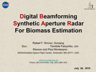
  • 1. DigitalBeamformingSynthetic ApertureRadar For Biomass Estimation Rafael F. Rincon, Guoqing Sun, TemilolaFatoyinbo, Jon Ranson and Paul Montesano NASA/Goddard Space Flight Center, Greenbelt, MD 20771, USA rafael.rincon@nasa.gov Phone: (301) 614-5725. Fax: (301) 286-1810 July 26, 2010
  • 2.
  • 3. The DBSAR Concept
  • 7.
  • 8. The amount of carbon in above ground vegetation, especially forests, is poorly understood because of the difficulty in acquiring sufficient on-ground measurements of biomass across the diversity of vegetated ecosystems. 
  • 9.
  • 10. DBSAR combines digital beamforming, reconfigurable waveform generation, and real-time processing in order to enable multi-mode radar techniques not possible with conventional SARs.
  • 11. DBSAR's highly innovative architecture provide the means to implement and demonstrate advanced SAR techniques that can provide the needed data for biomass studies.
  • 12.
  • 13. Transmit modules feature digital phase steering and amplitude taper
  • 14. Phased array antenna has 64 active microstrip patch elements
  • 15. DBSAR was designed for operation on board of the NASA P3 aircraft Waveform Generator / Digital Beamformer Processor A/D A/D A/D A/D A/D A/D A/D A/D REU T/R T/R T/R T/R T/R T/R T/R T/R Antenna
  • 16.
  • 18. Three Stratix II FPGAs
  • 19. Eight A/D converters
  • 22. 1-Gb Ethernet interface
  • 23. Size (cm): 17 x 24 x 4
  • 24. Power: 94 W maxMixed signal board Digital signal board
  • 25. System Architecture Main Parameters R A D A R A N T E N N A M I S C DBSAR Calibration in Anechoic Chamber
  • 26. System Architecture Main Features Summary Performs 1-Dimensional scanning (across track in nominal configuration). Capable of sequential polarimetricoperation (HH,VV,VH). (New) Employs software defined radar functions: waveform, T/R taper, digital In-phase and quadrature (I&Q) generation, digital filtering, etc… Implements real-time onboard processing. Supports In-phase and quadrature (I&Q) high data rate acquisition mode. Capable of adjustable transmitter illumination from narrow-beamwidth(high-gain) beam steering to wide-beamwidthillumination. Capable of in-flight reconfigurable waveform generation Employs noise source and closed loop calibration schemes Uses real-time data monitoring through a customized graphical interface unit. 
  • 27.
  • 28.
  • 29.
  • 30.
  • 31. The beam illuminates entire field of view
  • 32. Signal returns are collected with the full aperture
  • 33. Several beams are synthesized simultaneously
  • 34.
  • 35.
  • 36. The beam illuminates a single swath
  • 37. Signal returns are collected with the full aperture
  • 38. Selected beam is synthesized on receive
  • 39.
  • 40. Biomass Retrieval Efforts Evaluation of DBSAR and PALSAR Images over the Delmarva Peninsula. Biomass Field measurements over DBSAR mapped areas. Correlation between DBSAR backscatter and ground truth biomass.
  • 41. Biomass Retrieval Efforts Image calibration and evaluation using PALSAR PALSAR DBSAR
  • 42. Biomass Retrieval Efforts Wallops Biomass Field Campaign
  • 43. Biomass Retrieval Efforts Wallops Biomass Field Campaign Coastal plain mixed forest (loblolly pine, hardwood spp.) Mature forest Understory varied: shrub regeneration open 10 m circular plots dGPS location of plot center Trees > 10cm DBH: DBH, species collected
  • 44. Biomass Retrieval Efforts Wallops Biomass Field Campaign
  • 45.
  • 46. Results from the DBBSAR first campaign indicated a successful performance of the radar system and its potential benefits for biomass studies.
  • 47. DBSAR was recently upgraded with polarimetric operation (HH,VV,VH) which enhances the science capability of the system.
  • 48. DBSAR’s next flight campaign is schedule in the summer 2011 when the system will be used to map forests over the US east coast.
  • 49.
  • 50.
  • 51. Transmit channels include programmable attenuators and phase shifter.
  • 52. Receive channels amplify and condition and signal returns .
  • 53. Performs internal calibration by sampling 1) the transmit signal and 2) the signal from a noise source.Single Channel
  • 54. End of Presentation LIS in Anechoic Chamber DBSAR Processor Graphical User Interface Chirp Spectrum Reconfigurable Algorithms Chirp Signal Generator Rack mount Host computer
  • 55. Derived from Jenkins et al. 2003

Notes de l'éditeur

  1. The effort is a collaboration between the Biospherics Sciences branch and the Microwave instruments branch.The science drivers for the DBSAR measurements include biomass, soil moisture, ocean roughness, ice dynamics and surface topography.