This presentation discusses using WorldView-2 satellite imagery to classify land cover in Atlanta, Georgia. It combined multi-spectral data with multi-angle observations from 13 images. Four experiments classified imagery using a nadir multi-spectral image only, full multi-angle data, and dimensionality reduction techniques. The multi-angle data improved classification accuracy by 14% over using a single nadir image alone. Specific classes like cars and highways benefited more from the multi-angle information.
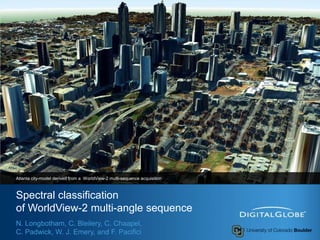
1. Spectral classificationof WorldView-2 multi-angle sequence Atlanta city-model derived from a WorldView-2 multi-sequence acquisition N. Longbotham, C. Bleilery, C. Chaapel, C. Padwick, W. J. Emery, and F. Pacifici
2. Outline 2 This presentation illustrates the unique aspects of the WorldView-2 satellite platform by combining multi-spectral information with multi-angle observations The previous presentation dealt with very high spatial resolution imagery with multi-angle observations What can we do with this kind of data set? Four experiments have been carried out to investigate the classification contribution of multi-angle reflectance (MAR) as well as different feature extraction data sets (reducing the large size of the raw data space)
3. Methodology (1/2) 3 13 Multispectral Images 13 Panchromatic Images Digital Surface Model Atmospheric Correction Nadir Multispectral Multi-angle Multispectral 13 Multispectral True-Ortho Images Polynomial Multispectral Principal Component Analysis
4. Methodology (2/2) 4 Polynomial Multispectral Nadir Multispectral Multi-angle Multispectral PCA y = ax2 + bx + c Poly fit standard error 104 bands 32bands 10 bands 8 bands
7. Information Sources 7 The MAR contains a partial bidirectional reflectance distribution function (BRDF) over a single satellite track at a single sun angle Objects with pitched surfaces, such as trees and residential roofs, will present a different observational cross-section at each angle Surfaces with varying reflectance in both time and angle can be described by an error term that encapsulates the variation of a pixel through the multi-angle sequence
10. Varying reflectance in both time and angle (1/2) 10 Differentiates land-use of similar spectral signature low vs. high volume traffic roads Multi-angle spectral variability stationary vehicles
13. Classification and Validation 15 classes of interest have been selected representing a wide variety of both natural and man-made land-covers, including different kind of roof, roads, and vegetation Training: 50 samples per class Validation: 90,000 of independent samples Each of the classification experiments are conducted using the Random Forest algorithm 13
22. Conclusions 18 This study showed that there is significant improvement in classification accuracy available from the spectral data in a multi-angle WorldView-2 image sequence. Four spectral classification experiments were separately presented using a nadir multi-spectral image, the full multi-angle multispectral data set, and two feature extraction techniques. The multi-angle spectral information provided 14% improvement in kappa coefficient over the base case of a single nadir multispectral image. Specific classes benefited from the unique aspects of the multi-angle information: The classes car and highway are of particular interest