SlideShare une entreprise Scribd logo
1  sur  20
Global Positioning System
Global Positioning Systems
• GPS is a revolutionary navigation system
– 24 satellites orbiting the earth
– Provide location within metres or less anywhere on
the globe.
– Now available in many cars as an option
– Created and operated by the US Department of
Defense
More about GPS satellites
• Constellation of 27 satellites
– (24 active + 3 spare)
• Orbit 12,600 miles above earth
– (10,900 nautical miles)
• Satellites in 12 hour orbit
• First satellite launched in 1978, 24th
became operational
in 1994
• Selective availability was removed in May, 2000
– Handheld receivers are now much more accurate
How does GPS work?
• Measuring distance by measuring time
– Satellites send coded signals indicating their position
in space and the exact time the signals are being sent
– Receivers use the time it takes signal to travel from
satellite to receiver to determine distance from
satellite to receiver
– Information from multiple satellites is used to
determine position through ‘triangulation’
How does GPS work?
How does GPS work?
More about GPS receivers
• A GPS receiver's job is to locate four
or more satellites, figure out the
distance to each, and use this
information to deduce its own
location.
– Hand-held receivers for recreational use
with accuracy of 10-15 metres
– Vehicle mounted receivers for navigation
or agricultural use with accuracy of < 1
metre
– Backpack or tripod mounted receivers for
surveying use with accuracy of 5 – 10
centimetres
More about GPS receivers
• Receivers require clear line-of-sight; thus, they will not
work indoors or where tall objects obscure the sky
What’s so cool about GPS?
• GPS units
– Can be used as a digital compass
– Can be used to determine ground speed
– Can store landmarks (locations)
– Can be used for dynamic routing
– Can be used for mapping applications
Applications of GPS
• In-vehicle Navigation (car, boat, airplane)
• Asset Management
• Construction
• Geologic Research & Mining
• Military Navigation and Operations
• Mapping & Surveying
• Precision Agriculture
• Public Health
• Public Safety
• Wireless Communications
Integrating GIS and GPS
• Collect a series of latitude and longitude points using
GPS receivers
– add them into an existing digital map
• Skills in
– data collection/creation
– GPS reading
– observation
• Digital photos
Collecting data
• Collect data in the field using GPS
– Write down point coordinates and additional data observations
- OR -
– Use tracking function of your unit to store points, lines, or
polygons, and write down additional observations
Using the data you collect
• Manually enter the coordinates and observations into a
table (Excel, etc.)
– Save as a .dbf file
– Use “Add X,Y” or “Add Event Theme” to create points on your
map
- OR -
• Use your GPS unit cable to download the data from the
unit to your computer
World Scenario
• Developed by the United States Department of Defense, GPS is
officially named NAVSTAR GPS
• Other satellite navigation systems in use or various states of
development include:
• Beidou – China's regional system that China has proposed to
expand into a global system named COMPASS.
• Galileo – a proposed global system being developed by the
European Union, joined by China, Israel, India, Morocco,
Saudi Arabia, South Korea, and Ukraine, planned to be operational
by 2011–12.
• GLONASS – Russia's global system which is being restored to full
availability in partnership with India.
• Indian Regional Navigational Satellite System (IRNSS) – India's
proposed regional system.
• QZSS – Japanese proposed regional system, adding better
coverage to the Japanese Islands.
Indian Regional Navigational Satellite
System
• The Indian Regional Navigational Satellite System
(IRNSS) is an autonomous regional satellite navigation
system being developed by Indian Space Research
Organisation which would be under total control of
Indian government.
• Development
• The government approved the project in May 2006, with
the intention it be implemented within six to seven
years. The first satellite of the proposed constellation,
developed at a cost of Rupee 1,600 crore (16 billion
rupees), is expected to be launched in 2009.
For more information…
• Garmin website
– http://www.garmin.com/
• Trimble GPS
– www.trimble.com/gps
• Wikipedia
- http://en.wikipedia.org/wiki/Gps
• How stuff works
– www.howstuffworks.com
Queries …………….
•
ThAnk yOU

Contenu connexe

Tendances

Practical Applications of GPS Technology
Practical Applications of GPS TechnologyPractical Applications of GPS Technology
Practical Applications of GPS Technologyshakezula
 
Remote sensing and gps
Remote sensing and gpsRemote sensing and gps
Remote sensing and gpsmsfbi1521
 
Global positioning system (gps)
Global positioning  system (gps)Global positioning  system (gps)
Global positioning system (gps)Vandana Verma
 
GNSS(GLOBAL NAVIGATION SATELLITE SYSTEM)
GNSS(GLOBAL NAVIGATION SATELLITE SYSTEM)GNSS(GLOBAL NAVIGATION SATELLITE SYSTEM)
GNSS(GLOBAL NAVIGATION SATELLITE SYSTEM)NinaPlays
 
F:\Work\Gps &amp; Gis\Gps
F:\Work\Gps &amp; Gis\GpsF:\Work\Gps &amp; Gis\Gps
F:\Work\Gps &amp; Gis\Gpsguestf48f25
 
GIS application in Defense
GIS application in DefenseGIS application in Defense
GIS application in DefensePARNIKA GUPTA
 
Global positioning system
Global positioning systemGlobal positioning system
Global positioning systemDivya Lattoo
 
Part 1: An Overview of Aviation GNSS GPS and Augmentation Systems
Part 1: An Overview of Aviation GNSS GPS and Augmentation SystemsPart 1: An Overview of Aviation GNSS GPS and Augmentation Systems
Part 1: An Overview of Aviation GNSS GPS and Augmentation SystemsStephen Sancewich
 
Remote sensing & Gis
Remote sensing & GisRemote sensing & Gis
Remote sensing & Gisgopichand's
 
Gps and remote sensing
Gps and remote sensingGps and remote sensing
Gps and remote sensingSanila Khalid
 
Remote sensing and its applications, DIP, GIS, GPS
Remote sensing and its applications, DIP, GIS, GPSRemote sensing and its applications, DIP, GIS, GPS
Remote sensing and its applications, DIP, GIS, GPSUniversity of Jammu
 

Tendances (20)

Practical Applications of GPS Technology
Practical Applications of GPS TechnologyPractical Applications of GPS Technology
Practical Applications of GPS Technology
 
Remote sensing and gps
Remote sensing and gpsRemote sensing and gps
Remote sensing and gps
 
Gps and its application
Gps and its applicationGps and its application
Gps and its application
 
Global positioning system (gps)
Global positioning  system (gps)Global positioning  system (gps)
Global positioning system (gps)
 
GNSS(GLOBAL NAVIGATION SATELLITE SYSTEM)
GNSS(GLOBAL NAVIGATION SATELLITE SYSTEM)GNSS(GLOBAL NAVIGATION SATELLITE SYSTEM)
GNSS(GLOBAL NAVIGATION SATELLITE SYSTEM)
 
F:\Work\Gps &amp; Gis\Gps
F:\Work\Gps &amp; Gis\GpsF:\Work\Gps &amp; Gis\Gps
F:\Work\Gps &amp; Gis\Gps
 
Gps application
Gps applicationGps application
Gps application
 
GIS application in Defense
GIS application in DefenseGIS application in Defense
GIS application in Defense
 
Basics of Global Positioning System
Basics of Global Positioning SystemBasics of Global Positioning System
Basics of Global Positioning System
 
Gps technology 2020
Gps technology 2020Gps technology 2020
Gps technology 2020
 
Gps
GpsGps
Gps
 
Gps final main
Gps final mainGps final main
Gps final main
 
GPS OVERVIEW
GPS OVERVIEWGPS OVERVIEW
GPS OVERVIEW
 
GIS & RS
GIS & RSGIS & RS
GIS & RS
 
Global positioning system
Global positioning systemGlobal positioning system
Global positioning system
 
Part 1: An Overview of Aviation GNSS GPS and Augmentation Systems
Part 1: An Overview of Aviation GNSS GPS and Augmentation SystemsPart 1: An Overview of Aviation GNSS GPS and Augmentation Systems
Part 1: An Overview of Aviation GNSS GPS and Augmentation Systems
 
Remote sensing & Gis
Remote sensing & GisRemote sensing & Gis
Remote sensing & Gis
 
Gps and remote sensing
Gps and remote sensingGps and remote sensing
Gps and remote sensing
 
Remote sensing and its applications, DIP, GIS, GPS
Remote sensing and its applications, DIP, GIS, GPSRemote sensing and its applications, DIP, GIS, GPS
Remote sensing and its applications, DIP, GIS, GPS
 
8 17
8 178 17
8 17
 

En vedette (7)

Microwave Band
Microwave BandMicrowave Band
Microwave Band
 
Introduction 20to 20architecture
Introduction 20to 20architectureIntroduction 20to 20architecture
Introduction 20to 20architecture
 
Architecture
ArchitectureArchitecture
Architecture
 
Gps 1
Gps 1Gps 1
Gps 1
 
تواصل
تواصلتواصل
تواصل
 
Microwave remote sensing
Microwave remote sensingMicrowave remote sensing
Microwave remote sensing
 
landscape
landscapelandscape
landscape
 

Similaire à Gps (20)

GPS, An Introduction
GPS, An IntroductionGPS, An Introduction
GPS, An Introduction
 
Global positioning system (GPS)
Global positioning system (GPS)Global positioning system (GPS)
Global positioning system (GPS)
 
Gps
GpsGps
Gps
 
Gps
GpsGps
Gps
 
Presentation on GPS by Harvendra Singh
Presentation on GPS by Harvendra SinghPresentation on GPS by Harvendra Singh
Presentation on GPS by Harvendra Singh
 
GPSS ,DEFENITION,TYPE,WORKING,PRINCIPLES
GPSS ,DEFENITION,TYPE,WORKING,PRINCIPLESGPSS ,DEFENITION,TYPE,WORKING,PRINCIPLES
GPSS ,DEFENITION,TYPE,WORKING,PRINCIPLES
 
Global Positioning System (GPS)
Global Positioning System (GPS) Global Positioning System (GPS)
Global Positioning System (GPS)
 
Global Positioning system GPS - Dr. S. Balamurugan
Global Positioning system GPS - Dr. S. BalamuruganGlobal Positioning system GPS - Dr. S. Balamurugan
Global Positioning system GPS - Dr. S. Balamurugan
 
Gps satellite tracking
Gps satellite trackingGps satellite tracking
Gps satellite tracking
 
A seminar on GPS Technology
A seminar on GPS TechnologyA seminar on GPS Technology
A seminar on GPS Technology
 
Global positioning system
Global positioning systemGlobal positioning system
Global positioning system
 
Role of Sensors-Applications.pdf
Role of Sensors-Applications.pdfRole of Sensors-Applications.pdf
Role of Sensors-Applications.pdf
 
GPS Satellite Tracking.pdf
GPS Satellite Tracking.pdfGPS Satellite Tracking.pdf
GPS Satellite Tracking.pdf
 
Global positioning system
Global positioning systemGlobal positioning system
Global positioning system
 
GPS.pptx
GPS.pptxGPS.pptx
GPS.pptx
 
Day 9: Make Your App Location Aware using Location API
Day 9: Make Your App Location Aware using Location APIDay 9: Make Your App Location Aware using Location API
Day 9: Make Your App Location Aware using Location API
 
GPS-1 (1).ppt
GPS-1 (1).pptGPS-1 (1).ppt
GPS-1 (1).ppt
 
Satellite Navigation
Satellite Navigation Satellite Navigation
Satellite Navigation
 
Missile guidance
Missile guidanceMissile guidance
Missile guidance
 
Remote Sensing ppt
Remote Sensing pptRemote Sensing ppt
Remote Sensing ppt
 

Dernier

Sanyam Choudhary Chemistry practical.pdf
Sanyam Choudhary Chemistry practical.pdfSanyam Choudhary Chemistry practical.pdf
Sanyam Choudhary Chemistry practical.pdfsanyamsingh5019
 
1029 - Danh muc Sach Giao Khoa 10 . pdf
1029 -  Danh muc Sach Giao Khoa 10 . pdf1029 -  Danh muc Sach Giao Khoa 10 . pdf
1029 - Danh muc Sach Giao Khoa 10 . pdfQucHHunhnh
 
Holdier Curriculum Vitae (April 2024).pdf
Holdier Curriculum Vitae (April 2024).pdfHoldier Curriculum Vitae (April 2024).pdf
Holdier Curriculum Vitae (April 2024).pdfagholdier
 
Presentation by Andreas Schleicher Tackling the School Absenteeism Crisis 30 ...
Presentation by Andreas Schleicher Tackling the School Absenteeism Crisis 30 ...Presentation by Andreas Schleicher Tackling the School Absenteeism Crisis 30 ...
Presentation by Andreas Schleicher Tackling the School Absenteeism Crisis 30 ...EduSkills OECD
 
Kisan Call Centre - To harness potential of ICT in Agriculture by answer farm...
Kisan Call Centre - To harness potential of ICT in Agriculture by answer farm...Kisan Call Centre - To harness potential of ICT in Agriculture by answer farm...
Kisan Call Centre - To harness potential of ICT in Agriculture by answer farm...Krashi Coaching
 
Software Engineering Methodologies (overview)
Software Engineering Methodologies (overview)Software Engineering Methodologies (overview)
Software Engineering Methodologies (overview)eniolaolutunde
 
Interactive Powerpoint_How to Master effective communication
Interactive Powerpoint_How to Master effective communicationInteractive Powerpoint_How to Master effective communication
Interactive Powerpoint_How to Master effective communicationnomboosow
 
BASLIQ CURRENT LOOKBOOK LOOKBOOK(1) (1).pdf
BASLIQ CURRENT LOOKBOOK  LOOKBOOK(1) (1).pdfBASLIQ CURRENT LOOKBOOK  LOOKBOOK(1) (1).pdf
BASLIQ CURRENT LOOKBOOK LOOKBOOK(1) (1).pdfSoniaTolstoy
 
APM Welcome, APM North West Network Conference, Synergies Across Sectors
APM Welcome, APM North West Network Conference, Synergies Across SectorsAPM Welcome, APM North West Network Conference, Synergies Across Sectors
APM Welcome, APM North West Network Conference, Synergies Across SectorsAssociation for Project Management
 
A Critique of the Proposed National Education Policy Reform
A Critique of the Proposed National Education Policy ReformA Critique of the Proposed National Education Policy Reform
A Critique of the Proposed National Education Policy ReformChameera Dedduwage
 
The basics of sentences session 2pptx copy.pptx
The basics of sentences session 2pptx copy.pptxThe basics of sentences session 2pptx copy.pptx
The basics of sentences session 2pptx copy.pptxheathfieldcps1
 
Arihant handbook biology for class 11 .pdf
Arihant handbook biology for class 11 .pdfArihant handbook biology for class 11 .pdf
Arihant handbook biology for class 11 .pdfchloefrazer622
 
Beyond the EU: DORA and NIS 2 Directive's Global Impact
Beyond the EU: DORA and NIS 2 Directive's Global ImpactBeyond the EU: DORA and NIS 2 Directive's Global Impact
Beyond the EU: DORA and NIS 2 Directive's Global ImpactPECB
 
Key note speaker Neum_Admir Softic_ENG.pdf
Key note speaker Neum_Admir Softic_ENG.pdfKey note speaker Neum_Admir Softic_ENG.pdf
Key note speaker Neum_Admir Softic_ENG.pdfAdmir Softic
 
Class 11th Physics NEET formula sheet pdf
Class 11th Physics NEET formula sheet pdfClass 11th Physics NEET formula sheet pdf
Class 11th Physics NEET formula sheet pdfAyushMahapatra5
 
Explore beautiful and ugly buildings. Mathematics helps us create beautiful d...
Explore beautiful and ugly buildings. Mathematics helps us create beautiful d...Explore beautiful and ugly buildings. Mathematics helps us create beautiful d...
Explore beautiful and ugly buildings. Mathematics helps us create beautiful d...christianmathematics
 
The Most Excellent Way | 1 Corinthians 13
The Most Excellent Way | 1 Corinthians 13The Most Excellent Way | 1 Corinthians 13
The Most Excellent Way | 1 Corinthians 13Steve Thomason
 
9548086042 for call girls in Indira Nagar with room service
9548086042  for call girls in Indira Nagar  with room service9548086042  for call girls in Indira Nagar  with room service
9548086042 for call girls in Indira Nagar with room servicediscovermytutordmt
 

Dernier (20)

Sanyam Choudhary Chemistry practical.pdf
Sanyam Choudhary Chemistry practical.pdfSanyam Choudhary Chemistry practical.pdf
Sanyam Choudhary Chemistry practical.pdf
 
1029 - Danh muc Sach Giao Khoa 10 . pdf
1029 -  Danh muc Sach Giao Khoa 10 . pdf1029 -  Danh muc Sach Giao Khoa 10 . pdf
1029 - Danh muc Sach Giao Khoa 10 . pdf
 
Holdier Curriculum Vitae (April 2024).pdf
Holdier Curriculum Vitae (April 2024).pdfHoldier Curriculum Vitae (April 2024).pdf
Holdier Curriculum Vitae (April 2024).pdf
 
Presentation by Andreas Schleicher Tackling the School Absenteeism Crisis 30 ...
Presentation by Andreas Schleicher Tackling the School Absenteeism Crisis 30 ...Presentation by Andreas Schleicher Tackling the School Absenteeism Crisis 30 ...
Presentation by Andreas Schleicher Tackling the School Absenteeism Crisis 30 ...
 
Kisan Call Centre - To harness potential of ICT in Agriculture by answer farm...
Kisan Call Centre - To harness potential of ICT in Agriculture by answer farm...Kisan Call Centre - To harness potential of ICT in Agriculture by answer farm...
Kisan Call Centre - To harness potential of ICT in Agriculture by answer farm...
 
INDIA QUIZ 2024 RLAC DELHI UNIVERSITY.pptx
INDIA QUIZ 2024 RLAC DELHI UNIVERSITY.pptxINDIA QUIZ 2024 RLAC DELHI UNIVERSITY.pptx
INDIA QUIZ 2024 RLAC DELHI UNIVERSITY.pptx
 
Software Engineering Methodologies (overview)
Software Engineering Methodologies (overview)Software Engineering Methodologies (overview)
Software Engineering Methodologies (overview)
 
Interactive Powerpoint_How to Master effective communication
Interactive Powerpoint_How to Master effective communicationInteractive Powerpoint_How to Master effective communication
Interactive Powerpoint_How to Master effective communication
 
BASLIQ CURRENT LOOKBOOK LOOKBOOK(1) (1).pdf
BASLIQ CURRENT LOOKBOOK  LOOKBOOK(1) (1).pdfBASLIQ CURRENT LOOKBOOK  LOOKBOOK(1) (1).pdf
BASLIQ CURRENT LOOKBOOK LOOKBOOK(1) (1).pdf
 
APM Welcome, APM North West Network Conference, Synergies Across Sectors
APM Welcome, APM North West Network Conference, Synergies Across SectorsAPM Welcome, APM North West Network Conference, Synergies Across Sectors
APM Welcome, APM North West Network Conference, Synergies Across Sectors
 
A Critique of the Proposed National Education Policy Reform
A Critique of the Proposed National Education Policy ReformA Critique of the Proposed National Education Policy Reform
A Critique of the Proposed National Education Policy Reform
 
The basics of sentences session 2pptx copy.pptx
The basics of sentences session 2pptx copy.pptxThe basics of sentences session 2pptx copy.pptx
The basics of sentences session 2pptx copy.pptx
 
Arihant handbook biology for class 11 .pdf
Arihant handbook biology for class 11 .pdfArihant handbook biology for class 11 .pdf
Arihant handbook biology for class 11 .pdf
 
Beyond the EU: DORA and NIS 2 Directive's Global Impact
Beyond the EU: DORA and NIS 2 Directive's Global ImpactBeyond the EU: DORA and NIS 2 Directive's Global Impact
Beyond the EU: DORA and NIS 2 Directive's Global Impact
 
Key note speaker Neum_Admir Softic_ENG.pdf
Key note speaker Neum_Admir Softic_ENG.pdfKey note speaker Neum_Admir Softic_ENG.pdf
Key note speaker Neum_Admir Softic_ENG.pdf
 
Class 11th Physics NEET formula sheet pdf
Class 11th Physics NEET formula sheet pdfClass 11th Physics NEET formula sheet pdf
Class 11th Physics NEET formula sheet pdf
 
Explore beautiful and ugly buildings. Mathematics helps us create beautiful d...
Explore beautiful and ugly buildings. Mathematics helps us create beautiful d...Explore beautiful and ugly buildings. Mathematics helps us create beautiful d...
Explore beautiful and ugly buildings. Mathematics helps us create beautiful d...
 
The Most Excellent Way | 1 Corinthians 13
The Most Excellent Way | 1 Corinthians 13The Most Excellent Way | 1 Corinthians 13
The Most Excellent Way | 1 Corinthians 13
 
Mattingly "AI & Prompt Design: The Basics of Prompt Design"
Mattingly "AI & Prompt Design: The Basics of Prompt Design"Mattingly "AI & Prompt Design: The Basics of Prompt Design"
Mattingly "AI & Prompt Design: The Basics of Prompt Design"
 
9548086042 for call girls in Indira Nagar with room service
9548086042  for call girls in Indira Nagar  with room service9548086042  for call girls in Indira Nagar  with room service
9548086042 for call girls in Indira Nagar with room service
 

Gps

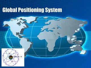
  • 2. Global Positioning Systems • GPS is a revolutionary navigation system – 24 satellites orbiting the earth – Provide location within metres or less anywhere on the globe. – Now available in many cars as an option – Created and operated by the US Department of Defense
  • 3. More about GPS satellites • Constellation of 27 satellites – (24 active + 3 spare) • Orbit 12,600 miles above earth – (10,900 nautical miles) • Satellites in 12 hour orbit • First satellite launched in 1978, 24th became operational in 1994 • Selective availability was removed in May, 2000 – Handheld receivers are now much more accurate
  • 4. How does GPS work? • Measuring distance by measuring time – Satellites send coded signals indicating their position in space and the exact time the signals are being sent – Receivers use the time it takes signal to travel from satellite to receiver to determine distance from satellite to receiver – Information from multiple satellites is used to determine position through ‘triangulation’
  • 5. How does GPS work?
  • 6. How does GPS work?
  • 7. More about GPS receivers • A GPS receiver's job is to locate four or more satellites, figure out the distance to each, and use this information to deduce its own location. – Hand-held receivers for recreational use with accuracy of 10-15 metres – Vehicle mounted receivers for navigation or agricultural use with accuracy of < 1 metre – Backpack or tripod mounted receivers for surveying use with accuracy of 5 – 10 centimetres
  • 8. More about GPS receivers • Receivers require clear line-of-sight; thus, they will not work indoors or where tall objects obscure the sky
  • 9. What’s so cool about GPS? • GPS units – Can be used as a digital compass – Can be used to determine ground speed – Can store landmarks (locations) – Can be used for dynamic routing – Can be used for mapping applications
  • 10. Applications of GPS • In-vehicle Navigation (car, boat, airplane) • Asset Management • Construction • Geologic Research & Mining • Military Navigation and Operations • Mapping & Surveying • Precision Agriculture • Public Health • Public Safety • Wireless Communications
  • 11.
  • 12.
  • 13. Integrating GIS and GPS • Collect a series of latitude and longitude points using GPS receivers – add them into an existing digital map • Skills in – data collection/creation – GPS reading – observation • Digital photos
  • 14. Collecting data • Collect data in the field using GPS – Write down point coordinates and additional data observations - OR - – Use tracking function of your unit to store points, lines, or polygons, and write down additional observations
  • 15. Using the data you collect • Manually enter the coordinates and observations into a table (Excel, etc.) – Save as a .dbf file – Use “Add X,Y” or “Add Event Theme” to create points on your map - OR - • Use your GPS unit cable to download the data from the unit to your computer
  • 16. World Scenario • Developed by the United States Department of Defense, GPS is officially named NAVSTAR GPS • Other satellite navigation systems in use or various states of development include: • Beidou – China's regional system that China has proposed to expand into a global system named COMPASS. • Galileo – a proposed global system being developed by the European Union, joined by China, Israel, India, Morocco, Saudi Arabia, South Korea, and Ukraine, planned to be operational by 2011–12. • GLONASS – Russia's global system which is being restored to full availability in partnership with India. • Indian Regional Navigational Satellite System (IRNSS) – India's proposed regional system. • QZSS – Japanese proposed regional system, adding better coverage to the Japanese Islands.
  • 17. Indian Regional Navigational Satellite System • The Indian Regional Navigational Satellite System (IRNSS) is an autonomous regional satellite navigation system being developed by Indian Space Research Organisation which would be under total control of Indian government. • Development • The government approved the project in May 2006, with the intention it be implemented within six to seven years. The first satellite of the proposed constellation, developed at a cost of Rupee 1,600 crore (16 billion rupees), is expected to be launched in 2009.
  • 18. For more information… • Garmin website – http://www.garmin.com/ • Trimble GPS – www.trimble.com/gps • Wikipedia - http://en.wikipedia.org/wiki/Gps • How stuff works – www.howstuffworks.com