Unmanned Aircraft Systems (UAS) for disaster relief, environmental monitoring and precision agriculture.
•Télécharger en tant que PPT, PDF•
3 j'aime•2,721 vues


Recommandé
Contenu connexe
Tendances
Tendances (19)
Similaire à Unmanned Aircraft Systems (UAS) for disaster relief, environmental monitoring and precision agriculture.
Similaire à Unmanned Aircraft Systems (UAS) for disaster relief, environmental monitoring and precision agriculture. (20)
Plus de Hawaii Geographic Information Coordinating Council
Plus de Hawaii Geographic Information Coordinating Council (20)
Dernier
Dernier (20)
Unmanned Aircraft Systems (UAS) for disaster relief, environmental monitoring and precision agriculture.
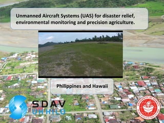
- 1. Unmanned Aircraft Systems (UAS) for disaster relief, environmental monitoring and precision agriculture. Philippines and Hawaii
- 2. “Prediction: By year 2020, UAS will emerge as the primary collection platform for remotely sensed data.” USGS National UAS Office.
- 3. • Public Organizations should acquire a COA (Certificate of Authorization) to fly UAV in designated areas. • Crew must be properly trained and certified regarding aviation regulations, medical etc. • Federal Judge from the NTSB ruled against FAA in March 2014, regarding regulation of UAS. • Congress has not passed any laws specifically regulating UAS, but FAA has promised to pass a law regarding small UAS sometime in 2015… or by 2025. FAA Regulations?
- 4. Temporal Resolution Hours DecadesDays Weeks Months Years Spatial Resolution .01 m 0.1 m 10 m 100 m 1000 m1 m Cost Free Low High Very HighModerate 1 m2 100 m2 1 km2 1,000 km2 Global10,000 m2 Max. Spatial Coverage Gov’t Satellite Commercial Sat. Plot Data Airborne RS Fixed-wing UAV Rotary wing UAV
- 6. Aklan River
- 7. Aklan River
- 8. Researchers from University of Hawaii and Ateneo de Manila University
- 10. UAV Fleet Airframe Name Type X8 Fixed Wing Powertrain 2X 5,000 Mah LiPo Battery 45-60mins flight Payload Canon S100 Go Pro Cameras Autopilot APM 2.5 (Arduino)
- 11. UAV Fleet Airframe Name Type FX-61 Fixed Wing Powertrain 2X 2,200 Mah LiPo Battery 20-30mins flight Payload Canon SX260 Autopilot APM 2.6 (Arduiono)
- 18. Destroyed Levee • Yolanda impact on agriculture fields? • Philippines facing a rice shortage this year. • 85,004 homes damaged in Aklan province. UAS team meets with Mayor of Libacao.
- 19. • Leaves start to yellow around edges and bunch together. • Plant stops producing fruit. • Disease can spread to nearby plantings quickly. • State lacks resources to contain spread of virus. BBTV Detection with UAS
- 20. 5 m 5 m 5 m cm-resolution point-and-shoot camera imagery (12/16/13) sub-meter Digital Globe imagery from Google Earth (1/21/13) 30-m Landsat 8 imagery (6/17/13)
- 21. Early Detection of Banana Bunchy Top Virus (BBTV)
- 22. Healthy Banana Field Hamakua Springs, Hawaii. Suspected Infected Banana Patch, Keaau, Hawaii. Infected Keiki, remain stunted. Aphids, spreading BBTV Virus. Feature Detection with Visible RGB Imagery
- 23. Dr. Ryan Perroy taking field samples with spectral radiometer.
- 25. • Rare plant survey, fence line assessment, forest biomass estimation. • University of Hawaii at Hilo FAA Certificate of Authorization (COA) for Pu’uwa’awa’a reserve. • First University in the State of Hawaii to receive a COA. Environmental Monitoring in HETF Pu’uwa’awa’a Makai Subunit
- 26. 90% of commercial UAV Companies World Wide are small start ups, not big aerospace.
- 27. Please contact us for research related collaborations! Website: www.spatial.hawaii.edu Ph: 808.932.7276