SlideShare une entreprise Scribd logo
1  sur  64
Télécharger pour lire hors ligne
HoLIS Web Site
City and County of Honolulu
   Upgrading to ArcGIS 9.2 and
  fulfilling Federal Requirements
Topics to Discuss
1.   Project Goal
2.   Project Background
3.   Project Objectives
4.   How do we execute
Topics to Discuss
5.    Who is BEI Hawaii?
6.    Project Goal
7.    Functional Requirements
8.    Technology Platform
9.    DEMO (screenshots)
10.   Lesson Learned
11.   Where do we go from here?
Who is BEI Consulting
We are consultants that     Core Competencies:
bring expertise to your          Program and Project
organization.                    Management
     Assess Challenges           Assist in defining
     Pursue Opportunities        Functional
                                 Requirements
     Mobilize the right
     resource                    ERP Consulting
     Manage project risk         Application
                                 Development
                                 GIS Application
                                 Developer
BEI Team                     ArcIMS
The Development team                                   3.1
that had design and built
the original GIS Map
Service for the City (circa
2001)


Lead Consultant: John Higuchi, PMP
•   10 + years in Project Management in IT projects. Hawaiian
    Airlines, Title Guaranty, City & County of Honolulu and Federal
    telemedicine projects. Certified PMP from 2005.
Developer: Robert Dolormente
•   Robert has significant experience as a database administrator and
    software development manager.
Sharing Session
Two Mission Critical Recommendations

1. Guidance and Principles for
   Development
2. Treat it as a project. (start and end)
In a nut shell

     Fast
     Good
     Cheap
 Pick any two!
Guiding Rules & Principles
•   3 second rule
•   KISS Rule
•   Less think
•   Who are you speaking to (target
    audience)
Rules & Principle in Use
3 Second rule
KISS
Less Think
Target audience is clear
Project Management Guidance
• Manage by
  deliverables
• Establish a Start
  and End date
• Follow a process
  – Define, Plan,
    Implement,
    Control, and
    Close
Project Goal
Project Goal
The project goal is to design, build, and
implement a GIS Web publishing system to
deliver maps, data, and metadata to users
on the Web based upon ERSI
ArcGIS/ArcSDE 9.2 Server that complies
with Federal USGS and FGDC standards.
Target Audience
•   Checking on building permits
•   Project research, permit tracking.
•   Find landowner info to gain access to property.
•   TMK for permits
•   To download and print maps with tax map key information to submit
    along with my building permit application.
•   obtain or confirm ownership, assessed values and land use
    designations such as zoning, height limit, SMA status, SLU and
    flood zone. This is often the source of preliminary information
    regarding census tract and existing improvement data such as year
    built and gross floor area. Under the old site, we also regularly use
    the tabs for obtaining the zoning map, flood zone, and utilties
    (sewer).
•   Locating flood boundaries and elevations, flood zone, if property is
    in an ohana zone, verifying sewer lateral location, locating other
    infrastructure, general street widths, identify general topography of
    site, etc.
What are the Functional
   Requirements?
Functional Requirements
•   Software upgrade requirements
•   Map Publishing functions
•   Data Update/Maintenance work flows and operations
•   Data Download demands and functions
•   Raster imagery integration
•   TMK Relationships (multiple record display and query)
•   Google/Virtual Earth Functionality
•   GIS Server Configuration
•   Metadata Standards to be reviewed include, but are not limited to, are:
     –   Roads & Structures – Existing layer of the map services
     –   Cadastre – Existing layer of the map services
     –   Utility – Existing layer of the map services
•   Web Service Linkages/Connectivity - BEI will establish a Web Service
    Linkage/connectivity between the proposed online map service and
    USGS. It will supply the layer and metadata as listed in their USGS Best
    Practice Data Model – Structures document.
•   National Grid conformance/referencing
•   Geospatial One Stop
Federal Requirements
• Data sharing with Federal agencies –
  DHS, FEMA, and USGS
• (USGS) Read-only direct access to The
  City’s ArcSDE online database
  – Initial upload
  – Ongoing/updates to database
  – Automating the pull of data
• National Grid
USGS Requirements
• Goal of the National Map is to have
  consistent and current data within a
  centralized database, hopefully automated
• Structure Data – Homeland Security
  – Hospitals
  – Clinics
  – Fire and Police Stations
Federal Requirements

Geospatial one stop
geodata.gov is a web-based portal for one-
stop access to maps, data and other
geospatial services that will simplify the
ability of all levels of government and
citizens to find geospatial data and learn
more about geospatial projects underway.
Technology Platform
Technology Platform
Hardware List
Web Server
•   Dell Quad Core Xeon Processor X53552x4MB Cache, 2.66GHz, 1333MHz
    FSB, PE2950, 4GB 667MHz RAM
•   438 GB Hard Drive Storage
Database Server
•   Dell Quad Core Xeon Processor X53552x4MB Cache, 2.66GHz, 1333MHz
    FSB, PE2950, 4GB 667MHz (4X1GB)
•   876 GB Hard Drive Storage
FTP Server
•   Dell Quad Core Xeon Processor X53552x4MB Cache, 2.66GHz, 1333MHz
    FSB, PE2950, 4GB 667MHz (4X1GB)
•   1.8 TB Hard Drive Storage
WWW


City & County of Honolulu
            HoLIS Web Site
           November 13, 2008
                                                                 Firewall


                                    Website access                     Map Web Service accesses data
                              Geospatial data via web service            stored on Database Server
                                                                                                            SDE
                                                                        Map                               Database
                           Public
                                                                        Web                                Storing
                           Website                                                                        Geospatial
                                                                       Service                              Data

                                        Web Server                                             Database Server


   Website links to shape files
    stored on FTPServerGIS


                                                                                                           BEI Hawaii
                                                                                                       BEI Consulting
                                     FTP Server                                                        John Higuchi, PMP
                                                                                                       November 13, 2008

                                                   Scalable Web Servers
Technology Platform
                                Access Geospatial Data


                                                                  `

              WebDataGIS        Access Public Website      USGS
Microsoft Windows Server 2003
Microsoft SQL Server 2005            Access and
ESRI ArcSDE 9.2                       download
                                     shape files


                                                                  `
                                     Administer
                                     Geospatial          Public Users
              WebServerGIS             Data
Microsoft Windows Server 2003
ESRI ArcGIS Server 9.2
ESRI ArcGIS Desktop 9.2
                                    Administer
                                     Website


                                                                  `
                                    Administer
                                    FTP Data
             FTPServerGIS                                C&C Users
Microsoft Windows Server 2003
Microsoft SQL Server 2005
Static Demo

  Show me!
“Out of the box”
Customizations
 • Tool Bars (3)
     • Tasks
  • Grid Results
Customizations
Plat Map
Tax Parcel
Improved Map Printing
Tasks
Working with Imagery
Map Detail
Working with Layers
Lessons Learned
•   Be Flexible
•   Joint Collaboration with ESRI & City
•   Upgrading to 9.3 is necessary
•   Balance between Data Feast or Famine =
    Enriched Application or Performance
Lessons Learned

Tweaking the Map for optimal
       performance
Lessons Learned
1.   With adequate hardware and bandwidth, optimizing
     the database, layers and cartography is more
     important than limiting content to ensure adequate
     performance.

2.   If many layers, organizing content (hidden or within
     groups/tabs) is highly recommended.

3.   Probably better to produce many focused map
     services with a specific purpose and targeted
     audience rather than an all purpose mapping site for
     everyone (Zoning, Parks, Flood, etc)
Lessons Learned
1. With adequate hardware and bandwidth, optimizing the
   database, layers and cartography is more important than
   limiting content to ensure adequate performance.
   Use simple optimized symbology (ESRI Optimized style)
   Use Static annotation with scale dependant anno classes in single layer
   Combine points into single layer, use multi part, generalize geometry
   Cache large static layers (contours) and imagery (ArcSDE may be better)
   Use simple feature classes (limit feature dataset overhead) and reduce fields
   Create joins in the db or programmatically, not in map document
   Check spatial indexing after importing data (“Recalulate”) and index columns
   Run Analyze on the database regularly (ArcSDE)
   Ensure adequate connections in Arcsde for the socs (instances X 2)
   Ensure adequate number of instances on the map service for the expected traffic
   and functionality (geoprocessing)
Lessons Learned
1.   With adequate hardware and infrastructure, optimizing the database, layers and
     cartography is more important than limiting content to ensure adequate
     performance.

2.   If many layers, organizing content (hidden or within
     groups/tabs) is highly recommended.
3.   Probably better to produce many focused map services with a specific purpose
     and targeted audience rather than an all purpose mapping site (Zoning, Parks,
     Flood)


           Group into topic categories
           Use expandable drill down or tabs
           consistent between Arc Catalog, Data Catalog listing
           and Groups in Map Doc TOC (facilitates recall and
           browsing)
ISO 19115 Topic Category or “Theme Codes”
Lessons Learned
1.   With adequate hardware and infrastructure, optimizing the database, layers and
     cartography is more important than limiting content to ensure adequate
     performance.
2.   Organizing content (hidden or within groups/tabs) is highly recommended.

3.   Probably better to produce many focused map
     services with a specific purpose and targeted
     audience rather than an all purpose mapping site
     (Zoning, Parks, Flood)


          Streamlined functionality               Cityview 9.2 = > 100 layers
          More user friendly                      Public GIS WebSite = 66
BEI: Mastered the technology
--Adapted functionality on the old site to the new
--Many improvements in data display and
functionality
Now what?

•   Mashups: bring in other services
•   Add your own layers from the data catalog
•   Save your own bookmarks (My Places)
•   Post My Places on Google? (write out KMZ file)
•   Redlining and Notes (potholes, identify errors in data)
•   3D Application
•   Replication
•   Ability to add this service to ArcMap or Arc Explorer
Potential Applications
•       Questions to ask of the map service---based on
        your address
                                                    Emergency:
•       General-                                       closest hospital/clinic (how do I
                                                                    get there)
    –    show me nearest bus stop
                                                                 Am i in an evacuation zone
    –    what school district am I in                            what my designated shelter
    –    what voter precinct                                     Closest police or fire station
    –    closest freeway access (on/off ramp)                    Beaches with lifeguard towers
    –    nearest life guarded beach                              Beach access right of ways
    –    what neighborhood board, council district
                                                          Other:
    –    Closest recycling stations
                                                          Routing/Directions (ESRI Web Service?)
    –    Recycling, green and waste pickup days           Save your place of interest (poi)
    –    points of interest (physical/cultural landmarks) Share your poi
    –    city halls and other government offices          Redlining
    –    Businesses (banks, grocery store, pharmacy,      Download location to Google KML
         theaters)
    –    Special Events (farmers markets)
    –    Senior resources (senior centers, golden diners,
         senior fitness)
Other Examples:
Thinking outside the Box
3D Viewer: Buildings, Planning

Use of Google Earth:

  –   Responsive performance during peak time
  –   Scalability to large numbers of users
  –   Familiar and intuitive user interface
  –   Easy to integrate to sophisticated back-end spatial
      processing and data validation
  –   Existing GIS software can direct processed data to the
      intuitive public mapping API
  –   Easy to keep up with technology advances (Google Earth
      and Virtual Earth advance full version)
  –   Ability to easily integrate existing GIS web services
Future: Better Documentation
Searchable GIS Data catalog: Keyword/Alphabetized
Using Metadata services?
Future: Better Documentation
Have a Good Web Presence
Status of Documentation and Data Transfer


• Metadata 98% complete, Data Dictionary
  98%;
• Holis Website under revision
• Data Transfer: nightly transfer within days
  (month old)
• FTP Shape file repository: not yet
  refreshed (several months old)
Original
Data Dictionary
•   Descriptive
•   Useful information
•   References
•   Download Shapefile
•   Download ArcGIS Layer file (lyr) (work in
    progress)
Example: Chicago Maps
Where do we stand
Where do we stand?
• Launched as Beta on September 2, 2008
• Currently gathering user feedback
• Web Site Statistics
  – Oct. 10, 2008 – Nov. 9, 2008
  – 6,175 Visits or 199.19 Visits/Day Avg
Where do we stand?
“…Very satisfied with their overall
performance on this and other
projects. They are able to adapt/integrate
new technologies as they become available,
set goals and reach milestones yet are able
to be flexible when the situation requires it.
                                        Jon Hodge
                                       GIS Analyst
                        City and County of Honolulu
Where do we stand?
“The City and County of Honolulu’s Web
Service is way ahead of the curve
nationally.”
                                        Paul Wiese
               National Vector Program Coordinator
                    United States Geological Survey
Where to now?
Future Enhancements
• Upgrade to 9.3.
• Define specific map services geared to unique
  users.
• Overlay your own data with the GIS Layers
  using this service with ArcGIS Explorer or Arc
  Reader
• More functionality, better printing
• 3D functionality
• More imagery
• Streamlined services
• My Places
Preview
Thanks to:
                    Henry Wolter
USGS Geospatial Liaison for Hawaii, Pacific Basin Islands
              NSDI Partnership Office
          677 Ala Moana Blvd, Suite 415
                 Honolulu, HI 96813
                Phone: 808-587-2409
             E-mail: hwolter@usgs.gov


                    Ken Schmidt
                   GIS Administrator
           Honolulu Land Information System
             City and County of Honolulu
                     808-768-8057
            E-mail: kschmidt@honolulu.gov
Links
• City and County of Honolulu HoLIS Map
  Service
  – http://www.honoluludpp.org/gis
• The National Map - The Nation's topographic map
  for the 21st century
  – http://nationalmap.usgs.gov
• BEI Hawaii
  – http://www.beiconsultants.com

Contenu connexe

Similaire à HoLIS GIS Update

How to Easily Load Data into ArcGIS for Local Government
How to Easily Load Data into ArcGIS for Local GovernmentHow to Easily Load Data into ArcGIS for Local Government
How to Easily Load Data into ArcGIS for Local GovernmentSafe Software
 
FME = Features Made Easy
FME = Features Made EasyFME = Features Made Easy
FME = Features Made EasySafe Software
 
nsgic 2012 - your plumbing is done!
nsgic 2012 - your plumbing is done!nsgic 2012 - your plumbing is done!
nsgic 2012 - your plumbing is done!Marten Hogeweg
 
GI2012 buono-cnr-geo-platform
GI2012 buono-cnr-geo-platformGI2012 buono-cnr-geo-platform
GI2012 buono-cnr-geo-platformIGN Vorstand
 
WEB GIS AND WEB MAP.pptx
WEB GIS AND WEB MAP.pptxWEB GIS AND WEB MAP.pptx
WEB GIS AND WEB MAP.pptxAsim Pt
 
Evolution of Esri Data Formats Seminar
Evolution of Esri Data Formats SeminarEvolution of Esri Data Formats Seminar
Evolution of Esri Data Formats SeminarEsri South Africa
 
Getting Started with the ArcGIS API for JavaScript, Esri, Julie Powell, Antoo...
Getting Started with the ArcGIS API for JavaScript, Esri, Julie Powell, Antoo...Getting Started with the ArcGIS API for JavaScript, Esri, Julie Powell, Antoo...
Getting Started with the ArcGIS API for JavaScript, Esri, Julie Powell, Antoo...Esri Nederland
 
ArcGIS Server 10 Applications Advancing Local Government Service Delivery
ArcGIS Server 10 Applications  Advancing Local Government Service DeliveryArcGIS Server 10 Applications  Advancing Local Government Service Delivery
ArcGIS Server 10 Applications Advancing Local Government Service DeliveryChristopher Blough
 
Strategies for Integrating Utility System Operational Data into ArcGIS Server...
Strategies for Integrating Utility System Operational Data into ArcGIS Server...Strategies for Integrating Utility System Operational Data into ArcGIS Server...
Strategies for Integrating Utility System Operational Data into ArcGIS Server...True North Geographic Technologies
 
Eastern Band of Cherokee Indians Effiencey Vision
Eastern Band of Cherokee Indians Effiencey VisionEastern Band of Cherokee Indians Effiencey Vision
Eastern Band of Cherokee Indians Effiencey Visiondaviwyat
 
RGreenway - TriDroid Presentation
RGreenway - TriDroid PresentationRGreenway - TriDroid Presentation
RGreenway - TriDroid Presentationemajewicz
 
2008 Geodatabase Re Design V2
2008 Geodatabase Re Design V22008 Geodatabase Re Design V2
2008 Geodatabase Re Design V2davinci7_gis
 
Dotted Eyes - Open Software, Standards and Data
Dotted Eyes - Open Software, Standards and DataDotted Eyes - Open Software, Standards and Data
Dotted Eyes - Open Software, Standards and DataDotted Eyes
 

Similaire à HoLIS GIS Update (20)

How to Easily Load Data into ArcGIS for Local Government
How to Easily Load Data into ArcGIS for Local GovernmentHow to Easily Load Data into ArcGIS for Local Government
How to Easily Load Data into ArcGIS for Local Government
 
Internet GIS
Internet GISInternet GIS
Internet GIS
 
ITCV
ITCVITCV
ITCV
 
Hawaii Pacific GIS Conference 2012: Real-Time Data Acquisitions - Bringing In...
Hawaii Pacific GIS Conference 2012: Real-Time Data Acquisitions - Bringing In...Hawaii Pacific GIS Conference 2012: Real-Time Data Acquisitions - Bringing In...
Hawaii Pacific GIS Conference 2012: Real-Time Data Acquisitions - Bringing In...
 
Hawaii Pacific GIS Conference 2012: Esri ArcGIS 10.1 - What's Coming in ArcGI...
Hawaii Pacific GIS Conference 2012: Esri ArcGIS 10.1 - What's Coming in ArcGI...Hawaii Pacific GIS Conference 2012: Esri ArcGIS 10.1 - What's Coming in ArcGI...
Hawaii Pacific GIS Conference 2012: Esri ArcGIS 10.1 - What's Coming in ArcGI...
 
FME = Features Made Easy
FME = Features Made EasyFME = Features Made Easy
FME = Features Made Easy
 
nsgic 2012 - your plumbing is done!
nsgic 2012 - your plumbing is done!nsgic 2012 - your plumbing is done!
nsgic 2012 - your plumbing is done!
 
Earth Science Data and Information System (ESDIS) Project Update
Earth Science Data and Information System (ESDIS) Project UpdateEarth Science Data and Information System (ESDIS) Project Update
Earth Science Data and Information System (ESDIS) Project Update
 
Leveraging GIS with AutoCAD
Leveraging GIS with AutoCADLeveraging GIS with AutoCAD
Leveraging GIS with AutoCAD
 
GI2012 buono-cnr-geo-platform
GI2012 buono-cnr-geo-platformGI2012 buono-cnr-geo-platform
GI2012 buono-cnr-geo-platform
 
WEB GIS AND WEB MAP.pptx
WEB GIS AND WEB MAP.pptxWEB GIS AND WEB MAP.pptx
WEB GIS AND WEB MAP.pptx
 
Evolution of Esri Data Formats Seminar
Evolution of Esri Data Formats SeminarEvolution of Esri Data Formats Seminar
Evolution of Esri Data Formats Seminar
 
Getting Started with the ArcGIS API for JavaScript, Esri, Julie Powell, Antoo...
Getting Started with the ArcGIS API for JavaScript, Esri, Julie Powell, Antoo...Getting Started with the ArcGIS API for JavaScript, Esri, Julie Powell, Antoo...
Getting Started with the ArcGIS API for JavaScript, Esri, Julie Powell, Antoo...
 
ArcGIS10 Land Records Mgmt (EPAN 2010)
ArcGIS10 Land Records Mgmt (EPAN 2010)ArcGIS10 Land Records Mgmt (EPAN 2010)
ArcGIS10 Land Records Mgmt (EPAN 2010)
 
ArcGIS Server 10 Applications Advancing Local Government Service Delivery
ArcGIS Server 10 Applications  Advancing Local Government Service DeliveryArcGIS Server 10 Applications  Advancing Local Government Service Delivery
ArcGIS Server 10 Applications Advancing Local Government Service Delivery
 
Strategies for Integrating Utility System Operational Data into ArcGIS Server...
Strategies for Integrating Utility System Operational Data into ArcGIS Server...Strategies for Integrating Utility System Operational Data into ArcGIS Server...
Strategies for Integrating Utility System Operational Data into ArcGIS Server...
 
Eastern Band of Cherokee Indians Effiencey Vision
Eastern Band of Cherokee Indians Effiencey VisionEastern Band of Cherokee Indians Effiencey Vision
Eastern Band of Cherokee Indians Effiencey Vision
 
RGreenway - TriDroid Presentation
RGreenway - TriDroid PresentationRGreenway - TriDroid Presentation
RGreenway - TriDroid Presentation
 
2008 Geodatabase Re Design V2
2008 Geodatabase Re Design V22008 Geodatabase Re Design V2
2008 Geodatabase Re Design V2
 
Dotted Eyes - Open Software, Standards and Data
Dotted Eyes - Open Software, Standards and DataDotted Eyes - Open Software, Standards and Data
Dotted Eyes - Open Software, Standards and Data
 

Plus de Hawaii Geographic Information Coordinating Council

Plus de Hawaii Geographic Information Coordinating Council (20)

Taking 3D to the next Level with 3D Streaming Maps
Taking 3D to the next Level with 3D Streaming MapsTaking 3D to the next Level with 3D Streaming Maps
Taking 3D to the next Level with 3D Streaming Maps
 
US Army Real Estate Holdings in Hawaii
US Army Real Estate Holdings in HawaiiUS Army Real Estate Holdings in Hawaii
US Army Real Estate Holdings in Hawaii
 
NOAA's Coastal Change Analysis Program
NOAA's Coastal Change Analysis ProgramNOAA's Coastal Change Analysis Program
NOAA's Coastal Change Analysis Program
 
Hawaii and US Pacific Basin Orthoimagery Update
Hawaii and US Pacific Basin Orthoimagery UpdateHawaii and US Pacific Basin Orthoimagery Update
Hawaii and US Pacific Basin Orthoimagery Update
 
The ArcGIS Platform: Appyling Geography Everywhere
The ArcGIS Platform: Appyling Geography EverywhereThe ArcGIS Platform: Appyling Geography Everywhere
The ArcGIS Platform: Appyling Geography Everywhere
 
Web based Data and Tools for Coastal Management
Web based Data and Tools for Coastal ManagementWeb based Data and Tools for Coastal Management
Web based Data and Tools for Coastal Management
 
Ecosystem Vulnerability and Cumulative Impacts on th eOceans of hawaii
Ecosystem Vulnerability and Cumulative Impacts on th eOceans of hawaiiEcosystem Vulnerability and Cumulative Impacts on th eOceans of hawaii
Ecosystem Vulnerability and Cumulative Impacts on th eOceans of hawaii
 
Using GIS to Connect Communities
Using GIS to Connect CommunitiesUsing GIS to Connect Communities
Using GIS to Connect Communities
 
Assessing Reef Health Using a Low Altitude Sensing Platform
Assessing Reef Health Using a Low Altitude Sensing PlatformAssessing Reef Health Using a Low Altitude Sensing Platform
Assessing Reef Health Using a Low Altitude Sensing Platform
 
Hawaii DOT Monitoring Stations Versus National Performance Measurement Resear...
Hawaii DOT Monitoring Stations Versus National Performance Measurement Resear...Hawaii DOT Monitoring Stations Versus National Performance Measurement Resear...
Hawaii DOT Monitoring Stations Versus National Performance Measurement Resear...
 
Use of GIS Technology to Inform Planning Efforts Through Visualization of Com...
Use of GIS Technology to Inform Planning Efforts Through Visualization of Com...Use of GIS Technology to Inform Planning Efforts Through Visualization of Com...
Use of GIS Technology to Inform Planning Efforts Through Visualization of Com...
 
Expanding GIS Access to Technical and Non-Technical Users to Enhance Project ...
Expanding GIS Access to Technical and Non-Technical Users to Enhance Project ...Expanding GIS Access to Technical and Non-Technical Users to Enhance Project ...
Expanding GIS Access to Technical and Non-Technical Users to Enhance Project ...
 
STEMworks: K12 Education in Hawaii in Science Technology Engineering and Math
STEMworks: K12 Education in Hawaii in Science Technology Engineering and MathSTEMworks: K12 Education in Hawaii in Science Technology Engineering and Math
STEMworks: K12 Education in Hawaii in Science Technology Engineering and Math
 
Planning for Technological Change
Planning for Technological ChangePlanning for Technological Change
Planning for Technological Change
 
Now & the Future of geodesy in Hawaii for the GIS Users
Now & the Future of geodesy in Hawaii for the GIS UsersNow & the Future of geodesy in Hawaii for the GIS Users
Now & the Future of geodesy in Hawaii for the GIS Users
 
314 woods- uav mapping history
314   woods- uav mapping history314   woods- uav mapping history
314 woods- uav mapping history
 
314 smith 2015 higicc-final
314  smith 2015 higicc-final314  smith 2015 higicc-final
314 smith 2015 higicc-final
 
Real Time Corrections for GNSS Receivers
Real Time Corrections for GNSS ReceiversReal Time Corrections for GNSS Receivers
Real Time Corrections for GNSS Receivers
 
Honolulu Board of Water Supply: Enterprise GIS
Honolulu Board of Water Supply: Enterprise GISHonolulu Board of Water Supply: Enterprise GIS
Honolulu Board of Water Supply: Enterprise GIS
 
State of Hawaii Digital Leveling Project
State of Hawaii Digital Leveling ProjectState of Hawaii Digital Leveling Project
State of Hawaii Digital Leveling Project
 

Dernier

The 7 Things I Know About Cyber Security After 25 Years | April 2024
The 7 Things I Know About Cyber Security After 25 Years | April 2024The 7 Things I Know About Cyber Security After 25 Years | April 2024
The 7 Things I Know About Cyber Security After 25 Years | April 2024Rafal Los
 
Raspberry Pi 5: Challenges and Solutions in Bringing up an OpenGL/Vulkan Driv...
Raspberry Pi 5: Challenges and Solutions in Bringing up an OpenGL/Vulkan Driv...Raspberry Pi 5: Challenges and Solutions in Bringing up an OpenGL/Vulkan Driv...
Raspberry Pi 5: Challenges and Solutions in Bringing up an OpenGL/Vulkan Driv...Igalia
 
Finology Group – Insurtech Innovation Award 2024
Finology Group – Insurtech Innovation Award 2024Finology Group – Insurtech Innovation Award 2024
Finology Group – Insurtech Innovation Award 2024The Digital Insurer
 
Presentation on how to chat with PDF using ChatGPT code interpreter
Presentation on how to chat with PDF using ChatGPT code interpreterPresentation on how to chat with PDF using ChatGPT code interpreter
Presentation on how to chat with PDF using ChatGPT code interpreternaman860154
 
08448380779 Call Girls In Greater Kailash - I Women Seeking Men
08448380779 Call Girls In Greater Kailash - I Women Seeking Men08448380779 Call Girls In Greater Kailash - I Women Seeking Men
08448380779 Call Girls In Greater Kailash - I Women Seeking MenDelhi Call girls
 
Swan(sea) Song – personal research during my six years at Swansea ... and bey...
Swan(sea) Song – personal research during my six years at Swansea ... and bey...Swan(sea) Song – personal research during my six years at Swansea ... and bey...
Swan(sea) Song – personal research during my six years at Swansea ... and bey...Alan Dix
 
Handwritten Text Recognition for manuscripts and early printed texts
Handwritten Text Recognition for manuscripts and early printed textsHandwritten Text Recognition for manuscripts and early printed texts
Handwritten Text Recognition for manuscripts and early printed textsMaria Levchenko
 
Kalyanpur ) Call Girls in Lucknow Finest Escorts Service 🍸 8923113531 🎰 Avail...
Kalyanpur ) Call Girls in Lucknow Finest Escorts Service 🍸 8923113531 🎰 Avail...Kalyanpur ) Call Girls in Lucknow Finest Escorts Service 🍸 8923113531 🎰 Avail...
Kalyanpur ) Call Girls in Lucknow Finest Escorts Service 🍸 8923113531 🎰 Avail...gurkirankumar98700
 
#StandardsGoals for 2024: What’s new for BISAC - Tech Forum 2024
#StandardsGoals for 2024: What’s new for BISAC - Tech Forum 2024#StandardsGoals for 2024: What’s new for BISAC - Tech Forum 2024
#StandardsGoals for 2024: What’s new for BISAC - Tech Forum 2024BookNet Canada
 
How to Troubleshoot Apps for the Modern Connected Worker
How to Troubleshoot Apps for the Modern Connected WorkerHow to Troubleshoot Apps for the Modern Connected Worker
How to Troubleshoot Apps for the Modern Connected WorkerThousandEyes
 
Slack Application Development 101 Slides
Slack Application Development 101 SlidesSlack Application Development 101 Slides
Slack Application Development 101 Slidespraypatel2
 
08448380779 Call Girls In Diplomatic Enclave Women Seeking Men
08448380779 Call Girls In Diplomatic Enclave Women Seeking Men08448380779 Call Girls In Diplomatic Enclave Women Seeking Men
08448380779 Call Girls In Diplomatic Enclave Women Seeking MenDelhi Call girls
 
IAC 2024 - IA Fast Track to Search Focused AI Solutions
IAC 2024 - IA Fast Track to Search Focused AI SolutionsIAC 2024 - IA Fast Track to Search Focused AI Solutions
IAC 2024 - IA Fast Track to Search Focused AI SolutionsEnterprise Knowledge
 
Maximizing Board Effectiveness 2024 Webinar.pptx
Maximizing Board Effectiveness 2024 Webinar.pptxMaximizing Board Effectiveness 2024 Webinar.pptx
Maximizing Board Effectiveness 2024 Webinar.pptxOnBoard
 
Enhancing Worker Digital Experience: A Hands-on Workshop for Partners
Enhancing Worker Digital Experience: A Hands-on Workshop for PartnersEnhancing Worker Digital Experience: A Hands-on Workshop for Partners
Enhancing Worker Digital Experience: A Hands-on Workshop for PartnersThousandEyes
 
Breaking the Kubernetes Kill Chain: Host Path Mount
Breaking the Kubernetes Kill Chain: Host Path MountBreaking the Kubernetes Kill Chain: Host Path Mount
Breaking the Kubernetes Kill Chain: Host Path MountPuma Security, LLC
 
A Call to Action for Generative AI in 2024
A Call to Action for Generative AI in 2024A Call to Action for Generative AI in 2024
A Call to Action for Generative AI in 2024Results
 
Understanding the Laravel MVC Architecture
Understanding the Laravel MVC ArchitectureUnderstanding the Laravel MVC Architecture
Understanding the Laravel MVC ArchitecturePixlogix Infotech
 
Scaling API-first – The story of a global engineering organization
Scaling API-first – The story of a global engineering organizationScaling API-first – The story of a global engineering organization
Scaling API-first – The story of a global engineering organizationRadu Cotescu
 
Transforming Data Streams with Kafka Connect: An Introduction to Single Messa...
Transforming Data Streams with Kafka Connect: An Introduction to Single Messa...Transforming Data Streams with Kafka Connect: An Introduction to Single Messa...
Transforming Data Streams with Kafka Connect: An Introduction to Single Messa...HostedbyConfluent
 

Dernier (20)

The 7 Things I Know About Cyber Security After 25 Years | April 2024
The 7 Things I Know About Cyber Security After 25 Years | April 2024The 7 Things I Know About Cyber Security After 25 Years | April 2024
The 7 Things I Know About Cyber Security After 25 Years | April 2024
 
Raspberry Pi 5: Challenges and Solutions in Bringing up an OpenGL/Vulkan Driv...
Raspberry Pi 5: Challenges and Solutions in Bringing up an OpenGL/Vulkan Driv...Raspberry Pi 5: Challenges and Solutions in Bringing up an OpenGL/Vulkan Driv...
Raspberry Pi 5: Challenges and Solutions in Bringing up an OpenGL/Vulkan Driv...
 
Finology Group – Insurtech Innovation Award 2024
Finology Group – Insurtech Innovation Award 2024Finology Group – Insurtech Innovation Award 2024
Finology Group – Insurtech Innovation Award 2024
 
Presentation on how to chat with PDF using ChatGPT code interpreter
Presentation on how to chat with PDF using ChatGPT code interpreterPresentation on how to chat with PDF using ChatGPT code interpreter
Presentation on how to chat with PDF using ChatGPT code interpreter
 
08448380779 Call Girls In Greater Kailash - I Women Seeking Men
08448380779 Call Girls In Greater Kailash - I Women Seeking Men08448380779 Call Girls In Greater Kailash - I Women Seeking Men
08448380779 Call Girls In Greater Kailash - I Women Seeking Men
 
Swan(sea) Song – personal research during my six years at Swansea ... and bey...
Swan(sea) Song – personal research during my six years at Swansea ... and bey...Swan(sea) Song – personal research during my six years at Swansea ... and bey...
Swan(sea) Song – personal research during my six years at Swansea ... and bey...
 
Handwritten Text Recognition for manuscripts and early printed texts
Handwritten Text Recognition for manuscripts and early printed textsHandwritten Text Recognition for manuscripts and early printed texts
Handwritten Text Recognition for manuscripts and early printed texts
 
Kalyanpur ) Call Girls in Lucknow Finest Escorts Service 🍸 8923113531 🎰 Avail...
Kalyanpur ) Call Girls in Lucknow Finest Escorts Service 🍸 8923113531 🎰 Avail...Kalyanpur ) Call Girls in Lucknow Finest Escorts Service 🍸 8923113531 🎰 Avail...
Kalyanpur ) Call Girls in Lucknow Finest Escorts Service 🍸 8923113531 🎰 Avail...
 
#StandardsGoals for 2024: What’s new for BISAC - Tech Forum 2024
#StandardsGoals for 2024: What’s new for BISAC - Tech Forum 2024#StandardsGoals for 2024: What’s new for BISAC - Tech Forum 2024
#StandardsGoals for 2024: What’s new for BISAC - Tech Forum 2024
 
How to Troubleshoot Apps for the Modern Connected Worker
How to Troubleshoot Apps for the Modern Connected WorkerHow to Troubleshoot Apps for the Modern Connected Worker
How to Troubleshoot Apps for the Modern Connected Worker
 
Slack Application Development 101 Slides
Slack Application Development 101 SlidesSlack Application Development 101 Slides
Slack Application Development 101 Slides
 
08448380779 Call Girls In Diplomatic Enclave Women Seeking Men
08448380779 Call Girls In Diplomatic Enclave Women Seeking Men08448380779 Call Girls In Diplomatic Enclave Women Seeking Men
08448380779 Call Girls In Diplomatic Enclave Women Seeking Men
 
IAC 2024 - IA Fast Track to Search Focused AI Solutions
IAC 2024 - IA Fast Track to Search Focused AI SolutionsIAC 2024 - IA Fast Track to Search Focused AI Solutions
IAC 2024 - IA Fast Track to Search Focused AI Solutions
 
Maximizing Board Effectiveness 2024 Webinar.pptx
Maximizing Board Effectiveness 2024 Webinar.pptxMaximizing Board Effectiveness 2024 Webinar.pptx
Maximizing Board Effectiveness 2024 Webinar.pptx
 
Enhancing Worker Digital Experience: A Hands-on Workshop for Partners
Enhancing Worker Digital Experience: A Hands-on Workshop for PartnersEnhancing Worker Digital Experience: A Hands-on Workshop for Partners
Enhancing Worker Digital Experience: A Hands-on Workshop for Partners
 
Breaking the Kubernetes Kill Chain: Host Path Mount
Breaking the Kubernetes Kill Chain: Host Path MountBreaking the Kubernetes Kill Chain: Host Path Mount
Breaking the Kubernetes Kill Chain: Host Path Mount
 
A Call to Action for Generative AI in 2024
A Call to Action for Generative AI in 2024A Call to Action for Generative AI in 2024
A Call to Action for Generative AI in 2024
 
Understanding the Laravel MVC Architecture
Understanding the Laravel MVC ArchitectureUnderstanding the Laravel MVC Architecture
Understanding the Laravel MVC Architecture
 
Scaling API-first – The story of a global engineering organization
Scaling API-first – The story of a global engineering organizationScaling API-first – The story of a global engineering organization
Scaling API-first – The story of a global engineering organization
 
Transforming Data Streams with Kafka Connect: An Introduction to Single Messa...
Transforming Data Streams with Kafka Connect: An Introduction to Single Messa...Transforming Data Streams with Kafka Connect: An Introduction to Single Messa...
Transforming Data Streams with Kafka Connect: An Introduction to Single Messa...
 

HoLIS GIS Update

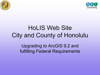
  • 1. HoLIS Web Site City and County of Honolulu Upgrading to ArcGIS 9.2 and fulfilling Federal Requirements
  • 2. Topics to Discuss 1. Project Goal 2. Project Background 3. Project Objectives 4. How do we execute
  • 3. Topics to Discuss 5. Who is BEI Hawaii? 6. Project Goal 7. Functional Requirements 8. Technology Platform 9. DEMO (screenshots) 10. Lesson Learned 11. Where do we go from here?
  • 4. Who is BEI Consulting We are consultants that Core Competencies: bring expertise to your Program and Project organization. Management Assess Challenges Assist in defining Pursue Opportunities Functional Requirements Mobilize the right resource ERP Consulting Manage project risk Application Development GIS Application Developer
  • 5. BEI Team ArcIMS The Development team 3.1 that had design and built the original GIS Map Service for the City (circa 2001) Lead Consultant: John Higuchi, PMP • 10 + years in Project Management in IT projects. Hawaiian Airlines, Title Guaranty, City & County of Honolulu and Federal telemedicine projects. Certified PMP from 2005. Developer: Robert Dolormente • Robert has significant experience as a database administrator and software development manager.
  • 6. Sharing Session Two Mission Critical Recommendations 1. Guidance and Principles for Development 2. Treat it as a project. (start and end)
  • 7. In a nut shell Fast Good Cheap Pick any two!
  • 8. Guiding Rules & Principles • 3 second rule • KISS Rule • Less think • Who are you speaking to (target audience)
  • 9. Rules & Principle in Use 3 Second rule KISS Less Think Target audience is clear
  • 10. Project Management Guidance • Manage by deliverables • Establish a Start and End date • Follow a process – Define, Plan, Implement, Control, and Close
  • 12. Project Goal The project goal is to design, build, and implement a GIS Web publishing system to deliver maps, data, and metadata to users on the Web based upon ERSI ArcGIS/ArcSDE 9.2 Server that complies with Federal USGS and FGDC standards.
  • 13. Target Audience • Checking on building permits • Project research, permit tracking. • Find landowner info to gain access to property. • TMK for permits • To download and print maps with tax map key information to submit along with my building permit application. • obtain or confirm ownership, assessed values and land use designations such as zoning, height limit, SMA status, SLU and flood zone. This is often the source of preliminary information regarding census tract and existing improvement data such as year built and gross floor area. Under the old site, we also regularly use the tabs for obtaining the zoning map, flood zone, and utilties (sewer). • Locating flood boundaries and elevations, flood zone, if property is in an ohana zone, verifying sewer lateral location, locating other infrastructure, general street widths, identify general topography of site, etc.
  • 14. What are the Functional Requirements?
  • 15. Functional Requirements • Software upgrade requirements • Map Publishing functions • Data Update/Maintenance work flows and operations • Data Download demands and functions • Raster imagery integration • TMK Relationships (multiple record display and query) • Google/Virtual Earth Functionality • GIS Server Configuration • Metadata Standards to be reviewed include, but are not limited to, are: – Roads & Structures – Existing layer of the map services – Cadastre – Existing layer of the map services – Utility – Existing layer of the map services • Web Service Linkages/Connectivity - BEI will establish a Web Service Linkage/connectivity between the proposed online map service and USGS. It will supply the layer and metadata as listed in their USGS Best Practice Data Model – Structures document. • National Grid conformance/referencing • Geospatial One Stop
  • 16. Federal Requirements • Data sharing with Federal agencies – DHS, FEMA, and USGS • (USGS) Read-only direct access to The City’s ArcSDE online database – Initial upload – Ongoing/updates to database – Automating the pull of data • National Grid
  • 17. USGS Requirements • Goal of the National Map is to have consistent and current data within a centralized database, hopefully automated • Structure Data – Homeland Security – Hospitals – Clinics – Fire and Police Stations
  • 18. Federal Requirements Geospatial one stop geodata.gov is a web-based portal for one- stop access to maps, data and other geospatial services that will simplify the ability of all levels of government and citizens to find geospatial data and learn more about geospatial projects underway.
  • 20. Technology Platform Hardware List Web Server • Dell Quad Core Xeon Processor X53552x4MB Cache, 2.66GHz, 1333MHz FSB, PE2950, 4GB 667MHz RAM • 438 GB Hard Drive Storage Database Server • Dell Quad Core Xeon Processor X53552x4MB Cache, 2.66GHz, 1333MHz FSB, PE2950, 4GB 667MHz (4X1GB) • 876 GB Hard Drive Storage FTP Server • Dell Quad Core Xeon Processor X53552x4MB Cache, 2.66GHz, 1333MHz FSB, PE2950, 4GB 667MHz (4X1GB) • 1.8 TB Hard Drive Storage
  • 21. WWW City & County of Honolulu HoLIS Web Site November 13, 2008 Firewall Website access Map Web Service accesses data Geospatial data via web service stored on Database Server SDE Map Database Public Web Storing Website Geospatial Service Data Web Server Database Server Website links to shape files stored on FTPServerGIS BEI Hawaii BEI Consulting FTP Server John Higuchi, PMP November 13, 2008 Scalable Web Servers
  • 22. Technology Platform Access Geospatial Data ` WebDataGIS Access Public Website USGS Microsoft Windows Server 2003 Microsoft SQL Server 2005 Access and ESRI ArcSDE 9.2 download shape files ` Administer Geospatial Public Users WebServerGIS Data Microsoft Windows Server 2003 ESRI ArcGIS Server 9.2 ESRI ArcGIS Desktop 9.2 Administer Website ` Administer FTP Data FTPServerGIS C&C Users Microsoft Windows Server 2003 Microsoft SQL Server 2005
  • 23. Static Demo Show me!
  • 24. “Out of the box”
  • 25. Customizations • Tool Bars (3) • Tasks • Grid Results
  • 31. Tasks
  • 35. Lessons Learned • Be Flexible • Joint Collaboration with ESRI & City • Upgrading to 9.3 is necessary • Balance between Data Feast or Famine = Enriched Application or Performance
  • 36. Lessons Learned Tweaking the Map for optimal performance
  • 37. Lessons Learned 1. With adequate hardware and bandwidth, optimizing the database, layers and cartography is more important than limiting content to ensure adequate performance. 2. If many layers, organizing content (hidden or within groups/tabs) is highly recommended. 3. Probably better to produce many focused map services with a specific purpose and targeted audience rather than an all purpose mapping site for everyone (Zoning, Parks, Flood, etc)
  • 38. Lessons Learned 1. With adequate hardware and bandwidth, optimizing the database, layers and cartography is more important than limiting content to ensure adequate performance. Use simple optimized symbology (ESRI Optimized style) Use Static annotation with scale dependant anno classes in single layer Combine points into single layer, use multi part, generalize geometry Cache large static layers (contours) and imagery (ArcSDE may be better) Use simple feature classes (limit feature dataset overhead) and reduce fields Create joins in the db or programmatically, not in map document Check spatial indexing after importing data (“Recalulate”) and index columns Run Analyze on the database regularly (ArcSDE) Ensure adequate connections in Arcsde for the socs (instances X 2) Ensure adequate number of instances on the map service for the expected traffic and functionality (geoprocessing)
  • 39. Lessons Learned 1. With adequate hardware and infrastructure, optimizing the database, layers and cartography is more important than limiting content to ensure adequate performance. 2. If many layers, organizing content (hidden or within groups/tabs) is highly recommended. 3. Probably better to produce many focused map services with a specific purpose and targeted audience rather than an all purpose mapping site (Zoning, Parks, Flood) Group into topic categories Use expandable drill down or tabs consistent between Arc Catalog, Data Catalog listing and Groups in Map Doc TOC (facilitates recall and browsing)
  • 40. ISO 19115 Topic Category or “Theme Codes”
  • 41. Lessons Learned 1. With adequate hardware and infrastructure, optimizing the database, layers and cartography is more important than limiting content to ensure adequate performance. 2. Organizing content (hidden or within groups/tabs) is highly recommended. 3. Probably better to produce many focused map services with a specific purpose and targeted audience rather than an all purpose mapping site (Zoning, Parks, Flood) Streamlined functionality Cityview 9.2 = > 100 layers More user friendly Public GIS WebSite = 66
  • 42. BEI: Mastered the technology --Adapted functionality on the old site to the new --Many improvements in data display and functionality Now what? • Mashups: bring in other services • Add your own layers from the data catalog • Save your own bookmarks (My Places) • Post My Places on Google? (write out KMZ file) • Redlining and Notes (potholes, identify errors in data) • 3D Application • Replication • Ability to add this service to ArcMap or Arc Explorer
  • 43. Potential Applications • Questions to ask of the map service---based on your address Emergency: • General- closest hospital/clinic (how do I get there) – show me nearest bus stop Am i in an evacuation zone – what school district am I in what my designated shelter – what voter precinct Closest police or fire station – closest freeway access (on/off ramp) Beaches with lifeguard towers – nearest life guarded beach Beach access right of ways – what neighborhood board, council district Other: – Closest recycling stations Routing/Directions (ESRI Web Service?) – Recycling, green and waste pickup days Save your place of interest (poi) – points of interest (physical/cultural landmarks) Share your poi – city halls and other government offices Redlining – Businesses (banks, grocery store, pharmacy, Download location to Google KML theaters) – Special Events (farmers markets) – Senior resources (senior centers, golden diners, senior fitness)
  • 45. Thinking outside the Box 3D Viewer: Buildings, Planning Use of Google Earth: – Responsive performance during peak time – Scalability to large numbers of users – Familiar and intuitive user interface – Easy to integrate to sophisticated back-end spatial processing and data validation – Existing GIS software can direct processed data to the intuitive public mapping API – Easy to keep up with technology advances (Google Earth and Virtual Earth advance full version) – Ability to easily integrate existing GIS web services
  • 46. Future: Better Documentation Searchable GIS Data catalog: Keyword/Alphabetized Using Metadata services?
  • 48. Have a Good Web Presence
  • 49. Status of Documentation and Data Transfer • Metadata 98% complete, Data Dictionary 98%; • Holis Website under revision • Data Transfer: nightly transfer within days (month old) • FTP Shape file repository: not yet refreshed (several months old)
  • 51. Data Dictionary • Descriptive • Useful information • References • Download Shapefile • Download ArcGIS Layer file (lyr) (work in progress)
  • 52.
  • 53.
  • 54.
  • 56. Where do we stand
  • 57. Where do we stand? • Launched as Beta on September 2, 2008 • Currently gathering user feedback • Web Site Statistics – Oct. 10, 2008 – Nov. 9, 2008 – 6,175 Visits or 199.19 Visits/Day Avg
  • 58. Where do we stand? “…Very satisfied with their overall performance on this and other projects. They are able to adapt/integrate new technologies as they become available, set goals and reach milestones yet are able to be flexible when the situation requires it. Jon Hodge GIS Analyst City and County of Honolulu
  • 59. Where do we stand? “The City and County of Honolulu’s Web Service is way ahead of the curve nationally.” Paul Wiese National Vector Program Coordinator United States Geological Survey
  • 61. Future Enhancements • Upgrade to 9.3. • Define specific map services geared to unique users. • Overlay your own data with the GIS Layers using this service with ArcGIS Explorer or Arc Reader • More functionality, better printing • 3D functionality • More imagery • Streamlined services • My Places
  • 63. Thanks to: Henry Wolter USGS Geospatial Liaison for Hawaii, Pacific Basin Islands NSDI Partnership Office 677 Ala Moana Blvd, Suite 415 Honolulu, HI 96813 Phone: 808-587-2409 E-mail: hwolter@usgs.gov Ken Schmidt GIS Administrator Honolulu Land Information System City and County of Honolulu 808-768-8057 E-mail: kschmidt@honolulu.gov
  • 64. Links • City and County of Honolulu HoLIS Map Service – http://www.honoluludpp.org/gis • The National Map - The Nation's topographic map for the 21st century – http://nationalmap.usgs.gov • BEI Hawaii – http://www.beiconsultants.com