
![[object Object],[object Object],[object Object],[object Object],The History of GPS](data:image/gif;base64,R0lGODlhAQABAIAAAAAAAP///yH5BAEAAAAALAAAAAABAAEAAAIBRAA7)
Recommandé
Contenu connexe
Tendances
Tendances (20)
En vedette
En vedette (14)
Similaire à How gps works
Similaire à How gps works (20)
Plus de Hossam Zein
Plus de Hossam Zein (20)
Dernier
Dernier (20)
How gps works
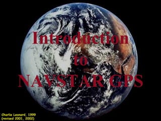
- 1. Introduction to NAVSTAR GPS Charlie Leonard, 1999 (revised 2001, 2002)
- 4. Three Segments of the GPS Control Segment Space Segment User Segment Monitor Stations Ground Antennas Master Station
- 5. Control Segment Kwajalein Atoll US Space Command Hawaii Ascension Is. Diego Garcia Cape Canaveral Ground Antenna Master Control Station Monitor Station
- 9. Position is Based on Time T + 3 Distance between satellite and receiver = “3 times the speed of light” T Signal leaves satellite at time “T” Signal is picked up by the receiver at time “T + 3”
- 10. Pseudo Random Noise Code Receiver PRN Satellite PRN Time Difference
- 11. What Time is It? Zulu Time Military Time (local time on a 24 hour clock) Universal Coordinated Time Greenwich Mean Time Local Time: AM and PM (adjusted for local time zone) GPS Time + 13* * GPS Time is ahead of UTC by approximately 13 seconds
- 12. Signal From One Satellite The receiver is somewhere on this sphere.
- 13. Signals From Two Satellites
- 14. Three Satellites (2D Positioning)
- 16. Three Dimensional (3D) Positioning
- 19. Receiver Errors are Cumulative! User error = +- 1 km System and other flaws = < 9 meters
- 20. Sources of Signal Interference Earth’s Atmosphere Solid Structures Metal Electro-magnetic Fields
- 21. Using GPS Receivers for Positioning and Navigation
- 22. GPS Navigation Terminology XTE (CDI) N (000 0 ) (0 0 ) N Desired Track (DTK) (x º ) Active Leg Distance to Waypoint Bearing (X 0 ) Present Location Speed Over Ground (SOG) Tracking (TRK) (x º ) Active GOTO Waypoint Course Made Good (CMG) (CMG) (x º ) Active From Waypoint
- 23. GPS Navigation: On the Ground Active GOTO Waypoint Location Where GOTO Was Executed Bearing = Course Over Ground (COG) = Cross Track Error (XTE) = Bearing = 65 0 COG = 5 0 XTE = 1/2 mi. Bearing = 78 0 COG = 350 0 XTE = 1/3 mi. Bearing = 40 0 COG = 104 0 XTE = 1/4 mi. Active Leg N
- 26. Planning a Navigation Route Start = Waypoint
- 27. How A Receiver Sees Your Route
- 28. GPS Waypoint Circle of Error X
- 29. GPS Dilution of Precision and Its Affects On GPS Accuracy
- 31. Ideal Satellite Geometry N S W E
- 34. Poor Satellite Geometry N S W E
- 37. Differential GPS
- 38. Real Time Differential GPS True coordinates = x +0, y +0 Correction = x -5, y +3 DGPS correction = x +(30-5) and y +(60+3) True coordinates = x +25, y +63 DGPS Site x +30, y +60 x +5, y -3 x -5, y +3 DGPS Receiver Receiver
- 39. NDGPS Ground Stations National Differential Global Positioning System Yellow areas show overlap between NDGPS stations. Green areas are little to no coverage. Topography may also limit some areas of coverage depicted here.
- 40. NDGPS Ground Stations National Differential Global Positioning System Yellow areas show overlap between NDGPS stations. Green areas are little to no coverage. Topography may also limit some areas of coverage depicted here.
- 41. Wide Area Augmentation System Geostationary WAAS satellites GPS Constellation WAAS Control Station (West Coast) Local Area System (LAAS) WAAS Control Station (East Coast)
- 42. How good is WAAS? With Selective Availability set to zero, and under ideal conditions, a GPS receiver without WAAS can achieve fifteen meter accuracy most of the time.* Under ideal conditions a WAAS equipped GPS receiver can achieve three meter accuracy 95% of the time.* * Precision depends on good satellite geometry, open sky view, and no user induced errors. + - 3 meters +-15 meters