Change Detection Dubai
•Télécharger en tant que PPTX, PDF•
1 j'aime•1,208 vues

1) The document summarizes the use of remote sensing to detect changes in Dubai between 1987 and 2010, focusing on offshore development projects. 2) Methods used for change detection included image differencing, image rationing, and change vector analysis applied to Landsat imagery from the two time periods. 3) Results showed areas of new development for the Palm Jumeirah, Palm Jebel Ali, and The World islands using threshold imagery from differenced and rationed bands that isolated changed pixels.

Recommandé
Recommandé
Contenu connexe
En vedette
En vedette (15)
Plus de Ipsit Dash
Change Detection Dubai
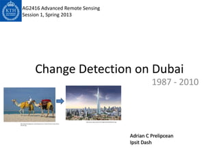
- 1. AG2416 Advanced Remote Sensing Session 1, Spring 2013 Change Detection on Dubai 1987 - 2010 http://www.ssqq.com/archive/images/dubai20%20tower.jpg http://blog.friendlyplanet.com/media/Camels-at-Jebel-Ali-beach-Dubai-iStock- 5011247.jpg Adrian C Prelipcean Ipsit Dash
- 2. Flow of Presentation • Why Dubai? • What Changed from 1987 – 2010? • Which Data? • What Methods? • What Results? 2
- 3. Financially Strong Dubai backed by Oil 2006 Resources Landsat 7 ETM+; 28.5 m Lies in Arabian Desert Area- Sandy and Gravel Desert, Well known for frequent Dunes running N-S due to Salt Crusted 1990 Landsat 4 Coastal Plains TM; 28.5 m Mega Project City- (Offshore) ~ Palm Islands 1973 ~ The World Landsat (Inland) 1 MSS; 57 m ~Business Bay ~ Burj Khalifha http://earthobservatory.nasa.gov/IOTD/view.ph p?id=7153 ~ Dubai Waterfront 3
- 4. Changes • Huge Real Estate Changes involving Mega Projects • Transport Network and Urbanization changed. • Creation of offshore projects like Palm Jumeriah, The World • Our Work bases on change detection in Offshore Projects from 1987 - 2010 4
- 5. The PALM JEBEL ALI The PALM JUMERIAH The WORLD The PALM DEIRA Dubai 2012 5 http://citizenfable.files.wordpress.com/2012/11/dubai_masterplan.jpg
- 6. Change Detection – Remote Sensing • The change must be detectable in the Imagery • Describing Change Abrupt vs Subtle Real vs Detected Natural vs Artificial Interesting vs Uninteresting Uninteresting Changes • Phenological Changes – Seasonal Variations • Sun angle effects – Radiometric calibration – Same period while acquiring images • Atmospheric effects – Radiometric calibration • Geometric – Ensure highly accurate registration 6
- 7. Flow Plan • Image Differencing • Image Rationing Output Input ~ 1987 Imagery • Change Vector Analysis ~ Differenced Imagery ~ 2010 Imagery ~ Rationed Imagery ~ CVA Imagery ~ Accuracy Assessment 7
- 8. Data and its characteristics Landsat Imagery TM 4-5 Procesing Softwares 8
- 9. Feature Gray- False Color, or Best scale NIR Band (black and white) Selecting the Bands Clear Water Black Black 4 tone Band TM Silty Water 2, 4 Dark in 4 Bluish Nonforested Dark gray Blocky pinks, 1 .45-.52 µm blue Coastal Wetlands tone reds, blues, 2 .52-.6 µm green between blacks 3 .63-.69 µm red 4 black water and 4 .76-.9 µm NIR light gray 5 1.55-1.75 µm SWIR land 6 10.4-12.5 µm TIR Sand and Beaches Bright in White, bluish, 7 2.08-2.35 µm SWIR 2, 3 all bands light buff Urban Areas: Usually Mottled bluish- light gray with Band 2: Green light penetrates clear water fairly well, and gives excellent tones in whitish and 3, 4 contrast between clear and turbid (muddy) water. It helps find oil on the 3, reddish specks surface of water, and vegetation (plant life) reflects more green light than any other visible color. Manmade features are still visible. Commercial dark in 4 Band 3: Red light has limited water penetration. It reflects well from dead Urban Areas: Mottled Pinkish to foliage, but not well from live foliage with chlorophyll. It is useful for gray, reddish 3, 4 street identifying vegetation types, soils, and urban features. Residential patterns Band 4: Near IR is good for mapping shorelines and biomass content. It is visible very good at detecting and analyzing vegetation. Transportation Linear Band 7: Another short wavelength infrared has limited cloud penetration patterns; and provides good contrast between different types of vegetation. It is also dirt and useful to measure the moisture content of soil and vegetation concrete 3, 4 roads light in 3, asphalt dark in 4. Source: http://zulu.ssc.nasa.gov/mrsid/tutorial/Landsat%20Tutorial-V1.html 9
- 10. Image normalization • The relative correction aims to reduce variation among multiple images by adjusting the target image (the bands from 1987) to match the base image (the bands from 2010) i.e. to normalize the target image with respect to the base image. • We used the pseudo invariant feature (PIFs) in PCI Geomatica for this. 10
- 11. Image normalization X Y Slope Intercept R Band 1 -1987 Band 1 -2010 0.53 12.51 0.97 Band 2 -1987 Band 2 -2010 0.54 5.16 0.97 Band 3 -1987 Band 3 -2010 0.57 2.53 0.97 Band 4 -1987 Band 4 -2010 0.64 0.22 0.97 Band 5 -1987 Band 5 -2010 0.57 -0.01 0.96 Band 6 -1987 Band 6 -2010 0.42 66.15 0.98 Band 7 -1987 Band 7 -2010 0.55 0.23 0.96 11
- 12. Image differencing • Pros: – Simple – Straightforward – Easy to interpret • Cons: – Cannot provide a detailed change matrix – The difficulty in selecting suitable thresholds to identify the changed areas – Requires atmospheric calibration so that the “no- change” value is equal to 0 – Have to worry about selecting suitable image bands 12
- 13. Image differencing 13
- 14. Image differencing 14
- 15. Image rationing • Pros: – Simple – Reduces impacts of the sun angle, shadow and topography • Cons: – Cannot provide a detailed change matrix – Scales change according to a single date, so same change on the ground may have different score depending on direction of change – Non-normal distribution of the result is often criticized – The difficulty in selecting suitable thresholds to identify the changed areas – Have to worry about selecting suitable image bands 15
- 16. Image rationing 16
- 17. Change Vector Analysis 17
- 18. Results – Image Differencing Band 3 Band 4 Band 7 Band 2 Threshold Threshold Threshold Threshold Imagery Imagery Imagery Imagery 18
- 19. Band 4 19
- 20. Difference Imagery FCC Absolute Difference Band 4,3,2 20
- 21. Results- Image Rationing Band 2 Band 3 Band 4 Band 7 Threshold Imagery Threshold Imagery Threshold Imagery Threshold Imagery 21
- 22. Band 4 22
- 23. Rationed Imagery FCC Ratio band 4,3,2 23
- 24. Change Vector Analysis 24
- 25. References • Introductory Digital Image Processing: A Remote Sensing Perspective – John R. Jensen (Third Edition 2005) • Change detection techniques - D. Lu, P. Mausel, E. Brondi’Zio and E. Moran • Geographic Resources Decision Support System for land use, land cover dynamics analysis - T. V. Ramachandra, Uttam Kumar • http://zulu.ssc.nasa.gov/mrsid/tutorial/Landsat%20Tutorial-V1.html 25