SlideShare une entreprise Scribd logo
1  sur  43
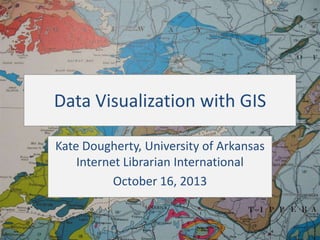
Data Visualization with GIS
Kate Dougherty, University of Arkansas
Internet Librarian International
October 16, 2013
What is GIS?
• Geographic Information Systems (GIS) is a
computer-based method for collecting,
managing, analyzing, modeling, and
presenting geographic or spatial data.
• Can overlay maps and datasets and query
them in terms of their spatial relationships to
each other.
Vector Data
Individual features:
– Points for cities
– Roads
– Boundaries

Raster Data
Continuous or gridded data:
– Air photos
– Satellite imagery
– Scanned maps
What is GIS Used For?
•
•
•
•
•

Identifying conservation areas
Vehicle routing
Siting new facilities
Market and demographic research
Much more!
Where does the data come from?
• Federal
– Geo.data.gov
– Many countries have a
central GIS portal

• State GIS portals
• Local (counties/cities)
– Quality & availability of
local portals vary widely

• Educational institutions
• Non-profits

• Commercial sources
Types of GIS Software
“GIS Lite”

Professional

• Focus on display:

• Focus on analysis:

–
–
–
–

Google Earth
Google Maps
BatchGeo
Many others

–
–
–
–

Esri’s ArcGIS/ArcMap
Quantum GIS
GRASS
Others
Quantum GIS (QGIS)
• Open source professional-level software
– From the Open Source Geospatial Foundation

http://www.qgis.org/
Click to add data

Table of
contents that
shows &
organizes the
project’s
layers.

The “data frame” that displays the spatial data.
“Lightweight” Applications
• GeoCommons.com
• Google Maps/Google
Fusion Tables
• BatchGeo.com

• Simply Map
(subscription)
• Policy Map
(subscription)
GeoCommons.com
• Platform for sharing and • Upload & map data
(files up to 20 MB)
visualization of data
through maps
• Analyze data
• Open source
• Use or combine with
others’ data to create
• Cloud-based
new maps
Description
for field

Check to get
summary
statistics
Summary statistics
for fields where
we checked
“Categorize”.
Analysis
Sample “GIS Lite” Projects for
Libraries
http://www.visualcomplexity.com/vc/project_details.cfm?id=747&index=747&domain=#.Ua0SofwoZIY.twitter
Thank You!
Kate Dougherty
Geosciences and Maps Librarian
University of Arkansas
kdough03@gmail.com
Twitter: @kate_dougherty

Background: Geologic Map of County Clare, http://frackingfreeireland.org/info-to-download/maps/

Contenu connexe

Tendances

Surface Analysis in GIS
Surface Analysis in GISSurface Analysis in GIS
Surface Analysis in GISRituSaha3
 
QUERY AND NETWORK ANALYSIS IN GIS
QUERY AND NETWORK ANALYSIS IN GISQUERY AND NETWORK ANALYSIS IN GIS
QUERY AND NETWORK ANALYSIS IN GISDEVANG KAPADIA
 
Change detection techniques
Change detection techniquesChange detection techniques
Change detection techniquesFemi Opaleye
 
Network analysis in gis
Network analysis in gisNetwork analysis in gis
Network analysis in gisstudent
 
Seminar on gis analysis functions
Seminar on gis analysis functionsSeminar on gis analysis functions
Seminar on gis analysis functionsPramoda Raj
 
Conversion of Existing Data
Conversion of Existing DataConversion of Existing Data
Conversion of Existing DataTilok Chetri
 
Gis Geographical Information System Fundamentals
Gis Geographical Information System FundamentalsGis Geographical Information System Fundamentals
Gis Geographical Information System FundamentalsUroosa Samman
 
Change detection using remote sensing and GIS
Change detection using remote sensing and GISChange detection using remote sensing and GIS
Change detection using remote sensing and GISTilok Chetri
 
MODERN trends of GIS
MODERN trends of GISMODERN trends of GIS
MODERN trends of GISVAISHALI JAIN
 
Image Classification Techniques in GIS
Image Classification Techniques in GISImage Classification Techniques in GIS
Image Classification Techniques in GISSadia Rahat
 
Introduction to gis and arc gis
Introduction to gis and arc gis Introduction to gis and arc gis
Introduction to gis and arc gis Saad Raja
 

Tendances (20)

Introduction to gis
Introduction to gisIntroduction to gis
Introduction to gis
 
Surface Analysis in GIS
Surface Analysis in GISSurface Analysis in GIS
Surface Analysis in GIS
 
Fundamentals of GIS
Fundamentals of GISFundamentals of GIS
Fundamentals of GIS
 
QUERY AND NETWORK ANALYSIS IN GIS
QUERY AND NETWORK ANALYSIS IN GISQUERY AND NETWORK ANALYSIS IN GIS
QUERY AND NETWORK ANALYSIS IN GIS
 
Raster data and Vector data
Raster data and Vector dataRaster data and Vector data
Raster data and Vector data
 
Change detection techniques
Change detection techniquesChange detection techniques
Change detection techniques
 
Network analysis in gis
Network analysis in gisNetwork analysis in gis
Network analysis in gis
 
Seminar on gis analysis functions
Seminar on gis analysis functionsSeminar on gis analysis functions
Seminar on gis analysis functions
 
Gis functions
Gis functionsGis functions
Gis functions
 
Conversion of Existing Data
Conversion of Existing DataConversion of Existing Data
Conversion of Existing Data
 
Gis Geographical Information System Fundamentals
Gis Geographical Information System FundamentalsGis Geographical Information System Fundamentals
Gis Geographical Information System Fundamentals
 
Types of GIS Data
Types of GIS DataTypes of GIS Data
Types of GIS Data
 
Change detection using remote sensing and GIS
Change detection using remote sensing and GISChange detection using remote sensing and GIS
Change detection using remote sensing and GIS
 
GIS Geographical Information System
GIS Geographical Information SystemGIS Geographical Information System
GIS Geographical Information System
 
Geo-spatial Analysis and Modelling
Geo-spatial Analysis and ModellingGeo-spatial Analysis and Modelling
Geo-spatial Analysis and Modelling
 
MODERN trends of GIS
MODERN trends of GISMODERN trends of GIS
MODERN trends of GIS
 
Image Classification Techniques in GIS
Image Classification Techniques in GISImage Classification Techniques in GIS
Image Classification Techniques in GIS
 
Land cover and Land Use
Land cover and Land UseLand cover and Land Use
Land cover and Land Use
 
Manual of Remote Sensing
Manual of Remote SensingManual of Remote Sensing
Manual of Remote Sensing
 
Introduction to gis and arc gis
Introduction to gis and arc gis Introduction to gis and arc gis
Introduction to gis and arc gis
 

En vedette

freeDatamap presentation - data visualization BI & GIS -
freeDatamap presentation - data visualization BI & GIS -freeDatamap presentation - data visualization BI & GIS -
freeDatamap presentation - data visualization BI & GIS -free datamap
 
Geography 110 intro
Geography 110 introGeography 110 intro
Geography 110 introlschmidt1170
 
Intro summer 2016 chc geog 110
Intro summer 2016 chc geog 110Intro summer 2016 chc geog 110
Intro summer 2016 chc geog 110lschmidt1170
 
9 Essential GIS Skills a user should posses
9 Essential GIS Skills a user should posses9 Essential GIS Skills a user should posses
9 Essential GIS Skills a user should possesWanjohi Kibui
 
Monday may 2 water on earth powerpoint
Monday may 2 water on earth powerpointMonday may 2 water on earth powerpoint
Monday may 2 water on earth powerpointMau Dijamco
 
Climates 21 2
Climates 21 2Climates 21 2
Climates 21 2Tamara
 
GIS Solutions for Highway and Roadway Management
GIS Solutions for Highway and Roadway ManagementGIS Solutions for Highway and Roadway Management
GIS Solutions for Highway and Roadway ManagementEsri
 
11 weather and climate
11   weather and climate11   weather and climate
11 weather and climateSUNY Ulster
 
Atmospheric and Oceanic Circulation
Atmospheric and Oceanic CirculationAtmospheric and Oceanic Circulation
Atmospheric and Oceanic Circulationrbrindley
 
Pg class27-midlat cyclones and anti, hurricanes
Pg class27-midlat cyclones and anti, hurricanesPg class27-midlat cyclones and anti, hurricanes
Pg class27-midlat cyclones and anti, hurricanesSUNY Ulster
 
Cyclones and anticyclones
Cyclones and anticyclonesCyclones and anticyclones
Cyclones and anticyclonesNaveenpadukone
 
Inverse distance weighting
Inverse distance weightingInverse distance weighting
Inverse distance weightingPenchala Vineeth
 
Introduction to ArcGIS
Introduction to ArcGISIntroduction to ArcGIS
Introduction to ArcGISKate Dougherty
 

En vedette (20)

freeDatamap presentation - data visualization BI & GIS -
freeDatamap presentation - data visualization BI & GIS -freeDatamap presentation - data visualization BI & GIS -
freeDatamap presentation - data visualization BI & GIS -
 
Surfer
SurferSurfer
Surfer
 
Geography 110 intro
Geography 110 introGeography 110 intro
Geography 110 intro
 
Intro summer 2016 chc geog 110
Intro summer 2016 chc geog 110Intro summer 2016 chc geog 110
Intro summer 2016 chc geog 110
 
9 Essential GIS Skills a user should posses
9 Essential GIS Skills a user should posses9 Essential GIS Skills a user should posses
9 Essential GIS Skills a user should posses
 
Monday may 2 water on earth powerpoint
Monday may 2 water on earth powerpointMonday may 2 water on earth powerpoint
Monday may 2 water on earth powerpoint
 
Climates 21 2
Climates 21 2Climates 21 2
Climates 21 2
 
GIS Solutions for Highway and Roadway Management
GIS Solutions for Highway and Roadway ManagementGIS Solutions for Highway and Roadway Management
GIS Solutions for Highway and Roadway Management
 
11 weather and climate
11   weather and climate11   weather and climate
11 weather and climate
 
natural vegetation
natural vegetationnatural vegetation
natural vegetation
 
Atmospheric and Oceanic Circulation
Atmospheric and Oceanic CirculationAtmospheric and Oceanic Circulation
Atmospheric and Oceanic Circulation
 
7
77
7
 
Pg class27-midlat cyclones and anti, hurricanes
Pg class27-midlat cyclones and anti, hurricanesPg class27-midlat cyclones and anti, hurricanes
Pg class27-midlat cyclones and anti, hurricanes
 
Cyclones and anticyclones
Cyclones and anticyclonesCyclones and anticyclones
Cyclones and anticyclones
 
Pressure And Winds
Pressure And WindsPressure And Winds
Pressure And Winds
 
Inverse distance weighting
Inverse distance weightingInverse distance weighting
Inverse distance weighting
 
Unit 8 water on earth
Unit 8 water on earthUnit 8 water on earth
Unit 8 water on earth
 
Introduction to ArcGIS
Introduction to ArcGISIntroduction to ArcGIS
Introduction to ArcGIS
 
NATURAL VEGETATION
NATURAL VEGETATIONNATURAL VEGETATION
NATURAL VEGETATION
 
Water earth
Water earthWater earth
Water earth
 

Similaire à Visualizing Data with Geographic Information Systems (GIS)

What is GIS (Course Presentation).pdf
What is GIS (Course Presentation).pdfWhat is GIS (Course Presentation).pdf
What is GIS (Course Presentation).pdfjarriesgado
 
Fundamentals of Geographical Information System.ppt
Fundamentals of Geographical Information System.pptFundamentals of Geographical Information System.ppt
Fundamentals of Geographical Information System.pptbimalp7
 
URISA and the Development of a Geospatial Society: Past, Present and Future 
URISA and the Development of a Geospatial Society: Past, Present and Future URISA and the Development of a Geospatial Society: Past, Present and Future 
URISA and the Development of a Geospatial Society: Past, Present and Future Greg Babinski
 
URISA and the Development of a Geospatial Society 
URISA and the Development of a Geospatial Society URISA and the Development of a Geospatial Society 
URISA and the Development of a Geospatial Society Greg Babinski
 
What is Geography Information Systems (GIS)
What is Geography Information Systems (GIS)What is Geography Information Systems (GIS)
What is Geography Information Systems (GIS)John Lanser
 
Geographical information system
Geographical information systemGeographical information system
Geographical information systemBipin Karki
 
Geographical information system
Geographical information systemGeographical information system
Geographical information systemBipin Karki
 
Geographic information system
Geographic information systemGeographic information system
Geographic information systemSumanta Das
 
Crowd-Sourcing Approach of Building Ground Truth Database for Global Urban Ar...
Crowd-Sourcing Approach of Building Ground Truth Database for Global Urban Ar...Crowd-Sourcing Approach of Building Ground Truth Database for Global Urban Ar...
Crowd-Sourcing Approach of Building Ground Truth Database for Global Urban Ar...Hiroyuki Miyazaki
 
GIS in the Miami Valley Region
GIS in the Miami Valley RegionGIS in the Miami Valley Region
GIS in the Miami Valley RegionMVRPC
 
Mvrpcgis p&z 2016
Mvrpcgis p&z 2016Mvrpcgis p&z 2016
Mvrpcgis p&z 2016MVRPC
 
The Use of GIS in Local Government - The City of Monash
The Use of GIS in Local Government - The City of MonashThe Use of GIS in Local Government - The City of Monash
The Use of GIS in Local Government - The City of MonashSteven Truman
 
Intro GIS.pptx
Intro GIS.pptxIntro GIS.pptx
Intro GIS.pptxSamiDan2
 
URISA’s GIS Management Institute
URISA’s GIS Management InstituteURISA’s GIS Management Institute
URISA’s GIS Management InstituteGreg Babinski
 

Similaire à Visualizing Data with Geographic Information Systems (GIS) (20)

What is GIS (Course Presentation).pdf
What is GIS (Course Presentation).pdfWhat is GIS (Course Presentation).pdf
What is GIS (Course Presentation).pdf
 
What is gis
What is gisWhat is gis
What is gis
 
Fundamentals of Geographical Information System.ppt
Fundamentals of Geographical Information System.pptFundamentals of Geographical Information System.ppt
Fundamentals of Geographical Information System.ppt
 
URISA and the Development of a Geospatial Society: Past, Present and Future 
URISA and the Development of a Geospatial Society: Past, Present and Future URISA and the Development of a Geospatial Society: Past, Present and Future 
URISA and the Development of a Geospatial Society: Past, Present and Future 
 
Visualize Data with Maps
Visualize Data with MapsVisualize Data with Maps
Visualize Data with Maps
 
URISA and the Development of a Geospatial Society 
URISA and the Development of a Geospatial Society URISA and the Development of a Geospatial Society 
URISA and the Development of a Geospatial Society 
 
Concept, approach, history, trend
Concept, approach, history, trendConcept, approach, history, trend
Concept, approach, history, trend
 
Gis
GisGis
Gis
 
What is Geography Information Systems (GIS)
What is Geography Information Systems (GIS)What is Geography Information Systems (GIS)
What is Geography Information Systems (GIS)
 
Geographical information system
Geographical information systemGeographical information system
Geographical information system
 
Geographical information system
Geographical information systemGeographical information system
Geographical information system
 
Geographic information system
Geographic information systemGeographic information system
Geographic information system
 
GIS Services at Michigan State University Libraries: Interactions with the Wi...
GIS Services at Michigan State University Libraries: Interactions with the Wi...GIS Services at Michigan State University Libraries: Interactions with the Wi...
GIS Services at Michigan State University Libraries: Interactions with the Wi...
 
GIS BY NIKHIL PAKWANNE
GIS BY NIKHIL PAKWANNEGIS BY NIKHIL PAKWANNE
GIS BY NIKHIL PAKWANNE
 
Crowd-Sourcing Approach of Building Ground Truth Database for Global Urban Ar...
Crowd-Sourcing Approach of Building Ground Truth Database for Global Urban Ar...Crowd-Sourcing Approach of Building Ground Truth Database for Global Urban Ar...
Crowd-Sourcing Approach of Building Ground Truth Database for Global Urban Ar...
 
GIS in the Miami Valley Region
GIS in the Miami Valley RegionGIS in the Miami Valley Region
GIS in the Miami Valley Region
 
Mvrpcgis p&z 2016
Mvrpcgis p&z 2016Mvrpcgis p&z 2016
Mvrpcgis p&z 2016
 
The Use of GIS in Local Government - The City of Monash
The Use of GIS in Local Government - The City of MonashThe Use of GIS in Local Government - The City of Monash
The Use of GIS in Local Government - The City of Monash
 
Intro GIS.pptx
Intro GIS.pptxIntro GIS.pptx
Intro GIS.pptx
 
URISA’s GIS Management Institute
URISA’s GIS Management InstituteURISA’s GIS Management Institute
URISA’s GIS Management Institute
 

Plus de Kate Dougherty

Making Maps for Campus Collaborations
Making Maps for Campus CollaborationsMaking Maps for Campus Collaborations
Making Maps for Campus CollaborationsKate Dougherty
 
Library Resources for Archaeology
Library Resources for ArchaeologyLibrary Resources for Archaeology
Library Resources for ArchaeologyKate Dougherty
 
Library Resources for Pop Culture
Library Resources for Pop CultureLibrary Resources for Pop Culture
Library Resources for Pop CultureKate Dougherty
 
Search Tips for Pop Culture Class
Search Tips for Pop Culture ClassSearch Tips for Pop Culture Class
Search Tips for Pop Culture ClassKate Dougherty
 
Tips on Starting Your Library Research
Tips on Starting Your Library ResearchTips on Starting Your Library Research
Tips on Starting Your Library ResearchKate Dougherty
 
Library Resources for Geology Field Trip Class
Library Resources for Geology Field Trip ClassLibrary Resources for Geology Field Trip Class
Library Resources for Geology Field Trip ClassKate Dougherty
 
Overview of Library Resources for the Geosciences
Overview of Library Resources for the Geosciences Overview of Library Resources for the Geosciences
Overview of Library Resources for the Geosciences Kate Dougherty
 
Introduction to Government Documents
Introduction to Government DocumentsIntroduction to Government Documents
Introduction to Government DocumentsKate Dougherty
 

Plus de Kate Dougherty (8)

Making Maps for Campus Collaborations
Making Maps for Campus CollaborationsMaking Maps for Campus Collaborations
Making Maps for Campus Collaborations
 
Library Resources for Archaeology
Library Resources for ArchaeologyLibrary Resources for Archaeology
Library Resources for Archaeology
 
Library Resources for Pop Culture
Library Resources for Pop CultureLibrary Resources for Pop Culture
Library Resources for Pop Culture
 
Search Tips for Pop Culture Class
Search Tips for Pop Culture ClassSearch Tips for Pop Culture Class
Search Tips for Pop Culture Class
 
Tips on Starting Your Library Research
Tips on Starting Your Library ResearchTips on Starting Your Library Research
Tips on Starting Your Library Research
 
Library Resources for Geology Field Trip Class
Library Resources for Geology Field Trip ClassLibrary Resources for Geology Field Trip Class
Library Resources for Geology Field Trip Class
 
Overview of Library Resources for the Geosciences
Overview of Library Resources for the Geosciences Overview of Library Resources for the Geosciences
Overview of Library Resources for the Geosciences
 
Introduction to Government Documents
Introduction to Government DocumentsIntroduction to Government Documents
Introduction to Government Documents
 

Dernier

What Are The Drone Anti-jamming Systems Technology?
What Are The Drone Anti-jamming Systems Technology?What Are The Drone Anti-jamming Systems Technology?
What Are The Drone Anti-jamming Systems Technology?Antenna Manufacturer Coco
 
08448380779 Call Girls In Greater Kailash - I Women Seeking Men
08448380779 Call Girls In Greater Kailash - I Women Seeking Men08448380779 Call Girls In Greater Kailash - I Women Seeking Men
08448380779 Call Girls In Greater Kailash - I Women Seeking MenDelhi Call girls
 
Real Time Object Detection Using Open CV
Real Time Object Detection Using Open CVReal Time Object Detection Using Open CV
Real Time Object Detection Using Open CVKhem
 
Slack Application Development 101 Slides
Slack Application Development 101 SlidesSlack Application Development 101 Slides
Slack Application Development 101 Slidespraypatel2
 
Data Cloud, More than a CDP by Matt Robison
Data Cloud, More than a CDP by Matt RobisonData Cloud, More than a CDP by Matt Robison
Data Cloud, More than a CDP by Matt RobisonAnna Loughnan Colquhoun
 
IAC 2024 - IA Fast Track to Search Focused AI Solutions
IAC 2024 - IA Fast Track to Search Focused AI SolutionsIAC 2024 - IA Fast Track to Search Focused AI Solutions
IAC 2024 - IA Fast Track to Search Focused AI SolutionsEnterprise Knowledge
 
A Call to Action for Generative AI in 2024
A Call to Action for Generative AI in 2024A Call to Action for Generative AI in 2024
A Call to Action for Generative AI in 2024Results
 
Presentation on how to chat with PDF using ChatGPT code interpreter
Presentation on how to chat with PDF using ChatGPT code interpreterPresentation on how to chat with PDF using ChatGPT code interpreter
Presentation on how to chat with PDF using ChatGPT code interpreternaman860154
 
A Year of the Servo Reboot: Where Are We Now?
A Year of the Servo Reboot: Where Are We Now?A Year of the Servo Reboot: Where Are We Now?
A Year of the Servo Reboot: Where Are We Now?Igalia
 
Raspberry Pi 5: Challenges and Solutions in Bringing up an OpenGL/Vulkan Driv...
Raspberry Pi 5: Challenges and Solutions in Bringing up an OpenGL/Vulkan Driv...Raspberry Pi 5: Challenges and Solutions in Bringing up an OpenGL/Vulkan Driv...
Raspberry Pi 5: Challenges and Solutions in Bringing up an OpenGL/Vulkan Driv...Igalia
 
A Domino Admins Adventures (Engage 2024)
A Domino Admins Adventures (Engage 2024)A Domino Admins Adventures (Engage 2024)
A Domino Admins Adventures (Engage 2024)Gabriella Davis
 
Exploring the Future Potential of AI-Enabled Smartphone Processors
Exploring the Future Potential of AI-Enabled Smartphone ProcessorsExploring the Future Potential of AI-Enabled Smartphone Processors
Exploring the Future Potential of AI-Enabled Smartphone Processorsdebabhi2
 
Finology Group – Insurtech Innovation Award 2024
Finology Group – Insurtech Innovation Award 2024Finology Group – Insurtech Innovation Award 2024
Finology Group – Insurtech Innovation Award 2024The Digital Insurer
 
08448380779 Call Girls In Civil Lines Women Seeking Men
08448380779 Call Girls In Civil Lines Women Seeking Men08448380779 Call Girls In Civil Lines Women Seeking Men
08448380779 Call Girls In Civil Lines Women Seeking MenDelhi Call girls
 
Boost PC performance: How more available memory can improve productivity
Boost PC performance: How more available memory can improve productivityBoost PC performance: How more available memory can improve productivity
Boost PC performance: How more available memory can improve productivityPrincipled Technologies
 
How to convert PDF to text with Nanonets
How to convert PDF to text with NanonetsHow to convert PDF to text with Nanonets
How to convert PDF to text with Nanonetsnaman860154
 
Apidays Singapore 2024 - Building Digital Trust in a Digital Economy by Veron...
Apidays Singapore 2024 - Building Digital Trust in a Digital Economy by Veron...Apidays Singapore 2024 - Building Digital Trust in a Digital Economy by Veron...
Apidays Singapore 2024 - Building Digital Trust in a Digital Economy by Veron...apidays
 
04-2024-HHUG-Sales-and-Marketing-Alignment.pptx
04-2024-HHUG-Sales-and-Marketing-Alignment.pptx04-2024-HHUG-Sales-and-Marketing-Alignment.pptx
04-2024-HHUG-Sales-and-Marketing-Alignment.pptxHampshireHUG
 
GenCyber Cyber Security Day Presentation
GenCyber Cyber Security Day PresentationGenCyber Cyber Security Day Presentation
GenCyber Cyber Security Day PresentationMichael W. Hawkins
 
Artificial Intelligence: Facts and Myths
Artificial Intelligence: Facts and MythsArtificial Intelligence: Facts and Myths
Artificial Intelligence: Facts and MythsJoaquim Jorge
 

Dernier (20)

What Are The Drone Anti-jamming Systems Technology?
What Are The Drone Anti-jamming Systems Technology?What Are The Drone Anti-jamming Systems Technology?
What Are The Drone Anti-jamming Systems Technology?
 
08448380779 Call Girls In Greater Kailash - I Women Seeking Men
08448380779 Call Girls In Greater Kailash - I Women Seeking Men08448380779 Call Girls In Greater Kailash - I Women Seeking Men
08448380779 Call Girls In Greater Kailash - I Women Seeking Men
 
Real Time Object Detection Using Open CV
Real Time Object Detection Using Open CVReal Time Object Detection Using Open CV
Real Time Object Detection Using Open CV
 
Slack Application Development 101 Slides
Slack Application Development 101 SlidesSlack Application Development 101 Slides
Slack Application Development 101 Slides
 
Data Cloud, More than a CDP by Matt Robison
Data Cloud, More than a CDP by Matt RobisonData Cloud, More than a CDP by Matt Robison
Data Cloud, More than a CDP by Matt Robison
 
IAC 2024 - IA Fast Track to Search Focused AI Solutions
IAC 2024 - IA Fast Track to Search Focused AI SolutionsIAC 2024 - IA Fast Track to Search Focused AI Solutions
IAC 2024 - IA Fast Track to Search Focused AI Solutions
 
A Call to Action for Generative AI in 2024
A Call to Action for Generative AI in 2024A Call to Action for Generative AI in 2024
A Call to Action for Generative AI in 2024
 
Presentation on how to chat with PDF using ChatGPT code interpreter
Presentation on how to chat with PDF using ChatGPT code interpreterPresentation on how to chat with PDF using ChatGPT code interpreter
Presentation on how to chat with PDF using ChatGPT code interpreter
 
A Year of the Servo Reboot: Where Are We Now?
A Year of the Servo Reboot: Where Are We Now?A Year of the Servo Reboot: Where Are We Now?
A Year of the Servo Reboot: Where Are We Now?
 
Raspberry Pi 5: Challenges and Solutions in Bringing up an OpenGL/Vulkan Driv...
Raspberry Pi 5: Challenges and Solutions in Bringing up an OpenGL/Vulkan Driv...Raspberry Pi 5: Challenges and Solutions in Bringing up an OpenGL/Vulkan Driv...
Raspberry Pi 5: Challenges and Solutions in Bringing up an OpenGL/Vulkan Driv...
 
A Domino Admins Adventures (Engage 2024)
A Domino Admins Adventures (Engage 2024)A Domino Admins Adventures (Engage 2024)
A Domino Admins Adventures (Engage 2024)
 
Exploring the Future Potential of AI-Enabled Smartphone Processors
Exploring the Future Potential of AI-Enabled Smartphone ProcessorsExploring the Future Potential of AI-Enabled Smartphone Processors
Exploring the Future Potential of AI-Enabled Smartphone Processors
 
Finology Group – Insurtech Innovation Award 2024
Finology Group – Insurtech Innovation Award 2024Finology Group – Insurtech Innovation Award 2024
Finology Group – Insurtech Innovation Award 2024
 
08448380779 Call Girls In Civil Lines Women Seeking Men
08448380779 Call Girls In Civil Lines Women Seeking Men08448380779 Call Girls In Civil Lines Women Seeking Men
08448380779 Call Girls In Civil Lines Women Seeking Men
 
Boost PC performance: How more available memory can improve productivity
Boost PC performance: How more available memory can improve productivityBoost PC performance: How more available memory can improve productivity
Boost PC performance: How more available memory can improve productivity
 
How to convert PDF to text with Nanonets
How to convert PDF to text with NanonetsHow to convert PDF to text with Nanonets
How to convert PDF to text with Nanonets
 
Apidays Singapore 2024 - Building Digital Trust in a Digital Economy by Veron...
Apidays Singapore 2024 - Building Digital Trust in a Digital Economy by Veron...Apidays Singapore 2024 - Building Digital Trust in a Digital Economy by Veron...
Apidays Singapore 2024 - Building Digital Trust in a Digital Economy by Veron...
 
04-2024-HHUG-Sales-and-Marketing-Alignment.pptx
04-2024-HHUG-Sales-and-Marketing-Alignment.pptx04-2024-HHUG-Sales-and-Marketing-Alignment.pptx
04-2024-HHUG-Sales-and-Marketing-Alignment.pptx
 
GenCyber Cyber Security Day Presentation
GenCyber Cyber Security Day PresentationGenCyber Cyber Security Day Presentation
GenCyber Cyber Security Day Presentation
 
Artificial Intelligence: Facts and Myths
Artificial Intelligence: Facts and MythsArtificial Intelligence: Facts and Myths
Artificial Intelligence: Facts and Myths
 

Visualizing Data with Geographic Information Systems (GIS)

  • 1. Data Visualization with GIS Kate Dougherty, University of Arkansas Internet Librarian International October 16, 2013
  • 2. What is GIS? • Geographic Information Systems (GIS) is a computer-based method for collecting, managing, analyzing, modeling, and presenting geographic or spatial data. • Can overlay maps and datasets and query them in terms of their spatial relationships to each other.
  • 3. Vector Data Individual features: – Points for cities – Roads – Boundaries Raster Data Continuous or gridded data: – Air photos – Satellite imagery – Scanned maps
  • 4. What is GIS Used For? • • • • • Identifying conservation areas Vehicle routing Siting new facilities Market and demographic research Much more!
  • 5. Where does the data come from? • Federal – Geo.data.gov – Many countries have a central GIS portal • State GIS portals • Local (counties/cities) – Quality & availability of local portals vary widely • Educational institutions • Non-profits • Commercial sources
  • 6. Types of GIS Software “GIS Lite” Professional • Focus on display: • Focus on analysis: – – – – Google Earth Google Maps BatchGeo Many others – – – – Esri’s ArcGIS/ArcMap Quantum GIS GRASS Others
  • 7. Quantum GIS (QGIS) • Open source professional-level software – From the Open Source Geospatial Foundation http://www.qgis.org/
  • 8. Click to add data Table of contents that shows & organizes the project’s layers. The “data frame” that displays the spatial data.
  • 9.
  • 10.
  • 11.
  • 12.
  • 13.
  • 14.
  • 15.
  • 16.
  • 17.
  • 18.
  • 19. “Lightweight” Applications • GeoCommons.com • Google Maps/Google Fusion Tables • BatchGeo.com • Simply Map (subscription) • Policy Map (subscription)
  • 20. GeoCommons.com • Platform for sharing and • Upload & map data (files up to 20 MB) visualization of data through maps • Analyze data • Open source • Use or combine with others’ data to create • Cloud-based new maps
  • 21.
  • 22.
  • 23.
  • 24.
  • 25.
  • 26.
  • 27.
  • 28.
  • 29. Description for field Check to get summary statistics
  • 30.
  • 31. Summary statistics for fields where we checked “Categorize”.
  • 32.
  • 33.
  • 34.
  • 35.
  • 36.
  • 38.
  • 39. Sample “GIS Lite” Projects for Libraries
  • 40.
  • 41.
  • 43. Thank You! Kate Dougherty Geosciences and Maps Librarian University of Arkansas kdough03@gmail.com Twitter: @kate_dougherty Background: Geologic Map of County Clare, http://frackingfreeireland.org/info-to-download/maps/