Outdoor propagatiom model
•Télécharger en tant que PPTX, PDF•
14 j'aime•16,628 vues

wireless communication

Recommandé
Contenu connexe
Tendances
Tendances (20)
Similaire à Outdoor propagatiom model
Similaire à Outdoor propagatiom model (20)
Dernier
Dernier (20)
Outdoor propagatiom model
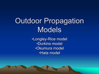
- 1. Outdoor Propagation Models •Longley-Rice model •Durkins model •Okumura model •Hata model
- 2. Outdoor Propagation Models • Radio communication over irregular terrain • Terrain profile taken into account for predicting path loss • Profile- varies from simple curved earth profile to highly mountainous profile • Other propagation models- predict signal strength at a particular point from the receiver. • Outdoor Propagation Models- Based on systematic interpretation of measured data obtained in the specific area. 2
- 3. Longley-Rice model • Applicable for point to point communication system. • Frequency---- 40Mhz to 100Ghz. • Transmission loss---- predicted using path geometry of terrain profile and refractivity of troposphere. • Signal strength within radio horizon---- predicted using Two ray ground reflection model • Diffraction losses from obstacles---- predicted using Fresnel-Kirchoff, knife edge models. • Far field diffraction losses---- predicted using Van der Pol-Bremmer method. 3
- 4. Longley-Rice model • Also available as a computer program to find large-scale median transmission loss relative to free space loss btw 20MHz and 10 GHz. • Inputs to the program ---- – frequency – path length – polarization – ht, hr – surface refractivity – effective radius of the earth – conductivity and dielectric constant of the ground climate. 4
- 5. Longley-Rice model • Program also works on following path specific parameter inputs--- – Horizon distance of antennas – Horizon elevation angle – Angular trans-horizon distance – Terrain irregularity 5
- 6. Longley-Rice model • Two modes of operation • Point-to-point mode prediction: when detailed terrain path profile is available and path specific parameters can be easily determined. • Area mode prediction: when terrain path profile is not available Longley-Rice method provides techniques to estimate path specific parameters. 6
- 7. Longley-Rice Model • Urban Factor (UF) • Deals with radio propagation in urban areas. • Relevant to mobile radio. • An excess term as an allowance for additional attenuation due to urban cluster near the receiving antenna. 7
- 8. Longley-Rice Model • Drawbacks: • Does not provide a way of determining corrections due to environmental factors in the immediate vicinity of the mobile receiver. • Does not consider correction factors due to the effect of buildings and foliage. • Multipath is not considered. 8
- 9. Okumura Model • Widely used model for signal prediction in urban areas. • Frequency ---- 150MHz to 1920MHz • Distance ---- 1km to 100km • Can be used for base station antenna heights ---- 30m to 1000m 9
- 10. Okumura Model • Set of curves--- median attenuation A(f,d) relative to free space--- Amu(f,d) over a quasi-smooth terrain • hte--- 200m and hre---3m • Curves developed with omni-directional antennas at both base and mobile stations. • Frequency (100MHz to 1920MHz) and distance from base station (1km to 100km) vs median attenuation A(f,d) 10
- 11. Okumura Model • Finding path loss--- • find free space path loss (LF) between points of interest • Find median attenuation relative to free space [Amu(f,d)] from the standard curves. • Add Lf and Amu(f,d) along with correction factors (gain factors of base station antenna height G(hte) , mobile station antenna height G( hre ) and gain due to type of environment GAREA) that account for the type of terrain. Median value (50th percentile) of propagation path loss is L50(dB) = LF + Amu(f,d) - G(hte) – G( hre ) - GAREA 11
- 12. Okumura Model • G (hte) = 20 log (hte /200) for 1000m> hte >30m • G (hre ) = 10 log (hre /3) for hre < =3m • G (hre ) = 20 log (hre /3) for 10m> hre >3m • Important terrain related parameters are terrain undulation height, isolated ridge height, average slope of the terrain, mixed land-sea parameter. • Above parameters are taken into consideration for corrective measures. 12
- 13. Okumura Model • Merits • Simplest and best in accuracy in path loss prediction for cellular and land mobile radio systems in cluttered environments. • Very practical and is used in modern land mobile radio systems in Japan. • De-merits • Slow response to rapid changes in terrain hence fairly good in urban and sub-urban areas but not as good in rural areas. • Standard deviation between predicted and measured path loss ---- 10dB to 14dB 13