1.water resources
•Télécharger en tant que PPTX, PDF•
1 j'aime•904 vues

Here are the key points about domestic water use: - Water is used for drinking, cooking, bathing, washing clothes and dishes, flushing toilets, watering lawns and gardens, washing cars, etc. - Domestic use accounts for a relatively small percentage of total water use compared to agriculture and industry. However, it is a high priority use. - Access to safe drinking water and sanitation is essential for public health. Ensuring an adequate domestic water supply is important for communities. - Per capita domestic water use varies significantly between countries and regions depending on factors like climate, infrastructure, appliances, and conservation practices. Developed countries tend to use more water domestically. So in

Recommandé
Recommandé
Contenu connexe
Similaire à 1.water resources
Similaire à 1.water resources (20)
1.water resources
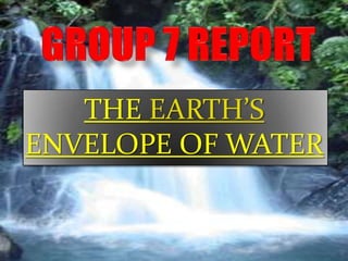
- 1. THE EARTH’S ENVELOPE OF WATER
- 2. • Class Expectations – You can show respect by… • Listening when the teacher or others are talking. – One speaker at a time, please raise your hand. • Please no cross-room conservations during work time. – You can be responsible by… • Staying organized and avoiding distraction. • Staying focused on task completion. – You can make good choices by… • Attending class regularly • Doing your best and never giving up. – Be Safe! • First, last, and always. Copyright © 2010 Ryan P. Murphy
- 3. • Class Expectations – You can show respect by… • Listening when the teacher or others are talking. – One speaker at a time, please raise your hand. • Please no cross-room conservations during work time. – You can be responsible by… • Staying organized and avoiding distraction. • Staying focused on task completion. – You can make good choices by… • Attending class regularly • Doing your best and never giving up. – Be Safe! • First, last, and always. Copyright © 2010 Ryan P. Murphy
- 4. • Class Expectations – You can show respect by… • Listening when the teacher or others are talking. – One speaker at a time, please raise your hand. • Please no cross-room conservations during work time. – You can be responsible by… • Staying organized and avoiding distraction. • Staying focused on task completion. – You can make good choices by… • Attending class regularly • Doing your best and never giving up. – Be Safe! • First, last, and always. Copyright © 2010 Ryan P. Murphy
- 5. • Class Expectations – You can show respect by… • Listening when the teacher or others are talking. – One speaker at a time, please raise your hand. • Please no cross-room conservations during work time. – You can be responsible by… • Staying organized and avoiding distraction. • Staying focused on task completion. – You can make good choices by… • Attending class regularly • Doing your best and never giving up. – Be Safe! • First, last, and always. Copyright © 2010 Ryan P. Murphy
- 6. • Class Expectations – You can show respect by… • Listening when the teacher or others are talking. – One speaker at a time, please raise your hand. • Please no cross-room conversations during work time. – You can be responsible by… • Staying organized and avoiding distraction. • Staying focused on task completion. – You can make good choices by… • Attending class regularly • Doing your best and never giving up. – Be Safe! • First, last, and always. Copyright © 2010 Ryan P. Murphy
- 7. • Class Expectations – You can show respect by… • Listening when the teacher or others are talking. – One speaker at a time, please raise your hand. • Please no cross-room conversations during work time. – You can be responsible by… • Staying organized and avoiding distraction. • Staying focused on task completion. – You can make good choices by… • Attending class regularly • Doing your best and never giving up. – Be Safe! • First, last, and always. Copyright © 2010 Ryan P. Murphy
- 8. • Class Expectations – You can show respect by… • Listening when the teacher or others are talking. – One speaker at a time, please raise your hand. • Please no cross-room conversations during work time. – You can be responsible by… • Staying organized and avoiding distraction. • Staying focused on task completion. – You can make good choices by… • Attending class regularly • Doing your best and never giving up. – Be Safe! • First, last, and always. Copyright © 2010 Ryan P. Murphy
- 9. • Class Expectations – You can show respect by… • Listening when the teacher or others are talking. – One speaker at a time, please raise your hand. • Please no cross-room conversations during work time. – You can be responsible by… • Staying organized and avoiding distraction. • Staying focused on task completion. – You can make good choices by… • Attending class regularly • Doing your best and never giving up. – Be Safe! • First, last, and always. Copyright © 2010 Ryan P. Murphy
- 10. • Class Expectations – You can show respect by… • Listening when the teacher or others are talking. – One speaker at a time, please raise your hand. • Please no cross-room conversations during work time. – You can be responsible by… • Staying organized and avoiding distraction. • Staying focused on task completion. – You can make good choices by… • Attending class regularly • Doing your best and never giving up. – Be Safe! • First, last, and always. Copyright © 2010 Ryan P. Murphy
- 11. • Class Expectations – You can show respect by… • Listening when the teacher or others are talking. – One speaker at a time, please raise your hand. • Please no cross-room conversations during work time. – You can be responsible by… • Staying organized and avoiding distraction. • Staying focused on task completion. – You can make good choices by… • Attending class regularly • Doing your best and never giving up. – Be Safe! • First, last, and always. Copyright © 2010 Ryan P. Murphy
- 12. • Class Expectations – You can show respect by… • Listening when the teacher or others are talking. – One speaker at a time, please raise your hand. • Please no cross-room conversations during work time. – You can be responsible by… • Staying organized and avoiding distraction. • Staying focused on task completion. – You can make good choices by… • Attending class regularly • Doing your best and never giving up. – Be Safe! • First, last, and always. Copyright © 2010 Ryan P. Murphy
- 13. • Class Expectations – You can show respect by… • Listening when the teacher or others are talking. – One speaker at a time, please raise your hand. • Please no cross-room conversations during work time. – You can be responsible by… • Staying organized and avoiding distraction. • Staying focused on task completion. – You can make good choices by… • Attending class regularly • Doing your best and never giving up. – Be Safe! • First, last, and always. Copyright © 2010 Ryan P. Murphy
- 14. • Class Expectations – You can show respect by… • Listening when the teacher or others are talking. – One speaker at a time, please raise your hand. • Please no cross-room conversations during work time. – You can be responsible by… • Staying organized and avoiding distraction. • Staying focused on task completion. – You can make good choices by… • Attending class regularly • Doing your best and never giving up. – Be Safe! • First, last, and always. Copyright © 2010 Ryan P. Murphy
- 15. • Remember! – Working hard and earning a strong education will help you reach your hopes and dreams. Copyright © 2010 Ryan P. Murphy
- 16. 9.1 The earth’s water supply. 9.2 Water in the ground. 9.3 Rivers. 9.4 Oceans. 9.5Waves,Tides and Currents. 9.6 The depth of the sea. 9.7 Deep-sea exploration.
- 17. Global Environment Awareness Lectured by: Leonard Vincent credo Presented by: Group 7
- 19. Table of Contents 1. Water – The Definition 2. Water Forms and Distribution 3. Types of Water Uses 4. Water Availability 5. Fresh Water Shortage 6. Water Use Problems and Conflicts 7. Increase Water Supply 8. Watershed Management 9. Multipurpose Water Resource Management 10. Conclusion and Recommendation 19
- 20. 1. Water – The Definition Water is a marvelous substance which can be beautiful, powerful and destructive. 20
- 21. 1.1. Water Physical Attributes Water is found in three states Liquid Solid Gas 21
- 22. 1.2. Hydrologic Cycle 22
- 23. 2. Water Forms and Distribution About 71% of the earth’s surface is covered with water. 23
- 24. 2. Water Forms and Distribution Source: Environmental Science – A Global Concern, Water Use and Management 24
- 25. 2.1. Oceans Is the largest area and volume of water. Contain more than 97% of the earth’s water. Contain an average of 35g salt per liter. Can be used after being desalinated. 25
- 26. 2.2. Ice and Snow Contain almost 90% of freshwater. Is as much as 2km thick. Situate mostly in Antarctica (85%), Greenland (10%), and other snow mountain (5%). 26
- 27. 2.3. Groundwater Groundwater is water in the rock and soil layer beneath Earth’s surface. Absorb excess runoff rain and snow on ground. Return to lakes, streams, rivers and/or marshes. Is readily available for use and drinking. 27
- 28. 2.4. Lakes Lakes are created from variety of geological events: Tectonic-basin lake Volcanic lake Glacial lake Groundwater-discharge lake Lakes generate water from: Collection of water in low areas Natural or man-made dam(s) Rivers and streams Groundwater 28
- 29. 2.4. Lakes (cont.) Freshwater lakes Contribute 91,000km3 (about 0.007% of total Earth’s water) Provide water for agricultural irrigation, industrial processes, municipal uses and residential water supplies. Major freshwater lakes: Caspian Sea (Central Asia), Baikal Lake (Russia), Tanganyika Lake (Eastern Africa), Lake Superior (U.S), and Malawi Lake (Eastern Africa) 29
- 30. 2.4. Lakes (cont.) Saline lakes Possess 85,000km3 (about 0.006% of total Earth’s water) Saline lakes’ water cannot be used due to high salinity. The Great Salt Lake Major saline lakes: Caspian Sea (Central Asia), The Great Salt Lake (U.S.), The Dead Sea (between Jordan & Israel), and Aral Sea (between Kazakhstan and Uzbekistan). The Dead Sea 30
- 31. 2.5. Rivers and Streams Rivers and streams are bodies of flowing surface water driven by gravity. Rivers and Streams contain only 2,120km3 (about 0.6% of liquid fresh water surface and around 0.0002% of the Earth’s water.) 31
- 32. 2.5. Rivers and Streams (cont.) World’s Major Rivers (based on average annual discharge) Source: Environmental Science – A Global Concern, Water Use and Management 32
- 33. 2.6. Wetlands and Soil Moisture Wetland are areas of land where water covers the surface for at least part of the year. They are not as important as lakes and rivers for water storage. However, they play vital roles in: Erosion protection Flood reduction Groundwater replenishment Trapping nutrient and sediment Water purification Providing fish and wildlife habitat 33
- 34. 5.7. Atmosphere Atmosphere contains about 0.001% of total Earth’s water. It is around 4% of air volume in the atmosphere. Movement of water through atmosphere provide mechanism for distributing freshwater to terrestrial reservoir (in form of rain, snow, hail…). 34
- 35. 3. Types of Water Uses Off-Stream Uses In-Stream Uses Agriculture Hydropower Thermoelectric Navigation Industrial Recreation Mining Ecosystem Support Domestic Commercial 35
- 36. 3. Types of Water Uses Basic Assumption (by UN Water) World Water Use Irrigation Industry Domestic 8% 22% 70% Source: World Water Assessment Source: Food and Agriculture Program (WWAP) Organization (FAO) 36
- 37. 3. Types of Water Uses China 2008 Water Resource Report Ecological Residential 2% 12% Source: China 2008 Water Industry Resources Report 24% Agriculture 62% Cambodia 2010 Water Use Others Industry 10% 4% Domestic Source: Cambodian Ministry 17% Agriculture of Environment 56% Livestock 13% 37
- 38. 3.1. Off-Stream Uses Agriculture Thermoelectric Industrial Mining Domestic Commercial 38
- 39. a. Agriculture Irrigation Crop irrigation consume 2/3 of water withdrawal. Evaporation and seepage from unlined irrigation systems are the principal water losses. There are three types of irrigation systems: Flood Irrigation Sprinkler Irrigation Drip Irrigation 39
- 40. a. Agriculture (cont.) Livestock Watering livestock Dairy operation Cooling livestock facilities Dairy sanitation and clean-up Animal waste disposal 40
- 41. a. Agriculture (cont.) Aquaculture Raising fish. Raising shellfish. Raising shrimp and lobster. Raising other creatures living in water. 41
- 42. b. Thermoelectric Water is used in production of electrical power. Thermoelectric is one of the largest uses of water in U.S. In 2005, it consumed about 201,000 million gallons of water each day. Thermoelectric occupied 49% of total water use in U.S. Both freshwater and saline water are used in thermoelectric. 42
- 43. c. Industrial Industries need water to cool down their machinery to a temperature that allows the manufacturing process to keep going. Water is also needed to clean machinery, products, and buildings. 43
- 44. c. Industrial (cont.) In 2005, U.S. industrial uses were 83% (15,000 gallons/day) surface water and 17% (3,110 gallons/day) groundwater. In Cambodia, rough estimation by Water Environment Partnership in Asia showed: Major industry consumed: 1,000-2,000 m3/day Large industry consumed: 100-500 m3/day Medium & small industry: 50 m3/day 44
- 45. d. Mining Water is used for the extraction of minerals that can be in forms of: Solid: coal, iron, gold, sand – etc. Liquid: crude oil. Gas: natural gases. 45
- 46. e. Domestic Domestic water use is the consumption for household purposes – both indoor and outdoor. In Cambodia, domestic water use was around 136 million m3 (17% of total consumption). Only people in Phnom Penh can access to piped water. 85% of piped water was consumed. 46
- 47. f. Commercial Water is used in businesses such as hotels, restaurants, marketplaces, and so on. In Phnom Penh, commercial use was 14% of total piped water consumption (about 11,480 m3 per day). 47
- 48. 3.2. In-Stream Uses Hydropower Recreation Navigation Ecosystem Support 48
- 49. 4. Water Availability Source: Environmental Science – A Global Concern, Water Use and Management 49
- 50. 4.1. Earth’s Water 50
- 51. 4.2. Water Stress & Water Scarcity Water Stress: Annual water supplies is less than 1,700m3 per person. Water Scarcity: Annual water supplies is less than 1,000m3 per person. Absolute scarcity: Annual water supplies is less than 500m3 per person. 51
- 52. 52
- 53. 5. Fresh Water Shortage Fresh Water Shortage is due to: Population growth Lack of access to clean water Groundwater is being depleted Climate change / global warming Rivers and lakes are shrinking 53
- 54. Strangled by the water policies of its neighbors, Turkey and Syria, a two-year drought and years of misuse by Iraq and its farmers, the Euphrates River is significantly smaller than it was just a few years ago, and some officials worry that it could soon be half of what it is now. 54
- 55. Leaky canals and wasteful irrigation practices squandered the water, and poor drainage left fields so salty from evaporated water. 55
- 56. In the marshes, where the Euphrates nears the end of its 1,730-mile journey and mingles with the less salty waters of the Tigris before emptying into the Persian Gulf, the situation is grave. 56
- 57. Fishermen in the Hafar Canal, a shallow tributary of the Euphrates River. 57
- 58. 10 year drought in the Colorado River basin. 2007 1983 58
- 59. 6. Water Use Problems and Conflicts Water Overuse Overuse in agriculture Overuse in residence Overuse in community Some interesting facts: Water needed to produce our daily food: 40 liters to produce 1 slice of white bread. 70 liters to produce 1 apple. 1,300 liters to produce 1kg of wheat. 3,400 liters to produce 1kg of rice. 3,900 liters to produce 1kg of chicken meat. 15,500 liters to produce 1kg of beef. 59
- 60. 7. Increase Water Supply Water Conservation Reclamation of sewage water Development of groundwater Desalinization Developing salt-resistant crops Developing drought-resistant crops Rainmaking Harvesting iceberg Long distance water transport Improve integration of water use 60
- 61. 8. Watershed Management Watershed – the definition A watershed is a connected series of streams, rivers, and lakes that collects water from a specific area of land. Watersheds are important habitats for animals and plants, and offer a source of drinking and recreational water for many communities. 61
- 62. Tips on How to Save Water Increasing water resources start from all of us! Don’t flush every time you use the toilet. Take shorter showers Don’t wash your car so often. Don’t let the faucet run while washing hands, dishes, food, or brushing your teeth. Don’t run the dishwasher when half full. Dispose of used motor oil, household hazardous waste, batteries, etc., responsibly. 62
- 63. Tips on How to Save Water Don’t dump anything down a storm sewer that you DOWNLOAD OUR wouldn’t want to drink. Avoid using toxic or hazardous chemicals for simple PRESENTATION AT cleaning or plumbing jobs. If you have a lawn, use water sparingly. Water your grass www.leonpower.com.ph and garden at night, not in the middle of the day. Use water-conserving appliances: low-flow showers, low- flush toilets, and aerated faucets. Use recycled (gray) water for lawns, house plants, car washing. Check your toilet for leaks. 63
- 64. Prepared by: Leonard Vincent Credo Presented by: Group 7
- 65. 65
- 66. Ground Water • ground water: the water that lies beneath the ground surface, filling the pore space between grains in bodies of sediment and clastic sedimentary rock, and filling cracks and crevices in all types of rock • ground water is a major economic resource, particularly in the dry western areas of the US and Canada • source of ground water is rain and snow that falls to the ground a portion of which percolates down into the ground to become ground water
- 67. Porosity and Permeability • porosity: the percentage of rock or sediment that consists of voids or openings • permeability: the capacity of a rock to transmit a fluid such as water or petroleum through pores and fractures • porous: a rock that holds much water • permeable: a rock that allows water to flow easily through it • impermeable: a rock that does not allow water to flow through it easily
- 68. The Water Table • saturated zone: the subsurface zone in which all rock openings are filled with water • water table: the upper surface of the zone of saturation • vadose zone: a subsurface zone in which rock openings are generally unsaturated and filled partly with air and partly with water; above the saturated zone • capillary fringe: a transition zone with higher moisture content at the base of the vadose zone just above the water table
- 69. The Water Table (cont.)
- 70. The Water Table (cont.) • perched water table: the top of a body of ground water separated from the main water table beneath it by a zone that is not saturated
- 71. The Movement of Ground Water • most ground water moves relatively slowly through rock underground • because it moves in response to differences in water pressure and elevation, water within the upper part of the saturated zone tends to move downward following the slope of the water table Movement of ground water beneath a sloping water table in uniformly permeable rock. Near the surface the ground water tends to flow parallel to the sloping water table
- 72. Movement of Ground Water (cont.) • factors affecting the flow of ground water: • the slope of the water table - the steeper the water table, the faster ground water moves • permeability - if rock pores are small and poorly connected, water moves slowly; when openings are large and well connected, the flow of water is more rapid
- 73. Aquifers • aquifer: a body of saturated rock or sediment through which water can move easily • good aquifers include sandstone, conglomerate, well-joined limestone, bodies of sand and gravel, and some fragmental or fractured volcanic rocks such as columnar basalt • aquitards: when the porosity of a rock is 1% or less and therefore retards the flow of ground water
- 74. Aquifers (cont.) • unconfined aquifer: a partially filed aquifer exposed to the land surface and marked by a rising and falling water table • confined aquifer (artesian aquifer): an aquifer completely filled with pressurized water and separated from the land surface by a relatively impermeable confining bed, such as shale
- 75. Wells • well: a deep hole, generally cylindrical, that is dug of drilled into the ground to penetrate an aquifer within the saturated zone • recharge: the addition of new water to the saturated zone • the water table in an unconfined aquifer rises in wet seasons and falls in dry seasons as water drains out of the saturated zone into rivers Wet season: water table and rivers are high; Dry season: water table and rivers are low; springs and wells flow readily some springs and wells dry up
- 76. Wells (cont.) • cone of depression: a depression of the water table formed around a well when water is pumped out; it is shaped like an inverted cone • drawdown: the lowering of the water table near a pumped well Pumping well lowers the water table into a cone of depression
- 77. Wells (cont.) • artesian well: a well in which water rises above the aquifer Artesian well spouts water above land surface in South Dakota, early 1900s. Heave use of this aquifer has reduced water pressure so much that spouts do not occur today
- 78. Springs and Streams • spring: a place where water flows naturally from rock onto the land surface • some springs discharge where the water table Springs can form along faults when permeable rock has been the land surface, but they also occur intersects moved against less permeable rock. where water flows out from caverns or along Arrows show relative motion along fault fractures, faults, or rock contacts that come to the surface Springs form at the contact between a permeable rock such as sandstone and an underlying less permeable rock such as shale Water enters caves along joints in limestone and exits as springs at the mouths of caves Water moves along fractures in crystalline rock and forms springs where the fractures intersect the land surface
- 79. Springs and Streams (cont.) • gaining stream: a stream that receives water from the zone of saturation • losing stream: a stream that looses water to the zone of saturation Stream gaining water from saturated zone Water table can be close to the land surface beneath a dry stream bed Stream losing water through stream bed to saturated zone
- 80. Pollution of Ground Water • pesticides, herbicides, fertilizers: chemicals that are applied to agricultural crops that can find their way into ground water when rain or irrigation water leaches the poisons downward into the soil • rain can also leach pollutants from city dumps into ground-water supplies • Heavy metals such as mercury, lead, chromium, copper, and cadmium, together with household chemicals and poisons, can all be concentrated in ground-water supplies beneath dumps
- 81. Pollution of Ground Water (cont.) • liquid and solid wastes from septic tanks, sewage plants, and animal feedlots and slaughterhouses may contain bacteria, viruses, and parasites that can contaminate ground water • acid mine drainage from coal and metal mines can contaminate both surface and ground water • radioactive waste can cause the pollution of ground water due to the shallow burial of low-level solid and liquid radioactive wastes from the nuclear power industry
- 82. Water-table slope is reversed by pumping, changing direction of the ground-water flow, and polluting the well Pollution of Ground Watersteepens near drawing pollutants intoveloci Water table (cont.) increasing the a well of ground-water flow and a dump, • pumping wells can cause or aggravate ground- water pollution
- 83. Balancing Withdrawal and Recharge • a local supply of groundwater will last indefinitely if it is withdrawn for use at a rate equal to or less than the rate of recharge to the aquifer • if ground water is withdrawn faster than it is being recharged, however, the supply is being reduced and will one day be gone
- 84. Balancing Withdrawal and Recharge • heavy use of ground water can result in: • a regional water table dropping • deepening of a well which means more electricity is needed to pump the water to the surface • the ground surface settling because the water no longer supports the rock and sediment Subsidence of the land surface caused by the extraction of ground water, near Mendota, San Joaquin Valley, CA. Signs on the pole indicate the positions of the land surface in 1925, 1955, and 1977. The land sank 30 feet in 52 years.
- 85. Balancing Withdrawal and Recharge (cont.) • to avoid the problems of falling water tables, subsidence, and compaction, many towns use artificial recharge to increase recharge; natural floodwaters or treated industrial or domestic wastewaters are stored in infiltration ponds in the surface to increase the rate of water percolation into the ground
- 86. Effects of Ground-Water Action • caves (or caverns): naturally formed underground chamber • most caves develop when slightly acidic ground water dissolves limestone along joints and bedding planes, opening up cavern systems as calcite is carried away in solution • most caves probably are formed by ground water circulating below the water table H2O + CO2 + CaCO3 Ca++ + 2HCO3- water carbon calcite in calcium bicarbonate dioxide limestone ion ion development of caves (solution) development of flowstone and dripstone (precipitation)
- 87. Effects of Ground-Water Action (cont.) • stalactites: icicle-like pendants of dripstone hanging from cave ceilings, generally slender and are commonly aligned along cracks in the ceiling, which act as conduits for ground water • stalagmites: cone-shaped masses of drip-stone formed on cave floors, generally directly below stalactites Water moves along fractures and bedding planes in Falling water table allows cave system, now greatly limestone, dissolving the limestone to form caves enlarged, to fill with air. Calcite precipitation forms below the water table stalactites, stalagmites, and columns above the water tab
- 88. Effects of Ground-Water Action (cont.) Karst topography is marked by underground caves and numerous surface sinkholes. A major river may cross the region, but small surface streams generally disappear down sinkholes • karst topography: an area with many sinkholes and with cave systems beneath the land surface
- 89. Effects of Ground-Water Action (cont.) • petrified wood: develops when porous buried wood is either filled in or replaced by inorganic silica carried in by ground water • concentration: a hard, round mass that develops when a considerable amount of cementing material precipitates locally in a rock, often around an organic nucleus • geodes: partly hollow, globe-shaped bodies found in some limestones and locally in other rocks Petrified log Concretions that have weathered out of shale Geodes
- 90. Hot Water Underground • hot springs: springs in which the water is warmer than human body temperature • water can gain heat in two ways while underground: • ground water may circulate near a magma chamber or a body of cooling igneous rock • ground water may circulate unusually deep in the earth
- 91. Hot Water Underground • geyser: a type of hot spring that periodically erupts hot water and stream; the water is generally near boiling (100oC) 1 3 2 4
- 92. Geothermal Energy • Electricity can be generated by harnessing naturally occurring stream and hot water in areas that are exceptionally hot underground (geothermal areas); • nonelectric uses of geothermal energy include space heating, as well as paper manufacturing, ore processing, and food preparation
- 93. Effects of Ground-Water Action (cont.) • sinkholes: closed depressions found on land surfaces underlain by limestone; they form either by the collapse of a cave roof or by solution as descending water enlarges a crack in limestone Trees grow in a sinkhole formed in limestone near Mammoth Cave, Kentucky A collapse sinkhole that formed suddenly in Winter Park, Florida, in 1981
- 94. 94
- 95. Leonard Vincent B. Credo
- 96. This science unit belongs to Ryan P Murphy Copyright 2010 Copyright © 2010 Ryan P. Murphy
- 97. Bar
- 98. • Overview of River Unit – Watersheds – Rivers of the United States – Profile of Rivers – Headwater, Downriver, Floodplain, Delta – Stream Order – Stream Table – Features of the river – Water Quality Assessment (EPT’s) – Vernal Pools – Rivers and Flooding – Levees – Dams – Salmon Simulation – Fish – Lake Turnover Copyright © 2010 Ryan P. Murphy
- 99. • Overview of River Unit – Watersheds – Rivers of the United States – Profile of Rivers – Headwater, Downriver, Floodplain, Delta – Stream Order – Stream Table – Features of the river – Water Quality Assessment (EPT’s) – Vernal Pools – Rivers and Flooding – Levees – Dams – Salmon Simulation – Fish – Lake Turnover Copyright © 2010 Ryan P. Murphy
- 100. • Overview of River Unit – Watersheds – Rivers of the United States – Profile of Rivers – Headwater, Downriver, Floodplain, Delta – Stream Order – Stream Table – Features of the river – Water Quality Assessment (EPT’s) – Vernal Pools – Rivers and Flooding – Levees – Dams – Salmon Simulation – Fish – Lake Turnover Copyright © 2010 Ryan P. Murphy
- 101. • Overview of River Unit – Watersheds – Rivers of the United States – Profile of Rivers – Headwater, Downriver, Floodplain, Delta – Stream Order – Stream Table – Features of the river – Water Quality Assessment (EPT’s) – Vernal Pools – Rivers and Flooding – Levees – Dams – Salmon Simulation – Fish – Lake Turnover Copyright © 2010 Ryan P. Murphy
- 102. • Overview of River Unit – Watersheds – Rivers of the United States – Profile of Rivers – Headwater, Downriver, Floodplain, Delta – Stream Order – Stream Table – Features of the river – Water Quality Assessment (EPT’s) – Vernal Pools – Rivers and Flooding – Levees – Dams – Salmon Simulation – Fish – Lake Turnover Copyright © 2010 Ryan P. Murphy
- 103. • Overview of River Unit – Watersheds – Rivers of the United States – Profile of Rivers – Headwater, Downriver, Floodplain, Delta – Stream Order – Stream Table – Features of the river – Water Quality Assessment (EPT’s) – Vernal Pools – Rivers and Flooding – Levees – Dams – Salmon Simulation – Fish – Lake Turnover Copyright © 2010 Ryan P. Murphy
- 104. • Overview of River Unit – Watersheds – Rivers of the United States – Profile of Rivers – Headwater, Downriver, Floodplain, Delta – Stream Order – Stream Table – Features of the river – Water Quality Assessment (EPT’s) – Vernal Pools – Rivers and Flooding – Levees – Dams – Salmon Simulation – Fish – Lake Turnover Copyright © 2010 Ryan P. Murphy
- 105. • Overview of River Unit – Watersheds – Rivers of the United States – Profile of Rivers – Headwater, Downriver, Floodplain, Delta – Stream Order – Stream Table – Features of the river – Water Quality Assessment (EPT’s) – Vernal Pools – Rivers and Flooding – Levees – Dams – Salmon Simulation – Fish – Lake Turnover Copyright © 2010 Ryan P. Murphy
- 106. • Overview of River Unit – Watersheds – Rivers of the United States – Profile of Rivers – Headwater, Downriver, Floodplain, Delta – Stream Order – Stream Table – Features of the river – Water Quality Assessment (EPT’s) – Vernal Pools – Rivers and Flooding – Levees – Dams – Salmon Simulation – Fish – Lake Turnover Copyright © 2010 Ryan P. Murphy
- 107. • Overview of River Unit – Watersheds – Rivers of the United States – Profile of Rivers – Headwater, Downriver, Floodplain, Delta – Stream Order – Stream Table – Features of the river – Water Quality Assessment (EPT’s) – Vernal Pools – Rivers and Flooding – Levees – Dams – Salmon Simulation – Fish – Lake Turnover Copyright © 2010 Ryan P. Murphy
- 108. • Overview of River Unit – Watersheds – Rivers of the United States – Profile of Rivers – Headwater, Downriver, Floodplain, Delta – Stream Order – Stream Table – Features of the river – Water Quality Assessment (EPT’s) – Vernal Pools – Rivers and Flooding – Levees – Dams – Salmon Simulation – Fish – Lake Turnover Copyright © 2010 Ryan P. Murphy
- 109. • Overview of River Unit – Watersheds – Rivers of the United States – Profile of Rivers – Headwater, Downriver, Floodplain, Delta – Stream Order – Stream Table – Features of the river – Water Quality Assessment (EPT’s) – Vernal Pools – Rivers and Flooding – Levees – Dams – Salmon Simulation – Fish – Lake Turnover Copyright © 2010 Ryan P. Murphy
- 110. • Overview of River Unit – Watersheds – Rivers of the United States – Profile of Rivers – Headwater, Downriver, Floodplain, Delta – Stream Order – Stream Table – Features of the river – Water Quality Assessment (EPT’s) – Vernal Pools – Rivers and Flooding – Levees – Dams – Salmon Simulation – Fish – Lake Turnover Copyright © 2010 Ryan P. Murphy
- 111. • Overview of River Unit – Watersheds – Rivers of the United States – Profile of Rivers – Headwater, Downriver, Floodplain, Delta – Stream Order – Stream Table – Features of the river – Water Quality Assessment (EPT’s) – Vernal Pools – Rivers and Flooding – Levees – Dams – Salmon Simulation – Fish – Lake Turnover Copyright © 2010 Ryan P. Murphy
- 112. • Overview of River Unit – Watersheds – Rivers of the United States – Profile of Rivers – Headwater, Downriver, Floodplain, Delta – Stream Order – Stream Table – Features of the river – Water Quality Assessment (EPT’s) – Vernal Pools – Rivers and Flooding – Levees – Dams – Salmon Simulation – Fish – Lake Turnover Copyright © 2010 Ryan P. Murphy
- 113. • Overview of River Unit – Watersheds – Rivers of the United States – Profile of Rivers – Headwater, Downriver, Floodplain, Delta – Stream Order – Stream Table – Features of the river – Water Quality Assessment (EPT’s) – Vernal Pools – Rivers and Flooding – Levees – Dams – Salmon Simulation – Fish – Lake Turnover – Much more… Copyright © 2010 Ryan P. Murphy
- 114. Area of Focus: Watersheds Copyright © 2010 Ryan P. Murphy
- 115. Area of Focus: Watersheds Copyright © 2010 Ryan P. Murphy
- 116. Watershed: The region draining into a river. Copyright © 2010 Ryan P. Murphy
- 118. • Picture of the Mississippi River Watershed. – This watershed is the largest in the United States. Copyright © 2010 Ryan P. Murphy
- 119. • Picture of the Mississippi River Watershed. – This watershed is the largest in the United States. Copyright © 2010 Ryan P. Murphy
- 133. • What do you think the Great Basin is?
- 134. • What do you think the Great Basin is?
- 135. • The Great Basin is a watershed where the water does not flow to the ocean. – The Great Salt Lake is in the Great Basin. Copyright © 2010 Ryan P. Murphy
- 136. Copyright © 2010 Ryan P. Murphy
- 137. The mineral rich water has nowhere to go. Copyright © 2010 Ryan P. Murphy
- 138. The water then Evaporates. Copyright © 2010 Ryan P. Murphy
- 139. The Great Salt Lake Evaporation becomes more salty as the salt is left behind. Copyright © 2010 Ryan P. Murphy
- 140. • Which letters represent places we would find the largest rivers.
- 141. • Which letters represent places we would find the largest rivers.
- 142. • Which letters represent places we would find the largest rivers.
- 143. • Which letters represent places we would find the largest rivers.
- 144. • Which letters represent places we would find the largest rivers.
- 145. • Which letters represent places we would find the largest rivers.
- 146. • Which letters represent places we would find the largest rivers.
- 147. • Which letters represent places we would find the largest rivers.
- 148. • Which letters represent places we would find the largest rivers.
- 149. • Which letters represent places we would find the largest rivers.
- 150. • Which letters represent places we would find the largest rivers.
- 151. • Which letters represent places we would find the largest rivers.
- 152. • Which letters represent places we would find the largest rivers.
- 153. • Which letters represent places we would find the largest rivers.
- 154. • Which letters represent places we would find the largest rivers.
- 155. • Which letters represent places we would find the largest rivers.
- 166. • What are some of the major rivers in the United States? Copyright © 2010 Ryan P. Murphy
- 168. Next
- 169. Next
- 170. Next
- 171. Next
- 187. • Activity! Do you remember? – We will do it again. Plan on contributing if you haven’t. “Oh-no!” Copyright © 2010 Ryan P. Murphy
- 189. Next
- 190. Next
- 191. Next
- 192. Next
- 208. • Activity Worksheet! Please color code some of the major watersheds in the US. – Example on next slide. Copyright © 2010 Ryan P. Murphy
- 210. Next
- 211. Next
- 212. Next
- 213. Next
- 214. Next
- 215. Next
- 216. Next
- 217. Next
- 218. Next
- 219. Next
- 220. Next
- 222. All water flows into the Gulf / Atlantic
- 227. Mississippi Watershed Colorado Watershed Next
- 228. Mississippi Watershed Colorado Watershed Next
- 229. Mississippi Sacramento Watershed Colorado Watershed Next
- 230. Columbia Mississippi Sacramento Watershed Colorado Watershed Next
- 231. Columbia Mississippi Sacramento Watershed Colorado Watershed Next
- 232. Columbia Mississippi Sacramento Watershed Colorado Watershed Next
- 233. Columbia Mississippi Sacramento Watershed Colorado Watershed Next
- 234. Columbia Mississippi Sacramento Watershed Colorado Watershed Next
- 235. • Where do rivers start? Copyright © 2010 Ryan P. Murphy
- 236. • Most rivers start in the mountains and work their way downhill. Copyright © 2010 Ryan P. Murphy
- 237. • Most rivers start in the mountains and work their way downhill. – Water always travels downhill toward the path of least resistance. Copyright © 2010 Ryan P. Murphy
- 238. • Water does not cris-cross in steep valleys like this… Copyright © 2010 Ryan P. Murphy
- 239. • Does the river with the yellow line flow into the river with the blue line? Copyright © 2010 Ryan P. Murphy
- 240. • Answer! No, smaller rivers feed into larger rivers.
- 241. • Which direction is the largest river flowing? – How do you know? Copyright © 2010 Ryan P. Murphy
- 242. • Answer! The river is flowing to the left. – You can tell by the following clues. Copyright © 2010 Ryan P. Murphy
- 243. • The clear water is mixing with the cloudier water in a downriver direction. Copyright © 2010 Ryan P. Murphy
- 244. • The shallow Islands / sand bars in the middle are shaped with points facing the direction of the current. Copyright © 2010 Ryan P. Murphy
- 245. • The shallow Islands / sand bars in the middle are shaped with points facing the direction of the current. Copyright © 2010 Ryan P. Murphy
- 246. • The shallow Islands / sand bars in the middle are shaped with points facing the direction of the current. Copyright © 2010 Ryan P. Murphy
- 247. • The shallow Islands / sand bars in the middle are shaped with points facing the direction of the current. Copyright © 2010 Ryan P. Murphy
- 248. • The cut bank is on the left and the bar on the right around the turn. Copyright © 2010 Ryan P. Murphy
- 249. • The cut bank is on the left and the bar on the right around the turn. Cut-bank Copyright © 2010 Ryan P. Murphy
- 250. • The cut bank is on the left and the bar on the right around the turn. Cut-bank Bar Copyright © 2010 Ryan P. Murphy
- 251. • The cut bank is on the left and the bar on the right around the turn. Cut-bank Bar Copyright © 2010 Ryan P. Murphy
- 252. Parts of a river - - - - Copyright © 2010 Ryan P. Murphy
- 253. • The headwaters. Copyright © 2010 Ryan P. Murphy
- 254. Headwaters: Extreme upper reaches of a stream. Copyright © 2010 Ryan P. Murphy
- 261. Downriver. Copyright © 2010 Ryan P. Murphy
- 262. Downriver: Between headwaters and floodplain. Copyright © 2010 Ryan P. Murphy
- 265. Tributary: A stream or river which flows into a mainstream. Copyright © 2010 Ryan P. Murphy
- 266. • Which letter is the tributary?
- 267. • Which letter is the tributary?
- 270. • If a friend told you to meet them at the confluence, where should you go? Copyright © 2010 Ryan P. Murphy
- 271. • If a friend told you to meet them at the confluence, where should you go? Copyright © 2010 Ryan P. Murphy
- 272. • If a friend told you to meet them at the confluence, where should you go? Copyright © 2010 Ryan P. Murphy
- 273. Floodplain. Copyright © 2010 Ryan P. Murphy
- 274. Floodplain: The relatively flat land adjacent to a river channel that is underwater when the river floods. Copyright © 2010 Ryan P. Murphy
- 281. • The water carries more sediment in the floodplain.
- 282. • The water carries more sediment in the floodplain. – More light and nutrients also causes more plant matter to grow.
- 283. • In the headwater streams, light is blocked by trees making plant life in the streams scarce.
- 284. • In the headwater streams, light is blocked by trees making plant life in the streams scarce. – Also little nutrients available.
- 296. • Google Earth Opportunity. – Use Google Earth to look at the floodplain section of a local river. – http://www.google.com/earth/index.html Copyright © 2010 Ryan P. Murphy
- 297. Mouth / Delta. Copyright © 2010 Ryan P. Murphy
- 298. Mouth/Delta: An area formed from the deposition of sediments at the mouth of a river. Copyright © 2010 Ryan P. Murphy
- 303. • Estuary: the area where a river meets the sea or ocean, where fresh water from the river meets salt water from the sea (tidal) Copyright © 2010 Ryan P. Murphy
- 304. • Many aquatic species from the ocean can be found in the mouth / delta as the ocean water mixes with the freshwater. Copyright © 2010 Ryan P. Murphy
- 305. Stream Order: A classification system for rivers. Copyright © 2010 Ryan P. Murphy
- 306. • Activity! Please sketch this river in your journal.
- 307. 1
- 308. 1 1
- 309. 1 1 1
- 310. 1 1 1 1 1
- 311. 1 1 1 1 1 1 1 1 1 1 1 1 1
- 312. 1 1 1 1 1 1 1 1 1 1 1 1 1 1 1 1 1 1
- 313. 1 1 1 1 1 1 1 1 2 1 1 1 1 1 1 1 1 1 1
- 314. 1 1 1 2 1 1 1 1 1 2 1 1 1 1 1 1 1 1 1 1
- 315. 1 1 1 2 1 1 1 1 1 2 2 2 1 1 1 1 1 1 1 1 1 1
- 316. 1 1 1 2 1 1 1 1 1 2 2 2 2 1 1 1 1 1 1 1 1 1 1
- 317. 1 1 1 2 1 1 1 1 1 2 2 2 2 1 1 1 1 2 1 1 1 1 1 1
- 318. 1 1 1 2 1 1 1 1 1 2 2 2 2 1 1 1 1 2 1 1 1 1 2 1 1
- 319. 1 1 1 2 1 1 1 1 1 2 2 2 2 1 3 1 1 1 2 1 1 1 1 2 1 1
- 320. 1 1 1 2 1 1 1 1 1 2 2 2 2 1 3 3 1 1 1 2 1 1 1 1 2 1 1
- 321. 1 1 1 2 1 1 1 1 1 2 2 2 2 1 3 3 1 1 1 2 1 1 1 4 2 1 1 1
- 322. 1 1 1 Stream Order = 4 2 1 1 1 1 1 2 2 2 2 1 3 3 1 1 1 2 1 1 1 4 2 1 1 1
- 323. • Activity! Try this one on your own.
- 324. • Answer: Headwaters 11 1 1 11 1 1 1 1
- 325. • When two first order streams meet = 11 1 1 11 1 1 1 1
- 326. • Forms second order stream. 11 1 1 11 1 1 1 2 1
- 327. 11 1 1 11 1 1 1 2 1 2
- 328. 11 1 1 11 1 1 1 2 1 2
- 329. 11 1 1 11 1 1 1 2 1 2 2
- 330. • When two second order streams meet? 11 1 1 11 1 1 1 2 1 2 2
- 331. • Forms a third order stream. 11 1 1 11 1 1 1 2 1 2 2 3
- 332. • When a third order meets a second order? 11 1 1 11 1 1 1 2 1 2 2 3
- 333. • Stays a third order stream.. 11 1 1 11 1 1 1 2 1 2 2 3 3
- 334. • Answer: Stream Order of 3 11 1 1 11 1 1 1 2 1 2 2 3 Stream Order = 3 3
- 335. • Activity! Try this one on your own.
- 336. • Answer: 1 1 1 1 1 1 1 1 1 2 2 2 1 1 1 2 12 3 3 1 1 1 4 1 1
- 337. • Answer: Stream Order = 4 1 1 1 1 1 1 1 1 1 2 2 2 1 1 1 2 12 3 3 1 1 1 4 1 1 Stream Order =4
- 339. Erosion: Process where fragments of soil and rock are broken off from the surface and carried away. Copyright © 2010 Ryan P. Murphy
- 340. Copyright © 2010 Ryan P. Murphy
- 341. Deposition: Process by which fragments of rock are deposited in a new location. Copyright © 2010 Ryan P. Murphy
- 342. • Please sketch a river like this in your journal. Copyright © 2010 Ryan P. Murphy
- 343. Cut Bank: High steep banks along the edge of a channel.
- 344. • Where would we find the cut-banks, the place the water moves quickly and causes erosion. Copyright © 2010 Ryan P. Murphy
- 345. • Answer! Cut banks are on the outside of curves. Cut- bank Copyright © 2010 Ryan P. Murphy
- 346. • Answer! Cut banks are on the outside of curves. – The water moves more quickly here and erodes the banks. Cut- bank Copyright © 2010 Ryan P. Murphy
- 347. • If you are interested in catching large trout, than always throw your fly… Copyright © 2010 Ryan P. Murphy
- 348. • If you are interested in catching large trout, than always throw your fly… Copyright © 2010 Ryan P. Murphy
- 349. • Cut-banks will often erode the riverbank and trees will fall into the river. Copyright © 2010 Ryan P. Murphy
- 351. • These trees are dangerous for boaters and are called “strainers”. Copyright © 2010 Ryan P. Murphy
- 352. • These trees are dangerous for boaters and are called “strainers”. – They are dangerous because they can pin and hold you under that water like pasta in a strainer. Copyright © 2010 Ryan P. Murphy
- 353. • If you can’t avoid a strainer try to climb up on top of it, rather than going under it. – It is a nice thing to breathe while you wait for help. Copyright © 2010 Ryan P. Murphy
- 356. This is a dangerous situation, getting caught under the water in this strainer is certain death.
- 357. • Video Link! Moving Water Safety. – Watch from the 9:30 minute mark to learn about strainers. – http://www.youtube.com/watch?v=1xE8EOVU Z3I
- 358. Riffles: Shallow fast moving section of the river between meanders. Copyright © 2010 Ryan P. Murphy
- 359. Riffles: Shallow fast moving section of the river between meanders. Copyright © 2010 Ryan P. Murphy
- 360. Copyright © 2010 Ryan P. Murphy
- 362. Pool: Deep section of the river Copyright © 2010 Ryan P. Murphy
- 364. Copyright © 2010 Ryan P. Murphy
- 365. Point Bar: Shallow part on the inside curve of a river where the water slows and drops off its sediment load. Copyright © 2010 Ryan P. Murphy
- 366. Copyright © 2010 Ryan P. Murphy
- 367. Bar
- 368. A Glossary of Ocean Terms
- 369. Categories of Words •Animals •Bodies of Water •Landforms •Ocean Words •Other •Plants
- 370. Animal Vocabulary Mammal A mammal is a warm blooded animal that breathes air. A whale is a mammal.
- 371. Animal Vocabulary Fish A fish is a water animal that breathes with gills. We saw a fish at the aquarium.
- 372. Animal Vocabulary Shellfish A shellfish is a water animal that has a shell for an outer covering. A clam is an example of a shellfish.
- 373. Animal Vocabulary Bivalve Shell A bivalve shell is a shell that has 2 parts. A clam has a bivalve shell.
- 374. Animal Vocabulary Univalve Shell A univalve shell is a shell that has 1 part. A snail has a univalve shell.
- 375. Bodies of Water Vocabulary Ocean An ocean is the largest body of water. There are 4 oceans on the Earth.
- 376. Bodies of Water Vocabulary Sea A sea is a part of an ocean. Mediterranean Sea The Indian Ocean has several seas.
- 377. Bodies of Water Vocabulary River A river is a body of flowing water within 2 banks. Potomac River My family likes to go boating on the
- 378. Bodies of Water Vocabulary Creek A creek is a small body of flowing water that empties into a river. We took trash out of the creek behind
- 379. Bodies of Water Vocabulary Lake A lake is a large body of water surrounded by land on all sides. Lake Gordon at Rocky Gap My family likes to go swimming at the lake at
- 380. Landforms Vocabulary Mountain A mountain is a very high, natural place on Earth. It took us 3 hours to climb to the top of the
- 381. Landforms Vocabulary Valley A valley is an area between mountains or hills. The family built their home in the valley.
- 382. Landforms Vocabulary Volcano A volcano is a mountain with a vent. When it erupts lava, ashes, and hot gases come out. There was smoke coming from the volcano.
- 383. Landforms Vocabulary Plateau A plateau is high land with a mostly flat top. This is called a guyot when it is found in the ocean. The Indians made their camp on the plateau.
- 384. Landforms Vocabulary Plain A plain is a large, flat area of land. We traveled across the plains in a covered
- 385. Ocean Vocabulary Ocean Floor The ocean floor is the bottom of the ocean. Many animals live on the ocean floor.
- 386. Ocean Vocabulary Island An island is a piece of land completely surrounded by water. Hawaii is an island in the Pacific Ocean.
- 387. Ocean Vocabulary Ooze Ooze is a covering of dead animals and plants on the ocean floor. The octopus hid in the ooze.
- 388. Ocean Vocabulary Tidal Pools A tidal pool is formed in the shallow places of the beach after the tide has gone down. Tidal pools are filled with ocean life.
- 389. Ocean Vocabulary Shore Beach Coast All of these words describe the area where land meets the ocean. We walked along the shore and watched the
- 390. Ocean Vocabulary Coral Reef A coral reef is a collection of living organisms in the ocean. The coral reef near Australia is the largest in
- 391. Ocean Vocabulary Oceanographer An oceanographer is a scientist who studies the ocean. I would like to be an oceanographer when I get
- 392. Ocean Vocabulary Continental Shelf Continental Slope The continental shelf slopes gradually from the shore into the ocean. The continental slope drops suddenly at the end of the shelf.
- 393. Other Vocabulary Food Chain A food chain is a natural cycle where creatures rely on other organisms for food. A food chain makes it possible for animals to
- 394. Other Vocabulary Harbor A harbor is a place in the water where boats can dock or anchor. We went to the harbor to meet the boat.
- 395. Other Vocabulary Plankton Plankton are small, microscopic plants and animals in the ocean. Plankton is the first part of a food chain for many
- 396. Other Vocabulary Aquarium An aquarium is a building people can visit to see marine animals. My class saw a dolphin at the aquarium.
- 397. Plants Vocabulary Kelp Kelp is a type of seaweed that is usually brown. Some fish hide from their predators in kelp
- 398. Plants Vocabulary Seaweed Seaweed are plants in the ocean. There are many different kinds of seaweed in
- 399. Rivers of the World!
- 401. River Nile The Nile is the longest river in the world! The river is about 4,160 miles long and can be found in Africa Although the Nile is usually associated with Egypt Only 22% of the river runs through Egypt!
- 402. River Amazon The Amazon is the second longest river in the world! The river is 3,912 miles long! It can be found in South America! No bridge crosses the river along the entire length!
- 403. Mississippi The Mississippi is the third longest river in the world stretching 3,710 miles long! You can find it in the United States! Many of Mark Twain‟s famous stories including „Adventures of Huckleberry Finn‟ tool place near the Mississippi!
- 404. River Chang Jiang The river Chang Jiang is the fourth longest river in the world! The river is 3,602 miles long! You can find it in China! The river Chang Jiang is also known asYangtze.
- 405. River Ob The River Ob is the fifth longest river in the world! The river is 3,459 miles long! You can find it in Russia! The Ob contains over 50 species of fish!
- 408. Over 70% of the Earth’s surface is covered by water Of that, 95% is salt water – only 5% is fresh water – and part of that is ice Oceans
- 409. All the oceans are really just one body of water This is divided into the four named oceans: Pacific Atlantic Indian Arctic Ocean names
- 410. The oceans are always in motion Tides happen twice daily Tides are caused by the pull of gravity by the moon, and to a lesser degree by the sun Why do you think the sun would pull less than the moon? Tides
- 411. There are two type of Ocean Currents: Surface Currents-Surface Circulation These waters make up about 10% of all the water in the ocean. These waters are the upper 400 meters of the ocean. Currents
- 412. Deep Water Currents-Thermohaline Circulation These waters make up the other 90% of the ocean These waters move around the ocean basins by density driven forces and gravity The density difference is caused by different temperatures and salinity These deep waters sink into the deep ocean basins at high latitudes where the temperatures are cold enough to cause the density to increase. Currents
- 413. Ocean Currents are influenced by two types of forces 1. Primary Forces--start the water moving The primary forces are: Solar Heating Winds Gravity Coriolis effect Forces
- 414. 2. Secondary Forces--influence where the currents flow Surface Circulation ◦ Solar heating cause water to expand. Near the equator the water is about 8 centimeters high than in middle latitudes. This cause a very slight slope and water wants to flow down the slope. ◦ Winds blowing on the surface of the ocean push the water. Friction occurs between the wind and the water's surface. Forces
- 415. Wind direction
- 416. A wind blowing for 10 hours across the ocean will cause the surface waters to flow at about 2% of the wind speed. Water will pile up in the direction the wind is blowing. Gravity will pull the water down the "hill" or pile of water. But the Coriolis Force causes the water to move to the right (in the northern hemisphere) around the mound of water. Wind
- 417. Mounding
- 418. These large mounds of water and the flow around them are called Gyres. The produce large circular currents in all the ocean basins. Gyres
- 419. Remember the Coriolis Force move objects to the right in the northern hemisphere, and to the left in the southern hemisphere
- 420. MOTION IN THE OCEAN Waves, Tides, and Currents
- 421. Waves A disturbance which moves through or over the surface of a fluid Mostly caused by winds (Also earthquakes, volcanoes, grav. pull) Form of great energy
- 422. Wave Characteristics Parts of a Wave Crest = high point Trough = low point Height = vertical distance from crest to trough Wavelength = Horizontal distance between crest to crest or trough to
- 423. Wave period : time for 2 crests to pass fixed point (T) sec Wave speed (C) : C = wavelength / T (m/s) Wave steepness : H / wavelength When H / wavelength = 1/7 or angle at crest 120 or less = Breaker
- 424. Size of Wind Generated Waves Depends on 3 things: Wind Speed Wind Duration (length of time wind blows) “Fetch” Extent of open water across which the wind can blow
- 425. Water Motion in Waves Water travels in vertical circular orbits Wave moves, particles don‟t!
- 426. Importance of Waves Shaping Coastlines Erode cliffs Grind rock into sand Ecology Returns O2 to water Stir up food for filter feeders
- 427. Types of Waves CHOP – Short period (back bays) SWELL – Long period (boat rolls; seasickness) SWASH – water up beach BACKWASH – back down
- 428. TSUNAMI “TIDAL WAVE” Caused by undersea quake or volcano • Wavelength = ~150 mi. Wave height = 6” – 1’ Can NOT perceive in boat Speed > 500 mph Slows down to ~25 mph at shore; water builds up to ~65+ ft
- 429. Tsunami Waves
- 430. Creation of a Tsunami
- 431. Tides The rhythmic rise and fall of the ocean’s water High tide = rising, incoming tide, flow Low tide = receding, outgoing tide, ebb Slack tide = vertical movement stops
- 432. Tides are very long, slow waves They have a wave period of 12 hours 25 min Tidal day is 24 hours 50 min NJ has 2 high and 2 low tides daily
- 433. What Causes Tides? 1. Gravitational pull of sun & moon on Earth • Moon closer, therefore > effect • Like magnet, pulls water away from surface = TIDAL BULGE
- 434. 2. Centrifugal Forces • Bulge on opposite side • Produced by motions of because centr. force Earth, sun, & moon > pull of moon
- 435. Types of Tides •Spring Tide - Moon and sun are in direct line with one another - Results in unusually high tidal range -Tidal Range = vertical distance between high & low tides 2x’s/month
- 436. Neap Tide sun and moon are at right angles Pulls cancel each other out – causes a weak pull unusually low tidal range 2 x’s / month
- 437. Spring vs. Neap Tides
- 438. Distance bet. Moon & Earth Perigee Tides Moon closest to earth, very high tides (causes flooding) Apogee Tides Moon farthest away from earth, very low tides
- 440. Types of Tides Continued Diurnal Tides 1 high & 1 low / day Parts of Gulf of Mexico and Asia Semi-Diurnal Tides 2 high & 2 low / day Atlantic coasts of North America and Europe Mixed 2 high & 2 low / day (height varies)
- 441. Importance of Tides • Expose & submerge orgs • Circulate water in bays & estuaries • Circulates food, wastes, etc • Trigger spawning (grunion, horseshoe crab)
- 442. Currents • What are currents? - “Rivers” of circulating water • Causes - Wind - Rotating Earth - Density Changes
- 444. Surface Ocean Currents • Broad, slow drifts; never cross equator • Wind generated; circular gyres
- 445. • Coriolis Effect - N. Hemis – clockwise; Right - S. Hemis – counterclockwise; Left
- 446. • Gulf Stream - N. Atlantic - Brings warm water from equator north along east coast of N. A. -Sometimes form eddies – circulating water that pinches off from the current
- 447. MIGRATION NAVIGATION WEATHER
- 448. Localized Surface Currents Longshore Current. Flows parallel to shore; move sediment
- 449. RIP CURRENT - Caused by converging longshore currents - Very dangerous ; Red Flag - DO NOT fight rip current; swim parallel to shore to get out of channel
- 451. Deep Ocean Currents Flowbeneath surface; cross equator Move North to South Separated from surface currents by boundary called a “Thermohaline” (diff in densities)
- 452. Importance Of Deep Currents Upwelling Brings deep water to surf. Circulates nutrients up Moves plankton & larvae
- 453. The Deep Sea
- 454. 1. The earth has two kinds of crust 2. Continents have thick, light, granitic crust, Oceans have thin, dense, basaltic crust 3. How we probe the sea floor 4. Features on the sea floor and edges of continents are products of plate tectonics 5. Submarine landslides are important on continental margins 6. Deep ocean sediment comes from the continents and marine organisms Take-Away Points
- 455. The Two- Story Planet 1. The earth has two kinds of crust
- 456. Earth Has Two Kinds of Crust 2. Continents have thick, light, granitic crust, Oceans have thin, dense, basaltic crust
- 457. Continental and Oceanic Crust Continental Crust (Granitic) Residue of Long-Continued Partial Melting Thick and Light Ancient: > 2.5 b.y. Oceanic Crust (Basaltic) Derived Directly From Mantle Thin and Dense 2. Continents have thick, light, granitic crust, Oceans have Young: < 200 m.y. thin, dense, basaltic crust
- 458. Investigating the Sea Floor Coring Deep-Sea Drilling Sonar Seismic Refraction Gravity Surveys Magnetic 3.Surveys sea floor How we probe the
- 459. 3. How we probe the sea floor Piston Coring
- 460. Deep Sea Drilling Project Mohole Original Intent: Drill to Earth’s Mantle Drill in Oceans where Crust is Thinnest Hidden Agenda: Complete History of Oceans Challenge: Replacing Drill Bits in 5 km of Water Plate Tectonics Showed that Mantle is Exposed in 3. How we probe the sea floor a Number of Places
- 461. Deep Sea Drilling Original Objective Abandoned Renamed Deep Sea Drilling Program Now Called Ocean Drilling Program 3. How we probe the sea floor
- 462. 3. How we probe the sea floor Sonar
- 463. Seismic Refraction 3. How we probe the sea floor
- 464. 4. Features on the sea floor and edges of continents are products of plate tectonics Makeup of Sea Crust
- 465. Anatomy of a Mid-Sea Ridge
- 466. Continental Margins Shelf Slope Rise Active: Subduction Zones. Sometimes Called Leading Edge Passive: No Subduction. Sometimes Called Rifted or Trailing Edge Features on the sea floor and edges of 4. continents are products of plate tectonics
- 467. A Continental Margin 4. Features on the sea floor and edges of continents are products of plate tectonics
- 468. 4. Features on the sea floor and edges of continents are products of plate tectonics Evolution of a Passive Margin
- 469. Anatomy of a Passive Margin 4. Features on the sea floor and edges of continents are products of plate tectonics
- 470. Features of the Deep Sea Mid-Sea Ridges Abyssal Plains Fracture Zones Seaic Trenches Seamounts Submarine Canyons Submarine Fans 4. Features on the sea floor and edges of continents are products of plate tectonics
- 471. Crest of the Mid- Atlantic Ridge 4. Features on the sea floor and edges of continents are products of plate tectonics
- 472. Sea-Floor Spreading, Mi d-Atlantic Ridge 1. Features on the sea floor and edges of continents are products of plate tectonics
- 473. 5. Submarine landslides are important on continental margins Turbidity Flows – Grand Banks, 1929
- 474. 6. Deep Sea sediment comes from the continents and marine organisms Where Sediment Comes From
- 475. Atlantic Sediments
- 476. 6. Deep Sea sediment comes from the continents and marine organisms Deep Sea Sediments
- 477. 1. The earth has two kinds of crust 2. Continents have thick, light, granitic crust, Seas have thin, dense, basaltic crust 3. How we probe the sea floor 4. Features on the sea floor and edges of continents are products of plate tectonics 5. Submarine landslides are important on continental margins 6. Deep Sea sediment comes from the continents and marine organisms Take-Away Points
- 479. Slide 2 Station A: Deep Sea Exploration A ship Using SONAR Deep sea exploration advanced dramatically in the 1900’s with a series of inventions. For example, Sonar allowed explorers to detect the presence of objects underwater.
- 480. Deep Sea Slide 3 Another important invention for deep sea exploration was deep diving submarines. Alvin is the name of one of these submarines and can carry a crew of three people to depths of 4,000 meters. The sub is equipped with lights, cameras, and highly maneuverable arms.
- 481. Slide 4 Alvin collects samples of hydrothermal soil, plant, and animal life on vent site on the ocean floor and sends the ocean them to scientific laboratories floor across the world for scientists to study. For example, Alvin travelled 1.5 miles below the surface to hydrothermal vent sites which spit out super hot mineral water from the ocean floor. These vents support a lot of different life forms from A ghost giant tube worms to ghost white crab white crabs.
- 482. Slide 5 To be a deep sea explorer you must overcome some major challenges. For one the voyage to the ocean floor is a cold, 4-hour round trip in a cramped submarine. Another problem is that submarines like Alvin can cost up to 3 million dollars.
- 483. Slide 6 Once Alvin gets to the ocean floor, the hydrothermal vent sites have super hot, mineral rich water which can be dangerous to be in. Scientists are trying to figure out how to observe these waters without being so close to them in the submarine. 662 degrees Fahrenheit
- 484. Station B Slide 8 : Exploring Antarctica Serious exploration of Antarctica began with the invention of the airplane. American pilot Robert Byrd was the first to fly over the South Pole in 1929 and he made repeated flights over the continent from 1930-1950. Robert Byrd and his crew.
- 485. Slide 9 The Newest scientific laboratory in Antarctica. Built in 2009, it runs entirely on renewable solar and wind energy. Byrd conducted many scientific experiments in his Antarctic travels. By doing this Byrd helped to make scientific research the main purpose for exploring Antarctica. Scientists came to Antarctica to study wildlife, the land, and most recently global warming.
- 486. Slide 10 There have been many challenges Early Explorer of Antarctica past and present for Antarctic explorers. Early explorers had to dress in heavy layers of itchy wool fabrics to protect themselves from the extreme temperatures (the average temp in the summer is -18 degrees). The wool fabric would soak up sweat, which meant getting dressed in the morning would often involve putting on layers of clothing that were frozen solid from yesterday’s sweat.
- 487. Slide 11 Early explorers also went out on their trips with their food in tin cans or dried up, this meant it was low in vitamin C. Scurvy (a disease that causes you to lose your teeth and develop skin rashes) was a serious problem for these explorers. Scurvy was also a problem for explorers during the Age of Exploration. Crew members on board ships could get killed for stealing fruit rich in vitamin C.
Notes de l'éditeur
- Gift: What are the five biggest oceans in the world?Explain more about Point 3: some are only 6g/liter and some are 40g/liter.
- Tectonic lake: Lake VictoriaVolcanic lake: Crater Lake (Oregon)Glacial lake: The Great LakeGroundwater lake: Union City Lake
- http://www.worldlakes.org/lakeprofiles.asp?anchor=volume
- Caspian Sea is a freshwater lake. It’s saltier only one the Iranian side; however, salinity is only 1/3 of ocean’s.
- http://commerce.wi.gov/ie/IE-MexicoWaterReport-2011-Winter-Article-AgricultureWater.htmlhttp://www.chinawaternexus.com/?p=207http://www.fao.org/nr/water/aquastat/countries_regions/cambodia/index.stm
- Pic link: http://www.statcan.gc.ca/pub/16-002-x/2008001/charts/5008076-eng.htm
- http://www.nytimes.com/slideshow/2009/07/13/world/20090713EUPHRATES_index.html