

Recommandé
Contenu connexe
En vedette
En vedette (14)
Plus de Leonardus Ouma
Plus de Leonardus Ouma (13)
Dernier
Dernier (20)
Fce 552 part6-3
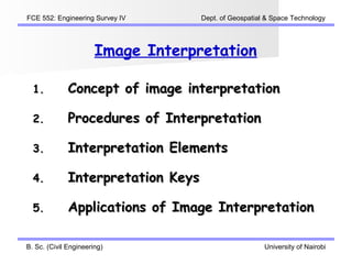
- 1. FCE 552: Engineering Survey IV Dept. of Geospatial & Space Technology Image Interpretation 1. Concept of image interpretation 2. Procedures of Interpretation 3. Interpretation Elements 4. Interpretation Keys 5. Applications of Image Interpretation B. Sc. (Civil Engineering) University of Nairobi
- 2. FCE 552: Engineering Survey IV Dept. of Geospatial & Space Technology Concept of Image Interpretation Engineering Surveying IV University of Nairobi
- 3. FCE 552: Engineering Survey IV Dept. of Geospatial & Space Technology The Remote Sensing Process Engineering Surveying IV University of Nairobi
- 4. FCE 552: Engineering Survey IV Dept. of Geospatial & Space Technology Objective of Image Interpretation To extract qualitative and quantitative information from imagery about the shape, location, structure, characteristics, quality, condition, relationship of and between objects using human knowledge. B. Sc. (Civil Engineering) University of Nairobi
- 5. FCE 552: Engineering Survey IV Dept. of Geospatial & Space Technology Information from Imagery B. Sc. (Civil Engineering) University of Nairobi
- 6. FCE 552: Engineering Survey IV Dept. of Geospatial & Space Technology Human Interpretation vs Computer based Interpretation B. Sc. (Civil Engineering) University of Nairobi
- 7. FCE 552: Engineering Survey IV Dept. of Geospatial & Space Technology Procedures of Interpretation B. Sc. (Civil Engineering) University of Nairobi
- 8. FCE 552: Engineering Survey IV Dept. of Geospatial & Space Technology Procedures of Interpretation B. Sc. (Civil Engineering) University of Nairobi
- 9. FCE 552: Engineering Survey IV Dept. of Geospatial & Space Technology Image Classification (1) Image Classification involves assigning all pixels in the image to particular classes or themes (e.g., water, coniferous forest, deciduous forest, maize, wheat, etc.). The resulting classified image is comprised of a mosaic of pixels, each of which belong to a particular theme, and is essentially a thematic "map" of the original image. B. Sc. (Civil Engineering) University of Nairobi
- 10. FCE 552: Engineering Survey IV Dept. of Geospatial & Space Technology Image Classification (2) Information Classes and Spectral Classes: Information classes are those categories of interest that the analyst is actually trying to identify in the imagery, such as different kinds of crops, different forest types or tree species, different geologic units or rock types, etc. Spectral classes are groups of pixels that are uniform (or near-similar) with respect to their brightness values in the different spectral channels of the data. The objective is to match the spectral classes in the data to the information classes of interest. Rarely is there a simple one-to one match between these two types of classes. B. Sc. (Civil Engineering) University of Nairobi
- 11. FCE 552: Engineering Survey IV Dept. of Geospatial & Space Technology Interpretation Elements B. Sc. (Civil Engineering) University of Nairobi
- 12. FCE 552: Engineering Survey IV Dept. of Geospatial & Space Technology Interpretation Elements B. Sc. (Civil Engineering) University of Nairobi
- 13. FCE 552: Engineering Survey IV Dept. of Geospatial & Space Technology Interpretation Keys B. Sc. (Civil Engineering) University of Nairobi
- 14. FCE 552: Engineering Survey IV Dept. of Geospatial & Space Technology Elements of Tone/Colour B. Sc. (Civil Engineering) University of Nairobi
- 15. FCE 552: Engineering Survey IV Dept. of Geospatial & Space Technology Elements of Size & Shape B. Sc. (Civil Engineering) University of Nairobi
- 16. FCE 552: Engineering Survey IV Dept. of Geospatial & Space Technology Elements of Texture B. Sc. (Civil Engineering) University of Nairobi
- 17. FCE 552: Engineering Survey IV Dept. of Geospatial & Space Technology Elements of Pattern B. Sc. (Civil Engineering) University of Nairobi
- 18. FCE 552: Engineering Survey IV Dept. of Geospatial & Space Technology Elements of Height & Shadow B. Sc. (Civil Engineering) University of Nairobi
- 19. FCE 552: Engineering Survey IV Dept. of Geospatial & Space Technology Elements of Associated Relationships B. Sc. (Civil Engineering) University of Nairobi
- 20. FCE 552: Engineering Survey IV Dept. of Geospatial & Space Technology Interpretation Keys for Trees B. Sc. (Civil Engineering) University of Nairobi
- 21. FCE 552: Engineering Survey IV Dept. of Geospatial & Space Technology Applications of Image Interpretation B. Sc. (Civil Engineering) University of Nairobi
- 22. FCE 552: Engineering Survey IV Dept. of Geospatial & Space Technology Interpretation of Aster Image B. Sc. (Civil Engineering) University of Nairobi
- 23. FCE 552: Engineering Survey IV Dept. of Geospatial & Space Technology Colour Composition B. Sc. (Civil Engineering) University of Nairobi
- 24. FCE 552: Engineering Survey IV Dept. of Geospatial & Space Technology Image Interpretation – Land Covers B. Sc. (Civil Engineering) University of Nairobi
- 25. FCE 552: Engineering Survey IV Dept. of Geospatial & Space Technology Image Interpretation – Floods B. Sc. (Civil Engineering) University of Nairobi
- 26. FCE 552: Engineering Survey IV Dept. of Geospatial & Space Technology Image Interpretation – Wildlife B. Sc. (Civil Engineering) University of Nairobi
- 27. FCE 552: Engineering Survey IV Dept. of Geospatial & Space Technology Image Interpretation – Volcano B. Sc. (Civil Engineering) University of Nairobi
- 28. FCE 552: Engineering Survey IV Dept. of Geospatial & Space Technology Image Interpretation – Mine B. Sc. (Civil Engineering) University of Nairobi
- 29. FCE 552: Engineering Survey IV Dept. of Geospatial & Space Technology Image Interpretation – Environment B. Sc. (Civil Engineering) University of Nairobi
- 30. FCE 552: Engineering Survey IV Dept. of Geospatial & Space Technology Image Interpretation – Ocean B. Sc. (Civil Engineering) University of Nairobi