Map making for Cartographers
•
4 j'aime•1,151 vues

The document discusses different types of web mapping services including proprietary, open source, and commercial options. It covers topics such as how to add data to maps, reasons for using certain services, limitations of proprietary services, and examples of open source mapping services and their benefits and limitations. The conclusion calls for cartographers to contribute their knowledge and principles to the field of web mapping.

Recommandé
Recommandé
Contenu connexe
Tendances
En vedette
En vedette (20)
Similaire à Map making for Cartographers
Similaire à Map making for Cartographers (20)
Dernier
Dernier (20)
Map making for Cartographers
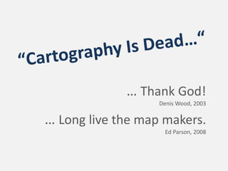
- 1. … Thank God! Denis Wood, 2003 … Long live the map makers. Ed Parson, 2008
- 2. The ‚map stack‘ Server Web Browser UI Server Tile Tile Cache Map Server Application Server Geospatial Data http://www.alistapart.com/articles/ takecontrolofyourmaps
- 3. The ‚map stack‘ Server Web Browser UI Server Tile Tile Cache Map Server Application Server Geospatial Data
- 4. The ‚map stack‘ Server Web Browser UI Server Tile Tile Cache Map Server Application Server Geospatial Data Source: Microsoft Virtual Earth SDK
- 5. The ‚map stack‘ Server Web Browser UI Server Tile Tile Cache Map Server Application Server Geospatial Data
- 6. The ‚map stack‘ Types of web Server Web Browser UI mapping services proprietary Server Tile Tile Cache open source commercial Map Server Application Server Geospatial Data
- 7. Proprietary web mapping services Server Web Browser UI Server Tile Tile Cache Map Server Application Server Geospatial Data
- 8. Proprietary web mapping services How to add data Server Web Browser UI Gadgets API KML, GeoRSS, … Server Tile Tile Cache Image overlays Own tiles + Map Server Application Server Geospatial Data
- 9. Proprietary web mapping services Why using them? Server Web Browser UI quick setup API intuitive interface Server Tile Tile Cache accessible by everybody with an internet browser availability of a huge Map Server Application amount of geo data Server many thousands of servers Geospatial Data
- 10. Proprietary web mapping services Limitations Server Web Browser UI pre‐rendered map tiles API no access on vector data Server Tile or 3rd dimension Tile Cache Mercator projection limitations according to Map Server Application API options Server licensing issues Geospatial Data
- 11. A cartographer‘s options comparing tiles of different vendors optimizing overlay quality using region functionality for scale dependent results optimizing data and user interface for user needs
- 12. Basic cartographic issues A cartographer‘s options What’s the purpose of the map? comparing tiles of different vendors Who is the user? optimizing overlay quality Readability using region functionality Visual Hierarchy for scale dependent results … optimizing data and user interface for user needs
- 13. Open source web mapping services Server Web Open Layers, Modest Maps Browser UI Server Tile Er, Tile Cache Tile Cache UMN MapServer Map Server Application Server Geospatial Data OpenStreetMap Data
- 14. Why using them? creating own map tiles and/or map tiles from proprietary vendors programming own functionalities data on own servers http://www.sander-partner.ch/be/en/Nawa/index.html vector functionality offline‐ and intranet usage possible http://chicago.everyblock.com
- 15. Limitations more complex setup more programming limited server capacities http://www.sander-partner.ch/be/en/Nawa/index.html http://chicago.everyblock.com
- 16. Conclusions Web mapping services are not only tools for non‐expert map makers Cartographic principles can also be applied in geobrowsers A good knowledge of available tools is important to pick the right solution for a certain use case
- 17. BUT: Cartographers should actively contribute their ideas and principles to the world of web mapping.