SlideShare une entreprise Scribd logo
1  sur  26
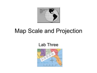
Map Scale and Projection Lab Three
Map Scale ,[object Object],[object Object]
Ways to Indicate Scale ,[object Object],[object Object],[object Object],[object Object],[object Object],Graphic Scale
Graphic Scale ,[object Object],[object Object],[object Object],[object Object],[object Object]
Fractional Scale ,[object Object],[object Object],[object Object],[object Object],[object Object]
Computing Distances with Fractional Scales ,[object Object],[object Object],[object Object],[object Object]
[object Object],[object Object],[object Object],[object Object]
English Measurements ,[object Object],[object Object],[object Object]
Metric Measurements ,[object Object],[object Object],[object Object],[object Object],[object Object]
Examples ,[object Object],[object Object],[object Object],[object Object]
Examples ,[object Object],[object Object],[object Object],[object Object],[object Object]
Large Versus Small Scale Maps ,[object Object],[object Object],[object Object],[object Object],Small Scale  Medium Scale  Large Scale
Map Projections ,[object Object],[object Object],[object Object]
Map Projection ,[object Object],[object Object]
[object Object],[object Object],[object Object],The Lambert cylindrical equal-area projection as an example of an equivalent, cylindrical projection   http://www.kartografie.nl/geometrics/Map%20projections/body.htm
[object Object],[object Object],[object Object],www.kartografie.nl/.../body.htm
[object Object],[object Object],[object Object],[object Object]
Map Projections ,[object Object]
Map Projections ,[object Object],[object Object],[object Object],[object Object],[object Object],[object Object],http://lh4.ggpht.com/FaizRious73/R8jSlC3rAaI/AAAAAAAAAaU/3Je0VCBRfj8/The+three+classes+of+map+projections%5B5%5D
Characteristics of Map Projections ,[object Object],[object Object],[object Object],[object Object]
Characteristics of Map Projections ,[object Object],[object Object]
Characteristics of Map Projections ,[object Object],http://www.geog.ucsb.edu/~kclarke/G176B/stpar.jpg http://www.staff.amu.edu.pl/~zbzw/glob/plcc.jpg
Characteristics of Map Projections ,[object Object],[object Object],[object Object],[object Object]
Characteristics of Map Projections ,[object Object],[object Object],[object Object]
Characteristics of Map Projections ,[object Object],[object Object]
[object Object],[object Object],[object Object],[object Object]

Contenu connexe

Tendances

Aerial photographs and their interpretation
Aerial photographs and their interpretationAerial photographs and their interpretation
Aerial photographs and their interpretationSumant Diwakar
 
Introduction to aerial photography and photogrammetry.ppt
Introduction to aerial photography and photogrammetry.pptIntroduction to aerial photography and photogrammetry.ppt
Introduction to aerial photography and photogrammetry.pptsrinivas2036
 
Geodetic systems (earth, ellipsoid)
Geodetic systems (earth, ellipsoid)Geodetic systems (earth, ellipsoid)
Geodetic systems (earth, ellipsoid)Md. Tamim Haider
 
Scale and distance
Scale and distanceScale and distance
Scale and distanceSteven Heath
 
Geometry and types of aerial photographs
Geometry and types of aerial photographsGeometry and types of aerial photographs
Geometry and types of aerial photographsPooja Kumari
 
Topographic maps presentation_mine
Topographic maps presentation_mineTopographic maps presentation_mine
Topographic maps presentation_minemisterbatroms
 
Measurement and Scale
Measurement and ScaleMeasurement and Scale
Measurement and ScaleJohn Reiser
 
Map Projections ―concepts, classes and usage
Map Projections ―concepts, classes and usage Map Projections ―concepts, classes and usage
Map Projections ―concepts, classes and usage Prof Ashis Sarkar
 
Geometry of Aerial photograph
Geometry of Aerial photographGeometry of Aerial photograph
Geometry of Aerial photographApoorva Mathur
 
Aerial photography abraham thomas
Aerial photography abraham thomasAerial photography abraham thomas
Aerial photography abraham thomasSumant Diwakar
 
Projections and coordinate system
Projections and coordinate systemProjections and coordinate system
Projections and coordinate systemMohsin Siddique
 
Aerial Photogrammetry
Aerial Photogrammetry Aerial Photogrammetry
Aerial Photogrammetry Mujeeb Muji
 
Topographic Map
Topographic MapTopographic Map
Topographic Mapmjcnavarro
 

Tendances (20)

Aerial photographs and their interpretation
Aerial photographs and their interpretationAerial photographs and their interpretation
Aerial photographs and their interpretation
 
Introduction to aerial photography and photogrammetry.ppt
Introduction to aerial photography and photogrammetry.pptIntroduction to aerial photography and photogrammetry.ppt
Introduction to aerial photography and photogrammetry.ppt
 
Geodetic systems (earth, ellipsoid)
Geodetic systems (earth, ellipsoid)Geodetic systems (earth, ellipsoid)
Geodetic systems (earth, ellipsoid)
 
Map projection
Map projectionMap projection
Map projection
 
Scale and distance
Scale and distanceScale and distance
Scale and distance
 
Geometry and types of aerial photographs
Geometry and types of aerial photographsGeometry and types of aerial photographs
Geometry and types of aerial photographs
 
Cartographic map design
Cartographic map designCartographic map design
Cartographic map design
 
Topographic maps presentation_mine
Topographic maps presentation_mineTopographic maps presentation_mine
Topographic maps presentation_mine
 
Measurement and Scale
Measurement and ScaleMeasurement and Scale
Measurement and Scale
 
Maps Ppt
Maps PptMaps Ppt
Maps Ppt
 
Map Projections ―concepts, classes and usage
Map Projections ―concepts, classes and usage Map Projections ―concepts, classes and usage
Map Projections ―concepts, classes and usage
 
Basic coordinate system
Basic coordinate systemBasic coordinate system
Basic coordinate system
 
Map Projection
Map ProjectionMap Projection
Map Projection
 
Geometry of Aerial photograph
Geometry of Aerial photographGeometry of Aerial photograph
Geometry of Aerial photograph
 
Aerial photography abraham thomas
Aerial photography abraham thomasAerial photography abraham thomas
Aerial photography abraham thomas
 
Projections and coordinate system
Projections and coordinate systemProjections and coordinate system
Projections and coordinate system
 
Aerial Photogrammetry
Aerial Photogrammetry Aerial Photogrammetry
Aerial Photogrammetry
 
Map projections
Map projectionsMap projections
Map projections
 
Topographic Map
Topographic MapTopographic Map
Topographic Map
 
Historical Development of Photogrammetry
Historical Development of PhotogrammetryHistorical Development of Photogrammetry
Historical Development of Photogrammetry
 

En vedette

Geography Skills: Scale
Geography Skills:  ScaleGeography Skills:  Scale
Geography Skills: ScaleTim Bonnar
 
Lab three map scale
Lab three map scaleLab three map scale
Lab three map scaleLisa Schmidt
 
Projections Eps
Projections EpsProjections Eps
Projections Epsesambale
 
map projections
map projectionsmap projections
map projectionsom290979
 
Lab three map scale
Lab three map scaleLab three map scale
Lab three map scalelschmidt1170
 
The Map, Map Reading and Principles of Geography - World Tourism
The Map, Map Reading and Principles of Geography - World TourismThe Map, Map Reading and Principles of Geography - World Tourism
The Map, Map Reading and Principles of Geography - World TourismCris dela Peña
 
Computer infrastructure
Computer infrastructureComputer infrastructure
Computer infrastructureSantosh Tiwari
 
9 essential gis skills
9 essential gis skills9 essential gis skills
9 essential gis skillsWanjohi Kibui
 
Wetware programming
Wetware programmingWetware programming
Wetware programmingmoorethunder
 
Geography Skills Review
Geography Skills ReviewGeography Skills Review
Geography Skills Reviewmr_rodriguez23
 
Standard Deviation
Standard DeviationStandard Deviation
Standard DeviationJRisi
 
GIS Development for Seismic Vulnerability Kiel-Germany 2007
GIS Development for Seismic Vulnerability Kiel-Germany 2007GIS Development for Seismic Vulnerability Kiel-Germany 2007
GIS Development for Seismic Vulnerability Kiel-Germany 2007Vladimir Gutierrez, PhD
 
Types of maps, long, lat, satellites, time zones
Types of maps, long, lat, satellites, time zonesTypes of maps, long, lat, satellites, time zones
Types of maps, long, lat, satellites, time zonesBantay's Earth Science!
 
Statistical Methods
Statistical MethodsStatistical Methods
Statistical Methodsguest9fa52
 
Presentationmaps
PresentationmapsPresentationmaps
PresentationmapsNoel Hogan
 

En vedette (20)

Geography Skills: Scale
Geography Skills:  ScaleGeography Skills:  Scale
Geography Skills: Scale
 
Lab three map scale
Lab three map scaleLab three map scale
Lab three map scale
 
Projections Eps
Projections EpsProjections Eps
Projections Eps
 
map projections
map projectionsmap projections
map projections
 
Map projections
Map projectionsMap projections
Map projections
 
Lab three map scale
Lab three map scaleLab three map scale
Lab three map scale
 
Mapping Projections and Data conversions
Mapping Projections and Data conversionsMapping Projections and Data conversions
Mapping Projections and Data conversions
 
The Map, Map Reading and Principles of Geography - World Tourism
The Map, Map Reading and Principles of Geography - World TourismThe Map, Map Reading and Principles of Geography - World Tourism
The Map, Map Reading and Principles of Geography - World Tourism
 
Computer infrastructure
Computer infrastructureComputer infrastructure
Computer infrastructure
 
9 essential gis skills
9 essential gis skills9 essential gis skills
9 essential gis skills
 
Wetware programming
Wetware programmingWetware programming
Wetware programming
 
Geography Skills Review
Geography Skills ReviewGeography Skills Review
Geography Skills Review
 
1 introduction to world geography
1  introduction to world geography1  introduction to world geography
1 introduction to world geography
 
Standard Deviation
Standard DeviationStandard Deviation
Standard Deviation
 
GIS Development for Seismic Vulnerability Kiel-Germany 2007
GIS Development for Seismic Vulnerability Kiel-Germany 2007GIS Development for Seismic Vulnerability Kiel-Germany 2007
GIS Development for Seismic Vulnerability Kiel-Germany 2007
 
Map design in GIS
Map design in GISMap design in GIS
Map design in GIS
 
Types of maps, long, lat, satellites, time zones
Types of maps, long, lat, satellites, time zonesTypes of maps, long, lat, satellites, time zones
Types of maps, long, lat, satellites, time zones
 
Statistical Methods
Statistical MethodsStatistical Methods
Statistical Methods
 
Map reading
Map readingMap reading
Map reading
 
Presentationmaps
PresentationmapsPresentationmaps
Presentationmaps
 

Similaire à Map scale and projection

Cartography Unit_ 3.pptx
Cartography Unit_ 3.pptxCartography Unit_ 3.pptx
Cartography Unit_ 3.pptxwarkisafile1
 
BOLTSS - Mapping Geography
BOLTSS - Mapping GeographyBOLTSS - Mapping Geography
BOLTSS - Mapping GeographyYaryalitsa
 
1 How does a topographic map show the shape of the land sur.pdf
1 How does a topographic map show the shape of the land sur.pdf1 How does a topographic map show the shape of the land sur.pdf
1 How does a topographic map show the shape of the land sur.pdfcbholla1
 
PROJECTIONS & COORDINATE SYSTEMS-1.pptx
PROJECTIONS & COORDINATE SYSTEMS-1.pptxPROJECTIONS & COORDINATE SYSTEMS-1.pptx
PROJECTIONS & COORDINATE SYSTEMS-1.pptxSaitarunKuna
 
Practical work in geography
Practical work in geographyPractical work in geography
Practical work in geographyShivam Kapri
 
Maps as Models of Earth
Maps as Models of EarthMaps as Models of Earth
Maps as Models of Earthmlong24
 
Maps as Models of Earth
Maps as Models of EarthMaps as Models of Earth
Maps as Models of Earthmlong24
 
RebekahHannonMapSkillsTutorial
RebekahHannonMapSkillsTutorialRebekahHannonMapSkillsTutorial
RebekahHannonMapSkillsTutoriallanderbraves
 
International Journal of Engineering and Science Invention (IJESI)
International Journal of Engineering and Science Invention (IJESI)International Journal of Engineering and Science Invention (IJESI)
International Journal of Engineering and Science Invention (IJESI)inventionjournals
 
Geography skills handbook1
Geography skills handbook1Geography skills handbook1
Geography skills handbook1kjanchild
 
map reading unit 1.pdf
map reading unit 1.pdfmap reading unit 1.pdf
map reading unit 1.pdfwarkisafile1
 
8.Charts
8.Charts8.Charts
8.ChartsAmenBAL
 
Chapter 3 gateway 123 combined
Chapter 3 gateway 123 combinedChapter 3 gateway 123 combined
Chapter 3 gateway 123 combinedMissST
 
TYBSC IT PGIS Unit III Chapter I Spatial Referencing and Positioning
TYBSC IT PGIS Unit III Chapter I Spatial Referencing and PositioningTYBSC IT PGIS Unit III Chapter I Spatial Referencing and Positioning
TYBSC IT PGIS Unit III Chapter I Spatial Referencing and PositioningArti Parab Academics
 
Continuing Our Look At Primary And Secondary Data
Continuing Our Look At Primary And Secondary DataContinuing Our Look At Primary And Secondary Data
Continuing Our Look At Primary And Secondary Dataguest2137aa
 
Continuing Our Look At Primary And Secondary Data
Continuing Our Look At Primary And Secondary DataContinuing Our Look At Primary And Secondary Data
Continuing Our Look At Primary And Secondary Dataguest9fa52
 
INTRODUCTION TO SURVEYING
INTRODUCTION TO SURVEYINGINTRODUCTION TO SURVEYING
INTRODUCTION TO SURVEYINGfarhana saiyed
 

Similaire à Map scale and projection (20)

Chapter two
Chapter twoChapter two
Chapter two
 
Cartography Unit_ 3.pptx
Cartography Unit_ 3.pptxCartography Unit_ 3.pptx
Cartography Unit_ 3.pptx
 
BOLTSS - Mapping Geography
BOLTSS - Mapping GeographyBOLTSS - Mapping Geography
BOLTSS - Mapping Geography
 
1 How does a topographic map show the shape of the land sur.pdf
1 How does a topographic map show the shape of the land sur.pdf1 How does a topographic map show the shape of the land sur.pdf
1 How does a topographic map show the shape of the land sur.pdf
 
Graphs and Representation.pptx
Graphs and Representation.pptxGraphs and Representation.pptx
Graphs and Representation.pptx
 
GEODESIA
GEODESIAGEODESIA
GEODESIA
 
PROJECTIONS & COORDINATE SYSTEMS-1.pptx
PROJECTIONS & COORDINATE SYSTEMS-1.pptxPROJECTIONS & COORDINATE SYSTEMS-1.pptx
PROJECTIONS & COORDINATE SYSTEMS-1.pptx
 
Practical work in geography
Practical work in geographyPractical work in geography
Practical work in geography
 
Maps as Models of Earth
Maps as Models of EarthMaps as Models of Earth
Maps as Models of Earth
 
Maps as Models of Earth
Maps as Models of EarthMaps as Models of Earth
Maps as Models of Earth
 
RebekahHannonMapSkillsTutorial
RebekahHannonMapSkillsTutorialRebekahHannonMapSkillsTutorial
RebekahHannonMapSkillsTutorial
 
International Journal of Engineering and Science Invention (IJESI)
International Journal of Engineering and Science Invention (IJESI)International Journal of Engineering and Science Invention (IJESI)
International Journal of Engineering and Science Invention (IJESI)
 
Geography skills handbook1
Geography skills handbook1Geography skills handbook1
Geography skills handbook1
 
map reading unit 1.pdf
map reading unit 1.pdfmap reading unit 1.pdf
map reading unit 1.pdf
 
8.Charts
8.Charts8.Charts
8.Charts
 
Chapter 3 gateway 123 combined
Chapter 3 gateway 123 combinedChapter 3 gateway 123 combined
Chapter 3 gateway 123 combined
 
TYBSC IT PGIS Unit III Chapter I Spatial Referencing and Positioning
TYBSC IT PGIS Unit III Chapter I Spatial Referencing and PositioningTYBSC IT PGIS Unit III Chapter I Spatial Referencing and Positioning
TYBSC IT PGIS Unit III Chapter I Spatial Referencing and Positioning
 
Continuing Our Look At Primary And Secondary Data
Continuing Our Look At Primary And Secondary DataContinuing Our Look At Primary And Secondary Data
Continuing Our Look At Primary And Secondary Data
 
Continuing Our Look At Primary And Secondary Data
Continuing Our Look At Primary And Secondary DataContinuing Our Look At Primary And Secondary Data
Continuing Our Look At Primary And Secondary Data
 
INTRODUCTION TO SURVEYING
INTRODUCTION TO SURVEYINGINTRODUCTION TO SURVEYING
INTRODUCTION TO SURVEYING
 

Plus de lschmidt1170

How did the magna carta influence the united states bill of rights
How did the magna carta influence the united states bill of rightsHow did the magna carta influence the united states bill of rights
How did the magna carta influence the united states bill of rightslschmidt1170
 
Sustainable development goals
Sustainable development goalsSustainable development goals
Sustainable development goalslschmidt1170
 
Magna cartas lessons for the me
Magna cartas lessons for the meMagna cartas lessons for the me
Magna cartas lessons for the melschmidt1170
 
What is the magna carta and why there is a google doodle telegraph
What is the magna carta and why there is a google doodle    telegraphWhat is the magna carta and why there is a google doodle    telegraph
What is the magna carta and why there is a google doodle telegraphlschmidt1170
 
Universal declaration of human rights
Universal declaration of human rightsUniversal declaration of human rights
Universal declaration of human rightslschmidt1170
 
Magna carta and the law of nature
Magna carta and the law of natureMagna carta and the law of nature
Magna carta and the law of naturelschmidt1170
 
King john the most evil monarch in britain's history telegraph
King john  the most evil monarch in britain's history   telegraphKing john  the most evil monarch in britain's history   telegraph
King john the most evil monarch in britain's history telegraphlschmidt1170
 
How did the magna carta influence the united states bill of rights
How did the magna carta influence the united states bill of rightsHow did the magna carta influence the united states bill of rights
How did the magna carta influence the united states bill of rightslschmidt1170
 
Constitution billofrightsfacts
Constitution billofrightsfactsConstitution billofrightsfacts
Constitution billofrightsfactslschmidt1170
 
Feudal strength! henry ii and the struggle for royal control in
Feudal strength!  henry ii and the struggle for royal control inFeudal strength!  henry ii and the struggle for royal control in
Feudal strength! henry ii and the struggle for royal control inlschmidt1170
 
A magna carta for the earth oecd observer
A magna carta for the earth    oecd observerA magna carta for the earth    oecd observer
A magna carta for the earth oecd observerlschmidt1170
 
Denis haley catherine douglas geneaology 1793 to 1989
Denis haley catherine douglas geneaology 1793 to 1989Denis haley catherine douglas geneaology 1793 to 1989
Denis haley catherine douglas geneaology 1793 to 1989lschmidt1170
 
Na map 1 with terms
Na map 1 with termsNa map 1 with terms
Na map 1 with termslschmidt1170
 
Introfall 2016 14week
Introfall 2016 14weekIntrofall 2016 14week
Introfall 2016 14weeklschmidt1170
 
Fall 2016 syllabus geog 110 71
Fall 2016 syllabus geog 110 71Fall 2016 syllabus geog 110 71
Fall 2016 syllabus geog 110 71lschmidt1170
 
Intro fall 2016 geog lab
Intro fall 2016 geog labIntro fall 2016 geog lab
Intro fall 2016 geog lablschmidt1170
 
Fall 2016 intro wed
Fall 2016 intro wedFall 2016 intro wed
Fall 2016 intro wedlschmidt1170
 
Fall 2016 intro mon
Fall 2016 intro monFall 2016 intro mon
Fall 2016 intro monlschmidt1170
 

Plus de lschmidt1170 (20)

How did the magna carta influence the united states bill of rights
How did the magna carta influence the united states bill of rightsHow did the magna carta influence the united states bill of rights
How did the magna carta influence the united states bill of rights
 
Sustainable development goals
Sustainable development goalsSustainable development goals
Sustainable development goals
 
Magna cartas lessons for the me
Magna cartas lessons for the meMagna cartas lessons for the me
Magna cartas lessons for the me
 
What is the magna carta and why there is a google doodle telegraph
What is the magna carta and why there is a google doodle    telegraphWhat is the magna carta and why there is a google doodle    telegraph
What is the magna carta and why there is a google doodle telegraph
 
Universal declaration of human rights
Universal declaration of human rightsUniversal declaration of human rights
Universal declaration of human rights
 
Magna carta and the law of nature
Magna carta and the law of natureMagna carta and the law of nature
Magna carta and the law of nature
 
King john the most evil monarch in britain's history telegraph
King john  the most evil monarch in britain's history   telegraphKing john  the most evil monarch in britain's history   telegraph
King john the most evil monarch in britain's history telegraph
 
How did the magna carta influence the united states bill of rights
How did the magna carta influence the united states bill of rightsHow did the magna carta influence the united states bill of rights
How did the magna carta influence the united states bill of rights
 
Constitution billofrightsfacts
Constitution billofrightsfactsConstitution billofrightsfacts
Constitution billofrightsfacts
 
Feudal strength! henry ii and the struggle for royal control in
Feudal strength!  henry ii and the struggle for royal control inFeudal strength!  henry ii and the struggle for royal control in
Feudal strength! henry ii and the struggle for royal control in
 
Constitution
ConstitutionConstitution
Constitution
 
Bill of rights
Bill of rightsBill of rights
Bill of rights
 
A magna carta for the earth oecd observer
A magna carta for the earth    oecd observerA magna carta for the earth    oecd observer
A magna carta for the earth oecd observer
 
Denis haley catherine douglas geneaology 1793 to 1989
Denis haley catherine douglas geneaology 1793 to 1989Denis haley catherine douglas geneaology 1793 to 1989
Denis haley catherine douglas geneaology 1793 to 1989
 
Na map 1 with terms
Na map 1 with termsNa map 1 with terms
Na map 1 with terms
 
Introfall 2016 14week
Introfall 2016 14weekIntrofall 2016 14week
Introfall 2016 14week
 
Fall 2016 syllabus geog 110 71
Fall 2016 syllabus geog 110 71Fall 2016 syllabus geog 110 71
Fall 2016 syllabus geog 110 71
 
Intro fall 2016 geog lab
Intro fall 2016 geog labIntro fall 2016 geog lab
Intro fall 2016 geog lab
 
Fall 2016 intro wed
Fall 2016 intro wedFall 2016 intro wed
Fall 2016 intro wed
 
Fall 2016 intro mon
Fall 2016 intro monFall 2016 intro mon
Fall 2016 intro mon
 

Map scale and projection

  • 1. Map Scale and Projection Lab Three
  • 2.
  • 3.
  • 4.
  • 5.
  • 6.
  • 7.
  • 8.
  • 9.
  • 10.
  • 11.
  • 12.
  • 13.
  • 14.
  • 15.
  • 16.
  • 17.
  • 18.
  • 19.
  • 20.
  • 21.
  • 22.
  • 23.
  • 24.
  • 25.
  • 26.