1. Proceedings of the Second World Landslide Forum – 3-7 October 2011, Rome
Luciana Pascarelli(1), Rafaela Lançone(1), Rodrigo Costa(1), Luiz
Pires(1), Eduardo Macedo(2), Fabricio Mirandola(2), Fabiana
Checchinato(2), Katia Canil(2)
Mapping geological at-risk areas in the city of São
Paulo: issues and results from the largest risk
survey in Brazil
(1) Consultancy Services and Technical Works Department, Sao Paulo City Hall, Rua Libero
Badaro, 425, Brazil –lupsantos@prefeitura.sp.gov.br
(2) Laboratory Environmental Risks, Environmental Technology Centre, Technological
Research Institute, Sao Paulo, Brazil - emacedo@ipt.br
Abstract Since the 1980s the risk studies have definitely geological process causes consequences on Humans or
been unable to follow the growth and the density of their property. This concept involves, besides the
favelas, and some communities have started to trigger the physical process that causes instability (landslides,
first records of accidents in areas hitherto stable. The exfoliations, etc), the accident attributed to it.
mapping made in 2010 is today the largest geological-risk Although the Brazilian slopes have witnessed some
database in the country. Besides technical information, instability phenomena, it was through the advent of soil
the survey has also shown the types of intervention to be mechanics that Brazil has deepened its research. The
implemented according to the degree of risk and the type improvement of these studies had a breakthrough in the
of verified occupation, - vital data to prioritizing the 1950s, when the first works appeared, and each new
public-authority actions. Out of 1,602 favelas and occurrence generated the study phase, aiming at
informal settlements in the city, 25 percent have understanding the mechanisms of such events (Guidicini
currently occupied areas with some occurrence and Nieble, 1976).
probability of mass-movement processes. Together, the In the City of São Paulo, the first reports of
assessed areas cover about 13.5 square kilometers, located accidents resulting from landslides have had a direct
in the outskirt regions. Nowadays, about 115,000 people relationship to the urban expansion that has been going
are living in landslide-prone areas in the capital. As a on since the 1930s. According to Nogueira (2002), the
result the low-income intervention projects by the urban sprawl to the city has increased from 355 square
government have been reassessed and adjusted, meters to 1,370 square meters in five decades. The real
prioritizing housing, social-educational infrastructure, estate speculation has used a method of the land
and basic-sanitation actions in areas of greatest subdivision that has generated “urban voids”, later
susceptibility. occupied by favelas and irregular settlements.
Especially since the 1970s, this occupation has also
Keywords mapping, susceptibility, disaster, urban area begun in areas of major environmental fragility, such as
slopes and stream banks. In the late 1980s, the first
Risk scenario in São Paulo City, political and social accident on the slopes happened, and in the mid-1990’s,
framework these accidents became more frequent and less localized,
revealing the presence of a large population in at-risk
The magnitude of the concept of geological risk is larger occupation areas.
than the “natural risk”. Other terms such as
environmental risk and technological risk are also Instability processes in São Paulo
interrelated, and sometimes these concepts partially
overlap. The presence of floodplain and watershed areas and
Any research and risk assessment should consider reservoirs has characterized the geography of the City of
which events affect the social and economic aspects of a São Paulo. An extensive hydrographical network
particular place and community. The geological composed of streams and rivers has served every area of
occurrence does not represent a risk in itself if its the municipality, with approximately 3,200 km of
triggering event does not generate material, economic, or watercourses.
environmental damages, or losses. Mass movement are Within their administrative boundaries, the
natural processes and they are part of the erosive/ municipality has schematically covered three sets of quite
depositional cycle, responsible for modelling the Earth’s different sectors: the Sedimentary Basin of São Paulo,
surface and its landscape setting. However, the concept from the Tertiary age; its granite-gneiss-schist edge,
of geological accident arises when the occurrence of a broken in a system of blocks and wedges in steps by a
2. Pascarelli, L et al. – Mapping geological at-risk areas in the city of São Paulo…
reactivated the Precambrian old fault system; and the Sliding on Slopes
quaternary colluvial and alluvial cover.
It consists of gravitational mass movement (soil, rock, or
Sand deposits, clays, and subordinate conglomerates
debris). The loss of stability of the slope material can
predominate in the sedimentary basin. The alluvial
occur through infiltration and water concentration. The
deposits have their occurrence along the floodplains of
increase in the weight by the flooding, the loss of internal
rivers and streams in the city, especially the plains of the
cohesion, and the geometry of the slope (steepness,
Tietê, Pinheiros, and Tamanduateí, though human
morphology, height, etc) lead to destabilization and
activity has intensely reshaped them, through channel
triggers the slides. In São Paulo, there is a higher
rectification, floodplain grounding, etc. These are areas
occurrence of induced landslides, whose outbreak is due
prone to flooding and differential settling by the presence
to the implementation of cuts and inadequate landfills,
of shallow groundwater.
concentration of storm water and served water, as well as
In the granitic unit, the biggest instability problems
the removal of vegetation.
correspond to boulder rolling, especially in areas near the
In the City of São Paulo, the PLANAR slides are
mountains.
usually the most common types of sliding, common in
The oldest rocks in the area of São Paulo are gneiss,
thin soils and rocks with a weakness plane, and the
mica-schist, and quartzite, covered by diverse
CIRCULAR slides, which occur in homogeneous thick
metasediments and basic metavolcanics. The main
soils and fractured rocks. They feature variable geometry
problems associated with massive land occupation of this
and material compound, where soil, gravel and, mostly, a
unit are landslides of altered mica schist with low degree
mixture of these two components represent the
of soil compaction. There are also intense erosions in
mobilized materials. This type of mixed material is today
heavy cuts (bare soil) and schist-phyllite dumped
the worst kind of soil if we think of stability, since its
landfills, exfoliation of massive quartz, and low capacity
porosity and permeability indexes are extremely high,
of soil support due to the presence of expanded clay.
compared to natural soil.
This geologic framework has conditioned the
morphology of the region, reflecting the existence of a
Erosions on Stream Banks
hilly topography, with floodplains and terraces of the
Tietê and Pinheiros Rivers and tributaries, where lies its They correspond to the active erosion on marginal slopes
consolidated urban core, surrounded by the most salient of the streams/ rivers. There is often a correlation
forms of elevations, and sustained by granitic bodies between them and the high water and/or flood processes.
(Serra da Cantareira) and resistant metasediments. The presence of landfill and pouring of water directly on
This natural landscape, associated with illegal the banks have enhanced them.
human occupation, promotes the development of the
processes associated with natural disasters. Modification Rock-block Exfoliation and Falling
of soil characteristics happens in non-ordered areas
Gravity on the rock blocks causes exfoliation and falling,
where the stable areas can become highly susceptible to
associated with erosion and/or anthropogenic activities.
occurrences of these processes, even if that interference
It creates movement and subsequent break and fall along
happens to be punctual. The main events in the urban
the discontinuities or weakness planes.
area are mass movements (landslides/slumps), stream-
bank erosion, and sliding and falling boulders.
Aspects to define in at-risk areas
The causes can be natural, enhanced by the
accumulation of rainwater, or induced by human When examining an at-risk area, it is necessary to
intervention through the modification of natural understand the geological processes, their occurrence
conditions of the terrain, such as cuts, landfills, and probability, and their potential to cause harm.
pouring and concentration of the water on the hillsides, Based on technical information on a land in a given
etc. The highest number of accidents takes place during region, it is possible to identify the scenarios where such
the months of highest rainfall – November to March in events may occur. Only from information on the actual
the Southeast region. However, the records show use and occupation specific to each area of the city, one
occurrences in the “dry seasons”, as the water from can measure the magnitude of these events. For example,
sewage or households contributes to the processes. if in a particular site, there has been some identification
There have been increasingly common occurrences of a geological EVENT possibility that can generate
of destabilization in areas of uncontrolled deposits of “social and/or economic harm”, one can admit that this is
litter and/or debris, directly affecting nearby occupations. an AT-RISK AREA. Conceptually, there is only risk when
These situations can be more critical where high there is some prospect of loss or damage.
permeability and porosity of this material promote rapid These areas have generally corresponded to low-
saturation and, therefore, its collapse by overweight. income housing units (settlements) in the context of
Brazilian cities.
3. Proceedings of the Second World Landslide Forum – 3-7 October 2011, Rome
Favelas and informal
settlements (SEHAB,
2006)
Figure 1: Records of deaths from landslide in Brazil and location of favelas in São Paulo City. Note that most events occurred in
crowded areas of the metropolitan region of São Paulo
The product of two or more terms represents most of the Risk analysis should consider information on the
at-risk equations that different authors have proposed geological and geomorphological and morphometric
that relate the probability of a process or phenomenon to features of the terrain as height and steepness of the
the magnitude of the socially harmful consequences that slopes, soil/rock composition observations, and
it may cause [1]. structures that might constrain movements analyses (e.g.
foliation, fractures, and other geological discontinuities),
R (hazard) = P (probability) x C (consequences) on the possible geological processes. Besides that, it
[1] should also consider which conditions could trigger
them, as well as their consequences.
The term “probability” relates to specific risk or Considering that our study has focused on densely
hazard that should be at least qualified for the intended populated areas or on the occupational expansion, the
use of the equation. The probability of a landslide in a human level interference has a large weight in the risk
given area is certainly different from the one of flooding, qualification process. Also, one can say that changing the
for example. Another element to consider is the original setting configuration could also change the
“vulnerability of a given area or community”. Similar dynamics of the processes that act upon it, that is,
processes of the same intensity can frequently generate processes that might gradually have occurred over the
intense damage if the village housings are poor. On the years would occur suddenly. People have made these
other hand, damages are barely noticeable if the affected changes in order to build houses or to expand the
area consists of more consolidated and more resistant existing ones. People have made cuts or landfills without
buildings. any appropriated criteria, which may favour
The risk equation has already included the presence destabilization, as well as the vegetation removal, which,
of an effective management system administered by by exposing the soil, has favoured erosion and reduced
public officials or by the community. It shows that the the soil capacity for absorbing water.
adoption of policies to prevent accidents, although Besides that, the growing of certain kinds of plant
difficult to quantify, directly and positively influences the species can be harmful, as in the case of the “banana
policy of reducing risks. trees”, which favour the water accumulation on their
roots, increasing the terrain weight and reducing the
The importance of field work in mapping vulnerable areas internal cohesion by soil saturation.
Water is the main triggering agent of mass-
Through the knowledge of the areas naturally susceptible movement The absence of a drainage system can make
to movement-process occurrences, it is possible to assess the area susceptible to instability. In the field, one
behaviour of a certain place, from the data on geology, should check for points of upwelling, infiltration, and
geotechnical engineering, geomorphology, and hydrology concentration of the surface water, observing the
collected from previous studies and analyses of aerial rainwater direction, and identifying the sewage/
photographs, low-altitude satellite images, and radar. wastewater treatment systems from the houses.
4. Pascarelli, L et al. – Mapping geological at-risk areas in the city of São Paulo…
Table 1: Risk qualitative classification (Brasil, 2006 – simplified) Note that the definition of risk sectors based on
judgment of the professionals have been responsible for
Low Risk Medium Risk risk mapping and for assigning to each sector a degree of
(R1) (R2) occurrence probability of the destabilizing process.
Gently sloping (<17º), stable soils There are some evidence of
No evidence of instability. incipient instability. There is a
This is a qualitative analysis recognized by the IUGS
Less critical condition. reduced possibility of destructive Working Group – Committee on Risk Assessment
events during episodes of heavy and (Cruden and Fell, 1997), which allows the information
prolonged rainfall. refinement, and specially, the ranking of the areas
High Risk Very High Risk needing preventive or emergency management.
(R3) (R4) It is worth to mention that, according to Nardocci
Inclined slopes > 30° Low stability soils. (1999), even if the event-probability calculation is
High potential for landslides High conditions of instability
accurate, this is only a probability. It is not possible to
process. Great deal of instability (garbage, poor drainage, no
evidence (cracks in the ground, vegetation) say for sure if the event will occur, neither to define when
steps abatement). It is possible the Lot of evidences of instability. it happens.
occurrence of destructive events Recent records of landslides. It is the
during episodes of heavy and most critical condition.
prolonged rainfall.
The São Paulo City’s case
From September 2009 to December 2010, the São Paulo
Because most mass-movement processes occur City held a survey entitled “Análise e mapeamento de
gradually and continuously, it is possible to identify riscos associados a escorregamentos em áreas de encostas
evidences of movement even before the event starts. e a solapamentos de margens de córregos em favelas do
Some evidences are cracks and steps on ground surface município de São Paulo” (Analysis and mapping of risks
tilting of trees, utility poles and linear structures, and associated with slopes landslides and stream-bank
cracks on walls and houses that may indicate local or washouts in the favelas of São Paulo city), through the
regional terrain destabilization. One should evaluate Instituto de Pesquisas Tecnológicas do Estado de São
these signs for its scope (localized or not) and magnitude Paulo (Institute for Technological Research) - IPT. The
(low or high), and use them as movement speed work involved the reassessment of the areas mapped in
indicators of unstable terrain. Once compiled the previous years, as well as the survey of new sites of
information obtained in the field and those gathered in geological risk in the city. More than a geotechnical
maps, images, photographs, one can classify the areas survey, the mapping had its focus turned to areas where
according to Table 01. the population vulnerability was the highest one.
Border of área
Border of probability
sector
VP-07-01 (R3)
VP: Area code (neighborhood
name)
07: Area number
01: Sector number
R3: High risk
Orthophotos 1:5000 (São Paulo)
EMPLASA 2007
Figure 2: Representation of sector in air photo with probability degree indication
5. Proceedings of the Second World Landslide Forum – 3-7 October 2011, Rome
In these locations, any type of event, even the small
ones, could cause significant damage to the community,
given its low risk-perception and its low capacity for
rapid management within the proposed period of
implementation.
Furthermore, the survey needed to establish
response and recovery
Initially, more than 400 assessment areas were
assigned for assessment, which required a different plan
for the organization of work within the proposed period
of implementation. Moreover, it was necessary to lay
down guidelines that would ensure the objective
effectiveness of the work the staff should performed. In
addition to 20 technical experts responsible for
developing the work from IPT and São Paulo City Hall,
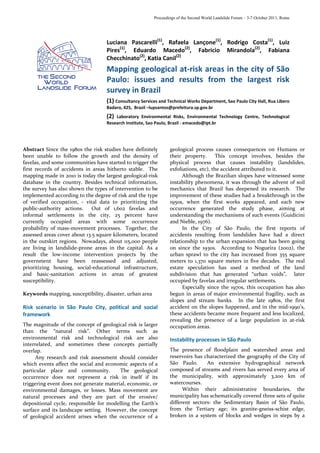
other 52 servers have actively participated in this Figure 3 Oblique image of risk area. View of homes in specific
mapping, from the indication of the areas to the risk sectors.
monitoring of the final field works. This is the greatest
risk mapping Brazil has done, considering the amount of Quantified results obtained
analyzed areas and the professionals directly or indirectly São Paulo municipality has hired the IPT to do the
involved in this activity. The work consisted of the mapping of at risk-areas and they have identified 407
following 5 phases, implemented in groups for each stream-bank and slope areas subject to landslide and
region of the city, that is, Northern, Southern/Western erosion processes. Such areas comprise around 13.5
and Eastern Zones: square meters representing 0.9 percent of the total
Phase one - Appointment and selection of areas the municipality area.
staff should evaluate, after the official consultation to Every risk survey has the a technical-report format,
each district. There were meetings to explain about the containing location, delimitation, photographic
survey and introduce the team, as well as for the documentation, and fieldwork technical data in digital
designation of the places to assess. and printed media, making available the easy access to
Phase two – Field Screening: visits to the areas listed needed information that will lead to planning of actions
in “Phase 1” for the GPS data and for the over flight plans. and decision-making.
Phase three – Flying over region for picturing
oblique image: the staff made low-altitude oblique (A) (B)
photos to identify large-size risk signs or constraints,
primary sectoring, and housing quantification.
Phase four –Fieldwork: based on previous data, IPT
team checked the specific characteristics of occupations,
behavior of water on the terrain, presence of movement
signs, and other information that enabled the needed
refinement for the risk sectoring.
Phase five – Delivering Results: final report,
including the information on occurrences of destructive
processes, potential consequences on household Figure 4 Distribution of areas by risk degree (A) and percentage
vulnerability, area sectoring, definition of the sector risk of houses in each one (B) in São Paulo City.
degree, recommendations of interventions to control risk,
and data insertion into geo-referenced database This study has included all the vulnerable areas in
integrated to the São Paulo City system (HABISP/ the city, located in the 26 administrative districts.
SEHAB). Considering the details and the obtained information,
The team qualitatively analyzed risk estimate from this has been the largest survey ever conducted in Brazil
field observations, by integrating the analysis parameters on the at-risk areas. Among 407 identified areas, 179
contained in a risk-assessment form, with the support of were located in the South, 107 in the North, 100 at East,
aerial images. In addition to that, the team set four types and 24 in the Western region. Out of 1,179 identified at-
of occupations that indicated their consolidation level: risk areas, 57 percent correspond to slopes and 43 percent
consolidated, partially consolidated, subdivided, and to the occupied stream banks.
mixed areas. This information has directly affected the The figure 4 shows the distribution number of the
risk degree, once higher consolidation levels and better at-risk sectors (A) and the amount of housing (B)
basic infrastructure collaborate to increase the security of estimated according to the destabilization probability
the areas. degree.
6. Pascarelli, L et al. – Mapping geological at-risk areas in the city of São Paulo…
The mapping results use in the municipality Among the main activities in progress is the “Favela and
management risk system Watershed Upgrade Program”, which includes basic-
sanitation and infrastructure actions, relocation of
From 2010, the works on the at-risk areas have counted families to new homes, preservation of natural water
with a technological tool, enabling the integration of reservoirs (Guarapiranga and Billings Dams).
information from all Secretariats and other public The municipality has also conducted the stream-
agencies, as well as the joint and continuous intervention dredging action and the implementation of a small-to-
planning, from punctual actions to the implementation medium-scale intervention project.
of governmental programs. Today, through the HABISP They are as part of the Intervention on the at-Risk
System, all the collected mapping data are available to all Area Program, as well as some maintenance actions to
staff involved. This system allows identifying, for prevent potential risks. The Linear Park implementation
instance, if the limits of a linear park implementation has restored and expanded green and permeable areas in
area are co-incident with a very high at-risk sector, or if a the city in areas along the rivers and streams previously
given road project requires the relocation of the occupied by illegal housing. These integrated actions
community families from an at-risk area. have reduced the risk in areas previously considered
Through this resource, the São Paulo municipality’s critical, such as Paraisópolis and New Jaguaré Favelas.
technicians have been identifying and readjusted the It is worth mentioning that, in addition to the
actions undertaken by the different departments allowing infrastructure and resettlement of families, an effective
a multidisciplinary approach and, consequently, more system of risk management needs to count on the
efficient work. preventive, emergency, and recuperative local actions.
AFTER
Figure 5: Example of a risk intervention project in a susceptible area “Favela Paraisópolis”
For this reason, São Paulo City Hall administration Nowadays, São Paulo has monitored information on
has defined and has been adopting standard proceeding such proceedings in real time, as well as any ongoing
for the rainy season. Actions as signaling risky areas, occurrence in the city. Central remains linked to the all
community orientation, hillside monitoring, and districts for 24 hours a day, providing them with
evaluation and removal of material mobilized by information on the level in the “big pools” of water and
landslides are some examples of specific procedures of traffic condition on main roads of the City, besides the
these patronization. Secretariat has also recommend meteorology data that the Emergency Management
theses actions in case of floods, overflows, and tree falls, Center make available. Some emergency services require
which have their high incidence during the summer large numbers of operations or machines. At this point,
(From October to March). It has also described each of in order to provide them, Central works together with
these actions in detail to ensure standardization of Centro de Controle de Operações Integrada – CCOI
services performed in each district, and a speedy service (Integrated Operations Control Center), as an integrated
at the affected areas, responding to the guidelines of action facilitator among the municipal secretariats and
Municipal Civil Defense Plan. other governmental spheres.
7. Proceedings of the Second World Landslide Forum – 3-7 October 2011, Rome
In order to ensure the continuity of risk
management actions, São Paulo municipality held the
first Risk Area Mapping Training Course, for geologists,
engineers, architect, Civil Defense, and Fire Department
teams working in at-risk areas. This course has addressed
mapping-related themes, risk management, and technical
reports and examinations based on the municipality
condition, as well as evaluation of recovering solutions
for the area, in face of the obtained results. This 40-hour
course has involved both practice and theory.
This program has started the mapping techniques,
gone through orientation and training the public
authorities, and reached the careful selection of at-risk
area interventions. A multidisciplinary perspective has
been showing the importance of integrated work of both
government and society in building an effective policy on
disaster reduction.
References
Brasil, Ministério das Cidades (2006). Capacitação em Mapeamento
e Gerenciamento de Risco. Ministério das Cidades, Brasília, DF,
Brazil.
CETAE-IPT/ATOS (2010). Análise e mapeamento de riscos associados
a escorregamentos em áreas de encostas e a solapamentos de
margens de córregos em favelas do município de São Paulo. São
Paulo City Hall, São Paulo, Brazil.
Cruden D., Fell, R. (1997) Quantitative risk assessment for slopes
and landslides. The state of the art. IUGS WORKING GROUP –
Committee on Risk Assessment. Proceedings of the
International Workshop on Landslide Risk Assessment.
Nardocci, A.C. (1999) Risco como instrumento de gestão ambiental.
São Paulo, 1999, DR Thesis Departamento de Saúde Ambiental
da Faculdade de Saúde Pública, University de São Paulo, São
Paulo, Brazil.
Guidicini G., Nieble C.M. (1976) Estabilidade de Taludes Naturais e
de Escavação. University of São Paulo, São Paulo, Brazil.
Nogueira F.R. (2002) Gerenciamento de Riscos Ambientais
Associados à Escorregamento: Contribuição às Políticas
Municipais Para Áreas de Ocupação Subnormal. DR Thesis,
UNESP, Rio Claro, São Paulo, Brazil.
SEHAB (2008) HABISP: Information system for social housing in the
city of São Paulo (http://www.habisp.inf.br)
7