About World Continents
•Télécharger en tant que PPT, PDF•
1 j'aime•1,058 vues

Just go through

Recommandé
Contenu connexe
En vedette
Similaire à About World Continents
Similaire à About World Continents (20)
Dernier
Dernier (20)
About World Continents
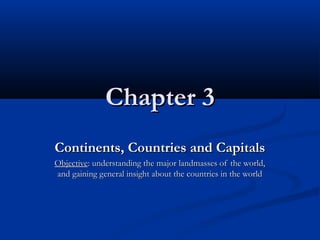
- 1. Chapter 3Chapter 3 Continents, Countries and CapitalsContinents, Countries and Capitals ObjectiveObjective: understanding the major landmasses of the world,: understanding the major landmasses of the world, and gaining general insight about the countries in the worldand gaining general insight about the countries in the world
- 2. ContinentsContinents The major landmasses of the world are;The major landmasses of the world are; EuropeEurope AsiaAsia AfricaAfrica North AmericaNorth America South AmericaSouth America AntarcticaAntarctica Australia/OceaniaAustralia/Oceania http://go.hrw.com/atlas/norm_htm/world.htmhttp://go.hrw.com/atlas/norm_htm/world.htm
- 4. Continents by SizeContinents by Size #1#1 AsiaAsia - (44,579,000 sq km)- (44,579,000 sq km) #2#2 AfricaAfrica - (30,065,000 sq km)- (30,065,000 sq km) #3#3 North AmericaNorth America - (24,256,000 sq km)- (24,256,000 sq km) #4#4 South AmericaSouth America - (17,819,000 sq km)- (17,819,000 sq km) #5#5 AntarcticaAntarctica - (13,209,000 sq km)- (13,209,000 sq km) #6 Europe - (9,938,000 sq km)#6 Europe - (9,938,000 sq km) #7 Australia/Oceania - (7,687,000 sq km)#7 Australia/Oceania - (7,687,000 sq km) http://www.graphicmaps.com/geoquiz/thelist.htmhttp://www.graphicmaps.com/geoquiz/thelist.htm
- 5. Continents by populationContinents by population #1#1 AsiaAsia - (3,674,000,000)- (3,674,000,000) #2#2 AfricaAfrica - (778,000,000)- (778,000,000) #3#3 EuropeEurope - (732,000,000)- (732,000,000) #4#4 North AmericaNorth America - (483,000,000)- (483,000,000) #5#5 South AmericaSouth America - (342,000,000)- (342,000,000) #6#6 Australia/OceaniaAustralia/Oceania - (31,000,000)- (31,000,000) #7#7 AntarcticaAntarctica - (0)- (0)
- 6. Continents by the number of countriesContinents by the number of countries #1#1 AfricaAfrica - (53)- (53) #3#3 EuropeEurope - (46)- (46) #2#2 AsiaAsia - (44)- (44) #4#4 North AmericaNorth America - (23)- (23) #5#5 Australia/Australia/OceaniaOceania - (14)- (14) #6#6 South AmericaSouth America - (12)- (12)
- 7. EuropeEurope The landmass that extends from the UralThe landmass that extends from the Ural Mountains in Russia on the east and theMountains in Russia on the east and the Bosporus Strait in Turkey to the Atlantic OceanBosporus Strait in Turkey to the Atlantic Ocean on the west.on the west. Also includes the islands/nations of the UnitedAlso includes the islands/nations of the United Kingdom, Ireland, Iceland and Malta.Kingdom, Ireland, Iceland and Malta. httphttp://go.hrw.com/atlas/norm_htm/europe.htm://go.hrw.com/atlas/norm_htm/europe.htm
- 8. AsiaAsia The landmass that extends from the Bosporus Strait inThe landmass that extends from the Bosporus Strait in Turkey on the west, the Ural Mountains in Russia onTurkey on the west, the Ural Mountains in Russia on the north and the Suez Canal in Egypt on the south tothe north and the Suez Canal in Egypt on the south to the Pacific Ocean on the east.the Pacific Ocean on the east. Also includes islands/nations of Cyprus, Sri Lanka, theAlso includes islands/nations of Cyprus, Sri Lanka, the Maldives, Japan, Taiwan, Indonesia and the Philippines.Maldives, Japan, Taiwan, Indonesia and the Philippines. Since Europe and Asia are connected at the UralSince Europe and Asia are connected at the Ural Mountains, the entire landmass is called Eurasia.Mountains, the entire landmass is called Eurasia. http://go.hrw.com/atlas/norm_htm/asia.htmhttp://go.hrw.com/atlas/norm_htm/asia.htm
- 9. AfricaAfrica The landmass bordered by the Atlantic OceanThe landmass bordered by the Atlantic Ocean on the west, the Indian Ocean on the east, theon the west, the Indian Ocean on the east, the Mediterranean Sea on the north and the Red SeaMediterranean Sea on the north and the Red Sea and Suez Canal on the northeast.and Suez Canal on the northeast. Includes the islands/nations of the Seychelles,Includes the islands/nations of the Seychelles, Comoros, Mauritius, Reunion, Sao Tome andComoros, Mauritius, Reunion, Sao Tome and Principe, Madagascar, Cape Verde, and thePrincipe, Madagascar, Cape Verde, and the Canary Islands.Canary Islands. http://go.hrw.com/atlas/norm_htm/africa.htmhttp://go.hrw.com/atlas/norm_htm/africa.htm
- 10. North AmericaNorth America The landmass bordered by the Atlantic OceanThe landmass bordered by the Atlantic Ocean on the east, the Pacific Ocean on the west, theon the east, the Pacific Ocean on the west, the Arctic Ocean on the north and the nation ofArctic Ocean on the north and the nation of Colombia on the south.Colombia on the south. Includes Greenland, Bermuda, the Bahamas andIncludes Greenland, Bermuda, the Bahamas and the islands of the Caribbean Sea.the islands of the Caribbean Sea. http://go.hrw.com/atlas/norm_htm/namerica.htmhttp://go.hrw.com/atlas/norm_htm/namerica.htm
- 11. South AmericaSouth America The landmass bordered by the Pacific Ocean onThe landmass bordered by the Pacific Ocean on the west, the Atlantic Ocean on the east and thethe west, the Atlantic Ocean on the east and the nation of Panama on the north.nation of Panama on the north. Includes the Galapagos Islands and the FalklandIncludes the Galapagos Islands and the Falkland Islands.Islands. http://go.hrw.com/atlas/norm_htm/samerica.htmhttp://go.hrw.com/atlas/norm_htm/samerica.htm
- 12. AntarcticaAntarctica The landmass on the very southeast, bordered by theThe landmass on the very southeast, bordered by the Atlantic, Pacific and Indian Oceans.Atlantic, Pacific and Indian Oceans. The world's coldest and most inaccessible regionThe world's coldest and most inaccessible region LLargely covered by floating pack iceargely covered by floating pack ice The Antarctic is much colder than the ArcticThe Antarctic is much colder than the Arctic,, onlyonly inhabitants are visiting scientists.inhabitants are visiting scientists. Various nations claim different parts of the AntarcticVarious nations claim different parts of the Antarctic mainland. In 1959, twelve nations signed the Antarcticmainland. In 1959, twelve nations signed the Antarctic Treaty and agreed that Antarctica should be used forTreaty and agreed that Antarctica should be used for peaceful purposes only.peaceful purposes only.
- 13. AustraliaAustralia The landmass bordered by the Indian Ocean onThe landmass bordered by the Indian Ocean on the west, south and northwest; the Timor Sea,the west, south and northwest; the Timor Sea, the Arafura Sea and the Gulf of Carpentaria onthe Arafura Sea and the Gulf of Carpentaria on the north; the Coral Sea on the east andthe north; the Coral Sea on the east and northeast; and the Tasman Sea on the southeast.northeast; and the Tasman Sea on the southeast. http://www.atlapedia.com/online/maps/physical/Australia.htmhttp://www.atlapedia.com/online/maps/physical/Australia.htm http://go.hrw.com/atlas/norm_htm/oceania.htmhttp://go.hrw.com/atlas/norm_htm/oceania.htm
- 14. Oceans of the WorldOceans of the World Oceans cover 70% of the Earth’s surface.Oceans cover 70% of the Earth’s surface. They affect the weather and temperature by absorbingThey affect the weather and temperature by absorbing the heat (solar radiation) coming from the sun.the heat (solar radiation) coming from the sun. All oceans on earth are connected to each other.All oceans on earth are connected to each other. There are four oceans: theThere are four oceans: the PacificPacific (the biggest and the(the biggest and the deepest),deepest), AtlanticAtlantic,, IndianIndian andand ArcticArctic (the smallest). In(the smallest). In 2000, another is labeled as the2000, another is labeled as the Southern OceanSouthern Ocean (surrounds Antarctica, really the southern portion of(surrounds Antarctica, really the southern portion of the Atlantic and Pacific Oceans).the Atlantic and Pacific Oceans). http://http://www.enchantedlearning.comwww.enchantedlearning.com/subjects/ocean//subjects/ocean/
- 15. Island GroupsIsland Groups Islands are generally associated with the nearestIslands are generally associated with the nearest continent to them, except the islands in the Pacificcontinent to them, except the islands in the Pacific Ocean. The islands in the Pacific Ocean are collectivelyOcean. The islands in the Pacific Ocean are collectively referred to as “Oceania” (the continent of Australia isreferred to as “Oceania” (the continent of Australia is also included in Oceania).also included in Oceania). Islands especially in warm climates attracts travelers.Islands especially in warm climates attracts travelers. Some are visited as part of a travel to a mainlandSome are visited as part of a travel to a mainland country (such as the Greek islands when traveled tocountry (such as the Greek islands when traveled to Greece), some are destinations themselves. The mostGreece), some are destinations themselves. The most popular are in the Caribbean Sea and the Pacific Ocean.popular are in the Caribbean Sea and the Pacific Ocean.
- 16. CaribbeanCaribbean Caribbean islands are the islands in the Caribbean Sea.Caribbean islands are the islands in the Caribbean Sea. They do not include the Bahamas and Bermuda.They do not include the Bahamas and Bermuda. AntillesAntilles: another name for the Caribbean Islands.: another name for the Caribbean Islands. Great AntillesGreat Antilles: the largest ones including Cuba,: the largest ones including Cuba, Hispaniola (countries of Haiti and the DominicanHispaniola (countries of Haiti and the Dominican Republic), Jamaica and Puerto Rico.Republic), Jamaica and Puerto Rico. Lesser AntillesLesser Antilles: those Caribbean islands not among: those Caribbean islands not among the Greater Antilles.the Greater Antilles. http://www.unspoiledislands.com/sunscribers/maps/map.cfmhttp://www.unspoiledislands.com/sunscribers/maps/map.cfm
- 17. PacificPacific PolynesiaPolynesia: includes the islands within the triangle of: includes the islands within the triangle of Hawaii, New Zealand and Eastern Island. It does notHawaii, New Zealand and Eastern Island. It does not include Fiji, though it includes Tuvalu. The terminclude Fiji, though it includes Tuvalu. The term “Polynesia” means many islands.“Polynesia” means many islands. MelanesiaMelanesia: the islands from New Guinea to Fiji and: the islands from New Guinea to Fiji and New Caledonia.New Caledonia. MicronesiaMicronesia: the islands in the western Pacific,: the islands in the western Pacific, including islands from Palau to Kiribati, the Marshallsincluding islands from Palau to Kiribati, the Marshalls and Nauru. The term “Micronesia” means small islands.and Nauru. The term “Micronesia” means small islands. httphttp://www.mapsouthpacific.com/pacific/index.html://www.mapsouthpacific.com/pacific/index.html
- 18. Major Mountain RangesMajor Mountain Ranges Rockies;Rockies; North American range running from AlaskaNorth American range running from Alaska to Mexico. It covers the Sierra Nevada range betweento Mexico. It covers the Sierra Nevada range between California and Nevada.California and Nevada. Sierra Madre (Occidental);Sierra Madre (Occidental); the continuation of thethe continuation of the Rockies, runs through Mexico in the north-southRockies, runs through Mexico in the north-south direction.direction. Andes;Andes; a South American mountain chain, running in aa South American mountain chain, running in a north-south direction, primarily in Ecuador, Bolivia,north-south direction, primarily in Ecuador, Bolivia, Peru, Chile and Argentina.Peru, Chile and Argentina. http://http://www.eduplace.com/ss/maps/pdf/americas_phys.pdfwww.eduplace.com/ss/maps/pdf/americas_phys.pdf
- 19. Alps;Alps; a European mountain chain running in an east-a European mountain chain running in an east- west direction, primarily in Germany, Austria,west direction, primarily in Germany, Austria, Switzerland, France, Italy and Slovenia.Switzerland, France, Italy and Slovenia. Himalaya;Himalaya; An Asian mountain chain running in anAn Asian mountain chain running in an east-west direction, primarily in China (Tibet), Bhutan,east-west direction, primarily in China (Tibet), Bhutan, Nepal, India, and Pakistan.Nepal, India, and Pakistan. http://http://www.eduplace.com/ss/maps/pdf/world_phys.pdfwww.eduplace.com/ss/maps/pdf/world_phys.pdf (also see the world map on page 5 of your course book)(also see the world map on page 5 of your course book)
- 20. Countries of the WorldCountries of the World According to UN, there are 191 countries in the worldAccording to UN, there are 191 countries in the world (excluding the Vatican City).(excluding the Vatican City). There are 193 countries (including Taiwan and theThere are 193 countries (including Taiwan and the Vatican City).Vatican City). Places commonly confused as being countries includePlaces commonly confused as being countries include Puerto Rico,Puerto Rico, Bermuda,, andand Greenland. httphttp://geography.about.com/library/weekly/aa091399.htm://geography.about.com/library/weekly/aa091399.htm The countries of the World and their CapitalsThe countries of the World and their Capitals http://geography.about.com/library/misc/blnationalcapitals.htmhttp://geography.about.com/library/misc/blnationalcapitals.htm
- 21. Countries in EuropeCountries in Europe and their Capitalsand their Capitals IcelandIceland IrelandIreland United KingdomUnited Kingdom PortugalPortugal SpainSpain FranceFrance NorwayNorway SwedenSweden FinlandFinland ReykjavikReykjavik DublinDublin LondonLondon LisbonLisbon MadridMadrid ParisParis OsloOslo StockholmStockholm HelsinkiHelsinki
- 22. DenmarkDenmark NetherlandsNetherlands BelgiumBelgium LuxembourgLuxembourg GermanyGermany SwitzerlandSwitzerland LiechtensteinLiechtenstein ItalyItaly MonacoMonaco AustriaAustria Czech RepublicCzech Republic CopenhagenCopenhagen AmsterdamAmsterdam BrusselsBrussels LuxembourgLuxembourg BerlinBerlin BernBern VaduzVaduz RomeRome Monte CarloMonte Carlo ViennaVienna PragPrag
- 23. HungaryHungary PolandPoland SlovakiaSlovakia CroatiaCroatia Bosnia and HerzegovinaBosnia and Herzegovina AlbaniaAlbania The Former YugoslavThe Former Yugoslav Rep. of MacedoniaRep. of Macedonia EstoniaEstonia LatviaLatvia LithuaniaLithuania BudapestBudapest WarsawWarsaw BratislavaBratislava ZagrebZagreb SarajevoSarajevo TiranaTirana SkopjeSkopje TallinnTallinn RigaRiga VilniusVilnius
- 24. BelarusBelarus UkraineUkraine RomaniaRomania BulgariaBulgaria GreeceGreece MoldovaMoldova MaltaMalta RussiaRussia SloveniaSlovenia Serbia and MontenegroSerbia and Montenegro AndorraAndorra MinskMinsk KievKiev BucharestBucharest SofiaSofia AthensAthens ChisinauChisinau VallettaValletta MoscowMoscow LjubljanaLjubljana BelgradeBelgrade Andorra La VellaAndorra La Vella
- 25. http://www.eduplace.com/ss/maps/pdf/eur_country.pdfhttp://www.eduplace.com/ss/maps/pdf/eur_country.pdf Geography Game:Geography Game: httphttp://www.nationalgeographic.com/geospy://www.nationalgeographic.com/geospy//
- 26. Countries in AsiaCountries in Asia http://www.eduplace.com/ss/maps/pdf/asia_pacific.pdfhttp://www.eduplace.com/ss/maps/pdf/asia_pacific.pdf
- 27. Countries in AfricaCountries in Africa http://www.eduplace.com/ss/maps/pdf/afr_asia_pol.pdfhttp://www.eduplace.com/ss/maps/pdf/afr_asia_pol.pdf
- 28. Countries in North AmericaCountries in North America http://www.eduplace.com/ss/maps/pdf/n_america.pdfhttp://www.eduplace.com/ss/maps/pdf/n_america.pdf
- 29. Countries in South AmericaCountries in South America http://www.eduplace.com/ss/maps/pdf/s_america.pdfhttp://www.eduplace.com/ss/maps/pdf/s_america.pdf
- 30. Countries in OceaniaCountries in Oceania http://www.eduplace.com/ss/maps/pdf/se_asia_pac_pol.pdfhttp://www.eduplace.com/ss/maps/pdf/se_asia_pac_pol.pdf