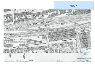
14. Thanks flickr... http://flickr.com/photos/christopherdaniel/8790186/ http://flickr.com/photos/uriba/102642846/ http://flickr.com/photos/tompagenet/181003142/ http://flickr.com/photos/56104845@N00/385458466/ http://flickr.com/photos/karlpalmas/322567195/ http://en.wikipedia.org/wiki/Image:ShoreditchNowClosed.JPG http://flickr.com/photos/lewishamdreamer/354164407/ http://flickr.com/photos/stevecadman/496736169/ http://flickr.com/photos/emdot/45249090/ http://flickr.com/photos/jbuhler/38911881/ http://flickr.com/photos/44b/291043135/ Maps.. * Published at the Act Directs By R. Harwood 1799 * Laurie and Whittle's New Plan of London With Its Environs 1809-10 (reprinted by London Borough of Tower Hamlets Libraries 2000) * Laurie and Whittle's New Map of London With Its Environs, Including the Recent Improvements 1819 (reprinted by London Borough of Tower Hamlets Libraries 1993) * Churchley's New Plan of London Improved to 1829 (reprinted by London Borough of Tower Hamlets Libraries 1994) * Churchley's New Plan of London to 1839 (reprinted by London Borough of Tower Hamlets Libraries 1998) * Cross's New Plan of London 1847 (reprinted by London Borough of Tower Hamlets Libraries 1995) * Stanford's Library Map of London and Its Suburbs, 1862 (Sheet 7,11) * Ordnance Survey 1872-1873 * Booth Poverty Map * Jewish East London, 1901 * Ordnance Survey 1894 (revised 1907) (heliozincographed and published by the director general at the ordnance survey office, southampton) * Ordnance Survey 1907 (revised 1938) * Map of the Borough of Bethnal Green Showing Major Air Raid Incidents During The War of 1935-1945 ** Including H.E. Bombs, parachute mines, flying bombs and long-range rockets but excluding incendiary bombs.. Area 759 acres. Population 94560 (1939) 50641 (1945) * Ordnance Survey 1962/3 More references soon..