2024: Domino Containers - The Next Step. News from the Domino Container commu...
Post Accuracy Assessment Classification
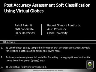
1. Rahul Rakshit Robert Gilmore Pontius Jr.
PhD Candidate Asst. Professor
Clark University Clark University
Objectives
1. To use the high quality sampled information that accuracy assessment reveals
for creating a soft classified residential lawns map.
2. To incorporate supplemental variables for aiding the segregation of residential
lawns from fine- green (grassy) areas.
3. To use virtual fieldwork for validation.
holmes, Graduate School of Geography, Clark University 1
2. Traditional image Satellite Image/ Objectives
processing Aerial Photo
methodology
Image
Classification
1. To use the high quality sampled information
Accuracy
that accuracy assessment reveals for creating
Assessment a soft classified residential lawns map.
Hard Classified
Map
Our Contribution Supplemental 2. To incorporate supplemental
Virtual Variables variables for aiding the
segregation of residential
3. To use virtual Fieldwork for
lawns from fine- green
fieldwork for validation. Accuracy (grassy) areas.
Assessment
Soft Classified
Map
holmes, Graduate School of Geography, Clark University 2
3. Aerial Photos
•4 Bands
•Orthorectified
•0.45 m Resolution
Image Courtesy:
Google Earth
holmes, Graduate School of Geography, Clark University 2
8. Supplemental variables are selected based on the likelihood of
them containing residential lawns.
holmes, Graduate School of Geography, Clark University 7
19. Coniferous Fine-Green Fine-Green
Impervious Impervious Deciduous
Images Courtesy: Google Earth
holmes, Graduate School of Geography, Clark University 18
20. Images Courtesy: Google Earth
and MS Virtual Earth
Street View
Google Earth
Virtual Earth 1 Virtual Earth 2 Virtual Earth 3 Virtual Earth 4
holmes, Graduate School of Geography, Clark University 19
21. Percentage of Upper Percentage Lower
Stratum Fine-Green Near Buildings Zoned Res Res -1999
Study Area Bound of Lawn Bound
1 TRUE TRUE TRUE TRUE 5 64% 76 88%
2 TRUE TRUE TRUE FALSE 6 24% 38 52%
3 TRUE TRUE FALSE UN -USED 1 1% 6 13%
4 TRUE FALSE UN -USED UN -USED 6 0% 0 0%
5 FALSE TRUE TRUE TRUE 12 1% 10 19%
6 FALSE UNUSED UN -USED UN -USED 70 1% 2 6%
Total 100 5% 8 12%
holmes, Graduate School of Geography, Clark University 20
23. Figure of Merit: The rate at which the classification is entirely correct
Error of omission Correctly classified Error of comission Figure of Merit
Stratum 1U2U3U4 29
Stratum 1U2U3 41
Stratum 1U2 44
Stratum 1 37
0 5 10 15 20
holmes, Graduate School of Geography, Clark University 22
24. 1. To use the high quality sampled information that accuracy
assessment reveals for creating a soft classified residential
lawns map.
2. To incorporate supplemental variables for aiding the
segregation of residential lawns from fine- green (grassy)
areas.
3. To use virtual fieldwork for validation.
holmes, Graduate School of Geography, Clark University 23
25. This material is based upon work supported by the National Science Foundation under Grant No. 0709685
Any opinions, findings, & conclusions or recommendations expressed in this material are those of the author(s) & do not necessarily reflect the
views of the National Science Foundation.
holmes, Graduate School of Geography, Clark University 24