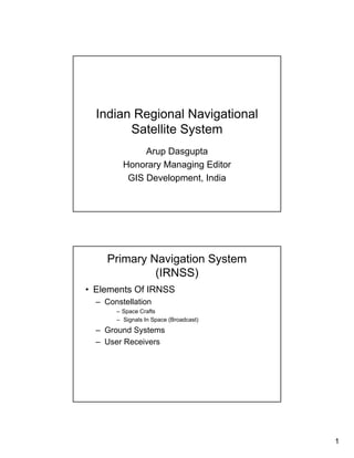
1. Indian Regional Navigational
Satellite System
Arup Dasgupta
Honorary Managing Editor
GIS Development, India
Primary Navigation System
(IRNSS)
• Elements Of IRNSS
– Constellation
– Space Crafts
– Signals In Space (Broadcast)
– Ground Systems
– User Receivers
1
2. IRNSS Constellation
3 geo-stationary satellites revolving in
equatorial orbit
4 geo-synchronous satellites revolving in
independent 290 inclined orbits
IRNSS – Space Segment
• The orbital slots where the 7 satellites will be positioned
are 1 each satellite in geo-stationary orbit at 34 0E, 83
0E and 132 0E longitudes and 2 satellites each in geo-
synchronous orbit with 290 inclination at 55 0E and 111
0E longitudes
• All satellites are configured identically for convenience of
realization and production
• Each satellite supports 110 Kgs of navigation payload.
• Antenna pattern is global in coverage and circular in
shape with the beam centre positioned at 10 0N latitude
and 83 0E longitude.
• Coverage being global (Antenna Global Beam) and
circular, no antenna pointing mechanism is required.
2
3. IRNSS – Space Segment
• Continuous yaw manoeuvre of satellites in inclined orbit
so as to ensure that sun is always perpendicular to the
solar panels.
• Satellites to be launched by PSLV. Possibility of
launching two satellites onboard GSLV studied as an
alternative.
• Constellation to be commissioned by 2012. Calls for
launching of 1 satellite every 6 months..
• Lift-off mass of each spacecraft is 1370 kgs and power
generation capability is 1.6 kW.
• Launch strategies being worked out – explained later.
• Satellite to carry enough fuel for orbit raising as well as
in-orbit manoeuvres.
IRNSS Constellation Definition
•The 4 satellites in inclined orbits trace a figure of ‘8’ on the earth.
•When 2 of the 4 satellites are at equator, other 2 are at extreme positions.
550 E 1110 E
longitude longitude
290 GSO 290 GSO
340 E 1320 E
longitude longitude
GEO GEO
830 E
longitude
GEO
550 E 1110 E
longitude longitude
290 GSO 290 GSO
earth’s rotation satellites’s movement
3
4. Signals In Space
• Signals at L Band
– 1 MBPS BPSK (similar to GPS C/A)
– 2 MBPS BOC (BOC 5, 2)
• Signals at S Band
– 1 MBPS BPSK
– 2 MBPS BOC (BOC 5,2)
BOC (Binary Offset Carrier)
BOC (5,2) 2 MBPS Code is modulated by a sub carrier of 5 MHz Clock .
IRNSS Configuration
8
4
5. ELEMENTS OF SATELLITE
NAVIGATION GROUND
SEGMENT
PNT Services
Satellite Navigation is a method employing Global or Regional
Constellation of satellites to accurately determine
Position (P) , Navigation (N) and Time (T)
anywhere on the earth
Using a Navigation Satellite System one can determine
• Exact Position (Latitude, Longitude and Altitude)
• Exact Speed and Direction of travel (course)
• Exact Time ( IST,UTC,TAI)
5
6. Ground Segment
TT&C and
Nav. Uplink
TT&C and User
Nav. Uplink Monitor
Monitor 1 1 stations
stations
Two way Two way
Ranging
Ranging SCC 1
1
MCC Laser
Laser Timing
Ranging
Ranging Centre
Service Area for IRNSS
Longitude 40 deg E to 125 deg E
Latitude 30 deg S to 45 deg N
6
7. IRNSS Ground Segment
Objectives
• Carry out house-keeping and station-keeping of the
IRNSS satellites
• Carry out precise orbit determination of all IRNSS
Satellites using one way, two-way and laser ranging
• Generate maintain and disseminate IRNSS network time
using an ensemble of highly stable clocks
• Estimate the onboard satellite clock bias and drift rate
and ionospheric delay using one way range
measurement data
• Generate ephemeris parameters that will be broadcast
by IRNSS satellites for user community
• Have uplink dedicated uplink facility for each satellite for
housekeeping and navigation uplinks
IRNSS Ground Segment Architecture
34° E 83° E 132° E
55° E 110° E
1 5 6 9
Satellite Control Facility
(SCF( M )) Satellite Control Facility
Hassan (SCF( R ))
Bhopal
IRLUS IRLUS
SCC +TTC SCC +TTC
Backup INC
IRNSS Navigation Centre
IRNSS CDMA Ranging Bangalore IRNSS Laser Ranging
1-4
IRNWT
IRIMS IRIMS
1 17
7
8. IRNSS Ground Segment Elements
• IRNSS Satellite Control Facility ( IRSCF )
– IRNSS TTC and Land Uplink Stations ( IRTTC) - 9 Nos
– IRNSS Satellite Control Centre ( IRSCC ) - 2 Nos
• IRNSS Range and Integrity Monitoring Stations(IRIMS) -
17Nos
• IRNSS Navigation Control Facility ( IRNCF )
– IRNSS Navigation Centre ( INC ) - 2 Nos
– IRNSS Network Time ( IRNWT ) - 2 No
– IRNSS CDMA Ranging Stations ( IRCDR ) - 4 Nos
– IRNSS Laser Ranging Service ( ILRS )
• IRNSS Data Communication Network ( IRDCN ) - 2 Nos
Iono Modeling Requirements
8
9. IRIMS Network
IRNSS
User Receivers
Single Frequency
Ionospheric Correction from data in navigation message
sent from ground and through extrapolation in receiver
through modeling (Less Accurate)
Dual Frequency
On line ionosphere correction by measuring the delay on
two frequencies (More accurate)
9