![Overview ,[object Object],[object Object],[object Object],[object Object],[object Object],[object Object]](data:image/gif;base64,R0lGODlhAQABAIAAAAAAAP///yH5BAEAAAAALAAAAAABAAEAAAIBRAA7)
Recommandé
Contenu connexe
Tendances
Tendances (20)
Similaire à Lake Ontario Unleashed: An Analysis of a February 2007 Lake Effect Event
Similaire à Lake Ontario Unleashed: An Analysis of a February 2007 Lake Effect Event (20)
Dernier
Dernier (20)
Lake Ontario Unleashed: An Analysis of a February 2007 Lake Effect Event
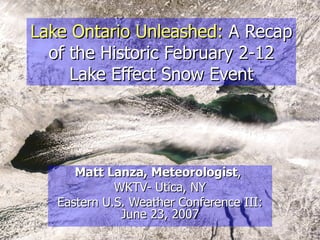
- 1. Lake Ontario Unleashed: A Recap of the Historic February 2-12 Lake Effect Snow Event Matt Lanza, Meteorologist , WKTV- Utica, NY Eastern U.S. Weather Conference III: June 23, 2007
- 10. Geography Lesson
- 14. Synoptic Setup for LES Event Alberta Clipper swings through Synoptic snows wind down at 00Z.
- 15. 00Z February 3 rd (Friday, 7 PM) Alberta Clipper dragged a cold front through Great Lakes Anomalously cold 850 mb temperatures driven south and eastward with Polar Vortex; -10°C was threshold for LES Deep synoptic moisture was in place
- 16. 12Z February 3 rd (Saturday, 7 AM) Deepening Polar air mass over Lakes, as 850 mb temps fall to -18°C over Lake Ontario. Deep synoptic moisture remained in place Secondary push of Polar air seen with low pressure over U.P. of Michigan
- 17. 12Z February 4 th (Sunday, 7 AM) Shortwave trough passed through Deepening 850 mb cold, as temps fall to -23°C Synoptic moisture in place across all the Lakes Core of upper level cold laid out near Lakes
- 18. 00Z February 5 th (Sunday, 7 PM) Another weak shortwave crossed over Lakes Winds shifted aloft from WSW to more Westerly direction 850 mb cold continued to deepen with temperature range of -28°C to -24°C across the Lakes Synoptic moisture continued to reload across the Lakes
- 19. 12Z February 5 th (Monday, 7 AM) Final major shift occurred, shifting winds into broad west and west-northwest direction; 850 mb cold continued to hold Synoptic moisture continued to remain deep and in tact
- 21. February 2
- 22. February 3
- 23. February 4
- 24. February 5
- 25. February 6
- 26. February 7
- 27. February 8
- 28. February 9
- 29. February 10
- 30. February 11
- 31. February 12
- 33. Results… Point Rock, NY, February 6
- 34. Results… Point Rock, NY, February 6
- 35. Results… Westernville, NY, February 6
- 36. Results… Westernville, NY, February 6
- 37. Results… Lake Delta, NY, February 6 Lawn Chairs!
- 38. Results… Lake Delta, NY, February 6
- 39. Results… Westdale, NY, February 7
- 40. Results… Turin, NY, February 10
- 48. Results… Viewer in Deerfield, NY
- 51. Matt’s Unofficial Snowfall Map
- 60. Thank You! Questions or comments: mlanza@wktv.com