SlideShare une entreprise Scribd logo
1  sur  14
Course: Geography of Pakistan, Part-I (9351)
Semester: Autumn, 2019
1
ASSIGNMENT No. 1
Q.1 Define the term Physiography? Discuss its three major features including mountains, plateaus and
plains.
Landforms
Weathering, water, elevation, sinking, and erosion of the soil are constantly shaping the surface of the Earth. It
doesn’t really happen overnight but takes hundreds and thousands of years for us to notice these changes. These are
the natural processes that lead to various formations of the Landforms. Landforms originate from these geological
processes. Let’s understand the processes that shape the landforms.
External Process
External process means effects caused by the external factors such as rain or wind. Erosion occurs when material
on the surface like soil and rocks which are called sediments are deposited or dropped off in a different location.
These natural processes change the surface of the Earth. Erosion and Deposition are the processes that are occurring
externally.
Internal Process
Needless to say, internal processes occur inside the surface of the Earth, beneath the crust. The internal
process, like Volcanic eruption and Plate tectonics, are caused because of the intense heat in the Earth’s core that
causes molten rock in the mantle layer to move thus creating uneven movement on the surface. These layers are
either uplifting or sinking.
Landforms can be categorized into Mountains, Plateaus, and Plains depending upon their elevation and slope. Let
us look at them individually.
Source: wpclipart
Course: Geography of Pakistan, Part-I (9351)
Semester: Autumn, 2019
2
Mountain
Source: Wikia
Any landmass that is higher and steeper than a hill is called a Mountain. A hill is a landform that extends above the
surrounding terrain. Generally, mountains are higher than 2000 ft. In any other natural elevation like atmosphere, as
you go higher and higher, the temperature drops down and the climate becomes colder. Habitation becomes
harsher. That’s why there is less habitation in the mountainous areas.
Due to the temperature drop, it is not uncommon for mountains to develop ice on them. In some mountains, there
are permanently frozen rivers of ice called as glaciers. Because of the steep slopes of the mountains, there is less
land available for proper farming.
If the surface is calculated considering the sea base as the scale, there are mountains even under the sea. Mauna Kea
(Hawaii) in the Pacific Ocean is an example. It is elevated higher than Mt. Everest. Also, a line of mountains is
known as a range. For example, the Himalayas in Asia, the Alps in Europe and the Andes in South America. These
ranges are the storehouses of water. Many rivers have their origins in these mountains, the glaciers of the mountains
are the source of these rivers.
Mountains are generally untouched by civilisations are thus have the endangered species of plants and animals.
They also inhibit a rich variety of flora and fauna. Mountains are further divided into three categories:
1. Fold Mountains
Source: Quora
Fold mountains are created when two tectonic plates collide and the edges of these plates ‘fold’ because of the
enormous push force between them. Scientists classify the fold mountains into ‘young fold mountains’ are the ‘old
fold mountains’ according to the mountains age.
Course: Geography of Pakistan, Part-I (9351)
Semester: Autumn, 2019
3
 The young fold mountains are between 10 and 25 million years old such as the Himalayas in Nepal, the
Alps in Europe and the Andes in South America.
 Now, the old fold mountains are older than 200 million years old such as the Aravalli mountains in India
(Rajasthan) Ural mountain in Russia.
2. Block Mountains
Source: Quora
Block mountains occur when large areas are broken and displaced vertically. These large areas of rock, sometimes
stretching across hundreds of kilometres are created by tectonic and localized stresses in the Earth’s crust.
The uplifted blocks are termed as horsts. The lowered blocks are called grabens. They resemble piano keys. The
examples of block mountains are the Rhine valley and the Vosges mountain in Europe.
3. Volcanic Mountains
Source: HubPages
Volcanic mountains are formed by magma rising up from the mantle to the crust of the earth. The example of
volcanic mountains is Kilimanjaro and Mount Fuji.
Course: Geography of Pakistan, Part-I (9351)
Semester: Autumn, 2019
4
Plateaus
Plateaus are elevated flatlands. It is a flat land which is standing above the surrounding area. Plateaus may have one
or more sides with steep slopes. Depending upon the plateau their height varies from a few hundred meters to
several thousand meters.
The most familiar plateau in India is the Deccan Plateau and these plateaus are mainly formed by lava, meaning
they are volcanic in origin. The extension of Deccan Plateau is the Chhotanagpur plateau in India. It’s a reserve for
minerals such as iron ore, manganese and coal. African plateau is most famous for gold and diamond mining.
The Tibetan plateau is the highest plateau in the world. Plateau regions give birth to the waterfall, for example,
Hundru falls in the Chhotanagpur plateau and the Jog falls in Karnataka. These plateaus are also centres for tourism
and scenic activities.
Plains
Source: NYTimes
Plains are the most fertile regions. They are stretches of large land. The predominant activity is the primary sector
in plains which is A surrounding. These stretches of land are the most suitable for human habitation
and agriculture activities like farming and poultry.
Course: Geography of Pakistan, Part-I (9351)
Semester: Autumn, 2019
5
Plains are formed by rivers and their tributaries. The rivers flow down the mountains and erode them. They deposit
sediments along their courses and in valleys. It is from these deposits that plains are formed. In India, the Indo-
Gangetic plains are the most densely populated regions of the country. Where there is water, there is life.
Q.2 Write notes on the following:
i. Vegetations and its variety
Scientists divide the Earth’s land into what are called vegetation regions. These areas have distinct types of
plants, soil, and weather patterns. Vegetation regions can be divided into five major
types: forest, grassland, tundra, desert, and ice sheet. Climate, soil, the ability of soil to hold water, and
the slope, or angle, of the land all determine what types of plants will grow in a particular region.
Forest
Forests are areas with trees grouped in a way so their leaves, or foliage, shade the ground. Forests can be found
just about anywhere trees can grow, from below sea level to high in the mountains. From tropical rain forests
near the Equator to boreal forests in cold climates close to the Arctic Circle, different types of forests can be
found all over the world.
One way to classify different types of forests is by the type of trees a forest has. Deciduous forests have trees
with green leaves that change color in the fall and drop altogether in the winter. Trees that are common in
deciduous forests are oak and maple. The northeastern United States is covered in deciduous forest, and tourists
flock to the area every autumn to experience the orange, yellow, and red leaves blanketing the region.
Evergreen forests have trees with leaves that stay green all year long. One of the places evergreen forests can be
found is on the opposite side of the North American continent—in the Pacific Northwest, which includes the
Canadian province of British Columbia and the U.S. states of Washington and Oregon. The Pacific Northwest is
full of evergreen trees like fir.
Sometimes forests are classified by the type of leaves on their trees. Trees in broad-leaved forests have wide,
flat leaves. Tropical rain forests are a type of broad-leaved forest. Tropical rain forests, such as Brazil’s Amazon
Basin rain forest, are found near the Equator. They contain more than half of the world’s biodiversity, or variety
of plant and animal species.
Coniferous forests have trees with cones and needles instead of leaves. Coniferous forests have the tallest (coast
redwood), largest (giant sequoia), and oldest (bristlecone pine) trees in the world.
Course: Geography of Pakistan, Part-I (9351)
Semester: Autumn, 2019
6
Many forests are mixed, meaning they have both broadleaf and coniferous trees. The eucalyptus forests of
Australia are mixed forests, for instance. The evergreen eucalyptus trees are mixed with deciduous trees
like beech.
Grassland
Grasslands are, as their name suggests, flat and open areas where grasses are the dominant type of vegetation.
Grasslands can be found on every continent except Antarctica.
Climate plays a role in the type of grassland you get. In cool, mild climates, like northwest Europe, grasslands
are dominated by tough vegetation, such as oats, that thrives all year. Some of these grasses are so tough
and hardy that they are considered weeds.
In warmer climates, seasonal vegetation survives better. Temperate grasslands exist where there are seasonal
variations in temperature over the course of the year: hot summers and cold winters. Different grasses thrive in
different temperatures here. Temperate grasslands exist from the prairies of North America to the veld, or rural
grassland, of South Africa.
Tropical grasslands are called savannas. They do well in weather that is warm year-round and usually pretty
dry. The most famous savannas are in Africa. Serengeti National Park, in Tanzania, has three distinct types
of savanna grassland: long grass, intermediate grass, and short grass. This part of the Serengeti is known as
the Serengeti Plains, and it supports wildlife from aardvarks to zebras.
Grasslands are important for milk and dairy production; dairy cows are happiest, and most productive, in areas
in which they can munch on grass all day.
Tundra
Tundra is an area where tree growth is difficult because of cold temperatures and short seasons. Vegetation in
tundra is limited to a few shrubs, grasses, and mosses. Scientists estimate roughly 1,700 different species live in
the tundra, which isn’t much compared to forests and grasslands. The ground is often too cold for plants to set
down roots, and without plants, few animal species can survive.
There are two types of tundra: alpine tundra and arctic tundra. Alpine tundra is separated from a
forest vegetation region by the tree line, the area beyond which conditions are too harsh or cold for tree growth.
The weather in alpine tundras is cold, snowy, and windy. Most of the Tibetan Plateau, the so-called “roof of the
Course: Geography of Pakistan, Part-I (9351)
Semester: Autumn, 2019
7
world” located in Tibet, China, and India, is alpine tundra. Animals like mountain goats live in this vegetation
region.
Arctic tundra occurs in the far-northern hemisphere of the Earth. It has a bare landscape and is frozen for much
of the year. Here, the tundra can include permafrost, or soil that is permanently frozen. Russia and Canada have
huge areas of arctic tundra. During the summer, the permafrost thaws just a bit, allowing some plants to grow in
the wet, marshy ground. You won’t find many mammals in the arctic tundra, but thousands of insects and birds
show up every year and enjoy the marshes before they freeze. Among the few mammals that actually thrive in
the arctic tundra are caribou and polar bears.
Desert
Deserts have almost no precipitation, or rainfall. In fact, deserts are specifically defined as areas with an average
annual precipitation of less than 10 inches per year. Deserts usually have really high daytime temperatures, low
nighttime temperatures, and very low humidity.
Desert soil is often sandy, rocky, or gravely. Plant life is highly specialized to adapt to these coarse, dry
conditions, with long roots, small leaves, stems that store water, and prickly spines that discourage animals from
touching or eating them. Cactuses, which are native to deserts in North and South America, are an example of
this kind of plant. Despite the barren look of hot deserts, they are full of animal life. Most desert animals, such
as lizards or snakes, are nocturnal, meaning they are active at night. Nocturnal animals take advantage of the
cooler nighttime temperatures of the hot desert.
Not all deserts are hot and sandy, however. The largest desert in the world is the Antarctic Desert, which takes
up most of the continent of Antarctica. In the Antarctic Desert, ice sheets cover barren rock. Few animals can
live in the Antarctic Desert. Those that do are often microscopic, such as lice.
Ice Sheet
The interesting thing about the ice sheet “vegetation region” is that there really isn’t any vegetation there at all!
An ice sheet is a large stretch of glacier ice that covers the land all around it for more than 50,000 square
kilometers (20,000 square miles). Currently, the only ice sheets are in Antarctica and Greenland. Don’t confuse
the ice sheets, called polar ice caps, with other ice shelves or glaciers; an ice sheet is much, much bigger.
Ice sheets are important research sites for scientists. The Antarctic ice sheet is a record of Earth’s atmospheric
changes. By looking at layers in the ice, scientists can keep track of different levels of pollution or volcanic
Course: Geography of Pakistan, Part-I (9351)
Semester: Autumn, 2019
8
gases in the atmosphere. The 1883 eruption of the Indonesian island volcano of Krakatoa can be located and
dated by the distinct air bubbles in the Antarctic ice sheet, for instance.
Scientists are also studying ice sheets to measure the rate of melting ice. Parts of the Greenland ice sheet were
once thought to be permanent, but they are now melting at a fast pace.
ii. Advantages of forests
1. They help us breathe.
2. Forests help in climate control.
3. They help the ground absorb during flood, reducing soil loss and property damage by slowing the flow.
4. Forests are of economic importance to us. For example, plantation forests provide humans with timber and
wood, which is exported and used in all parts of the world.
5. Forests serve as a home (habitat) to millions of animals.
5. Forests help in regulation of ecosystems.
6. Forests reduce noise pollution.
7. Forests provide a wealth of natural medicines.
8. Forests helps in cooling the Earth's temperature.
9. The natural beauty and peace of the forest offer a special source of enjoyment.
10. Forests serve as employment to village people.
Q.3 Discuss the major features of Pakistan’s hydrology. Also elaborate the importance of rivers, lakes
and canals.
Hydrology is the scientific study of the movement, distribution and management of water on Earth and other
planets, including the water cycle, water resources and environmental watershed sustainability. A practitioner of
hydrology is called a hydrologist. Hydrologists are scientists studying earth or environmental
science, civil or environmental engineering and physical geography. Using various analytical methods and
scientific techniques, they collect and analyze data to help solve water related problems such as environmental
preservation, natural disasters, and water management.
Hydrology subdivides into surface water hydrology, groundwater hydrology (hydrogeology), and marine
hydrology. Domains of hydrology include hydrometeorology, surface hydrology, hydrogeology, drainage-
basin management and water quality, where water plays the central role.
Oceanography and meteorology are not included because water is only one of many important aspects within
those fields.
Hydrological research can inform environmental engineering, policy and planning.
 Chemical hydrology is the study of the chemical characteristics of water.
 Ecohydrology is the study of interactions between organisms and the hydrologic cycle.
 Hydrogeology is the study of the presence and movement of groundwater.
Course: Geography of Pakistan, Part-I (9351)
Semester: Autumn, 2019
9
 Hydrogeochemistry is the study of how terrestrial water dissolves minerals weathering and this effect on
water chemistry.
 Hydroinformatics is the adaptation of information technology to hydrology and water resources
applications.
 Hydrometeorology is the study of the transfer of water and energy between land and water body surfaces
and the lower atmosphere.
 Isotope hydrology is the study of the isotopic signatures of water.
 Surface hydrology is the study of hydrologic processes that operate at or near Earth's surface.
 Drainage basin management covers water storage, in the form of reservoirs, and floods protection.
 Water quality includes the chemistry of water in rivers and lakes, both of pollutants and natural solutes.
Application:
 Calculation of rainfall.
 Calculating surface runoff and precipitation.
 Determining the water balance of a region.
 Determining the agricultural water balance.
 Designing riparian restoration projects.
 Mitigating and predicting flood, landslide and drought risk.
 Real-time flood forecasting and flood warning.
 Designing irrigation schemes and managing agricultural productivity.
 Part of the hazard module in catastrophe modeling.
 Providing drinking water.
 Designing dams for water supply or hydroelectric power generation.
 Designing bridges.
 Designing sewers and urban drainage system.
 Analyzing the impacts of antecedent moisture on sanitary sewer systems.
 Predicting geomorphologic changes, such as erosion or sedimentation.
 Assessing the impacts of natural and anthropogenic environmental change on water resources.
 Assessing contaminant transport risk and establishing environmental policy guidelines.
 Estimating the water resource potential of river basins.
Hydrology has been a subject of investigation and engineering for millennia. For example, about 4000 BC the
Nile was dammed to improve agricultural productivity of previously barren lands. Mesopotamian towns were
protected from flooding with high earthen walls. Aqueducts were built by the Greeks and Ancient Romans,
while the history of China shows they built irrigation and flood control works. The ancient Sinhalese used
Course: Geography of Pakistan, Part-I (9351)
Semester: Autumn, 2019
10
hydrology to build complex irrigation works in Sri Lanka, also known for invention of the Valve Pit which
allowed construction of large reservoirs, anicuts and canals which still function.
Marcus Vitruvius, in the first century BC, described a philosophical theory of the hydrologic cycle, in which
precipitation falling in the mountains infiltrated the Earth's surface and led to streams and springs in the
lowlands.[citation needed] With the adoption of a more scientific approach, Leonardo da Vinci and Bernard
Palissy independently reached an accurate representation of the hydrologic cycle. It was not until the 17th
century that hydrologic variables began to be quantified.
Pioneers of the modern science of hydrology include Pierre Perrault, Edme Mariotte and Edmund Halley. By
measuring rainfall, runoff, and drainage area, Perrault showed that rainfall was sufficient to account for the flow
of the Seine. Mariotte combined velocity and river cross-section measurements to obtain a discharge, again in
the Seine. Halley showed that the evaporation from the Mediterranean Sea was sufficient to account for the
outflow of rivers flowing into the sea.[2]
Advances in the 18th century included the Bernoulli piezometer and Bernoulli's equation, by Daniel Bernoulli,
and the Pitot tube, by Henri Pitot. The 19th century saw development in groundwater hydrology,
including Darcy's law, the Dupuit-Thiem well formula, and Hagen-Poiseuille's capillary flow equation.
Rational analyses began to replace empiricism in the 20th century, while governmental agencies began their
own hydrological research programs. Of particular importance were Leroy Sherman's unit hydrograph, the
infiltration theory of Robert E. Horton, and C.V. Theis' aquifer test/equation describing well hydraulics.
Since the 1950s, hydrology has been approached with a more theoretical basis than in the past, facilitated by
advances in the physical understanding of hydrological processes and by the advent of computers and
especially geographic information systems (GIS). (See also GIS and hydrology)
Q.4 Define the agricultural industry? Give your arguments that how stock, poultry and fishing had
become the industries in Pakistan?
Agriculture is a vital sector of Pakistan's economy and accounted for 25.9 percent of GDP in 1999-2000,
according to government estimates. The sector directly supports three-quarters of the country's population,
employs half the labor force , and contributes a large share of foreign exchange earnings. The main agricultural
products are cotton, wheat, rice, sugarcane, fruits, and vegetables, in addition to milk, beef, mutton, and eggs.
Pakistan depends on one of the world's largest irrigation systems to support production. There are 2 principal
seasons. Cotton, rice, and sugarcane are produced during the kharif season, which lasts from May to November.
Wheat is the major rabi crop, which extends from November to April. The key to a much-needed improvement
of productivity lies in a more efficient use of resources, principally land and water. However, change is
dependent on the large landowners who own 40 percent of the arable land and control most of the irrigation
system, which makes widespread reform difficult. Assessments by independent agencies, including the World
Bank, show these large landholdings to be very unproductive. Pakistan is a net importer of agricultural
Course: Geography of Pakistan, Part-I (9351)
Semester: Autumn, 2019
11
commodities. Annual imports total about US$2 billion and include wheat, edible oils, pulses, and consumer
foods.
Pakistan is one of the world's largest producers of raw cotton. The size of the annual cotton crop—the bulk of it
grown in Punjab province—is a crucial barometer of the health of the overall economy, as it determines the
availability and cost of the main raw material for the yarn-spinning industry, much of which is concentrated
around the southern port city of Karachi. Official estimates put the 1999-2000 harvest at some 11.2 million 170-
kilogram bales, compared with the 1998-99 outturn of 8.8 million bales and the record 12.8 million bales
achieved in 1991-92. The government recently actively intervened in the market to boost prices and to
encourage production. A major problem is that the cotton crop is highly susceptible to adverse weather and pest
damage, which is reflected in crop figures. After peaking at 2.18 million tons in 1991-92, the lint harvest has
since fluctuated considerably, ranging from a low of 1.37 million tons in 1993-94 to a high of 1.9 million tons
in 1999-2000.
The 2000-01 wheat crop was forecast at a record 19.3 million tons, compared to 17.8 million tons produced
during the previous year. This increase is due largely to favorable weather and a 25-percent increase in
the procurement price to about US$135 per ton. About 85 percent of the crop is irrigated. Despite the record
production, Pakistan will continue to be a major wheat importer. The government has imported an average of
US$2.4 million annually over the past 5 years. The United States and Australia are the major suppliers. Demand
for wheat is increasing from Pakistan's rapidly growing population as well as from cross-border trade with
Afghanistan.
Pakistan is a major rice exporter and annually exports about 2 million tons, or about 10 percent of world trade.
About 25 percent of exports is Pakistan's famous fragrant Basmati rice. Rice is Pakistan's second leading source
of export earnings. Private traders handle all exports. Pakistan's main competitors in rice trade are Thailand,
Vietnam, and India.
Tobacco is grown mainly in the North-West Frontier Province and Punjab and is an important cash crop .
Yields in Pakistan are about twice those for neighboring countries largely due to the extension services provided
by the industry. Quality, however, is improving only slowly due to problems related to climate and soil.
Farmers have started inter-cropping tobacco with vegetables and sugarcane to increase returns. About half of
the total production is used for cigarette manufacturing and the remainder used in traditional ways of smoking
(in hand-rolled cigarettes called birris, in water pipes, and as snuff). The share of imported tobacco is increasing
gradually in response to an increased demand for high-quality cigarettes.
Minor crops account for only 5 percent of total cultivated area; these include oilseeds (sunflower, soybean),
chilies, potatoes, and onions. Domestic oilseed production accounts only for about 25 percent of Pakistan total
edible oil needs. As a result, Pakistan spends more than US$1 billion annually in scarce foreign exchange to
import edible oils, while its oilseed processing industry operates at less than 25 percent of capacity due to an
Course: Geography of Pakistan, Part-I (9351)
Semester: Autumn, 2019
12
inadequate supply of oilseeds. For 2000-01 total oilseed production was forecast to decrease 10 percent to 3.6
million tons. The government has highlighted development of the oilseed sector as a priority.
Pakistan's fishing industry is relatively modest, but has shown strong growth in recent years. The domestic
market is quite small, with per capita annual consumption of approximately 2 kilograms. About 80 percent of
production comes from marine fisheries from 2 main areas, the Sindh coast east from Karachi to the Indian
border, and the Makran coast of Baluchistan. Ninety percent of the total marine catch is fish; the shrimp which
constitute the remainder are prized because of their greater relative value and demand in foreign markets.
During 1999-00, total fish production was 620,000 tons, of which 440,000 tons consisted of sea fish and the
remainder were fresh-water species. About one-third of the catch is consumed fresh, 9 percent is frozen, 8
percent canned, and about 43 percent used as fish meal for animal food.
Livestock accounts for 40 percent of the agricultural sector and 9 percent of the total GDP. Principal products
are milk, beef, mutton, poultry, and wool. During 1999, the livestock population increased to 120 million head.
That same year Pakistan generated 970,000 tons of beef, 640,000 tons of mutton, and 190,000 tons of poultry.
In an effort to enhance milk and meat production, the government recently launched a comprehensive livestock
development project with Asian Development Bank assistance. Poultry production provides an increasingly
popular low-cost source of protein. Modern poultry production is constrained by high mortality, high incidence
of disease, poor quality chicks, and poor quality feed, combined with an inadequate marketing system. Frozen
poultry have only recently been introduced.
Forests cover an area of 4.2 million hectares or about 5 percent of the total area of Pakistan. The principal forest
products are timber, principally for house construction, furniture, and firewood. Many of the country's wooded
areas are severely depleted as a result of over-exploitation. The government has restricted cutting to protect
remaining resources—though corruption often jeopardizes environmental efforts—and has lowered duties to
encourage imports. Forestry production has since declined from 1.07 million cubic meters in 1990-91 to
475,000 cubic meters in 1998-99. Pakistan imports an estimated US$150 million of wood products annually to
meet the requirements of a growing population and rising demand by a wealthy elite.
Q.5 Discuss the water-logging and salinity problems in Pakistan. Also discuss the measurements taken
by the government to solve these issues.
After a lifetime of tending his lands, a desperate Khudayar Khan has now started working as a daily wage
labourer to make ends meet. His three-acre farm along the vast Indus river in Ghotki district of Pakistan’s Sindh
province has turned barren due to waterlogging and salinity.
“Repeated cultivation of rice and sugarcane on my land has resulted in waterlogging and I am left with no
option but to start working as a labourer in a factory,” he said.
His is not the only tale of ruin in the area, most of which is irrigated by the Indus, one of the longest rivers in
Asia and a lifeline for millions of people in Pakistan.
Course: Geography of Pakistan, Part-I (9351)
Semester: Autumn, 2019
13
Urging the government to initiate a programme to deal with growing waterlogging and salinity, Khan says the
twin problems were destroying hundreds of acres of arable land each year. The excessive use of water for crops
like rice and sugarcane has raised the groundwater table in Ghotki and some other adjoining districts.
Experts and studies back the farmer’s claims. The excessive use of water for crops, non-cemented canals and a
poor drainage system are causing waterlogging and salinity in the area.
“The entire left bank of the Indus river could turn into lakes of saline water in the next 10 to 15 years if timely
action isn’t initiated to curb waterlogging and salinity,” warned Nabi Bukhsh, general secretary of the Sindh
Chamber of Agriculture.
“Rice and sugarcane are the most water consuming crops and they ultimately raise groundwater table to a
dangerous level,” Bukhsh told thethirdpole.net. In his estimate, over 90% of farmers on the left bank of the
Indus had been cultivating the two crops for the last three decades.
According to Bukhsh, farmers benefit from the crops initially but after some time, the excessive use of water
turns fertile land barren and reduces yield.
He added that irrigation water seeps through the ground as all canals in the area are non-cemented and this
ultimately results in waterlogging. “The stagnant water gradually turns saline and destroys nearby arable lands.”
The government has to do its bit to alleviate the problem. The water flow in the Kotri barrage, for instance, is
hampered by silt and sludge. The authorities show little interest in dredging the drainage network in Sindh.
The government, Bukhsh added, should redesign the drain network to discharge fresh water into the sea.
Besides, tubewells should be installed in the area to suck out water from the fertile lands.
According to a research paper, Salinity and Water-logging in the Indus Basin of Pakistan: Economic Loss to
Agricultural Economy, around 43% of the area in the Indus Basin Irrigation System is classified as waterlogged
with the water table at a depth of less than three metres, affecting around 7.1 million hectares of land.
A salinity survey conducted in 2001-03 by the Soil and Reclamation Directorate of the Water and Power
Development Authority (WAPDA) showed that 27% of the area was salt affected.
The government of Sindh has recently banned rice cultivation in command areas of the canals on the left bank
of the Indus to control waterlogging and salinity. A grower who violates the ban would be fined Rs.25,000
rupees ($246) per acre or with three years’ imprisonment. But a majority of farmers complain that the
government ensures that the ban is imposed only on small growers.
The area where the rice cultivation is banned includes districts like Ghotki, Khairpur, Sanghar, Mirpur Khas and
Tando Allah Yar.
Not just Sindh
Pakistan’s agriculture sector contributes a fifth of the country’s GDP and employs almost half of the labour
force, according to the Pakistan Economic Survey 2013-14.
Course: Geography of Pakistan, Part-I (9351)
Semester: Autumn, 2019
14
The issue of waterlogging is turning around 100,000 acres of land barren per annum while sea intrusion across
the coastal belt of the country has been exacerbating the salinity problem each passing day, said Sardar
Muhammad Tariq, former regional chair, Global Water Partnership South Asia.
Tariq told thethirdpole.net that Pakistan lacks a proper law to regulate use of water in the agriculture sector and
farmers grow crops like rice and sugarcane in running water. “The government should promote salt-tolerant
crops in the salinity-hit areas instead of investing on curbing the problem,” he suggested.
Tariq also suggested that the government install vertical tubewells and improve drainage system to address the
waterlogging problem and also develop specific seed varieties for the area.
Government officials say they are doing their bit to address the problems.
The Sindh government had initiated a project in 1967 to address the issue of waterlogging and salinity in the
province with the help of World Bank. As many as 3,657 tube wells were installed in different districts, said an
official.
Zaheer Hyder Shah, secretary, Sindh Irrigation Department, added that the tubewells run eight hours daily and
pump out around 7,588 cusecs of water. “Around 2,400 tubewells are operational now while the remaining have
developed some faults,” he told thethirdpole.net. The provincial government pays the bills for electricity and
repair of all the tubewells. Bukhsh of the Sindh Chamber of Agriculture, however, said only 5% of the
tubewells were operational.
Shah admitted that waterlogging and salinity were the biggest issues in agriculture and the government was
planning to install more tubewells in the problem areas to keep a check on the groundwater table.

Contenu connexe

Similaire à 9351-1.doc

#16 Ecosystems
#16 Ecosystems#16 Ecosystems
#16 Ecosystemsstanwood
 
national vegetation
national vegetationnational vegetation
national vegetationXadafAttique
 
GEOGRAPHY YEAR 10: ECOSYSTEMS. BIOMES
GEOGRAPHY YEAR 10: ECOSYSTEMS. BIOMESGEOGRAPHY YEAR 10: ECOSYSTEMS. BIOMES
GEOGRAPHY YEAR 10: ECOSYSTEMS. BIOMESGeorge Dumitrache
 
Class 7 chapter 6 , natural vegetation and wild life
Class 7 chapter  6 , natural vegetation and wild life Class 7 chapter  6 , natural vegetation and wild life
Class 7 chapter 6 , natural vegetation and wild life PoonamMudaliar
 
BIOMES.pptx
BIOMES.pptxBIOMES.pptx
BIOMES.pptxMacMak4
 
GEOGRAPHY IGCSE: WEATHER AND CLIMATE
GEOGRAPHY IGCSE: WEATHER AND CLIMATEGEOGRAPHY IGCSE: WEATHER AND CLIMATE
GEOGRAPHY IGCSE: WEATHER AND CLIMATEGeorge Dumitrache
 
Forest ecosystem
Forest ecosystemForest ecosystem
Forest ecosystemjosnarajp
 
terrestial ecosystem.pptx
terrestial ecosystem.pptxterrestial ecosystem.pptx
terrestial ecosystem.pptxaniltuli
 
Major biological communities
Major biological communitiesMajor biological communities
Major biological communitiespcalabri
 
12 forests
12 forests12 forests
12 forestsksealexa
 
Forest life and its conservation
Forest life and its conservationForest life and its conservation
Forest life and its conservationSimar3979
 
Natural vegetation and wildlife
Natural vegetation and wildlifeNatural vegetation and wildlife
Natural vegetation and wildlifethemassmaker
 

Similaire à 9351-1.doc (20)

#16 Ecosystems
#16 Ecosystems#16 Ecosystems
#16 Ecosystems
 
national vegetation
national vegetationnational vegetation
national vegetation
 
GEOGRAPHY YEAR 10: ECOSYSTEMS. BIOMES
GEOGRAPHY YEAR 10: ECOSYSTEMS. BIOMESGEOGRAPHY YEAR 10: ECOSYSTEMS. BIOMES
GEOGRAPHY YEAR 10: ECOSYSTEMS. BIOMES
 
Major types of ecosystem
Major types of ecosystemMajor types of ecosystem
Major types of ecosystem
 
Class 7 chapter 6 , natural vegetation and wild life
Class 7 chapter  6 , natural vegetation and wild life Class 7 chapter  6 , natural vegetation and wild life
Class 7 chapter 6 , natural vegetation and wild life
 
BIOMES.pptx
BIOMES.pptxBIOMES.pptx
BIOMES.pptx
 
GEOGRAPHY IGCSE: WEATHER AND CLIMATE
GEOGRAPHY IGCSE: WEATHER AND CLIMATEGEOGRAPHY IGCSE: WEATHER AND CLIMATE
GEOGRAPHY IGCSE: WEATHER AND CLIMATE
 
Forest ecosystem
Forest ecosystemForest ecosystem
Forest ecosystem
 
HABITAT
HABITATHABITAT
HABITAT
 
terrestial ecosystem.pptx
terrestial ecosystem.pptxterrestial ecosystem.pptx
terrestial ecosystem.pptx
 
Presentation1
Presentation1Presentation1
Presentation1
 
Biomes
BiomesBiomes
Biomes
 
Major biological communities
Major biological communitiesMajor biological communities
Major biological communities
 
12 forests
12 forests12 forests
12 forests
 
Forest life and its conservation
Forest life and its conservationForest life and its conservation
Forest life and its conservation
 
Natural vegetation and wildlife
Natural vegetation and wildlifeNatural vegetation and wildlife
Natural vegetation and wildlife
 
Ecosystems
EcosystemsEcosystems
Ecosystems
 
LAndforms
LAndformsLAndforms
LAndforms
 
Africa climate and vegetation
Africa  climate and vegetationAfrica  climate and vegetation
Africa climate and vegetation
 
Chapt05 lecture
Chapt05 lectureChapt05 lecture
Chapt05 lecture
 

Plus de Noaman Akbar (20)

8514 Presentation.ppt
8514 Presentation.ppt8514 Presentation.ppt
8514 Presentation.ppt
 
8516 Presentation.ppt
8516 Presentation.ppt8516 Presentation.ppt
8516 Presentation.ppt
 
9351-12.doc
9351-12.doc9351-12.doc
9351-12.doc
 
9351-2.doc
9351-2.doc9351-2.doc
9351-2.doc
 
9335-2.docx
9335-2.docx9335-2.docx
9335-2.docx
 
9001-2.docx
9001-2.docx9001-2.docx
9001-2.docx
 
9002-12.docx
9002-12.docx9002-12.docx
9002-12.docx
 
840-1-U.docx
840-1-U.docx840-1-U.docx
840-1-U.docx
 
840-1.docx
840-1.docx840-1.docx
840-1.docx
 
837-12.docx
837-12.docx837-12.docx
837-12.docx
 
840-2.docx
840-2.docx840-2.docx
840-2.docx
 
837-2.docx
837-2.docx837-2.docx
837-2.docx
 
837-1.docx
837-1.docx837-1.docx
837-1.docx
 
838-1-U.docx
838-1-U.docx838-1-U.docx
838-1-U.docx
 
837-1-U.docx
837-1-U.docx837-1-U.docx
837-1-U.docx
 
838-2.docx
838-2.docx838-2.docx
838-2.docx
 
838-12.docx
838-12.docx838-12.docx
838-12.docx
 
837-2-U.docx
837-2-U.docx837-2-U.docx
837-2-U.docx
 
838-2-U.docx
838-2-U.docx838-2-U.docx
838-2-U.docx
 
838-1.docx
838-1.docx838-1.docx
838-1.docx
 

Dernier

Introduction to AI in Higher Education_draft.pptx
Introduction to AI in Higher Education_draft.pptxIntroduction to AI in Higher Education_draft.pptx
Introduction to AI in Higher Education_draft.pptxpboyjonauth
 
1029 - Danh muc Sach Giao Khoa 10 . pdf
1029 -  Danh muc Sach Giao Khoa 10 . pdf1029 -  Danh muc Sach Giao Khoa 10 . pdf
1029 - Danh muc Sach Giao Khoa 10 . pdfQucHHunhnh
 
“Oh GOSH! Reflecting on Hackteria's Collaborative Practices in a Global Do-It...
“Oh GOSH! Reflecting on Hackteria's Collaborative Practices in a Global Do-It...“Oh GOSH! Reflecting on Hackteria's Collaborative Practices in a Global Do-It...
“Oh GOSH! Reflecting on Hackteria's Collaborative Practices in a Global Do-It...Marc Dusseiller Dusjagr
 
Advanced Views - Calendar View in Odoo 17
Advanced Views - Calendar View in Odoo 17Advanced Views - Calendar View in Odoo 17
Advanced Views - Calendar View in Odoo 17Celine George
 
BASLIQ CURRENT LOOKBOOK LOOKBOOK(1) (1).pdf
BASLIQ CURRENT LOOKBOOK  LOOKBOOK(1) (1).pdfBASLIQ CURRENT LOOKBOOK  LOOKBOOK(1) (1).pdf
BASLIQ CURRENT LOOKBOOK LOOKBOOK(1) (1).pdfSoniaTolstoy
 
POINT- BIOCHEMISTRY SEM 2 ENZYMES UNIT 5.pptx
POINT- BIOCHEMISTRY SEM 2 ENZYMES UNIT 5.pptxPOINT- BIOCHEMISTRY SEM 2 ENZYMES UNIT 5.pptx
POINT- BIOCHEMISTRY SEM 2 ENZYMES UNIT 5.pptxSayali Powar
 
A Critique of the Proposed National Education Policy Reform
A Critique of the Proposed National Education Policy ReformA Critique of the Proposed National Education Policy Reform
A Critique of the Proposed National Education Policy ReformChameera Dedduwage
 
Student login on Anyboli platform.helpin
Student login on Anyboli platform.helpinStudent login on Anyboli platform.helpin
Student login on Anyboli platform.helpinRaunakKeshri1
 
Call Girls in Dwarka Mor Delhi Contact Us 9654467111
Call Girls in Dwarka Mor Delhi Contact Us 9654467111Call Girls in Dwarka Mor Delhi Contact Us 9654467111
Call Girls in Dwarka Mor Delhi Contact Us 9654467111Sapana Sha
 
Activity 01 - Artificial Culture (1).pdf
Activity 01 - Artificial Culture (1).pdfActivity 01 - Artificial Culture (1).pdf
Activity 01 - Artificial Culture (1).pdfciinovamais
 
CARE OF CHILD IN INCUBATOR..........pptx
CARE OF CHILD IN INCUBATOR..........pptxCARE OF CHILD IN INCUBATOR..........pptx
CARE OF CHILD IN INCUBATOR..........pptxGaneshChakor2
 
1029-Danh muc Sach Giao Khoa khoi 6.pdf
1029-Danh muc Sach Giao Khoa khoi  6.pdf1029-Danh muc Sach Giao Khoa khoi  6.pdf
1029-Danh muc Sach Giao Khoa khoi 6.pdfQucHHunhnh
 
URLs and Routing in the Odoo 17 Website App
URLs and Routing in the Odoo 17 Website AppURLs and Routing in the Odoo 17 Website App
URLs and Routing in the Odoo 17 Website AppCeline George
 
Hybridoma Technology ( Production , Purification , and Application )
Hybridoma Technology  ( Production , Purification , and Application  ) Hybridoma Technology  ( Production , Purification , and Application  )
Hybridoma Technology ( Production , Purification , and Application ) Sakshi Ghasle
 
Kisan Call Centre - To harness potential of ICT in Agriculture by answer farm...
Kisan Call Centre - To harness potential of ICT in Agriculture by answer farm...Kisan Call Centre - To harness potential of ICT in Agriculture by answer farm...
Kisan Call Centre - To harness potential of ICT in Agriculture by answer farm...Krashi Coaching
 

Dernier (20)

Introduction to AI in Higher Education_draft.pptx
Introduction to AI in Higher Education_draft.pptxIntroduction to AI in Higher Education_draft.pptx
Introduction to AI in Higher Education_draft.pptx
 
1029 - Danh muc Sach Giao Khoa 10 . pdf
1029 -  Danh muc Sach Giao Khoa 10 . pdf1029 -  Danh muc Sach Giao Khoa 10 . pdf
1029 - Danh muc Sach Giao Khoa 10 . pdf
 
“Oh GOSH! Reflecting on Hackteria's Collaborative Practices in a Global Do-It...
“Oh GOSH! Reflecting on Hackteria's Collaborative Practices in a Global Do-It...“Oh GOSH! Reflecting on Hackteria's Collaborative Practices in a Global Do-It...
“Oh GOSH! Reflecting on Hackteria's Collaborative Practices in a Global Do-It...
 
Advanced Views - Calendar View in Odoo 17
Advanced Views - Calendar View in Odoo 17Advanced Views - Calendar View in Odoo 17
Advanced Views - Calendar View in Odoo 17
 
INDIA QUIZ 2024 RLAC DELHI UNIVERSITY.pptx
INDIA QUIZ 2024 RLAC DELHI UNIVERSITY.pptxINDIA QUIZ 2024 RLAC DELHI UNIVERSITY.pptx
INDIA QUIZ 2024 RLAC DELHI UNIVERSITY.pptx
 
TataKelola dan KamSiber Kecerdasan Buatan v022.pdf
TataKelola dan KamSiber Kecerdasan Buatan v022.pdfTataKelola dan KamSiber Kecerdasan Buatan v022.pdf
TataKelola dan KamSiber Kecerdasan Buatan v022.pdf
 
BASLIQ CURRENT LOOKBOOK LOOKBOOK(1) (1).pdf
BASLIQ CURRENT LOOKBOOK  LOOKBOOK(1) (1).pdfBASLIQ CURRENT LOOKBOOK  LOOKBOOK(1) (1).pdf
BASLIQ CURRENT LOOKBOOK LOOKBOOK(1) (1).pdf
 
POINT- BIOCHEMISTRY SEM 2 ENZYMES UNIT 5.pptx
POINT- BIOCHEMISTRY SEM 2 ENZYMES UNIT 5.pptxPOINT- BIOCHEMISTRY SEM 2 ENZYMES UNIT 5.pptx
POINT- BIOCHEMISTRY SEM 2 ENZYMES UNIT 5.pptx
 
A Critique of the Proposed National Education Policy Reform
A Critique of the Proposed National Education Policy ReformA Critique of the Proposed National Education Policy Reform
A Critique of the Proposed National Education Policy Reform
 
Mattingly "AI & Prompt Design: Structured Data, Assistants, & RAG"
Mattingly "AI & Prompt Design: Structured Data, Assistants, & RAG"Mattingly "AI & Prompt Design: Structured Data, Assistants, & RAG"
Mattingly "AI & Prompt Design: Structured Data, Assistants, & RAG"
 
Student login on Anyboli platform.helpin
Student login on Anyboli platform.helpinStudent login on Anyboli platform.helpin
Student login on Anyboli platform.helpin
 
Call Girls in Dwarka Mor Delhi Contact Us 9654467111
Call Girls in Dwarka Mor Delhi Contact Us 9654467111Call Girls in Dwarka Mor Delhi Contact Us 9654467111
Call Girls in Dwarka Mor Delhi Contact Us 9654467111
 
Activity 01 - Artificial Culture (1).pdf
Activity 01 - Artificial Culture (1).pdfActivity 01 - Artificial Culture (1).pdf
Activity 01 - Artificial Culture (1).pdf
 
Mattingly "AI & Prompt Design: The Basics of Prompt Design"
Mattingly "AI & Prompt Design: The Basics of Prompt Design"Mattingly "AI & Prompt Design: The Basics of Prompt Design"
Mattingly "AI & Prompt Design: The Basics of Prompt Design"
 
CARE OF CHILD IN INCUBATOR..........pptx
CARE OF CHILD IN INCUBATOR..........pptxCARE OF CHILD IN INCUBATOR..........pptx
CARE OF CHILD IN INCUBATOR..........pptx
 
1029-Danh muc Sach Giao Khoa khoi 6.pdf
1029-Danh muc Sach Giao Khoa khoi  6.pdf1029-Danh muc Sach Giao Khoa khoi  6.pdf
1029-Danh muc Sach Giao Khoa khoi 6.pdf
 
URLs and Routing in the Odoo 17 Website App
URLs and Routing in the Odoo 17 Website AppURLs and Routing in the Odoo 17 Website App
URLs and Routing in the Odoo 17 Website App
 
Hybridoma Technology ( Production , Purification , and Application )
Hybridoma Technology  ( Production , Purification , and Application  ) Hybridoma Technology  ( Production , Purification , and Application  )
Hybridoma Technology ( Production , Purification , and Application )
 
Kisan Call Centre - To harness potential of ICT in Agriculture by answer farm...
Kisan Call Centre - To harness potential of ICT in Agriculture by answer farm...Kisan Call Centre - To harness potential of ICT in Agriculture by answer farm...
Kisan Call Centre - To harness potential of ICT in Agriculture by answer farm...
 
Staff of Color (SOC) Retention Efforts DDSD
Staff of Color (SOC) Retention Efforts DDSDStaff of Color (SOC) Retention Efforts DDSD
Staff of Color (SOC) Retention Efforts DDSD
 

9351-1.doc

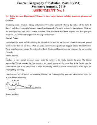
  • 1. Course: Geography of Pakistan, Part-I (9351) Semester: Autumn, 2019 1 ASSIGNMENT No. 1 Q.1 Define the term Physiography? Discuss its three major features including mountains, plateaus and plains. Landforms Weathering, water, elevation, sinking, and erosion of the soil are constantly shaping the surface of the Earth. It doesn’t really happen overnight but takes hundreds and thousands of years for us to notice these changes. These are the natural processes that lead to various formations of the Landforms. Landforms originate from these geological processes. Let’s understand the processes that shape the landforms. External Process External process means effects caused by the external factors such as rain or wind. Erosion occurs when material on the surface like soil and rocks which are called sediments are deposited or dropped off in a different location. These natural processes change the surface of the Earth. Erosion and Deposition are the processes that are occurring externally. Internal Process Needless to say, internal processes occur inside the surface of the Earth, beneath the crust. The internal process, like Volcanic eruption and Plate tectonics, are caused because of the intense heat in the Earth’s core that causes molten rock in the mantle layer to move thus creating uneven movement on the surface. These layers are either uplifting or sinking. Landforms can be categorized into Mountains, Plateaus, and Plains depending upon their elevation and slope. Let us look at them individually. Source: wpclipart
  • 2. Course: Geography of Pakistan, Part-I (9351) Semester: Autumn, 2019 2 Mountain Source: Wikia Any landmass that is higher and steeper than a hill is called a Mountain. A hill is a landform that extends above the surrounding terrain. Generally, mountains are higher than 2000 ft. In any other natural elevation like atmosphere, as you go higher and higher, the temperature drops down and the climate becomes colder. Habitation becomes harsher. That’s why there is less habitation in the mountainous areas. Due to the temperature drop, it is not uncommon for mountains to develop ice on them. In some mountains, there are permanently frozen rivers of ice called as glaciers. Because of the steep slopes of the mountains, there is less land available for proper farming. If the surface is calculated considering the sea base as the scale, there are mountains even under the sea. Mauna Kea (Hawaii) in the Pacific Ocean is an example. It is elevated higher than Mt. Everest. Also, a line of mountains is known as a range. For example, the Himalayas in Asia, the Alps in Europe and the Andes in South America. These ranges are the storehouses of water. Many rivers have their origins in these mountains, the glaciers of the mountains are the source of these rivers. Mountains are generally untouched by civilisations are thus have the endangered species of plants and animals. They also inhibit a rich variety of flora and fauna. Mountains are further divided into three categories: 1. Fold Mountains Source: Quora Fold mountains are created when two tectonic plates collide and the edges of these plates ‘fold’ because of the enormous push force between them. Scientists classify the fold mountains into ‘young fold mountains’ are the ‘old fold mountains’ according to the mountains age.
  • 3. Course: Geography of Pakistan, Part-I (9351) Semester: Autumn, 2019 3  The young fold mountains are between 10 and 25 million years old such as the Himalayas in Nepal, the Alps in Europe and the Andes in South America.  Now, the old fold mountains are older than 200 million years old such as the Aravalli mountains in India (Rajasthan) Ural mountain in Russia. 2. Block Mountains Source: Quora Block mountains occur when large areas are broken and displaced vertically. These large areas of rock, sometimes stretching across hundreds of kilometres are created by tectonic and localized stresses in the Earth’s crust. The uplifted blocks are termed as horsts. The lowered blocks are called grabens. They resemble piano keys. The examples of block mountains are the Rhine valley and the Vosges mountain in Europe. 3. Volcanic Mountains Source: HubPages Volcanic mountains are formed by magma rising up from the mantle to the crust of the earth. The example of volcanic mountains is Kilimanjaro and Mount Fuji.
  • 4. Course: Geography of Pakistan, Part-I (9351) Semester: Autumn, 2019 4 Plateaus Plateaus are elevated flatlands. It is a flat land which is standing above the surrounding area. Plateaus may have one or more sides with steep slopes. Depending upon the plateau their height varies from a few hundred meters to several thousand meters. The most familiar plateau in India is the Deccan Plateau and these plateaus are mainly formed by lava, meaning they are volcanic in origin. The extension of Deccan Plateau is the Chhotanagpur plateau in India. It’s a reserve for minerals such as iron ore, manganese and coal. African plateau is most famous for gold and diamond mining. The Tibetan plateau is the highest plateau in the world. Plateau regions give birth to the waterfall, for example, Hundru falls in the Chhotanagpur plateau and the Jog falls in Karnataka. These plateaus are also centres for tourism and scenic activities. Plains Source: NYTimes Plains are the most fertile regions. They are stretches of large land. The predominant activity is the primary sector in plains which is A surrounding. These stretches of land are the most suitable for human habitation and agriculture activities like farming and poultry.
  • 5. Course: Geography of Pakistan, Part-I (9351) Semester: Autumn, 2019 5 Plains are formed by rivers and their tributaries. The rivers flow down the mountains and erode them. They deposit sediments along their courses and in valleys. It is from these deposits that plains are formed. In India, the Indo- Gangetic plains are the most densely populated regions of the country. Where there is water, there is life. Q.2 Write notes on the following: i. Vegetations and its variety Scientists divide the Earth’s land into what are called vegetation regions. These areas have distinct types of plants, soil, and weather patterns. Vegetation regions can be divided into five major types: forest, grassland, tundra, desert, and ice sheet. Climate, soil, the ability of soil to hold water, and the slope, or angle, of the land all determine what types of plants will grow in a particular region. Forest Forests are areas with trees grouped in a way so their leaves, or foliage, shade the ground. Forests can be found just about anywhere trees can grow, from below sea level to high in the mountains. From tropical rain forests near the Equator to boreal forests in cold climates close to the Arctic Circle, different types of forests can be found all over the world. One way to classify different types of forests is by the type of trees a forest has. Deciduous forests have trees with green leaves that change color in the fall and drop altogether in the winter. Trees that are common in deciduous forests are oak and maple. The northeastern United States is covered in deciduous forest, and tourists flock to the area every autumn to experience the orange, yellow, and red leaves blanketing the region. Evergreen forests have trees with leaves that stay green all year long. One of the places evergreen forests can be found is on the opposite side of the North American continent—in the Pacific Northwest, which includes the Canadian province of British Columbia and the U.S. states of Washington and Oregon. The Pacific Northwest is full of evergreen trees like fir. Sometimes forests are classified by the type of leaves on their trees. Trees in broad-leaved forests have wide, flat leaves. Tropical rain forests are a type of broad-leaved forest. Tropical rain forests, such as Brazil’s Amazon Basin rain forest, are found near the Equator. They contain more than half of the world’s biodiversity, or variety of plant and animal species. Coniferous forests have trees with cones and needles instead of leaves. Coniferous forests have the tallest (coast redwood), largest (giant sequoia), and oldest (bristlecone pine) trees in the world.
  • 6. Course: Geography of Pakistan, Part-I (9351) Semester: Autumn, 2019 6 Many forests are mixed, meaning they have both broadleaf and coniferous trees. The eucalyptus forests of Australia are mixed forests, for instance. The evergreen eucalyptus trees are mixed with deciduous trees like beech. Grassland Grasslands are, as their name suggests, flat and open areas where grasses are the dominant type of vegetation. Grasslands can be found on every continent except Antarctica. Climate plays a role in the type of grassland you get. In cool, mild climates, like northwest Europe, grasslands are dominated by tough vegetation, such as oats, that thrives all year. Some of these grasses are so tough and hardy that they are considered weeds. In warmer climates, seasonal vegetation survives better. Temperate grasslands exist where there are seasonal variations in temperature over the course of the year: hot summers and cold winters. Different grasses thrive in different temperatures here. Temperate grasslands exist from the prairies of North America to the veld, or rural grassland, of South Africa. Tropical grasslands are called savannas. They do well in weather that is warm year-round and usually pretty dry. The most famous savannas are in Africa. Serengeti National Park, in Tanzania, has three distinct types of savanna grassland: long grass, intermediate grass, and short grass. This part of the Serengeti is known as the Serengeti Plains, and it supports wildlife from aardvarks to zebras. Grasslands are important for milk and dairy production; dairy cows are happiest, and most productive, in areas in which they can munch on grass all day. Tundra Tundra is an area where tree growth is difficult because of cold temperatures and short seasons. Vegetation in tundra is limited to a few shrubs, grasses, and mosses. Scientists estimate roughly 1,700 different species live in the tundra, which isn’t much compared to forests and grasslands. The ground is often too cold for plants to set down roots, and without plants, few animal species can survive. There are two types of tundra: alpine tundra and arctic tundra. Alpine tundra is separated from a forest vegetation region by the tree line, the area beyond which conditions are too harsh or cold for tree growth. The weather in alpine tundras is cold, snowy, and windy. Most of the Tibetan Plateau, the so-called “roof of the
  • 7. Course: Geography of Pakistan, Part-I (9351) Semester: Autumn, 2019 7 world” located in Tibet, China, and India, is alpine tundra. Animals like mountain goats live in this vegetation region. Arctic tundra occurs in the far-northern hemisphere of the Earth. It has a bare landscape and is frozen for much of the year. Here, the tundra can include permafrost, or soil that is permanently frozen. Russia and Canada have huge areas of arctic tundra. During the summer, the permafrost thaws just a bit, allowing some plants to grow in the wet, marshy ground. You won’t find many mammals in the arctic tundra, but thousands of insects and birds show up every year and enjoy the marshes before they freeze. Among the few mammals that actually thrive in the arctic tundra are caribou and polar bears. Desert Deserts have almost no precipitation, or rainfall. In fact, deserts are specifically defined as areas with an average annual precipitation of less than 10 inches per year. Deserts usually have really high daytime temperatures, low nighttime temperatures, and very low humidity. Desert soil is often sandy, rocky, or gravely. Plant life is highly specialized to adapt to these coarse, dry conditions, with long roots, small leaves, stems that store water, and prickly spines that discourage animals from touching or eating them. Cactuses, which are native to deserts in North and South America, are an example of this kind of plant. Despite the barren look of hot deserts, they are full of animal life. Most desert animals, such as lizards or snakes, are nocturnal, meaning they are active at night. Nocturnal animals take advantage of the cooler nighttime temperatures of the hot desert. Not all deserts are hot and sandy, however. The largest desert in the world is the Antarctic Desert, which takes up most of the continent of Antarctica. In the Antarctic Desert, ice sheets cover barren rock. Few animals can live in the Antarctic Desert. Those that do are often microscopic, such as lice. Ice Sheet The interesting thing about the ice sheet “vegetation region” is that there really isn’t any vegetation there at all! An ice sheet is a large stretch of glacier ice that covers the land all around it for more than 50,000 square kilometers (20,000 square miles). Currently, the only ice sheets are in Antarctica and Greenland. Don’t confuse the ice sheets, called polar ice caps, with other ice shelves or glaciers; an ice sheet is much, much bigger. Ice sheets are important research sites for scientists. The Antarctic ice sheet is a record of Earth’s atmospheric changes. By looking at layers in the ice, scientists can keep track of different levels of pollution or volcanic
  • 8. Course: Geography of Pakistan, Part-I (9351) Semester: Autumn, 2019 8 gases in the atmosphere. The 1883 eruption of the Indonesian island volcano of Krakatoa can be located and dated by the distinct air bubbles in the Antarctic ice sheet, for instance. Scientists are also studying ice sheets to measure the rate of melting ice. Parts of the Greenland ice sheet were once thought to be permanent, but they are now melting at a fast pace. ii. Advantages of forests 1. They help us breathe. 2. Forests help in climate control. 3. They help the ground absorb during flood, reducing soil loss and property damage by slowing the flow. 4. Forests are of economic importance to us. For example, plantation forests provide humans with timber and wood, which is exported and used in all parts of the world. 5. Forests serve as a home (habitat) to millions of animals. 5. Forests help in regulation of ecosystems. 6. Forests reduce noise pollution. 7. Forests provide a wealth of natural medicines. 8. Forests helps in cooling the Earth's temperature. 9. The natural beauty and peace of the forest offer a special source of enjoyment. 10. Forests serve as employment to village people. Q.3 Discuss the major features of Pakistan’s hydrology. Also elaborate the importance of rivers, lakes and canals. Hydrology is the scientific study of the movement, distribution and management of water on Earth and other planets, including the water cycle, water resources and environmental watershed sustainability. A practitioner of hydrology is called a hydrologist. Hydrologists are scientists studying earth or environmental science, civil or environmental engineering and physical geography. Using various analytical methods and scientific techniques, they collect and analyze data to help solve water related problems such as environmental preservation, natural disasters, and water management. Hydrology subdivides into surface water hydrology, groundwater hydrology (hydrogeology), and marine hydrology. Domains of hydrology include hydrometeorology, surface hydrology, hydrogeology, drainage- basin management and water quality, where water plays the central role. Oceanography and meteorology are not included because water is only one of many important aspects within those fields. Hydrological research can inform environmental engineering, policy and planning.  Chemical hydrology is the study of the chemical characteristics of water.  Ecohydrology is the study of interactions between organisms and the hydrologic cycle.  Hydrogeology is the study of the presence and movement of groundwater.
  • 9. Course: Geography of Pakistan, Part-I (9351) Semester: Autumn, 2019 9  Hydrogeochemistry is the study of how terrestrial water dissolves minerals weathering and this effect on water chemistry.  Hydroinformatics is the adaptation of information technology to hydrology and water resources applications.  Hydrometeorology is the study of the transfer of water and energy between land and water body surfaces and the lower atmosphere.  Isotope hydrology is the study of the isotopic signatures of water.  Surface hydrology is the study of hydrologic processes that operate at or near Earth's surface.  Drainage basin management covers water storage, in the form of reservoirs, and floods protection.  Water quality includes the chemistry of water in rivers and lakes, both of pollutants and natural solutes. Application:  Calculation of rainfall.  Calculating surface runoff and precipitation.  Determining the water balance of a region.  Determining the agricultural water balance.  Designing riparian restoration projects.  Mitigating and predicting flood, landslide and drought risk.  Real-time flood forecasting and flood warning.  Designing irrigation schemes and managing agricultural productivity.  Part of the hazard module in catastrophe modeling.  Providing drinking water.  Designing dams for water supply or hydroelectric power generation.  Designing bridges.  Designing sewers and urban drainage system.  Analyzing the impacts of antecedent moisture on sanitary sewer systems.  Predicting geomorphologic changes, such as erosion or sedimentation.  Assessing the impacts of natural and anthropogenic environmental change on water resources.  Assessing contaminant transport risk and establishing environmental policy guidelines.  Estimating the water resource potential of river basins. Hydrology has been a subject of investigation and engineering for millennia. For example, about 4000 BC the Nile was dammed to improve agricultural productivity of previously barren lands. Mesopotamian towns were protected from flooding with high earthen walls. Aqueducts were built by the Greeks and Ancient Romans, while the history of China shows they built irrigation and flood control works. The ancient Sinhalese used
  • 10. Course: Geography of Pakistan, Part-I (9351) Semester: Autumn, 2019 10 hydrology to build complex irrigation works in Sri Lanka, also known for invention of the Valve Pit which allowed construction of large reservoirs, anicuts and canals which still function. Marcus Vitruvius, in the first century BC, described a philosophical theory of the hydrologic cycle, in which precipitation falling in the mountains infiltrated the Earth's surface and led to streams and springs in the lowlands.[citation needed] With the adoption of a more scientific approach, Leonardo da Vinci and Bernard Palissy independently reached an accurate representation of the hydrologic cycle. It was not until the 17th century that hydrologic variables began to be quantified. Pioneers of the modern science of hydrology include Pierre Perrault, Edme Mariotte and Edmund Halley. By measuring rainfall, runoff, and drainage area, Perrault showed that rainfall was sufficient to account for the flow of the Seine. Mariotte combined velocity and river cross-section measurements to obtain a discharge, again in the Seine. Halley showed that the evaporation from the Mediterranean Sea was sufficient to account for the outflow of rivers flowing into the sea.[2] Advances in the 18th century included the Bernoulli piezometer and Bernoulli's equation, by Daniel Bernoulli, and the Pitot tube, by Henri Pitot. The 19th century saw development in groundwater hydrology, including Darcy's law, the Dupuit-Thiem well formula, and Hagen-Poiseuille's capillary flow equation. Rational analyses began to replace empiricism in the 20th century, while governmental agencies began their own hydrological research programs. Of particular importance were Leroy Sherman's unit hydrograph, the infiltration theory of Robert E. Horton, and C.V. Theis' aquifer test/equation describing well hydraulics. Since the 1950s, hydrology has been approached with a more theoretical basis than in the past, facilitated by advances in the physical understanding of hydrological processes and by the advent of computers and especially geographic information systems (GIS). (See also GIS and hydrology) Q.4 Define the agricultural industry? Give your arguments that how stock, poultry and fishing had become the industries in Pakistan? Agriculture is a vital sector of Pakistan's economy and accounted for 25.9 percent of GDP in 1999-2000, according to government estimates. The sector directly supports three-quarters of the country's population, employs half the labor force , and contributes a large share of foreign exchange earnings. The main agricultural products are cotton, wheat, rice, sugarcane, fruits, and vegetables, in addition to milk, beef, mutton, and eggs. Pakistan depends on one of the world's largest irrigation systems to support production. There are 2 principal seasons. Cotton, rice, and sugarcane are produced during the kharif season, which lasts from May to November. Wheat is the major rabi crop, which extends from November to April. The key to a much-needed improvement of productivity lies in a more efficient use of resources, principally land and water. However, change is dependent on the large landowners who own 40 percent of the arable land and control most of the irrigation system, which makes widespread reform difficult. Assessments by independent agencies, including the World Bank, show these large landholdings to be very unproductive. Pakistan is a net importer of agricultural
  • 11. Course: Geography of Pakistan, Part-I (9351) Semester: Autumn, 2019 11 commodities. Annual imports total about US$2 billion and include wheat, edible oils, pulses, and consumer foods. Pakistan is one of the world's largest producers of raw cotton. The size of the annual cotton crop—the bulk of it grown in Punjab province—is a crucial barometer of the health of the overall economy, as it determines the availability and cost of the main raw material for the yarn-spinning industry, much of which is concentrated around the southern port city of Karachi. Official estimates put the 1999-2000 harvest at some 11.2 million 170- kilogram bales, compared with the 1998-99 outturn of 8.8 million bales and the record 12.8 million bales achieved in 1991-92. The government recently actively intervened in the market to boost prices and to encourage production. A major problem is that the cotton crop is highly susceptible to adverse weather and pest damage, which is reflected in crop figures. After peaking at 2.18 million tons in 1991-92, the lint harvest has since fluctuated considerably, ranging from a low of 1.37 million tons in 1993-94 to a high of 1.9 million tons in 1999-2000. The 2000-01 wheat crop was forecast at a record 19.3 million tons, compared to 17.8 million tons produced during the previous year. This increase is due largely to favorable weather and a 25-percent increase in the procurement price to about US$135 per ton. About 85 percent of the crop is irrigated. Despite the record production, Pakistan will continue to be a major wheat importer. The government has imported an average of US$2.4 million annually over the past 5 years. The United States and Australia are the major suppliers. Demand for wheat is increasing from Pakistan's rapidly growing population as well as from cross-border trade with Afghanistan. Pakistan is a major rice exporter and annually exports about 2 million tons, or about 10 percent of world trade. About 25 percent of exports is Pakistan's famous fragrant Basmati rice. Rice is Pakistan's second leading source of export earnings. Private traders handle all exports. Pakistan's main competitors in rice trade are Thailand, Vietnam, and India. Tobacco is grown mainly in the North-West Frontier Province and Punjab and is an important cash crop . Yields in Pakistan are about twice those for neighboring countries largely due to the extension services provided by the industry. Quality, however, is improving only slowly due to problems related to climate and soil. Farmers have started inter-cropping tobacco with vegetables and sugarcane to increase returns. About half of the total production is used for cigarette manufacturing and the remainder used in traditional ways of smoking (in hand-rolled cigarettes called birris, in water pipes, and as snuff). The share of imported tobacco is increasing gradually in response to an increased demand for high-quality cigarettes. Minor crops account for only 5 percent of total cultivated area; these include oilseeds (sunflower, soybean), chilies, potatoes, and onions. Domestic oilseed production accounts only for about 25 percent of Pakistan total edible oil needs. As a result, Pakistan spends more than US$1 billion annually in scarce foreign exchange to import edible oils, while its oilseed processing industry operates at less than 25 percent of capacity due to an
  • 12. Course: Geography of Pakistan, Part-I (9351) Semester: Autumn, 2019 12 inadequate supply of oilseeds. For 2000-01 total oilseed production was forecast to decrease 10 percent to 3.6 million tons. The government has highlighted development of the oilseed sector as a priority. Pakistan's fishing industry is relatively modest, but has shown strong growth in recent years. The domestic market is quite small, with per capita annual consumption of approximately 2 kilograms. About 80 percent of production comes from marine fisheries from 2 main areas, the Sindh coast east from Karachi to the Indian border, and the Makran coast of Baluchistan. Ninety percent of the total marine catch is fish; the shrimp which constitute the remainder are prized because of their greater relative value and demand in foreign markets. During 1999-00, total fish production was 620,000 tons, of which 440,000 tons consisted of sea fish and the remainder were fresh-water species. About one-third of the catch is consumed fresh, 9 percent is frozen, 8 percent canned, and about 43 percent used as fish meal for animal food. Livestock accounts for 40 percent of the agricultural sector and 9 percent of the total GDP. Principal products are milk, beef, mutton, poultry, and wool. During 1999, the livestock population increased to 120 million head. That same year Pakistan generated 970,000 tons of beef, 640,000 tons of mutton, and 190,000 tons of poultry. In an effort to enhance milk and meat production, the government recently launched a comprehensive livestock development project with Asian Development Bank assistance. Poultry production provides an increasingly popular low-cost source of protein. Modern poultry production is constrained by high mortality, high incidence of disease, poor quality chicks, and poor quality feed, combined with an inadequate marketing system. Frozen poultry have only recently been introduced. Forests cover an area of 4.2 million hectares or about 5 percent of the total area of Pakistan. The principal forest products are timber, principally for house construction, furniture, and firewood. Many of the country's wooded areas are severely depleted as a result of over-exploitation. The government has restricted cutting to protect remaining resources—though corruption often jeopardizes environmental efforts—and has lowered duties to encourage imports. Forestry production has since declined from 1.07 million cubic meters in 1990-91 to 475,000 cubic meters in 1998-99. Pakistan imports an estimated US$150 million of wood products annually to meet the requirements of a growing population and rising demand by a wealthy elite. Q.5 Discuss the water-logging and salinity problems in Pakistan. Also discuss the measurements taken by the government to solve these issues. After a lifetime of tending his lands, a desperate Khudayar Khan has now started working as a daily wage labourer to make ends meet. His three-acre farm along the vast Indus river in Ghotki district of Pakistan’s Sindh province has turned barren due to waterlogging and salinity. “Repeated cultivation of rice and sugarcane on my land has resulted in waterlogging and I am left with no option but to start working as a labourer in a factory,” he said. His is not the only tale of ruin in the area, most of which is irrigated by the Indus, one of the longest rivers in Asia and a lifeline for millions of people in Pakistan.
  • 13. Course: Geography of Pakistan, Part-I (9351) Semester: Autumn, 2019 13 Urging the government to initiate a programme to deal with growing waterlogging and salinity, Khan says the twin problems were destroying hundreds of acres of arable land each year. The excessive use of water for crops like rice and sugarcane has raised the groundwater table in Ghotki and some other adjoining districts. Experts and studies back the farmer’s claims. The excessive use of water for crops, non-cemented canals and a poor drainage system are causing waterlogging and salinity in the area. “The entire left bank of the Indus river could turn into lakes of saline water in the next 10 to 15 years if timely action isn’t initiated to curb waterlogging and salinity,” warned Nabi Bukhsh, general secretary of the Sindh Chamber of Agriculture. “Rice and sugarcane are the most water consuming crops and they ultimately raise groundwater table to a dangerous level,” Bukhsh told thethirdpole.net. In his estimate, over 90% of farmers on the left bank of the Indus had been cultivating the two crops for the last three decades. According to Bukhsh, farmers benefit from the crops initially but after some time, the excessive use of water turns fertile land barren and reduces yield. He added that irrigation water seeps through the ground as all canals in the area are non-cemented and this ultimately results in waterlogging. “The stagnant water gradually turns saline and destroys nearby arable lands.” The government has to do its bit to alleviate the problem. The water flow in the Kotri barrage, for instance, is hampered by silt and sludge. The authorities show little interest in dredging the drainage network in Sindh. The government, Bukhsh added, should redesign the drain network to discharge fresh water into the sea. Besides, tubewells should be installed in the area to suck out water from the fertile lands. According to a research paper, Salinity and Water-logging in the Indus Basin of Pakistan: Economic Loss to Agricultural Economy, around 43% of the area in the Indus Basin Irrigation System is classified as waterlogged with the water table at a depth of less than three metres, affecting around 7.1 million hectares of land. A salinity survey conducted in 2001-03 by the Soil and Reclamation Directorate of the Water and Power Development Authority (WAPDA) showed that 27% of the area was salt affected. The government of Sindh has recently banned rice cultivation in command areas of the canals on the left bank of the Indus to control waterlogging and salinity. A grower who violates the ban would be fined Rs.25,000 rupees ($246) per acre or with three years’ imprisonment. But a majority of farmers complain that the government ensures that the ban is imposed only on small growers. The area where the rice cultivation is banned includes districts like Ghotki, Khairpur, Sanghar, Mirpur Khas and Tando Allah Yar. Not just Sindh Pakistan’s agriculture sector contributes a fifth of the country’s GDP and employs almost half of the labour force, according to the Pakistan Economic Survey 2013-14.
  • 14. Course: Geography of Pakistan, Part-I (9351) Semester: Autumn, 2019 14 The issue of waterlogging is turning around 100,000 acres of land barren per annum while sea intrusion across the coastal belt of the country has been exacerbating the salinity problem each passing day, said Sardar Muhammad Tariq, former regional chair, Global Water Partnership South Asia. Tariq told thethirdpole.net that Pakistan lacks a proper law to regulate use of water in the agriculture sector and farmers grow crops like rice and sugarcane in running water. “The government should promote salt-tolerant crops in the salinity-hit areas instead of investing on curbing the problem,” he suggested. Tariq also suggested that the government install vertical tubewells and improve drainage system to address the waterlogging problem and also develop specific seed varieties for the area. Government officials say they are doing their bit to address the problems. The Sindh government had initiated a project in 1967 to address the issue of waterlogging and salinity in the province with the help of World Bank. As many as 3,657 tube wells were installed in different districts, said an official. Zaheer Hyder Shah, secretary, Sindh Irrigation Department, added that the tubewells run eight hours daily and pump out around 7,588 cusecs of water. “Around 2,400 tubewells are operational now while the remaining have developed some faults,” he told thethirdpole.net. The provincial government pays the bills for electricity and repair of all the tubewells. Bukhsh of the Sindh Chamber of Agriculture, however, said only 5% of the tubewells were operational. Shah admitted that waterlogging and salinity were the biggest issues in agriculture and the government was planning to install more tubewells in the problem areas to keep a check on the groundwater table.