2. North Coast Design Competition
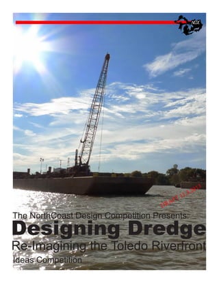
Designing Dredge:
Reconsidering the Toledo Riverfront
F
A
DR
2
11.
T
3
1
.20
2
The Project
The city of Toledo is currently reconsidering a series of highly visible landscapes along its river waterfront. These sites
are either undergoing construction due to the installation of large stormwater mitigation infrastructure or were small
dredge storage facilities that have reached design capacity. In both cases, these landscapes have the potential to be
repositioned as a series of unique and highly valuable sites along the Maumee River, amassing over 170 acres. The
competition calls for ideas that re-envision the role of the riverfront in Toledo and how this new role can embrace the
realities of dredging while enhancing the overall quality of public space within the city.
Background
dredging
In order to maintain navigation channels in the Great Lakes / St. Lawrence system approximately 3 million cubic yards
of material must be removed from the United States federal shipping channels each year. With increasing ship size,
decreasing water levels and serious deficiencies in upland sediment management, this dredging operation is likely to
continue indefinitely.
Almost 1/3 of this dredged material from the Great Lakes Basin comes from the Maumee Bay, near the city of Toledo,
Ohio. Situated on the shallow, western end of Lake Erie, historic Toledo was the product of large dredging and ditching
operations in the 1800s to drain what was then the Black Swamp and allow development to occur. Today this process of
sediment management is still essential in order to keep the valuable and growing Toledo port industry functioning properly.
It is estimated that up to 1 million cubic yards of material must be removed from the federal shipping channel each year
in the Toledo harbor / Maumee Bay. Currently a good deal of this material is deemed safe and acceptable for open-water
placement back into the lake. Smaller percentages are placed in confined disposal facilities or beneficially re-used. The
subject of open-water placement is contentious, with speculations of its contributions to phosphorus loading and algal
blooms in Lake Erie. While the immense volume of material in Toledo may require open-lake disposal to remain part of
the solution, there is strong pressure to find ways of minimizing it.
Stormwater Infrastructure
The City of Toledo is also well underway in addressing the stormwater management concerns it and many other Great
Lakes Cities face. Mandated to reduce Combined Sewer Overflow Events by the EPA, Toledo and many other cities have
begun implementing large stormwater management projects. In Toledo, due to the early EPA mandate, most of these
management projects come in the form of hard or “Grey” infrastructure as opposed to “Green” infrastructure. The process
of installing these projects (large, underground stormwater storage pipes) will require the temporary excavation and partial
demolition of two current park spaces within the city (Edison Park and International Park)
Riverfront Development
The City of Toledo is slowly redirecting itself back to the river. A collection of recent and proposed projects attempt to
leverage the Maumee river as a resource. Some of these include the proposed Marina District development project, the
Maumee Bike Trail, The National Museum of the Great Lakes, the Imagination Station, Renovations to Promenade Park
the Marina District and the Middlegrounds Metropark. Projects of this type are indicative of the importance of the water’s
edge in Toledo. These civic assets share this edge with considerable industrial property managed by the Lucas County
Port Authority. The port of Toledo is ranked 7th in the Great Lakes and handles almost 11 million tons of cargo annually.
It is estimated that the port generates over $500M dollars in personal income and supports 7,000 jobs. Finding ways to
cohabit the riverfront with this essential regional industry is a necessary and ongoing challenge.
3. The Program
F
A
DR
2
11.
T
3
1
.20
2
The design and programming of these new waterfront sites is quite open to the participants, however, the use of dredge
material in some capacity is required. Projects could consider residential or commercial development, parks and
recreational programs, water management, habitat creation, or all of the above. While it is assumed that these sites will
remain “public”, the level and types of accessibility remain at the discretion of the design teams. Projects that explore
new ways of managing or incorporating dredge material are highly encouraged. Regionally proposed and supported
projects such as the Maumee River Bikeway could also be taken into consideration. It is not necessary for project teams
to address all 5 sites, however, be reminded that a core agenda of the competition is the envisioning of a transformed
riverfront.
The only piece of required program for the competition is the placement and design of a dredge research site. This site
will be the location of a series of ongoing research projects that explore the possibilities of dredge material and its uses.
The type of research is open to speculation by the design teams, but dewatering experiments, plant growth studies and
admixing operations would all be likely. The research site is intended to also serve as an education location where
residents, contractors and other interested parties can learn about dredging and dredge material management. The
design of this area should prioritize the relationship between dredge material and the public. By default, the Dredge
Research Site should be located at the Riverside site (see below), but other locations are possible should they align with a
larger design agenda.
The Details
The Sites
Edison Park
24 acres
Former Soil Dump
Situated directly below the new... bridge, and in very close proximity to the city center, Edison Park has a rich collection
of possible futures. While its history as a dump site could provide structural challenges, It is one of the only sites in
consideration that could logically support development in a traditional sense. The proposed stormwater infrastructure
installation at Edison Park will govern where development (if desired) could occur. As a rule, no physical structures should
be placed over this infrastructure.
International Park acres City Park
25
Once home to the James M Schoonmaker Museum Ship, International park now sits relatively vacant. Like Edison Park,
International Park could also conceptually hold traditional development.
Penn 7
60 acres (12 acres currently submerged)
Former CDF
Penn 8 28 acres Former CDF
Riverside 36 acres Former CDF
These three sites were once disposal areas of dredge material. This fact makes their development difficult as the soil
there has very little bearing capacity. All three of these sites could however contain recreation, habitat, research and other
light, less intense uses. Due to its current dredge re-use operation, the Riverside site is the most logical location for the
Dredge Research Site.
The Dredge Material
The dredge material available for the sites will be transported from CDF #3 on the eastern edge of the river mouth
by truck. This material will be considered dewatered and safe when it arrives on site. The amount available will
be considered unlimited. In its raw state, slopes of 1:5 are considered maximum, but explorations in structure and
reinforcement are encouraged. The dredge material pulled from the Maumee is also extremely high in silt, significantly
impeding its drainage characteristics. Projects that consider the particular qualities of the sediment will be favored over
those that simply treat it as ubiquitous soil.
4. 11.
T
F
A
DR
Deliverables
13
20
22.
(2) 24x36 boards in landscape orientation saved as PDF files and submitted via wetransfer (20m max file size)
Schedule
December 15
Feburary 1
Feburary 30
March 15
March 20
March 30
April 15
May 1
June 15
Website Launch
Registration open
Early registration deadline
FAQ deadline
FAQ answers posted
Registration deadline
Submission due
Jury Review
Winners Announced
Awards
First Prize $2000
Finalists (2)
$500 each
Honorable Mention (3)
Registration
$35 Early
$45 Standard
Jury TBD
Questions?
Sean Burkholder
Assistant Professor of Landscape and Urban Design
SUNY | University at Buffalo
School of Architecture and Planning
seanburk@buffalo.edu
6. Downtown Toledo
Penn 8
Riverside
Penn 7
International Park
Edison Park
North Coast Design Competition
Designing Dredge: Toledo, Ohio
Competition Areas Map
CDF #3
7. LEGEND
800,000-1,040,000 CUBIC YARDS
600,000-800,000 CUBIC YARDS
400,000-600,000 CUBIC YARDS
200,000-400,000 CUBIC YARDS
15,000-200,000 CUBIC YARDS
0-MINIMAL DREDGING (UNDER 15,000 CUBIC YARDS)
THE COLOR-CODED AREAS REPRESENT AN ESTIMATE OF THE CUMULATIVE
VOLUME OF SEDIMENT DREDGED FROM THE TOLEDO HARBOR FEDERAL
SHIPPING CHANNEL BETWEEN 2001 AND 2010 AS FOLLOWS:
SOURCE:
75
PENN 8
RIVERSIDE PARK
RIVER CHANNEL
CENTER OF GRAVITY
(STA. 146+00)
280
OVERALL CENTER
OF GRAVITY
(STA. 559+00)
3401 GLENDALE AVENUE
SUITE 300
TOLEDO, OHIO 43614
LAKE CHANNEL
CENTER OF GRAVITY
(STA. 593+00)
3) THE JULY 1989 OVERALL CENTER OF GRAVITY WAS REPORTED IN THE
"EVALUATION OF WOODTICK PENINSULA RESTORATION AND RECREATIONAL
HILL/UPLAND DISPOSAL ALTERNATIVES USING TOLEDO HARBOR DREDGE SPOIL
MATERIAL", PREPARED BY HULL & ASSOCIATES, INC., DATED JULY 1989,
USING DATA BETWEEN 1984 AND 1988.
2) CENTER OF GRAVITY REPRESENTS THE EQUIVALENT DISTANCE IF ALL
MATERIAL WERE TO BE REPLACED BY A POINT MASS ACTING AT ONE
LOCATION. IT ESSENTIALLY REPRESENTS THE CENTER OF WHERE DREDGING
HAS OCCURRED BETWEEN 2001 AND 2010 BY VOLUME OF SEDIMENT.
1) AERIAL PHOTO OBTAINED FROM ESRI IMAGERY DATED 10-15-09.
NOTES:
PENN 7
DATA PROVIDED BY THE US ARMY CORPS OF ENGINEERS BASED ON
ESTIMATED VOLUME OF DREDGED SEDIMENT BETWEEN 2001 AND 2010
USED TO QUANTIFY THE CONTRACTOR'S WORK EFFORT.
75
PHONE: (419) 385-2018
FAX: (419) 385-5487
www.hullinc.com
POTENTIAL AGRICULTURAL FIELD IMPROVEMENT PILOT PROJECT
TPA044
PLOT DATE:
11/9/12
SUBMITTAL DATE: NOVEMBER 2012
MAUMEE RIVER/LAKE ERIE, OHIO
FIGURE 1
FEDERAL CHANNEL CENTER OF GRAVITY
PROJECT NO.:
CAD DWG FILE: TPA044.100.0011