
Recommandé
Recommandé
Contenu connexe
Tendances
Tendances (20)
Similaire à Hawaii conservation Awareness 2006 Presentation
Similaire à Hawaii conservation Awareness 2006 Presentation (20)
Dernier
Dernier (20)
Hawaii conservation Awareness 2006 Presentation
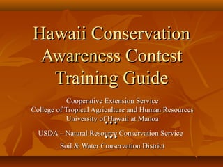
- 1. Hawaii ConservationHawaii Conservation Awareness ContestAwareness Contest Training GuideTraining Guide Cooperative Extension ServiceCooperative Extension Service College of Tropical Agriculture and Human ResourcesCollege of Tropical Agriculture and Human Resources University of Hawaii at ManoaUniversity of Hawaii at Manoa...... USDA – Natural Resource Conservation ServiceUSDA – Natural Resource Conservation Service...... Soil & Water Conservation DistrictSoil & Water Conservation District
- 2. IntroductionIntroduction Participants involved in the program have theParticipants involved in the program have the opportunity to learn about the land and valueopportunity to learn about the land and value its usefulness.its usefulness. As we learn how to judge the land, we begin toAs we learn how to judge the land, we begin to understand what controls the use of land, whyunderstand what controls the use of land, why some types of land can be used for growingsome types of land can be used for growing food crops, while other soils are better used forfood crops, while other soils are better used for forest or pasture.forest or pasture.
- 3. Conservation Awareness GuideConservation Awareness Guide Divided into 5 partsDivided into 5 parts Physical Features of the SoilPhysical Features of the Soil Major Factors Affecting Land UseMajor Factors Affecting Land Use Land Capability ClassificationLand Capability Classification Recommended Conservation PracticesRecommended Conservation Practices Judging Land for a HomesiteJudging Land for a Homesite
- 4. Physical Features of the SoilPhysical Features of the Soil Hawaiian soils – formed from lava rocks,Hawaiian soils – formed from lava rocks, volcanic ash and cinders, coral sand andvolcanic ash and cinders, coral sand and organic matter.organic matter. Soil is formed from these materials bySoil is formed from these materials by weathering and decomposition.weathering and decomposition. Soil Profile – developed from weatheringSoil Profile – developed from weathering process.process.
- 5. Soil ProfileSoil Profile Cross-section of the soil.Cross-section of the soil. Consist of layers (horizons) that are different in color,Consist of layers (horizons) that are different in color, physical properties, chemical composition, andphysical properties, chemical composition, and biological characteristics.biological characteristics. Consists of three major layers.Consists of three major layers. Topsoil or “A” horizon.Topsoil or “A” horizon. Contains most of organic matter (OM), soil microorganismsContains most of organic matter (OM), soil microorganisms and chemical activity.and chemical activity. Subsoil or “ B” horizonSubsoil or “ B” horizon Has less OM, water movement slower, may have accumulationHas less OM, water movement slower, may have accumulation of nutrients.of nutrients. Parent Material or “C” horizonParent Material or “C” horizon Least weatheredLeast weathered Contains fragments of weathered rocks.Contains fragments of weathered rocks.
- 6. Soil ProfileSoil Profile topsoil subsoil parent material
- 7. Part 1. Physical Features of the SoilPart 1. Physical Features of the Soil 1.1. Surface TextureSurface Texture 2.2. Subsoil TextureSubsoil Texture 3.3. PermeabilityPermeability 4.4. Soil DepthSoil Depth 5.5. SlopeSlope 6.6. ErosionErosion
- 8. Surface and Subsoil TextureSurface and Subsoil Texture TextureTexture Proportion of sand-silt-clay in soil.Proportion of sand-silt-clay in soil. Important property of soil.Important property of soil. It affects:It affects: Water-holding capacityWater-holding capacity Movement of air and water through soilMovement of air and water through soil Nutrient holding capacityNutrient holding capacity Ease of cultivationEase of cultivation Erodibility of soilErodibility of soil
- 10. Part 1. Physical FeaturesPart 1. Physical Features 1.1. Surface TextureSurface Texture A. SandyA. Sandy B. LoamyB. Loamy C. ClayeyC. Clayey D. Very ClayeyD. Very Clayey
- 11. Part 1. Physical Features (cont.)Part 1. Physical Features (cont.) 2. Subsoil Texture2. Subsoil Texture A. SandyA. Sandy B. LoamyB. Loamy C. ClayeyC. Clayey D. Very ClayeyD. Very Clayey
- 12. Feeling soil to determine soil texture
- 13. Determine soil texture during contest
- 14. PermeabilityPermeability Refers to the ability of the soil to transmit airRefers to the ability of the soil to transmit air and water.and water. Expressed in inches/hour.Expressed in inches/hour. Soil properties affecting permeability areSoil properties affecting permeability are texture and structure.texture and structure.
- 15. Part 1. Physical Features (cont.)Part 1. Physical Features (cont.) 3. Permeability3. Permeability A. Slow: < 0.2 inches/hourA. Slow: < 0.2 inches/hour B. Moderate: 0.2-6.0 inches/hourB. Moderate: 0.2-6.0 inches/hour C. Rapid: > 6.0 inches/hourC. Rapid: > 6.0 inches/hour
- 16. Soil DepthSoil Depth It is the thickness of the surface layer and theIt is the thickness of the surface layer and the subsoil plus any parent material that is easilysubsoil plus any parent material that is easily penetrated by roots.penetrated by roots.
- 17. Part 1. Physical Features (cont.)Part 1. Physical Features (cont.) 4. Soil Depth4. Soil Depth A. Deep: 40 inches or moreA. Deep: 40 inches or more B. Moderately Deep: 20-39 inchesB. Moderately Deep: 20-39 inches C. Shallow: 10-19 inchesC. Shallow: 10-19 inches D. Very Shallow: 0-9 inchesD. Very Shallow: 0-9 inches
- 18. Soil depth
- 19. Participants measuring soil depth during contest
- 20. SlopeSlope Slope is the “lay of the land” and is theSlope is the “lay of the land” and is the steepness of the land.steepness of the land. Measured in percent.Measured in percent.
- 21. Part 1. Physical Features (cont.)Part 1. Physical Features (cont.) 5. Slope5. Slope A. Nearly Level: 0-2%A. Nearly Level: 0-2% B. Gently Sloping: 3-7%B. Gently Sloping: 3-7% C. Strongly Sloping: 8-14%C. Strongly Sloping: 8-14% D. Moderately Steep: 15-24%D. Moderately Steep: 15-24% E. Steep: 25-39%E. Steep: 25-39% F. Very Steep/Extremely Steep: 40% or moreF. Very Steep/Extremely Steep: 40% or more
- 22. Slope on cabbage field
- 23. Participant measuring slope during the contest
- 24. ErosionErosion It is the loss of soil caused by water or wind.It is the loss of soil caused by water or wind.
- 25. Part 1. Physical Features (cont.)Part 1. Physical Features (cont.) 6. Erosion6. Erosion A. None-SlightA. None-Slight B. ModerateB. Moderate C. SevereC. Severe D. Very SevereD. Very Severe
- 26. None to slight soil erosion
- 28. Severe erosion
- 30. very severe soil erosion
- 31. Example to CalculateExample to Calculate Percent Loss:Percent Loss: Thickness of the original topsoil is 10 inches,Thickness of the original topsoil is 10 inches, (Given on condition sheet).(Given on condition sheet). Thickness of present topsoil is 7 inches,Thickness of present topsoil is 7 inches, (measured by contestant).(measured by contestant). [([(10-710-7)] x 100 = 30 % soil loss or)] x 100 = 30 % soil loss or 1010 moderate erosionmoderate erosion
- 32. Participant calculating soil erosion
- 33. TABLE 6. EROSIONTABLE 6. EROSION ErosionErosion None to slight erosionNone to slight erosion ModerateModerate SevereSevere Very severeVery severe % of Original% of Original Topsoil RemovedTopsoil Removed <25% 25-75% 75% or more ~100%
- 34. Part 2. Major FactorsPart 2. Major Factors 1. Surface Texture1. Surface Texture 2. Permeability2. Permeability 3. Soil Depth3. Soil Depth 4. Slope4. Slope 5. Erosion5. Erosion 6. Wetness6. Wetness 7. Rainfall7. Rainfall 8. Elevation and Climate8. Elevation and Climate 9. Wind9. Wind 10. Flooding10. Flooding 11. Stoniness/Rock Outcrop11. Stoniness/Rock Outcrop 12. Salinity12. Salinity 13. None13. None
- 35. Part 2. Major Factors (cont.)Part 2. Major Factors (cont.) 1. Surface Texture1. Surface Texture • If texture of the topsoil is very clayey orIf texture of the topsoil is very clayey or sandy, it is a problem.sandy, it is a problem. • Very clayey soils are difficult to cultivateVery clayey soils are difficult to cultivate • very sticky when wet andvery sticky when wet and • very hard when dry.very hard when dry. • Sandy soils are loose and poor water holdingSandy soils are loose and poor water holding capacity.capacity.
- 36. Part 2. Major Factors (cont.)Part 2. Major Factors (cont.) 2. Permeability2. Permeability • Is a problem if it is rapid or slow.Is a problem if it is rapid or slow. • Affects application rates for irrigation.Affects application rates for irrigation. • Slow permeable soilsSlow permeable soils • prone to more runoffprone to more runoff • ponding may occur in low areasponding may occur in low areas • Rapidly permeable soilsRapidly permeable soils • take in water so fast that furrow irrigation cannot be used.take in water so fast that furrow irrigation cannot be used. • High potential of fertilizer and pesticides leaching.High potential of fertilizer and pesticides leaching. Note: for contest, permeability is based on the leastNote: for contest, permeability is based on the least permeable layer, of either topsoil or subsoil.permeable layer, of either topsoil or subsoil.
- 38. Part 2. Major Factors (cont.)Part 2. Major Factors (cont.) 3. Soil Depth3. Soil Depth • An adequate soil depth is needed for effectiveAn adequate soil depth is needed for effective rooting.rooting. • Soil depth is a major factor if it is less than 20Soil depth is a major factor if it is less than 20 inches.inches.
- 39. Part 2. Major Factors (cont.)Part 2. Major Factors (cont.) 4. Slope4. Slope • Slope is a major factor when it is 8 percent orSlope is a major factor when it is 8 percent or more.more.
- 40. Part 2. Major Factors (cont.)Part 2. Major Factors (cont.) 5. Erosion5. Erosion Severely eroded and very severely erodedSeverely eroded and very severely eroded soils present major problems for growingsoils present major problems for growing plants.plants. • These soils have lost most of the topsoil and aThese soils have lost most of the topsoil and a large part of the subsoil.large part of the subsoil. • With the topsoil gone, these soils are low inWith the topsoil gone, these soils are low in fertility.fertility. • These soils are susceptible to more erosion ifThese soils are susceptible to more erosion if cultivated.cultivated.
- 41. Part 2. Major Factors (cont.)Part 2. Major Factors (cont.) 6. Wetness6. Wetness • Wetness or poor drainage indicates the presenceWetness or poor drainage indicates the presence of excess water in the soil.of excess water in the soil. • It is a problem if the soil has a water tableIt is a problem if the soil has a water table within 4 feet of the surface.within 4 feet of the surface. ((water table = the level of groundwater in the soil belowwater table = the level of groundwater in the soil below which the soil is wholly saturated with water.)which the soil is wholly saturated with water.) • Wetness is also a problem if there is no waterWetness is also a problem if there is no water table but the soil remains wet for long periods.table but the soil remains wet for long periods.
- 42. Kealia pond - wetness
- 43. Maalaea mudflats - wetness
- 44. Part 2. Major Factors (cont.)Part 2. Major Factors (cont.) 7. Rainfall7. Rainfall • Rainfall is a problem if there is too little, tooRainfall is a problem if there is too little, too much, or if it is poorly distributed throughout themuch, or if it is poorly distributed throughout the year.year. • It is a problem if annual rainfall is < 50 inches, >It is a problem if annual rainfall is < 50 inches, > 175 inches, or if there is < 2 inches per month for175 inches, or if there is < 2 inches per month for 2 or more consecutive months.2 or more consecutive months. • Low rainfall and poor distribution can beLow rainfall and poor distribution can be overcome with irrigation.overcome with irrigation. • Therefore, if there is low or poor distribution of rainfall, butTherefore, if there is low or poor distribution of rainfall, but irrigation water is available, do not mark rainfall as a problem.irrigation water is available, do not mark rainfall as a problem.
- 45. Part 2. Major Factors (cont.)Part 2. Major Factors (cont.) 8. Elevation and Climate8. Elevation and Climate • If elevation is 3,000 feet or more.If elevation is 3,000 feet or more. • If there is cloud cover more than 30% of theIf there is cloud cover more than 30% of the time.time. • If average temperature is less than 50If average temperature is less than 50ºF.ºF.
- 46. cloud cover 30% or more of the time
- 47. Part 2. Major Factors (cont.)Part 2. Major Factors (cont.) 9. Wind9. Wind • It is a problem if average velocities areIt is a problem if average velocities are greater than 20 miles per hour or if gusts aregreater than 20 miles per hour or if gusts are > 40 mph.> 40 mph. • Wind does not affect land capabilityWind does not affect land capability because it can be controlled withbecause it can be controlled with windbreaks.windbreaks.
- 48. Wind damage on a banana plantation in Haiku
- 49. Part 2. Major Factors (cont.)Part 2. Major Factors (cont.) 10. Flooding10. Flooding • Flooding is a major problem if it occurs moreFlooding is a major problem if it occurs more often than once in two years.often than once in two years.
- 50. May 1987 Storm –Wailuku Sugar
- 51. Flooding – Hana Highway
- 52. Flooding -
- 53. Part 2. Major Factors (cont.)Part 2. Major Factors (cont.) 11. Stoniness or Rock Outcrop11. Stoniness or Rock Outcrop • This is a problem if 25% or more of theThis is a problem if 25% or more of the surface area is covered with stones or rocksurface area is covered with stones or rock outcrop.outcrop. • (Stones here refer to rock fragments of all sizes,(Stones here refer to rock fragments of all sizes, although technically, stones are rock fragments 10-although technically, stones are rock fragments 10- 24 inches in diameter. Rock outcrop is exposed24 inches in diameter. Rock outcrop is exposed solid bedrock.)solid bedrock.) • Use of machinery for cultivation will be veryUse of machinery for cultivation will be very difficult or impractical.difficult or impractical.
- 55. Stoniness – Haleakala ranch
- 56. Part 2. Major Factors (cont.)Part 2. Major Factors (cont.) 12. Salinity12. Salinity • Salinity refers to the salt content of the soil.Salinity refers to the salt content of the soil. • Salinity is a problem if the soil has moreSalinity is a problem if the soil has more than 0.2% salt.than 0.2% salt.
- 57. Maalaea mudflats – soil with salinity problems
- 58. Part 2. Major Factors (cont.)Part 2. Major Factors (cont.) 13. None13. None • Mark “none” on the score card if none of theMark “none” on the score card if none of the factors above is a major problemfactors above is a major problem..
- 59. Part 3. Land Capability ClassPart 3. Land Capability Class Eight land capability classes.Eight land capability classes. Class I. Best soilsClass I. Best soils Class VIII. Poorest soils.Class VIII. Poorest soils. Soils in Class I to IV – suitable for cultivatedSoils in Class I to IV – suitable for cultivated crops.crops. Soils in Class V to VIII – generally not suited forSoils in Class V to VIII – generally not suited for cultivation.cultivation.
- 60. Part 3. Land Capability ClassPart 3. Land Capability Class 1. Class I1. Class I 2. Class II2. Class II 3. Class III3. Class III 4. Class IV4. Class IV 5. Class V5. Class V 6. Class VI6. Class VI 7. Class VII7. Class VII 8. Class VIII8. Class VIII
- 61. CLASS ICLASS I • These lands have nearly level slopes (0-2% slopes).These lands have nearly level slopes (0-2% slopes). • They are suitable for intensive crop production andThey are suitable for intensive crop production and can grow a wide variety of plants.can grow a wide variety of plants.
- 62. CLASS IICLASS II • These lands have gentle slopes (3-7% slopes) ifThese lands have gentle slopes (3-7% slopes) if all other factors are favorable.all other factors are favorable. • Other factors that can place soils in this classOther factors that can place soils in this class • very clayey surface texturevery clayey surface texture • slow permeabilityslow permeability • moderate depthmoderate depth • moderate erosionmoderate erosion
- 63. CLASS IIICLASS III • These lands have moderate slopes (8-14% slopes)These lands have moderate slopes (8-14% slopes) if all other factors are favorable.if all other factors are favorable. • Other factors that can place soils in this classOther factors that can place soils in this class • sandy surface texturesandy surface texture • rapid permeabilityrapid permeability • shallow depthshallow depth • severe erosionsevere erosion • wetnesswetness • high rainfallhigh rainfall • adverse elevation and climateadverse elevation and climate • floodingflooding • salinitysalinity
- 64. CLASS IVCLASS IV • These lands are strongly sloping (15-24% slopes).These lands are strongly sloping (15-24% slopes). • Other factors that can place soils in this classOther factors that can place soils in this class • ErosionErosion • WetnessWetness • Low or poor distribution of rainfall.Low or poor distribution of rainfall.
- 65. CLASS VCLASS V • These soils may be nearly level (0-2% slopes) andThese soils may be nearly level (0-2% slopes) and excessively wet with the water table less than 1excessively wet with the water table less than 1 foot from the surface.foot from the surface.
- 66. CLASS VICLASS VI • These lands have steep slopes (25-39% slopes) if allThese lands have steep slopes (25-39% slopes) if all other factors are favorable.other factors are favorable. • Other factors that can place soils in this class are lowOther factors that can place soils in this class are low rainfall, stoniness, and salinity.rainfall, stoniness, and salinity. • Class VI lands have limitations that restrict their useClass VI lands have limitations that restrict their use to a permanent vegetative cover.to a permanent vegetative cover. • Pasture is considered the highest safe use for the land.Pasture is considered the highest safe use for the land. • It can also be used safely for orchards if there isIt can also be used safely for orchards if there is enough rainfall and a good vegetative cover isenough rainfall and a good vegetative cover is maintained.maintained. • Woodland, wildlife, or recreation are other possibleWoodland, wildlife, or recreation are other possible uses.uses.
- 67. CLASS VIICLASS VII • Pasture is the highest safe use for this capability class.Pasture is the highest safe use for this capability class. • These lands may have very steep slopes (40-69%These lands may have very steep slopes (40-69% slopes), very shallow depth, very severe past erosion,slopes), very shallow depth, very severe past erosion, or extreme stoniness or rock outcropor extreme stoniness or rock outcrop (Note: Certain soils on the Big Island are in Class(Note: Certain soils on the Big Island are in Class VII because of extreme stoniness, but are suitable forVII because of extreme stoniness, but are suitable for orchard crops such as macadamia, coffee, andorchard crops such as macadamia, coffee, and papaya.)papaya.)
- 68. CLASS VIIICLASS VIII • Class VIII lands have very severe limitations andClass VIII lands have very severe limitations and cannot be used for commercial plant production.cannot be used for commercial plant production. • The highest safe use for this capability class isThe highest safe use for this capability class is recreation or wildlife.recreation or wildlife. • These lands have extremely steep slopes (70% orThese lands have extremely steep slopes (70% or more), or have 85% or more rock outcrops.more), or have 85% or more rock outcrops.
- 69. TABLE 7. Guide to Determine landTABLE 7. Guide to Determine land Capability Classes in HawaiiCapability Classes in Hawaii Surface TextureSurface Texture Very ClayVery Clay Clayey, LoamyClayey, Loamy SandySandy PermeabilityPermeability SlowSlow ModerateModerate RapidRapid Best Land ClassBest Land Class PossiblePossible IIII II IIII IIII II IIIIII
- 70. TABLE 7. Guide to Determine landTABLE 7. Guide to Determine land Capability Classes in HawaiiCapability Classes in Hawaii Soil DepthSoil Depth Deep (40 inches or moreDeep (40 inches or more Moderately Deep (20-39 inches)Moderately Deep (20-39 inches) Shallow (10-19 inches)Shallow (10-19 inches) Very Shallow (0-9 inches)Very Shallow (0-9 inches) Rock OutcropRock Outcrop Best Land ClassBest Land Class possiblepossible II IIII IIIIII VIIVII VIIIVIII
- 71. TABLE 7. Guide to Determine landTABLE 7. Guide to Determine land Capability Classes in HawaiiCapability Classes in Hawaii SlopeSlope Nearly level (0 to 2%)Nearly level (0 to 2%) Gently sloping (3 to 7%)Gently sloping (3 to 7%) Strongly sloping (8 to 14%)Strongly sloping (8 to 14%) Moderately Steep (15 to 24%)Moderately Steep (15 to 24%) Steep (25 to 39%)Steep (25 to 39%) Very step (40 to69%)Very step (40 to69%) Extremely Steep (79% or more)Extremely Steep (79% or more) Best Land ClassBest Land Class possiblepossible II IIII IIIIII IVIV VIVI VIIVII VIIIVIII
- 72. TABLE 7. Guide to Determine landTABLE 7. Guide to Determine land Capability Classes in HawaiiCapability Classes in Hawaii ErosionErosion None to slight erosionNone to slight erosion ModerateModerate SevereSevere Very severeVery severe Best Land ClassBest Land Class possiblepossible II IIII III*III* VIIVII *Class IV if strongly sloping (8-14%) or Class VI if moderately steep (15-24%) Original topsoil Removed <25% 25-75% 75% or more ~100%
- 73. TABLE 7. Guide to Determine landTABLE 7. Guide to Determine land Capability Classes in HawaiiCapability Classes in Hawaii WetnessWetness Not saturated for long periodsNot saturated for long periods Excessively wet (water table >4ft.)Excessively wet (water table >4ft.) Excessively wet (water table 1-4ft.)Excessively wet (water table 1-4ft.) Excessively wet (water table <1ft.)Excessively wet (water table <1ft.) Best Land ClassBest Land Class PossiblePossible II IIIIII IVIV VV
- 74. TABLE 7. Guide to Determine landTABLE 7. Guide to Determine land Capability Classes in HawaiiCapability Classes in Hawaii RainfallRainfall <20 inches<20 inches 20 to49 inches20 to49 inches 50 to 174 inches50 to 174 inches 175 inches or more175 inches or more Poor distributionPoor distribution Best Land ClassBest Land Class possiblepossible VI*VI* IV*IV* II IIIIII IV*IV* * Class I if irrigation water available
- 75. TABLE 7. Guide to Determine landTABLE 7. Guide to Determine land Capability Classes in HawaiiCapability Classes in Hawaii Elevation and ClimateElevation and Climate Elevation <3000 ft.Elevation <3000 ft. Elevation 3000 ft or moreElevation 3000 ft or more Cloud cover >30% of the timeCloud cover >30% of the time Average temperature <50Average temperature <50°° Best Land ClassBest Land Class PossiblePossible II IIIIII IIIIII IIIIII II IIIIII Flooding None to occasional (once in 2 yrs. Or less) Frequent (more than once in 2 years
- 76. TABLE 7. Guide to Determine landTABLE 7. Guide to Determine land Capability Classes in HawaiiCapability Classes in Hawaii Stoniness or Rock outcropStoniness or Rock outcrop <25%<25% 25 to 60%25 to 60% >60%>60% >85% rock outcrop>85% rock outcrop SalinitySalinity Non-saline (<0.2%)Non-saline (<0.2%) Moderately (0.2 to 0.4% salt)Moderately (0.2 to 0.4% salt) Strongly saline (>0.4% salt)Strongly saline (>0.4% salt) Best Land ClassBest Land Class PossiblePossible II VIVI VIIVII VIIIVIII II IIIIII VIVI
- 77. Part 4. Recommended Conservation PracticesPart 4. Recommended Conservation Practices A.A. For Cropland and OrchardFor Cropland and Orchard 1. Soil Conserving Crop every 41. Soil Conserving Crop every 4thth or 5or 5thth yearyear 2. Soil Conserving Crop every 32. Soil Conserving Crop every 3rdrd or 4or 4thth yearyear 3. Soil Conserving Crop every 23. Soil Conserving Crop every 2ndnd yearyear 4. Soil Conserving Crop every year4. Soil Conserving Crop every year 5. Return Crop Residue to the Soil5. Return Crop Residue to the Soil 6. Establish Grassed Waterways6. Establish Grassed Waterways 7. Establish Recommended Windbreaks for Erosion7. Establish Recommended Windbreaks for Erosion Control or Crop ProtectionControl or Crop Protection 8. Cross-slope (Contour) Farming8. Cross-slope (Contour) Farming 9. Construct and Maintain Diversions or Terraces9. Construct and Maintain Diversions or Terraces 10. Irrigation Water Management10. Irrigation Water Management 11. Use Animal Manure11. Use Animal Manure 12. Use Green Manure Crops12. Use Green Manure Crops Class 1 2 3 4
- 78. Part 4. Recommended Conservation PracticesPart 4. Recommended Conservation Practices for Cropland and Orchardfor Cropland and Orchard 5. Return Crop Residues to the Soil5. Return Crop Residues to the Soil This practice is always needed on Cropland andThis practice is always needed on Cropland and Orchard.Orchard. Leaves, stems, and other crop residues are tilledLeaves, stems, and other crop residues are tilled back into the soil to help conserve moisture,back into the soil to help conserve moisture, reduce erosion, and add organic matter toreduce erosion, and add organic matter to improve the soil.improve the soil.
- 79. Return crop residues to the soil
- 80. Part 4. Recommended Conservation PracticesPart 4. Recommended Conservation Practices for Cropland and Orchardfor Cropland and Orchard 6. Establish grassed waterways6. Establish grassed waterways These are natural or man-made water courses thatThese are natural or man-made water courses that are shaped or planted with suitable grass.are shaped or planted with suitable grass. They are needed at outlets of terraces andThey are needed at outlets of terraces and diversions or in natural drains or swales to carrydiversions or in natural drains or swales to carry concentrated flows.concentrated flows.
- 81. Grass waterway in Corn field
- 82. Part 4. Recommended Conservation PracticesPart 4. Recommended Conservation Practices for Cropland and Orchardfor Cropland and Orchard 7. Establish recommended windbreaks for7. Establish recommended windbreaks for erosion control or crop protection.erosion control or crop protection. Windbreaks reduce the force of the winds.Windbreaks reduce the force of the winds. Windbreaks helps to reduce physical damage toWindbreaks helps to reduce physical damage to crops, reduce soil moisture loss and reduce windcrops, reduce soil moisture loss and reduce wind erosion.erosion.
- 83. Norfolk Island Pine windbreak
- 85. Part 4. Recommended Conservation PracticesPart 4. Recommended Conservation Practices for Cropland and Orchardfor Cropland and Orchard 8. Cross-slope, or contour farming8. Cross-slope, or contour farming In cross slope farming all plowing, planting andIn cross slope farming all plowing, planting and other farming operations are done across the slopeother farming operations are done across the slope of the land, rather than up and down hill.of the land, rather than up and down hill. This practice is needed on all cropland andThis practice is needed on all cropland and orchards with slopes greater than one percent.orchards with slopes greater than one percent.
- 87. Part 4. Recommended Conservation PracticesPart 4. Recommended Conservation Practices for Cropland and Orchardfor Cropland and Orchard 9. Construct and9. Construct and Maintain Diversion orMaintain Diversion or TerracesTerraces Used on Cropland and Orchards to breakup theUsed on Cropland and Orchards to breakup the flow of water down long slopes.flow of water down long slopes. Recommended on soils that are shallow or veryRecommended on soils that are shallow or very stony.stony.
- 88. Terraces and contour farming
- 89. Part 4. Recommended Conservation PracticesPart 4. Recommended Conservation Practices for Cropland and Orchardfor Cropland and Orchard 10. Irrigation Water Management10. Irrigation Water Management This practice is needed where rainfall is a problem.This practice is needed where rainfall is a problem. Water should be applied at rates and amounts thatWater should be applied at rates and amounts that will not cause significant amount of erosion orwill not cause significant amount of erosion or water loss through surface runoff or deepwater loss through surface runoff or deep percolation.percolation.
- 90. Part 4. Recommended Conservation PracticesPart 4. Recommended Conservation Practices for Cropland and Orchardfor Cropland and Orchard 11. Use of Animal Manures11. Use of Animal Manures Manures from farm livestock applied to the surfaceManures from farm livestock applied to the surface or mixed into the soil is an excellent soilor mixed into the soil is an excellent soil management practice as well as a good method ofmanagement practice as well as a good method of disposing animal manures.disposing animal manures. Manures add organic matter, nitrogen, and otherManures add organic matter, nitrogen, and other plant nutrients to the soil.plant nutrients to the soil.
- 91. Animal manures applied as a soil amendment
- 92. Part 4. Recommended Conservation PracticesPart 4. Recommended Conservation Practices for Cropland and Orchardfor Cropland and Orchard 12. Use of Green Manure Crops12. Use of Green Manure Crops It is grown specifically to add organic matter to theIt is grown specifically to add organic matter to the soil.soil. It improves soil structure, increase water holdingIt improves soil structure, increase water holding capacity, makes the soil easier to plow andcapacity, makes the soil easier to plow and cultivate, and increases the nutrient holdingcultivate, and increases the nutrient holding capacity of the soil.capacity of the soil.
- 93. Lana vetch used as a green manure crop
- 94. sunhemp
- 95. Part 4. Recommended Conservation PracticesPart 4. Recommended Conservation Practices for Pasturefor Pasture 13. Use of recommended Grasses and Legumes13. Use of recommended Grasses and Legumes This practice applies to pasture land where presentThis practice applies to pasture land where present grasses or legumes should be replaced bygrasses or legumes should be replaced by improved species.improved species.
- 96. Recommended grasses and legumes
- 97. Part 4. Recommended ConservationPart 4. Recommended Conservation Practices for PasturePractices for Pasture 14. Managing Grazing for Erosion Control14. Managing Grazing for Erosion Control Grazing is an intensity which maintains adequateGrazing is an intensity which maintains adequate residues for the soil and plant protection isresidues for the soil and plant protection is considered proper pasture use.considered proper pasture use. This deferred grazing, rotation grazing and properThis deferred grazing, rotation grazing and proper placement of water facilities, salts and minerals.placement of water facilities, salts and minerals.
- 99. Grazing management – elk herd in Ulupalakua ranch
- 100. Part 4. Recommended ConservationPart 4. Recommended Conservation Practices for PasturePractices for Pasture 15. Control of Noxious Plants15. Control of Noxious Plants Noxious plants include lantana, gorse,Noxious plants include lantana, gorse, christmasberry, guava, ,fireweed and sour grasschristmasberry, guava, ,fireweed and sour grass because they spread rapidly and compete withbecause they spread rapidly and compete with desirable grasses and legumes.desirable grasses and legumes.
- 101. Noxious weed problem (lantana) due to over grazing
- 102. Gorse weed problem in pasture
- 103. Aircraft spraying herbicide (Garlon) for gorse control
- 104. Herbicide weed control on gorse
- 105. Intensive grazing management in Olinda
- 106. Part 4. Recommended Conservation PracticesPart 4. Recommended Conservation Practices for Pasturefor Pasture 16. Improve and maintain Water Facilities such as16. Improve and maintain Water Facilities such as pipelines, catchments, reservoirs, and tankspipelines, catchments, reservoirs, and tanks for livestock.for livestock. It is necessary, in some areas of the State, to pumpIt is necessary, in some areas of the State, to pump water to high elevations for livestock use.water to high elevations for livestock use. Catchments or rain sheds can be used to collectCatchments or rain sheds can be used to collect water.water. Tanks, reservoirs, or earthen ponds are used toTanks, reservoirs, or earthen ponds are used to store water.store water.
- 107. Maui Land and Pine reservoir
- 108. Olinda Pipeline
- 109. Water trough for livestock
- 110. Part 4. Recommended ConservationPart 4. Recommended Conservation Practice for PasturePractice for Pasture 17. Establish windbreaks or shelterbelts for animal17. Establish windbreaks or shelterbelts for animal protection.protection. Shelterbelts or windbreaks are planted to break upShelterbelts or windbreaks are planted to break up large expanses of pasture to provide protection forlarge expanses of pasture to provide protection for animals.animals. In areas where pastures are exposed to winds,In areas where pastures are exposed to winds, protection should be provided for animals.protection should be provided for animals.
- 111. Goat shelter
- 112. Part 4. Recommended ConservationPart 4. Recommended Conservation Practices for WoodlandsPractices for Woodlands 18.18. Plant adapted treesPlant adapted trees Trees are planted for commercial wood products,Trees are planted for commercial wood products, erosion control, or watershed protection.erosion control, or watershed protection. Trees should be adapted to the soil and climate inTrees should be adapted to the soil and climate in that area.that area.
- 113. Plant adapted trees
- 114. Part 4. Recommended ConservationPart 4. Recommended Conservation Practices for WoodlandsPractices for Woodlands 19. Protect trees from burning and grazing19. Protect trees from burning and grazing Fire and grazing can damage trees or completelyFire and grazing can damage trees or completely destroy woodlands or forests.destroy woodlands or forests. Fences should be used to protect trees susceptible toFences should be used to protect trees susceptible to grazing damage.grazing damage. Firebreaks should be constructed to control fires onFirebreaks should be constructed to control fires on planted forests.planted forests.
- 115. Fire damage
- 116. Part 4. Recommended ConservationPart 4. Recommended Conservation Practices for WoodlandsPractices for Woodlands 20.20. Harvest trees selectivelyHarvest trees selectively Mature and commercial trees should be harvestedMature and commercial trees should be harvested periodically on a selective basis.periodically on a selective basis. This allows desired trees to develop and improve theThis allows desired trees to develop and improve the forest stand.forest stand.
- 118. Part 4. Recommended Conservation PracticesPart 4. Recommended Conservation Practices for Recreation and Wildlifefor Recreation and Wildlife 21. Wildlife Habitat Improvement, including Food21. Wildlife Habitat Improvement, including Food and Cover Plantingsand Cover Plantings 22. Improve Water Facilities for Wildlife and22. Improve Water Facilities for Wildlife and Recreation such as Pipelines, Catchments,Recreation such as Pipelines, Catchments, Tanks, and Ponds.Tanks, and Ponds. 23. Develop Recreational Facilities such as Access23. Develop Recreational Facilities such as Access Roads, Trails, Shelters, and CampsitesRoads, Trails, Shelters, and Campsites
- 119. Part 4. Recommended Conservation PracticesPart 4. Recommended Conservation Practices for Recreation and Wildlifefor Recreation and Wildlife 21. Wildlife Habitat Improvement, including21. Wildlife Habitat Improvement, including Food and Cover PlantingsFood and Cover Plantings
- 120. Part 4. Recommended Conservation PracticesPart 4. Recommended Conservation Practices for Recreation and Wildlifefor Recreation and Wildlife 22. Improve Water Facilities for Wildlife22. Improve Water Facilities for Wildlife and Recreation such as Pipelines,and Recreation such as Pipelines, Catchments, Tanks, and PondsCatchments, Tanks, and Ponds
- 121. Kanaha pond wildlife sanctuary
- 122. Part 4. Recommended Conservation PracticesPart 4. Recommended Conservation Practices for Recreation and Wildlifefor Recreation and Wildlife 23. Develop Recreational Facilities such as23. Develop Recreational Facilities such as Access Roads, Trails, Shelters, andAccess Roads, Trails, Shelters, and CampsitesCampsites
- 123. Iao Valley State Park
- 124. Iao needle from lookout
- 125. Part 4. Recommended Conservation PracticesPart 4. Recommended Conservation Practices for Either Cropland/Orchard, Pasture,for Either Cropland/Orchard, Pasture, or Woodlandor Woodland 24. Control Flooding, Construct Dikes or Levees24. Control Flooding, Construct Dikes or Levees
- 126. Outlet of Iao Stream
- 128. Part 4. Recommended Conservation PracticesPart 4. Recommended Conservation Practices for Either Cropland/Orchard, Pasture,for Either Cropland/Orchard, Pasture, or Woodlandor Woodland 24. Control Flooding, Construct Dikes or Levees24. Control Flooding, Construct Dikes or Levees 25. Install and Maintain a Drainage System25. Install and Maintain a Drainage System 26. Apply Lime or Soil Amendments According to26. Apply Lime or Soil Amendments According to Soil TestSoil Test 27. Fertilize with Nitrogen, Phosphorus, and/or27. Fertilize with Nitrogen, Phosphorus, and/or PotassiumPotassium 28. Fertilizer or Soil Amendments Not Needed28. Fertilizer or Soil Amendments Not Needed
- 129. Soil analysis