
Recommandé
Contenu connexe
Tendances
Tendances (20)
En vedette
Similaire à map projections
Similaire à map projections (14)
Dernier
Dernier (20)
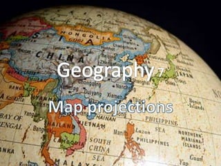
map projections
- 2. Map Projection • Date: Monday September 24 of 2012 • Session: 23 Look at the picture on the board and answer: Bell Ringer What do you think are the differences between these maps? Talk with your partner about the meaning of “Projection” 0:01 0:02 0:03 0:04 0:05 0:06 0:07 0:08 0:09 0:10 0:11 0:12 0:13 0:14 0:15 0:16 0:17 0:18 0:19 0:20 0:21 0:22 0:23 0:24 0:25 0:26 0:27 0:28 0:29 0:30 0:31 0:32 0:33 0:34 0:35 0:36 0:37 0:38 0:39 0:40 0:41 0:42 0:43 0:44 0:45 0:46 0:47 0:48 0:49 0:50 0:51 0:52 0:53 0:54 0:55 0:56 0:57 0:58 0:59 1:00 1:01 1:02 1:03 1:04 1:05 1:06 1:07 1:08 1:09 1:10 1:11 1:12 1:13 1:14 1:15 1:16 1:17 1:18 1:19 1:20 1:21 1:22 1:23 1:24 1:25 1:26 1:27 1:28 1:29 1:30 1:31 1:32 1:33 1:34 1:35 1:36 1:37 1:38 1:39 1:40 1:41 1:42 1:43 1:44 1:45 1:46 1:47 1:48 1:49 1:50 1:51 1:52 1:53 1:54 1:55 1:56 1:57 1:58 1:59 2:00 End
- 3. Objectives Students will learn the different map projections. Agenda • Bell Ringer • Objectives • Map making problems State Standard 8.4.6 By the end of eighth • Types of projection grade, students improve their skills in will • Mercator projection historical research and geographical analysis. • Closure
- 4. WHAT IF YOUR HEAD WOULD BE A PLANET… • What part of your head would be water and what would be land? • How would you do a map of this new planet?
- 5. Map-making problems • One of the problems map-makers encounter is that the globe is a sphere and maps are two-dimensional. • There are a variety of "projections" used to represent the globe in two dimensions.
- 6. Map projections • Project a round globe onto a flat surface • Options? • Stretch out some areas • Cut out some areas • Shrink some areas
- 7. Types of projection (By surface)
- 10. Plane Projection
- 12. Map projections • Three properties to consider – Area (equal-area or equivalent) – Shape (conformal) – Distance (equidistant) – Choose two out of three • How large an area? • Purpose of the map • Ulterior motives?
- 13. Cylindrical Projection MERCATOR • The Mercator projection exaggerates areas far from the equator Alaska takes as much area on the map as Brazil, when Brazil's area is nearly 5 times that of Alaska.
- 14. Notice that areas close to the equator have very little distortion. However, the closer to the poles that one travels, the more distorted the map
- 16. Cylindrical Projection – Gall-Peters • Useful for political maps, it shows the true area of land masses, choos ing instead to distort their shape
- 17. Pseudocylindrical map projection Mollweide • it sacrifices accuracy of angle and shape in favor of accurate proportions in area
- 18. Conic Projection • A conic projection map is created by placing a cone shaped screen on a globe. The resulting projection is more accurate than the cylindrical projection map discussed above.
- 19. Conic Projection • However, the further we travel down the map, the more distorted and less accurate the map becomes. It’s used by pilots
- 20. Plane Projection • A plane projection is created by placing an imaginary screen directly above or below a globe. The image that would result is called a plane projection. This type of map projection is not commonly used.
- 21. Interrupted Projection • There are many different types of interrupted projection maps. These types of maps try to depict the continents as accurately as possible by leaving blank space in the less important areas of the map, such as in the oceans.