SlideShare une entreprise Scribd logo
1  sur  23
Télécharger pour lire hors ligne
19.01.2008


                       SENIOR PROJECT

    Integration of Surface Seismic with
             Geo-electric Data
    By:                         Course Instructor and Project Coordinator
    Abdulrahman Al-Shuhail      Dr. Ali Oncel (KFUPM)
    Ali Al Halal
    Ahmed Al Zawwad             Academic & Industry Consultants:
    Hasan Ramadhan              Dr. Cesar Barajas-Olalde (Schlumberger)
    Omar Bawazir                Dr. Abdullatif Qahwash (KFUPM)


Outline
                        INTRODUCTION
                        LOCATION
                        GEOLOGY
    ( Seismic Part )                ( Geo-electric Part )
  SEISMIC EQUIPMENT             BACKGROUND
  FIELD GEOMETRY                INSTRUMENTAL USED
  NOISE ANALYSIS                GEOMETRY PARAMETERS
  PRE-PROCESSING                PARAMETERS AND
                                MEASUREMENTS
  PROCESSING                    PROCESSING
  INTERPRETATION                INTERPERTATION

                       INTEGRATION
                       CONCLUSION


                                                                                    1
19.01.2008


     INTRODUCTION
     LOCATION
     GEOLOGY


                             Ahmed Al Zawwad


INTRODUCTION

     W t t e e p o Sc u be ge
     With the help of Schlumberger we were going to make
                                         we e go g      a e
     our senior project an “Integration of Surface Seismic
     with Geo-electric data”

     From this we would like to accomplish:
       1. Acquiring as much knowledge about the
            subsurface.
       2. See the relation between Refraction and Geo-
            electric method.


                                                                      2
19.01.2008


LOCATION
• The area that we agreed on doing the experiment in, is
  Dhahran Techno Valley.
• It lies over the proven Dammam reservoir.
                   p
• By knowing the weathering layers properties over this
  region it could help in reflection seismic “ static
  correction”.

                               N


                                             160 m


  Geology


     Generally the geology
     expected     to    be
     encountered is either
     of the Dammam
     Formation or Rus
     Formation.
     Formation.


                                M. NAMIK CAGATAY 1990.


                                                                   3
19.01.2008


 SIESMIC PART


         SIESMIC EQUIPMENT
         FIELD GEOMETRY
         NOISE ANALYSIS


                                     Ali Al Halal


Seismic Equipment
    3 days field work
       Day 1:
          Decision of receiver and
          shot locations.
          Flags determined the
          locations.
          Digging to place the
          geophones.


                                                            4
19.01.2008


Seismic Equipment
  3 days field work
     Day 2:
        3D Geophones were put in.
        Cable connected.
        3 geodes were used.
        Noise analysis.


Seismic Equipment
    3 days field work
       Day 3:
          Hammer source.
                    source.
          9 shots were recorded
          with a stack of 7.
          Using      the    Seismic
          acquisition       machine
          “Geometrics” the shots
          were recorded.
                recorded.


                                              5
19.01.2008


Seismic Equipment


Field Geometry


             160m ( 32 Geophones 5m apart)


    Loose Sand
                            BEDROCK


                                                     6
19.01.2008


Noise Analysis

    Before any shots are
    recorded noise analysis
         d d i         l i
    has to be done for QC.


   We noticed a very noisy
   source that distorted the
   data.


Noise Analysis


                               Stop The
                               NOISE!!    ????


                                                         7
19.01.2008


            PRE-PROCESSING
            PROCESSING
            INTERPRETATION


                           Abdulrahman Al-Shuhail


Pre-Processing
 • The 3 component data was recorded using 1 profile, hence we
   got 96 traces in each record.
 • Before any processing could take place we had to separate the
   H-1 and H-2 components.
 • Using VISUAL SUNT we successfully separated the
   components and got only the V-3 component.


                                                                           8
19.01.2008


Processing

►   Then next was to pick the
    first breaks.
          breaks

►   Using SeisOPT Picker we
    were able to get the first
    arrivals.

►   It was difficult to find the
    first break when the shot was
    furthest from the sand.


Processing

    For modeling we used
    SeisOPT@2D.
    SeisOPT@2D


    Before modeling the data
    we had to check the first
    arrivals with respect to
       i l ih
    the other shots.


                                            9
19.01.2008


Interpretation

      • First model that we obtain has its parameters
        automatically calculated
                      calculated.

      • Then we run it ten more times while changing one
        of the parameters.

      • Finally we take the 3 least error models.


Interpretation
Best Models

         (a) Error: 4.872072e-006


         (b) Error:5.523698e-006


         (c) Error:4.934083e-006


                                                                  10
19.01.2008


Interpretation


  Each model defines a certain area bounded by the ray paths.


Interpretation


                                                                       11
19.01.2008


GEO-ELECTRIC PART


        BACKGROUND
        INSTRUMENTS USED
        GEOMETRY PARAMETERS
        PARAMETERS AND MEASUREMENTS


                               Hassan Al Ramadhan


 BACKGROUND

 • Principle: transmitting a DC current “I” through two
   electrodes and measuring a voltage “V” with two other
   electrodes

 • Apparent resistivity:   pa = k V / I   , K depending on the
   electrode separation

 • Detects many kinds of features
   – layering
   – folds, faults
   – bedrock
   – voids and cavities


                                                                        12
19.01.2008


SURVEY STRATEGY


                                             Dr. Laurent Marescot, 2007


 WENNER-SCHLUMBERGER ARRAY
• Sensitive to both horizontal & vertical changes

           CA                                    CB
                          PM       PN

                   nD          D        nD
      CA & CB = current electrodes
      PM & PN = potential electrodes
                      i l l      d

      n = the ratio of the distances between the CA- PM and PM- PN


                                                                                 13
19.01.2008


                               The IRIS instrument (Syscal R1 Plus):
           INSTRUMENTS USED
         Specifications: Applications:
    •     Measures both resistivity and                environmental studies,
          chargeability (IP)                           groundwater investigation,
    •     Two strings of cable with 24                 civil engineering,
          electrode
                                                       Archaeology.
    •     DC current of 2.5mA, 200 watts
                                                       geotechnical investigations


              A current electrode                Syscal R1 PLUS


        GEOMETRY PARAMETERS

•       Number of electrodes= 34
•       A constant electrode spacing “a” = 5 meters               Wenner-Schlumberger
                                                                         Array
                                                                         A
•       Spread length “ L”= 170 meters
•       Depth of investigation= 34 meters

Depth: about 0.2 x L


A        MN     B


                                                                                               14
19.01.2008


PARAMETERS AND MEASUREMENTS
  1) CREATE A SEQUENCE OF READING WITH
           ELECTRE II SOFTWARE.


PARAMETERS AND MEASUREMENTS
   2) TAKING READINGS IN THE FIELD WITH
                Syscal R1 Plus
                 y


                                                 15
19.01.2008


PARAMETERS AND MEASUREMENTS
  Regular check steps during the survey

   • Checking the internal transmitter battery of the SYSCAL.

   • Checking the connection of these electrodes with the “RS
     CHECK” key, by spraying slight salty water around a
     disconnected electrode.


         PARAMETERS AND MEASURMENTS
         PROCESSING
         INTERPERTATION (RES2Dinv)
         INTERPRETATION (RES1D)


                                  Omar Ba-wazir
                                       Ba-


                                                                       16
19.01.2008


PARAMETERS AND MEASUREMENTS
            3) Transfer And Process The Data With
                     PROSYSII Software.
The main functions of the PROSYSII software are the following:
• Data download:


PARAMETERS AND MEASUREMENTS
•Numeric & graphic presentation:


                                                                        17
19.01.2008


   PROCESSING
• Processing                Filtering:


   PROCESSING

       • Make a file readable by the interpretation software:


                                                                       18
19.01.2008


PROCESSING
 Vertical Electrical Sounding (VES):
  •Click on " File| Extract and Save", then "Spreadsheet Sounding".
                  |                           p                 g


• Enter the X location (mid-point of the quadripoles, in meters).
                                                                    AB/2   ohm-m
                                                                    7.5    74.95
                                                                    12.5   67.12
                                                                    17.5   67.15
                                                                    22.5   78.58
                                                                    27.5   93.17
                                                                    32.5   107.46
                                                                    37.5   120.62
                                                                    42.5   130.44
                                                                    47.5   140.37


                      INTERPRETATION
                    (RES2Dinv SOFTWARE)


                                                                                           19
19.01.2008


         INTERPRETATION
       (RES2Dinv SOFTWARE)


INTERPRETATION (RES1D)


                                    20
19.01.2008


INTERPRETATION (RES1D)


INTERPRETATION (RES1D)
                             Observed Field Data                                                       Calculated Data (Response of model B)

         160                                                                             160

         140                                                                             140
         120                                                                             120
         100                                                                             100
                                                                                Ohm -m
                                                                                     m
ohm -m


         80                                                                              80
         60                                                                              60
         40                                                                              40
         20                                                                              20
          0                                                                               0
               0   5   10   15    20     25    30   35   40   45   50                          0   5    10    15     20    25     30    35     40   45   50
                                        AB/2                                                                              AB/2


                                  Layer                            Resistivity (Ohm-m)                 Thickness (m)
                                  1                                91.095                              3.825
                                  2                                41.663                              4.781
                                  3                                73.141                              5.977
                                  4                                208.799                             7.471
                                  5                                484.053


                                                                                                                                                                     21
19.01.2008


Integration


 Conclusion

   • Using two geophysical methods proves to be very useful in
     interpreting the subsurface.
     i        i    h    b f

   • There were many models but we chose the one that agreed
     with real structures and the surface geology seen during the
     acquisition phase.

   • The Seismic and resistivity models agreed in some aspects
                                y          g                p
     (bulging structure), but in other aspects they greatly
     disagreed (middle outcrop).


                                                                           22
19.01.2008


Acknowledgments
• We would like to thank
  Earth              Sciences
  Department for giving us
     p              g    g
  this opportunity.

• We would also like to
  thank        Schlumberger
  Carbonate        Research
  Center for all their help
  and support.

• Everyone that helped us
  accomplish this project.


   Thank
         You


                                       23

Contenu connexe

En vedette

Meandering Rivers
Meandering RiversMeandering Rivers
Meandering RiversUmer Khayam
 
Quantitative and qualitative seismic attributes interpretation
Quantitative and qualitative seismic attributes interpretationQuantitative and qualitative seismic attributes interpretation
Quantitative and qualitative seismic attributes interpretationmohamed Shihata
 
Anastomosing Fluvial Systems
Anastomosing Fluvial SystemsAnastomosing Fluvial Systems
Anastomosing Fluvial SystemsWilliam W. Little
 
Deltas- types, formation, case studies
Deltas- types, formation, case studiesDeltas- types, formation, case studies
Deltas- types, formation, case studiesNishay Patel
 
L3 Meanders And Ox Bow Lakes Bv
L3 Meanders And Ox Bow Lakes BvL3 Meanders And Ox Bow Lakes Bv
L3 Meanders And Ox Bow Lakes Bvtudorgeog
 
Depositional landforms
Depositional landformsDepositional landforms
Depositional landformsMs Geoflake
 
sedimentary environment (fluvial channel)
sedimentary environment (fluvial channel)sedimentary environment (fluvial channel)
sedimentary environment (fluvial channel)Cyprian Ozigbo
 
Meander Formation
Meander FormationMeander Formation
Meander Formationjezbo16
 
Geophysical prospecting
Geophysical prospecting Geophysical prospecting
Geophysical prospecting Spondan Bora
 
V shaped valleys and interlocking spurs
V shaped valleys and interlocking spursV shaped valleys and interlocking spurs
V shaped valleys and interlocking spursSteven Heath
 
Hydrocarbon Generation & Migration
Hydrocarbon Generation & MigrationHydrocarbon Generation & Migration
Hydrocarbon Generation & MigrationM.T.H Group
 
Introduction to Seismic Method
Introduction to Seismic MethodIntroduction to Seismic Method
Introduction to Seismic MethodŞarlatan Avcısı
 
Hydrocarbon Traps & Seals
Hydrocarbon Traps & SealsHydrocarbon Traps & Seals
Hydrocarbon Traps & SealsM.T.H Group
 
Sedimentary depositional environments
Sedimentary depositional environmentsSedimentary depositional environments
Sedimentary depositional environmentsuos
 

En vedette (20)

Meandering Rivers
Meandering RiversMeandering Rivers
Meandering Rivers
 
Quantitative and qualitative seismic attributes interpretation
Quantitative and qualitative seismic attributes interpretationQuantitative and qualitative seismic attributes interpretation
Quantitative and qualitative seismic attributes interpretation
 
Anastomosing Fluvial Systems
Anastomosing Fluvial SystemsAnastomosing Fluvial Systems
Anastomosing Fluvial Systems
 
Deltas- types, formation, case studies
Deltas- types, formation, case studiesDeltas- types, formation, case studies
Deltas- types, formation, case studies
 
Braided channels
Braided channelsBraided channels
Braided channels
 
L3 Meanders And Ox Bow Lakes Bv
L3 Meanders And Ox Bow Lakes BvL3 Meanders And Ox Bow Lakes Bv
L3 Meanders And Ox Bow Lakes Bv
 
Deltas by universty of sargodha,pakistan
Deltas by universty of sargodha,pakistanDeltas by universty of sargodha,pakistan
Deltas by universty of sargodha,pakistan
 
Braided Fluvial Systems
Braided Fluvial SystemsBraided Fluvial Systems
Braided Fluvial Systems
 
Depositional landforms
Depositional landformsDepositional landforms
Depositional landforms
 
sedimentary environment (fluvial channel)
sedimentary environment (fluvial channel)sedimentary environment (fluvial channel)
sedimentary environment (fluvial channel)
 
Meander.ppt
Meander.pptMeander.ppt
Meander.ppt
 
Meander Formation
Meander FormationMeander Formation
Meander Formation
 
Deltaic Systems
Deltaic SystemsDeltaic Systems
Deltaic Systems
 
Geophysical prospecting
Geophysical prospecting Geophysical prospecting
Geophysical prospecting
 
V shaped valleys and interlocking spurs
V shaped valleys and interlocking spursV shaped valleys and interlocking spurs
V shaped valleys and interlocking spurs
 
Hydrocarbon Generation & Migration
Hydrocarbon Generation & MigrationHydrocarbon Generation & Migration
Hydrocarbon Generation & Migration
 
Introduction to Seismic Method
Introduction to Seismic MethodIntroduction to Seismic Method
Introduction to Seismic Method
 
Hydrocarbon Traps & Seals
Hydrocarbon Traps & SealsHydrocarbon Traps & Seals
Hydrocarbon Traps & Seals
 
Sedimentary depositional environments
Sedimentary depositional environmentsSedimentary depositional environments
Sedimentary depositional environments
 
EEG artifacts
EEG artifactsEEG artifacts
EEG artifacts
 

Similaire à Seniour Project: Integration of Surface Seismic with Geo-electric Data

geophysical exploration
geophysical explorationgeophysical exploration
geophysical explorationMishkatSakhi
 
Webinar-ERI-complete.pdf
Webinar-ERI-complete.pdfWebinar-ERI-complete.pdf
Webinar-ERI-complete.pdfDhirendra56
 
Joe Kelleher Presentation (May 27th 2014)
Joe Kelleher Presentation (May 27th 2014)Joe Kelleher Presentation (May 27th 2014)
Joe Kelleher Presentation (May 27th 2014)Roadshow2014
 
Overview To Linked In
Overview To Linked InOverview To Linked In
Overview To Linked Inkaadera
 
The MU-RAY project - PhD_defence
The MU-RAY project - PhD_defenceThe MU-RAY project - PhD_defence
The MU-RAY project - PhD_defenceLuigi Cimmino
 
SEISMIC FOR EXPLORING SEABED MINERALS AT THE MID-ATLANTIC RIDGE
SEISMIC FOR EXPLORING SEABED MINERALS AT THE MID-ATLANTIC RIDGESEISMIC FOR EXPLORING SEABED MINERALS AT THE MID-ATLANTIC RIDGE
SEISMIC FOR EXPLORING SEABED MINERALS AT THE MID-ATLANTIC RIDGEiQHub
 
Developments and directions in 3D mapping of mineral systems using geophysics
Developments and directions in 3D mapping of mineral systems using geophysicsDevelopments and directions in 3D mapping of mineral systems using geophysics
Developments and directions in 3D mapping of mineral systems using geophysicsRichard Lane
 
Well logging summary and Interpretation
Well logging summary and InterpretationWell logging summary and Interpretation
Well logging summary and InterpretationPE Mahmoud Jad
 
SPACEBORNE_MICROWAVE_OBSERVATIONS_OF_RAIN 1972-1997.ppt
SPACEBORNE_MICROWAVE_OBSERVATIONS_OF_RAIN 1972-1997.pptSPACEBORNE_MICROWAVE_OBSERVATIONS_OF_RAIN 1972-1997.ppt
SPACEBORNE_MICROWAVE_OBSERVATIONS_OF_RAIN 1972-1997.pptgrssieee
 
SPACEBORNE_MICROWAVE_OBSERVATIONS_OF_RAIN 1972-1997.ppt
SPACEBORNE_MICROWAVE_OBSERVATIONS_OF_RAIN 1972-1997.pptSPACEBORNE_MICROWAVE_OBSERVATIONS_OF_RAIN 1972-1997.ppt
SPACEBORNE_MICROWAVE_OBSERVATIONS_OF_RAIN 1972-1997.pptgrssieee
 
SPACEBORNE_MICROWAVE_OBSERVATIONS_OF_RAIN 1972-1997.ppt
SPACEBORNE_MICROWAVE_OBSERVATIONS_OF_RAIN 1972-1997.pptSPACEBORNE_MICROWAVE_OBSERVATIONS_OF_RAIN 1972-1997.ppt
SPACEBORNE_MICROWAVE_OBSERVATIONS_OF_RAIN 1972-1997.pptgrssieee
 
Microseismic monitoring at the CCS fields - what we learnt from Nagaoka
Microseismic monitoring at the CCS fields - what we learnt from NagaokaMicroseismic monitoring at the CCS fields - what we learnt from Nagaoka
Microseismic monitoring at the CCS fields - what we learnt from NagaokaGlobal CCS Institute
 
Airborne electromagnetic survey REPORT
Airborne electromagnetic survey REPORTAirborne electromagnetic survey REPORT
Airborne electromagnetic survey REPORTSaba Saif
 

Similaire à Seniour Project: Integration of Surface Seismic with Geo-electric Data (20)

At seismic survey
At seismic surveyAt seismic survey
At seismic survey
 
geophysical exploration
geophysical explorationgeophysical exploration
geophysical exploration
 
Webinar-ERI-complete.pdf
Webinar-ERI-complete.pdfWebinar-ERI-complete.pdf
Webinar-ERI-complete.pdf
 
Geophysics Labs
Geophysics LabsGeophysics Labs
Geophysics Labs
 
Joe Kelleher Presentation (May 27th 2014)
Joe Kelleher Presentation (May 27th 2014)Joe Kelleher Presentation (May 27th 2014)
Joe Kelleher Presentation (May 27th 2014)
 
Overview To Linked In
Overview To Linked InOverview To Linked In
Overview To Linked In
 
The MU-RAY project - PhD_defence
The MU-RAY project - PhD_defenceThe MU-RAY project - PhD_defence
The MU-RAY project - PhD_defence
 
SEISMIC FOR EXPLORING SEABED MINERALS AT THE MID-ATLANTIC RIDGE
SEISMIC FOR EXPLORING SEABED MINERALS AT THE MID-ATLANTIC RIDGESEISMIC FOR EXPLORING SEABED MINERALS AT THE MID-ATLANTIC RIDGE
SEISMIC FOR EXPLORING SEABED MINERALS AT THE MID-ATLANTIC RIDGE
 
Well logging
Well loggingWell logging
Well logging
 
Curcic - Atomic and Molecular Physics Program - Spring Review 2012
Curcic - Atomic and Molecular Physics Program - Spring Review 2012Curcic - Atomic and Molecular Physics Program - Spring Review 2012
Curcic - Atomic and Molecular Physics Program - Spring Review 2012
 
Developments and directions in 3D mapping of mineral systems using geophysics
Developments and directions in 3D mapping of mineral systems using geophysicsDevelopments and directions in 3D mapping of mineral systems using geophysics
Developments and directions in 3D mapping of mineral systems using geophysics
 
Well logging summary and Interpretation
Well logging summary and InterpretationWell logging summary and Interpretation
Well logging summary and Interpretation
 
SPACEBORNE_MICROWAVE_OBSERVATIONS_OF_RAIN 1972-1997.ppt
SPACEBORNE_MICROWAVE_OBSERVATIONS_OF_RAIN 1972-1997.pptSPACEBORNE_MICROWAVE_OBSERVATIONS_OF_RAIN 1972-1997.ppt
SPACEBORNE_MICROWAVE_OBSERVATIONS_OF_RAIN 1972-1997.ppt
 
SPACEBORNE_MICROWAVE_OBSERVATIONS_OF_RAIN 1972-1997.ppt
SPACEBORNE_MICROWAVE_OBSERVATIONS_OF_RAIN 1972-1997.pptSPACEBORNE_MICROWAVE_OBSERVATIONS_OF_RAIN 1972-1997.ppt
SPACEBORNE_MICROWAVE_OBSERVATIONS_OF_RAIN 1972-1997.ppt
 
SPACEBORNE_MICROWAVE_OBSERVATIONS_OF_RAIN 1972-1997.ppt
SPACEBORNE_MICROWAVE_OBSERVATIONS_OF_RAIN 1972-1997.pptSPACEBORNE_MICROWAVE_OBSERVATIONS_OF_RAIN 1972-1997.ppt
SPACEBORNE_MICROWAVE_OBSERVATIONS_OF_RAIN 1972-1997.ppt
 
Microseismic monitoring at the CCS fields - what we learnt from Nagaoka
Microseismic monitoring at the CCS fields - what we learnt from NagaokaMicroseismic monitoring at the CCS fields - what we learnt from Nagaoka
Microseismic monitoring at the CCS fields - what we learnt from Nagaoka
 
Airborne electromagnetic survey REPORT
Airborne electromagnetic survey REPORTAirborne electromagnetic survey REPORT
Airborne electromagnetic survey REPORT
 
Experimental Technologies
Experimental TechnologiesExperimental Technologies
Experimental Technologies
 
Webinar Geosciences 2012
Webinar Geosciences 2012Webinar Geosciences 2012
Webinar Geosciences 2012
 
Undergraduate Thesis
Undergraduate ThesisUndergraduate Thesis
Undergraduate Thesis
 

Plus de Ali Osman Öncel

Riskli Yapılar - Çevre ve Şehircilik
Riskli Yapılar - Çevre ve ŞehircilikRiskli Yapılar - Çevre ve Şehircilik
Riskli Yapılar - Çevre ve ŞehircilikAli Osman Öncel
 
Riskli Yapılar -Çevre ve Şehircilik
Riskli Yapılar -Çevre ve ŞehircilikRiskli Yapılar -Çevre ve Şehircilik
Riskli Yapılar -Çevre ve ŞehircilikAli Osman Öncel
 
Kar Kar Geothermal Field Work
Kar Kar Geothermal Field WorkKar Kar Geothermal Field Work
Kar Kar Geothermal Field WorkAli Osman Öncel
 
High Resolution Earth's Gravitational Field
High Resolution Earth's Gravitational FieldHigh Resolution Earth's Gravitational Field
High Resolution Earth's Gravitational FieldAli Osman Öncel
 
Gravity Predictions for Earthquakes
Gravity Predictions for EarthquakesGravity Predictions for Earthquakes
Gravity Predictions for EarthquakesAli Osman Öncel
 
Nakamura Technique for Soil Characterization
Nakamura Technique for Soil CharacterizationNakamura Technique for Soil Characterization
Nakamura Technique for Soil CharacterizationAli Osman Öncel
 
Geopsy: Seismic Vibration Processing
Geopsy: Seismic Vibration ProcessingGeopsy: Seismic Vibration Processing
Geopsy: Seismic Vibration ProcessingAli Osman Öncel
 

Plus de Ali Osman Öncel (20)

APA Yazım Kuralları
APA Yazım KurallarıAPA Yazım Kuralları
APA Yazım Kuralları
 
Gravimetri : Ders 14
Gravimetri : Ders 14Gravimetri : Ders 14
Gravimetri : Ders 14
 
Gravimetri : Ders 13
Gravimetri : Ders 13Gravimetri : Ders 13
Gravimetri : Ders 13
 
Gravimetri : Ders 12
Gravimetri : Ders 12Gravimetri : Ders 12
Gravimetri : Ders 12
 
Riskli Yapılar - Çevre ve Şehircilik
Riskli Yapılar - Çevre ve ŞehircilikRiskli Yapılar - Çevre ve Şehircilik
Riskli Yapılar - Çevre ve Şehircilik
 
Riskli Yapılar -Çevre ve Şehircilik
Riskli Yapılar -Çevre ve ŞehircilikRiskli Yapılar -Çevre ve Şehircilik
Riskli Yapılar -Çevre ve Şehircilik
 
Gravimetri : Ders 07
Gravimetri : Ders 07Gravimetri : Ders 07
Gravimetri : Ders 07
 
Gravimetri : Ders 06
Gravimetri : Ders 06Gravimetri : Ders 06
Gravimetri : Ders 06
 
Gravimetri: Ders 05
Gravimetri: Ders 05Gravimetri: Ders 05
Gravimetri: Ders 05
 
Gravimetri : Ders 04
Gravimetri : Ders 04Gravimetri : Ders 04
Gravimetri : Ders 04
 
Gravimetri : Ders 03
Gravimetri : Ders 03Gravimetri : Ders 03
Gravimetri : Ders 03
 
Gravimetri Ders 02
Gravimetri Ders 02Gravimetri Ders 02
Gravimetri Ders 02
 
Gravimetri Ders 01
Gravimetri Ders 01Gravimetri Ders 01
Gravimetri Ders 01
 
Kar Kar Geothermal Field Work
Kar Kar Geothermal Field WorkKar Kar Geothermal Field Work
Kar Kar Geothermal Field Work
 
Beppu geothermal field
Beppu geothermal fieldBeppu geothermal field
Beppu geothermal field
 
High Resolution Earth's Gravitational Field
High Resolution Earth's Gravitational FieldHigh Resolution Earth's Gravitational Field
High Resolution Earth's Gravitational Field
 
Gravity Predictions for Earthquakes
Gravity Predictions for EarthquakesGravity Predictions for Earthquakes
Gravity Predictions for Earthquakes
 
Nakamura Technique for Soil Characterization
Nakamura Technique for Soil CharacterizationNakamura Technique for Soil Characterization
Nakamura Technique for Soil Characterization
 
H/V User Guidelines
H/V User Guidelines H/V User Guidelines
H/V User Guidelines
 
Geopsy: Seismic Vibration Processing
Geopsy: Seismic Vibration ProcessingGeopsy: Seismic Vibration Processing
Geopsy: Seismic Vibration Processing
 

Dernier

FWD Group - Insurer Innovation Award 2024
FWD Group - Insurer Innovation Award 2024FWD Group - Insurer Innovation Award 2024
FWD Group - Insurer Innovation Award 2024The Digital Insurer
 
DBX First Quarter 2024 Investor Presentation
DBX First Quarter 2024 Investor PresentationDBX First Quarter 2024 Investor Presentation
DBX First Quarter 2024 Investor PresentationDropbox
 
AXA XL - Insurer Innovation Award Americas 2024
AXA XL - Insurer Innovation Award Americas 2024AXA XL - Insurer Innovation Award Americas 2024
AXA XL - Insurer Innovation Award Americas 2024The Digital Insurer
 
Why Teams call analytics are critical to your entire business
Why Teams call analytics are critical to your entire businessWhy Teams call analytics are critical to your entire business
Why Teams call analytics are critical to your entire businesspanagenda
 
Axa Assurance Maroc - Insurer Innovation Award 2024
Axa Assurance Maroc - Insurer Innovation Award 2024Axa Assurance Maroc - Insurer Innovation Award 2024
Axa Assurance Maroc - Insurer Innovation Award 2024The Digital Insurer
 
presentation ICT roal in 21st century education
presentation ICT roal in 21st century educationpresentation ICT roal in 21st century education
presentation ICT roal in 21st century educationjfdjdjcjdnsjd
 
Biography Of Angeliki Cooney | Senior Vice President Life Sciences | Albany, ...
Biography Of Angeliki Cooney | Senior Vice President Life Sciences | Albany, ...Biography Of Angeliki Cooney | Senior Vice President Life Sciences | Albany, ...
Biography Of Angeliki Cooney | Senior Vice President Life Sciences | Albany, ...Angeliki Cooney
 
Manulife - Insurer Transformation Award 2024
Manulife - Insurer Transformation Award 2024Manulife - Insurer Transformation Award 2024
Manulife - Insurer Transformation Award 2024The Digital Insurer
 
DEV meet-up UiPath Document Understanding May 7 2024 Amsterdam
DEV meet-up UiPath Document Understanding May 7 2024 AmsterdamDEV meet-up UiPath Document Understanding May 7 2024 Amsterdam
DEV meet-up UiPath Document Understanding May 7 2024 AmsterdamUiPathCommunity
 
[BuildWithAI] Introduction to Gemini.pdf
[BuildWithAI] Introduction to Gemini.pdf[BuildWithAI] Introduction to Gemini.pdf
[BuildWithAI] Introduction to Gemini.pdfSandro Moreira
 
"I see eyes in my soup": How Delivery Hero implemented the safety system for ...
"I see eyes in my soup": How Delivery Hero implemented the safety system for ..."I see eyes in my soup": How Delivery Hero implemented the safety system for ...
"I see eyes in my soup": How Delivery Hero implemented the safety system for ...Zilliz
 
AWS Community Day CPH - Three problems of Terraform
AWS Community Day CPH - Three problems of TerraformAWS Community Day CPH - Three problems of Terraform
AWS Community Day CPH - Three problems of TerraformAndrey Devyatkin
 
Apidays New York 2024 - Passkeys: Developing APIs to enable passwordless auth...
Apidays New York 2024 - Passkeys: Developing APIs to enable passwordless auth...Apidays New York 2024 - Passkeys: Developing APIs to enable passwordless auth...
Apidays New York 2024 - Passkeys: Developing APIs to enable passwordless auth...apidays
 
CNIC Information System with Pakdata Cf In Pakistan
CNIC Information System with Pakdata Cf In PakistanCNIC Information System with Pakdata Cf In Pakistan
CNIC Information System with Pakdata Cf In Pakistandanishmna97
 
Ransomware_Q4_2023. The report. [EN].pdf
Ransomware_Q4_2023. The report. [EN].pdfRansomware_Q4_2023. The report. [EN].pdf
Ransomware_Q4_2023. The report. [EN].pdfOverkill Security
 
Apidays New York 2024 - APIs in 2030: The Risk of Technological Sleepwalk by ...
Apidays New York 2024 - APIs in 2030: The Risk of Technological Sleepwalk by ...Apidays New York 2024 - APIs in 2030: The Risk of Technological Sleepwalk by ...
Apidays New York 2024 - APIs in 2030: The Risk of Technological Sleepwalk by ...apidays
 
Artificial Intelligence Chap.5 : Uncertainty
Artificial Intelligence Chap.5 : UncertaintyArtificial Intelligence Chap.5 : Uncertainty
Artificial Intelligence Chap.5 : UncertaintyKhushali Kathiriya
 
Architecting Cloud Native Applications
Architecting Cloud Native ApplicationsArchitecting Cloud Native Applications
Architecting Cloud Native ApplicationsWSO2
 
Polkadot JAM Slides - Token2049 - By Dr. Gavin Wood
Polkadot JAM Slides - Token2049 - By Dr. Gavin WoodPolkadot JAM Slides - Token2049 - By Dr. Gavin Wood
Polkadot JAM Slides - Token2049 - By Dr. Gavin WoodJuan lago vázquez
 

Dernier (20)

FWD Group - Insurer Innovation Award 2024
FWD Group - Insurer Innovation Award 2024FWD Group - Insurer Innovation Award 2024
FWD Group - Insurer Innovation Award 2024
 
DBX First Quarter 2024 Investor Presentation
DBX First Quarter 2024 Investor PresentationDBX First Quarter 2024 Investor Presentation
DBX First Quarter 2024 Investor Presentation
 
AXA XL - Insurer Innovation Award Americas 2024
AXA XL - Insurer Innovation Award Americas 2024AXA XL - Insurer Innovation Award Americas 2024
AXA XL - Insurer Innovation Award Americas 2024
 
Why Teams call analytics are critical to your entire business
Why Teams call analytics are critical to your entire businessWhy Teams call analytics are critical to your entire business
Why Teams call analytics are critical to your entire business
 
Axa Assurance Maroc - Insurer Innovation Award 2024
Axa Assurance Maroc - Insurer Innovation Award 2024Axa Assurance Maroc - Insurer Innovation Award 2024
Axa Assurance Maroc - Insurer Innovation Award 2024
 
presentation ICT roal in 21st century education
presentation ICT roal in 21st century educationpresentation ICT roal in 21st century education
presentation ICT roal in 21st century education
 
Biography Of Angeliki Cooney | Senior Vice President Life Sciences | Albany, ...
Biography Of Angeliki Cooney | Senior Vice President Life Sciences | Albany, ...Biography Of Angeliki Cooney | Senior Vice President Life Sciences | Albany, ...
Biography Of Angeliki Cooney | Senior Vice President Life Sciences | Albany, ...
 
Manulife - Insurer Transformation Award 2024
Manulife - Insurer Transformation Award 2024Manulife - Insurer Transformation Award 2024
Manulife - Insurer Transformation Award 2024
 
DEV meet-up UiPath Document Understanding May 7 2024 Amsterdam
DEV meet-up UiPath Document Understanding May 7 2024 AmsterdamDEV meet-up UiPath Document Understanding May 7 2024 Amsterdam
DEV meet-up UiPath Document Understanding May 7 2024 Amsterdam
 
[BuildWithAI] Introduction to Gemini.pdf
[BuildWithAI] Introduction to Gemini.pdf[BuildWithAI] Introduction to Gemini.pdf
[BuildWithAI] Introduction to Gemini.pdf
 
"I see eyes in my soup": How Delivery Hero implemented the safety system for ...
"I see eyes in my soup": How Delivery Hero implemented the safety system for ..."I see eyes in my soup": How Delivery Hero implemented the safety system for ...
"I see eyes in my soup": How Delivery Hero implemented the safety system for ...
 
AWS Community Day CPH - Three problems of Terraform
AWS Community Day CPH - Three problems of TerraformAWS Community Day CPH - Three problems of Terraform
AWS Community Day CPH - Three problems of Terraform
 
Apidays New York 2024 - Passkeys: Developing APIs to enable passwordless auth...
Apidays New York 2024 - Passkeys: Developing APIs to enable passwordless auth...Apidays New York 2024 - Passkeys: Developing APIs to enable passwordless auth...
Apidays New York 2024 - Passkeys: Developing APIs to enable passwordless auth...
 
CNIC Information System with Pakdata Cf In Pakistan
CNIC Information System with Pakdata Cf In PakistanCNIC Information System with Pakdata Cf In Pakistan
CNIC Information System with Pakdata Cf In Pakistan
 
Ransomware_Q4_2023. The report. [EN].pdf
Ransomware_Q4_2023. The report. [EN].pdfRansomware_Q4_2023. The report. [EN].pdf
Ransomware_Q4_2023. The report. [EN].pdf
 
+971581248768>> SAFE AND ORIGINAL ABORTION PILLS FOR SALE IN DUBAI AND ABUDHA...
+971581248768>> SAFE AND ORIGINAL ABORTION PILLS FOR SALE IN DUBAI AND ABUDHA...+971581248768>> SAFE AND ORIGINAL ABORTION PILLS FOR SALE IN DUBAI AND ABUDHA...
+971581248768>> SAFE AND ORIGINAL ABORTION PILLS FOR SALE IN DUBAI AND ABUDHA...
 
Apidays New York 2024 - APIs in 2030: The Risk of Technological Sleepwalk by ...
Apidays New York 2024 - APIs in 2030: The Risk of Technological Sleepwalk by ...Apidays New York 2024 - APIs in 2030: The Risk of Technological Sleepwalk by ...
Apidays New York 2024 - APIs in 2030: The Risk of Technological Sleepwalk by ...
 
Artificial Intelligence Chap.5 : Uncertainty
Artificial Intelligence Chap.5 : UncertaintyArtificial Intelligence Chap.5 : Uncertainty
Artificial Intelligence Chap.5 : Uncertainty
 
Architecting Cloud Native Applications
Architecting Cloud Native ApplicationsArchitecting Cloud Native Applications
Architecting Cloud Native Applications
 
Polkadot JAM Slides - Token2049 - By Dr. Gavin Wood
Polkadot JAM Slides - Token2049 - By Dr. Gavin WoodPolkadot JAM Slides - Token2049 - By Dr. Gavin Wood
Polkadot JAM Slides - Token2049 - By Dr. Gavin Wood
 

Seniour Project: Integration of Surface Seismic with Geo-electric Data

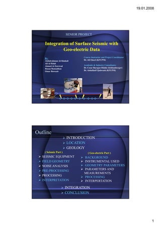
  • 1. 19.01.2008 SENIOR PROJECT Integration of Surface Seismic with Geo-electric Data By: Course Instructor and Project Coordinator Abdulrahman Al-Shuhail Dr. Ali Oncel (KFUPM) Ali Al Halal Ahmed Al Zawwad Academic & Industry Consultants: Hasan Ramadhan Dr. Cesar Barajas-Olalde (Schlumberger) Omar Bawazir Dr. Abdullatif Qahwash (KFUPM) Outline INTRODUCTION LOCATION GEOLOGY ( Seismic Part ) ( Geo-electric Part ) SEISMIC EQUIPMENT BACKGROUND FIELD GEOMETRY INSTRUMENTAL USED NOISE ANALYSIS GEOMETRY PARAMETERS PRE-PROCESSING PARAMETERS AND MEASUREMENTS PROCESSING PROCESSING INTERPRETATION INTERPERTATION INTEGRATION CONCLUSION 1
  • 2. 19.01.2008 INTRODUCTION LOCATION GEOLOGY Ahmed Al Zawwad INTRODUCTION W t t e e p o Sc u be ge With the help of Schlumberger we were going to make we e go g a e our senior project an “Integration of Surface Seismic with Geo-electric data” From this we would like to accomplish: 1. Acquiring as much knowledge about the subsurface. 2. See the relation between Refraction and Geo- electric method. 2
  • 3. 19.01.2008 LOCATION • The area that we agreed on doing the experiment in, is Dhahran Techno Valley. • It lies over the proven Dammam reservoir. p • By knowing the weathering layers properties over this region it could help in reflection seismic “ static correction”. N 160 m Geology Generally the geology expected to be encountered is either of the Dammam Formation or Rus Formation. Formation. M. NAMIK CAGATAY 1990. 3
  • 4. 19.01.2008 SIESMIC PART SIESMIC EQUIPMENT FIELD GEOMETRY NOISE ANALYSIS Ali Al Halal Seismic Equipment 3 days field work Day 1: Decision of receiver and shot locations. Flags determined the locations. Digging to place the geophones. 4
  • 5. 19.01.2008 Seismic Equipment 3 days field work Day 2: 3D Geophones were put in. Cable connected. 3 geodes were used. Noise analysis. Seismic Equipment 3 days field work Day 3: Hammer source. source. 9 shots were recorded with a stack of 7. Using the Seismic acquisition machine “Geometrics” the shots were recorded. recorded. 5
  • 6. 19.01.2008 Seismic Equipment Field Geometry 160m ( 32 Geophones 5m apart) Loose Sand BEDROCK 6
  • 7. 19.01.2008 Noise Analysis Before any shots are recorded noise analysis d d i l i has to be done for QC. We noticed a very noisy source that distorted the data. Noise Analysis Stop The NOISE!! ???? 7
  • 8. 19.01.2008 PRE-PROCESSING PROCESSING INTERPRETATION Abdulrahman Al-Shuhail Pre-Processing • The 3 component data was recorded using 1 profile, hence we got 96 traces in each record. • Before any processing could take place we had to separate the H-1 and H-2 components. • Using VISUAL SUNT we successfully separated the components and got only the V-3 component. 8
  • 9. 19.01.2008 Processing ► Then next was to pick the first breaks. breaks ► Using SeisOPT Picker we were able to get the first arrivals. ► It was difficult to find the first break when the shot was furthest from the sand. Processing For modeling we used SeisOPT@2D. SeisOPT@2D Before modeling the data we had to check the first arrivals with respect to i l ih the other shots. 9
  • 10. 19.01.2008 Interpretation • First model that we obtain has its parameters automatically calculated calculated. • Then we run it ten more times while changing one of the parameters. • Finally we take the 3 least error models. Interpretation Best Models (a) Error: 4.872072e-006 (b) Error:5.523698e-006 (c) Error:4.934083e-006 10
  • 11. 19.01.2008 Interpretation Each model defines a certain area bounded by the ray paths. Interpretation 11
  • 12. 19.01.2008 GEO-ELECTRIC PART BACKGROUND INSTRUMENTS USED GEOMETRY PARAMETERS PARAMETERS AND MEASUREMENTS Hassan Al Ramadhan BACKGROUND • Principle: transmitting a DC current “I” through two electrodes and measuring a voltage “V” with two other electrodes • Apparent resistivity: pa = k V / I , K depending on the electrode separation • Detects many kinds of features – layering – folds, faults – bedrock – voids and cavities 12
  • 13. 19.01.2008 SURVEY STRATEGY Dr. Laurent Marescot, 2007 WENNER-SCHLUMBERGER ARRAY • Sensitive to both horizontal & vertical changes CA CB PM PN nD D nD CA & CB = current electrodes PM & PN = potential electrodes i l l d n = the ratio of the distances between the CA- PM and PM- PN 13
  • 14. 19.01.2008 The IRIS instrument (Syscal R1 Plus): INSTRUMENTS USED Specifications: Applications: • Measures both resistivity and environmental studies, chargeability (IP) groundwater investigation, • Two strings of cable with 24 civil engineering, electrode Archaeology. • DC current of 2.5mA, 200 watts geotechnical investigations A current electrode Syscal R1 PLUS GEOMETRY PARAMETERS • Number of electrodes= 34 • A constant electrode spacing “a” = 5 meters Wenner-Schlumberger Array A • Spread length “ L”= 170 meters • Depth of investigation= 34 meters Depth: about 0.2 x L A MN B 14
  • 15. 19.01.2008 PARAMETERS AND MEASUREMENTS 1) CREATE A SEQUENCE OF READING WITH ELECTRE II SOFTWARE. PARAMETERS AND MEASUREMENTS 2) TAKING READINGS IN THE FIELD WITH Syscal R1 Plus y 15
  • 16. 19.01.2008 PARAMETERS AND MEASUREMENTS Regular check steps during the survey • Checking the internal transmitter battery of the SYSCAL. • Checking the connection of these electrodes with the “RS CHECK” key, by spraying slight salty water around a disconnected electrode. PARAMETERS AND MEASURMENTS PROCESSING INTERPERTATION (RES2Dinv) INTERPRETATION (RES1D) Omar Ba-wazir Ba- 16
  • 17. 19.01.2008 PARAMETERS AND MEASUREMENTS 3) Transfer And Process The Data With PROSYSII Software. The main functions of the PROSYSII software are the following: • Data download: PARAMETERS AND MEASUREMENTS •Numeric & graphic presentation: 17
  • 18. 19.01.2008 PROCESSING • Processing Filtering: PROCESSING • Make a file readable by the interpretation software: 18
  • 19. 19.01.2008 PROCESSING Vertical Electrical Sounding (VES): •Click on " File| Extract and Save", then "Spreadsheet Sounding". | p g • Enter the X location (mid-point of the quadripoles, in meters). AB/2 ohm-m 7.5 74.95 12.5 67.12 17.5 67.15 22.5 78.58 27.5 93.17 32.5 107.46 37.5 120.62 42.5 130.44 47.5 140.37 INTERPRETATION (RES2Dinv SOFTWARE) 19
  • 20. 19.01.2008 INTERPRETATION (RES2Dinv SOFTWARE) INTERPRETATION (RES1D) 20
  • 21. 19.01.2008 INTERPRETATION (RES1D) INTERPRETATION (RES1D) Observed Field Data Calculated Data (Response of model B) 160 160 140 140 120 120 100 100 Ohm -m m ohm -m 80 80 60 60 40 40 20 20 0 0 0 5 10 15 20 25 30 35 40 45 50 0 5 10 15 20 25 30 35 40 45 50 AB/2 AB/2 Layer Resistivity (Ohm-m) Thickness (m) 1 91.095 3.825 2 41.663 4.781 3 73.141 5.977 4 208.799 7.471 5 484.053 21
  • 22. 19.01.2008 Integration Conclusion • Using two geophysical methods proves to be very useful in interpreting the subsurface. i i h b f • There were many models but we chose the one that agreed with real structures and the surface geology seen during the acquisition phase. • The Seismic and resistivity models agreed in some aspects y g p (bulging structure), but in other aspects they greatly disagreed (middle outcrop). 22
  • 23. 19.01.2008 Acknowledgments • We would like to thank Earth Sciences Department for giving us p g g this opportunity. • We would also like to thank Schlumberger Carbonate Research Center for all their help and support. • Everyone that helped us accomplish this project. Thank You 23