SlideShare une entreprise Scribd logo
1  sur  4
Télécharger pour lire hors ligne
GIS Software - A description in 1000 words *

                                  Stefan Steiniger† and Robert Weibel‡

                         † University of Calgary (CA), ‡ University of Zurich (CH)

                                      Version – 1.2 – 08.May.2009


Software that is used to create, manage, analyze and visualize geographic data, i.e. data with a
reference to a place on earth, is usually denoted by the umbrella term ‘GIS software’. Typical
applications for GIS software include the evaluation of places for the location of new stores, the
management of power and gas lines, the creation of maps, the analysis of past crimes for crime
prevention, route calculations for transport tasks, the management of forests, parks and
infrastructure, such as roads and water ways, as well as applications in risk analysis of natural
hazards, and emergency planning and response. For this multitude of applications different types of
GIS functions are required and different categories of GIS software exist, which provide a particular
set of functions needed to fulfill certain data management tasks. We will first explain important GIS
software concepts, then list the typical tasks accomplished with GIS software, describe different GIS
software categories, and finally provide information on software producers and projects.


GIS Software Concepts
To represent a geographic object in a GIS, e.g. a building or a tree or a forest, a data representation
has to be established first. GIS usually provide two different possibilities to represent a geographic
phenomenon: the raster representation and the vector representation. In the raster representation a
regular mesh of cells is used, where every cell records the value of the attribute that describe the
phenomenon - like the Red/Green/Blue values in a digital image. Rasters are typically used to
represent variables that are continuous over space, such as terrain elevations or land cover. In the
vector model, which is commonly used to store objects that are spatially discrete, every object is
represented by a (vector) geometry (e.g.; a point, a line, or a polygon) and value fields that describe
the non-spatial object properties, the so-called ‘attributes’, in a table. For instance, a building might
be represented by a rectangle geometry and have attached two fields that describe the construction
year and the owner.
      In GIS software geographic objects that have the same geometric and attribute representation
are typically grouped in so-called ‘layers’ to simplify data management tasks. For instance, all
buildings that are represented by polygons and have information on owner and construction year are
grouped in a layer ‘buildings’. In Figure 1 we show the typical graphical user interface of a GIS
software package that includes the concept of geometries (map view) connected to values in tables
(attribute view), as well as layers that contain one class of objects (e.g. rivers).


*
    accepted as entry “GIS software” for the Encyclopeadia of Geography, B. Warf (ed), Sage Pub.
                                                      1
Figure 1: A typical desktop GIS user interface with map view, layer view, attribute view, tools for
        navigating and exploring data, as well as tools for creating and modifying geometries.


Typical Tasks Accomplished with GIS Software
Before any geographic analysis can take place the data need to be derived from field work, maps or
satellite imagery, or acquired from data providers. Hence, data need to be created (1) and - in case
something has changed - edited (2), and then stored (3). If data are obtained from other sources
they need to be viewed (4) and eventually integrated (conflation) with existing data (5). To answer
particular questions, e.g. who is living in street X and is affected by the planned renewal of a power
line, the data are queried (6) and analyzed (7). However, some specific analysis tasks may require a
data transformation and manipulation (8) before any analysis can take place. The query and analysis
results can finally be displayed on a map (9).


GIS Software Categories
Different types of GIS software exist with different functionality, as not every GIS user needs to carry
out all of the above tasks. For instance an assistant in the public services department of a city may
only provide information on house owners to construction companies and does not need to edit the
cadastral dataset.
    Table 1 and Figure 2 summarize commonly used GIS software categories. Desktop GIS usually
serve all GIS tasks and are sometimes classified into three functionality categories: GIS Viewer, GIS
Editor, and GIS Analyst. Spatial Database Management Systems (DBMS) are mainly used to store the
data, but often also provide (limited) analysis and data manipulation functionality. WebMap Servers


                                                     2
Figure 2: Different types of GIS software.

are used to distribute maps and data over the internet1. Similarly, WebGIS Clients are used for data
display and to access analysis and query functionality from Server GIS over the internet or intranet.
Libraries and Extensions provide additional (analysis) functionality that is not part of the basic GIS
software, for instance functions for network and terrain analysis, or functions to read specific data
formats. Finally, Mobile GIS are often used for field data collection.


    Table 1: Typical tasks accomplished with different GIS software. ● standard functionality, ◊
    optional functionality.
                                                                                      transformation


                                                                                                                          create maps
         GIS tasks vs.
                                                                         conflation
                                          creation


                                                                                                               analysis
                                viewing


                                                               storage


     GIS software category
                                                     editing


                                                                                                       query


    Desktop GIS
             Viewer            ●                               ●                                       ●                  ◊
             Editor            ●          ●          ●         ●                      ◊                ●                  ●
             Analyst           ●          ●          ●         ●         ●            ●                ●       ●          ●
    Spatial DBMS                                               ●                      ●                ●       ◊
    WebMap Server              ●          ◊          ◊                                                 ●                  ●
    Server GIS                                                 ●         ●            ●                ●       ●          ●
    WebGIS Client
             Thin Client        ●                                                                      ●
             Thick Client       ●         ●          ●         ●                                       ●       ●          ●
    Mobile GIS                 ●          ●          ●         ●                                       ●
    Libraries / Extensions                                     ●         ●            ●                        ●          ●


1
   Two important standards of the Open Geospatial Consortium (OGC) for map and geodata
dristribution via WebMap Servers are the Web Map Service (WMS) and Web Feature Service (WFS).
                                                  3
Software Manufacturers and Projects
    GIS software is not only provided by companies but increasingly also by free and open source
software projects. While commercial vendors usually offer products for all of software categories,
open software projects often concentrate on a single category, e.g. desktop GIS or WebMap server.
The key players in the GIS software market today are Autodesk, Bentley, ESRI Inc., GE (Smallworld),
Pitney Bowes (MapInfo), and Intergraph. GIS software companies tend to target specific application
domains. For instance, ESRI’s ArcGIS product tends to be mainly used for business analysis, planning,
and environmental applications, while Autodesk, GE and Bentley products are rather used in utility
and facility management. Competitive GIS software that is developed by free software projects exists
as well - especially with respect to server applications (MapServer, GeoServer) and spatial DBMS
(PostGIS). Free desktop GIS projects, such as Quantum GIS and gvSIG, currently experience growing
user communities. Such free GIS software rather complements the set of proprietary software instead
of competing with it.


Further Readings
Burrough, P.A., & R.A. McDonnell (1998). Principles of Geographical Information Systems. 2nd Edition.
    Oxford, UK: Oxford University Press.
DeMers, M.N. (2008). Fundamentals of Geographic Information Systems. 4th Edition. Chichester, UK:
    John Wiley & Sons.
Heywood, D.I., Cornelius, S., & S. Carver (2006). An introduction to Geographical Information
    Systems. 3rd Edition. Essex, UK: Pearson Prentice Hall.
Longley, P.A., Goodchild, M.F., Maguire, D.J., & D.W. Rhind (2005). Geographic Information Systems
    and Science. 2nd Edition. Chichester, UK: John Wiley & Sons.
Sherman, G.E. (2008). Desktop GIS: Mapping the Planet with Open Source Tools. Lewisville, TX: The
    Pragmatic Bookshelf.
Steiniger, S., & E. Bocher (2009). An overview on current free and open source desktop GIS
    developments. International Journal of Geographical Information Science 24 (in press).


                                                    4

Contenu connexe

Tendances

GIS Based Project Planning and Management
GIS Based Project Planning and ManagementGIS Based Project Planning and Management
GIS Based Project Planning and Management
SaurabhChobe
 
From concept to implementation: web-based cartographic visualisation with Car...
From concept to implementation: web-based cartographic visualisation with Car...From concept to implementation: web-based cartographic visualisation with Car...
From concept to implementation: web-based cartographic visualisation with Car...
Beniamino Murgante
 
Geographic information system
Geographic information systemGeographic information system
Geographic information system
Sumanta Das
 

Tendances (20)

GIS Based Project Planning and Management
GIS Based Project Planning and ManagementGIS Based Project Planning and Management
GIS Based Project Planning and Management
 
From concept to implementation: web-based cartographic visualisation with Car...
From concept to implementation: web-based cartographic visualisation with Car...From concept to implementation: web-based cartographic visualisation with Car...
From concept to implementation: web-based cartographic visualisation with Car...
 
RiskNat - foss4git
RiskNat - foss4gitRiskNat - foss4git
RiskNat - foss4git
 
Srinivas_Resume
Srinivas_ResumeSrinivas_Resume
Srinivas_Resume
 
2017 GIS in Development Track: USGS POD Implementation in USGS Cloud to Suppo...
2017 GIS in Development Track: USGS POD Implementation in USGS Cloud to Suppo...2017 GIS in Development Track: USGS POD Implementation in USGS Cloud to Suppo...
2017 GIS in Development Track: USGS POD Implementation in USGS Cloud to Suppo...
 
Heads up digitization- ON THE FLY- GIS
Heads up digitization- ON THE FLY- GISHeads up digitization- ON THE FLY- GIS
Heads up digitization- ON THE FLY- GIS
 
Geographic information system
Geographic information systemGeographic information system
Geographic information system
 
Open Source GIS
Open Source GISOpen Source GIS
Open Source GIS
 
GIS & CAD
GIS & CADGIS & CAD
GIS & CAD
 
Components of gis
Components of gisComponents of gis
Components of gis
 
Introduction to arc gis
Introduction to arc gisIntroduction to arc gis
Introduction to arc gis
 
Super map gis 8c
Super map gis 8cSuper map gis 8c
Super map gis 8c
 
2017 GIS in Emergency Management Track: Situational Awareness: Building an O...
2017 GIS in Emergency Management Track:  Situational Awareness: Building an O...2017 GIS in Emergency Management Track:  Situational Awareness: Building an O...
2017 GIS in Emergency Management Track: Situational Awareness: Building an O...
 
Functions of GIS
Functions of GISFunctions of GIS
Functions of GIS
 
Geodatabase with GIS & RS
Geodatabase with GIS & RSGeodatabase with GIS & RS
Geodatabase with GIS & RS
 
Application of GIS (Geographical information system)
Application of GIS (Geographical information system)Application of GIS (Geographical information system)
Application of GIS (Geographical information system)
 
DATA in GIS and DATA Query
DATA in GIS and DATA QueryDATA in GIS and DATA Query
DATA in GIS and DATA Query
 
Geographic Information Systems Based Quantity Takeoffs in Buildings Construction
Geographic Information Systems Based Quantity Takeoffs in Buildings ConstructionGeographic Information Systems Based Quantity Takeoffs in Buildings Construction
Geographic Information Systems Based Quantity Takeoffs in Buildings Construction
 
Gis applications
Gis applicationsGis applications
Gis applications
 
GIS - Project Planning and Implementation
GIS - Project Planning and ImplementationGIS - Project Planning and Implementation
GIS - Project Planning and Implementation
 

En vedette (13)

Презентация открытия бизнес-инкубатора Happy Farm
Презентация открытия бизнес-инкубатора Happy FarmПрезентация открытия бизнес-инкубатора Happy Farm
Презентация открытия бизнес-инкубатора Happy Farm
 
Oracle10g new features
Oracle10g new featuresOracle10g new features
Oracle10g new features
 
Presentacion gerencia industrial
Presentacion gerencia industrialPresentacion gerencia industrial
Presentacion gerencia industrial
 
Educational technology
Educational technologyEducational technology
Educational technology
 
Oct 29 2 are you building self-organised teams
Oct 29 2 are you building self-organised teamsOct 29 2 are you building self-organised teams
Oct 29 2 are you building self-organised teams
 
alee-020311768
alee-020311768alee-020311768
alee-020311768
 
Prediksi US/UN
Prediksi US/UNPrediksi US/UN
Prediksi US/UN
 
Pemetaan un 2013
Pemetaan un 2013Pemetaan un 2013
Pemetaan un 2013
 
Pembahasan un 2011
Pembahasan un 2011Pembahasan un 2011
Pembahasan un 2011
 
Ethanol biofuel and biodiesel
Ethanol   biofuel and biodieselEthanol   biofuel and biodiesel
Ethanol biofuel and biodiesel
 
Stating specific learning outcome
Stating specific learning outcomeStating specific learning outcome
Stating specific learning outcome
 
Sugar cane - an energy crop
Sugar cane - an energy cropSugar cane - an energy crop
Sugar cane - an energy crop
 
Sugar industry in india
Sugar industry in indiaSugar industry in india
Sugar industry in india
 

Similaire à Gissoftware steiniger2008

Dsm Presentation
Dsm PresentationDsm Presentation
Dsm Presentation
richoe
 
Geographical information system
Geographical information systemGeographical information system
Geographical information system
Bipin Karki
 

Similaire à Gissoftware steiniger2008 (20)

Mrp Intrim
Mrp IntrimMrp Intrim
Mrp Intrim
 
( G . i . s )
( G . i . s )( G . i . s )
( G . i . s )
 
Intro GIS.pptx
Intro GIS.pptxIntro GIS.pptx
Intro GIS.pptx
 
What is GIS (PDF).pdf
What is GIS (PDF).pdfWhat is GIS (PDF).pdf
What is GIS (PDF).pdf
 
introduction to GIS
introduction to GIS introduction to GIS
introduction to GIS
 
Geographic information system
Geographic information systemGeographic information system
Geographic information system
 
GIS and CAD Integration: The Bentley Perspective
GIS and CAD Integration: The Bentley PerspectiveGIS and CAD Integration: The Bentley Perspective
GIS and CAD Integration: The Bentley Perspective
 
Dsm Presentation
Dsm PresentationDsm Presentation
Dsm Presentation
 
Concept, approach, history, trend
Concept, approach, history, trendConcept, approach, history, trend
Concept, approach, history, trend
 
Components of GIS
Components of GISComponents of GIS
Components of GIS
 
Arcgis for Mobile
Arcgis for MobileArcgis for Mobile
Arcgis for Mobile
 
MODERN trends of GIS
MODERN trends of GISMODERN trends of GIS
MODERN trends of GIS
 
0 supermapproductsintroduction
0 supermapproductsintroduction0 supermapproductsintroduction
0 supermapproductsintroduction
 
Geographical information system
Geographical information systemGeographical information system
Geographical information system
 
Geographical information system
Geographical information systemGeographical information system
Geographical information system
 
Different GIS Software's (2).pptx
Different GIS Software's (2).pptxDifferent GIS Software's (2).pptx
Different GIS Software's (2).pptx
 
Web GIS using Google Map and QGIS
Web GIS using Google Map and QGISWeb GIS using Google Map and QGIS
Web GIS using Google Map and QGIS
 
Concepts and Methods of Embedding Statistical Data into Maps
Concepts and Methods of Embedding Statistical Data into MapsConcepts and Methods of Embedding Statistical Data into Maps
Concepts and Methods of Embedding Statistical Data into Maps
 
Concepts and Methods of Embedding Statistical Data into Maps
Concepts and Methods of Embedding Statistical Data into Maps Concepts and Methods of Embedding Statistical Data into Maps
Concepts and Methods of Embedding Statistical Data into Maps
 
Overview of gis new
Overview of gis newOverview of gis new
Overview of gis new
 

Dernier

+971581248768>> SAFE AND ORIGINAL ABORTION PILLS FOR SALE IN DUBAI AND ABUDHA...
+971581248768>> SAFE AND ORIGINAL ABORTION PILLS FOR SALE IN DUBAI AND ABUDHA...+971581248768>> SAFE AND ORIGINAL ABORTION PILLS FOR SALE IN DUBAI AND ABUDHA...
+971581248768>> SAFE AND ORIGINAL ABORTION PILLS FOR SALE IN DUBAI AND ABUDHA...
?#DUbAI#??##{{(☎️+971_581248768%)**%*]'#abortion pills for sale in dubai@
 

Dernier (20)

Partners Life - Insurer Innovation Award 2024
Partners Life - Insurer Innovation Award 2024Partners Life - Insurer Innovation Award 2024
Partners Life - Insurer Innovation Award 2024
 
Bajaj Allianz Life Insurance Company - Insurer Innovation Award 2024
Bajaj Allianz Life Insurance Company - Insurer Innovation Award 2024Bajaj Allianz Life Insurance Company - Insurer Innovation Award 2024
Bajaj Allianz Life Insurance Company - Insurer Innovation Award 2024
 
Strategize a Smooth Tenant-to-tenant Migration and Copilot Takeoff
Strategize a Smooth Tenant-to-tenant Migration and Copilot TakeoffStrategize a Smooth Tenant-to-tenant Migration and Copilot Takeoff
Strategize a Smooth Tenant-to-tenant Migration and Copilot Takeoff
 
Mastering MySQL Database Architecture: Deep Dive into MySQL Shell and MySQL R...
Mastering MySQL Database Architecture: Deep Dive into MySQL Shell and MySQL R...Mastering MySQL Database Architecture: Deep Dive into MySQL Shell and MySQL R...
Mastering MySQL Database Architecture: Deep Dive into MySQL Shell and MySQL R...
 
Data Cloud, More than a CDP by Matt Robison
Data Cloud, More than a CDP by Matt RobisonData Cloud, More than a CDP by Matt Robison
Data Cloud, More than a CDP by Matt Robison
 
Exploring the Future Potential of AI-Enabled Smartphone Processors
Exploring the Future Potential of AI-Enabled Smartphone ProcessorsExploring the Future Potential of AI-Enabled Smartphone Processors
Exploring the Future Potential of AI-Enabled Smartphone Processors
 
Apidays New York 2024 - The Good, the Bad and the Governed by David O'Neill, ...
Apidays New York 2024 - The Good, the Bad and the Governed by David O'Neill, ...Apidays New York 2024 - The Good, the Bad and the Governed by David O'Neill, ...
Apidays New York 2024 - The Good, the Bad and the Governed by David O'Neill, ...
 
A Domino Admins Adventures (Engage 2024)
A Domino Admins Adventures (Engage 2024)A Domino Admins Adventures (Engage 2024)
A Domino Admins Adventures (Engage 2024)
 
Tata AIG General Insurance Company - Insurer Innovation Award 2024
Tata AIG General Insurance Company - Insurer Innovation Award 2024Tata AIG General Insurance Company - Insurer Innovation Award 2024
Tata AIG General Insurance Company - Insurer Innovation Award 2024
 
Apidays Singapore 2024 - Building Digital Trust in a Digital Economy by Veron...
Apidays Singapore 2024 - Building Digital Trust in a Digital Economy by Veron...Apidays Singapore 2024 - Building Digital Trust in a Digital Economy by Veron...
Apidays Singapore 2024 - Building Digital Trust in a Digital Economy by Veron...
 
Manulife - Insurer Innovation Award 2024
Manulife - Insurer Innovation Award 2024Manulife - Insurer Innovation Award 2024
Manulife - Insurer Innovation Award 2024
 
Deploy with confidence: VMware Cloud Foundation 5.1 on next gen Dell PowerEdg...
Deploy with confidence: VMware Cloud Foundation 5.1 on next gen Dell PowerEdg...Deploy with confidence: VMware Cloud Foundation 5.1 on next gen Dell PowerEdg...
Deploy with confidence: VMware Cloud Foundation 5.1 on next gen Dell PowerEdg...
 
From Event to Action: Accelerate Your Decision Making with Real-Time Automation
From Event to Action: Accelerate Your Decision Making with Real-Time AutomationFrom Event to Action: Accelerate Your Decision Making with Real-Time Automation
From Event to Action: Accelerate Your Decision Making with Real-Time Automation
 
Connector Corner: Accelerate revenue generation using UiPath API-centric busi...
Connector Corner: Accelerate revenue generation using UiPath API-centric busi...Connector Corner: Accelerate revenue generation using UiPath API-centric busi...
Connector Corner: Accelerate revenue generation using UiPath API-centric busi...
 
+971581248768>> SAFE AND ORIGINAL ABORTION PILLS FOR SALE IN DUBAI AND ABUDHA...
+971581248768>> SAFE AND ORIGINAL ABORTION PILLS FOR SALE IN DUBAI AND ABUDHA...+971581248768>> SAFE AND ORIGINAL ABORTION PILLS FOR SALE IN DUBAI AND ABUDHA...
+971581248768>> SAFE AND ORIGINAL ABORTION PILLS FOR SALE IN DUBAI AND ABUDHA...
 
Top 5 Benefits OF Using Muvi Live Paywall For Live Streams
Top 5 Benefits OF Using Muvi Live Paywall For Live StreamsTop 5 Benefits OF Using Muvi Live Paywall For Live Streams
Top 5 Benefits OF Using Muvi Live Paywall For Live Streams
 
Top 10 Most Downloaded Games on Play Store in 2024
Top 10 Most Downloaded Games on Play Store in 2024Top 10 Most Downloaded Games on Play Store in 2024
Top 10 Most Downloaded Games on Play Store in 2024
 
TrustArc Webinar - Stay Ahead of US State Data Privacy Law Developments
TrustArc Webinar - Stay Ahead of US State Data Privacy Law DevelopmentsTrustArc Webinar - Stay Ahead of US State Data Privacy Law Developments
TrustArc Webinar - Stay Ahead of US State Data Privacy Law Developments
 
How to Troubleshoot Apps for the Modern Connected Worker
How to Troubleshoot Apps for the Modern Connected WorkerHow to Troubleshoot Apps for the Modern Connected Worker
How to Troubleshoot Apps for the Modern Connected Worker
 
Strategies for Landing an Oracle DBA Job as a Fresher
Strategies for Landing an Oracle DBA Job as a FresherStrategies for Landing an Oracle DBA Job as a Fresher
Strategies for Landing an Oracle DBA Job as a Fresher
 

Gissoftware steiniger2008

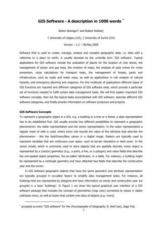
  • 1. GIS Software - A description in 1000 words * Stefan Steiniger† and Robert Weibel‡ † University of Calgary (CA), ‡ University of Zurich (CH) Version – 1.2 – 08.May.2009 Software that is used to create, manage, analyze and visualize geographic data, i.e. data with a reference to a place on earth, is usually denoted by the umbrella term ‘GIS software’. Typical applications for GIS software include the evaluation of places for the location of new stores, the management of power and gas lines, the creation of maps, the analysis of past crimes for crime prevention, route calculations for transport tasks, the management of forests, parks and infrastructure, such as roads and water ways, as well as applications in risk analysis of natural hazards, and emergency planning and response. For this multitude of applications different types of GIS functions are required and different categories of GIS software exist, which provide a particular set of functions needed to fulfill certain data management tasks. We will first explain important GIS software concepts, then list the typical tasks accomplished with GIS software, describe different GIS software categories, and finally provide information on software producers and projects. GIS Software Concepts To represent a geographic object in a GIS, e.g. a building or a tree or a forest, a data representation has to be established first. GIS usually provide two different possibilities to represent a geographic phenomenon: the raster representation and the vector representation. In the raster representation a regular mesh of cells is used, where every cell records the value of the attribute that describe the phenomenon - like the Red/Green/Blue values in a digital image. Rasters are typically used to represent variables that are continuous over space, such as terrain elevations or land cover. In the vector model, which is commonly used to store objects that are spatially discrete, every object is represented by a (vector) geometry (e.g.; a point, a line, or a polygon) and value fields that describe the non-spatial object properties, the so-called ‘attributes’, in a table. For instance, a building might be represented by a rectangle geometry and have attached two fields that describe the construction year and the owner. In GIS software geographic objects that have the same geometric and attribute representation are typically grouped in so-called ‘layers’ to simplify data management tasks. For instance, all buildings that are represented by polygons and have information on owner and construction year are grouped in a layer ‘buildings’. In Figure 1 we show the typical graphical user interface of a GIS software package that includes the concept of geometries (map view) connected to values in tables (attribute view), as well as layers that contain one class of objects (e.g. rivers). * accepted as entry “GIS software” for the Encyclopeadia of Geography, B. Warf (ed), Sage Pub. 1
  • 2. Figure 1: A typical desktop GIS user interface with map view, layer view, attribute view, tools for navigating and exploring data, as well as tools for creating and modifying geometries. Typical Tasks Accomplished with GIS Software Before any geographic analysis can take place the data need to be derived from field work, maps or satellite imagery, or acquired from data providers. Hence, data need to be created (1) and - in case something has changed - edited (2), and then stored (3). If data are obtained from other sources they need to be viewed (4) and eventually integrated (conflation) with existing data (5). To answer particular questions, e.g. who is living in street X and is affected by the planned renewal of a power line, the data are queried (6) and analyzed (7). However, some specific analysis tasks may require a data transformation and manipulation (8) before any analysis can take place. The query and analysis results can finally be displayed on a map (9). GIS Software Categories Different types of GIS software exist with different functionality, as not every GIS user needs to carry out all of the above tasks. For instance an assistant in the public services department of a city may only provide information on house owners to construction companies and does not need to edit the cadastral dataset. Table 1 and Figure 2 summarize commonly used GIS software categories. Desktop GIS usually serve all GIS tasks and are sometimes classified into three functionality categories: GIS Viewer, GIS Editor, and GIS Analyst. Spatial Database Management Systems (DBMS) are mainly used to store the data, but often also provide (limited) analysis and data manipulation functionality. WebMap Servers 2
  • 3. Figure 2: Different types of GIS software. are used to distribute maps and data over the internet1. Similarly, WebGIS Clients are used for data display and to access analysis and query functionality from Server GIS over the internet or intranet. Libraries and Extensions provide additional (analysis) functionality that is not part of the basic GIS software, for instance functions for network and terrain analysis, or functions to read specific data formats. Finally, Mobile GIS are often used for field data collection. Table 1: Typical tasks accomplished with different GIS software. ● standard functionality, ◊ optional functionality. transformation create maps GIS tasks vs. conflation creation analysis viewing storage GIS software category editing query Desktop GIS Viewer ● ● ● ◊ Editor ● ● ● ● ◊ ● ● Analyst ● ● ● ● ● ● ● ● ● Spatial DBMS ● ● ● ◊ WebMap Server ● ◊ ◊ ● ● Server GIS ● ● ● ● ● ● WebGIS Client Thin Client ● ● Thick Client ● ● ● ● ● ● ● Mobile GIS ● ● ● ● ● Libraries / Extensions ● ● ● ● ● 1 Two important standards of the Open Geospatial Consortium (OGC) for map and geodata dristribution via WebMap Servers are the Web Map Service (WMS) and Web Feature Service (WFS). 3
  • 4. Software Manufacturers and Projects GIS software is not only provided by companies but increasingly also by free and open source software projects. While commercial vendors usually offer products for all of software categories, open software projects often concentrate on a single category, e.g. desktop GIS or WebMap server. The key players in the GIS software market today are Autodesk, Bentley, ESRI Inc., GE (Smallworld), Pitney Bowes (MapInfo), and Intergraph. GIS software companies tend to target specific application domains. For instance, ESRI’s ArcGIS product tends to be mainly used for business analysis, planning, and environmental applications, while Autodesk, GE and Bentley products are rather used in utility and facility management. Competitive GIS software that is developed by free software projects exists as well - especially with respect to server applications (MapServer, GeoServer) and spatial DBMS (PostGIS). Free desktop GIS projects, such as Quantum GIS and gvSIG, currently experience growing user communities. Such free GIS software rather complements the set of proprietary software instead of competing with it. Further Readings Burrough, P.A., & R.A. McDonnell (1998). Principles of Geographical Information Systems. 2nd Edition. Oxford, UK: Oxford University Press. DeMers, M.N. (2008). Fundamentals of Geographic Information Systems. 4th Edition. Chichester, UK: John Wiley & Sons. Heywood, D.I., Cornelius, S., & S. Carver (2006). An introduction to Geographical Information Systems. 3rd Edition. Essex, UK: Pearson Prentice Hall. Longley, P.A., Goodchild, M.F., Maguire, D.J., & D.W. Rhind (2005). Geographic Information Systems and Science. 2nd Edition. Chichester, UK: John Wiley & Sons. Sherman, G.E. (2008). Desktop GIS: Mapping the Planet with Open Source Tools. Lewisville, TX: The Pragmatic Bookshelf. Steiniger, S., & E. Bocher (2009). An overview on current free and open source desktop GIS developments. International Journal of Geographical Information Science 24 (in press). 4