
Recommandé
Contenu connexe
Tendances
Tendances (20)
En vedette
En vedette (20)
Dernier
Dernier (20)
Watershed Creation
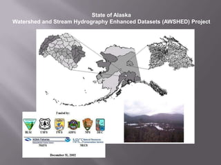
- 1. State of Alaska Watershed and Stream Hydrography Enhanced Datasets (AWSHED) Project
- 2. Project Background and Details Prior to the completion of this project, the State of Alaska had defined watersheds to the 4th Level sub-basin level. The Alaska Geospatial Data Committee (AGDC) and the Alaska state government expressed a need to further refine this scale to a watershed (5th level) and sub-watershed (6th level) system. These Watersheds and sub-watersheds would be Delineated and certified into the national Watershed Boundary Dataset (WBD), thus leading to Increased capabilities for watershed modeling and sharing of aquatic resources information in Alaska.
- 3. The following is a visual illustration of the process of watershed and sub-watershed delineation that took place.
- 4. ALASKA REGION (LEVEL 1)
- 5. SUB-REGION (LEVEL 2)
- 7. SUB-BASIN (LEVEL 4)
- 8. SUB-BASIN (LEVEL 4)
- 9. DELINEATE 5TH LEVEL WATERSHEDS ALONG THE UPLAND CONTOURS FROM THE MOST DOWNSTREAM POINT
- 10. REPEAT LAST STEP FOR NEXT WATERSHED
- 11. AND REPEAT AGAIN
- 12. UNTIL THE SUB-BASIN IS COMPLETELY DIVIDED INTO WATERSHEDS
- 13. NOW INPUT ATTRIBUTE DATA 4th level HUC No. 5th level HUC No. Downstream 5th level HUC No.
- 14. NOW DIVIDE THE 5TH LEVEL WATERSHEDS INTO 6TH LEVEL SUB-WATERSHEDS ALONG THE UPLAND CONTOURS FROM THE MOST DOWNSTREAM POINT
- 18. UNTIL THE WATERSHED IS COMPLETELY DIVIDED INTO SUB-WATERSHEDS
- 19. NOW INPUT ATTRIBUTE DATA FOR THE SUB-WATERSHEDS 5th level HUC No. 6th level HUC No.
- 20. NOW INPUT ATTRIBUTE DATA Downstream 5th level HUC No.
- 21. At time of completion over 1000 fully named and numbered watersheds were created and almost 15,000 sub-watersheds. Futher documentation on this project can be found at http://agdc.usgs.gov/hydro/