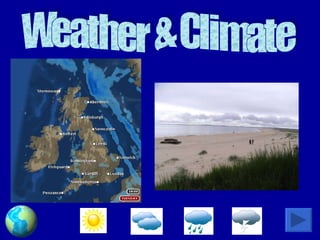
6. How do we measure weather? Temperature Sunshine Wind Air Pressure Precipitation
7.
8.
9.
10.
11.
12.
13.
14.
15.
16.
17. Global temperatures What do you notice about all the places along the dotted line? The further in land you go the hotter it gets in the Summer and the colder it gets in the Winter!
18.
19.
20. Relief rainfall Sea High land forces the air upwards where it cools and the water vapour condenses forming clouds. This in turn causes rain! Warm, moist air blows in from the Atlantic
21. Relief rainfall Sea High land forces the air upwards where it cools and the water vapour condenses forming clouds. This in turn causes rain! Warm, moist air blows in from the Atlantic
22. Convectional rainfall 1. The sun heats the ground. 2. The hot ground heats the lowest air and the water from the ground is evaporated. 3. Water vapor rapidly rises, cools and condenses.
23. Frontal rainfall Warm, moist air is forced up over the denser cool air. Water vapor condenses forming clouds and bringing rain.
24.
25. Why do we get seasons? Equator Equator S N N N S N S S SUN DECEMBER The Sun is overhead at the Tropic of Capricorn, 23½ºS JULY The Sun is overhead at the Tropic of Cancer, 23½ºN MARCH The Sun is overhead at the Equator. SEPTEMBER The Sun is overhead at the Equator. Spring Spring Autumn Autumn Summer Winter Equator TRopic of Capricorn Summer Tropic of Cancer Winter Equator
26.
27. Drawing a climate graph. Months Temperature ( °C) Rainfall (mm) A bar-chart is drawn to show the average monthly rainfall. A line graph is then added to show average monthly temperatures.
28. Draw a climate graph! The person nearest the window is to draw the climate graph for Inverness – the person nearest the door is to draw the climate graph for Stornoway!
![Contents ,[object Object],[object Object],[object Object],[object Object],[object Object],[object Object]](data:image/gif;base64,R0lGODlhAQABAIAAAAAAAP///yH5BAEAAAAALAAAAAABAAEAAAIBRAA7)