VVIP Pune Call Girls Moshi WhatSapp Number 8005736733 With Elite Staff And Re...
2009 araujo
1. HYDROLOGICAL PROCESSES
Hydrol. Process. 23, 1169–1178 (2009)
Published online 14 January 2009 in Wiley InterScience
(www.interscience.wiley.com) DOI: 10.1002/hyp.7232
Comparative hydrology: analysis of a semiarid and a humid
tropical watershed
Jos´e Carlos de Ara´ujo1
* and Julio Iv´an Gonz´alez Piedra2
1 Departamento de Engenharia Agr´ıcola, Universidade Federal do Cear´a, Fortaleza, Brazil
2 Facultad de Geograf´ıa, Universidad de La Habana, Ciudad de La Habana, Cuba
Abstract:
This paper analyses measured data from two small tropical watersheds: one in a semiarid (Aiuaba, Brazil, 12Ð0 km2
, 5 years
of measurements) and another in a humid environment (Jaruco, Cuba, 43Ð5 km2
, 21 years of measurements). The watersheds
are similar with respect to catchment area (tens of km2
), potential evaporation (2Ð1–2Ð6 m year 1
), temperature (22–30 °C)
and relief (mild hillslope steepness); but show considerable hydrological discrepancies: average precipitation in the humid
watershed is two times higher; average river discharge (mm year 1
) is five times higher; and surface water availability (mm
year 1
) is 14 times higher than in the semiarid watershed. Long-term operation of hypothetical surface reservoirs in both
basins is simulated. The analysis shows that 73% of the average river discharge are available (with 90% annual reliability)
in the humid watershed, against only 28% in the semiarid. The main cause of this difference is the excess evaporation,
which consumes 55% of the stored water in the semiarid reservoir, but only 12% in the humid one. The research concludes
that: (1) although precipitation indicators are higher in the humid area, they are of the same order of magnitude as in the
semiarid; and (2) fluvial-regime and water-availability variables are more than one order of magnitude higher in the humid
basin, which shows a multiplication effect of these hydrological processes. Such major hydrological differences, despite the
similarities between the two tropical watersheds, show the importance of further investigations in the field of comparative
hydrology. Copyright 2009 John Wiley & Sons, Ltd.
KEY WORDS semiarid tropical watershed; humid tropical watershed; hydrological differences; evaporation; Brazil
Received 22 March 2008; Accepted 6 November 2008
INTRODUCTION
The need for hydrological prediction in ungauged basins
has stimulated the use of information obtained in other
regions and/or at different spatial scales. This practice
has flaws related to information transfer among different
regions of the Earth, calling for a better understanding of
the hydrological differences among such regions, as well
as for a systematization of methods concerning the inter-
action between hydrology and ecosystems. Comparative
hydrology has the objective of filling this gap, focused
on such topics as climate change and arid/semiarid envi-
ronments. Comparative hydrology is, therefore, based on
the premise that models and methods developed in some
regions—temperate zones, for instance—might have
considerable limitations when applied to regions under
different conditions—arid or semiarid zones (Kovacs,
1984; Falkenmark and Chapman, 1993; Musiake, 2003;
Peel et al., 2004).
According to Kovacs (1993), the task of compara-
tive hydrology is, among others, to compare hydrological
processes in different regions so as to determine how
water balance depends on geographic conditions. Woo
and Liu (2006) consider that the task of comparative
* Correspondence to: Jos´e Carlos de Ara´ujo, Departamento de Engen-
haria Agr´ıcola, Universidade Federal do Cear´a, Fortaleza, Brazil.
E-mail: jcaraujo@ufc.br
hydrology is the identification of ‘regions with simi-
lar environmental attributes’ and consequent comparison
of their hydrological processes and responses, as they
did in mountainous regions of Canada and China. Park
et al. (2004) suggested the use of GIS-based informa-
tion as an important tool for a spatially-distributed com-
parative hydrology approach, and applied it to analyse
rainfall–runoff behaviour of three Asian watersheds. It
is noticeable in the literature that the number of exper-
imental areas in tropical zones is reduced compared
with temperate zones (McMahon, 1982; Falkenmark and
Chapman, 1993; Sadstr¨om, 1994).
The objective of this paper is, in this context, to
contribute to the discussion concerning comparative
hydrology by presenting new field data and analysing
similarities and differences between two tropical water-
sheds (in both hemispheres), one in a semiarid and the
other in a humid environment. To obtain meaningful
results, the watersheds should have some similarities,
which, for this research, are: (i) contribution areas of
the same order of magnitude (tens of km2
); (ii) land
use - rural; (iii) moderate hillslope steepness (5 to 20%);
and (iv) continuous hydrological monitoring of at least
5 years. The selected semiarid tropical watershed (here-
after called Stw) is the 12Ð0 km2
Aiuaba Experimental
Basin, in the north-east of Brazil, and the humid tropical
watershed (hereafter called Htw) is the 43Ð5 km2
Jaruco
Basin, in north-west Cuba. Several variables concerning
Copyright 2009 John Wiley & Sons, Ltd.
2. 1170 J. C. DE ARA ´UJO AND J. I. GONZ ´ALEZ PIEDRA
climate, morphology, rainfall, fluvial regime and water
availability are assessed and compared.
DESCRIPTION OF THE STUDY AREAS
The main characteristics of the investigated watersheds
are given in Table I. The semiarid tropical watershed
(Stw, Aiuaba Experimental Basin), located in the munic-
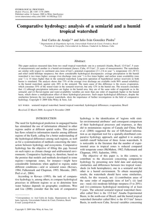
ipality of Aiuaba, State of Cear´a, Brazil (see Figure 1;
outlet coordinates 6°420
S; 40°170
W), is situated inside
the ‘drought polygon’, an area whose climate is ‘Bs’,
according to K¨oppen classification (Arag˜ao Ara´ujo, 1982;
Frischkorn et al., 2003). The geology of the south-
ern side of the watershed (upstream) is character-
ized by the crystalline complex, consisting of gran-
ite, migmatitic gneiss and banded gneiss with fascis
of mica schist (Mamede, 2008). In the northern side
(downstream) there is the Santar´em meta-sedimentary
Table I. Main characteristics of the tropical watersheds Aiuaba (Stw, 12Ð0 km2
) and Jaruco (Htw, 43Ð5 km2
)
Characteristic Stw Htw
K¨oppen climate classification Bs Aw
Average precipitation 650 mm year 1
1392 mm year 1
Annual insulation 2,600 h 2800 h
Global solar radiation 19Ð5 MJ m 2
day 1
16Ð3 MJ m 2
day 1
Relief 530–670 m.a.s.l. 20–160 m.a.s.l.
Mean hillslope steepness 19Ð4% 8Ð5%
Main river length 6Ð1 km 15Ð4 km
Main river slope 18Ð1 m km 1
7Ð1 m km 1
Geology Crystalline complex and meta-sedimentary
formation
Sedimentary Pe˜nalver Maastrichtian
formation
Soil Planosol and red-yellow Podsol Ferric deep red and carbonate shallow brown
Land use Preserved: located inside the Ecological Station
of Aiuaba
Highlands: preserved; lowlands: pasture and
sugar cane, 1Ð5% urban
Vegetation Natural Caatinga Natural Savannah and sugar cane crops
Sediment yield 2Ð4 ton km 2
year 1
90 ton km 2
year 1
Figure 1. Location of the focus watersheds: Jaruco (Htw), in the north-west of Cuba, northern hemisphere; and Aiuaba (Stw), in the north-east of
Brazil, southern hemisphere
Copyright 2009 John Wiley & Sons, Ltd. Hydrol. Process. 23, 1169–1178 (2009)
DOI: 10.1002/hyp
3. COMPARATIVE HYDROLOGY: SEMIARID AND HUMID TROPICAL WATERSHED 1171
formation (Ver´ıssimo, 2007). The basin soils are usually
shallow with rock fragments—mainly the Planosol and
Podsol (Creutzfeldt, 2006). The watershed, which is
completely located inside the ecological station of Aiuaba
of IBAMA—the Brazilian Environmental Institute—has
been integrally preserved since 1978. It is naturally cov-
ered by tropical xerophytic deciduous broadleaf vegeta-
tion (caatinga), consisting of a dense mixture of trees,
bushes and cacti (Souza and Oliveira, 2003; Mamede,
2008). Further information on the Aiuaba experimental
basin can be found in de Ara´ujo (2007).
The Cuban humid tropical watershed Jaruco (Figure 1)
has a tropical climate with relatively humid summer:
‘Aw’, according to the K¨oppen classification system
(Piedra, 2001). The region is subject to hurricanes, which
occur more frequently in September and October. The
Htw has its outlet at the Las Cavilas fluvial gauge
(23°200
N; 81°500
W) and corresponds to approximately
27% of the whole River Jaruco basin. The river, unlike
the main river of Stw, seldom runs dry, except in the
case of long droughts. The geology of the watershed
is sedimentary, predominantly the Pe˜nalver, a 180 m
thick Maastrichtian formation whose lithology encom-
passes the Basal, Lower, Middle, Upper and Upper-
most subdivisions. The formation might be related to
the Cretaceous–Tertiary boundary (K/T) impact, accord-
ing to Takayama et al. (2000). The prevailing soils are
the ferric deep red and the carbonate shallow brown.
Land use is mostly rural with highlands preserved (nat-
ural savannah and secondary vegetation), and lowlands
used mainly for cattle breeding and sugar cane cultiva-
tion. The village of Jaruco is located inside Htw, had a
population of about 10 000 inhabitants and an urban area
of about 0Ð7 km2
(roughly 1Ð5% of the catchment area)
during the monitoring period. The influence of this set-
tlement on the hydrology of the watershed is considered
negligible. Data and analyses concerning Htw characteri-
zation are based on Piedra (1981), Trujillo (1988), CUBA
(1989), and on field monitoring.
MATERIAL AND METHODS
Instrumentation
The hydrological variables of Stw have been continu-
ously monitored since January 2003. The data used in this
paper refer to the first 5 years (up to December 2007) of
the measurement programme, which uses, among others,
an automatic climate station (1 h resolution), three auto-
matic rainfall gauges (5 min resolution), an automatic
reservoir level gauge (30 min resolution), a Parshall
flume in the main river, a class A pan and an automatic
sediment sampler (see also www.hidrosed.ufc.br). The
monitoring instruments of the Jaruco watershed (Htw)
consist of two rainfall gauges with continuous measure-
ments (H-411 and H-412, Gonz´alez-Sp´ındola, 1999), four
rainfall gauges with daily measurements and an automatic
climate station measuring, with 15 min resolution, wind
velocity, radiation, temperature, air humidity and rainfall
in the nearby watershed of Guanabo (western boundary,
Figure 1). River discharges were assessed using a rating
curve of a control section located in an 80 m straight
reach at the Htw outlet, which was monitored by a limn-
igraphic gauge. Although the monitoring of climatic vari-
ables in Htw still continues, fluvial measurements ceased
at the beginning of 1986, due to the construction of a
31 Mm3
reservoir few metres upstream its outlet.
Storm precipitation
The precipitation of Stw is taken as the average of its
three rainfall gauges. Due to their planned spatial dis-
tribution, comparison between Thiessen and arithmetic-
average approaches for the 13 most intensive rainfall
events in Stw (2003–2007) showed low scatter, with
differences ranging from 10% to C6% and average dif-
ference 0Ð3%. Daily rainfall measurements in Htw used
Thiessen averages of all gauges. Regarding storms, only
the two pluviometric gauges with continuous measure-
ments were used in Htw. For storm analysis, annual series
are taken because the Stw series is short (5 years) and the
year 2004 was exceedingly wet, and partial series could
insert a biased trend. The empirical frequency of each
event is computed using the Weibull approach, according
to which frequency F D n/ N C 1 , in which ‘n’ is the
order of the event and ‘N’ is the number of observation
years. The storm analysis in Htw is based on the work of
Gonz´alez-Sp´ındola (1999), who investigated such events
for several Cuban watersheds, including the Jaruco.
Kovacz (1993) suggests that parameter ˇ (Equation
(1)) be used to compare interregional behaviour of
storms. The coefficient ˇ represents the slope of the
straight line connecting logarithm of precipitation (H,
mm) and the logarithm of its respective duration (t,
h) for a given period of return. The author states
that ˇ is approximately constant for a given region,
regardless of the period of return, and proves it correct
for several watersheds in Hungary, Kuwait, Cambodia
and Sri Lanka. In Equation (1) ε is a parameter, which
corresponds to the precipitation of the 1 h event for a
given period of return.
H D ε Ð t ˇ
1
Huff (1967) investigated the temporal evolution of
storms by plotting curves relating cumulative precipita-
tion with cumulative elapsed time. The author param-
eterized the curves with regard to the storm period of
return and to the quartile of the highest precipitation
intensity. Considering that the most intense event in Stw
has a 6-year period of return (16Ð7% probability of being
exceeded), a storm with the same period of return was
studied for Htw for comparative purpose. The duration
of the events was considered to be the respective time
of concentration, computed using the Kirpich equation
(see, for instance, Chow et al., 1988), which proved to
be consistent when comparing observed with SCS syn-
thetic hydrographs. The best-fit curve for each watershed,
Copyright 2009 John Wiley & Sons, Ltd. Hydrol. Process. 23, 1169–1178 (2009)
DOI: 10.1002/hyp
4. 1172 J. C. DE ARA ´UJO AND J. I. GONZ ´ALEZ PIEDRA
i.e. the quartile of the highest precipitation intensity, is
used as an analysis element.
Fluvial regime
The discharges of Stw are computed from the water
balance (Equation (2)) at the reservoir located at its
outlet. The existing Parshall flume data should not be
used for this purpose because it controls only two thirds
of the catchment area.
dV t
dt
D QR C QH C QG QE
C QW C QI C QO 2
V m3 ¾D ˛ Ð y3Ð0
3
In Equations (2) and (3), V D reservoir volume; t D
time; QR D river discharge into the reservoir; QH D
rainfall discharge direct into the reservoir; QG D ground-
water inflow; QE D evaporation; QW D water
withdrawal; QI D infiltration; QO D uncontrolled weir
outflow; y D reservoir level, given in metres; and ˛ is
a parameter, whose adjusted value for Stw reservoir is
655. The water balance is assessed at 1 h steps consid-
ering water-level changes, stage–volume (Equation (3))
and stage–area curves. Groundwater contribution was
shown to be negligible for the whole monitoring period
(2003–2007) due to the depth of its table level (Costa,
2007). Withdrawal is also negligible, considering that the
reservoir has not been used as a water source since 1978.
Evaporation is computed using the Penman model and
data from a nearby climate station. During the dry period
(usually 6 to 9 months a year), the terms QR, QH and QO
are zero, and Equation (2) reduces to Equation (4), which
allows computation of infiltration discharge (QI) hourly.
Costa (2007) used these data to model the infiltration rate
as a function of the reservoir level.
dV t
dt
D QE C QI 4
During the wet season, river discharge QR into the
reservoir (at the watershed outlet) can be computed using
Equation (2), considering that all remaining variables
and parameters are either directly measured or modelled.
Discharge measurements in Htw were obtained directly
from the gauge. The empirical frequency of the extreme
discharge events is computed as in rainfall events,
i.e. using the Weibull approach. Curve numbers and
watershed initial losses were calibrated using observed
and synthetic SCS hydrographs (Mishra and Singh,
2004). For more details on curve number calibration in
Stw, please refer to Costa (2007).
Water availability
Due to lack of continuous trustworthy groundwater
data, analysis in this paper considers only surface water
availability, which is assessed by designing an optimum
hypothetical reservoir at the outlet of each watershed. The
method consists of simulating long-term water balance
(Equation (5), simplified from Equation (2)) for different
reservoir sizes, computing its respective planning water
yield Q90, i.e. the water withdrawal QW with 90% annual
reliability (McMahon and Mein, 1986).
V t
t
¾D QR QED C QW C QO C υQ 5
QR t D C k t Ð 6
In Equation (5), QED D evaporation from the lake
in the dry season; and υQ D QH C QG QI C QEH ,
where QEW is the evaporation from the lake in the
wet season (note that QE D QED C QEW). The term υQ
is often assumed negligible for long-term simulations
(Campos, 1996; de Ara´ujo et al., 2006), such as in this
paper. The bars on top of the variables represent average
values over time step t. Stage–volume Equation (3) was
considered valid for analysis of both Stw and Htw reser-
voirs, so that eventual morphological differences do not
play any role in the analysis, which aims specifically at
hydrological comparison. Surface reservoir water balance
is simulated on a seasonal basis (two steps per year: wet
and dry seasons), considering mainly lake evaporation,
uncontrolled weir outflow and water withdrawal, which
depends on its operational rule. To simulate the water bal-
ance, a long-term synthetic series (10 000 years, in this
paper) of river discharge is stochastically generated using
the Ven Te Chow Equation (6), whose parameters are his-
torical average ( ) and standard deviation ( ) of annual
river discharges. Stochastic variable k is calculated using
a random seed and the two-parameter gamma probabil-
ity density function. It is relevant to remark that Farias
(2003) verified, for other semiarid watersheds in the State
of Cear´a, Brazil, that no inter-annual auto-correlation
(Markov process, for instance) was found. The objec-
tive function of the optimization process is the planning
water yield (Q90). In other words, the optimum reservoir
size is the one that yields the highest Q90, which behaves
non-linearly with the storage capacity of the reservoir:
if reservoir size is too small, uncontrolled weir outflow
is dominant, reducing the yield; whereas if it is too
large, evaporation is dominant, also reducing the yield.
In semiarid environments the objective function usually
presents a relatively sharp format, with a clear optimum
reservoir size, whereas in humid environments it often
presents a flat optimum surface (i.e. small variations of
Q90 for a wide range of reservoir sizes). In this case, the
selected reservoir size should be the smallest possible, so
as to reduce the negative impacts of dam construction.
After the storage capacity of the reservoir is selected, the
water balance simulation is repeated for various with-
drawal discharges, assessing their respective reliabilities.
As a result, a yield–reliability curve for the reservoir can
be plotted, allowing water availability analysis. A more
detailed explanation of this method and the operational
rule can be found elsewhere (de Ara´ujo et al., 2006).
Investment water costs are assessed, for both hypothet-
ical reservoirs, based on the work of de Ara´ujo et al.
(2005). The authors used data from 37 dams constructed
Copyright 2009 John Wiley & Sons, Ltd. Hydrol. Process. 23, 1169–1178 (2009)
DOI: 10.1002/hyp
5. COMPARATIVE HYDROLOGY: SEMIARID AND HUMID TROPICAL WATERSHED 1173
in the north-east of Brazil, considering annual interest rate
of 12% and 50 years for amortization. The costs (orig-
inally in Brazilian currency Real) are computed using
Equation (7), in which Cs D investment water costs (US$
m 3
); QR D long-term river discharge average; and ˛ D
reservoir shape parameter (Equation (3)).
Cs D 0Ð046 Ð Q90 QR Ð ˛0Ð10 0Ð94
7
Comparative analysis
In order to compare differences and similarities
between tropical watersheds Aiuaba and Jaruco, some
ratios are analysed. All ratios are the division of
indicators in the humid watershed by those in the
semiarid watershed and relate specific variables, so that
the different area sizes do not play any role in the
analysis. The data are clustered into four groups (as in
Table II) and, for each group, five parameters are used to
build the series of ratios. The series of Group I—general
characteristics of the watersheds—used ratios of area
(km2
), average slope, drainage density (km km 2
), aver-
age temperature (°C) and average humidity. The series
of Group II—precipitation—considers ratios of aridity
coefficient (defined as the ratio between average precip-
itation and average potential evaporation), average pre-
cipitation (mm/yr), slope coefficient ˇ, daily precipitation
Table II. Hydrological variables for the tropical watersheds Aiuaba (Stw, 12Ð0 km2
) and Jaruco (Htw, 43Ð5 km2
)
Variable Stw Htw
Group I: general characteristics
Temperature range of monthly averages (°C) 24–28 22–30
Potential evaporation E0 (m year 1
) 2Ð55 2Ð10
Relative humidity range of monthly averages 45–75% 75–85%
Drainage density (km km 2
). 4Ð4 0Ð65
Existing dams: number/storage capacity (Mm3
) One/0Ð060 Zero/0a
Years of the monitoring series 2003–2007 1965–1985
Group II: precipitation
Yearly average precipitation (mm)/Cvb
650/0Ð30 1392/0Ð25
Yearly median (mm) 559 1380
Aridity coefficient: precipitation/evaporation ratio 0Ð26 0Ð66
Monthly average (mm)/Cv 55/3Ð36 116/0Ð61
Wettest month: average (mm)/Cv Jan: 175/1Ð03 Jun: 244/1Ð20
Driest month: average (mm)/Cv Sept: 0Ð3/2Ð07 Dec: 45/1Ð80
Median month: average (mm)/Cv Jun: 26/1Ð62 Oct: 116/1Ð51
Average number of rainy days per year 81 110
Maximum observed daily rainfall (mm day 1
) 85 331
Daily rainfall for 10% highest probability (mm) 99Ð7 214Ð5
I-D-F logarithmic slope coefficient ˇc
0Ð26 0Ð39
Time of concentration (h) 1Ð1 2Ð5
Huff curve type 3rd
quartile 1st
quartile
Best-fit probability density function for storms Gumbel Log Normal/Exponential
Group III: fluvial regime
Yearly average (mm)/Cv 67/2Ð16 366/0Ð54
Yearly median (mm) 4 26
Yearly runoff coefficient average/Cv 0Ð06/2Ð10 0Ð26/0Ð50
Kurtosis of annual discharge C4Ð99 1Ð27
Highest-discharge month: average (mm)/Cv Feb: 31/2Ð19 Jun: 74/1Ð19
Lowest-discharge month: average (mm)/Cv Jun–Nov: zero. Mar: 10/1Ð07
Median month: average (mm)/Cv Dec: 0Ð02/1Ð91. Aug: 30/0Ð67
Discharge for 10% highest probability (L s 1
km 2
) 169 4418
Initial loss (mm) 30 20
Best-fit SCS curve number 42 80
Group IV: surface-water availability
Optimal storage capacity (Mm3
km 2
) 0Ð20 0Ð69
Residence time (year) 2Ð99 1Ð91
Water yield Q90 (mm year 1
) 19Ð7 279Ð8
Water yield Q90: precipitation ratio 0Ð03 0Ð20
Investment water costs (US$.m 3
) 0Ð08 0Ð03
Water yield Q99 (mm year 1
) 7Ð4 220Ð9
Average evaporation/inflow ratio 55% 12%
Average weir outflow/inflow ratio 17% 15%
Average water yield Q90/inflow ratio 28% 73%
a A dam in Htw was constructed after the end of the series used in this paper.
b Cv D coefficient of variation.
c Units used: intensity (mm h 1
); duration (h)
Copyright 2009 John Wiley & Sons, Ltd. Hydrol. Process. 23, 1169–1178 (2009)
DOI: 10.1002/hyp
6. 1174 J. C. DE ARA ´UJO AND J. I. GONZ ´ALEZ PIEDRA
for 10 year period of return and 5 min precipitation for
10 year period of return. Group III—fluvial regime—
encompasses ratios of average and median yearly dis-
charge (mm year 1
), discharge of the highest-flow month
(mm), run-off coefficient and instantaneous discharge (L
s 1
km 2
) for 10 year period of return. Ratios of Group
IV—water availability—relate optimum reservoir stor-
age capacity (Mm3
km 2
), water yield with 90% and
99% yearly reliability (mm year 1
), water volume per
US$ 1000 investment (m3
) and hydrological efficiency
(defined as Q90/QR).
RESULTS AND DISCUSSION
The main results of the research are synthesized in
Table II, which is divided into four groups of variables:
general characteristics, precipitation, fluvial regime and
surface water availability.
Data from Table II show that physiographic variables
of Stw and Htw are of the same order of magnitude.
Climates have a remarkable difference, although both
watersheds are tropical with a very similar temperature
range and average. Potential evaporation (E0) in the
watersheds is also similar (2Ð10 m year 1
in Htw and
2Ð55 m year 1
in Stw) but, considering differences in
precipitation, aridity coefficient (i.e. the ratio between
annual precipitation and annual potential evaporation) in
Stw (0Ð26) is almost one-third of the Htw coefficient
(0Ð66). According to Falkenmark and Chapman (1993,
p.71), aridity coefficients in semiarid regions are between
0Ð20 and 0Ð50, which is in agreement with the data of this
research. Intra-yearly rainfall distribution is more regular
in Htw, whereas in Stw, rainfall is concentrated in a few
months, which can be seen by comparing precipitation in
dry and wet seasons: in Htw, rainfall in the driest month
is 18% of that in the wettest, but in Stw it is less than
0Ð2%.
Fluvial regime analysis (Table II) shows some impor-
tant aspects concerning Stw. For instance, the wettest
month is January, but the highest discharges happen in
February, which can be explained by the great impor-
tance of initial soil moisture for surface runoff formation
in the basin. Intra-annual discharge in Stw is even more
concentrated than precipitation, and the river is contin-
uously dry for at least 6 months (June to November)
every year. In some cases, as in 2005, the river dried
out 50 weeks throughout the year. This is very different
from Htw, where the river flows continuously, except dur-
ing long droughts. In terms of inter-annual distribution,
Stw and Htw regimes are equally concentrated: median
yearly discharge in the semiarid river is only 6% of aver-
age discharge. In the humid river it is 7%. Infiltration
plays a more important role on surface runoff formation
in the semiarid watershed, where Hortonian runoff pre-
vails. Infiltration in Stw is considerable (reflected in high
initial loss: 30 mm) especially in the downstream side of
the basin and base-flow is practically nonexistent. Field
observation shows that only high-intensity events cause
runoff in Stw, which is not the case for Htw, and storm-
flow in the semiarid catchment is predominantly event
water, with negligible base-flow contribution, as also
observed by Sandstr¨om (1996) in the Tanzanian semi-
arid region. This is reflected in the curve number of the
watersheds: 42 in Stw against 80 in Htw. It is important
to mention that the processes involved in surface-runoff
formation are more related to the geology than to the
climatic attributes of the basins. In fact, Kovacs (1993),
based on the results of Kinoshita et al. (1986), states that
high discharges are determined by climate, whereas low
discharges are dominated by geology.
Water balance in both surface reservoirs has very
different results, as shown in Table II. For the Stw,
water balance was obtained using a discharge coefficient
of variation (Cv) different from that of the 2003–2007
series, which exceeds 2Ð16 (Table II), a high value
possibly biased by the occurrence of an extremely wet
year (2004) within the small series. Despite the high inter-
annual discharge variability in the Brazilian semiarid
region, no long-term measured series has ever registered
Cv higher than 1Ð5 (Campos, 1996; de Ara´ujo et al.,
2005; Costa, 2007), and average Cv in the region equals
1Ð0 (Campos, 1996). Therefore, in order to assess a
more probable scenario, annual-discharge Cv for Stw was
set to 1Ð0 in this paper, with average discharge equal
to that of the historical series (0Ð802 Mm3
year 1
). In
fact, simulations with Cv D 2Ð16 provided too low water
availability and too high uncontrolled water outflow,
incompatible with field measured data and with historical
information (1930–1978). The 90% water yield, used for
water resources planning purposes, is limited to 28% of
the mean river discharge in the dry area, whereas 73%
are available in the humid one. The main cause for such a
difference is the excess evaporation (evaporation minus
rainfall directly on the lake), which consumes 55% of
the water in the semiarid reservoir against 12% in the
humid one. High inter-annual discharge variability leads
to great uncontrolled losses during floods but, considering
that such variability is equally high in both tropical areas,
as mentioned before, outflow losses are also of the same
order of magnitude: 17% in the semiarid reservoir and
15% in the humid. This difference is not large due to
the considerable residence time of the semiarid reservoir:
3 years against 2 years for the humid reservoir. Further
discussion on the results is made based on the more
detailed information given in the figures.
Figure 2 presents four sets of data for storms in both
watersheds. Although yearly and high period of return
precipitations in Htw are much higher than in Stw, the
same does not occur with low period of return storms
(below 3Ð5 years). In fact, the storm precipitation curve
for Stw is much more horizontal (ˇ D 0Ð26; refer to
Equation (1)) than for Htw (ˇ D 0Ð39), considering that
practically every year there is at least one high-intensity
precipitation in the semiarid watershed, whereas in the
humid basin there are several years with only mild-
intensity precipitations. For example, the most intense
storm in the Stw series happened in the year 2005,
Copyright 2009 John Wiley & Sons, Ltd. Hydrol. Process. 23, 1169–1178 (2009)
DOI: 10.1002/hyp
7. COMPARATIVE HYDROLOGY: SEMIARID AND HUMID TROPICAL WATERSHED 1175
1
10
100
1000
1 10 100
Period of return (years)
Rainfall(mm.day-1
)
10
100
1000
10000
Peakdischarge(L.s-1
.km-2
)
Stw rainfall
Htw rainfall
Stw discharge
Htw discharge
Figure 2. Storms in Aiuaba (Stw: 2003–2007) and in Jaruco (Htw: 1965–1985): comparison of daily rainfalls and peak discharges versus period of
return
although it was below average (total rainfall 530, whereas
average is 650 mm year 1
). The data presented by
Kovacs (1993, p.138) for several countries show that
storm-curve slopes ˇ in Htw are relatively close to those
of Hungary (ˇ D 0Ð30), which could be explained by the
fact that both regions are humid, despite temperature
differences. Nonetheless, Stw storm-curve slopes are
much closer to those of Sri Lanka (ˇ D 0Ð27) than those
of Kuwait (ˇ D 0Ð60), for example, but no conclusive
explanation on that could be drawn from this research.
Data also show that, for 5 min storms, intensity in the
semiarid watershed is higher than for the humid one up to
10 years of recurrence interval. In terms of fluvial regime,
in contrast, Htw specific discharge is always about ten
times higher than that of Stw.
From Figure 3 it can be seen that the storms in
Htw are highly concentrated in the first quartile, with
80% of the whole rainfall falling in up to 15% of
the event duration. Storms in Stw, contrarily, are more
concentrated in the second and third quartiles, with 80%
of the rainfall occurring between 25% and 75% of the
precipitation duration. Observe that Stw storms approach
more closely the Huff curve for the third than for the
second quartile. Such storms tend to be more erosive than
those of the first quartile, considering that the soil will
be more humid when the most intensive rainfall occurs.
As a consequence, the highest runoff and highest rainfall
erosivity tend to occur simultaneously, leading to higher
erosion.
The hydrological efficiency of Stw presented in
Figure 4 was obtained using a discharge coefficient of
variation (Cv) equal to one, as previously explained.
Annual discharge Cv in Htw (0Ð55) is closer to those
of humid temperate areas, such as in Europe, than to
that of the tropical semiarid Stw. Falkenmark and Chap-
man (1993, p.91 and p.180) present several values of Cv
for rivers in Hungary (0Ð33), France (0Ð28–0Ð43), UK
(0Ð19–0Ð32) and Germany (0Ð31). Figure 4 shows that
the objective function applied to the semiarid reservoir is
relatively sharp, with a maximum value (28% efficiency)
occurring for specific storage of 0Ð20 Mm3
km 2
. This
does not occur in Htw function, as previously mentioned.
0.00
0.10
0.20
0.30
0.40
0.50
0.60
0.70
0.80
0.90
1.00
0.00 0.10 0.20 0.30 0.40 0.50 0.60 0.70 0.80 0.90 1.00
t/tmax
H/Hmax
1st quartile
2nd quartile
3rd quartile
4th quartile
Stw
Htw
Figure 3. Huff storm curves and observed storm events for Stw and Htw.
Curves and events refer to a 6 year period of return. The duration of the
observed events equals the time of concentration of the watersheds (1Ð1 h
for Stw and 2Ð5 h for Htw)
The humid-area function behaves almost asymptotically
for specific storage ranging from 0Ð69 Mm3
km 2
up
to 7Ð0 Mm3
km 2
(maximum simulated size), with effi-
ciency smoothly growing from 73% to 76%, correspond-
ingly. Considering the numerous impacts of a large-
dam construction, the selected Htw reservoir size was
0Ð69 Mm3
km 2
.
The yield–reliability curves for both reservoirs are
plotted in Figure 5, and indicate the surface-water avail-
ability in each basin. The available specific discharges in
Htw are clearly superior to those of Stw—at least one
order of magnitude—and differences increase with reli-
ability. This has an important impact on water resources
planning. For example, water supply for temporary crop
irrigation is often made at a 75% annual reliability
basis. For this reliability level, Htw reservoir can deliver
331 mm year 1
against 30 mm year 1
for Stw, a ratio of
Copyright 2009 John Wiley & Sons, Ltd. Hydrol. Process. 23, 1169–1178 (2009)
DOI: 10.1002/hyp
8. 1176 J. C. DE ARA ´UJO AND J. I. GONZ ´ALEZ PIEDRA
0.69
0.1
1
10
100
0.001 0.01 0.1 1 10
Reservoir storage capacity per unit
catchment area (Mm3
.km-2
)
Hydrologicalefficiency
Q90/QR(%)
Stw
Htw
0.20
Figure 4. Hydrological efficiency (Q90/QR) as a function of reservoir
storage capacity per unit catchment area for Aiuaba (Stw) and Jaruco
(Htw). The boxes indicate the optimum reservoir sizes: 0Ð20 Mm3 km 2
for Stw and 0Ð69 Mm3 km 2
for Htw
11 between them. On the other hand, water availability
for 99% reliability (Q99), used for household water sup-
ply, is estimated to be 221 mm year 1
in Htw against
only 7 mm year 1
in Stw, which raises the ratio to 30.
Another important issue concerning surface water avail-
ability is the temporal lowering of the yield–reliability
curves due to reservoir silting. De Ara´ujo et al. (2006)
quantified such impacts for semiarid reservoirs by plot-
ting the yield—reliability curves for seven reservoirs 0n
two occasions: in the year of construction and several
decades later, when the silting impact on water availabil-
ity could be assessed. In one case (Varzea Boi reservoir),
water demand (5 Mm3
year 1
) could be provided with
2Ð5% yearly scarcity probability (97Ð5% reliability) in
1954, whereas the scarcity probability for the same yield
rose to 5Ð0% (95Ð0% reliability) in year 2000, i.e. water
scarcity probability doubled in less than five decades.
Mamede et al. (2007) applied the same methodology to
a sub-humid reservoir for different global-change scenar-
ios, finding similar results in the case of intense defor-
estation. Although this can be a problem to reservoirs in
any climate, it is of greater concern in semiarid and arid
regions, where conflicts for water are a present reality (de
Ara´ujo et al., 2004).
Results plotted in Figure 6 suggest qualitative differ-
ences and similarities in the two tropical regions. The
0.01
0.1
1
10
100
1000
50 60 70 80 90 100
Reliability (%)
Wateryield(mmperyear)
Stw
Htw
Figure 5. Surface water yield–reliability curves for the optimum reservoir
sizes: 2Ð40 Mm3 for Aiuaba (Stw) and 30Ð0 Mm3 for Jaruco (Htw)
general-characteristics ratios are close to unity, with aver-
age 1Ð3. The most different parameter is the surface area
(3Ð6 times higher in Htw), and the least is average annual
temperature: 27 °C in Htw against 26 °C in Stw. The
ratios examined in group II (precipitation) are roughly
two times higher in Htw, although some low period of
return and short-duration storms in Stw exceed those in
Htw. Fluvial regime ratios (group III) present a broader
range, with average nine and median five times higher in
Htw. The lowest fluvial regime ratio (that between high-
est discharge months) is almost 2Ð5, whereas the highest
(between 10% probability specific discharges) surpasses
26. The most critical difference between the watersheds
is the surface water availability (group IV). Ratios range
from 3 (for hydrological efficiency) to 30 (for Q99). The
ratios are, on average, 11 times higher for the humid
watershed than for the semiarid one, taking into consid-
eration specific indexes (mm year 1
). The broken line of
Figure 6 suggests that the average ratio increases approx-
imately exponentially with the number of the cluster
group.
CONCLUSIONS
Despite some similar characteristics of the two small
tropical watersheds investigated, such as catchment area,
potential evaporation, temperature and relief, hydrologi-
cal variables differ considerably. The main conclusions
drawn from this research are:
1. Average and storm precipitation variables are of the
same order of magnitude as those in Stw, but usually
higher in Htw (double, on average). Exceptions are low
period of return (below 3Ð5 years) and short-duration
(5 min) storms, which are more intense in Stw.
2. Fluvial regimes in the focus areas are different: the Htw
main river is perennial with base-flow discharge and
moderate inter-annual variability; the Stw main river
is ephemeral (completely dry 6 months a year), with
flow composed predominantly by event water and with
high inter-annual variability.
0.1
1
10
100
Ratios
Class I Class II Class III Class IV
Figure 6. Box plot of comparative ratios between tropical watersheds
Aiuaba (Stw) and Jaruco (Htw): Class I represents general characteristics;
Class II precipitation; Class III fluvial regime; and Class IV water
availability. Plots show minimum, maximum, average and average š
(1/2).standard deviation. The dotted line represents an exponential curve
relating class with average ratios
Copyright 2009 John Wiley & Sons, Ltd. Hydrol. Process. 23, 1169–1178 (2009)
DOI: 10.1002/hyp
9. COMPARATIVE HYDROLOGY: SEMIARID AND HUMID TROPICAL WATERSHED 1177
3. Surface-water availability in the humid and semiarid
areas differs considerably, e.g. for 99% annual reliabil-
ity, Htw yields 7Ð0 L s 1
km 2
against 0Ð2 L s 1
km 2
in Stw. Considering that aridity in Stw is higher, which
leads to higher water demand, water stress in Stw will
exceed that of Htw by two orders of magnitude for
similar land use.
4. The 90% reliable water yield, used for water resources
planning purposes, is limited to 28% of the mean river
discharge in the dry area, whereas 73% are available
in the humid one. The main cause of such a difference
is the excess evaporation on the lake, which consumes
55% of the water in the semiarid reservoir against 12%
in the humid one.
5. Regarding the differences between the investigated
semiarid and humid tropical watersheds, surface water
availability differs most strongly, while precipitation
characteristics differ least strongly. River discharge
characteristics fall in between.
The finding of such differences in two tropical catch-
ments shows the importance of both comprehension and
quantification of the hydrological processes in watersheds
under the comparative hydrology approach.
ACKNOWLEDGEMENT
The authors are grateful to the Cuban and Brazilian Gov-
ernments for sponsoring the bilateral project ‘Manejo de
Cuencas Hidrogr´aficas Tropicales—An´alisis Compara-
tivo de Experiencias en Brasil y en Cuba’ (CAPES/MES-
Cuba, process 018/06), including the post-doctorate
scholarship of the first author. The authors also thank
the German Research Foundation DFG (SESAM Project),
the Brazilian Research Council CNPq (PROSED project,
process 552411/2005-1) and IBAMA for supporting the
monitoring program of the Aiuaba Experimental Basin.
REFERENCES
Arag˜ao Ara´ujo JA. 1982. Dam in the Northeast of Brazil. DNOCS:
Fortaleza, Brazil.
Campos JNB. 1996. Reservoirs Design (in Portuguese). UFC, Federal
University of Cear´a: Fortaleza, Brazil.
Chow VT, Maidment DR, Mays LW. 1988. Applied Hydrology.
McGraw-Hill: New York.
Costa AC. 2007. Hydrology of an experimental basin in a Caatinga
preservation area in Brazilian semiarid region (in Portuguese). MSc
thesis, Civil Engineering, Federal University of Cear´a, Fortaleza,
Brazil.
Creutzfeldt B. 2006. Remote sensing based characterization of land
cover and terrain properties for hydrological modeling in the semiarid
Northeast of Brazil. MSc thesis, Institute of Geoecology, University
of Potsdam, Germany.
CUBA. 1989. Nuevo Atlas Nacional de Cuba. Instituto de Geograf´ıa
Tropical and Intituto de Geodesia y Cartograf´ıa, REA: Madrid.
De Ara´ujo JC. 2003. Reservoirs silting in the semiarid region: modelling
and validation (in Portuguese). Revista Brasileira de Recursos H´ıdricos
8(2): 39–56.
De Ara´ujo JC, D¨oll P, G¨untner A, Krol M, Abreu CBR, Hauschild M,
Mendiondo EM. 2004. Water scarcity under scenarios for global
climate change and regional development in semiarid Northeastern
Brazil. Water International 29(2): 209–220.
De Ara´ujo JC, Molinas PA, Joca E, Barbosa C, Bemfeito C, Belo P.
2005. Availability and distribution water costs by several sources in
Cear´a (in Portuguese). Revista Econˆomica do Nordeste, BNB, 36(2):
281–307.
De Ara´ujo JC, G¨untner A, Bronstert A. 2006. Loss of reservoir volume
by sediment deposition and its impact on water availability in
semiarid Brazil. Hydrological Sciences Journal-Journal des Sciences
Hydrologiques 51(1): 157–170, DOI:10Ð1623/hysj.51Ð1Ð157.
De Ara´ujo JC. 2007. Entropy-based equation to assess hillslope
sediment production. Earth Surface Processes and Landforms 32(13):
2005–2018, DOI:10Ð1002/esp.1502.
Falkenmark M, Chapman T (eds). 1993. Hidrolog´ıa comparada: un
enfoque ecol´ogico a los recursos h´ıdricos y de suelo. UNESCO-
CEDEX: Madrid.
Farias JAM. 2003. Methods of generation of monthly discharges and
their influence on yield-reliability curves in the State of Cear´a (in
Portuguese). MSc thesis, Federal University of Cear´a, Fortaleza, Brazil.
Frischkorn H, de Ara´ujo JC, Santiago MMF. 2003. Water resources of
Cear´a and Piau´ı. In Global Change and Regional Impacts, Gaiser T,
Krol M, Frischkorn H, de Ara´ujo JC (eds). Springer-Verlag: Berlin;
87–94.
Gonz´alez-Sp´ındola L. 1999. Recomendaciones metodol´ogicas para la
estimaci´on de los eventos extremos: lluvias y gastos m´aximos en Cuba.
Dr dissertation, Civil Engineering Faculty, Politechnical Superior
Institute Jos´e Antonio Echeverr´ıa, Havana, Cuba.
Huff FA. 1967. Time distribution of rainfall in heavy storms. Water
Resources Research 3(4): 1007–1019.
Kinoshita T, Takeuchi K, Musiake K, Ikebushi S. 1986. Hydrology
of warm and humid lands. Workshop of Comparative Hydrology,
Budapest, July.
Kovacs G. 1984. Proposal to construct a coordinating matrix for
comparative hydrology. Hydrological Sciences Journal-Journal des
Sciences Hydrologiques 29(4): 435–443.
Kovacs G. 1993. T´ecnicas para comparaci´on interregional. In Hidrolog´ıa
comparada: un enfoque ecol´ogico a los recursos h´ıdricos y de
suelo, Falkenmark M, Chapman T (eds). UNESCO-CEDEX: Madrid;
133–145.
Mamede GL. 2008. Reservoir sedimentation in dryland catchments:
Modelling and management. Dr dissertation, Institute of Geoecology,
University of Potsdam, Germany.
Mamede GL, de Ara´ujo JC, Bronstert A. 2007. Global change scenarios
in the prediction of reservoir sedimentation. In III International
Symposium on Integrated Water Resources Management, Bochum.
IAHS Publication 317; 137–142.
McMahon TA. 1982. World hydrology: does Australia fit? Institute
Engineering Australian Natural Conference Publication 82(3): 1–7.
McMahon TA, Mein RG. 1986. River and reservoir yield. Water
Resources Publications: Littleton, CO, USA.
Mishra SK, Singh VP. 2004. Long-term hydrological simulation based on
the Soil Conservation Service curve number. Hydrological Processes
18(7): 1291–1313, DOI:10Ð1002/hyp.1344.
Musiake K. 2003. Hydrology and water resources in monsoon Asia:
a consideration of the necessity of establishing a standing research
community of hydrology and water resources in the Asia Pacific region.
Hydrological Processes 17(14): 2701–2709, DOI:10Ð1002/hyp.1428.
Park J, Kojiri T, Tomosugi K. 2004. Proposal of comparative hydrology
using GIS-based distributed runoff model. Journal of Japan
Society of Hydrology and Water Resources 17(4): 368–380.
DOI:10Ð3178/jjshwr.17Ð368.
Peel MC, McMahon TA, Finlayson BL. 2004. Continental differences in
the variability of annual runoff-update and reassessment. Journal of
Hydrology 295(1–4): 185–197, DOI:10Ð1016/j.jhydrol.2004Ð03Ð004.
Piedra JIG. 1981. Computation and spatial distribution of water balance
elements of Cuban occident (in Russian), BINITI Journal, University
of Lomonosov, Moscow.
Piedra JIG. 2001. Caracter´ısticas temporales y espaciales de la
evaporaci´on desde la superficie libre del agua en el occidente de la
Isla de Cuba. Revista Alquibla 7: 179–196.
Sandstr¨om K. 1996. Hydrochemical deciphering of streamflow generation
in semi-arid east Africa. Hydrological Processes 10(5): 703–720,
DOI:10Ð1002/(SICI)1099-1085(199605)10 : 5.
Souza MJN, Oliveira VPV. 2003. Physical and environmental context in
the state of Cear´a. In Global Change and Regional Impacts, Gaiser T,
Krol M, Frischkorn H, de Ara´ujo JC (eds). Springer-Verlag: Berlin;
95–104.
Takayama H, Tada R, Matsui T, Iturralde-Vinent MA, Oji T, Tajika E,
Kiyokawa S, Garcia D, Okada H, Hasegawa T, Toyoda K. 2000.
Origin of the Pe˜nalver Formation in northwestern Cuba and its relation
Copyright 2009 John Wiley & Sons, Ltd. Hydrol. Process. 23, 1169–1178 (2009)
DOI: 10.1002/hyp
10. 1178 J. C. DE ARA ´UJO AND J. I. GONZ ´ALEZ PIEDRA
to K/T boundary impact event. Sedimentary Geology 135(1–4):
295–320, DOI:10Ð1016/S0037-0738(00)00079-8.
Trujillo LM. 1988. Aspectos sobre la valoraci´on est´etica en el
asentamiento Jaruco y sus alrededores. MSc thesis, Faculty of
Geography, University of Havana, Cuba.
Ver´ıssimo CUV. 2007. Geology of the Aiuaba Experimental Basin
(in Portuguese). Technical Report. Department of Geology, Federal
University of Cear´a, Fortaleza, Brazil.
Woo M-K, Liu C. 2006. Mountain hydrology of Canada and China: a
case study in comparative hydrology. Hydrological Processes 8(6):
573–587, DOI:10Ð1002/hyp. 3360080608.
Copyright 2009 John Wiley & Sons, Ltd. Hydrol. Process. 23, 1169–1178 (2009)
DOI: 10.1002/hyp