
Recommandé
Recommandé
Contenu connexe
Tendances
Tendances (19)
Similaire à 2004-06-24 Satellite Data Us in PM Management: A Retrospective Assessment
Similaire à 2004-06-24 Satellite Data Us in PM Management: A Retrospective Assessment (20)
Plus de Rudolf Husar
Plus de Rudolf Husar (20)
Dernier
Dernier (20)
2004-06-24 Satellite Data Us in PM Management: A Retrospective Assessment
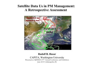
- 1. Satellite Data Us in PM Management: A Retrospective Assessment Rudolf B. Husar CAPITA, Washington University Presented at A&WMA’s 97 th Annual Conference and Exhibition June 22-27, Indianapolis, IN MexicanSmoke
- 2. Early Satellite Detection of Manmade Haze, 1976 Regional Haze Low Visibility Hazy ‘Blobs’ Lyons W.A., Husar R.B. Mon. Weather Rev. 1976 SMS GOES June 30 1975
- 6. Just like the human eye, satellite sensors detect the total amount of solar radiation that is reflected from the earth’s surface ( R o ) and backscattered by the atmosphere from aerosol, pure air, and clouds. A simplified expression for the relative radiatioin detected by a satellite sensor (I/I o ) is: I / I o = R o e - + (1- e - ) P Satellite Detection of Aerosols Today, geo-synchronous and polar orbiting satellites can detect different aspects of aerosols over the globe daily. where is the aerosol optical thickness and P the angular light scattering probability.
- 8. Information ‘Refinery’ Value Chain (Taylor, 1975) Organizing Grouping Classifying Formatting Displaying Analyzing Separating Evaluating Interpreting Synthesizing Judging Options Quality Advantages Disadvantages Deciding Matching goals, Compromising Bargaining Deciding e.g. CIRA VIEWS e.g. Langley IDEA RAW System e.g. WG Summary Rpt e.g. RPO Manager Informing Knowledge Action Productive Knowledge Information Data
- 9. Asian Dust Cloud over N. America On April 27, the dust cloud arrived in North America. Regional average PM10 concentrations increased to 65 g/m 3 In Washington State, PM10 concentrations exceeded 100 g/m 3 Asian Dust 100 g/m 3 Hourly PM10
- 10. The Asian Dust Event of April 1998 On April 19, 1998 a major dust storm occurred over the Gobi Desert The dust cloud was seen by SeaWiFS, TOMS, GMS, AVHRR satellites The transport of the dust cloud was followed on-line by an an ad-hoc international group China Mongolia Korea
- 11. Supporting Evidence: Transport Analysis Satellite data (e.g. SeaWiFS) show Sahara Dust reaching Gulf of Mexico and entering the continent. The air masses arrive to Big Bend, TX form the east (July) and from the west (April)
- 15. May-June 2003 Siberian Fires
- 20. Retrieved Optical Depth 2000.08.15
- 21. Retrieved Optical Depth 2000.08.18
- 22. CAPITA NASA REASON Project: Application of Satellite Data to PM Management Schematic representation of data sharing in a federated information system. Based on the premise that providers expose part of their data (green) to others Data Federation Concept and the FASNET Network
- 24. Web-based data delivery: Analysts Console
- 25. Near Real Time Public Satellite Data Delivery
- 26. Interactive Virtual Workgroup Websites July 2002 Quebec Smoke
- 27. R eal-Time A erosol W atch (RAW) RAW is an open communal facility to study non-industrial (e.g. dust and smoke) aerosol events , including detection, tracking and impact on PM and haze. RAW output will be directly applicable, to public health protection, Regional Haze rule, SIP and model development as well as toward stimulating the scientific community. The main asset of RAW is the community of data analysts, modelers, managers and others participating in the production of actionable knowledge from observations, models and human reasoning The RAW community will be supported by a networking infrastructure based on open Internet standards (web services) and a set of web-tools evolving under the umbrella of Fast Aerosol Sensing Tools for Natural Event Tracking (FASTNET) . Initially, FASTNET is composed of the Community Website for open community interaction, the Analysts Console for diverse data access and the Managers Console for AQ management decision support.