SlideShare une entreprise Scribd logo
1  sur  29
Blue RockUniversity Circle’s lost neighborhood
Sat. July 25, 2015, 2-4 pm, $5/person
Roy Larick
© 2015
Bluestone Heights
bluestoneheights.org
Two-mile interpretive hike
RSVP
welling@doanbrookpartnership.org 216-325-7781
Doan Brook Watershed Partnership
Sponsored by the
Led by
Blue RockUniversity Circle’s lost neighborhood
© 2015
Bluestone Heights
bluestoneheights.org
Blue Rock rose on a special local natural landscape comprising
lower Cedar Glen, the confluence of Blue Rock and Doan Brooks
and the outflow of a sulfurous spring.
Blue Rock is the forgotten neighborhood at the base of Cedar Hill.
The landscape is now dominated by the Nickel Plate/RTA track
corridor, several arterial highways and the buildings and parking
lots of CWRU and Judson Park.
In the 1880s, the Ambler family opened a water cure at the spring
and platted residential streets at the foot of Cedar Glen.
The Blue Rock hike explores remnants of the once complex natural
terrain, outlines the cultural transformation of the natural
landscape, and proposes small ways to rebuild ecological function.
Blue RockUniversity Circle’s lost neighborhood
© 2015
Bluestone Heights
bluestoneheights.org
The Blue Rock hike begins and ends in the Nighttown parking lot,
12375 Cedar Rd (25¢/hr). We cover ~2 mi of paved and earthen
paths with an optional short section on broken ground. The circuit
descends ~140' and rises back the same amount.
Sat. July 25, 2015, 2-4 pm, $5/person
RSVP
welling@doanbrookpartnership.org 216-325-7781
Doan Brook Watershed Partnership
Sponsored by the
© 2015
Bluestone Heights
bluestoneheights.org
Nature
Blue RockUniversity Circle’s lost neighborhood
A Bluestone Heights blog post details the Blue Rock Spring area:
http://bluestoneheights.org/bsh/2011/06/17/blue-rock-spring/
North
Cleveland Cleveland Heights
hike
pathway
LittleItaly
Blue Rock
Ambler Hts
Euclid Hts
The name, Blue Rock, likely derives from the Euclid bluestone, the
fine sandstone bedrock unit that caps the lowest terrace of the
Portage Escarpment.
Early settlers quarried 'blue rock' at several terrace locations,
including the top of Cedar Hill. In the 1870s, ‘blue rock’ found a
national market as Euclid bluestone.
bluestone
quarry
bluestone
quarry
bluestone
quarry
The bluestone terrace makes for the Hills rising to the East Side
Heights. Mayfield Hill and Cedar Hill are examples.
Geologists identify the rock unit as an informal member of the
Bedford formation, also calling it the Euclid bluestone.
North
Cleveland Cleveland Heights
hike
pathway
LittleItaly
Blue Rock
Ambler Hts
Euclid Hts
Blue Rock Brook on the Portage Escarpment
Comprising three small branches, Blue Rock Brook drains
the Euclid Heights and Ambler Heights neighborhoods,
from the bluestone terrace to Doan Brook.
In Euclid Heights, the Kent and Deming branches coalesce
under Euclid Heights Blvd to descend Cedar Glen.
In Ambler Heights, the Ambler branch travels its own
ravine to meet the trunk stream at the base of Cedar Hill.
bluestone
quarry
bluestone
quarry
bluestone
quarry
sandstone terrace
bluestone terrace
Portage Escarpment
Schematic view looking
southward from Lake Erie
Blue Rock
hike area
Blue Rock Brook descends the Portage Escarpment, Cleveland’s major terrain feature. This ancient bedrock
massif resisted the bulldozing effects of Ice Age glaciations.
As the last glacier retreated northward about 14 thousand years ago, rushing melt water spawned our
‘escarpment run’ streams including Doan and Blue Rock Brooks.
The Blue Rock settlement straddles the confluence of Doan and Blue Rock Brooks at escarpment base.
Bedrock deposition, glacial sculpting and stream cutting produced the natural landscape.
© 2015
Bluestone Heights
bluestoneheights.org
lake plain
Blue RockUniversity Circle’s lost neighborhood
© 2015
Bluestone Heights
bluestoneheights.org
History
A Bluestone Heights blog post details the Blue Rock Spring area:
http://bluestoneheights.org/bsh/2011/06/17/blue-rock-spring/
403
411
404
412
1881
1874
403
411
404
412
Blue Rock spring
Early Doan’s Corners residents
frequented a sulfurous spring in the
northern part of Cleveland Original
Lot 411. The parcel had ambiguous
ownership up through the 1860s.
In 1872, dentist Nathan Ambler
(1823-1888) and wife Martha Buell
bought much of lots 411 and 412,
which included the spring and the
lower part of Cedar Glen.
Shortly thereafter, the Amblers
fenced the spring area.
Nickel Plate RR construction began in
1881. The line opened in 1883.
N.H.Ambler
During the late 1870s, the Amblers
took on Daniel O. Caswell (1857-
1906) as business partner and
heir. The group began developing
Blue Rock.
In 1880, Blue Rock Springs opened as
a hydrothermal resort, The bathhouse
was built directly over the spring with
baths cut into the bedrock.
Blue Rock Springs
Nickel Plate
Road Historical
& Technical
Society
NYC&StL Ry
Right of Way Map
c. 1883
Blue Rock Station?
In 1955, CTS built
the Cedar rapid
transit station on
the Cedar site.
The RTA Red Line
station is called
Cedar-University.
The platform may have
been planned for just north
of Cedar or, less likely, just
south of Highland. Blue Rock would be a better name!
At right, ‘Nickel Plate’ (NYC&SL) Railroad Circular No. 82
is auspicious, but no timetable mentions Station 179 and
no map shows any such facility. Might the Ambler group
have lobbied for a station that never materialized?
NYC&StL Ry
Right of Way Map
c. 1883
Nickel Plate
Road Historical
& Technical
Society
NYC&StL Ry
Right of Way Map
c. 1883
403
411
404
412
1898 Daniel O. Caswell was a tireless
promoter for the resort. The business
grew in popularity during the 1890s,
the heydays for the ‘water cure’.
By the early 1900s, ‘hydrotherapy’
moved into full service hospitals—just
at the time its health benefits were
being questioned. Blue Rock Springs
responded with more park-like
amenities, such as a dance platform
and picnic areas.
The Blue Rock residential neighborhood was platted
in relation to the resort and to the Cedar Ave link
between Doan's Corners and the emerging 'Heights'.
Blue Rock Place (current Glenwood Ave) and Caswell
St (current E. 114th) focused the development which
included E Highland St (current Fairchild Ave) as well
as parts of Murray Hill, Cedar and Ambleside. From
about 1890, houses were built on the north side of
Cedar Ave.
Blue Rock Brook
North and south parts of the map are offset east-west along Cedar Rd.
At his death on March 11, 1897, Dare
was City of Lakewood engineer and an
Early Settlers Association member.
(Cleveland Plain Dealer)
…
Blue Rock Springs, c. 1900 (WRHS)
At left is a unique view of small natural features
at the confluence of Doan & Blue Rock Brooks.
The photographer shot northwest from under
the Nickel Plate Railroad bridge, across Cedar
Rd, along Doan Brook (white line below).
Visible are two ‘outliers’ (red & white), bedrock
islands left, by chance, as the Doan/Blue Rock
confluence meandered around the location.
The area is now entirely transformed within the
University Circle built environment (below left).
The one period topographic view comes from
the Cleveland Parks Dept map of c. 1900,
entitled Eastern Parkway (below).
Blue Rock Place crossed
the NKP tracks to enter
the resort’s east border.
Blue Rock, c. 1900Eastern Parkway map (~1900)
Cleveland Public Library
The purple contour
represents the low bluff
around the confluence
floodplain, including the
crests of the two bedrock
‘island’ outliers.
‘Blue Rock’ photographs from the
Western Reserve Historical Society
?
403
411
404
412
1920
1912
403
411
404
412
By 1912, the resort was demolished
with college athletic fields tooking
over the spring area. E. Highland Ave
was renamed Fairchild. Blue Rock
Place was now Glenwood Ave.
As Cedar was becoming a major
automobile thoroughfare, it was
widened on the north side. Several
1890s houses were demolished. Some
houses still stood on the south side of
Cedar, along Buell Place (named for
Martha Buell Ambler), but they would
later be cleared for a yet wider road.
In 1920, Blue Rock Brook was still
open. The area of its course is now the
green space between Cedar and
Glenwood. The stream flows directly
under the RTA Cedar-University
station. The new bioswale symbolizes
the stream (slide 22, below).
WRHS 7151
In a development plan of the mid
1920s, neither Blue Rock nor its
brook is to be found.
Lincoln
Storage
Doan Brook
Ambler Park
infrastructure
Cleveland Memory ProjectCleveland Memory Project
Cleveland Memory Project
Looking northeast across Doan Brook along old Ambleside to current
Ambleside (at cliff base).
Looking south-southeast from East Blvd (MLK), up Doan Brook to Fairhill
(Stokes Blvd).
Looking north-northwest down Doan Brook from
Fairhill (Stokes Blvd) to East Blvd (MLK).
Looking south-southeast from NKP tracks across East
Blvd (MLK) to the Baldwin Reservoir. Doan Brook
culvert construction in foreground.
In 1929, construction of the
Cleveland Union Terminal Railroad
was fully recorded in photographs.
CSU Special Collections now owns
the set which are online as part of
the Cleveland Memory Project.
Four of many showing CUT RR
work around “East Boulevard.”
Water mains feeding the
Baldwin Reservoir from
the Kirtland Pump Station
Looking SSE, up Doan Brook,
March 1929
Cleveland Memory Project
Gulf north wall, above North Park. Bluestone level
near top. Chestnut Hills Dr lies behind the left tree
line.
camera
viewpoint
Doan Brook
Cleveland Memory Project
In 1894, Martha Ambler and Daniel
O. Caswell donated 25 acres for the
construction of Ambler Park.
At its lower end, the Ambler Park
was bordered by East Boulevard.
Area landscaping was of high quality.
Looking SSE, up Doan Brook,
March 1929
Looking SSE, up Doan Brook,
Google Earth
Ambler Park
infrastructure
Blue RockUniversity Circle’s lost neighborhood
© 2015
Bluestone Heights
bluestoneheights.org
Hike Highlights
A Bluestone Heights blog post details the Blue Rock Spring area:
http://bluestoneheights.org/bsh/2011/06/17/blue-rock-spring/
The Blue Rock hike begins and ends in the Nighttown parking lot,
12375 Cedar Rd (25¢/hr). We cover ~2 mi of paved and earthen
paths with an optional short section on broken ground. The circuit
descends ~140' and rises back the same amount.
Blue Rock hike itinerary
1. Leave Nighttown parking lot.
2. Descend the Ranney ramp at
the Case dorms.
3. Visit the Blue Rock area.
4. Head south to Doan Brook
and Ambler Park.
5. Stop at the culvert entry.
6. Proceed upstream to the
retention basin.
7. Stop at bluestone outcrop.
8. Mount to cross N. Park and
go north on Chestnut Hills.
9. Stop at Ambler ravine.
10. Stop at the Gill house.
11. Return to Nighttown.
Nighttown
parking lot
Ranney
ramp
Blue Rock
spring
culvert entry
retention
basin
bluestone quarry
bluestone
outcrop
Ambler
Park
Gill house
Escarpment ramp roads
Parallel to local streams, ‘ramps’
connected lowlands and uplands.
Native Americans first defined the
ramps. Early Euro-American
settlers appropriated them.
Superior, Lee, Taylor, and Noble
Rds are examples.
Ranney ramp
A true parallel ramp may have
traversed the escarpment on
land Nathan Ambler sold to
Rufus P. Ranney in the 1870s.
The ramp now holds the covered
switchback stairway linking the
lower and upper Case dorms.
About 1905, the Southworths
graded a second switchback
ramp on their property.
1912
For Blue Rock Brook, Cedar Glen
Parkway is the exceptional ramp
lying within the stream valley.
Blue Rock Brook culvert & RTA bioswale
The Blue Rock settlement was platted on the
north bank of Blue Rock Brook to face Cedar
Glen Parkway. With successive road
widening, houses were demolished and the
brook was buried.
The culvert lies under the green space
between current Cedar and Glenwood.
In front of the new RTA Cedar-University Red
Line station, the bioswale essentially lies
over the brook.
Blue Rock significance
Blue Rock typified a natural amenity
settlement of the late 1800s. Springs,
streams, rock outcrops and the Lake Erie
shoreline served as natural bases. In some
places, a Christian tabernacle took
advantage of the amenity.
Blue Rock, like many amenity settlements,
lost its nature during the early 1900s. The
RTA bioswale is a first attempt to recover a
small bit of Blue Rock Brook.
Ambler Park culvert entry
The entrance to the University
Circle culvert sits below grade.
Stream flow crosses a weir and
then drops down to the culvert
level. The entry is an impressive
brick structure.
Doan Brook University Circle culvert
Upon leaving Blue Rock, the hike
heads upstream on Doan Brook to
Ambler Park. Here, we find Doan as
it drops into the University Circle
culvert. From this point in Ambler
Park, Doan flows underground all the
way to southern Wade Park. Along
the way, it picks up Blue Rock Brook.
Doan Brook Ambler Park retention basin
From the culvert entry, we trek upstream
to arrive at the Ambler Park retention
basin, shown here after a heavy rainfall.
After viewing the monstrosity, we climb
up over the Euclid bluestone to arrive at
the intersection of North Park Blvd and
Chestnut Hills Dr.
Euclid bluestone outcrop above the retention basin
Ambler Ravine
Blue Rock Brook’s Ambler branch drains
much of Ambler Hts. It descends a small
ravine to meet the trunk stream near the
base of Cedar Hill.
The ravine cuts through Euclid bluestone
and Cleveland Shale bedrock units. The
ravine bottom is full of bluestone rubble.
The area has bluestone retaining walls.
The 1898 map shows the Ambler
branch traversing a street grid
never fully implemented.
Currently, Chestnut Hills Drive
derives from sections of Beacon
Hill St, ‘Ave’ and ‘Harcourt’.
Harcourt derives from Northwood
Ave projected southward to North
Park Blvd.
The L.H. Elliott house, the first
built in Ambler Hts, is a Cleveland
Heights landmark. It sits in an area
once called Glen Point.
1898
Glen Point quarry
Lying between the Ambler Ravine and Cedar Glen, Glen
Point is a bluestone promontory. Much of the area was
quarried in the late 1800s, possibly for the bluestone
retaining wall on the south side of Cedar Glen. The east
quarry wall remains visible on the Gill house lot.
Gill House
Kermode F. Gill headed the
firm that built many of
Cleveland’s finer buildings,
including the Terminal
Tower complex. In 1911, Gill
had F.B. Meade design a
house to be set into the
quarry at 2178 Harcourt.
Blue Rock
© 2015
Bluestone Heights
bluestoneheights.org
Meet: Nighttown parking lot, Cedar-Fairmount
The Blue Rock hike begins and ends in the Nighttown parking lot,
12375 Cedar Rd--bring quarters. We cover ~2 mi of paved and
earthen paths with an optional short section on broken ground.
The circuit descends ~140' and rises back the same amount.
RSVP
welling@doanbrookpartnership.org 216-325-7781
July 25, 2015
2-4 pm, $5/person
Two-mile interpretive hike
Doan Brook Watershed Partnership
Sponsored by the
Roy Larick
Walk back in time
Look to the Future
Euclid bluestone outcrop
Doan Brook, Cleveland OH
Bluestone Heights
© 2015 Bluestone Heights
R. Larick
A production by
bluestoneheights.org
roylarick@gmail.com

Contenu connexe

Tendances

Tendances (17)

California lucy
California lucyCalifornia lucy
California lucy
 
Billie Eilish
Billie EilishBillie Eilish
Billie Eilish
 
Palm island
Palm islandPalm island
Palm island
 
Sydney
SydneySydney
Sydney
 
Presentasjon samene
Presentasjon samenePresentasjon samene
Presentasjon samene
 
Fraser island
Fraser islandFraser island
Fraser island
 
Golden gate bridge
Golden gate bridgeGolden gate bridge
Golden gate bridge
 
Canberra
CanberraCanberra
Canberra
 
California’s amazing 4 regions
California’s amazing 4 regionsCalifornia’s amazing 4 regions
California’s amazing 4 regions
 
Floating cities for human and ecological progress monitored real time by aqua...
Floating cities for human and ecological progress monitored real time by aqua...Floating cities for human and ecological progress monitored real time by aqua...
Floating cities for human and ecological progress monitored real time by aqua...
 
The Akashi Kaikyo bridge - longest suspension bridge in the world
The Akashi Kaikyo bridge - longest suspension bridge in the worldThe Akashi Kaikyo bridge - longest suspension bridge in the world
The Akashi Kaikyo bridge - longest suspension bridge in the world
 
golden gate bridge
golden gate bridgegolden gate bridge
golden gate bridge
 
Kalifornien Präsentation1
Kalifornien  Präsentation1Kalifornien  Präsentation1
Kalifornien Präsentation1
 
Suspension bridge (modern const. tech)
Suspension bridge (modern const. tech)Suspension bridge (modern const. tech)
Suspension bridge (modern const. tech)
 
Seattle the emerald city
Seattle the emerald citySeattle the emerald city
Seattle the emerald city
 
Powerpoint
PowerpointPowerpoint
Powerpoint
 
Us Geography
Us GeographyUs Geography
Us Geography
 

Similaire à Blue Rock, a lost Cleveland place

Doan Brook 'Suburban Gorge' hike
Doan Brook 'Suburban Gorge' hikeDoan Brook 'Suburban Gorge' hike
Doan Brook 'Suburban Gorge' hikeBluestone Heights
 
Dugway Brook West Br walking tour
Dugway Brook West Br walking tourDugway Brook West Br walking tour
Dugway Brook West Br walking tourBluestone Heights
 
Redstone Run Highland Reserve tour
Redstone Run Highland Reserve tourRedstone Run Highland Reserve tour
Redstone Run Highland Reserve tourBluestone Heights
 
Quilliams Creek walking tour
Quilliams Creek walking tourQuilliams Creek walking tour
Quilliams Creek walking tourBluestone Heights
 
Exploring Burk Run Hillandale
Exploring Burk Run HillandaleExploring Burk Run Hillandale
Exploring Burk Run HillandaleBluestone Heights
 
Euclid Creek east branch hike
Euclid Creek east branch hikeEuclid Creek east branch hike
Euclid Creek east branch hikeBluestone Heights
 
Quilliams Creek walk handout
Quilliams Creek walk handoutQuilliams Creek walk handout
Quilliams Creek walk handoutBluestone Heights
 
Candy - OC PK Night
Candy - OC PK NightCandy - OC PK Night
Candy - OC PK Nighttmadallas
 
Lilly Creek-Arcadia Beach walking tour
Lilly Creek-Arcadia Beach walking tourLilly Creek-Arcadia Beach walking tour
Lilly Creek-Arcadia Beach walking tourBluestone Heights
 
Dugway Brook W br walk handout
Dugway Brook W br walk handoutDugway Brook W br walk handout
Dugway Brook W br walk handoutBluestone Heights
 
Brooklyn Centre 1812 2012
Brooklyn Centre 1812 2012Brooklyn Centre 1812 2012
Brooklyn Centre 1812 2012Laura McShane
 
Preserving Cleveland's Unique Character and Heritage
Preserving Cleveland's Unique Character and HeritagePreserving Cleveland's Unique Character and Heritage
Preserving Cleveland's Unique Character and HeritageR Ray Saikus
 
Huletts Mather Dock32 20120309 VS1
Huletts Mather Dock32 20120309 VS1Huletts Mather Dock32 20120309 VS1
Huletts Mather Dock32 20120309 VS1R Ray Saikus
 
Part (3) Of Catfincut
Part (3) Of CatfincutPart (3) Of Catfincut
Part (3) Of Catfincutdonprivett
 
Favorite Places on a US-33 Roadtrip
Favorite Places on a US-33 RoadtripFavorite Places on a US-33 Roadtrip
Favorite Places on a US-33 RoadtripDonald Dale Milne
 
White Pass & Yukon Route
White Pass & Yukon RouteWhite Pass & Yukon Route
White Pass & Yukon RouteDave Henderson
 

Similaire à Blue Rock, a lost Cleveland place (20)

Doan Brook 'Suburban Gorge' hike
Doan Brook 'Suburban Gorge' hikeDoan Brook 'Suburban Gorge' hike
Doan Brook 'Suburban Gorge' hike
 
Dugway Brook West Br walking tour
Dugway Brook West Br walking tourDugway Brook West Br walking tour
Dugway Brook West Br walking tour
 
Redstone Run Highland Reserve tour
Redstone Run Highland Reserve tourRedstone Run Highland Reserve tour
Redstone Run Highland Reserve tour
 
Quilliams Creek walking tour
Quilliams Creek walking tourQuilliams Creek walking tour
Quilliams Creek walking tour
 
Exploring Burk Run Hillandale
Exploring Burk Run HillandaleExploring Burk Run Hillandale
Exploring Burk Run Hillandale
 
Euclid Creek east branch hike
Euclid Creek east branch hikeEuclid Creek east branch hike
Euclid Creek east branch hike
 
Quilliams Creek walk handout
Quilliams Creek walk handoutQuilliams Creek walk handout
Quilliams Creek walk handout
 
Exploring Burk Run Terrace
Exploring Burk Run TerraceExploring Burk Run Terrace
Exploring Burk Run Terrace
 
Euclid Streams into Sewers
Euclid Streams into SewersEuclid Streams into Sewers
Euclid Streams into Sewers
 
Candy - OC PK Night
Candy - OC PK NightCandy - OC PK Night
Candy - OC PK Night
 
Lilly Creek-Arcadia Beach walking tour
Lilly Creek-Arcadia Beach walking tourLilly Creek-Arcadia Beach walking tour
Lilly Creek-Arcadia Beach walking tour
 
Dugway Brook W br walk handout
Dugway Brook W br walk handoutDugway Brook W br walk handout
Dugway Brook W br walk handout
 
Brooklyn Centre 1812 2012
Brooklyn Centre 1812 2012Brooklyn Centre 1812 2012
Brooklyn Centre 1812 2012
 
Scrm presentation
Scrm presentationScrm presentation
Scrm presentation
 
Preserving Cleveland's Unique Character and Heritage
Preserving Cleveland's Unique Character and HeritagePreserving Cleveland's Unique Character and Heritage
Preserving Cleveland's Unique Character and Heritage
 
Huletts Mather Dock32 20120309 VS1
Huletts Mather Dock32 20120309 VS1Huletts Mather Dock32 20120309 VS1
Huletts Mather Dock32 20120309 VS1
 
Explore Euclid's Mt. Baldy
Explore Euclid's Mt. BaldyExplore Euclid's Mt. Baldy
Explore Euclid's Mt. Baldy
 
Part (3) Of Catfincut
Part (3) Of CatfincutPart (3) Of Catfincut
Part (3) Of Catfincut
 
Favorite Places on a US-33 Roadtrip
Favorite Places on a US-33 RoadtripFavorite Places on a US-33 Roadtrip
Favorite Places on a US-33 Roadtrip
 
White Pass & Yukon Route
White Pass & Yukon RouteWhite Pass & Yukon Route
White Pass & Yukon Route
 

Plus de Bluestone Heights

Rocks and Waters walking tours
Rocks and Waters walking toursRocks and Waters walking tours
Rocks and Waters walking toursBluestone Heights
 
Rockefeller-on-Doan hike handout
Rockefeller-on-Doan hike handoutRockefeller-on-Doan hike handout
Rockefeller-on-Doan hike handoutBluestone Heights
 
Caves & Castles news 2015: genomics
Caves & Castles news 2015: genomicsCaves & Castles news 2015: genomics
Caves & Castles news 2015: genomicsBluestone Heights
 
Caves & Castles news 2015: archaeology
Caves & Castles news 2015: archaeologyCaves & Castles news 2015: archaeology
Caves & Castles news 2015: archaeologyBluestone Heights
 
Megaliths & Monuments news, 2016
Megaliths & Monuments news, 2016Megaliths & Monuments news, 2016
Megaliths & Monuments news, 2016Bluestone Heights
 
Euclid Initial Green Solutions
Euclid Initial Green SolutionsEuclid Initial Green Solutions
Euclid Initial Green SolutionsBluestone Heights
 
Euclid Green Integrated Planning
Euclid Green Integrated PlanningEuclid Green Integrated Planning
Euclid Green Integrated PlanningBluestone Heights
 
CH2M Hill: Onondaga Co green stormwater solutions
CH2M Hill: Onondaga Co green stormwater solutionsCH2M Hill: Onondaga Co green stormwater solutions
CH2M Hill: Onondaga Co green stormwater solutionsBluestone Heights
 
CH2M Hill: Euclid stormwater Integrated Planing
CH2M Hill: Euclid stormwater Integrated PlaningCH2M Hill: Euclid stormwater Integrated Planing
CH2M Hill: Euclid stormwater Integrated PlaningBluestone Heights
 
Doan Brook Gorge walking tour
Doan Brook Gorge walking tourDoan Brook Gorge walking tour
Doan Brook Gorge walking tourBluestone Heights
 
Megaliths and Monuments study tour
Megaliths and Monuments study tourMegaliths and Monuments study tour
Megaliths and Monuments study tourBluestone Heights
 
West Creek Headwaters walking tour
West Creek Headwaters walking tourWest Creek Headwaters walking tour
West Creek Headwaters walking tourBluestone Heights
 
Dugway Brook East Br walking tour
Dugway Brook East Br walking tourDugway Brook East Br walking tour
Dugway Brook East Br walking tourBluestone Heights
 

Plus de Bluestone Heights (16)

Rocks and Waters walking tours
Rocks and Waters walking toursRocks and Waters walking tours
Rocks and Waters walking tours
 
Rockefeller-on-Doan hike handout
Rockefeller-on-Doan hike handoutRockefeller-on-Doan hike handout
Rockefeller-on-Doan hike handout
 
Restoring the Pulse handout
Restoring the Pulse handoutRestoring the Pulse handout
Restoring the Pulse handout
 
Caves & Castles news 2015: genomics
Caves & Castles news 2015: genomicsCaves & Castles news 2015: genomics
Caves & Castles news 2015: genomics
 
Caves & Castles news 2015: archaeology
Caves & Castles news 2015: archaeologyCaves & Castles news 2015: archaeology
Caves & Castles news 2015: archaeology
 
Megaliths & Monuments news, 2016
Megaliths & Monuments news, 2016Megaliths & Monuments news, 2016
Megaliths & Monuments news, 2016
 
Euclid Initial Green Solutions
Euclid Initial Green SolutionsEuclid Initial Green Solutions
Euclid Initial Green Solutions
 
Euclid Green Integrated Planning
Euclid Green Integrated PlanningEuclid Green Integrated Planning
Euclid Green Integrated Planning
 
Euclid Eco-Greenways
Euclid Eco-GreenwaysEuclid Eco-Greenways
Euclid Eco-Greenways
 
CH2M Hill: Onondaga Co green stormwater solutions
CH2M Hill: Onondaga Co green stormwater solutionsCH2M Hill: Onondaga Co green stormwater solutions
CH2M Hill: Onondaga Co green stormwater solutions
 
CH2M Hill: Euclid stormwater Integrated Planing
CH2M Hill: Euclid stormwater Integrated PlaningCH2M Hill: Euclid stormwater Integrated Planing
CH2M Hill: Euclid stormwater Integrated Planing
 
Archaeology at the Alcazar
Archaeology at the AlcazarArchaeology at the Alcazar
Archaeology at the Alcazar
 
Doan Brook Gorge walking tour
Doan Brook Gorge walking tourDoan Brook Gorge walking tour
Doan Brook Gorge walking tour
 
Megaliths and Monuments study tour
Megaliths and Monuments study tourMegaliths and Monuments study tour
Megaliths and Monuments study tour
 
West Creek Headwaters walking tour
West Creek Headwaters walking tourWest Creek Headwaters walking tour
West Creek Headwaters walking tour
 
Dugway Brook East Br walking tour
Dugway Brook East Br walking tourDugway Brook East Br walking tour
Dugway Brook East Br walking tour
 

Dernier

Science, Technology and Nation Building.pptx
Science, Technology and Nation Building.pptxScience, Technology and Nation Building.pptx
Science, Technology and Nation Building.pptxgrandmarshall132
 
办理学位证(KU证书)堪萨斯大学毕业证成绩单原版一比一
办理学位证(KU证书)堪萨斯大学毕业证成绩单原版一比一办理学位证(KU证书)堪萨斯大学毕业证成绩单原版一比一
办理学位证(KU证书)堪萨斯大学毕业证成绩单原版一比一F dds
 
World Environment Day PPT slides for Earth DAy arpil 2022
World Environment Day PPT slides for Earth DAy arpil 2022World Environment Day PPT slides for Earth DAy arpil 2022
World Environment Day PPT slides for Earth DAy arpil 2022herebasit
 
Gwalior Call Girls 7001305949 WhatsApp Number 24x7 Best Services
Gwalior Call Girls 7001305949 WhatsApp Number 24x7 Best ServicesGwalior Call Girls 7001305949 WhatsApp Number 24x7 Best Services
Gwalior Call Girls 7001305949 WhatsApp Number 24x7 Best Servicesnajka9823
 
Available to Promise Oracle R12 ATP.pptx
Available to Promise Oracle R12 ATP.pptxAvailable to Promise Oracle R12 ATP.pptx
Available to Promise Oracle R12 ATP.pptxbskumar_slideshare
 
EARTH DAY Slide show EARTHDAY.ORG is unwavering in our commitment to end plas...
EARTH DAY Slide show EARTHDAY.ORG is unwavering in our commitment to end plas...EARTH DAY Slide show EARTHDAY.ORG is unwavering in our commitment to end plas...
EARTH DAY Slide show EARTHDAY.ORG is unwavering in our commitment to end plas...Aqsa Yasmin
 
Limnology and Wetland Management 2023 NaRM.pptx
Limnology and Wetland Management 2023 NaRM.pptxLimnology and Wetland Management 2023 NaRM.pptx
Limnology and Wetland Management 2023 NaRM.pptxTesfahunTesema
 
Dwarka Call Girls 9643097474 Phone Number 24x7 Best Services
Dwarka Call Girls 9643097474 Phone Number 24x7 Best ServicesDwarka Call Girls 9643097474 Phone Number 24x7 Best Services
Dwarka Call Girls 9643097474 Phone Number 24x7 Best Servicesnajka9823
 
Hi-Fi Call Girls Valsad Ahmedabad 000000000000
Hi-Fi Call Girls Valsad Ahmedabad 000000000000Hi-Fi Call Girls Valsad Ahmedabad 000000000000
Hi-Fi Call Girls Valsad Ahmedabad 000000000000Call Girls Mumbai
 
Species composition, diversity and community structure of mangroves in Barang...
Species composition, diversity and community structure of mangroves in Barang...Species composition, diversity and community structure of mangroves in Barang...
Species composition, diversity and community structure of mangroves in Barang...Open Access Research Paper
 
Determination of antibacterial activity of various broad spectrum antibiotics...
Determination of antibacterial activity of various broad spectrum antibiotics...Determination of antibacterial activity of various broad spectrum antibiotics...
Determination of antibacterial activity of various broad spectrum antibiotics...Open Access Research Paper
 
global trend Chapter 1.presentation power point
global trend Chapter 1.presentation power pointglobal trend Chapter 1.presentation power point
global trend Chapter 1.presentation power pointyohannisyohannis54
 
Along the Lakefront, "Menacing Unknown"s
Along the Lakefront, "Menacing Unknown"sAlong the Lakefront, "Menacing Unknown"s
Along the Lakefront, "Menacing Unknown"syalehistoricalreview
 
Düsseldorf U学位证,杜塞尔多夫大学毕业证书1:1制作
Düsseldorf U学位证,杜塞尔多夫大学毕业证书1:1制作Düsseldorf U学位证,杜塞尔多夫大学毕业证书1:1制作
Düsseldorf U学位证,杜塞尔多夫大学毕业证书1:1制作f3774p8b
 
INSIDER THREAT PREVENTION IN THE US BANKING SYSTEM
INSIDER THREAT PREVENTION IN THE US BANKING SYSTEMINSIDER THREAT PREVENTION IN THE US BANKING SYSTEM
INSIDER THREAT PREVENTION IN THE US BANKING SYSTEMijsc
 
原版定制copy澳洲詹姆斯库克大学毕业证JCU毕业证成绩单留信学历认证保障质量
原版定制copy澳洲詹姆斯库克大学毕业证JCU毕业证成绩单留信学历认证保障质量原版定制copy澳洲詹姆斯库克大学毕业证JCU毕业证成绩单留信学历认证保障质量
原版定制copy澳洲詹姆斯库克大学毕业证JCU毕业证成绩单留信学历认证保障质量sehgh15heh
 
BIODIVERSITY QUIZ ELIMINATION ROUND.pptx
BIODIVERSITY QUIZ ELIMINATION ROUND.pptxBIODIVERSITY QUIZ ELIMINATION ROUND.pptx
BIODIVERSITY QUIZ ELIMINATION ROUND.pptxROLANARIBATO3
 
办理英属哥伦比亚大学毕业证成绩单|购买加拿大UBC文凭证书
办理英属哥伦比亚大学毕业证成绩单|购买加拿大UBC文凭证书办理英属哥伦比亚大学毕业证成绩单|购买加拿大UBC文凭证书
办理英属哥伦比亚大学毕业证成绩单|购买加拿大UBC文凭证书zdzoqco
 

Dernier (20)

Science, Technology and Nation Building.pptx
Science, Technology and Nation Building.pptxScience, Technology and Nation Building.pptx
Science, Technology and Nation Building.pptx
 
Call Girls In R.K. Puram 9953056974 Escorts ServiCe In Delhi Ncr
Call Girls In R.K. Puram 9953056974 Escorts ServiCe In Delhi NcrCall Girls In R.K. Puram 9953056974 Escorts ServiCe In Delhi Ncr
Call Girls In R.K. Puram 9953056974 Escorts ServiCe In Delhi Ncr
 
办理学位证(KU证书)堪萨斯大学毕业证成绩单原版一比一
办理学位证(KU证书)堪萨斯大学毕业证成绩单原版一比一办理学位证(KU证书)堪萨斯大学毕业证成绩单原版一比一
办理学位证(KU证书)堪萨斯大学毕业证成绩单原版一比一
 
World Environment Day PPT slides for Earth DAy arpil 2022
World Environment Day PPT slides for Earth DAy arpil 2022World Environment Day PPT slides for Earth DAy arpil 2022
World Environment Day PPT slides for Earth DAy arpil 2022
 
Gwalior Call Girls 7001305949 WhatsApp Number 24x7 Best Services
Gwalior Call Girls 7001305949 WhatsApp Number 24x7 Best ServicesGwalior Call Girls 7001305949 WhatsApp Number 24x7 Best Services
Gwalior Call Girls 7001305949 WhatsApp Number 24x7 Best Services
 
young call girls in Janakpuri🔝 9953056974 🔝 escort Service
young call girls in Janakpuri🔝 9953056974 🔝 escort Serviceyoung call girls in Janakpuri🔝 9953056974 🔝 escort Service
young call girls in Janakpuri🔝 9953056974 🔝 escort Service
 
Available to Promise Oracle R12 ATP.pptx
Available to Promise Oracle R12 ATP.pptxAvailable to Promise Oracle R12 ATP.pptx
Available to Promise Oracle R12 ATP.pptx
 
EARTH DAY Slide show EARTHDAY.ORG is unwavering in our commitment to end plas...
EARTH DAY Slide show EARTHDAY.ORG is unwavering in our commitment to end plas...EARTH DAY Slide show EARTHDAY.ORG is unwavering in our commitment to end plas...
EARTH DAY Slide show EARTHDAY.ORG is unwavering in our commitment to end plas...
 
Limnology and Wetland Management 2023 NaRM.pptx
Limnology and Wetland Management 2023 NaRM.pptxLimnology and Wetland Management 2023 NaRM.pptx
Limnology and Wetland Management 2023 NaRM.pptx
 
Dwarka Call Girls 9643097474 Phone Number 24x7 Best Services
Dwarka Call Girls 9643097474 Phone Number 24x7 Best ServicesDwarka Call Girls 9643097474 Phone Number 24x7 Best Services
Dwarka Call Girls 9643097474 Phone Number 24x7 Best Services
 
Hi-Fi Call Girls Valsad Ahmedabad 000000000000
Hi-Fi Call Girls Valsad Ahmedabad 000000000000Hi-Fi Call Girls Valsad Ahmedabad 000000000000
Hi-Fi Call Girls Valsad Ahmedabad 000000000000
 
Species composition, diversity and community structure of mangroves in Barang...
Species composition, diversity and community structure of mangroves in Barang...Species composition, diversity and community structure of mangroves in Barang...
Species composition, diversity and community structure of mangroves in Barang...
 
Determination of antibacterial activity of various broad spectrum antibiotics...
Determination of antibacterial activity of various broad spectrum antibiotics...Determination of antibacterial activity of various broad spectrum antibiotics...
Determination of antibacterial activity of various broad spectrum antibiotics...
 
global trend Chapter 1.presentation power point
global trend Chapter 1.presentation power pointglobal trend Chapter 1.presentation power point
global trend Chapter 1.presentation power point
 
Along the Lakefront, "Menacing Unknown"s
Along the Lakefront, "Menacing Unknown"sAlong the Lakefront, "Menacing Unknown"s
Along the Lakefront, "Menacing Unknown"s
 
Düsseldorf U学位证,杜塞尔多夫大学毕业证书1:1制作
Düsseldorf U学位证,杜塞尔多夫大学毕业证书1:1制作Düsseldorf U学位证,杜塞尔多夫大学毕业证书1:1制作
Düsseldorf U学位证,杜塞尔多夫大学毕业证书1:1制作
 
INSIDER THREAT PREVENTION IN THE US BANKING SYSTEM
INSIDER THREAT PREVENTION IN THE US BANKING SYSTEMINSIDER THREAT PREVENTION IN THE US BANKING SYSTEM
INSIDER THREAT PREVENTION IN THE US BANKING SYSTEM
 
原版定制copy澳洲詹姆斯库克大学毕业证JCU毕业证成绩单留信学历认证保障质量
原版定制copy澳洲詹姆斯库克大学毕业证JCU毕业证成绩单留信学历认证保障质量原版定制copy澳洲詹姆斯库克大学毕业证JCU毕业证成绩单留信学历认证保障质量
原版定制copy澳洲詹姆斯库克大学毕业证JCU毕业证成绩单留信学历认证保障质量
 
BIODIVERSITY QUIZ ELIMINATION ROUND.pptx
BIODIVERSITY QUIZ ELIMINATION ROUND.pptxBIODIVERSITY QUIZ ELIMINATION ROUND.pptx
BIODIVERSITY QUIZ ELIMINATION ROUND.pptx
 
办理英属哥伦比亚大学毕业证成绩单|购买加拿大UBC文凭证书
办理英属哥伦比亚大学毕业证成绩单|购买加拿大UBC文凭证书办理英属哥伦比亚大学毕业证成绩单|购买加拿大UBC文凭证书
办理英属哥伦比亚大学毕业证成绩单|购买加拿大UBC文凭证书
 

Blue Rock, a lost Cleveland place

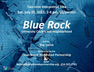
  • 1. Blue RockUniversity Circle’s lost neighborhood Sat. July 25, 2015, 2-4 pm, $5/person Roy Larick © 2015 Bluestone Heights bluestoneheights.org Two-mile interpretive hike RSVP welling@doanbrookpartnership.org 216-325-7781 Doan Brook Watershed Partnership Sponsored by the Led by
  • 2. Blue RockUniversity Circle’s lost neighborhood © 2015 Bluestone Heights bluestoneheights.org Blue Rock rose on a special local natural landscape comprising lower Cedar Glen, the confluence of Blue Rock and Doan Brooks and the outflow of a sulfurous spring. Blue Rock is the forgotten neighborhood at the base of Cedar Hill. The landscape is now dominated by the Nickel Plate/RTA track corridor, several arterial highways and the buildings and parking lots of CWRU and Judson Park. In the 1880s, the Ambler family opened a water cure at the spring and platted residential streets at the foot of Cedar Glen. The Blue Rock hike explores remnants of the once complex natural terrain, outlines the cultural transformation of the natural landscape, and proposes small ways to rebuild ecological function.
  • 3. Blue RockUniversity Circle’s lost neighborhood © 2015 Bluestone Heights bluestoneheights.org The Blue Rock hike begins and ends in the Nighttown parking lot, 12375 Cedar Rd (25¢/hr). We cover ~2 mi of paved and earthen paths with an optional short section on broken ground. The circuit descends ~140' and rises back the same amount. Sat. July 25, 2015, 2-4 pm, $5/person RSVP welling@doanbrookpartnership.org 216-325-7781 Doan Brook Watershed Partnership Sponsored by the
  • 4. © 2015 Bluestone Heights bluestoneheights.org Nature Blue RockUniversity Circle’s lost neighborhood A Bluestone Heights blog post details the Blue Rock Spring area: http://bluestoneheights.org/bsh/2011/06/17/blue-rock-spring/
  • 5. North Cleveland Cleveland Heights hike pathway LittleItaly Blue Rock Ambler Hts Euclid Hts The name, Blue Rock, likely derives from the Euclid bluestone, the fine sandstone bedrock unit that caps the lowest terrace of the Portage Escarpment. Early settlers quarried 'blue rock' at several terrace locations, including the top of Cedar Hill. In the 1870s, ‘blue rock’ found a national market as Euclid bluestone. bluestone quarry bluestone quarry bluestone quarry The bluestone terrace makes for the Hills rising to the East Side Heights. Mayfield Hill and Cedar Hill are examples. Geologists identify the rock unit as an informal member of the Bedford formation, also calling it the Euclid bluestone.
  • 6. North Cleveland Cleveland Heights hike pathway LittleItaly Blue Rock Ambler Hts Euclid Hts Blue Rock Brook on the Portage Escarpment Comprising three small branches, Blue Rock Brook drains the Euclid Heights and Ambler Heights neighborhoods, from the bluestone terrace to Doan Brook. In Euclid Heights, the Kent and Deming branches coalesce under Euclid Heights Blvd to descend Cedar Glen. In Ambler Heights, the Ambler branch travels its own ravine to meet the trunk stream at the base of Cedar Hill. bluestone quarry bluestone quarry bluestone quarry
  • 7. sandstone terrace bluestone terrace Portage Escarpment Schematic view looking southward from Lake Erie Blue Rock hike area Blue Rock Brook descends the Portage Escarpment, Cleveland’s major terrain feature. This ancient bedrock massif resisted the bulldozing effects of Ice Age glaciations. As the last glacier retreated northward about 14 thousand years ago, rushing melt water spawned our ‘escarpment run’ streams including Doan and Blue Rock Brooks. The Blue Rock settlement straddles the confluence of Doan and Blue Rock Brooks at escarpment base. Bedrock deposition, glacial sculpting and stream cutting produced the natural landscape. © 2015 Bluestone Heights bluestoneheights.org lake plain
  • 8. Blue RockUniversity Circle’s lost neighborhood © 2015 Bluestone Heights bluestoneheights.org History A Bluestone Heights blog post details the Blue Rock Spring area: http://bluestoneheights.org/bsh/2011/06/17/blue-rock-spring/
  • 9. 403 411 404 412 1881 1874 403 411 404 412 Blue Rock spring Early Doan’s Corners residents frequented a sulfurous spring in the northern part of Cleveland Original Lot 411. The parcel had ambiguous ownership up through the 1860s. In 1872, dentist Nathan Ambler (1823-1888) and wife Martha Buell bought much of lots 411 and 412, which included the spring and the lower part of Cedar Glen. Shortly thereafter, the Amblers fenced the spring area. Nickel Plate RR construction began in 1881. The line opened in 1883. N.H.Ambler
  • 10. During the late 1870s, the Amblers took on Daniel O. Caswell (1857- 1906) as business partner and heir. The group began developing Blue Rock. In 1880, Blue Rock Springs opened as a hydrothermal resort, The bathhouse was built directly over the spring with baths cut into the bedrock. Blue Rock Springs Nickel Plate Road Historical & Technical Society NYC&StL Ry Right of Way Map c. 1883
  • 11. Blue Rock Station? In 1955, CTS built the Cedar rapid transit station on the Cedar site. The RTA Red Line station is called Cedar-University. The platform may have been planned for just north of Cedar or, less likely, just south of Highland. Blue Rock would be a better name! At right, ‘Nickel Plate’ (NYC&SL) Railroad Circular No. 82 is auspicious, but no timetable mentions Station 179 and no map shows any such facility. Might the Ambler group have lobbied for a station that never materialized? NYC&StL Ry Right of Way Map c. 1883 Nickel Plate Road Historical & Technical Society NYC&StL Ry Right of Way Map c. 1883
  • 12. 403 411 404 412 1898 Daniel O. Caswell was a tireless promoter for the resort. The business grew in popularity during the 1890s, the heydays for the ‘water cure’. By the early 1900s, ‘hydrotherapy’ moved into full service hospitals—just at the time its health benefits were being questioned. Blue Rock Springs responded with more park-like amenities, such as a dance platform and picnic areas. The Blue Rock residential neighborhood was platted in relation to the resort and to the Cedar Ave link between Doan's Corners and the emerging 'Heights'. Blue Rock Place (current Glenwood Ave) and Caswell St (current E. 114th) focused the development which included E Highland St (current Fairchild Ave) as well as parts of Murray Hill, Cedar and Ambleside. From about 1890, houses were built on the north side of Cedar Ave. Blue Rock Brook North and south parts of the map are offset east-west along Cedar Rd. At his death on March 11, 1897, Dare was City of Lakewood engineer and an Early Settlers Association member. (Cleveland Plain Dealer) …
  • 13. Blue Rock Springs, c. 1900 (WRHS) At left is a unique view of small natural features at the confluence of Doan & Blue Rock Brooks. The photographer shot northwest from under the Nickel Plate Railroad bridge, across Cedar Rd, along Doan Brook (white line below). Visible are two ‘outliers’ (red & white), bedrock islands left, by chance, as the Doan/Blue Rock confluence meandered around the location. The area is now entirely transformed within the University Circle built environment (below left). The one period topographic view comes from the Cleveland Parks Dept map of c. 1900, entitled Eastern Parkway (below).
  • 14. Blue Rock Place crossed the NKP tracks to enter the resort’s east border. Blue Rock, c. 1900Eastern Parkway map (~1900) Cleveland Public Library The purple contour represents the low bluff around the confluence floodplain, including the crests of the two bedrock ‘island’ outliers.
  • 15. ‘Blue Rock’ photographs from the Western Reserve Historical Society ?
  • 16. 403 411 404 412 1920 1912 403 411 404 412 By 1912, the resort was demolished with college athletic fields tooking over the spring area. E. Highland Ave was renamed Fairchild. Blue Rock Place was now Glenwood Ave. As Cedar was becoming a major automobile thoroughfare, it was widened on the north side. Several 1890s houses were demolished. Some houses still stood on the south side of Cedar, along Buell Place (named for Martha Buell Ambler), but they would later be cleared for a yet wider road. In 1920, Blue Rock Brook was still open. The area of its course is now the green space between Cedar and Glenwood. The stream flows directly under the RTA Cedar-University station. The new bioswale symbolizes the stream (slide 22, below).
  • 17. WRHS 7151 In a development plan of the mid 1920s, neither Blue Rock nor its brook is to be found. Lincoln Storage
  • 18. Doan Brook Ambler Park infrastructure Cleveland Memory ProjectCleveland Memory Project Cleveland Memory Project Cleveland Memory Project Looking northeast across Doan Brook along old Ambleside to current Ambleside (at cliff base). Looking south-southeast from East Blvd (MLK), up Doan Brook to Fairhill (Stokes Blvd). Looking north-northwest down Doan Brook from Fairhill (Stokes Blvd) to East Blvd (MLK). Looking south-southeast from NKP tracks across East Blvd (MLK) to the Baldwin Reservoir. Doan Brook culvert construction in foreground. In 1929, construction of the Cleveland Union Terminal Railroad was fully recorded in photographs. CSU Special Collections now owns the set which are online as part of the Cleveland Memory Project. Four of many showing CUT RR work around “East Boulevard.” Water mains feeding the Baldwin Reservoir from the Kirtland Pump Station
  • 19. Looking SSE, up Doan Brook, March 1929 Cleveland Memory Project Gulf north wall, above North Park. Bluestone level near top. Chestnut Hills Dr lies behind the left tree line. camera viewpoint Doan Brook Cleveland Memory Project Cleveland Memory Project In 1894, Martha Ambler and Daniel O. Caswell donated 25 acres for the construction of Ambler Park. At its lower end, the Ambler Park was bordered by East Boulevard. Area landscaping was of high quality. Looking SSE, up Doan Brook, March 1929 Looking SSE, up Doan Brook, Google Earth Ambler Park infrastructure
  • 20. Blue RockUniversity Circle’s lost neighborhood © 2015 Bluestone Heights bluestoneheights.org Hike Highlights A Bluestone Heights blog post details the Blue Rock Spring area: http://bluestoneheights.org/bsh/2011/06/17/blue-rock-spring/ The Blue Rock hike begins and ends in the Nighttown parking lot, 12375 Cedar Rd (25¢/hr). We cover ~2 mi of paved and earthen paths with an optional short section on broken ground. The circuit descends ~140' and rises back the same amount.
  • 21. Blue Rock hike itinerary 1. Leave Nighttown parking lot. 2. Descend the Ranney ramp at the Case dorms. 3. Visit the Blue Rock area. 4. Head south to Doan Brook and Ambler Park. 5. Stop at the culvert entry. 6. Proceed upstream to the retention basin. 7. Stop at bluestone outcrop. 8. Mount to cross N. Park and go north on Chestnut Hills. 9. Stop at Ambler ravine. 10. Stop at the Gill house. 11. Return to Nighttown. Nighttown parking lot Ranney ramp Blue Rock spring culvert entry retention basin bluestone quarry bluestone outcrop Ambler Park Gill house
  • 22. Escarpment ramp roads Parallel to local streams, ‘ramps’ connected lowlands and uplands. Native Americans first defined the ramps. Early Euro-American settlers appropriated them. Superior, Lee, Taylor, and Noble Rds are examples. Ranney ramp A true parallel ramp may have traversed the escarpment on land Nathan Ambler sold to Rufus P. Ranney in the 1870s. The ramp now holds the covered switchback stairway linking the lower and upper Case dorms. About 1905, the Southworths graded a second switchback ramp on their property. 1912 For Blue Rock Brook, Cedar Glen Parkway is the exceptional ramp lying within the stream valley.
  • 23. Blue Rock Brook culvert & RTA bioswale The Blue Rock settlement was platted on the north bank of Blue Rock Brook to face Cedar Glen Parkway. With successive road widening, houses were demolished and the brook was buried. The culvert lies under the green space between current Cedar and Glenwood. In front of the new RTA Cedar-University Red Line station, the bioswale essentially lies over the brook. Blue Rock significance Blue Rock typified a natural amenity settlement of the late 1800s. Springs, streams, rock outcrops and the Lake Erie shoreline served as natural bases. In some places, a Christian tabernacle took advantage of the amenity. Blue Rock, like many amenity settlements, lost its nature during the early 1900s. The RTA bioswale is a first attempt to recover a small bit of Blue Rock Brook.
  • 24. Ambler Park culvert entry The entrance to the University Circle culvert sits below grade. Stream flow crosses a weir and then drops down to the culvert level. The entry is an impressive brick structure. Doan Brook University Circle culvert Upon leaving Blue Rock, the hike heads upstream on Doan Brook to Ambler Park. Here, we find Doan as it drops into the University Circle culvert. From this point in Ambler Park, Doan flows underground all the way to southern Wade Park. Along the way, it picks up Blue Rock Brook.
  • 25. Doan Brook Ambler Park retention basin From the culvert entry, we trek upstream to arrive at the Ambler Park retention basin, shown here after a heavy rainfall. After viewing the monstrosity, we climb up over the Euclid bluestone to arrive at the intersection of North Park Blvd and Chestnut Hills Dr. Euclid bluestone outcrop above the retention basin
  • 26. Ambler Ravine Blue Rock Brook’s Ambler branch drains much of Ambler Hts. It descends a small ravine to meet the trunk stream near the base of Cedar Hill. The ravine cuts through Euclid bluestone and Cleveland Shale bedrock units. The ravine bottom is full of bluestone rubble. The area has bluestone retaining walls. The 1898 map shows the Ambler branch traversing a street grid never fully implemented. Currently, Chestnut Hills Drive derives from sections of Beacon Hill St, ‘Ave’ and ‘Harcourt’. Harcourt derives from Northwood Ave projected southward to North Park Blvd. The L.H. Elliott house, the first built in Ambler Hts, is a Cleveland Heights landmark. It sits in an area once called Glen Point. 1898
  • 27. Glen Point quarry Lying between the Ambler Ravine and Cedar Glen, Glen Point is a bluestone promontory. Much of the area was quarried in the late 1800s, possibly for the bluestone retaining wall on the south side of Cedar Glen. The east quarry wall remains visible on the Gill house lot. Gill House Kermode F. Gill headed the firm that built many of Cleveland’s finer buildings, including the Terminal Tower complex. In 1911, Gill had F.B. Meade design a house to be set into the quarry at 2178 Harcourt.
  • 28. Blue Rock © 2015 Bluestone Heights bluestoneheights.org Meet: Nighttown parking lot, Cedar-Fairmount The Blue Rock hike begins and ends in the Nighttown parking lot, 12375 Cedar Rd--bring quarters. We cover ~2 mi of paved and earthen paths with an optional short section on broken ground. The circuit descends ~140' and rises back the same amount. RSVP welling@doanbrookpartnership.org 216-325-7781 July 25, 2015 2-4 pm, $5/person Two-mile interpretive hike Doan Brook Watershed Partnership Sponsored by the
  • 29. Roy Larick Walk back in time Look to the Future Euclid bluestone outcrop Doan Brook, Cleveland OH Bluestone Heights © 2015 Bluestone Heights R. Larick A production by bluestoneheights.org roylarick@gmail.com