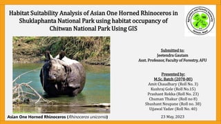
2. TABLE OF CONTENT
• Introduction
• Objective
• Methodology
• Steps in GIS
• Results
• Inference
3. INTRODUCTION
• Rhinoceros unicornis, a mega-herbivore is adapted to a mosaic of tall grasslands and riverine forests
habitats, Sal forests, and alluvial floodplains (Thapa, et. al, 2014).
• In Nepal, its population is 752 with the maximum in the Chitwan NP (694), Bardiya NP (38), Parsa NP (3),
while in Shuklaphanta NP (17) as per the National Rhino Count 2021 (NTNC, 2021).
• Rhino population in Chitwan is the source population for most of these rhinos as per the DNPWC records,
translocation efforts had been made to Shuklaphanta National Park in the years 2000 (4) and 2017 (5)
rhinos had been translocated (DNPWC, 2021).
• Habitat Suitability Mapping using remote sensing is being used as vital tool for analysis of suitability using
multiple parameters for present habitat suitability study but also understanding dynamics in future
condition with changing climate and biological invasion also anthropogenic disturbances in the wildlife
habitat.
4. OBJECTIVE
• To analyze the habitat suitability of Rhinoceros unicornis in the Shuklaphanta
National Park.
5. APPLICATION OF GIS IN HABITAT SUITABILITY MODELLING
LULC
Map
Slope
Map
Aspect
Map
Elevation
Map
Field
Data/Literatur
e review
LULC
Suitability
Map
Slope
Suitabilit
y Map
Aspect
Suitabilit
y Map
Elevation
Suitability
Map
Suitability
Assignmen
t
Final
Suitability
Map
Overlay
6. STEPS:
1. Determine Causative/Influential factors
II. Download those factor's layers
III. Assign suitable risk category for each factors (Field data/ literature)
IV. Reclassify download layers according to step 3 (High-3; Medium-2;
Low-1)
V. Carry out fuzzy/weighted overlay for final composite map
VI. Calculate areas for HML layers and Interpret result
7. 1. DETERMINE CAUSATIVE AND INFLUENTIAL FACTOR
• Literature Review
• Empirical Habitat Suitability Models analyze data on habitat use and habitat characteristics
collected at specific sites. While the process oriented Habitat Suitability Index model use
habitat requisite parameters such as food, cover, and proximity to water as input variables (Thapa,
et al., 2014).
• Pun, et al. (2022) had used Presence data, District boundary, PA Boundary, Settlement, Land use,
Water bodies, River bed, DEM, Slope, Aspect, Climate for Rhino habitat suitability.
Sarma, et. al.,
8. II. DOWNLOAD THE FACTORS’ LAYER
S.N. Layer Name Spatial
Resolution
Pixel Depth Spatial Data
type
Projection System Source
1. Presence Data (Rhino
location)
Point Shapefile WGS_1984_UTM_Z
one_45N
Field
Observation
2. CNP & ShNP
Boundary
Polygon
Shapefile
WGS_1984_UTM_Z
one_45N
Nepal
Administrative
Map
3. LULC 30m 8 bit
unsigned
Raster Lambert_Conforma
lConic_Survey_Nep
al
FRTC (2022)
4. DEM (Mahakali) 28.80 m 16 bit signed Raster WGS_1984_UTM_Z
one_45N
USGS Earth
Explorer
DEM (Narayani) 29.16 m 16 bit signed Raster WGS_1984_UTM_Z
one_45N
USGS Earth
Explorer
5. Slope Created from DEM
6. Aspect
10. FINDING OUT SUITABILITY FROM FIELD DATA
• We had used the habitat use characteristics (location point) to reclassify
the other parameters into 3 Suitability classes: (High -3; Medium-2 and
Low-1).
• Based on empirical data of Chitwan National Park we calculate suitable
habitat area in the Shuklaphanta National Park.
11. 1. Add Field Data (Location of Rhino);
DEM and Study Area Shape file
2. Clip DEM file to the Study
area
Tool Used: Clip (Data
Management)
13. 3. Using DEM as input create Slope
Percent Raster
Tool Used: Slope (Spatial Analyst)
Resultant Slope Percent raster
14. 4. Using DEM file as input create
Aspect Raster
Tool Used: Aspect (Spatial Analyst)
Resultant aspect file
15. 5. Add LULC Raster >> Match
Projection with other layers
Tool Used: Project Raster (Data
Management)
6. Clip LULC Raster to the
Area of Interest
Tool Used: Clip (Data
Management)
18. Open Attribute table and calculate Statistics
for the DEM file to find break values for
Reclassification
And
Reclassify using arbitrary elevation classes.
Arbitrary Elevation Classes:
Class1= <260
Class II=260-410
Class III =>410
22. Creating Buffer layers: If point
(waterholes, settlements) / linear
features (roads, transmission line) are
present and reclassifying them as well.
Though such features were not used
in this practical.
Tool used: Multi ring Buffer (Analysis)
34. 15. Using DEM as input create Slope Percent Raster
for ShNP
Tool Used: Slope (Spatial Analyst)
14. Using DEM as input create Aspect Raster for
ShNP
Tool Used: Aspect (Spatial Analyst)
38. 17. FUZZY OVERLAY
TOOL USED: FUZZY OVERLAY (SPATIAL ANALYST)
• Combine fuzzy membership rasters data together, based on selected overlay
type
• Specifies the method used to combine two or more membership data.
• AND—The minimum of the fuzzy memberships from the input fuzzy rasters.
• OR—The maximum of the fuzzy memberships from the input rasters.
41. 17. WEIGHTED OVERLAY
TOOL USED: WEIGHTED OVERLAY (SPATIAL ANALYST)
Overlays several
suitability rasters using a
common measurement
scale and weights each
according to its
importance.
47. REFERENCES
• Sarma, P. K., Mipun, B. S., Talukdar, B. K., Kumar, R., & Basumatary, A. K. (2011). Evaluation of habitat suitability for Rhino
(Rhinoceros unicornis) in Orang National Park using geo-spatial tools. International Scholarly Research Notices, 2011.
• Thapa, V., M.F. Acevedo & K.P. Limbu (2014). An analysis of the habitat of the Greater One-horned Rhinoceros Rhinoceros
unicornis (Mammalia: Perissodactyla: Rhinocerotidae) at the Chitwan National Park, Nepal. Journal of Threatened Taxa 6(10):
6313–6325; http://dx.doi.org/10.11609/JoTT.o3698.6313-25
• PUN, S., JOSHI, R., SUBEDI, R., BHATTARAI, S., & POUDEL, B. (2022). Geospatial Analysis of Habitat Suitability for Greater
One-horned Rhino Rhinoceros unicornis (Linnaeus, 1758) in Central lowlands of Nepal using MaxEnt Model . Borneo Journal
of Resource Science and Technology, 12(1), 166-176. https://doi.org/10.33736/bjrst.4422.2022