SlideShare une entreprise Scribd logo
1  sur  138
Basic
Remote Sensing and GIS
Basic
Remote Sensing and GIS
where, = Wavelength and = Frequency
Basic Remote Sensing and GIS
The wavelength and frequency are two characteristics of electromagnetic radiation which are
particularly important for understanding remote sensing and the information to be extracted from
remote sensing data.
The wavelength is the length of one wave cycle, which can be measured as the distance between
successive wave crests. It is represented by the Greek letter lambda ( ). It is measured in meters (m)
or some factor of meters such as nanometers (nm, 10-9
metres), micrometers (10-6
metres) or
centimeters (cm, 10-2
metres).
Frequency refers to the number of cycles of a wave passing a fixed point per unit of time. It is
measured in hertz (Hz), equivalent to one cycle per second, and various multiples of hertz.
Wavelength and frequency of electromagnetic energy are inversely related to each other. The shorter
the wavelength, the higher is the frequency and the longer the wavelength, the lower is the
frequency. The following equation provides the relationship between wavelength and frequency of
electromagnetic energy.
1. Introduction to Remote Sensing and ERDAS IMAGINE1-4
Wavelength and Frequency
Source: Canada Centre for Remote Sensing. 2007. Tutorial: Fundamentals of Remote Sensing.
Viewer
Import
Import/Export Dialog Box
Import - Select this button if you are importing data into ERDAS IMAGINE
Export - Select this button if you are exporting an ERDAS IMAGINE file into another format.
Type: Click on this dropdown list and select the data type to import or export. When
Import or Export is selected, the list of import or export data types display.
Media: Click this dropdown list to select the media from which you are importing: CD-
ROM, Tape, or File. Not all data types can be imported from all media types. A warning
displays when a Type-Media mismatch occurs.
Input File: Enter the name of the input file.
Basic Remote Sensing and GIS
The ERDAS IMAGINE Viewer is the "main window" for displaying raster, vector, and/or
annotation data. An IMAGINE Viewer opens automatically when IMAGINE starts. Also, you may
use the File > New menu to start a Viewer.
You may start additional Viewers of the default type by clicking the Viewer icon on the IMAGINE
icon panel. Viewer can be resized by dragging a corner or side. Both viewers have a Main Toolbar
that is always visible.
With the help of this menu a large number of data of raster and vector file formats are imported
from file, CD-Rom or Tape into ERDAS IMAGINE and exported and ERDAS IMAGINE file
into another format. This dialog enables you to import or export virtually any type of data to or
from ERDAS IMAGINE.
1. Introduction to Remote Sensing and ERDAS IMAGINE1-14
Output File: Enter the name for the output file (the name of the file in ERDAS IMAGINE).
Basic Remote Sensing and GIS
2. Satellite Image Characteristics and Viewer Function2-4
Resolution
Resolution is used to describe the area on the ground that a pixel represents in an image file.
Four distinct types of resolution must be considered :
Spatial - area on the ground represented by each pixel
Spectral - specific wavelength intervals that a sensor can record
Radiometric - number of possible data file values in each band
Temporal - how often a sensor obtains imagery of a particular area.
These four domains contain separate information that can be extracted from the raw data.
Spatial Resolution
Spatial resolution is a measure of the smallest object that can be resolved by the sensor, or the area
on the ground represented by each pixel (Simonett et al, 1983).For a homogeneous feature to be
detected, its size generally has to be equal to or larger than the resolution cell. If the feature is
smaller than this, it may not be detectable as the average brightness of all features in that resolution
cell will be recorded.
Large-scale in remote sensing refers to imagery in which each pixel represents a small area on the
ground, such as SPOT data, with a spatial resolution of 10 m or 20 m. Small scale refers to imagery
in which each pixel represents a large area on the ground, such as Advanced Very High Resolution
Radiometer (AVHRR) data, with a spatial resolution of 1.1 km.
http://www.satimagingcorp.com/services/resources/charact
erization-of-satellite-remote-sensing-systems
Basic Remote Sensing and GIS
2-14 2. Satellite Image Characteristics and Viewer Function
Source: ERDAS IMAGINE on line Help for the Zooming Tools
Zooming Tools
Zooming is the magnification or reduction of an image in the Viewer. Zooming has no effect on
how the image is stored in a file.
The quick zoom buttons, and , enlarge and reduce the image without changing the
center of the viewable area
The zoom tools, and , enlarge and reduce the image and also shift the image so that the
clicked spot is in the center of the Viewer. When the tool is selected, you can drag a box
around an area within the Viewer and when the mouse button is released, that area magnifies so
that the enclosed area fits entirely within the Viewer. When the tool is selected and a box is
dragged, the entire Viewer area is reduced so that it fits completely within the bounding box.
There are also options on the View > Zoom submenu (In By X... and Out By X...) that allow
you to specify the exact zoom ratio (1.37 for example) and to specify or change the resample
method.
3-14 3. Satellite Sensors and Platform and Application
Basic Remote Sensing and GIS
Agriculture Application
Agriculture plays a dominant role in economies of both developed and underdeveloped countries.
Producing food in a cost-effective manner is the goal of every farmer, large-scale farm manager and
regional agricultural agency. Satellite and airborne images are used as mapping tools to classify crops,
examine their health and stress, and monitor farming practices.
Remote sensing offers an efficient and reliable means of collecting the information required, in order
to map crop type and acreage. Optical remote sensing can see beyond the visible wavelengths into
the infrared, where wavelengths are highly sensitive to crop health and stress and crop damage.
Remote sensing can aid in identifying crops affected by too dry or wet conditions, affected by insect,
weed or fungal infestations or weather related damage. Following are the lists of few remote sensing
applications for agriculture:
crop type classification
crop yield estimation
crop condition assessment
mapping of soil characteristics
mapping of soil management practices
management practices
Basic Remote Sensing and GIS
4-6 4. Satellite Image Interpretation
Pattern
Pattern means arrangement of individual objects into distinctive recurring forms that facilitate their
recognition on imagery. The buildings in an industrial plant may have a distinctive pattern due to
their organization to permit economical flow of materials through the plant, from receiving raw
material to shipping of the finished product. The distinctive spacing of trees in an orchard arises
from careful planting of trees at intervals that prevent competition between individual trees and
permit convenient movement of equipment through the orchard.
Association
Association takes into account the relationship between other recognizable objects or features in
proximity to the target of interest. The identification of features that one would expect to associate
with other features may provide information to facilitate identification. In the example given above,
commercial properties may be associated with proximity to major transportation routes, whereas
residential areas would be associated with schools, playgrounds, and sports fields.
Source:
Wynne, James B. Campbell, Randolph H. (2011). Introduction to remote sensing (5th ed.). New York: Guilford Press.
Source: Canada Centre for Remote Sensing. 2007. Tutorial: Fundamentals of Remote Sensing
Cubic Convolution
Cubic convolution is similar to bilinear interpolation, except that a set of 16 pixels, in a 4 × 4
array, are averaged to determine the output data file value, and an approximation of a cubic
function, rather than a linear function, is applied to those 16 input values. The effect of the cubic
curve weighting can both sharpen the image and smooth out noise (Atkinson, 1985). The actual
effects depend upon the data being used.
This method is recommended when you are dramatically changing the cell size of the data, such as
in TM/aerial photo merges (i.e., matches the 4 × 4 window more closely than the 2 × 2
window).Data values may be altered. This method is extremely slow.
Source: ERDAS Field Guide™. (2005). Norcross, Georgia: Leica Geosystems Geospatial Imaging, LLC
Rectification Summary
Rectification or geo-referencing is essential for almost all remote sensing projects. It allows image
to correspond to real world map coordinates. It is required for combining imagery and GIS. It is
essential for obtaining spatially accurate products—requires considerable care.
Basic Remote Sensing and GIS
5-8 5. Satellite Image Rectification
Problems: Original pixel value integrity lost; slowest
Benefits: Sharpen images and smooth noise
Uses: Resampling large cell size differences
Basic
Remote Sensing and GIS
Basic
Remote Sensing and GIS
Basic
Remote Sensing and GIS
Training Manual Developed by CEGIS, USFS and BFD, 2014-15
Basic Remote Sensing and GIS
The electromagnetic spectrum consists of all the different wavelengths of electromagnetic radiation
ranges from the shorter wavelengths (including Gamma and X-rays) to the longer wavelengths
(including Microwaves and broadcast radio waves). There are several regions of the electromagnetic
spectrum such as visible spectrum, infrared spectrum and microwave spectrum, which are useful for
remote sensing.
The electromagnetic energy which our eyes can detect is part of the visible spectrum. The visible
spectrum of electromagnetic energy covers a range of wave length from 0.4 to 0.7. The longest
visible wavelength is red and the shortest is violet. There is a lot of electromagnetic energy around
us which is "invisible" to our eyes, but can be detected by other sensors and used to our advantage.
1. Introduction to Remote Sensing and ERDAS IMAGINE 1-5
Electromagnetic Spectrum
Visible Spectrum
Source: http://ls7pm3.gsfc.nasa.gov/whatsRM/em.html
Source: http://www.faculty.virginia.edu/rwoclass/astr1210/121supps2-3.html
Source: Canada Centre for Remote Sensing. 2007. Tutorial: Fundamentals of Remote Sensing.
Data Preparation
This menu gives you access to a set of tools that are useful in general data preparation. This
dialog opens when you click the Data Prep icon on the ERDAS IMAGINE icon panel
Subset Image Click to open the Subset dialog,
which enables you to create and
define a subset image.
Image
Geometric
Correction
Click to open the Set Geo Correction
Input File dialog, which is part of the
Geometric Correction Tool. This
dialog enables you to select the image
you want to rectify.
Mosaic
Images
Click to open the Mosaic Tool,
MosaicPro (PC Only), the Mosaic
Wizard (PC Only), or the Mosaic
Direct (PC Only), all of which enable
you to mosaic two or more images
together.
Unsupervised
Classification
Click to open the Unsupervised
Classification dialog.
Reproject
Images
Select this option to resample an
image into a different projection.
Basic Remote Sensing and GIS
1. Introduction to Remote Sensing and ERDAS IMAGINE 1-15
Source: ERDAS IMAGINE® Tour Guides™. (2006). Norcross, Georgia: Leica Geosystems Geospatial Imaging, LLC
Basic Remote Sensing and GIS
Spectral Resolution
Spectral resolution refers to the specific wavelength intervals in the electromagnetic spectrum that a
sensor can record (Simonett et al, 1983).
Wide intervals in the electromagnetic spectrum are referred to as coarse spectral resolution, and
narrow intervals are referred to as fine spectral resolution. For example, the SPOT panchromatic
sensor is considered to have coarse spectral resolution because it records EMR between 0.51 and
0.73. On the other hand, band 3 of the Landsat TM sensor has fine spectral resolution because it
records EMR between 0.63 and 0.69 (Jensen, 1996).
Radiometric Resolution
Radiometric resolution refers to the dynamic range, or numbers of possible data file values in each
band. This is referred to by the number of bits into which the recorded energy is divided. For
instance, in 8-bit data, the data file values range from 0 to 255for each pixel, but in 7-bit data, the
data file values for each pixel range from 0 to 128.
The sensor measures the EMR in its range. The total intensity of the energy from 0 to the maximum
amount the sensor measures is broken down into256 brightness values for 8-bit data, and
128brightness values for 7-bit data.
2. Satellite Image Characteristics and Viewer Function 2-5
Source: ERDAS Field Guide™. (2005). Norcross, Georgia: Leica Geosystems Geospatial Imaging, LLC.
Basic Remote Sensing and GIS
2. Satellite Image Characteristics and Viewer Function 2-15
Source: ERDAS IMAGINE on line Help for the Link Viewers
Linking Viewers
Select this option to link or unlink Viewer windows geographically so that the same image area
opens in all linked Viewers. This type of link will not reflect changes in the arrangement of the
layers, band combinations, or changes by other tools in the Viewer. Select this option again to
unlink.
a) In the first Viewer, select View | Link/Unlink Viewers | Geographical.
The Link/Unlink Instructions display.
b) Move your pointer to the second Viewer. The pointer becomes a Link symbol .
c) Move the pointer to the first Viewer.
d) The No Link symbol displays as the cursor in the first Viewer. Clicking in this Viewer
discontinues the link operation.
e) To link the Viewers, click anywhere in the second Viewer.
f) The two Viewers are now linked. A white cursor box opens over the image in the second
Viewer, indicating the image area displayed in the first Viewer.
g) You can move and resize this cursor box as desired, and the image area in the first Viewer
reflects each change. This is similar to the magnification box you used earlier.
Viewer 1
Viewer 2
Two Viewers are
Geographically
linked
 natural resource management
 wildlife habitat protection
 baseline mapping for GIS input
 urban expansion / encroachment
 routing and logistics planning for seismic / exploration / resource extraction activities
 damage delineation (tornadoes, flooding, volcanic, seismic, fire)
 legal boundaries for tax and property evaluation
 target detection - identification of landing strips, roads, clearings, bridges, land/water
interface
3. Satellite Sensors and Platform and Application 3-15
Basic Remote Sensing and GIS
Land use and cover studies are multidisciplinary and the participants involved in such work are
numerous and varied, ranging from international wildlife and conservation foundations, to
government researchers, and forestry companies. The land use and land cover information are used
for planning, monitoring, and evaluation of development, industrial activity, or land reclamation.
The impacts of land-use and land-cover change on carbon dynamics, hydrology, climate change, and
biodiversity have been recognized. Changes in land cover will be examined by environmental
monitoring researchers, conservation authorities, and departments of municipal affairs, with interests
varying from tax assessment to reconnaissance vegetation mapping. Remote-sensing data play an
important role in land use and land cover mapping and in land use and land cover modeling for
construction, parameterization, and validation. Following is the list of applications of land use and
land cover mapping:
Land use and Land Cover Mapping
Basic Remote Sensing and GIS
Shape
Shape refers to the general form, structure, or outline of individual objects. It can be a very
distinctive clue for interpretation. Straight edge typically represents urban or agricultural targets. On
the contrary, natural features, such as forest edges, are generally, more irregular in shape.
Agricultural fields irrigated by rotating sprinkler systems would appear as circular shapes.
Size
It is important to assess the size of a target relative to other objects and the absolute size, to aid in
the interpretation of that target. A quick approximation of target size can direct interpretation
quickly. For example, large buildings such as factories or warehouses would suggest commercial
property, whereas small buildings would indicate residential use.
4. Satellite Image Interpretation 4-7
Source: Canada Centre for Remote Sensing. 2007. Tutorial: Fundamentals of Remote Sensing
Basic Remote Sensing and GIS
5. Satellite Image Rectification 5-9
Lesson Review
Knowledge and Skills Practice 2: Satellite Image Rectification
 What is rectification
 When to rectify and georeferencing satellite images.
 Rectification steps
 Geo-referencing in ERDAS IMAGINE
 Resampling methods
The details of this assignment and data are given in the attached CD of the manual.
Please follow the Knowledge and Skills Practice 2: Satellite Image Rectification.
Basic Remote Sensing and GIS
Primary Colors
Blue, green, and red are the primary colors or wavelengths of the visible spectrum. No single primary
color can be created from the other two primary colors, but all other colors can be formed by
combining blue, green, and red in various proportions. The sunlight is actually composed of various
wavelengths of radiation in primarily the ultraviolet, visible and infrared portions of the spectrum.
The infrared spectrum region covers the wavelength range from approximately 0.7mm to 100mm.
This region can be divided into reflected IR and emitted or thermal IR based on the irradiation
properties.
The reflected IR region covers wavelengths from approximately 0.7mm to 3.0mm. This region is
further divided into near IR (0.7mm–1.3mm) and mid IR (1.3mm–3mm). The near IR records
energy related to vegetation health, while the mid IR is more related to moisture.
The thermal IR covers wavelengths from approximately 3.0mm to 100mm. The energy in this
This microwave spectrum covers the longest wavelengths of
electromagnetic energy used for remote sensing. It covers the
wavelength range from 1mm to 1m. The shorter wavelengths have
properties similar to the thermal infrared region while the longer
wavelengths approach the wavelengths used for radio broadcasts.
Because of their long wavelengths, microwaves have special properties
that are important for remote sensing. Longer wavelength microwave
radiation can penetrate through cloud cover, haze, dust, and all but the
heaviest rainfall. This property allows detection of microwave energy
under almost all weather and environmental conditions so that data can
be collected at any time.
1. Introduction to Remote Sensing and ERDAS IMAGINE1-6
Source: Canada Centre for Remote Sensing. 2007. Tutorial: Fundamentals of Remote Sensing.
Infrared Spectrum
Microwave Spectrum
Basic Remote Sensing and GIS
1. Introduction to Remote Sensing and ERDAS IMAGINE1-16
Source: ERDAS IMAGINE® Tour Guides™. (2006). Norcross, Georgia: Leica Geosystems Geospatial Imaging, LLC
Image Interpreter
This menu provides access to the ERDAS IMAGINE Image Interpreter functions. It opens
when you click the Interpreter icon in the ERDAS IMAGINE icon panel
Spatial
Enhancement
Click to access functions for enhancing
images using the values of individual
and surrounding pixels. The Spatial
Enhancement menu displays.
Radiometric
Enhancement
Click to access functions for enhancing
images using the values of individual
pixels within each band. The
Radiometric Enhancement menu
displays.
Spectral
Enhancement
Click to access functions for enhancing
images by transforming the values of
each pixel on a multiband basis. The
Spectral Enhancement menu displays.
GIS Analysis Click to access functions for use on
thematic data layers. The GIS Analysis
menu displays.
Utilities... Click to access some common utilities
used on raster layers. The Utilities menu
displays.
Basic Remote Sensing and GIS
Temporal Resolution
Temporal resolution refers to how often a sensor obtains imagery of a particular area. For example,
the Landsat satellite can view the same area of the globe once every 16 days. SPOT, on the other
hand, can revisit the same area every three days. Temporal resolution is an important factor to
consider in change detection studies.
Digital Image Format in Remote Sensing
Satellite image data is available in the following four different formats:
TIFF: It stands for Tagged Image File Format. It is one of the most popular and flexible of the
current public domain raster file formats. In TIFF files, information about the file structure is stored
in so-called "tags".
GeoTIFF: is an emerging standard for storing georeferenced image data. It is widely supported in
remote sensing and GIS software such as ERDAS Imagine, ENVI, ArcGIS etc.
The Hierarchical Data Format (HDF) is a multi-object file format for sharing scientific data in a
distributed environment.
MrSid: It is a powerful wavelet-based compressor. This data enable instantaneous viewing and
manipulation of massive images locally and over networks, while maintaining maximum image
quality and manageability.
2-6 2. Satellite Image Characteristics and Viewer Function
Jensen 20007
Source: ERDAS IMAGINE on line Help for the Raster Attribute Editor
Basic Remote Sensing and GIS
2-16 2. Satellite Image Characteristics and Viewer Function
Raster Attribute Editor
The Raster Attribute Editor provides access to the properties saved in the Descriptor Table for
each layer of a raster file. The Descriptor Table is part of the .img file. The Raster Attribute Editor
allows you to edit, add, or delete attributes as well as perform functions with them. The changes
effected by these operations can be saved with the image file.
There are several ways to access the Raster Attribute Editor:
Select Tools > Edit Raster Attributes... from the ERDAS IMAGINE icon panel.
Select Edit > Raster Attribute Editor... from the ImageInfo menu bar. This method allows
access to any layer of any .img file.
Select Raster > Attributes... from the Viewer menu bar. This method operates on the layer open
in ImageInfo.
Edit Column Properties
This dialog enables you to add, remove, and rearrange attribute columns. You may change the
alignment and format of data and the width of columns.
Click Edit > Column Properties... on the Raster Attribute Editor menu bar, or click the
icon on the toolbar to access this dialog.
 lithological mapping
 structural mapping
 sand and gravel (aggregate) exploration/ exploitation
 mineral exploration
 hydrocarbon exploration
 environmental geology
 baseline infrastructure
 sedimentation mapping and monitoring
 event mapping and monitoring
 geo-hazard mapping
 wetlands mapping and monitoring,
 soil moisture estimation,
 snow pack monitoring / delineation of extent,
 measuring snow thickness,
3-16 3. Satellite Sensors and Platform and Application
Basic Remote Sensing and GIS
Geology
Geology involves the study of landforms, structures, and the subsurface, to understand physical
processes creating and modifying the Earth's crust. Remote sensing is used as a tool to extract
information about the land surface structure, composition or subsurface. Information on lithology
or rock composition may be extracted from multispectral images based on spectral reflectance.
Radar provides information of surface topography and roughness, and it is extremely valuable when
integrated with another data source to provide detailed relief. Application of Remote Sensing in the
field of Geology may include:
Hydrology
Abilities of remote sensing technology in hydrology are to measure spatial, spectral, and temporal
information and provide data on the state of the earth's surface. It provides observation of changes
in hydrological states, which vary over both time and space that can be used to monitor hydrological
conditions and changes. Both active sensors that send a pulse and measure the return pulse (like
radar, microwave etc.) and passive sensors that measure emissions or reflectance from natural
sources (like Sun, thermal energy of the body) are used. Sensors can provide data on reflective,
thermal and dielectric properties of earth's surface.
Remote sensing techniques indirectly measure hydrological variables, so the electromagnetic
variables measured by remote sensing have to be related to hydrological variables empirically or with
transfer functions. Application of remote sensing in the field of hydrology:


Basic Remote Sensing and GIS
Lesson Review
Knowledge for Image Interpretation
Elements of Image Interpretation like Image Tone, Image Texture,
Shadow, Patterns, Association, Shape, Size and their significance.
4-8 4. Satellite Image Interpretation
Table of Contents
Preface....................................................................................................................................... iii
Introduction............................................................................................................................... iv
Lesson - 1 : Introduction to Remote Sensing and ERDAS IMAGINE............................. 1-1
Lesson - 2 : Satellite Image Characteristics and Viewer Functions........................................ 2-1
Lesson - 3 : Satellite Sensors and Platform and Application................................................. 3-1
Lesson - 4 : Satellite Image Interpretation............................................................................ 4-1
Lesson - 5 : Satellite Image Rectification............................................................................... 5-1
Lesson - 6 : Satellite Image Classification............................................................................. 6-1
Lesson - 7 : Introduction to GIS Concept and its Application.............................................. 7-1
Lesson - 8 : Spatial and Tabular Data model...................................................................... 8-1
Lesson - 9 : Spatial Analysis............................................................................................... 9-1
Lesson - 10 : Summary.......................................................................................................... 10-1
Lesson - 11 : Bibliography...................................................................................................... 11-1
v
Basic Remote Sensing and GIS
When electromagnetic energy passes through atmosphere, it is scattered or absorbed mainly by
particles and molecules of several gases (for example water vapor, carbon dioxide, and ozone) in the
Earth's atmosphere. Some radiation, such as visible light, largely passes through the atmosphere.
Atmospheric scattering occurs when particles (aerosols and dust particles) or large gas molecules in
the atmosphere interact with electromagnetic radiation and cause it to be redirected from its original
path. The amount of scattering depends on the wavelength of the radiation, the abundance of
particles or gases, and the travel distance of the radiation.
Types of Scattering
Scattering is a function of the wavelength of the electromagnetic energy, the size of the gas
molecule, dust particle and water vapor droplet encountered. There are three types of scattering:
Rayleigh scattering: Such phenomena occur when electromagnetic radiation interacts with particles
which are very small compared to the wavelength of the radiation. Such particles are very small dust
or nitrogen and oxygen molecules. In this process, shorter wavelengths of energy are scattered much
more than longer wavelengths. It is the dominant scattering mechanism in the upper atmosphere.
Mie scattering: Such phenomena occur when electromagnetic radiation interacts with particles which
are about the same size as the wavelength of the radiation. It occurs in the lower portions of the
atmosphere where larger particles are abundant, and dominants when cloud conditions are overcast.
1. Introduction to Remote Sensing and ERDAS IMAGINE 1-7
Interactions with the Atmosphere
Atmospheric Scattering
Image Classification
Classification is the process of sorting pixels into a finite number of individual classes, or
categories of data, based on their data file values. If a pixel satisfies a certain set of criteria, then
the pixel is assigned to the class that correspond the set of criteria.
For the first part of the classification process, the computer system must be trained to recognize
patterns in the data. Training is the process of defining the criteria by which these patterns are
recognized. The result of training is a set of signatures, which are criteria for a set of proposed
classes.
Source:
ERDAS
Signature
Editor
Unsupervised
Classification
Supervised
Classification
Basic Remote Sensing and GIS
1. Introduction to Remote Sensing and ERDAS IMAGINE 1-17
click to open the Signature Editor. This
utility allows you to create, manage, evaluate,
edit, and classify signatures.
There are two ways to classify pixels into different categories: supervised and unsupervised Many
of the Classification tools can also be accessed through the Signature Editor.
This menu displays when you click the Classifier icon on the ERDAS IMAGINE icon panel.
Click to open the Unsupervised Classification
dialog. This utility lets you perform an
unsupervised classification on an .img file
using the ISODATA algorithm. This utility can
also be accessed from the Signature Editor.
Click to open the Supervised Classification
dialog. This utility allows you to perform a
supervised classification on an .img file
using various decision rules. This utility can
also be accessed from the Signature Editor.
Source: IMAGINE® Tour Guides™. (2006). Norcross, Georgia: Leica Geosystems Geospatial Imaging, LLC
Introduction to IMAGINE Viewer
The ERDAS IMAGINE Viewer is the "main window" for displaying raster, vector, and/or
annotation data. You can open as many Viewers as your window manager supports. Following are
the IMAGINE viewer functions:
Using Utility Menu Options The Utility menu on the Viewer enables you to access
four separate groups of functions; inquiry functions,
measurement tool, layer viewing and information. Each
function group is separated by a line in the pull down menu.
Viewing Menu Options The Viewing menu on the Viewer enables you to access
Arrange Layers, Zooming and Linking Viewers functions.
Using Raster Menu Options The Raster menu is available whenever a raster view pane
is active.
Using the Raster Attribute Editor The Raster Editor enables you to edit portions of the
displayed image using various tools in the Viewer Raster
menu. When a specific raster editing tool is in use, that
tool locks the Viewer, therefore, work with one tool must
be completed before opening another one.
Using Profile Tools The spectral profile display is fundamental to the analysis
of hyper-spectral data sets. As the number of bands
increases and the band widths decrease, the remote sensor
is evolving toward the visible/infrared spectrometer. The
reflectance (DN) of each band within one (spatial) pixel
can be plotted to provide a curve approximating the
profile generated by a laboratory scanning spectrometer
Source: ERDAS IMAGINE on line Help file on Viewer
Basic Remote Sensing and GIS
2. Satellite Image Characteristics and Viewer Function 2-7
Source: ERDAS IMAGINE on line Help for the Spectral Profile Tools
Basic Remote Sensing and GIS
2. Satellite Image Characteristics and Viewer Function 2-17
Spectral Profile Tools
This dialog enables you to select which Profile Tool to open. It opens when you click the icon on
the Viewer toolbar, , or when you select Raster > Profile Tools... from the Viewer menu bar.
Select the Profile you want to view.
Spectral - Select this option to open the Spectral Profile dialog.
Spatial - Select this option to view the Spatial Profile dialog.
Surface - Select this option to view the Surface Profile dialog.
OK - Click to view the selected profile and close this dialog.
Cancel - Click to cancel this process and close this dialog.
 glacier dynamics monitoring (surges, ablation)
 river /delta change detection
 drainage basin mapping and watershed modelling
 irrigation canal leakage detection
 irrigation scheduling
Oil spill
 mapping and predicting oil spill extent and drift
 strategic support for oil spill emergency response decisions
 identification of natural oil seepage areas for exploration
Fish stock and marine mammal assessment
 water temperature monitoring
 water quality
 ocean productivity, phytoplankton concentration and drift
Intertidal zone
 tidal and storm effects
 delineation of the land /water interface
 mapping shoreline features / beach dynamics
 coastal vegetation mapping
 human activity / impact
Basic Remote Sensing and GIS
3. Satellite Sensors and Platform and Application 3-17
Source: http://ces.iisc.ernet.in/energy/monograph1/Gispage7.html
Coastal Monitoring
The coastal zone is a region subjected to increasing stress from human activity and natural disasters.
Government agencies concern with the impacts of human activities and natural disasters in this
region need new data sources for monitoring erosion and accretion, loss of natural habitats,
urbanization, land use and land cover, effluent sand offshore pollution. Many of the changes in the
coastal region and dynamics of the open ocean can be mapped and monitored using remote sensing
techniques. Major application includes:
 determining snow-water equivalent,
 river and lake ice monitoring,
 flood mapping and monitoring,
Basic Remote Sensing and GIS
Objective.....................................................................................................................................5-1
Rectification................................................................................................................................5-2
When to Rectify ? ......................................................................................................................5-2
When to Georeference ? ..............................................................................................................5-3
Rectification Steps ......................................................................................................................5-3
Resampling Methods ..................................................................................................................5-6
Rectification Summary ...............................................................................................................5-8
Lesson Review ............................................................................................................................5-9
Knowledge and Skills Practice 2: Satellite Image Rectification .....................................................5-9
Objective
By the end of this lesson, through the knowledge and skills practice the participants
will be able to:
1. Define rectification.
2. Explain when to rectify and geo-referencing satellite images.
3. Explain the Rectification steps
4. Geo-reference the satellite images using ERDAS Imagine software.
5. Tell and describe the four resampling methods and explain their significance.
A Training Manual Prepared for Bangladesh Forest Department
Satellite Image Rectification
Basic Remote Sensing and GIS
Nonselective scattering: Such phenomena occur when electromagnetic radiation interacts with
particles which are much larger (water droplets and large dust particles) than the wavelength of the
radiation. In this process, all wavelengths are scattered about equally.
The figure shows the relative size of the atmospheric particles that are responsible for various
scattering of the electromagnetic radiation in the atmosphere.
Absorption causes molecules in the atmosphere to absorb electromagnetic energy at various
wavelengths when it interacts with the atmospheric constituents. Ozone, carbon dioxide, and water
vapor are the three main atmospheric constituents which absorb electromagnetic energy. Ozone
absorbs the harmful ultraviolet radiation from the sun. Carbon dioxide, referred to as a greenhouse
gas, absorbs radiation strongly in the far infrared portion of the electromagnetic spectrum which
serves to trap this heat inside the atmosphere. The incoming long wave infrared and shortwave
microwave radiation (between 22 and 1m) are absorbed by water vapor in the atmosphere.
Atmospheric windows: The regions of the electromagnetic spectrum, which are not severely
influenced by atmospheric absorption and useful to remote sensing, are called atmospheric
windows.
1. Introduction to Remote Sensing and ERDAS IMAGINE1-8
Atmospheric Absorption
Source: Canada Centre for Remote Sensing. 2007. Tutorial: Fundamentals of Remote Sensing.
Spatial Modeler
Spatial Modeler enables you to create and run models for image processing and GIS analysis. It is
a highly flexible tool that uses Model Maker and the Spatial Modeler Language.
The Spatial Modeler Language is a modeling language that is used internally by Model Maker to
execute the operations specified in the graphical models that you create. You can also use the
Spatial Modeler Language directly to write your own script models.
Click this icon on the ERDAS IMAGINE icon panel to access Spatial Modeler:
Model Maker Click to open the Model Maker window and the Model Maker Tool
palette. This window allows you to work with graphical models. You can
view or edit existing models and create new models.
Script Librarian Click to open the Model Librarian dialog. This dialog lists all the existing
script models in the system. Using this option, you can view, edit, create,
and delete script models.
Basic Remote Sensing and GIS
1. Introduction to Remote Sensing and ERDAS IMAGINE1-18
Source: ERDAS IMAGINE® Tour Guides™. (2006). Norcross, Georgia: Leica Geosystems Geospatial Imaging, LLC
Title bar
Menu bar
Tool bar
Status Bar
Scroll Bars
Quick
View
Menu
Basic Remote Sensing and GIS
2-8 2. Satellite Image Characteristics and Viewer Function
Parts of Viewer Window
The parts of the Viewer window are explained in the following illustration. Left - hold and drag any
one of these corners to resize the Viewer.
Source: ERDAS IMAGINE on line Help file on Viewer
The Title Bar shows the number of the Viewer, which is referred to in other
operations
Left-hold on Viewer Menu Bar item for list of operations to perform on the
displayed data
The Tool Bar consists of icons to provide rapid access to frequently used
operations
Use Scroll Bars to scroll the data. The size of the bar in the panel shows how
much of the data area you are viewing now.
Right click inside the viewer to pop up a Quick View Menu of frequently used
functions.
Help for Viewer Select this option to see this On-Line Help document
Information about the button under the cursor is displayed in this Status Bar.
Basic Remote Sensing and GIS
2-18 2. Satellite Image Characteristics and Viewer Function
AOI Tools
The AOI Tools enable you to select, create, and edit areas of interest (AOIs). An AOI is a point,
line, or polygon that is selected as a training sample or as the image area to be used in an
operation. They are often used as input to the Signature Editor prior to image classification.
This tool palette opens when you select AOI -> Tools... from the Viewer menu bar.
Click to select, move, and resize AOI elements.
Click to select all AOI elements that fall within the boundary of the
rectangular marquee that you draw.
Click to create a rectangular AOI.
Click to create an elliptical AOI.
Click to create a polygonal AOI. Click to add each vertex. Double-
click to close the polygon.
Click to create a polyline AOI. In the Viewer, click to add each
vertex. Double-click to end the polyline.
Click to select a single pixel from which an AOI grows.
Click to create a point AOI.
AOI Tools
Source: ERDAS IMAGINE on line Help for the AOI Tools
Basic Remote Sensing and GIS
3-18 3. Satellite Sensors and Platform and Application
Lesson Review
Information about sensors, platforms, satellite orbit, satellite swath and
multispectral scanning
Different types of satellites and their use
Different Earth Observation satellites and their significance.
Different applications of satellite image
Rectification
Rectification is the process of transforming the data from one grid system into another grid system
using a geometric transformation. To be able to compare separate images pixel by pixel, the pixel
grids of each image must conform to the other images in the data base.
Registration is the process of conforming an image to another image. For example, if image A is not
rectified and it is being used with image B, then image B must be registered to image A so that they
conform to each other.
Geo-referencing refers to the process of assigning map coordinates to image data. The image data
may already be projected onto the desired plane, but not yet referenced to the proper coordinate
system.
Rectification involves geo-referencing, since all map projection systems are associated with map
coordinates. Image-to-image registration involves geo-referencing only if the reference image is
already georeferenced. Geo-referencing, by itself, involves changing only the map coordinate
information in the image file. The grid of the image does not change.
When to Rectify ?
There are several reasons for rectifying image data:
comparing pixels scene to scene in applications, such as change detection or thermal inertia
mapping (day and night comparison)
developing GIS data bases for GIS modeling identifying training samples according to map
coordinates prior to classification
creating accurate scaled photomaps and overlaying an image with vector data, such as ArcInfo
comparing images that are originally at different scales
extracting accurate distance and area measurements
mosaicking images and performing any other analyses requiring precise geographic locations
Before rectifying the data, you must determine the appropriate coordinate system for the data base.
Source: ERDAS Field Guide™. (2005). Norcross, Georgia: Leica Geosystems Geospatial Imaging, LLC.
Basic Remote Sensing and GIS
5-2 5. Satellite Image Rectification
Introduction
The manual on Basic Remote Sensing and GIS is for the trainees and trainers with
different objectives.
This manual has been designed as a resource tool for those who would be using
remote sensing and GIS in their area of work. It is expected that the Basic Remote
Sensing and GIS manual will substantially enhance the capacity of those who will be
imparting information and knowledge on the same as Trainers, and develop the
capacity of those Trainees to whom these information and knowledge will be
imparted.
The Trainees or the participants of the training on RS & GIS will go –post training-
through the manual in order to reinforce their learning of the fundamentals of the
remote sensing processes, use of GIS and to apply the learnt skills, effectively.
The Trainers will go through this manual to make an assessment of their own
knowledge and understanding of the subject, fill their own knowledge gaps on this
subject matter, if found any, and decide on the suitable approach to present/facilitate
knowledge and skills learning to the trainees, effectively. They may use this manual a
support material for conducting sessions.
The contents of the manual are organized under 9(Nine) sections or Lessons. Each
Lesson comprises a lecture [composed of several topics that cover the main subject of
the Lecture] and an end-of-lesson knowledge and skills practice session wherever
required. In addition, key objectives to be achieved after completion of each Lesson,
have been stated clearly so that the user is focused on the learning being transferred
through each lesson. Topic-wise detailed notes have also been included as
supplementary information. Moreover, notes also include additional reference links.
Knowledge and skills practice session is given with a view to help the users to assess
what they learn from each lesson and explore the significance of ERDAS Imagine
software and ArcGIS software in Remote Sensing and GIS.
In overall, this RS & GIS manual is intended to assist in developing human resource
capacity for Bangladesh Forest Department through a clear understanding of and
practice on basics of Remote Sensing and GIS concepts and their different
applications.
Basic Remote Sensing and GIS
Interaction with Targets
When energy incident upon the surface, three forms of interaction
take place: absorption (A); transmission (T); and reflection
(R).The proportions of each depends on the wavelength of the
energy and the material and condition of the feature.
Absorption (A) occurs when energy is absorbed into the target.
Transmission (T) occurs when radiation passes through a target and
Reflection (R) occurs when radiation "bounces" off the target. In
remote sensing, the radiation reflected from targets is measured.
Specular Reflection: When a surface is smooth
we get specular or mirror-like reflection where
almost all of the energy is directed away from
the surface in a single direction.
Diffuse reflection: such reflection occurs when
the surface is rough and the energy is reflected
almost uniformly in all directions.
There are two extreme ends of the way in which energy is reflected from a target: specular
reflection and diffuse reflection.
Interactions with Vegetation
Chlorophyll in leaves strongly absorbs radiation in the red and blue wavelengths but reflects
greenwavelengths. That is why leaves appear green. It appears "greenest" in the summer,
whenchlorophyll content is at its maximum. In autumn, there is less chlorophyll in the leaves, so
there isless absorption and proportionately more reflection of the red wavelengths, making the
leavesappear red or yellow.
The internal structure of healthy leaves act as excellent diffuse reflectors of near-infrared
wavelengths. Measuring and monitoring the near-IR reflectance in remote sensing, one can
determine how healthy (or unhealthy) vegetation may be.
http://earthobservatory.nasa.gov/Features/Measuring Vegetation/measuring_vegetation_2.php
1. Introduction to Remote Sensing and ERDAS IMAGINE 1-9
Basic Remote Sensing and GIS
1. Introduction to Remote Sensing and ERDAS IMAGINE 1-19
Lesson Review
 Remote Sensing and its Process
 Electromagnetic energy and different regions of Electromagnetic spectrum
 Interaction of Electromagnetic energy with Atmosphere and targets.
 Passive and Active Remote Sensing
 Data Reception, Transmission and Processing
 Information about different image processing software
 Introduction to ERDAS IMAGINE software
Basic Remote Sensing and GIS
2. Satellite Image Characteristics and Viewer Function 2-9
In the Viewer menu bar, select File | Open | Raster Layer or Click to open raster layer.
Select Layer to Add : Select file type from File of Type dropdown list and select the raster data to open.
Raster Options : Click on Raster Options and choose following raster options:
Display as :
True Color - appropriate for most interval or ratio multiband images; Pseudo Color - appropriate for
nominal or ordinal images in one band; Gray Scale - appropriate for a single band of interval or ratio data.
Layer to color: Red :
Enter the band to display in the red color channel; Green: Enter the band to display in the green
color channel; Blue: Enter the band to display in the blue color channel.
Clear Display- When this checkbox is enabled, and a new image is loaded, the image currently
displayed in the Viewer is removed. Disable this checkbox to overlay images.
Fit to Frame- If this checkbox is enabled, the image is magnified or reduced to fit the Viewer
window at its current size.
No Stretch- Click to display data without applying the normal two standard deviation stretch.
Using - Use one of the following resampling methods: Nearest Neighbor, Bilinear Interpolation,
Cubic Convolution, and Bi-cubic Spline.
Displaying an Image
Basic Remote Sensing and GIS
2. Satellite Image Characteristics and Viewer Function 2-19
Satellite Image Data
Bands
Multispectral Satellite Image
Different types of Raster Layer
Different types of Resolution and their significance
Different format of Digital Images
Introduction of Image Viewer and its different functions.
Lesson Review







The details of this assignment and data are given in the attached CD of the manual.
Please follow the Knowledge and Skills Practice 1: Satellite Image Characteristics
and Viewer Functions.
Knowledge and Skills Practice 1: Satellite Image Characteristics and
Viewer Functions
Burghausen, Germany Oahu, Hawaii
3. Satellite Sensors and Platform and Application 3-9
Basic Remote Sensing and GIS
RapidEye
The RapidEye constellation of five Earth Observation satellites has been in
operation since February 2009. The system images a 77 kilometer wide swath,
which produces more than five million square kilometers of earth every day for
its archive and over one billion km2 every year.RapidEye's sensors produce
imagery in five spectral bands (Red, Green, Blue, Red Edge and Near Infrared).
BlackBridge satellites include the Red-Edge band, which is sensitive to changes
in chlorophyll content. Several studies have suggested that the transition
between the red absorbance and the Near-Infrared (NIR) reflection is able to
provide additional information about vegetation and its characteristics.
Satellite Specification
Number of Satellites: 5
Orbit Altitude: 630 km in Sun-synchronous orbit
Sensor Type: Multi-spectral push broom imager
Global Revisit Time: 1 Day
Pixel size (ortho-rectified): 5 m
Swath Width: 77 km
Revisit time: Daily (off-nadir) / 5.5 days (at nadir)
Dynamic Range: 12 bit
Five Constellation Satellites (Image
Copyright © BlackBridge)
Source : http://www.satimagingcorp.com/satellite-
sensors/other-satellite-sensors/rapideye/
Source: BlackBridge. WHITE PAPER The RapidEye Red Edge Band
https://earth.esa.int/web/guest/missions/3rd-party-missions/current-missions/rapideye
http://www.satimagingcorp.com/satellite-sensors/other-satellite-sensors/rapideye/
Spectral Bands
440 – 510 nm (Blue)
520 – 590 nm (Green)
630 – 685 nm (Red)
690 – 730 nm (Red Edge)
760 – 850 nm (Near IR)
Typical spectral reflectance curves of selected surfaces inrelation to the RapidEye spectral bands
Source: BlackBridge. WHITE PAPER The RapidEye Red Edge Band.
Basic Remote Sensing and GIS
A Training Manual Prepared for Bangladesh Forest Department
Satellite Image Interpretation
Objective ................................................................................................................................... 4-1
Image Interpretation .................................................................................................................. 4-2
Knowledge for Interpretation....................................................................................................... 4-2
Image Interpretation Tasks........................................................................................................ 4-3
Elements of Image Interpretation................................................................................................ 4-4
Lesson Review............................................................................................................................ 4-8
Objective
By the end of this lesson, the participants will be able to:
1. Explain the knowledge for interpretation of satellite image
2. Explain fully the elements of image interpretation.
When to Geo-reference ?
Scanning and digitizing produce images that are planar, but do not contain any map coordinate
information. These images need only to be georeferenced. In many cases, the image header can
simply be updated with new map coordinate information. This involves redefining the:
· map coordinate of the upper left corner of the image
· cell size (the area represented by each pixel)
Source: ERDAS Field Guide™. (2005). Norcross, Georgia: Leica Geosystems Geospatial Imaging, LLC.
Disadvantages of Rectification
During rectification, the data file values of rectified pixels must be resembled to fit into a new grid
of pixel rows and columns. Although some of the algorithms for calculating these values are highly
reliable, some spectral integrity of the data can be lost during rectification. If map coordinates or
map units are not needed in the application, then it may be wiser not to rectify the image. An
unrectified image is more spectrally correct than a rectified image
Classification
Some analysts recommend classification before rectification, since the classification is then based on
the original data values. Another benefit is that a thematic file has only one band to rectify instead of
the multiple bands of a continuous file.
On the other hand, it may be beneficial to rectify the data first, especially when using GPS data for
the GCPs. Since these data are very accurate, the classification maybe more accurate if the new
coordinates help to locate better training samples.
Thematic Files
Nearest neighbor is the only appropriate resampling method for thematic files.
Rectification Steps
Usually, rectification is the conversion of data file coordinates to some other grid and coordinate
system, called a reference system. Rectifying or registering image data on disk involves the following
general steps, regardless of the application.
1. Locate GCPs.
2. Compute and test a transformation.
3. Create an output image file with the new coordinate information in the header. The pixels
must be resampled to conform to the new grid.
Source: ERDAS Field Guide™. (2005). Norcross, Georgia: Leica Geosystems Geospatial Imaging, LLC
Basic Remote Sensing and GIS
5. Satellite Image Rectification 5-3
A Training Manual Prepared for Bangladesh Forest Department
Basic Remote Sensing and GIS
Introduction to GIS Concept
and its Application
Objective ................................................................................................................................ 7-1
What is GIS ? (Geographic Information System) ................................................................... 7-2
How Data is Organized in GIS ............................................................................................ 7-5
Introduction to ArcGIS ......................................................................................................... 7-7
ArcMap................................................................................................................................. 7-10
Application of GIS................................................................................................................ 7-12
Lesson Review........................................................................................................................ 7-15
Knowledge and Skills Practice 4: Introduction to GIS Concept and its application .................. 7-15
By the end of this lesson, through the knowledge and skills practice the participants
will be able to:
1. Define what GIS is and its components.
2. Explain how data is organized in GIS.
3. Explore ArcGIS software and its capabilities.
4. Explain the application of GIS.
5. Open the different tools of ArcCatalog and ArcMap viewer.
Objective
Basic Remote Sensing and GIS
Interactions with Water
Water absorbs longer visible wavelength and near infrared radiation than shorter visible
wavelengths. That is why water typically looks blue or blue-green due to stronger reflectance at
shorter visible wavelengths, and darker if viewed at red or near infrared wavelengths.
Because of more absorption of the blue wavelengths and reflection of the green wavelengths by
chlorophyll in algae, the water appears greener in color when algae are present in water. If there is
suspended sediment in the upper layers of the water body, this will allow higher reflectivity and a
brighter appearance of the water.
Spectral Response
A spectral response for an object can be built up by measuring the energy that is reflected or emitted
from the object on the Earth's surface over a variety of different wavelengths.
By comparing the response patterns of different features over a variety of different wavelengths, it is
possible to distinguish between them. For example, water and vegetation may reflect somewhat
similarly in the visible wavelengths but are almost always separable in the infrared.
Spectral response for the same target type can be quite variable even it can vary temporally and
spatially. Understanding the factors, which influence the spectral response of the object of interest,
are critical to correctly interpreting the interaction of electromagnetic radiation with the object.
1. Introduction to Remote Sensing and ERDAS IMAGINE1-10
Source: Canada Centre for Remote Sensing. 2007. Tutorial: Fundamentals of Remote Sensing.
Basic Remote Sensing and GIS
2-10 2. Satellite Image Characteristics and Viewer Function
You can query a displayed image for information about each pixel using the inquiry functions.
1. Select Utility | Inquire Cursor from the Viewer menu bar.
A white crosshair displays in the Viewer and the Inquire Cursor dialog opens.
There are three methods when using the Inquire Cursor in the Viewer;
Drag the white crosshair over the image and, enter new coordinates into the Cell Array of the
Inquire Cursor dialog. The Inquire Cursor moves when you move the mouse cursor back into
the Viewer. As the crosshair is moved, the information in the Inquire Cursor dialog
automatically updates.
2. The Cell Array in the Inquire Cursor dialog reports a variety of pixel information. Drag on the
horizontal scroll bar (or enlarge the Inquire Cursor dialog by dragging any corner) to show all
of the pixel information available in the Cell Array.
Source: ERDAS IMAGINE on line Help for the Inquire Cursor
Inquiry Cursor Function
3-10 3. Satellite Sensors and Platform and Application
Basic Remote Sensing and GIS
LANDSAT 8
LANDSAT 8 satellite sensor is part of the Landsat Data Continuity Mission was successfully
launched on February 11, 2013 from Space Launch Complex-3, Vandenberg Air Force Base in
California and will join LANDSAT 7 satellite in orbit.
LANDSAT 8 satellite has two main sensors: the Operational Land Imager (OLI) and the Thermal
Infrared Sensor (TIRS).OLI will collect images using nine spectral bands in different wavelengths of
visible, near-infrared, and shortwave light to observe a 185 kilometer (115 mile) wide swath of the
Earth in 15-30 meter resolution covering wide areas of the Earth's landscape while providing
sufficient resolution to distinguish features like urban centers, farms, forests and other land uses.
TIRS was added to the satellite mission when it became clear that state water resource managers rely
on the highly accurate measurements of Earth's thermal energy obtained by LDCM's predecessors,
LANDSAT 5 and LANDSAT 7, to track how land and water are being used. With nearly 80 percent
of the fresh water in the Western U.S. being used to irrigate crops, TIRS will become an invaluable
tool for managing water consumption.
Source: http://www.satimagingcorp.com/satellite-sensors/other-satellite-sensors/landsat-8/
Basic Remote Sensing and GIS
4-2 4. Satellite Image Interpretation
Image Interpretation
Image Interpretation is "The examination of images for the purpose of identifying objects and
judging their significance". (McClone, 2004).
We must apply a specialized knowledge to translate images into information. The specialized
knowledge forms the field of image interpretation and we can apply this knowledge to derive useful
information from the images. Image interpretation involves the identification of various targets
(environmental or artificial features) from images which consist of points, lines, or areas.
Targets may be defined in terms of the way they reflect or emit radiation. This radiation is measured
and recorded by a sensor, and ultimately is depicted as an image product such as an air photo or a
satellite image.
Knowledge for Interpretation
Proficiency of image interpretation is formed by three separate kinds of knowledge:
Subject
Knowledge of the subject of interpretation is the heart of the interpretation. Accurate interpretation
requires familiarity with the subject of the interpretation. For example, interpretation of geologic
information requires education and experience in the field of geology. Yet narrow specialization is a
handicap, because each image records a complex mixture of many kinds of information, requiring
application of broad knowledge that crosses traditional boundaries between disciplines.
Geographic Region
Knowledge of the specific geographic region depicted on an image can be equally significant. Every
locality has unique characteristics that influence the patterns recorded on an image. In unfamiliar
regions the interpreter may find it necessary to make a field reconnaissance or to use maps and
books that describe analogous regions with similar climate, topography, or land use.
Remote Sensing System Subject
Different instruments use separate portions of the electromagnetic spectrum, operate at different
resolutions, and use different methods of recording images. The image interpreter must know how
each of these variables influences the image to be interpreted and how to evaluate their effects on
his or her ability to derive useful information from the imagery.
Source:
Wynne, James B. Campbell, Randolph H. (2011). Introduction to remote sensing (5th ed.). New York: Guilford Press.
Canada Centre for Remote Sensing. 2007. Tutorial: Fundamentals of Remote Sensing.
Source:
Wynne, James B. Campbell, Randolph H. (2011). Introduction to remote sensing (5th ed.). New York: Guilford Press
Ground Control Points
GCPs are specific pixels in an image for which the output map coordinates (or other output
coordinates) are known. GCPs consist of two X,Y pairs of coordinates:
Source Coordinate
Usually data file coordinates in the image being rectified is known as Source Coordinates
Reference Coordinate
The coordinates of the map or reference image to which the source image is being registered is
known as Reference Coordinates
GCP in ERDAS IMAGINE
Any ERDAS IMAGINE image can have one GCP set associated with it. The GCP set is stored in
the image file along with the Raster layers.
In the Cell Array of GCP data that displays in the GCP Tool, one column shows the point ID of
each GCP. The point ID is a name given to GCPs in separate files that represent the same
geographic location. Such GCPs are called corresponding GCPs.
A default point ID string is provided (such as GCP #1), but you can enter your own unique ID
strings to set up corresponding GCPs as needed. Even though only one set of GCPs is associated
with an image file, one GCP set can include GCPs for a number of rectifications by changing the
point IDs for different groups of corresponding GCPs.
Entering GCPs
Select many GCPs throughout the scene. The more dispersed the GCPs are, the more reliable the
rectification is. GCPs for large-scale imagery might include the intersection of two roads, airport
runways, utility corridors, towers, or buildings. For small scale imagery, larger features such as urban
areas or geologic features may be used. Landmarks that can vary (e.g., the edges of lakes or other
water bodies, vegetation, etc.) should not be used.
The source and reference coordinates of the GCPs can be entered in the following ways:
· They may be known as priori, and entered at the keyboard.
· Use the mouse to select a pixel from an image in the Viewer. With both the source and
destination Viewers open, enter source coordinates and reference coordinates for image-to
image registration.
· Use a digitizing tablet to register an image to a hardcopy map.
Basic Remote Sensing and GIS
5-4 5. Satellite Image Rectification
Source: ERDAS Field Guide™. (2005). Norcross, Georgia: Leica Geosystems Geospatial Imaging, LLC
GIS is the acronym for geographic information system. It is an integrated collection of compu
ter
software and data used to view and manage information about geographic places, analyze spat
ial
relationships, and model spatial processes. A GIS provides a framework for gathering a
nd
organizing spatial data and related information so that it can be displayed and analyzed.
Example:
 Information about places on the Earth’s surface.
– e.g. population of a country
 Knowledge about where something is
– e.g. locations of fishing villages
 Knowledge about what is at a given location
– e.g. bio-diversity of habitats
Characteristics of geographic information
 Can be very detailed e.g. individual trees in a forest
 Can be very coarse e.g. climate of a region
 Mostly static e.g. natural and manmade features does not change rapidly
 Can be moving e.g. vehicles, ships, aero planes
Basic Remote Sensing and GIS
7-2 7. Introduction to GIS Concepts and its Application
What is GIS? (Geographic Information System)
Sources:
http://en.wikipedia.org/wiki/Geographic_information_system
http://resources.arcgis.com/en/help/
a database management system (DBMS)
tools for the input and manipulation of
geographic information
tools that support geographic query, analysis,
and visualization
a graphical user interface (GUI) for easy
access to tools
Software : GIS software provides the functions
and tools needed to store, analyze, and display
geographic information. Key software components are
Hardware : Hardware is the computer on which a
GIS operates. Today, GIS runs on a wide range of
hardware types, from centralized computer servers
to desktop computers used in stand-alone or
networked configurations.
Components of a GIS
Basic Remote Sensing and GIS
Introduction to Remote Sensing
and ERDAS IMAGINE
Objective ................................................................................................................................. 1-1
What is RemoteSensing ? ........................................................................................................1-2
Electromagnetic Radiation .......................................................................................................1-3
Interactions with the Atmosphere .............................................................................................1-7
Interaction with Targets ...........................................................................................................1-9
Imagine Processing Software .................................................................................................... 1-12
Introduction to ERDAS Imagine ........................................................................................... 1-12
Lesson Review .........................................................................................................................1-19
By the end of this lesson, the participants will be able to:
1. Define Remote Sensing and describe its process, correctly.
2. Identify and interpret the different region of Electromagnetic spectrum,
correctly.
3. Explain the interaction of electromagnetic energy with atmosphere and targets.
4. Interpret the Spectral response pattern of different features of earth surface.
5. Delineate the Recording of energy by the sensor.
6. Recognize the different image processing software
7. Give an outline of the different functions of ERDAS IMAGINE software.
Objective
A Training Manual Prepared for Bangladesh Forest Department
Basic Remote Sensing and GIS
Recording of Energy by the Sensor
The sun is a convenient source of energy for remote sensing. The sun's energy is either reflected, as
it is for visible wavelengths, or absorbed and then reemitted, as it is for thermal infrared
wavelengths.
Passive Remote Sensing : In passive remote sensing systems, the reflected and emitted energy that is
naturally available are measured by sensors. The reflected energy is available during the time when
the sun is illuminating the Earth and naturally emitted energy such as thermal infrared is available at
day or night for remote sensing.
Active Remote Sensing : active remote sensing system, the energy that is required for remote sensing
is provided by its own energy source. The sensor transmits energy toward the target to be
investigated and the energy reflected from that target is detected and measured by the sensor. Some
examples of active sensors are laser fluorescence and synthetic aperture radar (SAR).
Data Reception, Transmission, and Processing
Data acquired from satellite platforms are electronically transmitted to the Earth. There are three
main options for transmitting data acquired by satellites to the surface. The data can be directly
transmitted to Earth if a Ground Receiving Station (GRS) is in the line of sight of the satellite or the
data can be recorded on board the satellite (B) for transmission to a GRS at a later time. Data can
also be relayed to the GRS through the Tracking and Data Relay Satellite System (TDRSS) which
consists of a series of communications satellites in geosynchronous orbit.
1. Introduction to Remote Sensing and ERDAS IMAGINE 1-11
Source: Canada Centre for Remote Sensing. 2007. Tutorial: Fundamentals of Remote Sensing
Basic Remote Sensing and GIS
A Training Manual Prepared for Bangladesh Forest Department
Satellite Image Characteristics
and Viewer Functions
Objective.................................................................................................................................. 2-1
Satellite Image Data................................................................................................................ 2-2
Raster Layers.......................................................................................................................... 2-3
Resolution................................................................................................................................ 2-4
Digital Image Format in Remote Sensing................................................................................. 2-6
Introduction to IMAGINE Viewer........................................................................................ 2-7
Lesson Review.......................................................................................................................... 2-19
Knowledge and Skills Practice1: Satellite Image Characteristics and Viewer Functions............. 2-19
Objective
By the end of this lesson, through the knowledge and skills practice the participantswill
be able to:
1. State what is Satellite Image data, Bands ?
2. Explain how multispectral image are formed.
3. Differentiate between different types of raster layer.
4. Describe different types of resolution and its significance.
5. Identify digital image format in remote sensing.
6. Explore the Image viewer and its different functions using
ERDASIMAGINE software.
Basic Remote Sensing and GIS
2. Satellite Image Characteristics and Viewer Function 2-11
This dialog gives you tools for taking many kinds of measurement in a Viewer.
Select Utility > Measure... from the Viewer menu bar or click the icon in the Viewer tool
bar to open this tool.
Click to disable the current Measurement Tool.
Click to measure points in the displayed image. Click in the Viewer to designate the point.
The point coordinates are reported in the text window.
Click to measure lengths and angles in the displayed image. Click in the Viewer to add each
vertex. Double-click or middle-click (depending upon how your preferences are set) to
end the polyline. The polyline length and azimuth (heading) are reported in the text
window.
Click to measure perimeters and areas in the displayed image. Click in the Viewer to add
each vertex. Double-click or middle-click (depending upon how your preferences are set)
to close the polygon. The polygon perimeter and area are reported in the text window.
Source: ERDAS IMAGINE on line Help for the measurement tools
Measurement Tools
Satellite Sensors and Platform and Application
A Training Manual Prepared for Bangladesh Forest Department
Basic Remote Sensing and GIS
Objective ................................................................................................................................ 3-1
What is a Sensor ? ................................................................................................................ 3-2
Platforms ............................................................................................................................... 3-2
Different Types of Satellite ..................................................................................................... 3-5
Earth Observation Satellites .................................................................................................. 3-6
Forestry Application .............................................................................................................. 3-11
Agriculture Application ......................................................................................................... 3-14
Land use and Land Cover Mapping ...................................................................................... 3-15
Geology ..................................................................................................................................3-16
Hydrology .............................................................................................................................. 3-16
Coastal Monitoring ................................................................................................................3-17
Lesson Review ....................................................................................................................... 3-18
Objective
By the end of this lesson, the participants will be able to:
1. Define what a Sensor is.
2. Define what are Platforms, Satellite Orbit, Satellite Swath, and Multispectral
Scanning.
3. Delineate different types of satellite and its uses.
4. Talk about all the Earth Observation Satellites introduced in the lesson.
5. State different application of satellite images
3. Satellite Sensors and Platform and Application 3-11
Basic Remote Sensing and GIS
Forestry Application
Forests are a valuable resource providing food, fuel, shelter, wildlife habitat and daily supplies. It
plays an important role in balancing the Earth's CO2 supply and exchange. The main issues
concerning forest management are depletion due to natural causes or anthropogenic activity, and
monitoring of health and growth for effective commercial exploitation and conservation.
Remote Sensing applications in forestry include sustainable forest resources development,
biodiversity, monitoring deforestation and reforestation, and managing commercial logging
operations, watershed protection, biophysical monitoring and other environmental concerns
 Reconnaissance mapping:
- forest cover type discrimination
- agroforestry mapping
 Commercial forestry:
- clear cut mapping / regeneration assessment
- burn delineation
- infrastructure mapping / operations support
- forest inventory
- biomass estimation
- species inventory
 Environmental monitoring
- deforestation (rainforest, mangrove colonies)
- species inventory
- watershed protection (riparian strips)
- coastal protection (mangrove forests)
- forest health and vigour
Basic Remote Sensing and GIS
4. Satellite Image Interpretation 4-3
Image Interpretation Tasks
The image interpreter must routinely conduct several kinds of tasks, many of which maybe
completed together in an integrated process. Nonetheless, for purposes of clarification, it is
important to distinguish between these separate functions
Classification
Classification is the assignment of objects, features, or areas to classes based on their appearance on
the imagery.
Enumeration
Enumeration is the task of listing or counting discrete items visible on an image.
Measurement
Measurement is the task of measuring distance and height and, by extension, of volumes and areas
as well. A second form of measurement is quantitative assessment of image brightness.
Delineation
Separate distinct areal units that are characterized by specific tones and textures and to identify
edges or boundaries between separate areas. Typical examples include delineation of separate classes
of forest or of land use—both of which occur only as aerial entities (rather than as discrete objects).
Classification Enumeration
Measurement Delineation
Source:
Wynne, James B. Campbell, Randolph H. (2011). Introduction to remote sensing (5th ed.). New York: Guilford Press
Polynomial Transformation
Polynomial equations are used to convert source file coordinates to rectified map coordinates. The order
of transformation is the order of the polynomial used in the transformation. ERDAS IMAGINE allows
1st- through nth-order transformations. Usually, 1st-order or 2nd-order transformations are used.
Transformation Matrix
A transformation matrix consists of coefficients is computed from the GCPs. The goal in calculating
the coefficients of the transformation matrix is to derive the polynomial equations for which there is
the least possible amount of error when they are used to transform the reference coordinates of the
GCPs into the source coordinates.
Linear Transformations
A 1st-order transformation is a linear transformation
Nonlinear Transformations
Transformations of the 2nd-order or higher are nonlinear transformations. These transformations
can correct nonlinear distortions.
RMS Error
RMS error is the distance between the input
(source) location of a GCP and the retransformed
location for the same GCP. In other words, it is
the difference between the desired output
coordinate for a GCP and the actual output
coordinate for the same point, when the point is
transformed with the geometric transformation.
RMS error is expressed as a distance in the source
coordinate system. If data file coordinates are the
source coordinates, then the RMS error is a
distance in pixel widths. For example, an RMS
error of2 means that the reference pixel is 2 pixels
away from the retransformed pixel.
Basic Remote Sensing and GIS
5. Satellite Image Rectification 5-5
Source: ERDAS Field Guide™. (2005). Norcross, Georgia: Leica Geosystems Geospatial Imaging, LLC
Decision Rule
Parametric Decision Rule
A parametric decision rule is trained by the parametric signatures. These signatures are defined by
the mean vector and covariance matrix for the data file values of the pixels in the signatures. When
a parametric decision rule is used, every pixel is assigned to a class since the parametric decision
space is continuous (Kloer, 1994).
Nonparametric Decision Rule
A nonparametric decision rule is not based on statistics; therefore, it is independent of the
properties of the data. If a pixel is located within the boundary of a nonparametric signature, then
this decision rule assigns the pixel to the signature’s class. Basically, a nonparametric decision rule
determines whether or not the pixel is located inside of nonparametric signature boundary.
Output File
When classifying an image file, the output file is an image file with a thematic raster layer. This file
automatically contains the following data:
class values
class names
color table
statistics
histogram
The image file also contains any signature attributes that were selected in the ERDAS IMAGINE
Supervised Classification utility.
 Thematic Layer is associated with a Raster
Attribute Table
 Each pixel is associated with a class value
 Each category is assigned a specific color
Basic Remote Sensing and GIS
After the signatures are defined, the pixels of the image are sorted into classes based on the
signatures by use of a classification decision rule. The decision rule is a mathematical algorithm that,
using data contained in the signature, performs the actual sorting of pixels into distinct class values.
6. Satellite Image Classification 6-5
Source: ERDAS Field Guide™. (2005). Norcross, Georgia: Leica Geosystems Geospatial Imaging, LLC.
Attribute: Attribute is spatial or
nonspatial information about a
geographic feature in GIS, usually
stored in a tabular form and linked
to the feature by a unique identifier.
For example, attributes of a river
might include its name, length, and
sediment load at a gauging station.
In Raster datasets, information
associated with each unique value
of a Raster cell.
Basic Remote Sensing and GIS
7. Introduction to GIS Concepts and its Application 7-3
Source: http://resources.arcgis.com/en/help/
Source:http://www.innovativegis.com/basis/BeyondMappingSeries/BeyondMapping_IV/Topic8/BM_IV_T8.htm
Source: http://slideplayer.com/slide/5682848/
Data: Maybe the most important component of a GIS is the data. Geographic data and related
tabular data can be collected in-house or bought from a commercial data provider. Most GISs
employ a DBMS to create and maintain a database to help organize and manage data.
People: GIS technology is of limited value without the people who manage the system and to
develop plans for applying it. GIS users range from technical specialists who design and maintain
the system to those, who use it for their everyday works.
Procedures: A successful GIS operates according to a well-designed plan and business rules, which
are the models and operating practices unique to each organization.
Presentation: Presentation is the final output of any GIS analysis. Anybody can present their GIS
data both in paper map or digital format.
GIS Concepts
GIS is used to represent the real world. For
example, in reality a place is stacked by
different layers like Roads, Forests, Water and
Houses. This layer has different characteristics
like dense forest or less dense forest,
ownership of house etc. Using GIS, you can
extract this layer with its characteristics.
Finally, you can represent all layers in a map
Basic Remote Sensing and GIS
What is Remote Sensing ?
Remote sensing is the science and art of acquiring information about the Earth's surface without
actually being in contact with it. This is done by sensing and recording reflected or emitted energy
from earth surface and processing, analyzing, and applying that data.
“Remote sensing is the practice of deriving information about the earth’s land and water surface using
images acquired from an overhead perspective, using electromagnetic radiation in one or more regions
of the electromagnetic spectrum, reflected or emitted from the earth’s surface.” (Campbell et.al., 2011)
Satellite Technology is an example of remote sensing.
Of our five senses, sight, hearing and smell, may be considered as forms of remote sensing.
Remote Sensing Process
The remote sensing process involves an interaction between incident radiation and the targets of
interest. The following seven elements as shown in the figure are involved with the process.
Energy Source or Illumination (A)
The first requirement for remote sensing is to have an energy source which illuminates or provides
electromagnetic energy to the target of interest.
Radiation and the Atmosphere (B)
The energy will come in contact with and interact with the atmosphere, as the energy travels from its
source to the target.
1. Introduction to Remote Sensing and ERDAS IMAGINE1-2
Basic Remote Sensing and GIS
Image Processing Software
There are different types of software that are used in Remote Sensing to Process image, image
interpretation, geo-referencing, classification, image enhancement and also data analyzing, as well as
map composing. The following software is usually used in remote sensing:
ERDAS IMAGINE It is the world’s best leading geospatial data authoring software. ERDAS
IMAGINE is a remote sensing application with raster graphics editor abilities designed by ERDAS
for geospatial applications.
ENVI has the latest processing and analysis tools that help to extract meaningful information to
make better decision using panchromatic, LiDAR, SAR and multispectral or hyperspectral imagery.
eCognition
eCognition Developer is a powerful development environment for object-based image analysis. It is
used in earth sciences to develop rule sets for the automatic analysis of remote sensing data
ArcGIS Esri’s ArcGIS is a geographical information system (GIS) for working with maps and
geographic information. It is used for creating and using maps, on screen digitization, compiling
geographic data, analyzing mapped information, sharing and discovering geographic information,
using maps and geographic information in a range of applications and managing geographic
information in a database.
Introduction to ERDAS Imagine
ERDAS IMAGINE is a remote sensing application with raster graphics editor abilities designed by
ERDAS for geospatial applications. ERDAS IMAGINE is aimed primarily, at geospatial raster data
processing and allows the user to prepare, display and enhance digital images for mapping use in
geographic information system (GIS) or in computer-aided design (CAD) software. It is a toolbox
allowing the user to perform numerous operations on an image and generate an answer to specific
geographical questions.
1. Introduction to Remote Sensing and ERDAS IMAGINE1-12
Source: ERDAS Field Guide™. (2005). Norcross, Georgia: Leica Geosystems Geospatial Imaging, LLC.
Basic Remote Sensing and GIS
2. Satellite Image Characteristics and Viewer Function2-2
Satellite Image Data
An image is a digital picture or representation of an object on the Earth Surface. Image data are stored
in image files on magnetic tapes, computer disks, or other media. The data consist only of numbers.
These representations form images when they are displayed on a screen or are output to hardcopy.
Pixel and Digital file value
Each number in an image file is a data file value, which are sometimes referred to as pixels. The term
pixel is abbreviated from picture element. It is the smallest part of a picture with a single value. The data
file value is the measured brightness value of the pixel at a specific wavelength.
Raster image data are arranged in a grid similar to the squares on a checkerboard. Each cell of the
grid is represented by a pixel, also known as a grid cell. In remotely sensed image data, each pixel
represents an area of the Earth at a specific location. The data file value assigned to that pixel is the
record of reflected radiation or emitted heat from the Earth’s surface at that location. Data file
values may also represent elevation, as in digital elevation models (DEMs).
Bands
Image data may include several bands of information. Each band is a set of data file values for
aspecific portion of the electromagnetic spectrum of reflected light or emitted heat (red, green, blue,
near-infrared, infrared, thermal, etc.) or some other user-defined information created by combiningor
enhancing the original bands, or creating new bands from other sources.
Source: ERDAS Field Guide™. (2005). Norcross, Georgia: Leica Geosystems Geospatial Imaging, LLC.
Basic Remote Sensing and GIS
2-12 2. Satellite Image Characteristics and Viewer Function
Layer Info
This dialog enables you to view and edit many elements of a raster image file (*.img), including
statistics, map information, and projection information. Select Utility > Layer Info... from the
Viewer menu bar to access this dialog. This dialog may contain one or more of the following tabs:
General This tab contains the File info, Layer info, Statistics info, Map info and
Projection info.
Projection
This tab displays the projection information if it is present in the image.
Histogram This tab shows the image histogram without the need to open a second dialog.
Pixel data This tab contains a table showing the pixel values for the current data band
File History This tab contains user comments describing changes to the image.
Elevation Info This tab contains the elevation information for the image.
GCP Table This tab displays the ground control points collected from a TIFF file an
used to populate the tag.
TIFF Info This tab allows you to view the values of the tags associated with key
associated with a TIFF file.
This information should be modified with caution because of ERDAS
IMAGINE programs.
Deforestation between 1967 and 2007
3-12 3. Satellite Sensors and Platform and Application
Basic Remote Sensing and GIS
Deforestation
Deforestation increases soil erosion, river siltation and deposition, affecting navigation, fisheries,
wildlife habitat, and drinking water supplies, as well as farming productivity and self-sufficiency. It
also affects the genetic diversity of species, which controls our intrinsic ability to adapt to changing
conditions and environment.
The rate and extent of deforestation and monitoring regeneration can be measured by remote
sensing technology. Using multi-temporal satellite data, forest cover change detection analyses can
be carried out. Radar, merged with optical data, can be used to efficiently monitor the status of
existing clear cuts or emergence of new ones, and even assess regeneration condition. Remote
sensing data provide a view of areas which are remote and inaccessible.
Derived from IRS P6 LISS III Satellite Image acquired in 2007Derived from Corona Image acquired in 1967
Basic Remote Sensing and GIS
4-4 4. Satellite Image Interpretation
Source:
Canada Centre for Remote Sensing. 2007. Tutorial: Fundamentals of Remote Sensing
Wynne, James B. Campbell, Randolph H. (2011). Introduction to remote sensing (5th ed.). New York: Guilford Press.
Source: Canada Centre for Remote Sensing. 2007. Tutorial: Fundamentals of Remote Sensing
Elements of Image Interpretation
Observing the differences between targets and their backgrounds involves comparing different
targets based on any, or all, of the visual elements of Image Tone, Image Texture, Shadow, Pattern,
Association, Shape, Size and Site. Identifying targets in remotely sensed images based on these visual
elements allows us to further interpret and analyze.
Image Tone
Tone refers to the relative brightness or color of objects in an image. It is the fundamental element
for distinguishing between different targets or features and variations in tone allows the elements of
shape, texture, and pattern of objects to be distinguished. For black-and-white images, tone may be
characterized as “light,” “medium gray,” “dark gray,” “dark,” and so on, as the image assumes varied
shades of white, gray, or black. For color or CIR imagery, image tone refers simply to “color,”
described informally perhaps in such terms as “dark green,” “light blue” or “pale pink”.
Resampling Methods
Since the grid of pixels in the source image rarely matches the grid for the reference image, the
pixels are resampled so that new data file values for the output file can be calculated.
The following resampling methods are supported in ERDASIMAGINE:
Nearest Neighbor - uses the value of the closest pixel to assign to the output pixel value.
Bilinear Interpolation - uses the data file values of four pixels in a 2 × 2 window to calculate an
output value with a bilinear function.
Cubic Convolution - uses the data file values of sixteen pixels in a 4 × 4 window to calculate an
output value with a cubic function.
Bicubic Spline Interpolation - fits a cubic spline surface through the current block of points.
Nearest Neighbor
To determine an output pixel’s nearest neighbor, the rectified coordinates of the pixel are
retransformed back to the source coordinate system using the inverse of the transformation. The
pixel that is closest to the retransformed coordinates is the nearest neighbor. The data file value(s)
for that pixel become the data file value(s) of the pixel in the output image.
Transfers original data values without averaging them as the other methods do. This is an important
consideration when discriminating between vegetation types, locating an edge associated with a
lineament, or determining different levels of turbidity or temperatures in a lake (Jensen, 1996).
This method is suitable for using before classification. This is the easiest of the three methods to
compute and the fastest to use.
Basic Remote Sensing and GIS
5-6 5. Satellite Image Rectification
Ground Truthing
Ground truthing refers to the acquisition of knowledge about the study area from field work,
analysis of aerial photography, personal experience, etc. Ground truth data are considered to be the
most accurate (true) data available about the area of study. They should be collected at the same time
as the remotely sensed data, so that the data correspond as much as possible. However, some
ground data may not be very accurate due to a number of errors and inaccuracies.
• Must be useful
• Must be detectable using the data you have
• Should be hierarchical
• Categories must be mutually exclusive
• Require explicit definitions of each class
Steps of Supervised Classification
 Selecting Training Samples
 Collecting Signatures from Training
Samples
 Evaluating Signatures
 Perform classification process
Basic Remote Sensing and GIS
6-6 6. Satellite Image Classification
Source: ERDAS Field Guide™. (2005). Norcross,
Georgia:Leica Geosystems Geospatial Imaging, LLC.
Classification Scheme
Supervised Classification
Usually, classification is performed with a set of target classes in mind. Such a set is called a
classification scheme (or classification system).
The purpose of such a scheme is to provide a framework for organizing and categorizing the
information that can be extracted from the data (Jensen et al, 1983).
A number of classification schemes have been developed by specialists who have inventoried a
geographic region. A classification scheme should possess the following characteristics:
Supervised classification requires a priori (already known) information about the data, such as:
What types of classes need to be extracted? Soil type? Land use? Vegetation? What classes are most
likely to be present in the data? That is, which types of land cover, soil, or vegetation (or whatever)
are represented by the data ?
In supervised training, you rely on your own pattern recognition skills and a priori knowledge of the
data to help the system determine the statistical criteria (signatures) for data classification. To select
reliable samples, you should know some information—spatial or spectral—about the pixels that you
want to classify. The location of a specific characteristic, such as a land cover type, may be known
through ground truthing.
Basic Remote Sensing and GIS
7-4 7. Introduction to GIS Concepts and its Application
Representation of Objects in GIS
The following figure gives an idea how you
represent an object like a house in GIS. If you draw
the boundary of this house then it gives the spatial
location of this house in this space. Now you can
add additional information within the attribute of
this feature (house) like house ID, owner, address,
registration date etc.
Following are the two big questions that can be answered by GIS:
a) Where is what? (Obtain information from a location)
For Example, Bariyadala is one of the ranges of Chittagong North Division. If you know the
spatial location of Bariyadala Range, you will find detailed information of this Range. You will
explore lots of information like number of Beats in this Range, total plantation area, plantation
year, open spaces etc.
b) What is where? (Query information to find location)
Similarly, you have a GIS dataset of Forest Administrative Unit. Now, you know there is a
Range by the name Bariyadala and it falls within the Chittagong North Division but you do not
know the location of this Bariyadala Range. If you query Bariyadala Range within the GIS
datasets of Forest Administrative Unit using the above information, you will find the spatial
location of Bariyadala Range.
Probable Fields of GIS Application Urban planning :
Especially for area monitoring (both on a sectoral and integral basis), regional potential and
feasibility analyses and site selection studies, land management and land use planning issues.
Environmental Science: Monitoring environmental risks, management of watersheds, floodplains,
wetlands, aquifers, groundwater modeling and contamination tracking, hazardous or toxic facility siting.
Utility planning and civil engineering: Geographic information system (GIS) technology
provides the tools for creating, managing, analyzing, and visualizing the data associated with
developing and managing infrastructure.
Business: Business network design, location based services, ESRI BIS Portfolio software run
reports, make maps and profile your customers from your desktop with the versatile combination of
data and software.
GIS Applied: Two Big Questions
Basic Remote Sensing and GIS
Interaction with the Target (C)
After traveling through atmosphere, the energy interacts with the target depending on the properties
of both the target and the radiation.
Recording of Energy by the Sensor (D):
We require a remote sensor to collect and record the electromagnetic radiation after the energy has
been scattered by, or emitted from the target. Transmission, Reception, and Processing (E):
After recording energy by the sensor, it is transmitted to a receiving and processing station where
the data are processed into an image.
Interpretation and Analysis (F)
The image is visually or digitally interpreted to extract information about the target which was
illuminated.
Application (G)
We apply the extracted information in order to better understand it, reveal some new information,
or assist in solving a particular problem.
Electromagnetic Radiation is a form of energy that is reflected or emitted from objects in the form
of electrical and magnetic waves. It can travel through space. The electromagnetic radiation has
fundamental properties and behaves in predictable ways according to the basics of the Wave
Theory.
Electromagnetic radiation consists of an electrical field (E) and magnetic field (M). The electric field
varies in magnitude in a direction perpendicular to the direction in which the radiation is traveling.
The magnetic field (M) oriented at right angles to the electrical field. Both these fields travel at the
speed of light (C).
1. Introduction to Remote Sensing and ERDAS IMAGINE 1-3
Electromagnetic Radiation
Source: Canada Centre for Remote Sensing. 2007. Tutorial: Fundamentals of Remote Sensing.
Basic remote sensing and gis

Contenu connexe

Tendances

Chap1 introduction to geographic information system (gis)
Chap1 introduction to geographic information system (gis)Chap1 introduction to geographic information system (gis)
Chap1 introduction to geographic information system (gis)Mweemba Hachita
 
Remote sensing and image interpretation
Remote sensing and image interpretationRemote sensing and image interpretation
Remote sensing and image interpretationMd. Nazir Hossain
 
Image classification, remote sensing, P K MANI
Image classification, remote sensing, P K MANIImage classification, remote sensing, P K MANI
Image classification, remote sensing, P K MANIP.K. Mani
 
Chapter 5: Remote sensing
Chapter 5: Remote sensingChapter 5: Remote sensing
Chapter 5: Remote sensingShankar Gangaju
 
Remote Sensing - Fundamentals
Remote Sensing - FundamentalsRemote Sensing - Fundamentals
Remote Sensing - FundamentalsAjay Singh Lodhi
 
Fundamentals of Remote Sensing
Fundamentals of Remote SensingFundamentals of Remote Sensing
Fundamentals of Remote SensingShah Naseer
 
Image intrepretation
Image intrepretationImage intrepretation
Image intrepretationMeer Raashid
 
Basics of Remote Sensing
Basics of Remote SensingBasics of Remote Sensing
Basics of Remote SensingAkash Tikhe
 
Geometric correction
Geometric correctionGeometric correction
Geometric correctionDocumentStory
 
Atmoshpheric effect on remote sensing data
Atmoshpheric effect on remote sensing dataAtmoshpheric effect on remote sensing data
Atmoshpheric effect on remote sensing dataYADAVVIVEKA
 
Introduction to remote sensing and gis
Introduction to remote sensing and gisIntroduction to remote sensing and gis
Introduction to remote sensing and gisMohsin Siddique
 
VISUAL IMAGE INTERPRETATION.pptx
VISUAL IMAGE INTERPRETATION.pptxVISUAL IMAGE INTERPRETATION.pptx
VISUAL IMAGE INTERPRETATION.pptxSamirsinh Parmar
 
Thermal Remote Sensing
Thermal Remote SensingThermal Remote Sensing
Thermal Remote SensingRohit Kumar
 
Terminology and Basic Questions About GIS
Terminology and Basic Questions About GISTerminology and Basic Questions About GIS
Terminology and Basic Questions About GISMrinmoy Majumder
 

Tendances (20)

Chap1 introduction to geographic information system (gis)
Chap1 introduction to geographic information system (gis)Chap1 introduction to geographic information system (gis)
Chap1 introduction to geographic information system (gis)
 
Remote sensing and image interpretation
Remote sensing and image interpretationRemote sensing and image interpretation
Remote sensing and image interpretation
 
Remote sensing
Remote sensingRemote sensing
Remote sensing
 
Image classification, remote sensing, P K MANI
Image classification, remote sensing, P K MANIImage classification, remote sensing, P K MANI
Image classification, remote sensing, P K MANI
 
remote sensing
remote sensingremote sensing
remote sensing
 
Chapter 5: Remote sensing
Chapter 5: Remote sensingChapter 5: Remote sensing
Chapter 5: Remote sensing
 
Landsat
LandsatLandsat
Landsat
 
Remote Sensing - Fundamentals
Remote Sensing - FundamentalsRemote Sensing - Fundamentals
Remote Sensing - Fundamentals
 
Fundamentals of Remote Sensing
Fundamentals of Remote SensingFundamentals of Remote Sensing
Fundamentals of Remote Sensing
 
Image intrepretation
Image intrepretationImage intrepretation
Image intrepretation
 
Basics of Remote Sensing
Basics of Remote SensingBasics of Remote Sensing
Basics of Remote Sensing
 
Geometric correction
Geometric correctionGeometric correction
Geometric correction
 
Remote sensing
Remote sensingRemote sensing
Remote sensing
 
Remote Sensing
Remote Sensing Remote Sensing
Remote Sensing
 
Atmoshpheric effect on remote sensing data
Atmoshpheric effect on remote sensing dataAtmoshpheric effect on remote sensing data
Atmoshpheric effect on remote sensing data
 
Introduction to remote sensing and gis
Introduction to remote sensing and gisIntroduction to remote sensing and gis
Introduction to remote sensing and gis
 
Visual Interpretation
Visual InterpretationVisual Interpretation
Visual Interpretation
 
VISUAL IMAGE INTERPRETATION.pptx
VISUAL IMAGE INTERPRETATION.pptxVISUAL IMAGE INTERPRETATION.pptx
VISUAL IMAGE INTERPRETATION.pptx
 
Thermal Remote Sensing
Thermal Remote SensingThermal Remote Sensing
Thermal Remote Sensing
 
Terminology and Basic Questions About GIS
Terminology and Basic Questions About GISTerminology and Basic Questions About GIS
Terminology and Basic Questions About GIS
 

Similaire à Basic remote sensing and gis

National Highway Alignment from Namakkal to Erode Using GIS
National Highway Alignment from Namakkal to Erode Using GISNational Highway Alignment from Namakkal to Erode Using GIS
National Highway Alignment from Namakkal to Erode Using GISIJERA Editor
 
Remote sensing 311
Remote sensing 311Remote sensing 311
Remote sensing 311Hafez Ahmad
 
Automatic traffic light controller for emergency vehicle using peripheral int...
Automatic traffic light controller for emergency vehicle using peripheral int...Automatic traffic light controller for emergency vehicle using peripheral int...
Automatic traffic light controller for emergency vehicle using peripheral int...IJECEIAES
 
spatial resolutionin remote sensing
 spatial resolutionin remote sensing spatial resolutionin remote sensing
spatial resolutionin remote sensingGhassan Hadi
 
REMOTE SENSING AND GEOGRAPHIC INFORMATION SYSTEMS
REMOTE SENSING AND GEOGRAPHIC INFORMATION SYSTEMS REMOTE SENSING AND GEOGRAPHIC INFORMATION SYSTEMS
REMOTE SENSING AND GEOGRAPHIC INFORMATION SYSTEMS AM Publications
 
Separability Analysis of Integrated Spaceborne Radar and Optical Data: Sudan ...
Separability Analysis of Integrated Spaceborne Radar and Optical Data: Sudan ...Separability Analysis of Integrated Spaceborne Radar and Optical Data: Sudan ...
Separability Analysis of Integrated Spaceborne Radar and Optical Data: Sudan ...rsmahabir
 
Remote Sensing & GIS.ppt
Remote Sensing & GIS.pptRemote Sensing & GIS.ppt
Remote Sensing & GIS.pptyhmamdam1
 
Intern report final
Intern report finalIntern report final
Intern report finalFazlul wahid
 
Estimating cellphone signal intensity & identifying
Estimating cellphone signal intensity & identifyingEstimating cellphone signal intensity & identifying
Estimating cellphone signal intensity & identifyingeSAT Publishing House
 
Remote Sensing2.ppt
Remote Sensing2.pptRemote Sensing2.ppt
Remote Sensing2.pptAbidHayat9
 
Multimodality medical image fusion using improved contourlet transformation
Multimodality medical image fusion using improved contourlet transformationMultimodality medical image fusion using improved contourlet transformation
Multimodality medical image fusion using improved contourlet transformationIAEME Publication
 

Similaire à Basic remote sensing and gis (20)

National Highway Alignment from Namakkal to Erode Using GIS
National Highway Alignment from Namakkal to Erode Using GISNational Highway Alignment from Namakkal to Erode Using GIS
National Highway Alignment from Namakkal to Erode Using GIS
 
Remote sensing
Remote sensingRemote sensing
Remote sensing
 
Lect 4
Lect 4Lect 4
Lect 4
 
Remote sensing 311
Remote sensing 311Remote sensing 311
Remote sensing 311
 
Ijcet 06 09_001
Ijcet 06 09_001Ijcet 06 09_001
Ijcet 06 09_001
 
Remote+Sensing
Remote+SensingRemote+Sensing
Remote+Sensing
 
2
22
2
 
Automatic traffic light controller for emergency vehicle using peripheral int...
Automatic traffic light controller for emergency vehicle using peripheral int...Automatic traffic light controller for emergency vehicle using peripheral int...
Automatic traffic light controller for emergency vehicle using peripheral int...
 
Modern Survey Techniques
Modern Survey TechniquesModern Survey Techniques
Modern Survey Techniques
 
spatial resolutionin remote sensing
 spatial resolutionin remote sensing spatial resolutionin remote sensing
spatial resolutionin remote sensing
 
Af33174179
Af33174179Af33174179
Af33174179
 
Af33174179
Af33174179Af33174179
Af33174179
 
REMOTE SENSING AND GEOGRAPHIC INFORMATION SYSTEMS
REMOTE SENSING AND GEOGRAPHIC INFORMATION SYSTEMS REMOTE SENSING AND GEOGRAPHIC INFORMATION SYSTEMS
REMOTE SENSING AND GEOGRAPHIC INFORMATION SYSTEMS
 
Separability Analysis of Integrated Spaceborne Radar and Optical Data: Sudan ...
Separability Analysis of Integrated Spaceborne Radar and Optical Data: Sudan ...Separability Analysis of Integrated Spaceborne Radar and Optical Data: Sudan ...
Separability Analysis of Integrated Spaceborne Radar and Optical Data: Sudan ...
 
Remote Sensing & GIS.ppt
Remote Sensing & GIS.pptRemote Sensing & GIS.ppt
Remote Sensing & GIS.ppt
 
Intern report final
Intern report finalIntern report final
Intern report final
 
Estimating cellphone signal intensity & identifying
Estimating cellphone signal intensity & identifyingEstimating cellphone signal intensity & identifying
Estimating cellphone signal intensity & identifying
 
Remote sensing
Remote sensingRemote sensing
Remote sensing
 
Remote Sensing2.ppt
Remote Sensing2.pptRemote Sensing2.ppt
Remote Sensing2.ppt
 
Multimodality medical image fusion using improved contourlet transformation
Multimodality medical image fusion using improved contourlet transformationMultimodality medical image fusion using improved contourlet transformation
Multimodality medical image fusion using improved contourlet transformation
 

Plus de SatGur Masters Academy

E-waste DEFINITION, SOURCES, EFFECTS AND MANAGEMENT
 E-waste DEFINITION, SOURCES, EFFECTS AND  MANAGEMENT   E-waste DEFINITION, SOURCES, EFFECTS AND  MANAGEMENT
E-waste DEFINITION, SOURCES, EFFECTS AND MANAGEMENT SatGur Masters Academy
 
Gilbert masters's Introduction to Environmental Engineering and Science part-1
Gilbert masters's Introduction to Environmental Engineering and Science part-1Gilbert masters's Introduction to Environmental Engineering and Science part-1
Gilbert masters's Introduction to Environmental Engineering and Science part-1SatGur Masters Academy
 
Complete list of NABL accredited labs in India
Complete list of NABL accredited labs in India Complete list of NABL accredited labs in India
Complete list of NABL accredited labs in India SatGur Masters Academy
 
One of the good book of Environmental Biotechnology
One of the good book of Environmental BiotechnologyOne of the good book of Environmental Biotechnology
One of the good book of Environmental BiotechnologySatGur Masters Academy
 
Environmental-pollution-control-by-CS RAO
Environmental-pollution-control-by-CS RAOEnvironmental-pollution-control-by-CS RAO
Environmental-pollution-control-by-CS RAOSatGur Masters Academy
 
STUDY MATERIAL OF UGC NET (ENVIRONMENTAL SCIENCES)
STUDY MATERIAL OF UGC NET (ENVIRONMENTAL SCIENCES)  STUDY MATERIAL OF UGC NET (ENVIRONMENTAL SCIENCES)
STUDY MATERIAL OF UGC NET (ENVIRONMENTAL SCIENCES) SatGur Masters Academy
 
complete list of EIA companies in India
complete list of EIA  companies in India complete list of EIA  companies in India
complete list of EIA companies in India SatGur Masters Academy
 
NOTES FOR UGC NET/JRF ENVIRONMENTAL SCIENCES
NOTES FOR UGC NET/JRF ENVIRONMENTAL SCIENCES NOTES FOR UGC NET/JRF ENVIRONMENTAL SCIENCES
NOTES FOR UGC NET/JRF ENVIRONMENTAL SCIENCES SatGur Masters Academy
 
notes for Ugc net-environmental sciences
notes for Ugc net-environmental sciencesnotes for Ugc net-environmental sciences
notes for Ugc net-environmental sciencesSatGur Masters Academy
 

Plus de SatGur Masters Academy (20)

E-waste DEFINITION, SOURCES, EFFECTS AND MANAGEMENT
 E-waste DEFINITION, SOURCES, EFFECTS AND  MANAGEMENT   E-waste DEFINITION, SOURCES, EFFECTS AND  MANAGEMENT
E-waste DEFINITION, SOURCES, EFFECTS AND MANAGEMENT
 
UGC NET - Chemistry is fun
UGC NET - Chemistry is funUGC NET - Chemistry is fun
UGC NET - Chemistry is fun
 
Handbook ecological monitoring method
Handbook ecological monitoring method Handbook ecological monitoring method
Handbook ecological monitoring method
 
Coliform standards in_india
Coliform standards in_indiaColiform standards in_india
Coliform standards in_india
 
Gilbert masters's Introduction to Environmental Engineering and Science part-1
Gilbert masters's Introduction to Environmental Engineering and Science part-1Gilbert masters's Introduction to Environmental Engineering and Science part-1
Gilbert masters's Introduction to Environmental Engineering and Science part-1
 
Complete list of NABL accredited labs in India
Complete list of NABL accredited labs in India Complete list of NABL accredited labs in India
Complete list of NABL accredited labs in India
 
Ugc net-jrf environmental sciences
Ugc net-jrf environmental sciencesUgc net-jrf environmental sciences
Ugc net-jrf environmental sciences
 
CBSE UGC NET ENVIRONMENTAL SCIENCES
CBSE UGC NET ENVIRONMENTAL SCIENCES  CBSE UGC NET ENVIRONMENTAL SCIENCES
CBSE UGC NET ENVIRONMENTAL SCIENCES
 
UGC NET- ENVIRONMENTAL SCIENCE
UGC NET- ENVIRONMENTAL SCIENCE UGC NET- ENVIRONMENTAL SCIENCE
UGC NET- ENVIRONMENTAL SCIENCE
 
UGC NET ENVIRONMENTAL SCIENCE
UGC NET ENVIRONMENTAL SCIENCE UGC NET ENVIRONMENTAL SCIENCE
UGC NET ENVIRONMENTAL SCIENCE
 
UGC NET ENVIRONMENTAL SCIENCE
UGC NET ENVIRONMENTAL SCIENCE UGC NET ENVIRONMENTAL SCIENCE
UGC NET ENVIRONMENTAL SCIENCE
 
One of the good book of Environmental Biotechnology
One of the good book of Environmental BiotechnologyOne of the good book of Environmental Biotechnology
One of the good book of Environmental Biotechnology
 
UGC NET ENVIRONMENTAL SCIENCE
UGC NET ENVIRONMENTAL SCIENCE UGC NET ENVIRONMENTAL SCIENCE
UGC NET ENVIRONMENTAL SCIENCE
 
UGC NET- ENVIRONMENTAL SCIENCE
UGC NET- ENVIRONMENTAL SCIENCE UGC NET- ENVIRONMENTAL SCIENCE
UGC NET- ENVIRONMENTAL SCIENCE
 
air-pollution-by-mn-rao-n-hvn-rao
 air-pollution-by-mn-rao-n-hvn-rao air-pollution-by-mn-rao-n-hvn-rao
air-pollution-by-mn-rao-n-hvn-rao
 
Environmental-pollution-control-by-CS RAO
Environmental-pollution-control-by-CS RAOEnvironmental-pollution-control-by-CS RAO
Environmental-pollution-control-by-CS RAO
 
STUDY MATERIAL OF UGC NET (ENVIRONMENTAL SCIENCES)
STUDY MATERIAL OF UGC NET (ENVIRONMENTAL SCIENCES)  STUDY MATERIAL OF UGC NET (ENVIRONMENTAL SCIENCES)
STUDY MATERIAL OF UGC NET (ENVIRONMENTAL SCIENCES)
 
complete list of EIA companies in India
complete list of EIA  companies in India complete list of EIA  companies in India
complete list of EIA companies in India
 
NOTES FOR UGC NET/JRF ENVIRONMENTAL SCIENCES
NOTES FOR UGC NET/JRF ENVIRONMENTAL SCIENCES NOTES FOR UGC NET/JRF ENVIRONMENTAL SCIENCES
NOTES FOR UGC NET/JRF ENVIRONMENTAL SCIENCES
 
notes for Ugc net-environmental sciences
notes for Ugc net-environmental sciencesnotes for Ugc net-environmental sciences
notes for Ugc net-environmental sciences
 

Dernier

Student login on Anyboli platform.helpin
Student login on Anyboli platform.helpinStudent login on Anyboli platform.helpin
Student login on Anyboli platform.helpinRaunakKeshri1
 
mini mental status format.docx
mini    mental       status     format.docxmini    mental       status     format.docx
mini mental status format.docxPoojaSen20
 
Measures of Central Tendency: Mean, Median and Mode
Measures of Central Tendency: Mean, Median and ModeMeasures of Central Tendency: Mean, Median and Mode
Measures of Central Tendency: Mean, Median and ModeThiyagu K
 
POINT- BIOCHEMISTRY SEM 2 ENZYMES UNIT 5.pptx
POINT- BIOCHEMISTRY SEM 2 ENZYMES UNIT 5.pptxPOINT- BIOCHEMISTRY SEM 2 ENZYMES UNIT 5.pptx
POINT- BIOCHEMISTRY SEM 2 ENZYMES UNIT 5.pptxSayali Powar
 
Beyond the EU: DORA and NIS 2 Directive's Global Impact
Beyond the EU: DORA and NIS 2 Directive's Global ImpactBeyond the EU: DORA and NIS 2 Directive's Global Impact
Beyond the EU: DORA and NIS 2 Directive's Global ImpactPECB
 
Web & Social Media Analytics Previous Year Question Paper.pdf
Web & Social Media Analytics Previous Year Question Paper.pdfWeb & Social Media Analytics Previous Year Question Paper.pdf
Web & Social Media Analytics Previous Year Question Paper.pdfJayanti Pande
 
BASLIQ CURRENT LOOKBOOK LOOKBOOK(1) (1).pdf
BASLIQ CURRENT LOOKBOOK  LOOKBOOK(1) (1).pdfBASLIQ CURRENT LOOKBOOK  LOOKBOOK(1) (1).pdf
BASLIQ CURRENT LOOKBOOK LOOKBOOK(1) (1).pdfSoniaTolstoy
 
Arihant handbook biology for class 11 .pdf
Arihant handbook biology for class 11 .pdfArihant handbook biology for class 11 .pdf
Arihant handbook biology for class 11 .pdfchloefrazer622
 
SOCIAL AND HISTORICAL CONTEXT - LFTVD.pptx
SOCIAL AND HISTORICAL CONTEXT - LFTVD.pptxSOCIAL AND HISTORICAL CONTEXT - LFTVD.pptx
SOCIAL AND HISTORICAL CONTEXT - LFTVD.pptxiammrhaywood
 
Advanced Views - Calendar View in Odoo 17
Advanced Views - Calendar View in Odoo 17Advanced Views - Calendar View in Odoo 17
Advanced Views - Calendar View in Odoo 17Celine George
 
Disha NEET Physics Guide for classes 11 and 12.pdf
Disha NEET Physics Guide for classes 11 and 12.pdfDisha NEET Physics Guide for classes 11 and 12.pdf
Disha NEET Physics Guide for classes 11 and 12.pdfchloefrazer622
 
Measures of Dispersion and Variability: Range, QD, AD and SD
Measures of Dispersion and Variability: Range, QD, AD and SDMeasures of Dispersion and Variability: Range, QD, AD and SD
Measures of Dispersion and Variability: Range, QD, AD and SDThiyagu K
 
Software Engineering Methodologies (overview)
Software Engineering Methodologies (overview)Software Engineering Methodologies (overview)
Software Engineering Methodologies (overview)eniolaolutunde
 
Z Score,T Score, Percential Rank and Box Plot Graph
Z Score,T Score, Percential Rank and Box Plot GraphZ Score,T Score, Percential Rank and Box Plot Graph
Z Score,T Score, Percential Rank and Box Plot GraphThiyagu K
 
Ecosystem Interactions Class Discussion Presentation in Blue Green Lined Styl...
Ecosystem Interactions Class Discussion Presentation in Blue Green Lined Styl...Ecosystem Interactions Class Discussion Presentation in Blue Green Lined Styl...
Ecosystem Interactions Class Discussion Presentation in Blue Green Lined Styl...fonyou31
 
Presentation by Andreas Schleicher Tackling the School Absenteeism Crisis 30 ...
Presentation by Andreas Schleicher Tackling the School Absenteeism Crisis 30 ...Presentation by Andreas Schleicher Tackling the School Absenteeism Crisis 30 ...
Presentation by Andreas Schleicher Tackling the School Absenteeism Crisis 30 ...EduSkills OECD
 
Russian Call Girls in Andheri Airport Mumbai WhatsApp 9167673311 💞 Full Nigh...
Russian Call Girls in Andheri Airport Mumbai WhatsApp  9167673311 💞 Full Nigh...Russian Call Girls in Andheri Airport Mumbai WhatsApp  9167673311 💞 Full Nigh...
Russian Call Girls in Andheri Airport Mumbai WhatsApp 9167673311 💞 Full Nigh...Pooja Nehwal
 
The Most Excellent Way | 1 Corinthians 13
The Most Excellent Way | 1 Corinthians 13The Most Excellent Way | 1 Corinthians 13
The Most Excellent Way | 1 Corinthians 13Steve Thomason
 
CARE OF CHILD IN INCUBATOR..........pptx
CARE OF CHILD IN INCUBATOR..........pptxCARE OF CHILD IN INCUBATOR..........pptx
CARE OF CHILD IN INCUBATOR..........pptxGaneshChakor2
 
JAPAN: ORGANISATION OF PMDA, PHARMACEUTICAL LAWS & REGULATIONS, TYPES OF REGI...
JAPAN: ORGANISATION OF PMDA, PHARMACEUTICAL LAWS & REGULATIONS, TYPES OF REGI...JAPAN: ORGANISATION OF PMDA, PHARMACEUTICAL LAWS & REGULATIONS, TYPES OF REGI...
JAPAN: ORGANISATION OF PMDA, PHARMACEUTICAL LAWS & REGULATIONS, TYPES OF REGI...anjaliyadav012327
 

Dernier (20)

Student login on Anyboli platform.helpin
Student login on Anyboli platform.helpinStudent login on Anyboli platform.helpin
Student login on Anyboli platform.helpin
 
mini mental status format.docx
mini    mental       status     format.docxmini    mental       status     format.docx
mini mental status format.docx
 
Measures of Central Tendency: Mean, Median and Mode
Measures of Central Tendency: Mean, Median and ModeMeasures of Central Tendency: Mean, Median and Mode
Measures of Central Tendency: Mean, Median and Mode
 
POINT- BIOCHEMISTRY SEM 2 ENZYMES UNIT 5.pptx
POINT- BIOCHEMISTRY SEM 2 ENZYMES UNIT 5.pptxPOINT- BIOCHEMISTRY SEM 2 ENZYMES UNIT 5.pptx
POINT- BIOCHEMISTRY SEM 2 ENZYMES UNIT 5.pptx
 
Beyond the EU: DORA and NIS 2 Directive's Global Impact
Beyond the EU: DORA and NIS 2 Directive's Global ImpactBeyond the EU: DORA and NIS 2 Directive's Global Impact
Beyond the EU: DORA and NIS 2 Directive's Global Impact
 
Web & Social Media Analytics Previous Year Question Paper.pdf
Web & Social Media Analytics Previous Year Question Paper.pdfWeb & Social Media Analytics Previous Year Question Paper.pdf
Web & Social Media Analytics Previous Year Question Paper.pdf
 
BASLIQ CURRENT LOOKBOOK LOOKBOOK(1) (1).pdf
BASLIQ CURRENT LOOKBOOK  LOOKBOOK(1) (1).pdfBASLIQ CURRENT LOOKBOOK  LOOKBOOK(1) (1).pdf
BASLIQ CURRENT LOOKBOOK LOOKBOOK(1) (1).pdf
 
Arihant handbook biology for class 11 .pdf
Arihant handbook biology for class 11 .pdfArihant handbook biology for class 11 .pdf
Arihant handbook biology for class 11 .pdf
 
SOCIAL AND HISTORICAL CONTEXT - LFTVD.pptx
SOCIAL AND HISTORICAL CONTEXT - LFTVD.pptxSOCIAL AND HISTORICAL CONTEXT - LFTVD.pptx
SOCIAL AND HISTORICAL CONTEXT - LFTVD.pptx
 
Advanced Views - Calendar View in Odoo 17
Advanced Views - Calendar View in Odoo 17Advanced Views - Calendar View in Odoo 17
Advanced Views - Calendar View in Odoo 17
 
Disha NEET Physics Guide for classes 11 and 12.pdf
Disha NEET Physics Guide for classes 11 and 12.pdfDisha NEET Physics Guide for classes 11 and 12.pdf
Disha NEET Physics Guide for classes 11 and 12.pdf
 
Measures of Dispersion and Variability: Range, QD, AD and SD
Measures of Dispersion and Variability: Range, QD, AD and SDMeasures of Dispersion and Variability: Range, QD, AD and SD
Measures of Dispersion and Variability: Range, QD, AD and SD
 
Software Engineering Methodologies (overview)
Software Engineering Methodologies (overview)Software Engineering Methodologies (overview)
Software Engineering Methodologies (overview)
 
Z Score,T Score, Percential Rank and Box Plot Graph
Z Score,T Score, Percential Rank and Box Plot GraphZ Score,T Score, Percential Rank and Box Plot Graph
Z Score,T Score, Percential Rank and Box Plot Graph
 
Ecosystem Interactions Class Discussion Presentation in Blue Green Lined Styl...
Ecosystem Interactions Class Discussion Presentation in Blue Green Lined Styl...Ecosystem Interactions Class Discussion Presentation in Blue Green Lined Styl...
Ecosystem Interactions Class Discussion Presentation in Blue Green Lined Styl...
 
Presentation by Andreas Schleicher Tackling the School Absenteeism Crisis 30 ...
Presentation by Andreas Schleicher Tackling the School Absenteeism Crisis 30 ...Presentation by Andreas Schleicher Tackling the School Absenteeism Crisis 30 ...
Presentation by Andreas Schleicher Tackling the School Absenteeism Crisis 30 ...
 
Russian Call Girls in Andheri Airport Mumbai WhatsApp 9167673311 💞 Full Nigh...
Russian Call Girls in Andheri Airport Mumbai WhatsApp  9167673311 💞 Full Nigh...Russian Call Girls in Andheri Airport Mumbai WhatsApp  9167673311 💞 Full Nigh...
Russian Call Girls in Andheri Airport Mumbai WhatsApp 9167673311 💞 Full Nigh...
 
The Most Excellent Way | 1 Corinthians 13
The Most Excellent Way | 1 Corinthians 13The Most Excellent Way | 1 Corinthians 13
The Most Excellent Way | 1 Corinthians 13
 
CARE OF CHILD IN INCUBATOR..........pptx
CARE OF CHILD IN INCUBATOR..........pptxCARE OF CHILD IN INCUBATOR..........pptx
CARE OF CHILD IN INCUBATOR..........pptx
 
JAPAN: ORGANISATION OF PMDA, PHARMACEUTICAL LAWS & REGULATIONS, TYPES OF REGI...
JAPAN: ORGANISATION OF PMDA, PHARMACEUTICAL LAWS & REGULATIONS, TYPES OF REGI...JAPAN: ORGANISATION OF PMDA, PHARMACEUTICAL LAWS & REGULATIONS, TYPES OF REGI...
JAPAN: ORGANISATION OF PMDA, PHARMACEUTICAL LAWS & REGULATIONS, TYPES OF REGI...
 

Basic remote sensing and gis

  • 1. Basic Remote Sensing and GIS Basic Remote Sensing and GIS
  • 2. where, = Wavelength and = Frequency Basic Remote Sensing and GIS The wavelength and frequency are two characteristics of electromagnetic radiation which are particularly important for understanding remote sensing and the information to be extracted from remote sensing data. The wavelength is the length of one wave cycle, which can be measured as the distance between successive wave crests. It is represented by the Greek letter lambda ( ). It is measured in meters (m) or some factor of meters such as nanometers (nm, 10-9 metres), micrometers (10-6 metres) or centimeters (cm, 10-2 metres). Frequency refers to the number of cycles of a wave passing a fixed point per unit of time. It is measured in hertz (Hz), equivalent to one cycle per second, and various multiples of hertz. Wavelength and frequency of electromagnetic energy are inversely related to each other. The shorter the wavelength, the higher is the frequency and the longer the wavelength, the lower is the frequency. The following equation provides the relationship between wavelength and frequency of electromagnetic energy. 1. Introduction to Remote Sensing and ERDAS IMAGINE1-4 Wavelength and Frequency Source: Canada Centre for Remote Sensing. 2007. Tutorial: Fundamentals of Remote Sensing.
  • 3. Viewer Import Import/Export Dialog Box Import - Select this button if you are importing data into ERDAS IMAGINE Export - Select this button if you are exporting an ERDAS IMAGINE file into another format. Type: Click on this dropdown list and select the data type to import or export. When Import or Export is selected, the list of import or export data types display. Media: Click this dropdown list to select the media from which you are importing: CD- ROM, Tape, or File. Not all data types can be imported from all media types. A warning displays when a Type-Media mismatch occurs. Input File: Enter the name of the input file. Basic Remote Sensing and GIS The ERDAS IMAGINE Viewer is the "main window" for displaying raster, vector, and/or annotation data. An IMAGINE Viewer opens automatically when IMAGINE starts. Also, you may use the File > New menu to start a Viewer. You may start additional Viewers of the default type by clicking the Viewer icon on the IMAGINE icon panel. Viewer can be resized by dragging a corner or side. Both viewers have a Main Toolbar that is always visible. With the help of this menu a large number of data of raster and vector file formats are imported from file, CD-Rom or Tape into ERDAS IMAGINE and exported and ERDAS IMAGINE file into another format. This dialog enables you to import or export virtually any type of data to or from ERDAS IMAGINE. 1. Introduction to Remote Sensing and ERDAS IMAGINE1-14 Output File: Enter the name for the output file (the name of the file in ERDAS IMAGINE).
  • 4. Basic Remote Sensing and GIS 2. Satellite Image Characteristics and Viewer Function2-4 Resolution Resolution is used to describe the area on the ground that a pixel represents in an image file. Four distinct types of resolution must be considered : Spatial - area on the ground represented by each pixel Spectral - specific wavelength intervals that a sensor can record Radiometric - number of possible data file values in each band Temporal - how often a sensor obtains imagery of a particular area. These four domains contain separate information that can be extracted from the raw data. Spatial Resolution Spatial resolution is a measure of the smallest object that can be resolved by the sensor, or the area on the ground represented by each pixel (Simonett et al, 1983).For a homogeneous feature to be detected, its size generally has to be equal to or larger than the resolution cell. If the feature is smaller than this, it may not be detectable as the average brightness of all features in that resolution cell will be recorded. Large-scale in remote sensing refers to imagery in which each pixel represents a small area on the ground, such as SPOT data, with a spatial resolution of 10 m or 20 m. Small scale refers to imagery in which each pixel represents a large area on the ground, such as Advanced Very High Resolution Radiometer (AVHRR) data, with a spatial resolution of 1.1 km. http://www.satimagingcorp.com/services/resources/charact erization-of-satellite-remote-sensing-systems
  • 5. Basic Remote Sensing and GIS 2-14 2. Satellite Image Characteristics and Viewer Function Source: ERDAS IMAGINE on line Help for the Zooming Tools Zooming Tools Zooming is the magnification or reduction of an image in the Viewer. Zooming has no effect on how the image is stored in a file. The quick zoom buttons, and , enlarge and reduce the image without changing the center of the viewable area The zoom tools, and , enlarge and reduce the image and also shift the image so that the clicked spot is in the center of the Viewer. When the tool is selected, you can drag a box around an area within the Viewer and when the mouse button is released, that area magnifies so that the enclosed area fits entirely within the Viewer. When the tool is selected and a box is dragged, the entire Viewer area is reduced so that it fits completely within the bounding box. There are also options on the View > Zoom submenu (In By X... and Out By X...) that allow you to specify the exact zoom ratio (1.37 for example) and to specify or change the resample method.
  • 6.
  • 7. 3-14 3. Satellite Sensors and Platform and Application Basic Remote Sensing and GIS Agriculture Application Agriculture plays a dominant role in economies of both developed and underdeveloped countries. Producing food in a cost-effective manner is the goal of every farmer, large-scale farm manager and regional agricultural agency. Satellite and airborne images are used as mapping tools to classify crops, examine their health and stress, and monitor farming practices. Remote sensing offers an efficient and reliable means of collecting the information required, in order to map crop type and acreage. Optical remote sensing can see beyond the visible wavelengths into the infrared, where wavelengths are highly sensitive to crop health and stress and crop damage. Remote sensing can aid in identifying crops affected by too dry or wet conditions, affected by insect, weed or fungal infestations or weather related damage. Following are the lists of few remote sensing applications for agriculture: crop type classification crop yield estimation crop condition assessment mapping of soil characteristics mapping of soil management practices management practices
  • 8. Basic Remote Sensing and GIS 4-6 4. Satellite Image Interpretation Pattern Pattern means arrangement of individual objects into distinctive recurring forms that facilitate their recognition on imagery. The buildings in an industrial plant may have a distinctive pattern due to their organization to permit economical flow of materials through the plant, from receiving raw material to shipping of the finished product. The distinctive spacing of trees in an orchard arises from careful planting of trees at intervals that prevent competition between individual trees and permit convenient movement of equipment through the orchard. Association Association takes into account the relationship between other recognizable objects or features in proximity to the target of interest. The identification of features that one would expect to associate with other features may provide information to facilitate identification. In the example given above, commercial properties may be associated with proximity to major transportation routes, whereas residential areas would be associated with schools, playgrounds, and sports fields. Source: Wynne, James B. Campbell, Randolph H. (2011). Introduction to remote sensing (5th ed.). New York: Guilford Press. Source: Canada Centre for Remote Sensing. 2007. Tutorial: Fundamentals of Remote Sensing
  • 9. Cubic Convolution Cubic convolution is similar to bilinear interpolation, except that a set of 16 pixels, in a 4 × 4 array, are averaged to determine the output data file value, and an approximation of a cubic function, rather than a linear function, is applied to those 16 input values. The effect of the cubic curve weighting can both sharpen the image and smooth out noise (Atkinson, 1985). The actual effects depend upon the data being used. This method is recommended when you are dramatically changing the cell size of the data, such as in TM/aerial photo merges (i.e., matches the 4 × 4 window more closely than the 2 × 2 window).Data values may be altered. This method is extremely slow. Source: ERDAS Field Guide™. (2005). Norcross, Georgia: Leica Geosystems Geospatial Imaging, LLC Rectification Summary Rectification or geo-referencing is essential for almost all remote sensing projects. It allows image to correspond to real world map coordinates. It is required for combining imagery and GIS. It is essential for obtaining spatially accurate products—requires considerable care. Basic Remote Sensing and GIS 5-8 5. Satellite Image Rectification Problems: Original pixel value integrity lost; slowest Benefits: Sharpen images and smooth noise Uses: Resampling large cell size differences
  • 10.
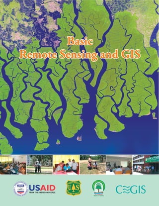
  • 11. Basic Remote Sensing and GIS Basic Remote Sensing and GIS Basic Remote Sensing and GIS Training Manual Developed by CEGIS, USFS and BFD, 2014-15
  • 12. Basic Remote Sensing and GIS The electromagnetic spectrum consists of all the different wavelengths of electromagnetic radiation ranges from the shorter wavelengths (including Gamma and X-rays) to the longer wavelengths (including Microwaves and broadcast radio waves). There are several regions of the electromagnetic spectrum such as visible spectrum, infrared spectrum and microwave spectrum, which are useful for remote sensing. The electromagnetic energy which our eyes can detect is part of the visible spectrum. The visible spectrum of electromagnetic energy covers a range of wave length from 0.4 to 0.7. The longest visible wavelength is red and the shortest is violet. There is a lot of electromagnetic energy around us which is "invisible" to our eyes, but can be detected by other sensors and used to our advantage. 1. Introduction to Remote Sensing and ERDAS IMAGINE 1-5 Electromagnetic Spectrum Visible Spectrum Source: http://ls7pm3.gsfc.nasa.gov/whatsRM/em.html Source: http://www.faculty.virginia.edu/rwoclass/astr1210/121supps2-3.html Source: Canada Centre for Remote Sensing. 2007. Tutorial: Fundamentals of Remote Sensing.
  • 13. Data Preparation This menu gives you access to a set of tools that are useful in general data preparation. This dialog opens when you click the Data Prep icon on the ERDAS IMAGINE icon panel Subset Image Click to open the Subset dialog, which enables you to create and define a subset image. Image Geometric Correction Click to open the Set Geo Correction Input File dialog, which is part of the Geometric Correction Tool. This dialog enables you to select the image you want to rectify. Mosaic Images Click to open the Mosaic Tool, MosaicPro (PC Only), the Mosaic Wizard (PC Only), or the Mosaic Direct (PC Only), all of which enable you to mosaic two or more images together. Unsupervised Classification Click to open the Unsupervised Classification dialog. Reproject Images Select this option to resample an image into a different projection. Basic Remote Sensing and GIS 1. Introduction to Remote Sensing and ERDAS IMAGINE 1-15 Source: ERDAS IMAGINE® Tour Guides™. (2006). Norcross, Georgia: Leica Geosystems Geospatial Imaging, LLC
  • 14. Basic Remote Sensing and GIS Spectral Resolution Spectral resolution refers to the specific wavelength intervals in the electromagnetic spectrum that a sensor can record (Simonett et al, 1983). Wide intervals in the electromagnetic spectrum are referred to as coarse spectral resolution, and narrow intervals are referred to as fine spectral resolution. For example, the SPOT panchromatic sensor is considered to have coarse spectral resolution because it records EMR between 0.51 and 0.73. On the other hand, band 3 of the Landsat TM sensor has fine spectral resolution because it records EMR between 0.63 and 0.69 (Jensen, 1996). Radiometric Resolution Radiometric resolution refers to the dynamic range, or numbers of possible data file values in each band. This is referred to by the number of bits into which the recorded energy is divided. For instance, in 8-bit data, the data file values range from 0 to 255for each pixel, but in 7-bit data, the data file values for each pixel range from 0 to 128. The sensor measures the EMR in its range. The total intensity of the energy from 0 to the maximum amount the sensor measures is broken down into256 brightness values for 8-bit data, and 128brightness values for 7-bit data. 2. Satellite Image Characteristics and Viewer Function 2-5 Source: ERDAS Field Guide™. (2005). Norcross, Georgia: Leica Geosystems Geospatial Imaging, LLC.
  • 15. Basic Remote Sensing and GIS 2. Satellite Image Characteristics and Viewer Function 2-15 Source: ERDAS IMAGINE on line Help for the Link Viewers Linking Viewers Select this option to link or unlink Viewer windows geographically so that the same image area opens in all linked Viewers. This type of link will not reflect changes in the arrangement of the layers, band combinations, or changes by other tools in the Viewer. Select this option again to unlink. a) In the first Viewer, select View | Link/Unlink Viewers | Geographical. The Link/Unlink Instructions display. b) Move your pointer to the second Viewer. The pointer becomes a Link symbol . c) Move the pointer to the first Viewer. d) The No Link symbol displays as the cursor in the first Viewer. Clicking in this Viewer discontinues the link operation. e) To link the Viewers, click anywhere in the second Viewer. f) The two Viewers are now linked. A white cursor box opens over the image in the second Viewer, indicating the image area displayed in the first Viewer. g) You can move and resize this cursor box as desired, and the image area in the first Viewer reflects each change. This is similar to the magnification box you used earlier. Viewer 1 Viewer 2 Two Viewers are Geographically linked
  • 16.
  • 17.  natural resource management  wildlife habitat protection  baseline mapping for GIS input  urban expansion / encroachment  routing and logistics planning for seismic / exploration / resource extraction activities  damage delineation (tornadoes, flooding, volcanic, seismic, fire)  legal boundaries for tax and property evaluation  target detection - identification of landing strips, roads, clearings, bridges, land/water interface 3. Satellite Sensors and Platform and Application 3-15 Basic Remote Sensing and GIS Land use and cover studies are multidisciplinary and the participants involved in such work are numerous and varied, ranging from international wildlife and conservation foundations, to government researchers, and forestry companies. The land use and land cover information are used for planning, monitoring, and evaluation of development, industrial activity, or land reclamation. The impacts of land-use and land-cover change on carbon dynamics, hydrology, climate change, and biodiversity have been recognized. Changes in land cover will be examined by environmental monitoring researchers, conservation authorities, and departments of municipal affairs, with interests varying from tax assessment to reconnaissance vegetation mapping. Remote-sensing data play an important role in land use and land cover mapping and in land use and land cover modeling for construction, parameterization, and validation. Following is the list of applications of land use and land cover mapping: Land use and Land Cover Mapping
  • 18. Basic Remote Sensing and GIS Shape Shape refers to the general form, structure, or outline of individual objects. It can be a very distinctive clue for interpretation. Straight edge typically represents urban or agricultural targets. On the contrary, natural features, such as forest edges, are generally, more irregular in shape. Agricultural fields irrigated by rotating sprinkler systems would appear as circular shapes. Size It is important to assess the size of a target relative to other objects and the absolute size, to aid in the interpretation of that target. A quick approximation of target size can direct interpretation quickly. For example, large buildings such as factories or warehouses would suggest commercial property, whereas small buildings would indicate residential use. 4. Satellite Image Interpretation 4-7 Source: Canada Centre for Remote Sensing. 2007. Tutorial: Fundamentals of Remote Sensing Source: Canada Centre for Remote Sensing. 2007. Tutorial: Fundamentals of Remote Sensing
  • 19. Basic Remote Sensing and GIS 5. Satellite Image Rectification 5-9 Lesson Review Knowledge and Skills Practice 2: Satellite Image Rectification  What is rectification  When to rectify and georeferencing satellite images.  Rectification steps  Geo-referencing in ERDAS IMAGINE  Resampling methods The details of this assignment and data are given in the attached CD of the manual. Please follow the Knowledge and Skills Practice 2: Satellite Image Rectification.
  • 20.
  • 21.
  • 22. Basic Remote Sensing and GIS Primary Colors Blue, green, and red are the primary colors or wavelengths of the visible spectrum. No single primary color can be created from the other two primary colors, but all other colors can be formed by combining blue, green, and red in various proportions. The sunlight is actually composed of various wavelengths of radiation in primarily the ultraviolet, visible and infrared portions of the spectrum. The infrared spectrum region covers the wavelength range from approximately 0.7mm to 100mm. This region can be divided into reflected IR and emitted or thermal IR based on the irradiation properties. The reflected IR region covers wavelengths from approximately 0.7mm to 3.0mm. This region is further divided into near IR (0.7mm–1.3mm) and mid IR (1.3mm–3mm). The near IR records energy related to vegetation health, while the mid IR is more related to moisture. The thermal IR covers wavelengths from approximately 3.0mm to 100mm. The energy in this This microwave spectrum covers the longest wavelengths of electromagnetic energy used for remote sensing. It covers the wavelength range from 1mm to 1m. The shorter wavelengths have properties similar to the thermal infrared region while the longer wavelengths approach the wavelengths used for radio broadcasts. Because of their long wavelengths, microwaves have special properties that are important for remote sensing. Longer wavelength microwave radiation can penetrate through cloud cover, haze, dust, and all but the heaviest rainfall. This property allows detection of microwave energy under almost all weather and environmental conditions so that data can be collected at any time. 1. Introduction to Remote Sensing and ERDAS IMAGINE1-6 Source: Canada Centre for Remote Sensing. 2007. Tutorial: Fundamentals of Remote Sensing. Source: Canada Centre for Remote Sensing. 2007. Tutorial: Fundamentals of Remote Sensing. Infrared Spectrum Microwave Spectrum
  • 23. Basic Remote Sensing and GIS 1. Introduction to Remote Sensing and ERDAS IMAGINE1-16 Source: ERDAS IMAGINE® Tour Guides™. (2006). Norcross, Georgia: Leica Geosystems Geospatial Imaging, LLC Image Interpreter This menu provides access to the ERDAS IMAGINE Image Interpreter functions. It opens when you click the Interpreter icon in the ERDAS IMAGINE icon panel Spatial Enhancement Click to access functions for enhancing images using the values of individual and surrounding pixels. The Spatial Enhancement menu displays. Radiometric Enhancement Click to access functions for enhancing images using the values of individual pixels within each band. The Radiometric Enhancement menu displays. Spectral Enhancement Click to access functions for enhancing images by transforming the values of each pixel on a multiband basis. The Spectral Enhancement menu displays. GIS Analysis Click to access functions for use on thematic data layers. The GIS Analysis menu displays. Utilities... Click to access some common utilities used on raster layers. The Utilities menu displays.
  • 24. Basic Remote Sensing and GIS Temporal Resolution Temporal resolution refers to how often a sensor obtains imagery of a particular area. For example, the Landsat satellite can view the same area of the globe once every 16 days. SPOT, on the other hand, can revisit the same area every three days. Temporal resolution is an important factor to consider in change detection studies. Digital Image Format in Remote Sensing Satellite image data is available in the following four different formats: TIFF: It stands for Tagged Image File Format. It is one of the most popular and flexible of the current public domain raster file formats. In TIFF files, information about the file structure is stored in so-called "tags". GeoTIFF: is an emerging standard for storing georeferenced image data. It is widely supported in remote sensing and GIS software such as ERDAS Imagine, ENVI, ArcGIS etc. The Hierarchical Data Format (HDF) is a multi-object file format for sharing scientific data in a distributed environment. MrSid: It is a powerful wavelet-based compressor. This data enable instantaneous viewing and manipulation of massive images locally and over networks, while maintaining maximum image quality and manageability. 2-6 2. Satellite Image Characteristics and Viewer Function Jensen 20007
  • 25. Source: ERDAS IMAGINE on line Help for the Raster Attribute Editor Basic Remote Sensing and GIS 2-16 2. Satellite Image Characteristics and Viewer Function Raster Attribute Editor The Raster Attribute Editor provides access to the properties saved in the Descriptor Table for each layer of a raster file. The Descriptor Table is part of the .img file. The Raster Attribute Editor allows you to edit, add, or delete attributes as well as perform functions with them. The changes effected by these operations can be saved with the image file. There are several ways to access the Raster Attribute Editor: Select Tools > Edit Raster Attributes... from the ERDAS IMAGINE icon panel. Select Edit > Raster Attribute Editor... from the ImageInfo menu bar. This method allows access to any layer of any .img file. Select Raster > Attributes... from the Viewer menu bar. This method operates on the layer open in ImageInfo. Edit Column Properties This dialog enables you to add, remove, and rearrange attribute columns. You may change the alignment and format of data and the width of columns. Click Edit > Column Properties... on the Raster Attribute Editor menu bar, or click the icon on the toolbar to access this dialog.
  • 26.
  • 27.  lithological mapping  structural mapping  sand and gravel (aggregate) exploration/ exploitation  mineral exploration  hydrocarbon exploration  environmental geology  baseline infrastructure  sedimentation mapping and monitoring  event mapping and monitoring  geo-hazard mapping  wetlands mapping and monitoring,  soil moisture estimation,  snow pack monitoring / delineation of extent,  measuring snow thickness, 3-16 3. Satellite Sensors and Platform and Application Basic Remote Sensing and GIS Geology Geology involves the study of landforms, structures, and the subsurface, to understand physical processes creating and modifying the Earth's crust. Remote sensing is used as a tool to extract information about the land surface structure, composition or subsurface. Information on lithology or rock composition may be extracted from multispectral images based on spectral reflectance. Radar provides information of surface topography and roughness, and it is extremely valuable when integrated with another data source to provide detailed relief. Application of Remote Sensing in the field of Geology may include: Hydrology Abilities of remote sensing technology in hydrology are to measure spatial, spectral, and temporal information and provide data on the state of the earth's surface. It provides observation of changes in hydrological states, which vary over both time and space that can be used to monitor hydrological conditions and changes. Both active sensors that send a pulse and measure the return pulse (like radar, microwave etc.) and passive sensors that measure emissions or reflectance from natural sources (like Sun, thermal energy of the body) are used. Sensors can provide data on reflective, thermal and dielectric properties of earth's surface. Remote sensing techniques indirectly measure hydrological variables, so the electromagnetic variables measured by remote sensing have to be related to hydrological variables empirically or with transfer functions. Application of remote sensing in the field of hydrology:
  • 28.   Basic Remote Sensing and GIS Lesson Review Knowledge for Image Interpretation Elements of Image Interpretation like Image Tone, Image Texture, Shadow, Patterns, Association, Shape, Size and their significance. 4-8 4. Satellite Image Interpretation
  • 29.
  • 30.
  • 31. Table of Contents Preface....................................................................................................................................... iii Introduction............................................................................................................................... iv Lesson - 1 : Introduction to Remote Sensing and ERDAS IMAGINE............................. 1-1 Lesson - 2 : Satellite Image Characteristics and Viewer Functions........................................ 2-1 Lesson - 3 : Satellite Sensors and Platform and Application................................................. 3-1 Lesson - 4 : Satellite Image Interpretation............................................................................ 4-1 Lesson - 5 : Satellite Image Rectification............................................................................... 5-1 Lesson - 6 : Satellite Image Classification............................................................................. 6-1 Lesson - 7 : Introduction to GIS Concept and its Application.............................................. 7-1 Lesson - 8 : Spatial and Tabular Data model...................................................................... 8-1 Lesson - 9 : Spatial Analysis............................................................................................... 9-1 Lesson - 10 : Summary.......................................................................................................... 10-1 Lesson - 11 : Bibliography...................................................................................................... 11-1 v
  • 32. Basic Remote Sensing and GIS When electromagnetic energy passes through atmosphere, it is scattered or absorbed mainly by particles and molecules of several gases (for example water vapor, carbon dioxide, and ozone) in the Earth's atmosphere. Some radiation, such as visible light, largely passes through the atmosphere. Atmospheric scattering occurs when particles (aerosols and dust particles) or large gas molecules in the atmosphere interact with electromagnetic radiation and cause it to be redirected from its original path. The amount of scattering depends on the wavelength of the radiation, the abundance of particles or gases, and the travel distance of the radiation. Types of Scattering Scattering is a function of the wavelength of the electromagnetic energy, the size of the gas molecule, dust particle and water vapor droplet encountered. There are three types of scattering: Rayleigh scattering: Such phenomena occur when electromagnetic radiation interacts with particles which are very small compared to the wavelength of the radiation. Such particles are very small dust or nitrogen and oxygen molecules. In this process, shorter wavelengths of energy are scattered much more than longer wavelengths. It is the dominant scattering mechanism in the upper atmosphere. Mie scattering: Such phenomena occur when electromagnetic radiation interacts with particles which are about the same size as the wavelength of the radiation. It occurs in the lower portions of the atmosphere where larger particles are abundant, and dominants when cloud conditions are overcast. 1. Introduction to Remote Sensing and ERDAS IMAGINE 1-7 Interactions with the Atmosphere Atmospheric Scattering
  • 33. Image Classification Classification is the process of sorting pixels into a finite number of individual classes, or categories of data, based on their data file values. If a pixel satisfies a certain set of criteria, then the pixel is assigned to the class that correspond the set of criteria. For the first part of the classification process, the computer system must be trained to recognize patterns in the data. Training is the process of defining the criteria by which these patterns are recognized. The result of training is a set of signatures, which are criteria for a set of proposed classes. Source: ERDAS Signature Editor Unsupervised Classification Supervised Classification Basic Remote Sensing and GIS 1. Introduction to Remote Sensing and ERDAS IMAGINE 1-17 click to open the Signature Editor. This utility allows you to create, manage, evaluate, edit, and classify signatures. There are two ways to classify pixels into different categories: supervised and unsupervised Many of the Classification tools can also be accessed through the Signature Editor. This menu displays when you click the Classifier icon on the ERDAS IMAGINE icon panel. Click to open the Unsupervised Classification dialog. This utility lets you perform an unsupervised classification on an .img file using the ISODATA algorithm. This utility can also be accessed from the Signature Editor. Click to open the Supervised Classification dialog. This utility allows you to perform a supervised classification on an .img file using various decision rules. This utility can also be accessed from the Signature Editor. Source: IMAGINE® Tour Guides™. (2006). Norcross, Georgia: Leica Geosystems Geospatial Imaging, LLC
  • 34. Introduction to IMAGINE Viewer The ERDAS IMAGINE Viewer is the "main window" for displaying raster, vector, and/or annotation data. You can open as many Viewers as your window manager supports. Following are the IMAGINE viewer functions: Using Utility Menu Options The Utility menu on the Viewer enables you to access four separate groups of functions; inquiry functions, measurement tool, layer viewing and information. Each function group is separated by a line in the pull down menu. Viewing Menu Options The Viewing menu on the Viewer enables you to access Arrange Layers, Zooming and Linking Viewers functions. Using Raster Menu Options The Raster menu is available whenever a raster view pane is active. Using the Raster Attribute Editor The Raster Editor enables you to edit portions of the displayed image using various tools in the Viewer Raster menu. When a specific raster editing tool is in use, that tool locks the Viewer, therefore, work with one tool must be completed before opening another one. Using Profile Tools The spectral profile display is fundamental to the analysis of hyper-spectral data sets. As the number of bands increases and the band widths decrease, the remote sensor is evolving toward the visible/infrared spectrometer. The reflectance (DN) of each band within one (spatial) pixel can be plotted to provide a curve approximating the profile generated by a laboratory scanning spectrometer Source: ERDAS IMAGINE on line Help file on Viewer Basic Remote Sensing and GIS 2. Satellite Image Characteristics and Viewer Function 2-7
  • 35. Source: ERDAS IMAGINE on line Help for the Spectral Profile Tools Basic Remote Sensing and GIS 2. Satellite Image Characteristics and Viewer Function 2-17 Spectral Profile Tools This dialog enables you to select which Profile Tool to open. It opens when you click the icon on the Viewer toolbar, , or when you select Raster > Profile Tools... from the Viewer menu bar. Select the Profile you want to view. Spectral - Select this option to open the Spectral Profile dialog. Spatial - Select this option to view the Spatial Profile dialog. Surface - Select this option to view the Surface Profile dialog. OK - Click to view the selected profile and close this dialog. Cancel - Click to cancel this process and close this dialog.
  • 36.
  • 37.  glacier dynamics monitoring (surges, ablation)  river /delta change detection  drainage basin mapping and watershed modelling  irrigation canal leakage detection  irrigation scheduling Oil spill  mapping and predicting oil spill extent and drift  strategic support for oil spill emergency response decisions  identification of natural oil seepage areas for exploration Fish stock and marine mammal assessment  water temperature monitoring  water quality  ocean productivity, phytoplankton concentration and drift Intertidal zone  tidal and storm effects  delineation of the land /water interface  mapping shoreline features / beach dynamics  coastal vegetation mapping  human activity / impact Basic Remote Sensing and GIS 3. Satellite Sensors and Platform and Application 3-17 Source: http://ces.iisc.ernet.in/energy/monograph1/Gispage7.html Coastal Monitoring The coastal zone is a region subjected to increasing stress from human activity and natural disasters. Government agencies concern with the impacts of human activities and natural disasters in this region need new data sources for monitoring erosion and accretion, loss of natural habitats, urbanization, land use and land cover, effluent sand offshore pollution. Many of the changes in the coastal region and dynamics of the open ocean can be mapped and monitored using remote sensing techniques. Major application includes:  determining snow-water equivalent,  river and lake ice monitoring,  flood mapping and monitoring,
  • 38. Basic Remote Sensing and GIS Objective.....................................................................................................................................5-1 Rectification................................................................................................................................5-2 When to Rectify ? ......................................................................................................................5-2 When to Georeference ? ..............................................................................................................5-3 Rectification Steps ......................................................................................................................5-3 Resampling Methods ..................................................................................................................5-6 Rectification Summary ...............................................................................................................5-8 Lesson Review ............................................................................................................................5-9 Knowledge and Skills Practice 2: Satellite Image Rectification .....................................................5-9 Objective By the end of this lesson, through the knowledge and skills practice the participants will be able to: 1. Define rectification. 2. Explain when to rectify and geo-referencing satellite images. 3. Explain the Rectification steps 4. Geo-reference the satellite images using ERDAS Imagine software. 5. Tell and describe the four resampling methods and explain their significance. A Training Manual Prepared for Bangladesh Forest Department Satellite Image Rectification
  • 39.
  • 40.
  • 41.
  • 42. Basic Remote Sensing and GIS Nonselective scattering: Such phenomena occur when electromagnetic radiation interacts with particles which are much larger (water droplets and large dust particles) than the wavelength of the radiation. In this process, all wavelengths are scattered about equally. The figure shows the relative size of the atmospheric particles that are responsible for various scattering of the electromagnetic radiation in the atmosphere. Absorption causes molecules in the atmosphere to absorb electromagnetic energy at various wavelengths when it interacts with the atmospheric constituents. Ozone, carbon dioxide, and water vapor are the three main atmospheric constituents which absorb electromagnetic energy. Ozone absorbs the harmful ultraviolet radiation from the sun. Carbon dioxide, referred to as a greenhouse gas, absorbs radiation strongly in the far infrared portion of the electromagnetic spectrum which serves to trap this heat inside the atmosphere. The incoming long wave infrared and shortwave microwave radiation (between 22 and 1m) are absorbed by water vapor in the atmosphere. Atmospheric windows: The regions of the electromagnetic spectrum, which are not severely influenced by atmospheric absorption and useful to remote sensing, are called atmospheric windows. 1. Introduction to Remote Sensing and ERDAS IMAGINE1-8 Atmospheric Absorption Source: Canada Centre for Remote Sensing. 2007. Tutorial: Fundamentals of Remote Sensing. Source: Canada Centre for Remote Sensing. 2007. Tutorial: Fundamentals of Remote Sensing.
  • 43. Spatial Modeler Spatial Modeler enables you to create and run models for image processing and GIS analysis. It is a highly flexible tool that uses Model Maker and the Spatial Modeler Language. The Spatial Modeler Language is a modeling language that is used internally by Model Maker to execute the operations specified in the graphical models that you create. You can also use the Spatial Modeler Language directly to write your own script models. Click this icon on the ERDAS IMAGINE icon panel to access Spatial Modeler: Model Maker Click to open the Model Maker window and the Model Maker Tool palette. This window allows you to work with graphical models. You can view or edit existing models and create new models. Script Librarian Click to open the Model Librarian dialog. This dialog lists all the existing script models in the system. Using this option, you can view, edit, create, and delete script models. Basic Remote Sensing and GIS 1. Introduction to Remote Sensing and ERDAS IMAGINE1-18 Source: ERDAS IMAGINE® Tour Guides™. (2006). Norcross, Georgia: Leica Geosystems Geospatial Imaging, LLC
  • 44. Title bar Menu bar Tool bar Status Bar Scroll Bars Quick View Menu Basic Remote Sensing and GIS 2-8 2. Satellite Image Characteristics and Viewer Function Parts of Viewer Window The parts of the Viewer window are explained in the following illustration. Left - hold and drag any one of these corners to resize the Viewer. Source: ERDAS IMAGINE on line Help file on Viewer The Title Bar shows the number of the Viewer, which is referred to in other operations Left-hold on Viewer Menu Bar item for list of operations to perform on the displayed data The Tool Bar consists of icons to provide rapid access to frequently used operations Use Scroll Bars to scroll the data. The size of the bar in the panel shows how much of the data area you are viewing now. Right click inside the viewer to pop up a Quick View Menu of frequently used functions. Help for Viewer Select this option to see this On-Line Help document Information about the button under the cursor is displayed in this Status Bar.
  • 45. Basic Remote Sensing and GIS 2-18 2. Satellite Image Characteristics and Viewer Function AOI Tools The AOI Tools enable you to select, create, and edit areas of interest (AOIs). An AOI is a point, line, or polygon that is selected as a training sample or as the image area to be used in an operation. They are often used as input to the Signature Editor prior to image classification. This tool palette opens when you select AOI -> Tools... from the Viewer menu bar. Click to select, move, and resize AOI elements. Click to select all AOI elements that fall within the boundary of the rectangular marquee that you draw. Click to create a rectangular AOI. Click to create an elliptical AOI. Click to create a polygonal AOI. Click to add each vertex. Double- click to close the polygon. Click to create a polyline AOI. In the Viewer, click to add each vertex. Double-click to end the polyline. Click to select a single pixel from which an AOI grows. Click to create a point AOI. AOI Tools Source: ERDAS IMAGINE on line Help for the AOI Tools
  • 46.
  • 47. Basic Remote Sensing and GIS 3-18 3. Satellite Sensors and Platform and Application Lesson Review Information about sensors, platforms, satellite orbit, satellite swath and multispectral scanning Different types of satellites and their use Different Earth Observation satellites and their significance. Different applications of satellite image
  • 48. Rectification Rectification is the process of transforming the data from one grid system into another grid system using a geometric transformation. To be able to compare separate images pixel by pixel, the pixel grids of each image must conform to the other images in the data base. Registration is the process of conforming an image to another image. For example, if image A is not rectified and it is being used with image B, then image B must be registered to image A so that they conform to each other. Geo-referencing refers to the process of assigning map coordinates to image data. The image data may already be projected onto the desired plane, but not yet referenced to the proper coordinate system. Rectification involves geo-referencing, since all map projection systems are associated with map coordinates. Image-to-image registration involves geo-referencing only if the reference image is already georeferenced. Geo-referencing, by itself, involves changing only the map coordinate information in the image file. The grid of the image does not change. When to Rectify ? There are several reasons for rectifying image data: comparing pixels scene to scene in applications, such as change detection or thermal inertia mapping (day and night comparison) developing GIS data bases for GIS modeling identifying training samples according to map coordinates prior to classification creating accurate scaled photomaps and overlaying an image with vector data, such as ArcInfo comparing images that are originally at different scales extracting accurate distance and area measurements mosaicking images and performing any other analyses requiring precise geographic locations Before rectifying the data, you must determine the appropriate coordinate system for the data base. Source: ERDAS Field Guide™. (2005). Norcross, Georgia: Leica Geosystems Geospatial Imaging, LLC. Basic Remote Sensing and GIS 5-2 5. Satellite Image Rectification
  • 49.
  • 50.
  • 51. Introduction The manual on Basic Remote Sensing and GIS is for the trainees and trainers with different objectives. This manual has been designed as a resource tool for those who would be using remote sensing and GIS in their area of work. It is expected that the Basic Remote Sensing and GIS manual will substantially enhance the capacity of those who will be imparting information and knowledge on the same as Trainers, and develop the capacity of those Trainees to whom these information and knowledge will be imparted. The Trainees or the participants of the training on RS & GIS will go –post training- through the manual in order to reinforce their learning of the fundamentals of the remote sensing processes, use of GIS and to apply the learnt skills, effectively. The Trainers will go through this manual to make an assessment of their own knowledge and understanding of the subject, fill their own knowledge gaps on this subject matter, if found any, and decide on the suitable approach to present/facilitate knowledge and skills learning to the trainees, effectively. They may use this manual a support material for conducting sessions. The contents of the manual are organized under 9(Nine) sections or Lessons. Each Lesson comprises a lecture [composed of several topics that cover the main subject of the Lecture] and an end-of-lesson knowledge and skills practice session wherever required. In addition, key objectives to be achieved after completion of each Lesson, have been stated clearly so that the user is focused on the learning being transferred through each lesson. Topic-wise detailed notes have also been included as supplementary information. Moreover, notes also include additional reference links. Knowledge and skills practice session is given with a view to help the users to assess what they learn from each lesson and explore the significance of ERDAS Imagine software and ArcGIS software in Remote Sensing and GIS. In overall, this RS & GIS manual is intended to assist in developing human resource capacity for Bangladesh Forest Department through a clear understanding of and practice on basics of Remote Sensing and GIS concepts and their different applications.
  • 52. Basic Remote Sensing and GIS Interaction with Targets When energy incident upon the surface, three forms of interaction take place: absorption (A); transmission (T); and reflection (R).The proportions of each depends on the wavelength of the energy and the material and condition of the feature. Absorption (A) occurs when energy is absorbed into the target. Transmission (T) occurs when radiation passes through a target and Reflection (R) occurs when radiation "bounces" off the target. In remote sensing, the radiation reflected from targets is measured. Specular Reflection: When a surface is smooth we get specular or mirror-like reflection where almost all of the energy is directed away from the surface in a single direction. Diffuse reflection: such reflection occurs when the surface is rough and the energy is reflected almost uniformly in all directions. There are two extreme ends of the way in which energy is reflected from a target: specular reflection and diffuse reflection. Interactions with Vegetation Chlorophyll in leaves strongly absorbs radiation in the red and blue wavelengths but reflects greenwavelengths. That is why leaves appear green. It appears "greenest" in the summer, whenchlorophyll content is at its maximum. In autumn, there is less chlorophyll in the leaves, so there isless absorption and proportionately more reflection of the red wavelengths, making the leavesappear red or yellow. The internal structure of healthy leaves act as excellent diffuse reflectors of near-infrared wavelengths. Measuring and monitoring the near-IR reflectance in remote sensing, one can determine how healthy (or unhealthy) vegetation may be. http://earthobservatory.nasa.gov/Features/Measuring Vegetation/measuring_vegetation_2.php 1. Introduction to Remote Sensing and ERDAS IMAGINE 1-9
  • 53. Basic Remote Sensing and GIS 1. Introduction to Remote Sensing and ERDAS IMAGINE 1-19 Lesson Review  Remote Sensing and its Process  Electromagnetic energy and different regions of Electromagnetic spectrum  Interaction of Electromagnetic energy with Atmosphere and targets.  Passive and Active Remote Sensing  Data Reception, Transmission and Processing  Information about different image processing software  Introduction to ERDAS IMAGINE software
  • 54. Basic Remote Sensing and GIS 2. Satellite Image Characteristics and Viewer Function 2-9 In the Viewer menu bar, select File | Open | Raster Layer or Click to open raster layer. Select Layer to Add : Select file type from File of Type dropdown list and select the raster data to open. Raster Options : Click on Raster Options and choose following raster options: Display as : True Color - appropriate for most interval or ratio multiband images; Pseudo Color - appropriate for nominal or ordinal images in one band; Gray Scale - appropriate for a single band of interval or ratio data. Layer to color: Red : Enter the band to display in the red color channel; Green: Enter the band to display in the green color channel; Blue: Enter the band to display in the blue color channel. Clear Display- When this checkbox is enabled, and a new image is loaded, the image currently displayed in the Viewer is removed. Disable this checkbox to overlay images. Fit to Frame- If this checkbox is enabled, the image is magnified or reduced to fit the Viewer window at its current size. No Stretch- Click to display data without applying the normal two standard deviation stretch. Using - Use one of the following resampling methods: Nearest Neighbor, Bilinear Interpolation, Cubic Convolution, and Bi-cubic Spline. Displaying an Image
  • 55. Basic Remote Sensing and GIS 2. Satellite Image Characteristics and Viewer Function 2-19 Satellite Image Data Bands Multispectral Satellite Image Different types of Raster Layer Different types of Resolution and their significance Different format of Digital Images Introduction of Image Viewer and its different functions. Lesson Review        The details of this assignment and data are given in the attached CD of the manual. Please follow the Knowledge and Skills Practice 1: Satellite Image Characteristics and Viewer Functions. Knowledge and Skills Practice 1: Satellite Image Characteristics and Viewer Functions
  • 56. Burghausen, Germany Oahu, Hawaii 3. Satellite Sensors and Platform and Application 3-9 Basic Remote Sensing and GIS RapidEye The RapidEye constellation of five Earth Observation satellites has been in operation since February 2009. The system images a 77 kilometer wide swath, which produces more than five million square kilometers of earth every day for its archive and over one billion km2 every year.RapidEye's sensors produce imagery in five spectral bands (Red, Green, Blue, Red Edge and Near Infrared). BlackBridge satellites include the Red-Edge band, which is sensitive to changes in chlorophyll content. Several studies have suggested that the transition between the red absorbance and the Near-Infrared (NIR) reflection is able to provide additional information about vegetation and its characteristics. Satellite Specification Number of Satellites: 5 Orbit Altitude: 630 km in Sun-synchronous orbit Sensor Type: Multi-spectral push broom imager Global Revisit Time: 1 Day Pixel size (ortho-rectified): 5 m Swath Width: 77 km Revisit time: Daily (off-nadir) / 5.5 days (at nadir) Dynamic Range: 12 bit Five Constellation Satellites (Image Copyright © BlackBridge) Source : http://www.satimagingcorp.com/satellite- sensors/other-satellite-sensors/rapideye/ Source: BlackBridge. WHITE PAPER The RapidEye Red Edge Band https://earth.esa.int/web/guest/missions/3rd-party-missions/current-missions/rapideye http://www.satimagingcorp.com/satellite-sensors/other-satellite-sensors/rapideye/ Spectral Bands 440 – 510 nm (Blue) 520 – 590 nm (Green) 630 – 685 nm (Red) 690 – 730 nm (Red Edge) 760 – 850 nm (Near IR) Typical spectral reflectance curves of selected surfaces inrelation to the RapidEye spectral bands Source: BlackBridge. WHITE PAPER The RapidEye Red Edge Band.
  • 57. Basic Remote Sensing and GIS A Training Manual Prepared for Bangladesh Forest Department Satellite Image Interpretation Objective ................................................................................................................................... 4-1 Image Interpretation .................................................................................................................. 4-2 Knowledge for Interpretation....................................................................................................... 4-2 Image Interpretation Tasks........................................................................................................ 4-3 Elements of Image Interpretation................................................................................................ 4-4 Lesson Review............................................................................................................................ 4-8 Objective By the end of this lesson, the participants will be able to: 1. Explain the knowledge for interpretation of satellite image 2. Explain fully the elements of image interpretation.
  • 58. When to Geo-reference ? Scanning and digitizing produce images that are planar, but do not contain any map coordinate information. These images need only to be georeferenced. In many cases, the image header can simply be updated with new map coordinate information. This involves redefining the: · map coordinate of the upper left corner of the image · cell size (the area represented by each pixel) Source: ERDAS Field Guide™. (2005). Norcross, Georgia: Leica Geosystems Geospatial Imaging, LLC. Disadvantages of Rectification During rectification, the data file values of rectified pixels must be resembled to fit into a new grid of pixel rows and columns. Although some of the algorithms for calculating these values are highly reliable, some spectral integrity of the data can be lost during rectification. If map coordinates or map units are not needed in the application, then it may be wiser not to rectify the image. An unrectified image is more spectrally correct than a rectified image Classification Some analysts recommend classification before rectification, since the classification is then based on the original data values. Another benefit is that a thematic file has only one band to rectify instead of the multiple bands of a continuous file. On the other hand, it may be beneficial to rectify the data first, especially when using GPS data for the GCPs. Since these data are very accurate, the classification maybe more accurate if the new coordinates help to locate better training samples. Thematic Files Nearest neighbor is the only appropriate resampling method for thematic files. Rectification Steps Usually, rectification is the conversion of data file coordinates to some other grid and coordinate system, called a reference system. Rectifying or registering image data on disk involves the following general steps, regardless of the application. 1. Locate GCPs. 2. Compute and test a transformation. 3. Create an output image file with the new coordinate information in the header. The pixels must be resampled to conform to the new grid. Source: ERDAS Field Guide™. (2005). Norcross, Georgia: Leica Geosystems Geospatial Imaging, LLC Basic Remote Sensing and GIS 5. Satellite Image Rectification 5-3
  • 59.
  • 60. A Training Manual Prepared for Bangladesh Forest Department Basic Remote Sensing and GIS Introduction to GIS Concept and its Application Objective ................................................................................................................................ 7-1 What is GIS ? (Geographic Information System) ................................................................... 7-2 How Data is Organized in GIS ............................................................................................ 7-5 Introduction to ArcGIS ......................................................................................................... 7-7 ArcMap................................................................................................................................. 7-10 Application of GIS................................................................................................................ 7-12 Lesson Review........................................................................................................................ 7-15 Knowledge and Skills Practice 4: Introduction to GIS Concept and its application .................. 7-15 By the end of this lesson, through the knowledge and skills practice the participants will be able to: 1. Define what GIS is and its components. 2. Explain how data is organized in GIS. 3. Explore ArcGIS software and its capabilities. 4. Explain the application of GIS. 5. Open the different tools of ArcCatalog and ArcMap viewer. Objective
  • 61.
  • 62. Basic Remote Sensing and GIS Interactions with Water Water absorbs longer visible wavelength and near infrared radiation than shorter visible wavelengths. That is why water typically looks blue or blue-green due to stronger reflectance at shorter visible wavelengths, and darker if viewed at red or near infrared wavelengths. Because of more absorption of the blue wavelengths and reflection of the green wavelengths by chlorophyll in algae, the water appears greener in color when algae are present in water. If there is suspended sediment in the upper layers of the water body, this will allow higher reflectivity and a brighter appearance of the water. Spectral Response A spectral response for an object can be built up by measuring the energy that is reflected or emitted from the object on the Earth's surface over a variety of different wavelengths. By comparing the response patterns of different features over a variety of different wavelengths, it is possible to distinguish between them. For example, water and vegetation may reflect somewhat similarly in the visible wavelengths but are almost always separable in the infrared. Spectral response for the same target type can be quite variable even it can vary temporally and spatially. Understanding the factors, which influence the spectral response of the object of interest, are critical to correctly interpreting the interaction of electromagnetic radiation with the object. 1. Introduction to Remote Sensing and ERDAS IMAGINE1-10 Source: Canada Centre for Remote Sensing. 2007. Tutorial: Fundamentals of Remote Sensing. Source: Canada Centre for Remote Sensing. 2007. Tutorial: Fundamentals of Remote Sensing.
  • 63.
  • 64. Basic Remote Sensing and GIS 2-10 2. Satellite Image Characteristics and Viewer Function You can query a displayed image for information about each pixel using the inquiry functions. 1. Select Utility | Inquire Cursor from the Viewer menu bar. A white crosshair displays in the Viewer and the Inquire Cursor dialog opens. There are three methods when using the Inquire Cursor in the Viewer; Drag the white crosshair over the image and, enter new coordinates into the Cell Array of the Inquire Cursor dialog. The Inquire Cursor moves when you move the mouse cursor back into the Viewer. As the crosshair is moved, the information in the Inquire Cursor dialog automatically updates. 2. The Cell Array in the Inquire Cursor dialog reports a variety of pixel information. Drag on the horizontal scroll bar (or enlarge the Inquire Cursor dialog by dragging any corner) to show all of the pixel information available in the Cell Array. Source: ERDAS IMAGINE on line Help for the Inquire Cursor Inquiry Cursor Function
  • 65.
  • 66. 3-10 3. Satellite Sensors and Platform and Application Basic Remote Sensing and GIS LANDSAT 8 LANDSAT 8 satellite sensor is part of the Landsat Data Continuity Mission was successfully launched on February 11, 2013 from Space Launch Complex-3, Vandenberg Air Force Base in California and will join LANDSAT 7 satellite in orbit. LANDSAT 8 satellite has two main sensors: the Operational Land Imager (OLI) and the Thermal Infrared Sensor (TIRS).OLI will collect images using nine spectral bands in different wavelengths of visible, near-infrared, and shortwave light to observe a 185 kilometer (115 mile) wide swath of the Earth in 15-30 meter resolution covering wide areas of the Earth's landscape while providing sufficient resolution to distinguish features like urban centers, farms, forests and other land uses. TIRS was added to the satellite mission when it became clear that state water resource managers rely on the highly accurate measurements of Earth's thermal energy obtained by LDCM's predecessors, LANDSAT 5 and LANDSAT 7, to track how land and water are being used. With nearly 80 percent of the fresh water in the Western U.S. being used to irrigate crops, TIRS will become an invaluable tool for managing water consumption. Source: http://www.satimagingcorp.com/satellite-sensors/other-satellite-sensors/landsat-8/
  • 67. Basic Remote Sensing and GIS 4-2 4. Satellite Image Interpretation Image Interpretation Image Interpretation is "The examination of images for the purpose of identifying objects and judging their significance". (McClone, 2004). We must apply a specialized knowledge to translate images into information. The specialized knowledge forms the field of image interpretation and we can apply this knowledge to derive useful information from the images. Image interpretation involves the identification of various targets (environmental or artificial features) from images which consist of points, lines, or areas. Targets may be defined in terms of the way they reflect or emit radiation. This radiation is measured and recorded by a sensor, and ultimately is depicted as an image product such as an air photo or a satellite image. Knowledge for Interpretation Proficiency of image interpretation is formed by three separate kinds of knowledge: Subject Knowledge of the subject of interpretation is the heart of the interpretation. Accurate interpretation requires familiarity with the subject of the interpretation. For example, interpretation of geologic information requires education and experience in the field of geology. Yet narrow specialization is a handicap, because each image records a complex mixture of many kinds of information, requiring application of broad knowledge that crosses traditional boundaries between disciplines. Geographic Region Knowledge of the specific geographic region depicted on an image can be equally significant. Every locality has unique characteristics that influence the patterns recorded on an image. In unfamiliar regions the interpreter may find it necessary to make a field reconnaissance or to use maps and books that describe analogous regions with similar climate, topography, or land use. Remote Sensing System Subject Different instruments use separate portions of the electromagnetic spectrum, operate at different resolutions, and use different methods of recording images. The image interpreter must know how each of these variables influences the image to be interpreted and how to evaluate their effects on his or her ability to derive useful information from the imagery. Source: Wynne, James B. Campbell, Randolph H. (2011). Introduction to remote sensing (5th ed.). New York: Guilford Press. Canada Centre for Remote Sensing. 2007. Tutorial: Fundamentals of Remote Sensing. Source: Wynne, James B. Campbell, Randolph H. (2011). Introduction to remote sensing (5th ed.). New York: Guilford Press
  • 68. Ground Control Points GCPs are specific pixels in an image for which the output map coordinates (or other output coordinates) are known. GCPs consist of two X,Y pairs of coordinates: Source Coordinate Usually data file coordinates in the image being rectified is known as Source Coordinates Reference Coordinate The coordinates of the map or reference image to which the source image is being registered is known as Reference Coordinates GCP in ERDAS IMAGINE Any ERDAS IMAGINE image can have one GCP set associated with it. The GCP set is stored in the image file along with the Raster layers. In the Cell Array of GCP data that displays in the GCP Tool, one column shows the point ID of each GCP. The point ID is a name given to GCPs in separate files that represent the same geographic location. Such GCPs are called corresponding GCPs. A default point ID string is provided (such as GCP #1), but you can enter your own unique ID strings to set up corresponding GCPs as needed. Even though only one set of GCPs is associated with an image file, one GCP set can include GCPs for a number of rectifications by changing the point IDs for different groups of corresponding GCPs. Entering GCPs Select many GCPs throughout the scene. The more dispersed the GCPs are, the more reliable the rectification is. GCPs for large-scale imagery might include the intersection of two roads, airport runways, utility corridors, towers, or buildings. For small scale imagery, larger features such as urban areas or geologic features may be used. Landmarks that can vary (e.g., the edges of lakes or other water bodies, vegetation, etc.) should not be used. The source and reference coordinates of the GCPs can be entered in the following ways: · They may be known as priori, and entered at the keyboard. · Use the mouse to select a pixel from an image in the Viewer. With both the source and destination Viewers open, enter source coordinates and reference coordinates for image-to image registration. · Use a digitizing tablet to register an image to a hardcopy map. Basic Remote Sensing and GIS 5-4 5. Satellite Image Rectification Source: ERDAS Field Guide™. (2005). Norcross, Georgia: Leica Geosystems Geospatial Imaging, LLC
  • 69.
  • 70. GIS is the acronym for geographic information system. It is an integrated collection of compu ter software and data used to view and manage information about geographic places, analyze spat ial relationships, and model spatial processes. A GIS provides a framework for gathering a nd organizing spatial data and related information so that it can be displayed and analyzed. Example:  Information about places on the Earth’s surface. – e.g. population of a country  Knowledge about where something is – e.g. locations of fishing villages  Knowledge about what is at a given location – e.g. bio-diversity of habitats Characteristics of geographic information  Can be very detailed e.g. individual trees in a forest  Can be very coarse e.g. climate of a region  Mostly static e.g. natural and manmade features does not change rapidly  Can be moving e.g. vehicles, ships, aero planes Basic Remote Sensing and GIS 7-2 7. Introduction to GIS Concepts and its Application What is GIS? (Geographic Information System) Sources: http://en.wikipedia.org/wiki/Geographic_information_system http://resources.arcgis.com/en/help/ a database management system (DBMS) tools for the input and manipulation of geographic information tools that support geographic query, analysis, and visualization a graphical user interface (GUI) for easy access to tools Software : GIS software provides the functions and tools needed to store, analyze, and display geographic information. Key software components are Hardware : Hardware is the computer on which a GIS operates. Today, GIS runs on a wide range of hardware types, from centralized computer servers to desktop computers used in stand-alone or networked configurations. Components of a GIS
  • 71. Basic Remote Sensing and GIS Introduction to Remote Sensing and ERDAS IMAGINE Objective ................................................................................................................................. 1-1 What is RemoteSensing ? ........................................................................................................1-2 Electromagnetic Radiation .......................................................................................................1-3 Interactions with the Atmosphere .............................................................................................1-7 Interaction with Targets ...........................................................................................................1-9 Imagine Processing Software .................................................................................................... 1-12 Introduction to ERDAS Imagine ........................................................................................... 1-12 Lesson Review .........................................................................................................................1-19 By the end of this lesson, the participants will be able to: 1. Define Remote Sensing and describe its process, correctly. 2. Identify and interpret the different region of Electromagnetic spectrum, correctly. 3. Explain the interaction of electromagnetic energy with atmosphere and targets. 4. Interpret the Spectral response pattern of different features of earth surface. 5. Delineate the Recording of energy by the sensor. 6. Recognize the different image processing software 7. Give an outline of the different functions of ERDAS IMAGINE software. Objective A Training Manual Prepared for Bangladesh Forest Department
  • 72. Basic Remote Sensing and GIS Recording of Energy by the Sensor The sun is a convenient source of energy for remote sensing. The sun's energy is either reflected, as it is for visible wavelengths, or absorbed and then reemitted, as it is for thermal infrared wavelengths. Passive Remote Sensing : In passive remote sensing systems, the reflected and emitted energy that is naturally available are measured by sensors. The reflected energy is available during the time when the sun is illuminating the Earth and naturally emitted energy such as thermal infrared is available at day or night for remote sensing. Active Remote Sensing : active remote sensing system, the energy that is required for remote sensing is provided by its own energy source. The sensor transmits energy toward the target to be investigated and the energy reflected from that target is detected and measured by the sensor. Some examples of active sensors are laser fluorescence and synthetic aperture radar (SAR). Data Reception, Transmission, and Processing Data acquired from satellite platforms are electronically transmitted to the Earth. There are three main options for transmitting data acquired by satellites to the surface. The data can be directly transmitted to Earth if a Ground Receiving Station (GRS) is in the line of sight of the satellite or the data can be recorded on board the satellite (B) for transmission to a GRS at a later time. Data can also be relayed to the GRS through the Tracking and Data Relay Satellite System (TDRSS) which consists of a series of communications satellites in geosynchronous orbit. 1. Introduction to Remote Sensing and ERDAS IMAGINE 1-11 Source: Canada Centre for Remote Sensing. 2007. Tutorial: Fundamentals of Remote Sensing
  • 73. Basic Remote Sensing and GIS A Training Manual Prepared for Bangladesh Forest Department Satellite Image Characteristics and Viewer Functions Objective.................................................................................................................................. 2-1 Satellite Image Data................................................................................................................ 2-2 Raster Layers.......................................................................................................................... 2-3 Resolution................................................................................................................................ 2-4 Digital Image Format in Remote Sensing................................................................................. 2-6 Introduction to IMAGINE Viewer........................................................................................ 2-7 Lesson Review.......................................................................................................................... 2-19 Knowledge and Skills Practice1: Satellite Image Characteristics and Viewer Functions............. 2-19 Objective By the end of this lesson, through the knowledge and skills practice the participantswill be able to: 1. State what is Satellite Image data, Bands ? 2. Explain how multispectral image are formed. 3. Differentiate between different types of raster layer. 4. Describe different types of resolution and its significance. 5. Identify digital image format in remote sensing. 6. Explore the Image viewer and its different functions using ERDASIMAGINE software.
  • 74. Basic Remote Sensing and GIS 2. Satellite Image Characteristics and Viewer Function 2-11 This dialog gives you tools for taking many kinds of measurement in a Viewer. Select Utility > Measure... from the Viewer menu bar or click the icon in the Viewer tool bar to open this tool. Click to disable the current Measurement Tool. Click to measure points in the displayed image. Click in the Viewer to designate the point. The point coordinates are reported in the text window. Click to measure lengths and angles in the displayed image. Click in the Viewer to add each vertex. Double-click or middle-click (depending upon how your preferences are set) to end the polyline. The polyline length and azimuth (heading) are reported in the text window. Click to measure perimeters and areas in the displayed image. Click in the Viewer to add each vertex. Double-click or middle-click (depending upon how your preferences are set) to close the polygon. The polygon perimeter and area are reported in the text window. Source: ERDAS IMAGINE on line Help for the measurement tools Measurement Tools
  • 75. Satellite Sensors and Platform and Application A Training Manual Prepared for Bangladesh Forest Department Basic Remote Sensing and GIS Objective ................................................................................................................................ 3-1 What is a Sensor ? ................................................................................................................ 3-2 Platforms ............................................................................................................................... 3-2 Different Types of Satellite ..................................................................................................... 3-5 Earth Observation Satellites .................................................................................................. 3-6 Forestry Application .............................................................................................................. 3-11 Agriculture Application ......................................................................................................... 3-14 Land use and Land Cover Mapping ...................................................................................... 3-15 Geology ..................................................................................................................................3-16 Hydrology .............................................................................................................................. 3-16 Coastal Monitoring ................................................................................................................3-17 Lesson Review ....................................................................................................................... 3-18 Objective By the end of this lesson, the participants will be able to: 1. Define what a Sensor is. 2. Define what are Platforms, Satellite Orbit, Satellite Swath, and Multispectral Scanning. 3. Delineate different types of satellite and its uses. 4. Talk about all the Earth Observation Satellites introduced in the lesson. 5. State different application of satellite images
  • 76. 3. Satellite Sensors and Platform and Application 3-11 Basic Remote Sensing and GIS Forestry Application Forests are a valuable resource providing food, fuel, shelter, wildlife habitat and daily supplies. It plays an important role in balancing the Earth's CO2 supply and exchange. The main issues concerning forest management are depletion due to natural causes or anthropogenic activity, and monitoring of health and growth for effective commercial exploitation and conservation. Remote Sensing applications in forestry include sustainable forest resources development, biodiversity, monitoring deforestation and reforestation, and managing commercial logging operations, watershed protection, biophysical monitoring and other environmental concerns  Reconnaissance mapping: - forest cover type discrimination - agroforestry mapping  Commercial forestry: - clear cut mapping / regeneration assessment - burn delineation - infrastructure mapping / operations support - forest inventory - biomass estimation - species inventory  Environmental monitoring - deforestation (rainforest, mangrove colonies) - species inventory - watershed protection (riparian strips) - coastal protection (mangrove forests) - forest health and vigour
  • 77. Basic Remote Sensing and GIS 4. Satellite Image Interpretation 4-3 Image Interpretation Tasks The image interpreter must routinely conduct several kinds of tasks, many of which maybe completed together in an integrated process. Nonetheless, for purposes of clarification, it is important to distinguish between these separate functions Classification Classification is the assignment of objects, features, or areas to classes based on their appearance on the imagery. Enumeration Enumeration is the task of listing or counting discrete items visible on an image. Measurement Measurement is the task of measuring distance and height and, by extension, of volumes and areas as well. A second form of measurement is quantitative assessment of image brightness. Delineation Separate distinct areal units that are characterized by specific tones and textures and to identify edges or boundaries between separate areas. Typical examples include delineation of separate classes of forest or of land use—both of which occur only as aerial entities (rather than as discrete objects). Classification Enumeration Measurement Delineation Source: Wynne, James B. Campbell, Randolph H. (2011). Introduction to remote sensing (5th ed.). New York: Guilford Press
  • 78. Polynomial Transformation Polynomial equations are used to convert source file coordinates to rectified map coordinates. The order of transformation is the order of the polynomial used in the transformation. ERDAS IMAGINE allows 1st- through nth-order transformations. Usually, 1st-order or 2nd-order transformations are used. Transformation Matrix A transformation matrix consists of coefficients is computed from the GCPs. The goal in calculating the coefficients of the transformation matrix is to derive the polynomial equations for which there is the least possible amount of error when they are used to transform the reference coordinates of the GCPs into the source coordinates. Linear Transformations A 1st-order transformation is a linear transformation Nonlinear Transformations Transformations of the 2nd-order or higher are nonlinear transformations. These transformations can correct nonlinear distortions. RMS Error RMS error is the distance between the input (source) location of a GCP and the retransformed location for the same GCP. In other words, it is the difference between the desired output coordinate for a GCP and the actual output coordinate for the same point, when the point is transformed with the geometric transformation. RMS error is expressed as a distance in the source coordinate system. If data file coordinates are the source coordinates, then the RMS error is a distance in pixel widths. For example, an RMS error of2 means that the reference pixel is 2 pixels away from the retransformed pixel. Basic Remote Sensing and GIS 5. Satellite Image Rectification 5-5 Source: ERDAS Field Guide™. (2005). Norcross, Georgia: Leica Geosystems Geospatial Imaging, LLC
  • 79. Decision Rule Parametric Decision Rule A parametric decision rule is trained by the parametric signatures. These signatures are defined by the mean vector and covariance matrix for the data file values of the pixels in the signatures. When a parametric decision rule is used, every pixel is assigned to a class since the parametric decision space is continuous (Kloer, 1994). Nonparametric Decision Rule A nonparametric decision rule is not based on statistics; therefore, it is independent of the properties of the data. If a pixel is located within the boundary of a nonparametric signature, then this decision rule assigns the pixel to the signature’s class. Basically, a nonparametric decision rule determines whether or not the pixel is located inside of nonparametric signature boundary. Output File When classifying an image file, the output file is an image file with a thematic raster layer. This file automatically contains the following data: class values class names color table statistics histogram The image file also contains any signature attributes that were selected in the ERDAS IMAGINE Supervised Classification utility.  Thematic Layer is associated with a Raster Attribute Table  Each pixel is associated with a class value  Each category is assigned a specific color Basic Remote Sensing and GIS After the signatures are defined, the pixels of the image are sorted into classes based on the signatures by use of a classification decision rule. The decision rule is a mathematical algorithm that, using data contained in the signature, performs the actual sorting of pixels into distinct class values. 6. Satellite Image Classification 6-5 Source: ERDAS Field Guide™. (2005). Norcross, Georgia: Leica Geosystems Geospatial Imaging, LLC.
  • 80. Attribute: Attribute is spatial or nonspatial information about a geographic feature in GIS, usually stored in a tabular form and linked to the feature by a unique identifier. For example, attributes of a river might include its name, length, and sediment load at a gauging station. In Raster datasets, information associated with each unique value of a Raster cell. Basic Remote Sensing and GIS 7. Introduction to GIS Concepts and its Application 7-3 Source: http://resources.arcgis.com/en/help/ Source:http://www.innovativegis.com/basis/BeyondMappingSeries/BeyondMapping_IV/Topic8/BM_IV_T8.htm Source: http://slideplayer.com/slide/5682848/ Data: Maybe the most important component of a GIS is the data. Geographic data and related tabular data can be collected in-house or bought from a commercial data provider. Most GISs employ a DBMS to create and maintain a database to help organize and manage data. People: GIS technology is of limited value without the people who manage the system and to develop plans for applying it. GIS users range from technical specialists who design and maintain the system to those, who use it for their everyday works. Procedures: A successful GIS operates according to a well-designed plan and business rules, which are the models and operating practices unique to each organization. Presentation: Presentation is the final output of any GIS analysis. Anybody can present their GIS data both in paper map or digital format. GIS Concepts GIS is used to represent the real world. For example, in reality a place is stacked by different layers like Roads, Forests, Water and Houses. This layer has different characteristics like dense forest or less dense forest, ownership of house etc. Using GIS, you can extract this layer with its characteristics. Finally, you can represent all layers in a map
  • 81. Basic Remote Sensing and GIS What is Remote Sensing ? Remote sensing is the science and art of acquiring information about the Earth's surface without actually being in contact with it. This is done by sensing and recording reflected or emitted energy from earth surface and processing, analyzing, and applying that data. “Remote sensing is the practice of deriving information about the earth’s land and water surface using images acquired from an overhead perspective, using electromagnetic radiation in one or more regions of the electromagnetic spectrum, reflected or emitted from the earth’s surface.” (Campbell et.al., 2011) Satellite Technology is an example of remote sensing. Of our five senses, sight, hearing and smell, may be considered as forms of remote sensing. Remote Sensing Process The remote sensing process involves an interaction between incident radiation and the targets of interest. The following seven elements as shown in the figure are involved with the process. Energy Source or Illumination (A) The first requirement for remote sensing is to have an energy source which illuminates or provides electromagnetic energy to the target of interest. Radiation and the Atmosphere (B) The energy will come in contact with and interact with the atmosphere, as the energy travels from its source to the target. 1. Introduction to Remote Sensing and ERDAS IMAGINE1-2
  • 82. Basic Remote Sensing and GIS Image Processing Software There are different types of software that are used in Remote Sensing to Process image, image interpretation, geo-referencing, classification, image enhancement and also data analyzing, as well as map composing. The following software is usually used in remote sensing: ERDAS IMAGINE It is the world’s best leading geospatial data authoring software. ERDAS IMAGINE is a remote sensing application with raster graphics editor abilities designed by ERDAS for geospatial applications. ENVI has the latest processing and analysis tools that help to extract meaningful information to make better decision using panchromatic, LiDAR, SAR and multispectral or hyperspectral imagery. eCognition eCognition Developer is a powerful development environment for object-based image analysis. It is used in earth sciences to develop rule sets for the automatic analysis of remote sensing data ArcGIS Esri’s ArcGIS is a geographical information system (GIS) for working with maps and geographic information. It is used for creating and using maps, on screen digitization, compiling geographic data, analyzing mapped information, sharing and discovering geographic information, using maps and geographic information in a range of applications and managing geographic information in a database. Introduction to ERDAS Imagine ERDAS IMAGINE is a remote sensing application with raster graphics editor abilities designed by ERDAS for geospatial applications. ERDAS IMAGINE is aimed primarily, at geospatial raster data processing and allows the user to prepare, display and enhance digital images for mapping use in geographic information system (GIS) or in computer-aided design (CAD) software. It is a toolbox allowing the user to perform numerous operations on an image and generate an answer to specific geographical questions. 1. Introduction to Remote Sensing and ERDAS IMAGINE1-12 Source: ERDAS Field Guide™. (2005). Norcross, Georgia: Leica Geosystems Geospatial Imaging, LLC.
  • 83. Basic Remote Sensing and GIS 2. Satellite Image Characteristics and Viewer Function2-2 Satellite Image Data An image is a digital picture or representation of an object on the Earth Surface. Image data are stored in image files on magnetic tapes, computer disks, or other media. The data consist only of numbers. These representations form images when they are displayed on a screen or are output to hardcopy. Pixel and Digital file value Each number in an image file is a data file value, which are sometimes referred to as pixels. The term pixel is abbreviated from picture element. It is the smallest part of a picture with a single value. The data file value is the measured brightness value of the pixel at a specific wavelength. Raster image data are arranged in a grid similar to the squares on a checkerboard. Each cell of the grid is represented by a pixel, also known as a grid cell. In remotely sensed image data, each pixel represents an area of the Earth at a specific location. The data file value assigned to that pixel is the record of reflected radiation or emitted heat from the Earth’s surface at that location. Data file values may also represent elevation, as in digital elevation models (DEMs). Bands Image data may include several bands of information. Each band is a set of data file values for aspecific portion of the electromagnetic spectrum of reflected light or emitted heat (red, green, blue, near-infrared, infrared, thermal, etc.) or some other user-defined information created by combiningor enhancing the original bands, or creating new bands from other sources. Source: ERDAS Field Guide™. (2005). Norcross, Georgia: Leica Geosystems Geospatial Imaging, LLC.
  • 84. Basic Remote Sensing and GIS 2-12 2. Satellite Image Characteristics and Viewer Function Layer Info This dialog enables you to view and edit many elements of a raster image file (*.img), including statistics, map information, and projection information. Select Utility > Layer Info... from the Viewer menu bar to access this dialog. This dialog may contain one or more of the following tabs: General This tab contains the File info, Layer info, Statistics info, Map info and Projection info. Projection This tab displays the projection information if it is present in the image. Histogram This tab shows the image histogram without the need to open a second dialog. Pixel data This tab contains a table showing the pixel values for the current data band File History This tab contains user comments describing changes to the image. Elevation Info This tab contains the elevation information for the image. GCP Table This tab displays the ground control points collected from a TIFF file an used to populate the tag. TIFF Info This tab allows you to view the values of the tags associated with key associated with a TIFF file. This information should be modified with caution because of ERDAS IMAGINE programs.
  • 85.
  • 86. Deforestation between 1967 and 2007 3-12 3. Satellite Sensors and Platform and Application Basic Remote Sensing and GIS Deforestation Deforestation increases soil erosion, river siltation and deposition, affecting navigation, fisheries, wildlife habitat, and drinking water supplies, as well as farming productivity and self-sufficiency. It also affects the genetic diversity of species, which controls our intrinsic ability to adapt to changing conditions and environment. The rate and extent of deforestation and monitoring regeneration can be measured by remote sensing technology. Using multi-temporal satellite data, forest cover change detection analyses can be carried out. Radar, merged with optical data, can be used to efficiently monitor the status of existing clear cuts or emergence of new ones, and even assess regeneration condition. Remote sensing data provide a view of areas which are remote and inaccessible. Derived from IRS P6 LISS III Satellite Image acquired in 2007Derived from Corona Image acquired in 1967
  • 87. Basic Remote Sensing and GIS 4-4 4. Satellite Image Interpretation Source: Canada Centre for Remote Sensing. 2007. Tutorial: Fundamentals of Remote Sensing Wynne, James B. Campbell, Randolph H. (2011). Introduction to remote sensing (5th ed.). New York: Guilford Press. Source: Canada Centre for Remote Sensing. 2007. Tutorial: Fundamentals of Remote Sensing Elements of Image Interpretation Observing the differences between targets and their backgrounds involves comparing different targets based on any, or all, of the visual elements of Image Tone, Image Texture, Shadow, Pattern, Association, Shape, Size and Site. Identifying targets in remotely sensed images based on these visual elements allows us to further interpret and analyze. Image Tone Tone refers to the relative brightness or color of objects in an image. It is the fundamental element for distinguishing between different targets or features and variations in tone allows the elements of shape, texture, and pattern of objects to be distinguished. For black-and-white images, tone may be characterized as “light,” “medium gray,” “dark gray,” “dark,” and so on, as the image assumes varied shades of white, gray, or black. For color or CIR imagery, image tone refers simply to “color,” described informally perhaps in such terms as “dark green,” “light blue” or “pale pink”.
  • 88. Resampling Methods Since the grid of pixels in the source image rarely matches the grid for the reference image, the pixels are resampled so that new data file values for the output file can be calculated. The following resampling methods are supported in ERDASIMAGINE: Nearest Neighbor - uses the value of the closest pixel to assign to the output pixel value. Bilinear Interpolation - uses the data file values of four pixels in a 2 × 2 window to calculate an output value with a bilinear function. Cubic Convolution - uses the data file values of sixteen pixels in a 4 × 4 window to calculate an output value with a cubic function. Bicubic Spline Interpolation - fits a cubic spline surface through the current block of points. Nearest Neighbor To determine an output pixel’s nearest neighbor, the rectified coordinates of the pixel are retransformed back to the source coordinate system using the inverse of the transformation. The pixel that is closest to the retransformed coordinates is the nearest neighbor. The data file value(s) for that pixel become the data file value(s) of the pixel in the output image. Transfers original data values without averaging them as the other methods do. This is an important consideration when discriminating between vegetation types, locating an edge associated with a lineament, or determining different levels of turbidity or temperatures in a lake (Jensen, 1996). This method is suitable for using before classification. This is the easiest of the three methods to compute and the fastest to use. Basic Remote Sensing and GIS 5-6 5. Satellite Image Rectification
  • 89. Ground Truthing Ground truthing refers to the acquisition of knowledge about the study area from field work, analysis of aerial photography, personal experience, etc. Ground truth data are considered to be the most accurate (true) data available about the area of study. They should be collected at the same time as the remotely sensed data, so that the data correspond as much as possible. However, some ground data may not be very accurate due to a number of errors and inaccuracies. • Must be useful • Must be detectable using the data you have • Should be hierarchical • Categories must be mutually exclusive • Require explicit definitions of each class Steps of Supervised Classification  Selecting Training Samples  Collecting Signatures from Training Samples  Evaluating Signatures  Perform classification process Basic Remote Sensing and GIS 6-6 6. Satellite Image Classification Source: ERDAS Field Guide™. (2005). Norcross, Georgia:Leica Geosystems Geospatial Imaging, LLC. Classification Scheme Supervised Classification Usually, classification is performed with a set of target classes in mind. Such a set is called a classification scheme (or classification system). The purpose of such a scheme is to provide a framework for organizing and categorizing the information that can be extracted from the data (Jensen et al, 1983). A number of classification schemes have been developed by specialists who have inventoried a geographic region. A classification scheme should possess the following characteristics: Supervised classification requires a priori (already known) information about the data, such as: What types of classes need to be extracted? Soil type? Land use? Vegetation? What classes are most likely to be present in the data? That is, which types of land cover, soil, or vegetation (or whatever) are represented by the data ? In supervised training, you rely on your own pattern recognition skills and a priori knowledge of the data to help the system determine the statistical criteria (signatures) for data classification. To select reliable samples, you should know some information—spatial or spectral—about the pixels that you want to classify. The location of a specific characteristic, such as a land cover type, may be known through ground truthing.
  • 90. Basic Remote Sensing and GIS 7-4 7. Introduction to GIS Concepts and its Application Representation of Objects in GIS The following figure gives an idea how you represent an object like a house in GIS. If you draw the boundary of this house then it gives the spatial location of this house in this space. Now you can add additional information within the attribute of this feature (house) like house ID, owner, address, registration date etc. Following are the two big questions that can be answered by GIS: a) Where is what? (Obtain information from a location) For Example, Bariyadala is one of the ranges of Chittagong North Division. If you know the spatial location of Bariyadala Range, you will find detailed information of this Range. You will explore lots of information like number of Beats in this Range, total plantation area, plantation year, open spaces etc. b) What is where? (Query information to find location) Similarly, you have a GIS dataset of Forest Administrative Unit. Now, you know there is a Range by the name Bariyadala and it falls within the Chittagong North Division but you do not know the location of this Bariyadala Range. If you query Bariyadala Range within the GIS datasets of Forest Administrative Unit using the above information, you will find the spatial location of Bariyadala Range. Probable Fields of GIS Application Urban planning : Especially for area monitoring (both on a sectoral and integral basis), regional potential and feasibility analyses and site selection studies, land management and land use planning issues. Environmental Science: Monitoring environmental risks, management of watersheds, floodplains, wetlands, aquifers, groundwater modeling and contamination tracking, hazardous or toxic facility siting. Utility planning and civil engineering: Geographic information system (GIS) technology provides the tools for creating, managing, analyzing, and visualizing the data associated with developing and managing infrastructure. Business: Business network design, location based services, ESRI BIS Portfolio software run reports, make maps and profile your customers from your desktop with the versatile combination of data and software. GIS Applied: Two Big Questions
  • 91. Basic Remote Sensing and GIS Interaction with the Target (C) After traveling through atmosphere, the energy interacts with the target depending on the properties of both the target and the radiation. Recording of Energy by the Sensor (D): We require a remote sensor to collect and record the electromagnetic radiation after the energy has been scattered by, or emitted from the target. Transmission, Reception, and Processing (E): After recording energy by the sensor, it is transmitted to a receiving and processing station where the data are processed into an image. Interpretation and Analysis (F) The image is visually or digitally interpreted to extract information about the target which was illuminated. Application (G) We apply the extracted information in order to better understand it, reveal some new information, or assist in solving a particular problem. Electromagnetic Radiation is a form of energy that is reflected or emitted from objects in the form of electrical and magnetic waves. It can travel through space. The electromagnetic radiation has fundamental properties and behaves in predictable ways according to the basics of the Wave Theory. Electromagnetic radiation consists of an electrical field (E) and magnetic field (M). The electric field varies in magnitude in a direction perpendicular to the direction in which the radiation is traveling. The magnetic field (M) oriented at right angles to the electrical field. Both these fields travel at the speed of light (C). 1. Introduction to Remote Sensing and ERDAS IMAGINE 1-3 Electromagnetic Radiation Source: Canada Centre for Remote Sensing. 2007. Tutorial: Fundamentals of Remote Sensing. Source: Canada Centre for Remote Sensing. 2007. Tutorial: Fundamentals of Remote Sensing.