SlideShare une entreprise Scribd logo
1  sur  20
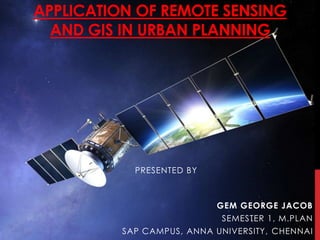
APPLICATION OF REMOTE SENSING
AND GIS IN URBAN PLANNING
PRESENTED BY
GEM GEORGE JACOB
SEMESTER 1, M.PLAN
SAP CAMPUS, ANNA UNIVERSITY, CHENNAI
 Acquiring information about an
object without touching the
object itself.
 Acquired data is digitized and
processed into image.
 Captures spatial (area),
spectral (colour)and temporal
(time) datas with accuracy,
speed and cost effective on a
repetative basis.
REMOTE SENSING
URBAN PLANNING - APPLICATIONS OF RS
 Important source of data for urban landuse/land cover
mapping
 Environmental monitoring
 helps in encroaching urban problems even of very
small magnitude.
URBAN PLANNING - APPLICATIONS OF RS
 Digitization of planning basemaps facilitated updating
of basemaps whereverchanges have taken place in
terms of land development etc.
 Superimposition of any two digital maps which are on
two different scales is feasible.
 Superimposition of revenue maps on basemaps with
reasonable accuracy is great advantage compared
to manually done jobs.
URBAN PLANNING - APPLICATIONS OF RS
• Study urban growth/sprawl and trend of growth
• Updating and monitoring using repetitive coverage
• Study of urban morphology, population estimation
• Space use surveys in city centers
• Slum detection, monitoring and updating
• Study of transportation system and important aspects both in static and
dynamic mode
• Site suitability and catchments area analysis
• Study of open/vacant space.
GIS
(GEOGRAPHIC INFORMATION SYSTEM)
GIS-WHAT IS IT?
Geographic/Geospatial Information
information about places on the earth’s surface
knowledge about “what is where when”
(Don’t forget time!)
Geographic/geospatial: synonymous
GIS--what’s in the S?
• Systems: the technology
• Science: the concepts and theory
• Studies: the societal context
GIS
DATA TYPES – SPATIAL & ATTRIBUTE
 Spatial - the absolute and relative
location of Geographic features.
 Attribute data – which describes the
characteristics of the spatial features.
characteristics can be quantitative
and/or qualitative in nature. Attribute
data is often referred to as tabular data.
GIS
 A map with a database behind it.
 A virtual representation of the real world and its
infrastructure.
 A consistent “as-built” of the real world, natural and
manmade which is queried to support on-going operations
 summarized to support strategic decision making and policy
formulation
 analyzed to support scientific inquiry
GIS
GIS TECHNIQUE PLANNING APPLICATION
OVERLAYING LAND SUITABILITY, LANDUSE
CHANGE DETECTION
BUFFERING LOCATION ANALYSIS (police
station, education etc)
ACCESIBILITY TO
TRANSPORTATION ( to find
inaccessible areas)
OPTIMAL ROUTE ANALYIS In terms of time, distance,
relevance, safety
GIS IN URBAN PLANNING, MANAGEMENT & POLICY
• Zoning, subdivision planning
• Land acquisition
• Economic development
• Code enforcement
• Housing renovation programs
• Emergency response
• Crime analysis
• Tax assessment
URBAN PLANNING - APPLICATIONS OF GIS
Area monitoring (both on a sectoral and integral basis)
Regional potential and feasibility analyses.
Site selection studies
Alternate plans are generated (flexible design,
optimization and evaluation tools)
URBAN PLANNING - APPLICATIONS OF GIS
Documentation of spatial plans and in the approval
process for the development, building and installation
permit.
Land management and land use planning issues
including the interpretation and formulation of land use
policy.
Land-use policy can be interpreted within GIS using a
modelling approach.
GEOGRAPHIC INFORMATION
TECHNOLOGIES
Global Positioning Systems (GPS)
• a system of earth-orbiting satellites which can provide
precise (100 meter to sub-cm.) location on the earth’s
surface (in lat/long coordinates or equiv.)
Remote Sensing (RS)
• use of satellites or aircraft to capture information about
the earth’s surface
• Digital ortho images a key product (map accurate
digital photos)
Geographic Information Systems (GIS)
• Software systems with capability for input, storage,
manipulation/analysis and output/display of
geographic (spatial) information.
GPS and RS are sources of input data for a GIS.
A GIS provides for storing and manipulating GPS and RS data.
CONCLUSION
 The present study indicates the uses of Remote
Sensing and Geographic Information System for
spatial planning.
 very easy to use analysis and visualization tools.
 Rapid development in city poses several
challenges including problems associated with
urbanization for urban managers and policy
makers. Meeting these challenges requires
access to timely and reliable information.
REFERENCES
 Remote Sensing and Urban Analysis, Taylor and Francis
Publications, London.
 Patkar, V.N. (2003), “Directions for GIS in Urban Planning”
 Tiwari, D.P. (2006), Remote Sensing and GIS for efficient
Urban Planning, GIS Development.
 GIS for Urban and Regional Planning, ESRI
THANK YOU!

Contenu connexe

Tendances

Raster data analysis
Raster data analysisRaster data analysis
Raster data analysisAbdul Raziq
 
Spatial vs non spatial
Spatial vs non spatialSpatial vs non spatial
Spatial vs non spatialSumant Diwakar
 
Remote Sensing and GIS in Land Use / Land Cover Mapping
Remote Sensing and GIS in Land Use / Land Cover MappingRemote Sensing and GIS in Land Use / Land Cover Mapping
Remote Sensing and GIS in Land Use / Land Cover MappingVenkatKamal1
 
Regional planning ppt
Regional planning pptRegional planning ppt
Regional planning pptshradha arun
 
Geo referencing by Mashhood Arif
Geo referencing by Mashhood ArifGeo referencing by Mashhood Arif
Geo referencing by Mashhood ArifKU Leuven
 
Application of GIS (Geographical information system)
Application of GIS (Geographical information system)Application of GIS (Geographical information system)
Application of GIS (Geographical information system)Fayaz Ahamed A P
 
land suitability under R.S and G.I.S
land suitability under R.S and G.I.Sland suitability under R.S and G.I.S
land suitability under R.S and G.I.Shena parveen
 
Application of gis in urban planning
Application of gis in urban planningApplication of gis in urban planning
Application of gis in urban planningWESLEY MELI
 
Types and delineation of regions ppt
Types and delineation of regions pptTypes and delineation of regions ppt
Types and delineation of regions pptgayathrysatheesan1
 
Seminar on gis analysis functions
Seminar on gis analysis functionsSeminar on gis analysis functions
Seminar on gis analysis functionsPramoda Raj
 
Introduction to GIS systems
Introduction to GIS systemsIntroduction to GIS systems
Introduction to GIS systemsVivek Srivastava
 
Land use and land cover classification
Land use and land cover classification Land use and land cover classification
Land use and land cover classification Calcutta University
 
Spatial analysis and modeling
Spatial analysis and modelingSpatial analysis and modeling
Spatial analysis and modelingTolasa_F
 
Applications of gis
Applications of gisApplications of gis
Applications of gisPramoda Raj
 
Scales and Preparation of Maps
Scales and Preparation of MapsScales and Preparation of Maps
Scales and Preparation of MapsIram Aziz
 
Components of gis
Components of gisComponents of gis
Components of gisPramoda Raj
 

Tendances (20)

Raster data analysis
Raster data analysisRaster data analysis
Raster data analysis
 
Spatial vs non spatial
Spatial vs non spatialSpatial vs non spatial
Spatial vs non spatial
 
Remote Sensing and GIS in Land Use / Land Cover Mapping
Remote Sensing and GIS in Land Use / Land Cover MappingRemote Sensing and GIS in Land Use / Land Cover Mapping
Remote Sensing and GIS in Land Use / Land Cover Mapping
 
Regional planning ppt
Regional planning pptRegional planning ppt
Regional planning ppt
 
Geo referencing by Mashhood Arif
Geo referencing by Mashhood ArifGeo referencing by Mashhood Arif
Geo referencing by Mashhood Arif
 
Application of GIS (Geographical information system)
Application of GIS (Geographical information system)Application of GIS (Geographical information system)
Application of GIS (Geographical information system)
 
Digital Elevation Model (DEM)
Digital Elevation Model (DEM)Digital Elevation Model (DEM)
Digital Elevation Model (DEM)
 
land suitability under R.S and G.I.S
land suitability under R.S and G.I.Sland suitability under R.S and G.I.S
land suitability under R.S and G.I.S
 
Digital elevation model in GIS
Digital elevation model in GISDigital elevation model in GIS
Digital elevation model in GIS
 
Application of gis in urban planning
Application of gis in urban planningApplication of gis in urban planning
Application of gis in urban planning
 
Types and delineation of regions ppt
Types and delineation of regions pptTypes and delineation of regions ppt
Types and delineation of regions ppt
 
georeference
georeferencegeoreference
georeference
 
Seminar on gis analysis functions
Seminar on gis analysis functionsSeminar on gis analysis functions
Seminar on gis analysis functions
 
Introduction to GIS systems
Introduction to GIS systemsIntroduction to GIS systems
Introduction to GIS systems
 
Land use and land cover classification
Land use and land cover classification Land use and land cover classification
Land use and land cover classification
 
National urban information system
National urban information systemNational urban information system
National urban information system
 
Spatial analysis and modeling
Spatial analysis and modelingSpatial analysis and modeling
Spatial analysis and modeling
 
Applications of gis
Applications of gisApplications of gis
Applications of gis
 
Scales and Preparation of Maps
Scales and Preparation of MapsScales and Preparation of Maps
Scales and Preparation of Maps
 
Components of gis
Components of gisComponents of gis
Components of gis
 

En vedette

Socio-Cultural Sustainability of Housing Environments in Kuwait
Socio-Cultural Sustainability of Housing Environments in KuwaitSocio-Cultural Sustainability of Housing Environments in Kuwait
Socio-Cultural Sustainability of Housing Environments in KuwaitGalala University
 
01 المحاضرة الاولى
01 المحاضرة الاولى01 المحاضرة الاولى
01 المحاضرة الاولىKhaled Ali
 
Impact of Infrastructure Projects on City Center - تأثير مشاريع البنية التحتي...
Impact of Infrastructure Projects on City Center - تأثير مشاريع البنية التحتي...Impact of Infrastructure Projects on City Center - تأثير مشاريع البنية التحتي...
Impact of Infrastructure Projects on City Center - تأثير مشاريع البنية التحتي...Galala University
 
Architecture in the Middle East
Architecture in the Middle EastArchitecture in the Middle East
Architecture in the Middle EastGalala University
 
District Cooling and Architecture
District Cooling and ArchitectureDistrict Cooling and Architecture
District Cooling and ArchitectureGalala University
 
هوية المدينة العربية وتحديات التحولات العمرانية السريعة" ورقة مقدمة فى المؤتم...
هوية المدينة العربية وتحديات التحولات العمرانية السريعة" ورقة مقدمة فى المؤتم...هوية المدينة العربية وتحديات التحولات العمرانية السريعة" ورقة مقدمة فى المؤتم...
هوية المدينة العربية وتحديات التحولات العمرانية السريعة" ورقة مقدمة فى المؤتم...Galala University
 
Remote Sensing PPT
Remote Sensing PPTRemote Sensing PPT
Remote Sensing PPTAmal Murali
 

En vedette (9)

Socio-Cultural Sustainability of Housing Environments in Kuwait
Socio-Cultural Sustainability of Housing Environments in KuwaitSocio-Cultural Sustainability of Housing Environments in Kuwait
Socio-Cultural Sustainability of Housing Environments in Kuwait
 
01 المحاضرة الاولى
01 المحاضرة الاولى01 المحاضرة الاولى
01 المحاضرة الاولى
 
Impact of Infrastructure Projects on City Center - تأثير مشاريع البنية التحتي...
Impact of Infrastructure Projects on City Center - تأثير مشاريع البنية التحتي...Impact of Infrastructure Projects on City Center - تأثير مشاريع البنية التحتي...
Impact of Infrastructure Projects on City Center - تأثير مشاريع البنية التحتي...
 
Architecture in the Middle East
Architecture in the Middle EastArchitecture in the Middle East
Architecture in the Middle East
 
Cairo and Egypt maps
Cairo and Egypt mapsCairo and Egypt maps
Cairo and Egypt maps
 
KATARA, Doha, Qatar Photos
KATARA, Doha, Qatar PhotosKATARA, Doha, Qatar Photos
KATARA, Doha, Qatar Photos
 
District Cooling and Architecture
District Cooling and ArchitectureDistrict Cooling and Architecture
District Cooling and Architecture
 
هوية المدينة العربية وتحديات التحولات العمرانية السريعة" ورقة مقدمة فى المؤتم...
هوية المدينة العربية وتحديات التحولات العمرانية السريعة" ورقة مقدمة فى المؤتم...هوية المدينة العربية وتحديات التحولات العمرانية السريعة" ورقة مقدمة فى المؤتم...
هوية المدينة العربية وتحديات التحولات العمرانية السريعة" ورقة مقدمة فى المؤتم...
 
Remote Sensing PPT
Remote Sensing PPTRemote Sensing PPT
Remote Sensing PPT
 

Similaire à Application of gis & rs in urban planning

application of gis rs in urban planninggem-150307035531-conversion-gate01 (1)...
application of gis rs in urban planninggem-150307035531-conversion-gate01 (1)...application of gis rs in urban planninggem-150307035531-conversion-gate01 (1)...
application of gis rs in urban planninggem-150307035531-conversion-gate01 (1)...Rajashekhar L
 
GEOGRAPHIC INFORMATION SYSTEM.pptx
GEOGRAPHIC INFORMATION SYSTEM.pptxGEOGRAPHIC INFORMATION SYSTEM.pptx
GEOGRAPHIC INFORMATION SYSTEM.pptxFizaNaaz8
 
Intro of geographic info system
Intro of geographic info systemIntro of geographic info system
Intro of geographic info systemJanak Parmar
 
Gis Geographical Information System Fundamentals
Gis Geographical Information System FundamentalsGis Geographical Information System Fundamentals
Gis Geographical Information System FundamentalsUroosa Samman
 
INTRODUCTION_TO_GIS.ppt
INTRODUCTION_TO_GIS.pptINTRODUCTION_TO_GIS.ppt
INTRODUCTION_TO_GIS.pptSafriyana1
 
GIS and GPS - applications in civil engg
GIS and GPS - applications  in civil enggGIS and GPS - applications  in civil engg
GIS and GPS - applications in civil enggPundlik Rathod
 
Introduction of GIS & Remote Sensing (RS)
Introduction of GIS & Remote Sensing (RS)Introduction of GIS & Remote Sensing (RS)
Introduction of GIS & Remote Sensing (RS)Subtain Hussain Syed
 
Lecture 1_ Intro n Basics_GIS.pptx
Lecture 1_ Intro n Basics_GIS.pptxLecture 1_ Intro n Basics_GIS.pptx
Lecture 1_ Intro n Basics_GIS.pptxnobelhasssan
 
Fundamentals of gis
Fundamentals of gisFundamentals of gis
Fundamentals of gisJessy Mol
 
Geographical information system
Geographical information systemGeographical information system
Geographical information systemBipin Karki
 
Geographical information system
Geographical information systemGeographical information system
Geographical information systemBipin Karki
 
Remote Sensing & GIS.ppt
Remote Sensing & GIS.pptRemote Sensing & GIS.ppt
Remote Sensing & GIS.pptyhmamdam1
 
Topic Introduction to GIS and its Applications.pptx
Topic Introduction to GIS and its Applications.pptxTopic Introduction to GIS and its Applications.pptx
Topic Introduction to GIS and its Applications.pptxAneeqaa Abrar
 
Basic of gis concept and theories
Basic of gis concept and theoriesBasic of gis concept and theories
Basic of gis concept and theoriesMohsin Siddique
 

Similaire à Application of gis & rs in urban planning (20)

application of gis rs in urban planninggem-150307035531-conversion-gate01 (1)...
application of gis rs in urban planninggem-150307035531-conversion-gate01 (1)...application of gis rs in urban planninggem-150307035531-conversion-gate01 (1)...
application of gis rs in urban planninggem-150307035531-conversion-gate01 (1)...
 
Gis dr rahul
Gis dr rahulGis dr rahul
Gis dr rahul
 
GEOGRAPHIC INFORMATION SYSTEM.pptx
GEOGRAPHIC INFORMATION SYSTEM.pptxGEOGRAPHIC INFORMATION SYSTEM.pptx
GEOGRAPHIC INFORMATION SYSTEM.pptx
 
Gis basic-2
Gis basic-2Gis basic-2
Gis basic-2
 
Intro of geographic info system
Intro of geographic info systemIntro of geographic info system
Intro of geographic info system
 
Gis Geographical Information System Fundamentals
Gis Geographical Information System FundamentalsGis Geographical Information System Fundamentals
Gis Geographical Information System Fundamentals
 
INTRODUCTION_TO_GIS.ppt
INTRODUCTION_TO_GIS.pptINTRODUCTION_TO_GIS.ppt
INTRODUCTION_TO_GIS.ppt
 
GIS and GPS - applications in civil engg
GIS and GPS - applications  in civil enggGIS and GPS - applications  in civil engg
GIS and GPS - applications in civil engg
 
Introduction of GIS & Remote Sensing (RS)
Introduction of GIS & Remote Sensing (RS)Introduction of GIS & Remote Sensing (RS)
Introduction of GIS & Remote Sensing (RS)
 
Lecture 1_ Intro n Basics_GIS.pptx
Lecture 1_ Intro n Basics_GIS.pptxLecture 1_ Intro n Basics_GIS.pptx
Lecture 1_ Intro n Basics_GIS.pptx
 
Geographical information system
Geographical information systemGeographical information system
Geographical information system
 
Fundamentals of gis
Fundamentals of gisFundamentals of gis
Fundamentals of gis
 
Geographical information system
Geographical information systemGeographical information system
Geographical information system
 
Geographical information system
Geographical information systemGeographical information system
Geographical information system
 
gis.pdf
gis.pdfgis.pdf
gis.pdf
 
gis.pdf
gis.pdfgis.pdf
gis.pdf
 
Remote Sensing & GIS.ppt
Remote Sensing & GIS.pptRemote Sensing & GIS.ppt
Remote Sensing & GIS.ppt
 
Topic Introduction to GIS and its Applications.pptx
Topic Introduction to GIS and its Applications.pptxTopic Introduction to GIS and its Applications.pptx
Topic Introduction to GIS and its Applications.pptx
 
Basic of gis concept and theories
Basic of gis concept and theoriesBasic of gis concept and theories
Basic of gis concept and theories
 
Remote sensing
Remote sensing   Remote sensing
Remote sensing
 

Dernier

presentation ICT roal in 21st century education
presentation ICT roal in 21st century educationpresentation ICT roal in 21st century education
presentation ICT roal in 21st century educationjfdjdjcjdnsjd
 
2024: Domino Containers - The Next Step. News from the Domino Container commu...
2024: Domino Containers - The Next Step. News from the Domino Container commu...2024: Domino Containers - The Next Step. News from the Domino Container commu...
2024: Domino Containers - The Next Step. News from the Domino Container commu...Martijn de Jong
 
Apidays New York 2024 - Scaling API-first by Ian Reasor and Radu Cotescu, Adobe
Apidays New York 2024 - Scaling API-first by Ian Reasor and Radu Cotescu, AdobeApidays New York 2024 - Scaling API-first by Ian Reasor and Radu Cotescu, Adobe
Apidays New York 2024 - Scaling API-first by Ian Reasor and Radu Cotescu, Adobeapidays
 
Finology Group – Insurtech Innovation Award 2024
Finology Group – Insurtech Innovation Award 2024Finology Group – Insurtech Innovation Award 2024
Finology Group – Insurtech Innovation Award 2024The Digital Insurer
 
Advantages of Hiring UIUX Design Service Providers for Your Business
Advantages of Hiring UIUX Design Service Providers for Your BusinessAdvantages of Hiring UIUX Design Service Providers for Your Business
Advantages of Hiring UIUX Design Service Providers for Your BusinessPixlogix Infotech
 
Real Time Object Detection Using Open CV
Real Time Object Detection Using Open CVReal Time Object Detection Using Open CV
Real Time Object Detection Using Open CVKhem
 
AWS Community Day CPH - Three problems of Terraform
AWS Community Day CPH - Three problems of TerraformAWS Community Day CPH - Three problems of Terraform
AWS Community Day CPH - Three problems of TerraformAndrey Devyatkin
 
Boost Fertility New Invention Ups Success Rates.pdf
Boost Fertility New Invention Ups Success Rates.pdfBoost Fertility New Invention Ups Success Rates.pdf
Boost Fertility New Invention Ups Success Rates.pdfsudhanshuwaghmare1
 
Strategize a Smooth Tenant-to-tenant Migration and Copilot Takeoff
Strategize a Smooth Tenant-to-tenant Migration and Copilot TakeoffStrategize a Smooth Tenant-to-tenant Migration and Copilot Takeoff
Strategize a Smooth Tenant-to-tenant Migration and Copilot Takeoffsammart93
 
Strategies for Landing an Oracle DBA Job as a Fresher
Strategies for Landing an Oracle DBA Job as a FresherStrategies for Landing an Oracle DBA Job as a Fresher
Strategies for Landing an Oracle DBA Job as a FresherRemote DBA Services
 
Developing An App To Navigate The Roads of Brazil
Developing An App To Navigate The Roads of BrazilDeveloping An App To Navigate The Roads of Brazil
Developing An App To Navigate The Roads of BrazilV3cube
 
Strategies for Unlocking Knowledge Management in Microsoft 365 in the Copilot...
Strategies for Unlocking Knowledge Management in Microsoft 365 in the Copilot...Strategies for Unlocking Knowledge Management in Microsoft 365 in the Copilot...
Strategies for Unlocking Knowledge Management in Microsoft 365 in the Copilot...Drew Madelung
 
ProductAnonymous-April2024-WinProductDiscovery-MelissaKlemke
ProductAnonymous-April2024-WinProductDiscovery-MelissaKlemkeProductAnonymous-April2024-WinProductDiscovery-MelissaKlemke
ProductAnonymous-April2024-WinProductDiscovery-MelissaKlemkeProduct Anonymous
 
TrustArc Webinar - Stay Ahead of US State Data Privacy Law Developments
TrustArc Webinar - Stay Ahead of US State Data Privacy Law DevelopmentsTrustArc Webinar - Stay Ahead of US State Data Privacy Law Developments
TrustArc Webinar - Stay Ahead of US State Data Privacy Law DevelopmentsTrustArc
 
How to Troubleshoot Apps for the Modern Connected Worker
How to Troubleshoot Apps for the Modern Connected WorkerHow to Troubleshoot Apps for the Modern Connected Worker
How to Troubleshoot Apps for the Modern Connected WorkerThousandEyes
 
Workshop - Best of Both Worlds_ Combine KG and Vector search for enhanced R...
Workshop - Best of Both Worlds_ Combine  KG and Vector search for  enhanced R...Workshop - Best of Both Worlds_ Combine  KG and Vector search for  enhanced R...
Workshop - Best of Both Worlds_ Combine KG and Vector search for enhanced R...Neo4j
 
[2024]Digital Global Overview Report 2024 Meltwater.pdf
[2024]Digital Global Overview Report 2024 Meltwater.pdf[2024]Digital Global Overview Report 2024 Meltwater.pdf
[2024]Digital Global Overview Report 2024 Meltwater.pdfhans926745
 
GenCyber Cyber Security Day Presentation
GenCyber Cyber Security Day PresentationGenCyber Cyber Security Day Presentation
GenCyber Cyber Security Day PresentationMichael W. Hawkins
 
Apidays Singapore 2024 - Building Digital Trust in a Digital Economy by Veron...
Apidays Singapore 2024 - Building Digital Trust in a Digital Economy by Veron...Apidays Singapore 2024 - Building Digital Trust in a Digital Economy by Veron...
Apidays Singapore 2024 - Building Digital Trust in a Digital Economy by Veron...apidays
 
What Are The Drone Anti-jamming Systems Technology?
What Are The Drone Anti-jamming Systems Technology?What Are The Drone Anti-jamming Systems Technology?
What Are The Drone Anti-jamming Systems Technology?Antenna Manufacturer Coco
 

Dernier (20)

presentation ICT roal in 21st century education
presentation ICT roal in 21st century educationpresentation ICT roal in 21st century education
presentation ICT roal in 21st century education
 
2024: Domino Containers - The Next Step. News from the Domino Container commu...
2024: Domino Containers - The Next Step. News from the Domino Container commu...2024: Domino Containers - The Next Step. News from the Domino Container commu...
2024: Domino Containers - The Next Step. News from the Domino Container commu...
 
Apidays New York 2024 - Scaling API-first by Ian Reasor and Radu Cotescu, Adobe
Apidays New York 2024 - Scaling API-first by Ian Reasor and Radu Cotescu, AdobeApidays New York 2024 - Scaling API-first by Ian Reasor and Radu Cotescu, Adobe
Apidays New York 2024 - Scaling API-first by Ian Reasor and Radu Cotescu, Adobe
 
Finology Group – Insurtech Innovation Award 2024
Finology Group – Insurtech Innovation Award 2024Finology Group – Insurtech Innovation Award 2024
Finology Group – Insurtech Innovation Award 2024
 
Advantages of Hiring UIUX Design Service Providers for Your Business
Advantages of Hiring UIUX Design Service Providers for Your BusinessAdvantages of Hiring UIUX Design Service Providers for Your Business
Advantages of Hiring UIUX Design Service Providers for Your Business
 
Real Time Object Detection Using Open CV
Real Time Object Detection Using Open CVReal Time Object Detection Using Open CV
Real Time Object Detection Using Open CV
 
AWS Community Day CPH - Three problems of Terraform
AWS Community Day CPH - Three problems of TerraformAWS Community Day CPH - Three problems of Terraform
AWS Community Day CPH - Three problems of Terraform
 
Boost Fertility New Invention Ups Success Rates.pdf
Boost Fertility New Invention Ups Success Rates.pdfBoost Fertility New Invention Ups Success Rates.pdf
Boost Fertility New Invention Ups Success Rates.pdf
 
Strategize a Smooth Tenant-to-tenant Migration and Copilot Takeoff
Strategize a Smooth Tenant-to-tenant Migration and Copilot TakeoffStrategize a Smooth Tenant-to-tenant Migration and Copilot Takeoff
Strategize a Smooth Tenant-to-tenant Migration and Copilot Takeoff
 
Strategies for Landing an Oracle DBA Job as a Fresher
Strategies for Landing an Oracle DBA Job as a FresherStrategies for Landing an Oracle DBA Job as a Fresher
Strategies for Landing an Oracle DBA Job as a Fresher
 
Developing An App To Navigate The Roads of Brazil
Developing An App To Navigate The Roads of BrazilDeveloping An App To Navigate The Roads of Brazil
Developing An App To Navigate The Roads of Brazil
 
Strategies for Unlocking Knowledge Management in Microsoft 365 in the Copilot...
Strategies for Unlocking Knowledge Management in Microsoft 365 in the Copilot...Strategies for Unlocking Knowledge Management in Microsoft 365 in the Copilot...
Strategies for Unlocking Knowledge Management in Microsoft 365 in the Copilot...
 
ProductAnonymous-April2024-WinProductDiscovery-MelissaKlemke
ProductAnonymous-April2024-WinProductDiscovery-MelissaKlemkeProductAnonymous-April2024-WinProductDiscovery-MelissaKlemke
ProductAnonymous-April2024-WinProductDiscovery-MelissaKlemke
 
TrustArc Webinar - Stay Ahead of US State Data Privacy Law Developments
TrustArc Webinar - Stay Ahead of US State Data Privacy Law DevelopmentsTrustArc Webinar - Stay Ahead of US State Data Privacy Law Developments
TrustArc Webinar - Stay Ahead of US State Data Privacy Law Developments
 
How to Troubleshoot Apps for the Modern Connected Worker
How to Troubleshoot Apps for the Modern Connected WorkerHow to Troubleshoot Apps for the Modern Connected Worker
How to Troubleshoot Apps for the Modern Connected Worker
 
Workshop - Best of Both Worlds_ Combine KG and Vector search for enhanced R...
Workshop - Best of Both Worlds_ Combine  KG and Vector search for  enhanced R...Workshop - Best of Both Worlds_ Combine  KG and Vector search for  enhanced R...
Workshop - Best of Both Worlds_ Combine KG and Vector search for enhanced R...
 
[2024]Digital Global Overview Report 2024 Meltwater.pdf
[2024]Digital Global Overview Report 2024 Meltwater.pdf[2024]Digital Global Overview Report 2024 Meltwater.pdf
[2024]Digital Global Overview Report 2024 Meltwater.pdf
 
GenCyber Cyber Security Day Presentation
GenCyber Cyber Security Day PresentationGenCyber Cyber Security Day Presentation
GenCyber Cyber Security Day Presentation
 
Apidays Singapore 2024 - Building Digital Trust in a Digital Economy by Veron...
Apidays Singapore 2024 - Building Digital Trust in a Digital Economy by Veron...Apidays Singapore 2024 - Building Digital Trust in a Digital Economy by Veron...
Apidays Singapore 2024 - Building Digital Trust in a Digital Economy by Veron...
 
What Are The Drone Anti-jamming Systems Technology?
What Are The Drone Anti-jamming Systems Technology?What Are The Drone Anti-jamming Systems Technology?
What Are The Drone Anti-jamming Systems Technology?
 

Application of gis & rs in urban planning

  • 1. APPLICATION OF REMOTE SENSING AND GIS IN URBAN PLANNING PRESENTED BY GEM GEORGE JACOB SEMESTER 1, M.PLAN SAP CAMPUS, ANNA UNIVERSITY, CHENNAI
  • 2.  Acquiring information about an object without touching the object itself.  Acquired data is digitized and processed into image.  Captures spatial (area), spectral (colour)and temporal (time) datas with accuracy, speed and cost effective on a repetative basis. REMOTE SENSING
  • 3. URBAN PLANNING - APPLICATIONS OF RS
  • 4. URBAN PLANNING - APPLICATIONS OF RS  Important source of data for urban landuse/land cover mapping  Environmental monitoring  helps in encroaching urban problems even of very small magnitude.
  • 5. URBAN PLANNING - APPLICATIONS OF RS  Digitization of planning basemaps facilitated updating of basemaps whereverchanges have taken place in terms of land development etc.  Superimposition of any two digital maps which are on two different scales is feasible.  Superimposition of revenue maps on basemaps with reasonable accuracy is great advantage compared to manually done jobs.
  • 6. URBAN PLANNING - APPLICATIONS OF RS • Study urban growth/sprawl and trend of growth • Updating and monitoring using repetitive coverage • Study of urban morphology, population estimation • Space use surveys in city centers • Slum detection, monitoring and updating • Study of transportation system and important aspects both in static and dynamic mode • Site suitability and catchments area analysis • Study of open/vacant space.
  • 8. GIS-WHAT IS IT? Geographic/Geospatial Information information about places on the earth’s surface knowledge about “what is where when” (Don’t forget time!) Geographic/geospatial: synonymous GIS--what’s in the S? • Systems: the technology • Science: the concepts and theory • Studies: the societal context
  • 9. GIS DATA TYPES – SPATIAL & ATTRIBUTE  Spatial - the absolute and relative location of Geographic features.  Attribute data – which describes the characteristics of the spatial features. characteristics can be quantitative and/or qualitative in nature. Attribute data is often referred to as tabular data.
  • 10. GIS  A map with a database behind it.  A virtual representation of the real world and its infrastructure.  A consistent “as-built” of the real world, natural and manmade which is queried to support on-going operations  summarized to support strategic decision making and policy formulation  analyzed to support scientific inquiry
  • 11. GIS GIS TECHNIQUE PLANNING APPLICATION OVERLAYING LAND SUITABILITY, LANDUSE CHANGE DETECTION BUFFERING LOCATION ANALYSIS (police station, education etc) ACCESIBILITY TO TRANSPORTATION ( to find inaccessible areas) OPTIMAL ROUTE ANALYIS In terms of time, distance, relevance, safety
  • 12.
  • 13.
  • 14. GIS IN URBAN PLANNING, MANAGEMENT & POLICY • Zoning, subdivision planning • Land acquisition • Economic development • Code enforcement • Housing renovation programs • Emergency response • Crime analysis • Tax assessment
  • 15. URBAN PLANNING - APPLICATIONS OF GIS Area monitoring (both on a sectoral and integral basis) Regional potential and feasibility analyses. Site selection studies Alternate plans are generated (flexible design, optimization and evaluation tools)
  • 16. URBAN PLANNING - APPLICATIONS OF GIS Documentation of spatial plans and in the approval process for the development, building and installation permit. Land management and land use planning issues including the interpretation and formulation of land use policy. Land-use policy can be interpreted within GIS using a modelling approach.
  • 17. GEOGRAPHIC INFORMATION TECHNOLOGIES Global Positioning Systems (GPS) • a system of earth-orbiting satellites which can provide precise (100 meter to sub-cm.) location on the earth’s surface (in lat/long coordinates or equiv.) Remote Sensing (RS) • use of satellites or aircraft to capture information about the earth’s surface • Digital ortho images a key product (map accurate digital photos) Geographic Information Systems (GIS) • Software systems with capability for input, storage, manipulation/analysis and output/display of geographic (spatial) information. GPS and RS are sources of input data for a GIS. A GIS provides for storing and manipulating GPS and RS data.
  • 18. CONCLUSION  The present study indicates the uses of Remote Sensing and Geographic Information System for spatial planning.  very easy to use analysis and visualization tools.  Rapid development in city poses several challenges including problems associated with urbanization for urban managers and policy makers. Meeting these challenges requires access to timely and reliable information.
  • 19. REFERENCES  Remote Sensing and Urban Analysis, Taylor and Francis Publications, London.  Patkar, V.N. (2003), “Directions for GIS in Urban Planning”  Tiwari, D.P. (2006), Remote Sensing and GIS for efficient Urban Planning, GIS Development.  GIS for Urban and Regional Planning, ESRI