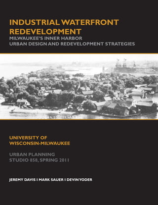
1. INDUSTRIAL WATERFRONT
REDEVELOPMENT
MILWAUKEE’S INNER HARBOR
URBAN DESIGN AND REDEVELOPMENT STRATEGIES
UNIVERSITY OF
WISCONSIN-MILWAUKEE
URBAN PLANNING
STUDIO 858, SPRING 2011
JEREMY DAVIS I MARK SAUER I DEVIN YODER
2.
3. CONTENTS
CONTENTS
4 INTRODUCTION
BRIEF HISTORY, PLANNING THEMES, POLITICAL CLIMATE
14 EXISTING CONDITIONS
DEMOGRAPHICS, PHYSICAL CONDITIONS, STAKEHOLDERS
CASE STUDIES
38 BROWNFIELD REMEDIATION, CONNECTING COMMUNITIES,
MIXED-USE WATERFRONTS, AGGLOMERATION, IDENTITY
AND ACCESS, PUBLIC-PRIVATE PARTNERSHIPS
STRATEGIES AND ALTERNATIVES
54 STRENGTHS, WEAKNESSES, OPPORTUNITIES,THREATS,
STRATEGIES AND ALTERNATIVES
78 NEXT STEPS
PLANNING, DESIGN, IMPLEMENTATION
3
4.
5. EXECUTIVE SUMMARY
THE INNER HARBOR and the
TRANSFORMATION of MILWAUKEE
Great cities emerge over time - not with one project, plan, or program, but through an evolu-
tion of transformative development. For decades, Milwaukee has engaged in this transforma-
tion process assertively and with broad community support.Today, the Inner Harbor offers the
potential for new achievements that can elevate Milwaukee even further on the international
stage of great cities.This publication moves us closer to that achievement by envisioning pos-
sibilities for the Inner Harbor’s transformation.
Since the 1970s, UWM’s School of Architecture and Urban Planning (SARUP) has played a
key role in helping Milwaukee envision successful long-term initiatives, including the Lakefront,
Park East, and the Menomonee Valley (to name a few).The frameworks for such community-
changing initiatives have matured through the open dialogue among Milwaukee’s elected
officials, professional experts, and students and faculty. Actions based on these visionary
frameworks have taken root in new public and private investments. This publication plants
new seeds for regenerating the Inner Harbor. The redevelopment strategies offer ideas - not
solutions - that can subsequently improve the ongoing process of implementation.
This publication represents the work of a team of undergraduate and graduate level students
(both planners and architects) investigating urban design and redevelopment strategies. The
projects range from overall master plans to designs for specific public places. All have grown
from a series of community-based initiatives engaging local neighborhoods, land owners, and
business leaders.
Work on the Inner Harbor was initiated in the plans, programs, and policies of various
stakeholders, including the City of Milwaukee, the Port of Milwaukee, and the Milwaukee
Metropolitan Sewerage District. Not the least of these efforts is the signature investment in
UWM’s new School of Freshwater Sciences - a leadership initiative based on Milwaukee’s
and UWM’s long-standing connection to the Great Lakes. At the same time, the integration
of existing plans offers opportunities for conceptualizing innovative yet pragmatic possibilities.
The projects in this publication focus on embracing urban redevelopment into a Port environ-
ment.The concepts integrate industrial, commercial, and institutional uses, as well as housing
and a full complement of public places and environmental features. Students also used con-
cepts gleaned from other classes focused on issues of landscape, engineering, water-based
design, urban agriculture, sustainability, and public policy.
This effort will continue each semester as a new Inner Harbor takes shape. SARUP’s Insti-
tute for Ecological Design will continue a school-wide effort to develop a coordinated pro-
gram of dialogue, research, planning, and design among multiple studio classes, work¬shops,
seminars, lectures, and presentations. This publication, as well as the work of other classes
in Spring 2011, sets a foundation of ideas that next semester’s students can use to move
further in the process. This multi-year and multi-class effort provides one more example of
SARUP’s innovation in community-based education and the achievement of UWM’s urban
mission. In a decade or less, Milwaukee should be able to look back at this effort and see re-
sults from this unique formula that combines UWM’s urban mission with Milwaukee’s public
and private leadership. Larry Witzling,
Studio Critic
5
6. INDUSTRIAL WATERFRONT REDEVELOPMENT
MILWAUKEE’S INNER HARBOR: URBAN DESIGN AND REDEVELOPMENT STRATEGIES
INTRODUCTION
The City of Milwaukee has developed and changed around the Inner Har-
bor, the area where the Menomonee, Kinnickinnic, and Milwaukee rivers
converge and empty into Lake Michigan. Milwaukee has grown and changed
around this area, seeing its fortunes rise and fall with the ebb and flow of
activity on the lake’s edge. The Inner Harbor has many assets to offer the
City, but also has challenges that local leaders will have to address as the
area continues to change with Milwaukee.
The Inner Harbor sits along rail lines near downtown, and is surrounded by
the neighborhoods of Bay View, Walker’s Point, the 5th Ward, and the 3rd
Ward. The adjacent area also has a large number of vacant properties, of-
fering opportunities for future development. The Inner Harbor represents
a place of great potential to the City and the region, but also has obstacles
to overcome , such as aging street infrastructure, brownfield sites, and phys-
ical and psychological disconnections from the surrounding area.
The groups of people and types of industries around the Inner Harbor have
gradually changed over time: fishing no longer provides a major way of life
Below: Walker’s Point, Jones Island, and
the Inner Harbor circa 1937. Notice the for local residents, and industries have moved away from the harbor, either
natural state of Jones Island (except for out of the City or the state. The Inner Harbor is still an active port, and
the sewage plant built in 1926) and the provides other uses too, such as storage for coal and salt and dry docks for
dense, residential neighborhood of Walk- boats. The Milwaukee Metropolitan Sewerage District also uses the land,
er’s Point before I-94. housing its large wastewater treatment facility there. The Inner Harbor
clearly still has value to Milwaukee, but how
might the city further utilize this resource?
BRIEF HISTORY
Milwaukee’s Inner Harbor area has long provid-
ed resources to local residents. Native groups,
explorers, and early settlers all harvested on the
bounty of wild rice and fish that the swampy bot-
tomlands held near the confluence of the three
rivers. As the City of Milwaukee grew, the ur-
ban area spread out from the harbor. The har-
bor became a major shipping port on the Great
Lakes, receiving products like coal, and shipping
out grain and industrial goods. The port’s loca-
tion at the mouth of three rivers also allowed for
inland waterway navigation. The Inner Harbor
contained various industries and rail yards,
helping further develop Milwaukee’s economy.
6
7. INTRODUCTION
Early Milwaukee residents also called the Inner Harbor home, with the
Kaszubian fishermen (immigrants from the West Prussian Peninsula of Hel)
and other European groups settling on what would come to be called Jones
Island.The island was home to a thriving fishing community until the 1940s,
when industry and the wastewater treatment facility started redeveloping
the land. Today, only a small park on the island and histiorical accounts re-
main to remind us of this former settlement.
Above: The average Jones Island family
had six to nine children. The youngsters’
playground was the beach, the lake, and
the river. They fished, crabbed, swam,
and built boats with sails made of stolen
bedsheets.
Above: A street scene on Jones Island.
In the heyday of the island, the near-
est building was a grocery store. In the
The Kaszubes 1930s it became a fish market.
To the question, “who are the Kaszubes?’ The answer varies. They were
mostly farmers and fishermen. Hard-working people who survived living
under many different regimes, they owe their preservation to the trait of
tenacity. They did not get involved in the politics of the particular regime
but went about their lives working, eating, drinking and making merry. They
were known for decades as a religious, peaceful, mostly Catholic group. A
close knit community, they depended on each other for survival. Below: A map of block 195 illustrates
the quilt pattern of houses and enclo-
sures on Jones Island in 1887.
These traits they carried over to Jones Island until they were forced to re-
locate to different areas and lost their community structure. However, their
assimilation into the larger community happened well before that time.
Henry Rotta writes in his book Jones Island that “many think we were only
fishermen but we held many jobs. Only small percentages were fishermen.
Some of those occupations were banker, lighthouse keeper, boat builder,
carpenter, factory worker and postal worker.”
(Excerpt from South Milwaukee Historical Society Newsletter:Volume 1, Issue 2. June 2009)
7
8. INDUSTRIAL WATERFRONT REDEVELOPMENT
MILWAUKEE’S INNER HARBOR: URBAN DESIGN AND REDEVELOPMENT STRATEGIES
Below: Various maps from 1836, 1870, 1876, and 1900. Notice the progression from a marshy wetland to an island
to an industrialized peninsula with port slips.
8
9. INTRODUCTION
Below: Various Maps from 1916, 1935, 1962, and 1984. While the street and block pattern for the northern part of
the site is carried over into a new century, the development pattern is much more scattered and industrialized.
9
10. INDUSTRIAL WATERFRONT REDEVELOPMENT
MILWAUKEE’S INNER HARBOR: URBAN DESIGN AND REDEVELOPMENT STRATEGIES
Above/next page (one image): A PLANNING THEMES
1915 view of Jones Island shows The Inner Harbor redevelopment project presents both a unique challenge
a conglomeration of fishing shan-
and opportunity to the City of Milwaukee. The following section looks at
ties, houses, trees, and boats. On
the northern tip are the U.S. Coast the significant planning themes which will be addressed in the design and
Guard station and the pumping sta- redevelopment strategies outlined in this document.
tion. Adjacent to them is land which
was condemned and cleared to make 1. Access
way for harbor and sewerage disposal The Inner Harbor, historically home to many of Milwaukee’s industries, is
improvements. Entering the harbor at present a neglected and overlooked area of the City. Once home to the
is the tourist vessel, Christopher railway switchyards that connected the City to the region, the Inner Har-
Columbus. bor never formally developed a robust street grid. Reconnecting the area
to Milwaukee’s street grid is an essential first action.
The Fisherpeople of Jones Island
Additionally, Lake Michigan is undoubtedly one of Milwaukee’s greatest as-
sets, an asset which should be accessible to its citizens. Redevelopment
therefore must emphasize public access to the waterfront. The Harbor
presents an opportunity for a continuous harbor walk along the water, as
well as a series of public parks, landings, and natural wetlands.
2. Working Brownfields
The Inner Harbor area includes over 90 separate brownfield sites, which
could better serve the City in active use, generating revenue and creating
employment. Environmental remediation will be an important first step.
Furthermore, new parcels and infrastructure should be planned to present
the best opportunity for working reuse. Finally, designs for reuse should
incorporate strategies to maintain or improve the environmental quality of
the site and its surroundings, using best ecological practices and stormwa-
ter management.
3. Milwaukee Manufacturing
Governor Walker’s commitment to add 250,000 jobs and 10,000 new busi-
nesses in the state means 65,000 jobs and 2,800 new businesses in the Mil-
waukee metropolitan statistical area. Demographics of the neighborhoods
adjacent to the Inner Harbor show that manufacturing and related
10
11. INTRODUCTION
industries are still major employers for this part of Milwaukee. The Inner
Harbor is a chance to further the tradition, connecting to the Menomonee
Valley and hosting the emerging organizations of Milwaukee’s water cluster.
4. A Rich History
Milwaukee historian John Gurda notes the Inner Harbor’s importance in
Milwaukee’s history, as well as its peculiarities. Redevelopment should seek
to build on this history - history as a working harbor, and history as home
to a group of exceptional Milwaukeeans—the Kaszubes. Relevant histori-
cal themes can be used in developing a memorable and exciting brand for
the Inner Harbor areas.
5. A Unique Approach
The unique aspects of the Inner Harbor demand a redevelopment strategy
that is not reproduced from a case study nor regurgitated from a previous
project. Redevelopment must focus on creating vibrant neighborhoods,
districts and corridors that incorporate traditionally separated land uses,
use innovative environmental strategies, and challenge stakeholders to
think outside the box.
6. Railway –Obstruction or Opportunity
Railways present a great challenge to urban design, as it is difficult to create
new crossings or encroach on railroad right-of-way. Critical upgrades to
the Greenfield Avenue bridge will undoubtedly interfere with the railway;
this could present opportunities to relocate the tracks into a configuration
more friendly to parceling land.
Moreover, the Inner Harbor presents a unique chance for the City of Mil-
waukee to create its first full-scale transit-oriented development, in a lo-
cation amenable to both a future streetcar and the growing Milwaukee-
Chicago commuter line. Above: Some of the existing rail lines in
the Inner Harbor
7. Water Quality
The EPA has designated the entire Inner Harbor an area of concern, where-
11
12. INDUSTRIAL WATERFRONT REDEVELOPMENT
MILWAUKEE’S INNER HARBOR: URBAN DESIGN AND REDEVELOPMENT STRATEGIES
by environmental degradation has impaired certain beneficial uses of natu-
ral waterways. The Inner Harbor hosts the confluence of the Kinnickinnic
To learn more about
and Milwaukee rivers, as well as the harbor and the connection to Lake
Milwaukee’s water Michigan. Redevelopment must incorporate strategies to clean up the In-
quality and Lake ner Harbor and rivers, and establish sustainable, green practices to protect
the invaluable resource in the future.
Michigan, visit:
http://waterlife.nfb.ca/ 8. School of Freshwater Sciences
Successful redevelopment projects at Goose Island, Chicago, and Dubuque,
Iowa, were both catalyzed with large research and development institutions
(Wrigley’s Global Innovation Center and the IBM Global Delivery Center,
respectively).
The University of Wisconsin-Milwaukee has made a very strong commit-
ment at the heart Inner Harbor with the new School of Freshwater Sci-
ence, the only of its kind in the nation. The school can serve as a catalyst
and anchor facility, incubating technologies that promote focus areas of
water, energy and advanced manufacturing.
9. Leverage Diversity
An inner-city endeavor at the scale of the Inner Harbor redevelopment
project will require coordination of numerous stakeholders. These stake-
holders, including the City of Milwaukee, the Port Authority, and UWM, each
have diverse concerns and unique interests. However, these stakeholders
together have the capacity to harness considerable resources needed for a
successful project at the scale for the Inner Harbor.
10.Think Long-Term
Finally, the Inner Harbor project is an expansive undertaking, thus certainly
an expensive one. A pragmatic redevelopment strategy must identify stages
of development, and include five-, ten- and twenty-year time frames. Long
range planning will outline a vision for the future of the site and provide
future planners and developers with the goals and objectives as well as
catalytic projects to be completed to make the development successful.
This framework will allow future planners to fill in the gaps where develop-
ment can and should occur.
POLITICAL CLIMATE
The redevelopment of the Inner Harbor will commence under a political
climate unique in Wisconsin’s history. A Democratic Milwaukee Mayor and
a Republican Governor with opposing budgets means Milwaukee will have
to be creative in its approach to redevelopment and its efforts for funding.
Despite some challenges, the Inner Harbor redevelopment project has the
opportunity to bridge political parties, and provide a common ground for
12
13. INTRODUCTION
both the State and City and County Governments of Milwaukee. The Milwaukee share
New Jobs and Businesses
of Governor Walker’s
Governor Scott Walker, in his inaugural address, declared that “Wisconsin new jobs and busi-
is open for business!” The Governor has stated goals of creating 250,000 nesses totals 65,500
new jobs in the state and 10,000 new businesses by 2015. As Milwaukee is
the largest economy in the state, a large percentage of those jobs will likely
new jobs and 2,800
be in the City. The Inner Harbor site can play a role in the economic future new businesses.
of the City of Milwaukee and the State of Wisconsin.
The Milwaukee metropolitan statistical area (MSA)
contains over one quarter of the state’s civilian labor
force. If Milwaukee’s labor force were to gain its
proportional share of the new jobs, the MSA would
grow by 65,500 new jobs.
The Milwaukee MSA is also home to roughly 37,000
of the 133,000 business establishments in the State
of Wisconsin; 28% of the State’s total. Adding 10,000
new businesses in the state would mean an addition-
al 2,800 new establishments in the Milwaukee MSA
The Inner Harbor project presents a unique opportunity to the State,
County, and City. Redevelopment of the Inner Harbor can incubate many
new businesses and create thousands of new jobs. This in turn will help
the Governor and Mayor to reach their economic goals for Milwaukee and US Census Bureau Statistics of US
Wisconsin. Businesses, 2007
As the table (above) shows, unemployment has dropped in the past year.
While the state has added 25,300 jobs from February 2010 to February
2011, the month-by-month statistics are not as promising. The state is
predicted to add 900,000 to its unemployment rolls from January 2011 to
February 2011.
2011-2012 Budget
The budget for the 2011-2012 biennium is constrained by the current eco-
nomic conditions. While many programs are experiencing stagnant or de-
creased funding, there are several bright spots which are encouraging for
13
14. INDUSTRIAL WATERFRONT REDEVELOPMENT
MILWAUKEE’S INNER HARBOR: URBAN DESIGN AND REDEVELOPMENT STRATEGIES
the Inner Harbor redevelopment.
Wisconsin Economic Development Corporation- The State Budget has an allot-
ment of $200 million for the WEDC. Set to replace the State’s Department
of Commerce, the WEDC will provide new and existing businesses with
support, expertise, and financial assistance. This is promising for the Inner
Harbor’s brownfields, potentially home to a variety of new industries.
Transportation infrastructure improvements- The State Budget has $3.2 billion
set aside for highway construction and rehabilitation projects. An impor-
tant first step to redevelop the Inner Harbor is repairing and extending the
existing street network to improve accessibility and connectivity.
Federal Funding of Projects
Inherent in the Inner Harbor redevelopment project are a litany of up-front
costs. An essential element in the redevelopment is leveraging federal dol-
lars to support the project. The following (page 11) are two opportunities
which currently exist.
American Recovery and Reinvestment Act- The ARRA provides funds for fed-
eral contracts, grants and loans with the intent of spurring economic activ-
ity and creating long term growth.
EPA Superfund- The EPA Superfund is a federal fund which helps to clean-up
hazardous waste sites. Environmental remediation will be necessary for
the redevelopment of the Inner Harbor.
14
15. INTRODUCTION
2012 Elections
While the Inner Harbor is not a politically charged area, local, state and fed-
eral elections will still doubtlessly influence the redevelopment prospects.
Milwaukee County elected Chris Abele as County Executive to serve until
the 2012 election cycle. In addition, 2012 will see new or re-elected of-
ficials at the City level (the Mayor and Aldermen), the County (Executive
positions), the State (half of Senators and all Assemblymen), and the Federal
level (President, Congress, and Senate).
The 2012 elections will no doubt change the face of Wisconsin politics.
This will have its impact on Milwaukee and the Inner Harbor in numer-
ous ways. However, the Inner Harbor is a massive land area with a lot of
development opportunities. It must be treated with a long time frame in
order to achieve a long- term result. The political climate is ever-changing
so taking advantage of all the opportunities for support at federal, state, and
local levels is something the City should watch and plan for.
15
16. INDUSTRIAL WATERFRONT REDEVELOPMENT
MILWAUKEE’S INNER HARBOR: URBAN DESIGN AND REDEVELOPMENT STRATEGIES
EXISTING CONDITIONS
This section, examining the existing conditions of the Inner Harbor site, in-
cludes demographics and physical conditions. Demographics are important
because they acknowledge the social capital of the study area, and help to
Manufacturing and understand who its residents are, where they work, how they travel, and
related industries how they live. By comparing the Inner Harbor to Milwaukee and other
employ 37.5% of the cities of similar size, we can begin to see similarities and differences which
present opportunities for the site. Working in tandem with physical condi-
population of the tions, demographics tell the story of the area and how it came to be. Physi-
Inner Harbor niegh- cal conditions paint the picture of the various land uses and their values,
borhoods. ownership and agglomeration, the urban form, vacancies in the fabric of the
city, accessibility, and opportunities for growth and development.
DEMOGRAPHICS
Demographic analysis shows the importance of manufacturing and industry
to the City of Milwaukee and the neighborhoods around the Inner Harbor.
The table below shows the working populations of four U.S. metropolitan
areas, and the neighborhoods surrounding the Milwaukee Inner Harbor.
Pittsburgh is noted for successfully reinventing its economy from industry
to health care and the service economy. Portland has a vibrant harbor and
industries. Both Milwaukee and Green Bay have long traditions of manu-
facturing and industry in their respective cities.
Manufacturing and related industries employ over
one-third of the workforce in metropolitan Milwau-
kee and Green Bay. In the neighborhoods surround-
ing the Inner Harbor, manufacturing and related in-
dustries employ 37.5% of the population, the highest
percentage in the comparison.
Manufacturing alone accounts for 23.5% of employ-
ment in the neighborhoods surrounding the Inner
Harbor, almost double the percent of metropolitan
Pittsburgh’s employment share, and higher than any
other in the comparison.
Employment in Industry & Employed Civilian Transportation
Total Population Construction Manufacturing Wholesale Trade Utilities Total Total Percent
Related Population, 16+ & Warehousing
Pittsburgh, Pennsylvania 2,358,695 1,074,663 6.10% 12.30% 3.60% 5.30% 1.30% 307,221 28.60%
Portland--Salem, Oregon 1,919,985 959,420 6.70% 15.10% 4.70% 4.10% 0.90% 301,935 31.50%
Milwaukee--Racine,
1,689,572 832,079 5.00% 21.40% 3.70% 3.90% 0.80% 289,612 34.80%
Wisconsin
The Inner Harbor &
64,814 27,657 5.00% 23.50% 3.60% 5.20% 0.40% 10,382 37.50%
Adjacent Neighborhoods
Green Bay, Wisconsin 226,778 120,530 6.20% 21.10% 4.00% 4.80% 1.40% 45,148 37.50%
Data: 2000 Decennial Census, SF-3 Files
16
17. EXISTING CONDITIONS
Milwaukee’s vision of the Inner Harbor calls for the development of several
economic clusters to build on the City’s strengths while exploring new op-
portunities. The two identified sectors, green energy and water technology,
are exciting growth sectors. Both sectors depend on creativity and innova-
tion as drivers of growth.
In turn, creativity and innovation are sourced from the ‘creative class’, young
and well-educated adults. So how do Milwaukee’s and the Inner Harbor’s
creative classes stack up? Below are some demographics looking at educa-
tion of the population 25 and above, as well as demographics of the 25-45
age range.
High school or Associate Bachelor's Master's Professional school Doctorate Total, Tertiary
Educational Attainment Population 25+
equivalent degree degree degree degree degree degree
Portland--Salem, Oregon 1,253,461 23.70% 6.60% 19.10% 6.40% 2.10% 1.00% 35.30%
Pittsburgh, Pennsylvania 1,643,114 37.70% 7.00% 15.10% 5.70% 2.00% 1.00% 30.90%
Milwaukee--Racine,
1,090,663 29.50% 6.80% 17.80% 5.80% 1.90% 0.70% 33.00%
Wisconsin
Inner Harbor & Adjacent
38404 45.20% 6.60% 15.00% 4.90% 1.50% 0.50% 28.50%
Neighborhoods
Historic Third Ward 381 7.30% 5.50% 42.50% 6.60% 8.70% 3.40% 66.70%
17
18. INDUSTRIAL WATERFRONT REDEVELOPMENT
MILWAUKEE’S INNER HARBOR: URBAN DESIGN AND REDEVELOPMENT STRATEGIES
In educational attainment of its population 25 years and older, metropolitan
Milwaukee compares well with its peers Portland and Pittsburgh. However,
the Inner Harbor & adjacent neighborhoods have the lowest percentage of
its population above 25 with a tertiary degree. This is in dramatic contrast
to the Historic Third Ward just across the river, where two-thirds of the
population has a tertiary degree. Planning for contemporary, urban housing
options in the Inner Harbor Area to complement the School of Freshwater
Sciences can introduce a higher percentage of the creative class into the
area.
The Creative Years, Percent Creative
Total population 25 to 29 30 to 34 35 to 39 40 to 44 Total, 25 to 44
of Population Class
Portland--Salem, Oregon 1,919,985 7.70% 7.80% 8.10% 8.20% 609,165 31.70%
Pittsburgh, Pennsylvania 2,358,695 5.60% 6.50% 7.60% 8.40% 661,710 28.10%
Milwaukee--Racine, Wisconsin 1,689,572 6.50% 7.10% 8.20% 8.40% 510,260 30.20%
Inner Harbor & Adjacent
38,113 9.70% 7.80% 7.60% 6.70% 12,121 31.80%
Neighborhoods
Historic Third Ward 491 10.80% 19.10% 9.80% 8.40% 236 48.10%
The above table shows the 25-44 age range as a percentage of population.
Again, the Inner Harbor area is in line with Metropolitan averages, but well
below Milwaukee’s Historic Third Ward. The Inner Harbor compares to
Pittsburgh in the percent of population in the creative class. This presents
Percentage of Population in the “Creative Class” Age Group, 25-44
the Inner Harbor an opportunity for a similar approach to redefining itself.
18
19. EXISTING CONDITIONS
The following tables show the housing, incomes, and commute times for
workers in neighborhoods surrounding the Inner Harbor. It is important
to know these demographics because there is often a direct relationship
between where people live and work. We’ve seen a shift in the average
commute time in recent years as the suburbs have grown. Correspond-
ingly, there has been a shift of higher income and higher value housing in the
suburbs. In this comparison, we see how that shift in wealth and proximity
to the workplace has not occurred in the Historic Third Ward. Although
it is a more affluent district in terms of housing and income, likely from
the Historic designation, the Historic Third Ward exemplifies how the live/
work relationship can prosper in the urban environment.
In both the Inner Harbor areas and the Historic Third Ward, residents are
often located very close to their workplace, and use a variety of transpor-
tation to get there. This allows for a multi-modal approach to transporta-
tion at the policy level. Additionally, it can allow for a more prosperous and
social neighborhood because residents are more active and their presence
on the street allows for a strong social capitol and a safer environment.
The area adjacent to the Inner Harbor is a vibrant residential area, with
over 25,000 households, and strong historical roots. The housing stock is
mature; the average residential structure built in 1940. This housing stock
compares to the Historic Third Ward in age, but not type. While the Third
Ward is a mix of old warehouses and distribution facilities converted to
lofts and condominiums, the Inner Harbor and adjacent neighborhoods
contains a residential building stock of bungalows and duplexes.
19
20. INDUSTRIAL WATERFRONT REDEVELOPMENT
MILWAUKEE’S INNER HARBOR: URBAN DESIGN AND REDEVELOPMENT STRATEGIES
Long Term
8 - 15 Years
17.6% Immediate Change PHYSICAL CONDITIONS
10.1%
Milwaukee’s Inner Harbor still serves as an active port, and will continue
Short Term
1 - 7 Years to receive and ship goods. Because of the required dock space, the Inner
Long Term 8.7%
8 - 15 Years Harbor currently has little public access either along the harbor itself, or on
Complicated 17.6% Immediate Change
10.1%
the lake side. Vehicle and pedestrian access to the Inner Harbor is also lim-
23.8%
Not Happening Short Term
ited because of incomplete and disjointed street infrastructure. Both the
location of the docks and the railways has reduced access in and around
1 - 7 Years
8.7%
39.7%
Complicated the Inner Harbor area. Additionally, Jones Island only has limited access at
23.8% the southern end, and the area has security considerations as well.
Not Happening
39.7%
Two large sites in the Inner Harbor area have redevelopment promise. The
Grand Trunk Railroad site at the southern end of the harbor contains some
protected wetlands, and is the future site for the Gillen Company. While
Immediate Change - 85.33 acres - Mean Value $3.47/sq. ft.
Short Term - 1 - 7 Years - 72.95 acres - Mean Value $5.73/sq. ft. this area has potential for redevelopment, change may not occur for some
Long Term - 8 - 15 Years - 147.49 acres - Mean Value $19.24/sq. ft.
Complicated - 199.84 acres - Mean Value $14.86/sq. ft. time. The former Solvay Coke site south of Greenfield Avenue represents
Not Happening - 332.52 acres - Mean Value - $24.40/sq. ft.
Immediate Change - 85.33 acres - Mean Value $3.47/sq. ft. a better near-term opportunity for redevelopment, but is also a brownfield
Short Term - 1 - 7 Years - 72.95 acres - Mean Value $5.73/sq. ft.
Long Term - 8 - 15 Years - 147.49 acres - Mean Value $19.24/sq. ft.
Complicated - 199.84 acres - Mean Value $14.86/sq. ft.
and will require remediation first.
Not Happening - 332.52 acres - Mean Value - $24.40/sq. ft.
The 1st Avenue corridor
represents opportunities The University of Wisconsin-Milwaukee has area at the end of Greenfield
Avenue for its School of Freshwater Sciences, which could potentially
for commercial, residential,
change the landscape at the edge of the harbor. While the school has not
and even industrial develop-
started new work yet, UWM stands to play a major role in the redevelop-
ment that could help better ment of the Inner Harbor. Key stakeholders see this area as a potential
knit together the surround- development for Milwaukee’s growing water-related industry cluster. The
ing neighborhoods with the railways in the Inner Harbor also creates a physical and psychological divi-
Inner Harbor. sion between the harbor and the 1st Street corridor.
20
21. EXISTING CONDITIONS
Images: Existing conditions from
various locations within the Inner
Harbor project boundary.
21
22. INDUSTRIAL WATERFRONT REDEVELOPMENT
MILWAUKEE’S INNER HARBOR: URBAN DESIGN AND REDEVELOPMENT STRATEGIES
Inner Harbor Study Area
Legend
Milwaukee County-owned Property
City-owned Property
¯
Inner Harbor Study Area
0 1,000 2,000 4,000
Feet 1 inch = 1,270 feet
22
23. EXISTING CONDITIONS
Total Assessed Land Value per Square Foot
Legend
Inner Harbor Study Area
VALUE_ACRE
$0.00 - $1.50
$1.51 - $2.73
$2.74 - $3.57
$3.58 - $5.38
$5.39 - $9.00
$9.01 - $15.36
$15.37 - $20.40
$20.41 - $28.49
$28.50 - $43.45
$43.46 - $175.56
±
0 650 1,300 2,600
Feet 1 inch = 900 feet
23
24. INDUSTRIAL WATERFRONT REDEVELOPMENT
MILWAUKEE’S INNER HARBOR: URBAN DESIGN AND REDEVELOPMENT STRATEGIES
Current Zoning - Inner Harbor Area
Legend
Inner Harbor Area
<all other values>
ZONING
Industrial-Heavy
Industrial-Light
Industrial-Mixed
Industrial-Office
Local Business
Pending
Parks
Two-Family
±
0 500 1,000 2,000 3,000 4,000
Feet
1 inch = 1,469 feet
24
25. EXISTING CONDITIONS
In 2011, the Redevelopment Plan for the Port of Milwaukee was passed
Sub Area “A”
by the Common Council. The Plan proposes less restrictive zoning to al-
Permits: Commercial, Light Indus-
low for redevelopment of the Inner Harbor area. Until the passage of the trial and Multi-Family Residential
Redevelopment Plan, the existing zoning was almost exclusively Industrial- Uses
Heavy. Alternatively, the new plan now allows for Industrial-Mixed and Prohibits: Heavy Industrial, Motor
Industrial-Office (along with Industrial-Heavy). These zoning changes will Vehicle Sales, Salvage Operations
enable mixed-use development and lessen restrictions on industry type, and Single-Family Residential
creating greater variety. Sub Area “B”
Permits: Commercial, Office, Re-
The Port as an Economic Driver: search and Light Industrial Uses
- 1,119 direct jobs Prohibits: Residential and Heavy
- 909 indirect jobs Industrial Uses, Motor Vehicle
Sales and Salvage Operations
- $93.6m in wages
Sub Area “C”
- $79.6m in business revenue Permits: Light to Heavy Industrial
- $35m in federal, state and local taxes and Manufacturing Uses
- Over 3m tons/year of imported raw materials Prohibits: Residential and most
(steel, salt and coal) and grain and heavy machinery exports Commercial Uses
- Profitable unit of City government
Park (PK) Zoning Zoning
Park (PK)
25
26. INDUSTRIAL WATERFRONT REDEVELOPMENT
MILWAUKEE’S INNER HARBOR: URBAN DESIGN AND REDEVELOPMENT STRATEGIES
Street Heirarchy
±
PITTSBURGH
BARCLAY
K
P OL
M A RS HA
OREGON
RI
VE
W
ER
RW
FLORIDA
1ST
AT
IE
AL
3RD
LL
E R
K
VIRGINIA
BRUCE BRUCE
Legend
PIERCE
Streets
NATIONAL
WALKER WALKER Street Type
MINERAL Thoroughfare
S
JO NE
BARCLAY
WASHINGTON
JONES Arterial
SCOTT
Collector
MADISON
GREENFIELD Local
ORCHARD
LI N
CO
2ND
LN
LAPHAM
ME
MO
4TH
R IA
MITCHELL
HAR
L
MAPLE
BO
CAR
R
BURNHAM
F ER
MARINA
ANDERSON
RY
STEWART
BECHER
LENOX
BECHER
2ND
ALLIS
BAY
KI
NN
RO
ALDRICH
WINCHESTER
WOODWARD
IC
BI
KI
MOUND
NS
LN
NN
LENOX LENOX
O
LINC
ON
D
IC
AR
W
LINCOLN
HOWELL
3RD
LOGAN
BAY
LINUS
BURRELL
AUSTIN
HAYES
SU
SMITH ER
CONWAY
P
IO
WILSON
R
0 950 1,900 3,800
Feet 1 inch = 1,108 feet
26
27. EXISTING CONDITIONS
Bus Stops and Routes - Inner Harbor Area
h g
g h
h h
g g
h h
g g Legend
h
g
h
g Bus Stops
h h
g g
h
g
"
)
18 Bus Routes
h
g
h
g
h h
g g Route
11D
15
h h
g g
h h
g g 18
h
g
h
g 48D
h h
g g
h h
g g 53
54
h
g 1/4 Mile Walking Buffer
hh h
gg g
h h
g g
h
g
"
)h
g
11D "
)
48D
±
"
)15 "
)
48D
h
g h
g
h
gh
g
h
g h hh
g gg
hh
gg
"
) 17
h
gh
g
h
g
h
g"
)
54
h
g
h
g
h
g "
)
40D
h
g h
g
h
gh
g h
g
h
g
h
g
hh
gg
h
g
h h
g g
h
g "
)
h
gh
g 53 gh
hg h
g
h
g
h
g h
g hh
gg
h
g
h
g
0 750 1,500 3,000h
g
Feet 1 inch = 1,010 feet
27
28. INDUSTRIAL WATERFRONT REDEVELOPMENT
MILWAUKEE’S INNER HARBOR: URBAN DESIGN AND REDEVELOPMENT STRATEGIES
Images: Susceptible to change
properties. From top to bottom:
Immediate change, short-term
(1-7 years), long-term (8-15 years)
or complicated.
28
29. EXISTING CONDITIONS
Potential Phases for Change
Inner Harbor Study Area
Immediate Change
Short Term - 1 - 7 years
Long Term - 8 - 15 years
Complicated
Not Happening
±
0 800 1,600 3,200
Feet 1 inch = 1,071 feet
29
30. INDUSTRIAL WATERFRONT REDEVELOPMENT
MILWAUKEE’S INNER HARBOR: URBAN DESIGN AND REDEVELOPMENT STRATEGIES
STAKEHOLDERS
The primary objectives of this chapter are to determine the catalytic proj-
ects and plans impacting the Inner Harbor site and its future use.These de-
terminations were made through analysis of Milwaukee’s Southeast Side and
Near South Side Area Plans, The Port of Milwaukee Redevelopment Plan,
the Southeastern Wisconsin Regional Planning Commission (SEWRPC)
study on the KRM South Side Station location and Request to Initiate Pre-
liminary Engineering, and several studies of the Kinnickinnic River.
While there are realistically hundreds of stakeholders in the primary proj-
ect study area, this report looks at some of the major stakeholders and
their interests. Included among these are the Redevelopment Authority
of the City of Milwaukee, the neighborhoods of Bay View, Walker’s Point,
and the 5th Ward, the Port of Milwaukee, the Wisconsin Department of
Natural Resources, the United States Environmental Protection Agency,
The University of Wisconsin-Milwaukee, and the Milwaukee Metropolitan
Sewerage District.
The University of Wisconsin-Milwaukee (UWM) is one of the major play-
ers in the future of the Inner Harbor. UWM has recently selected a site
on Greenfield Avenue as its new home for the School of Freshwater Sci-
ences. This site lies in the geographic center of the Inner Harbor and offers
UWM the opportunity for expansion as well as direct access to the lake
and potential future industries in the surrounding context. Much of the
land adjacent to the UWM site is will remain industrial. Since this is nearly
half of the project site, this analysis contains excerpts from the two Area
Plans which favor industry as a major use in the area. Additionally, this
land provides the City of Milwaukee the opportunity to market to national
and international companies to expand its economic development just as
it did in the Menomonee Valley. This site is perfect for the ever-growing
“green” industry cluster led by the Wisconsin Energy Research Consor-
tium (WERC) and the Milwaukee Water Council.
Another major theme throughout this analysis was the inclusion of Transit-
Oriented Development and a South Shore Station location. This type of
development, primarily mixed-use in nature, would be located at the south
end of the Inner Harbor site. The location provides an opportunity for
neighborhood development based on the future use of a commuter train
running between Milwaukee and Chicago. It also allows for a transition
between the neighborhood of Bay View to the south and The Port and
industrial uses to the north. While mixed-use was deemed to be the best
use of land in this area, increased density and architectural quality were also
major objectives. Mixed-use was also recommended to the north of the
Inner Harbor site as a transition to the 5th Ward.
30
31. EXISTING CONDITIONS
Finally, this document made clear the City’s plans for reclamation of the
water’s edge (Milwaukee River, Menomonee River, Kinnickinnic River, and “Great discoveries
Inner Harbor) for public access and use. The various projects and plans and improvements
collectively recommend balancing the need for economic development and
environmental protection while preserving the water’s edge for public ac- invariably involve
cess in the form of pocket parks and extended Riverwalk segments. Ad- the cooperation of
ditionally, the restoration of wetlands and natural habitat is intended to be
utilized as both stormwater and water quality management strategies. many minds.”
The preferred alternative for the Inner Harbor recommends a strategic,
aggressive, and focused approach to redevelopment for three objectives:
– Alexander Graham Bell
economic development, transit-oriented development, and public access
and environmental remediation of the water’s edge.
UNIVERSITY OF
WISCONSIN-MILWAUKEE
Of all the major stakeholders invested in the Inner Har-
bor, the University of Wisconsin-Milwaukee arguably
has the most to gain from the Inner Harbor’s redevel-
opment. Home to the new School of Freshwater Sci-
ences, the Inner Harbor presents acres of vacant land
for the University to continue its community involve-
ment by expanding its campus on the Inner Harbor site.
Surrounding the School of Freshwater Sciences, UWM
could provide housing, entertainment, and other ameni-
ties to serve a growing student population and act as a
catalyst to integrating the existing neighborhoods of
Above: A proposed rendering of UWM’s
Walker’s Point, Bay View, and the 5th Ward into future development.
School of Freshwater Sciences along
Greenfield Avenue in the heart of the
A large portion of the land in the Inner Harbor will remain industrial, pre- Inner Harbor
senting UWM with a second opportunity-to partner with new industries.
The industry/institution partnership allows partners to share information,
resources, and research and development facilities. As the School of Fresh-
water Sciences is the only graduate school in the nation dedicated solely to
the study of freshwater, the opportunity for a new water industry cluster
is ideal.
WERC seeking new world headquarters: Milwaukee in the Mix!
The Wisconsin Energy Research Consortium, of which UWM is already a member,
combines Wisconsin’s industry leaders with the state’s leading engineering research
Universities to provide consulting, research & workforce development capabilities. They
leverage the knowledge and resources of our University and Technical Colleges to sup-
port our member companies, develop new companies & expand Wisconsin’s Energy,
Power and Control Industries.
31
32. INDUSTRIAL WATERFRONT REDEVELOPMENT
MILWAUKEE’S INNER HARBOR: URBAN DESIGN AND REDEVELOPMENT STRATEGIES
DEPARTMENT OF CITY DEVELOPMENT
NEAR SOUTH SIDE AREA PLAN
The Near South Side Area Plan is a community-led comprehensive plan
facilitated by the City of Milwaukee and community partners. The plan is a
guide to future investment, development, and preservation in the area for
the benefit of the Near South Side’s residents and businesses. Below are
excerpts, taken from the plan, which impact the Inner Harbor study area.
Catalytic Projects
Catalytic Project #4: Riverfront Node Parks and Riverwalk Extension
Currently, no mechanism preserves areas along the river for public access
to open space, and there are limited parks and open spaces within the near
south side. A system of finger-like parks and canals that are connected by
the Riverwalk should be created. Nodes would generally be located where
existing and future roadways terminate at the rivers and canals, and provide
public access and maintain view sheds to the waterways.
Specific Recommendations
Above: Near South Side Area Plan: - Preserve space for river node parks prior to development occurring, (i.e.
Adopted May 2009 roadway stubs preserved for public access as conservation easements)spe-
cifically at Water and Bruce streets, Water and Florida streets, Water and
Oregon streets, 1st and Seeboth streets, and 3rd and Seeboth streets.
- River node parks should be primarily landscaped areas that contain vege-
tation, grass and other natural plant-
ing while limiting hardscapes. Addi- “...participants sug-
tional park activation features are en- gested targeting
couraged, i.e. benches, fountains, play
equipment. green industries,
- Focus preservation efforts for river research and de-
node parks in areas that are likely to
see development in the short term. velopment firms,
- Make each river node park unique educational facilities,
in the context of the surrounding
natural and built environment. and mixed commer-
- Space for parks and Riverwalk ex- cial and residential
tensions should be preserved regard-
less of adjacent land uses. uses...”
Accordance with the Port Redevelopment Plan
- Continue the adaptive re-use of former industrial/warehouse buildings
into mixed-use structures that support commercial and industrial uses.
- Encourage a mix of retail, residential, office and entertainment uses along
Above: Catalytic project # 4 proposes the 1st Street corridor.
parks and public access on the water. - North of Washington or Scott Streets, allow the transition of the area
into a mixed use business area with a range of commercial, retail and light
32
33. EXISTING CONDITIONS
manufacturing.
- South of Washington or Scott Streets, preserve large parcels and possibly Kinnickinnic River Corridor
combine underutilized and obsolete parcels to create a business park for Neighborhood Plan
offices, research and development, and light manufacturing. “The new KK River corridor is
DEPARTMENT OF CITY DEVELOPMENT envisioned as a greenway, with
SOUTHEAST SIDE AREA PLAN improved pedestrian and bicycle
connections, community gathering
Like the Near South Side Area Plan, the Southeast Side Area Plan contains
places, water quality and storm-
several catalytic projects and recommendations for the future of its neigh-
water management features, in-
borhood. Because of the proximity to the Bay View’s main commercial
stream and riparian habitat for
corridor (Kinnickinnic Avenue), all the recommendations and projects are
fish, birds, insects and other wild-
sensitive to the fact that there is a need for uses other than commercial.
life, and new economic opportuni-
One of those uses, proposed in Catalytic project #2: Army Reserve Site, is
ties for local businesses and entre-
the idea of Transit-Oriented Development (TOD). Primarily residential in
preneurs.”
nature, this type of development would be served by a South Shore station
and provide Bay View’s middle class with an alternative mode of transporta-
tion. Another design proposal for the site is a net-zero energy community
called Solar Village.
Catalytic Projects
Catalytic Project #2: Army Reserve Site
This site (2372 S. Logan Avenue) “is ideally suited for redevelopment, such
as multi-family and/or senior housing”. Increased housing means customer
base for local business like the Kinnickinnic commercial corridor, and in-
creased property value in the existing neighborhoods. There is an excellent
opportunity for a Kenosha Racine Milwaukee TOD passenger rail station
which has been identified east of the site.
Project Objectives
- Maintain neighborhood context while improving transition between resi-
dential and industrial Port.
- Create housing options which includes a diversity of housing and sup-
ports a dense customer base. Above: Southeast Side Area Plan:
- Facilitate transit-oriented development next to a future KRM site - mixed Adopted October 2008
use (boutique style hotel/inn), high-density residential, and green space. Below: A typical Dutch Woonerf is used
- Add significant architectural quality to the area to increase property val- to create a public space between build-
ings
ues. Consider limiting height to match the surrounding
context, while allowing a few developments of four stories
or more to take advantage of lake views.
- Extend Linus Street east to create a critical connection.
Consider the option of the Woonerf.
Specific Project Recommendations
- Multi-Family Housing
- Preserve option for Transit-Oriented Development
33
34. INDUSTRIAL WATERFRONT REDEVELOPMENT
MILWAUKEE’S INNER HARBOR: URBAN DESIGN AND REDEVELOPMENT STRATEGIES
Options for the Army Reserve
Site
- Elderly Housing
- Transit Oriented
Development
- Solar Village
- Combination of all
Catalytic Project #3:
Kinnickinnic River Area
Catalytic Project #4 proposes
to create a new neighbor-
hood which provides jobs and
housing in an improved natu-
ral setting. “Sensitive treat-
Above: A bird’s-eye view of Solar Village, ment of the KK River riparian
“Concept A” is one option for the Army edges could improve the water resource value in this EPA-designated “Area
Reserve Site. There is an active RFP for of Concern” while also spurring contextually appropriate economic de-
Eco Bay housing development which velopment.” An example is the Menomonee Valley in Milwaukee, where
proposes a “net zero” energy residential industrial parcels were created by raising the sites out of the floodplain and
development of 135 total residential, controlling stormwater runoff through ecological management techniques.
mixed-use units and a transit stop.
Industrial economic development has been the result, with almost all rede-
veloped parcels sold out.
Remediation and removal of contamination has occurred at the Solvay
Coke Plant. The Grand Trunk RR site has immediate access to RR and
the water. “It has a wetland and plant communities that stakeholders have
expressed a desire to protect, and the site may be large enough for the
development flexibility entailed in its protection.”
Project Objectives
(Guided by Ecological Riverfront Design)
- Create a new neighborhood in a vastly improved natural setting.
- Honor the form and functioning natural system of the Kinnickinnic River
by naturalizing river edges where viable.
- Redevelop underutilized riverfront land to create a green, accessible wa-
terway for public use and economic development.
- Create “Use Zones” to transition from industrial uses (at the harbor) to
mixed residential and green spaces (upstream and inland).
- Use parks to create a green infrastructure network of trails which con-
nect visually and physically with the river.
- Support Multi-modal transportation.
- Integrate seasonal activities.
- Design buildings to engage public space.
34
35. EXISTING CONDITIONS
Project Design Principles
- Preserve natural river features
and functions.
- Buffer sensitive natural areas.
- Restore riparian and in-stream
habitats.
- Use non-structural alternatives
to manage water resources.
- Reduce hardscapes.
- Manage stormwater on site and
use non-structural approaches.
- Balance public access with river
protection.
- Incorporate history and infor-
mation about the natural resources of the river into the design with inter- Above: Conceptual rendering of a
pretive signs, public areas, and other functional design elements. “Smart Growth” development along the
Kinnickinnic River
Specific Project Recommendations
- Balance economic development with environmental protection.
- Gradually transition from green space, waterfront residential and mixed
use development on the west, through industrial, mixed use and institu-
tional uses to industrial uses consistent with the working Port on the east.
- Case Study #1- Chicago River Corridor Design Guidelines and
Standards- narrow green riparian buffer along Kinnickinnic River
(30 ft). Balance pollutant removal with economic development.
- Case Study #2- Willamette River Greenway Program (Oregon)-
relatively wide green riparian buffer (100 to 150 ft). Maximize
pollutant removal but reduce economic potential.
Accordance with Milwaukee Port Redevelopment Plan
- Preserve the port as a resource.
- Identify development opportunities and encourage employment oppor-
tunities.
- Buffer industrial uses from residential uses.
- Encourage water-related industrial and market-rate industrial develop-
ment. Above: Two perceived concepts for the
edge of the Kinnickinnic River
35
36. INDUSTRIAL WATERFRONT REDEVELOPMENT
MILWAUKEE’S INNER HARBOR: URBAN DESIGN AND REDEVELOPMENT STRATEGIES
PORT OF MILWAUKEE REDEVELOPMENT PLAN
The Port Redevelopment Plan balances the need to create family-support-
ing jobs while remediating brownfields and restoring the natural environ-
ment. The Plan provides a framework for several hundred million dollars in
anticipated development and associated property tax revenues, as well as
hundreds of jobs and associated income tax revenue.
Main Objectives
- Preserve land for uses that support operations and growth of the Port of
Milwaukee and water-related businesses.
- Promote development that creates or retains employment opportunities
in the City of Milwaukee.
- Mitigate environmental contamination and eliminate blighted influences.
- Improve public access to natural water resources.
General Development Standards
- All new construction or building additions should follow urban design
principles, use high-quality materials and provide sufficient landscaping.
Above: Jones Island is home to the Port of - Buildings that incorporate aggressive energy-efficiency practices, alter-
Milwaukee and the Milwaukee Metropoli- native energy methods, recycled materials and other sustainable building
tan Sewerage District (MMSD) Wastewa- features are highly encouraged.
ter Treatment Facility.
- Wherever feasible, when a property along the water is redeveloped, public
access to the water should be provided in the form of a path or riverwalk
segment- a permanent public easement for each segment should be sought.
- Efforts should be made to preserve or reinstate wetlands where possible.
U.S. ENVIRONMENTAL PROTECTION AGENCY
Great Lakes Restoration Initiative
In 2009, President Obama, along with the Environmental Protection Agency
(EPA) and 15 other federal agencies, made restoring the Great lakes a na-
tional priority, proposing $475 million for a Great Lakes Restoration Initiative
(GLRI). The Action Plan will guide the various agencies in the restoration
process of the Great Lakes, with the EPA leading the development and
implementation of the initiative. The GLRI will report to the President
annually on the progress of the action plan and accomplishments to date.
Areas of Concern
Human populations, settled near polluted and degraded areas of the Great
Lakes, comprise the Area’s of Concern (AOCs). Wisconsin AOCs include:
the Menomonee River, the Fox River/Southern Green Bay area, the She-
boygan River, and the Milwaukee Estuary. The Action Plan, created to ad-
dress these areas, focuses on cleaning up legacy contamination (or prior-
use pollution), including persistent toxic substances (PTS) such as mercury
and polychlorinated biphenyls (PCBs). Flame retardants, surfactants, medi-
36
37. EXISTING CONDITIONS
cations and personal care products have increased concern among the sci-
entific community because of their harmful effects to humans and wildlife
surrounding the Great Lakes.
Beneficial Use Impairments
Beneficial Use Impairments, or BUIs, are defined in the Great Lakes Water
Quality Agreement (with Canada) as “a change in the chemical, physical, or
biological integrity of the Great lakes System sufficient to cause any of the
following”:
1. restrictions on fish and wildlife consumption 8. eutrophication or undesirable algae
2. tainting of fish and wildlife flavor; 9. restrictions on drinking water consumption, or
taste and odor problems;
3. degradation of fish wildlife populations 10. beach closings;
4. fish tumors or other deformities; 11. degradation of aesthetics
5. bird or animal deformities or reproduction problems; 12. added costs to agriculture or industry;
6. degradation of benthos (community of organisms 13. degradation of phytoplankton and
that live on lake bed); zooplankton populations;
7. restrictions on dredging activities; 14. and loss of fish and wildlife habitat.
Focus Areas
The vessel (image below) was originally owned by the
By identifying significant ecological stress factors, the Great
Edward E. Gillen Towing Company of Milwaukee. The
Lakes Restoration Initiative created five focus areas with Edward E. Gillen Company is to this day actively in-
goals and objectives to address those stress factors. These volved in marine construction projects, with a facility
include Toxic Substances and Areas of Concern; Invasive located on the Kinnickinnic River in the primary study
Species; Nearshore Health and Nonpoint Source Pollution; area. One of only three known Wisconsin-built wooden
Habitat and Wildlife Protection and Restoration; Account- tugs, this vessel was built by the Sturgeon Bay (WI)
ability, Education, Monitoring, Evaluation, Communication Ship Building and Dry Dock Company in 1928. The tug
and Partnerships. was sold by the Company in the mid-1960s and subse-
quently stripped (salvaged) and then abandoned at a
WISCONSIN DEPARTMENT OF bend in the Kinnickinnic River across from the Edward
NATURAL RESOURCES E. Gillen Company site. It was documented as a historic
The main role of the WI-DNR has been the remediation and artifact and removed by the US EPA and WI DNR in
removal of contaminated soil from the Kinnickinnic River 2008 as part of the KK River dredging.
and primary study area. Because the site contains a for-
ty-plus acre brownfield, the WI-DNR must work with the
RACM and the EPA to remediate the site for future devel-
opment. The removal of contaminants in the soils and wa-
terways of the project site will provide short- and long-term
environmental and economic benefits including reduction of
contaminated sediment getting in to Lake Michigan, reduc-
tion of toxicity and the risks of the contaminated sediments
to aquatic life and human health, improvement of habitat fish
and wildlife, and navigation improvements likely resulting in
an increase in recreational and commercial boating.
37