SlideShare une entreprise Scribd logo
1  sur  25
Télécharger pour lire hors ligne
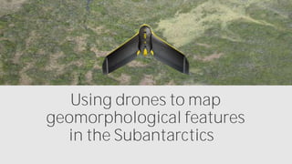
Using drones to map
geomorphological features
in the Subantarctics
One of the keys to better
understanding climate change
is to paint a more accurate picture
of environmental conditions
in the distant past
A good place to
measure
environmental
change over such
long timescales?
New
Subantarctic Islands
In November 2014, a team of
researchers from the Climate
Change Research Centre at the
University of New South Wales
set out to do just
This team decided
to map the
Musgrave
geomorphological
features, since
these provide
evidence of past
glaciation
complex geomorphology, so we
wanted to map it, in high resolution,
and create a 3D model that we could
use to identify and quantify past
Dr. Zoë
Thomas, a research associate
By then taking sediment cores, we
could also get an idea of what the
past vegetation and environmental
So why did the researchers
decide to use a drone?
No other method
of data collection
could provide the
imagery required
in the time
available.
There were
3 key reasons
Speed
#1
#2
Difficult terrain
High-resolution
imagery
#3
To map this area would
have taken us weeks using
traditional in-situ field
explains
resolution of the Landsat
imagery is 30 metres, much
lower than the 8.8 cm per
pixel our eBee achieved
she adds
choice to use
a senseFly
eBee also
brought an
additional
benefit
low noise is important
when working in protected areas
that contain large bird
says Thomas
But carrying out the drone flights
was not all plain
The Subantarctic islands are
located in the latitudes of the
strong trade winds, so finding
windows of opportunity to fly the
drone was always going to be a
challenge says
How did
they do it?
When planning each
eMotion software, the
team specified a
desired ground
resolution of 8.8
cm/pixel, with image
overlaps of 70%
lateral and 75%
longitudinal.
The team took a total
of 152 high-
resolution RGB
images over the
course of two
20-25 minute flights
The result?
These images were used to create the digital
surface model required to identify
geomorphological features
incredible, allowing us to identify a moraine
feature that we had not picked up at all on
the Landsat imagery reports
The ability to identify features like
this really helps us improve our
understanding of glacier flow lines
1 Identify site
of interest
2 Identify
suitable area for
drone to map
3 Identify take-
off/landing
locations
4 Wait for
suitable weather
conditions
5 Fly the drone
6 Process drone
images &
generate 3D DSM
7 Analyse drone
data
PROJECT WORKFLOW
PROJECT STATISTICS
For more information about using drones
for environmental applications, visit:
www.sensefly.com/applications/
environmental-protection.html

Contenu connexe

Tendances

Applications of used gps in land surveying
Applications of used gps in land surveyingApplications of used gps in land surveying
Applications of used gps in land surveyingFalcon Geomatics LLC
 
Remote sensing applications for seismic planning
Remote sensing applications for seismic planningRemote sensing applications for seismic planning
Remote sensing applications for seismic planningTTI Production
 
Satellite and Space Communication
Satellite and Space CommunicationSatellite and Space Communication
Satellite and Space CommunicationSayali Bodhankar
 
What is the gps surveying and its methods
What is the gps surveying and its methodsWhat is the gps surveying and its methods
What is the gps surveying and its methodsFalcon Geomatics LLC
 
Global Positioning System
Global Positioning SystemGlobal Positioning System
Global Positioning SystemPraveen Singh
 
8. aagw opening srw
8. aagw opening srw8. aagw opening srw
8. aagw opening srwaagw2010
 
GEOGRAPHIC INFORMATION SYSTEM (GIS) & REMOTE SENSING (RS)
GEOGRAPHIC  INFORMATION  SYSTEM (GIS)  & REMOTE SENSING  (RS)GEOGRAPHIC  INFORMATION  SYSTEM (GIS)  & REMOTE SENSING  (RS)
GEOGRAPHIC INFORMATION SYSTEM (GIS) & REMOTE SENSING (RS)Harish kumar Lekkala
 
New Jersey Land Change Viewer
New Jersey Land Change ViewerNew Jersey Land Change Viewer
New Jersey Land Change ViewerJohn Reiser
 
Geoinformatics ppt
Geoinformatics pptGeoinformatics ppt
Geoinformatics pptRevathy1993
 
F:\Work\Gps & Gis\Gps
F:\Work\Gps & Gis\GpsF:\Work\Gps & Gis\Gps
F:\Work\Gps & Gis\Gpsguestf48f25
 
Visualising geographical information in augmented reality - Geoforum 2016 - T...
Visualising geographical information in augmented reality - Geoforum 2016 - T...Visualising geographical information in augmented reality - Geoforum 2016 - T...
Visualising geographical information in augmented reality - Geoforum 2016 - T...EDINA, University of Edinburgh
 

Tendances (19)

URBAN GEOCROWDSOURCING?
URBAN GEOCROWDSOURCING?URBAN GEOCROWDSOURCING?
URBAN GEOCROWDSOURCING?
 
Applications of used gps in land surveying
Applications of used gps in land surveyingApplications of used gps in land surveying
Applications of used gps in land surveying
 
Gps seminar
Gps seminarGps seminar
Gps seminar
 
Remote sensing applications for seismic planning
Remote sensing applications for seismic planningRemote sensing applications for seismic planning
Remote sensing applications for seismic planning
 
GIS and Remote Sensing
GIS and Remote SensingGIS and Remote Sensing
GIS and Remote Sensing
 
Satellite and Space Communication
Satellite and Space CommunicationSatellite and Space Communication
Satellite and Space Communication
 
What is the gps surveying and its methods
What is the gps surveying and its methodsWhat is the gps surveying and its methods
What is the gps surveying and its methods
 
Global Positioning System
Global Positioning SystemGlobal Positioning System
Global Positioning System
 
Gps application
Gps applicationGps application
Gps application
 
8. aagw opening srw
8. aagw opening srw8. aagw opening srw
8. aagw opening srw
 
Global positioning system
Global positioning systemGlobal positioning system
Global positioning system
 
GEOGRAPHIC INFORMATION SYSTEM (GIS) & REMOTE SENSING (RS)
GEOGRAPHIC  INFORMATION  SYSTEM (GIS)  & REMOTE SENSING  (RS)GEOGRAPHIC  INFORMATION  SYSTEM (GIS)  & REMOTE SENSING  (RS)
GEOGRAPHIC INFORMATION SYSTEM (GIS) & REMOTE SENSING (RS)
 
GIS & RS
GIS & RSGIS & RS
GIS & RS
 
New Jersey Land Change Viewer
New Jersey Land Change ViewerNew Jersey Land Change Viewer
New Jersey Land Change Viewer
 
Geoinformatics ppt
Geoinformatics pptGeoinformatics ppt
Geoinformatics ppt
 
Learning Event No. 12, Session: Namirembe. ARDD2012 Rio
Learning Event No. 12, Session: Namirembe. ARDD2012 RioLearning Event No. 12, Session: Namirembe. ARDD2012 Rio
Learning Event No. 12, Session: Namirembe. ARDD2012 Rio
 
GIS for Defence
GIS for DefenceGIS for Defence
GIS for Defence
 
F:\Work\Gps & Gis\Gps
F:\Work\Gps & Gis\GpsF:\Work\Gps & Gis\Gps
F:\Work\Gps & Gis\Gps
 
Visualising geographical information in augmented reality - Geoforum 2016 - T...
Visualising geographical information in augmented reality - Geoforum 2016 - T...Visualising geographical information in augmented reality - Geoforum 2016 - T...
Visualising geographical information in augmented reality - Geoforum 2016 - T...
 

Similaire à Using senseFly Mapping Drones to Map Geomorphological Features in the Subantartics

UAV Mangroves Rev 0 colour
UAV Mangroves Rev 0 colourUAV Mangroves Rev 0 colour
UAV Mangroves Rev 0 colourPeter Mellor
 
An Automated Approach of Shoreline Detection Applied to Digital Videos using ...
An Automated Approach of Shoreline Detection Applied to Digital Videos using ...An Automated Approach of Shoreline Detection Applied to Digital Videos using ...
An Automated Approach of Shoreline Detection Applied to Digital Videos using ...Dwi Putra Asana
 
Using Remote Sensing Techniques For Monitoring Ecological Changes In Lakes: C...
Using Remote Sensing Techniques For Monitoring Ecological Changes In Lakes: C...Using Remote Sensing Techniques For Monitoring Ecological Changes In Lakes: C...
Using Remote Sensing Techniques For Monitoring Ecological Changes In Lakes: C...IJERA Editor
 
Flood risk mapping using GIS and remote sensing and SAR
Flood risk mapping using GIS and remote sensing and SARFlood risk mapping using GIS and remote sensing and SAR
Flood risk mapping using GIS and remote sensing and SARRohan Tuteja
 
OECD_PortugalKeynote_SatelliteTechnology_R1r00
OECD_PortugalKeynote_SatelliteTechnology_R1r00OECD_PortugalKeynote_SatelliteTechnology_R1r00
OECD_PortugalKeynote_SatelliteTechnology_R1r00Keiran Millard
 
DUAL-CHANNEL MODEL FOR SHALLOW WATER DEPTH RETRIEVAL FROM WORLDVIEW-3 IMAGERY...
DUAL-CHANNEL MODEL FOR SHALLOW WATER DEPTH RETRIEVAL FROM WORLDVIEW-3 IMAGERY...DUAL-CHANNEL MODEL FOR SHALLOW WATER DEPTH RETRIEVAL FROM WORLDVIEW-3 IMAGERY...
DUAL-CHANNEL MODEL FOR SHALLOW WATER DEPTH RETRIEVAL FROM WORLDVIEW-3 IMAGERY...Luhur Moekti Prayogo
 
Shallow Water Depth Mapping Using Single Band and Band Ratio on High-Resoluti...
Shallow Water Depth Mapping Using Single Band and Band Ratio on High-Resoluti...Shallow Water Depth Mapping Using Single Band and Band Ratio on High-Resoluti...
Shallow Water Depth Mapping Using Single Band and Band Ratio on High-Resoluti...Luhur Moekti Prayogo
 
Mangrove Vegetation Mapping Using Sentinel-2A Imagery Based on Google Earth E...
Mangrove Vegetation Mapping Using Sentinel-2A Imagery Based on Google Earth E...Mangrove Vegetation Mapping Using Sentinel-2A Imagery Based on Google Earth E...
Mangrove Vegetation Mapping Using Sentinel-2A Imagery Based on Google Earth E...Luhur Moekti Prayogo
 
Remote sensing and gis
Remote sensing and gisRemote sensing and gis
Remote sensing and gisKavinKumarR3
 
WETLAND MAPPING USING RS AND GIS
WETLAND MAPPING USING RS AND GISWETLAND MAPPING USING RS AND GIS
WETLAND MAPPING USING RS AND GISAbhiram Kanigolla
 
Utilizing drone in land development
Utilizing drone  in land developmentUtilizing drone  in land development
Utilizing drone in land developmentKosygin Leishangthem
 
UAVmapping_11111.ppt
UAVmapping_11111.pptUAVmapping_11111.ppt
UAVmapping_11111.pptBismaJZ
 
3D Cloud Visualizations
3D Cloud Visualizations3D Cloud Visualizations
3D Cloud VisualizationsJohn Pham
 
Meterological Technology International, Nov 2010
Meterological Technology International, Nov 2010Meterological Technology International, Nov 2010
Meterological Technology International, Nov 2010laurajairam
 
Jeofizik Tarımsal Toprak İncelemesi
Jeofizik Tarımsal Toprak İncelemesiJeofizik Tarımsal Toprak İncelemesi
Jeofizik Tarımsal Toprak İncelemesiAli Osman Öncel
 

Similaire à Using senseFly Mapping Drones to Map Geomorphological Features in the Subantartics (20)

UAV Mangroves Rev 0 colour
UAV Mangroves Rev 0 colourUAV Mangroves Rev 0 colour
UAV Mangroves Rev 0 colour
 
An Automated Approach of Shoreline Detection Applied to Digital Videos using ...
An Automated Approach of Shoreline Detection Applied to Digital Videos using ...An Automated Approach of Shoreline Detection Applied to Digital Videos using ...
An Automated Approach of Shoreline Detection Applied to Digital Videos using ...
 
Using Remote Sensing Techniques For Monitoring Ecological Changes In Lakes: C...
Using Remote Sensing Techniques For Monitoring Ecological Changes In Lakes: C...Using Remote Sensing Techniques For Monitoring Ecological Changes In Lakes: C...
Using Remote Sensing Techniques For Monitoring Ecological Changes In Lakes: C...
 
Using Remote Sensing Techniques For Monitoring Ecological Changes In Lakes: C...
Using Remote Sensing Techniques For Monitoring Ecological Changes In Lakes: C...Using Remote Sensing Techniques For Monitoring Ecological Changes In Lakes: C...
Using Remote Sensing Techniques For Monitoring Ecological Changes In Lakes: C...
 
Flood risk mapping using GIS and remote sensing and SAR
Flood risk mapping using GIS and remote sensing and SARFlood risk mapping using GIS and remote sensing and SAR
Flood risk mapping using GIS and remote sensing and SAR
 
OECD_PortugalKeynote_SatelliteTechnology_R1r00
OECD_PortugalKeynote_SatelliteTechnology_R1r00OECD_PortugalKeynote_SatelliteTechnology_R1r00
OECD_PortugalKeynote_SatelliteTechnology_R1r00
 
L012438186
L012438186L012438186
L012438186
 
DUAL-CHANNEL MODEL FOR SHALLOW WATER DEPTH RETRIEVAL FROM WORLDVIEW-3 IMAGERY...
DUAL-CHANNEL MODEL FOR SHALLOW WATER DEPTH RETRIEVAL FROM WORLDVIEW-3 IMAGERY...DUAL-CHANNEL MODEL FOR SHALLOW WATER DEPTH RETRIEVAL FROM WORLDVIEW-3 IMAGERY...
DUAL-CHANNEL MODEL FOR SHALLOW WATER DEPTH RETRIEVAL FROM WORLDVIEW-3 IMAGERY...
 
Shallow Water Depth Mapping Using Single Band and Band Ratio on High-Resoluti...
Shallow Water Depth Mapping Using Single Band and Band Ratio on High-Resoluti...Shallow Water Depth Mapping Using Single Band and Band Ratio on High-Resoluti...
Shallow Water Depth Mapping Using Single Band and Band Ratio on High-Resoluti...
 
Mangrove Vegetation Mapping Using Sentinel-2A Imagery Based on Google Earth E...
Mangrove Vegetation Mapping Using Sentinel-2A Imagery Based on Google Earth E...Mangrove Vegetation Mapping Using Sentinel-2A Imagery Based on Google Earth E...
Mangrove Vegetation Mapping Using Sentinel-2A Imagery Based on Google Earth E...
 
space technology
space technologyspace technology
space technology
 
Goal andga oct01
Goal andga oct01Goal andga oct01
Goal andga oct01
 
Remote sensing and gis
Remote sensing and gisRemote sensing and gis
Remote sensing and gis
 
Mercator Ocean newsletter 25
Mercator Ocean newsletter 25Mercator Ocean newsletter 25
Mercator Ocean newsletter 25
 
WETLAND MAPPING USING RS AND GIS
WETLAND MAPPING USING RS AND GISWETLAND MAPPING USING RS AND GIS
WETLAND MAPPING USING RS AND GIS
 
Utilizing drone in land development
Utilizing drone  in land developmentUtilizing drone  in land development
Utilizing drone in land development
 
UAVmapping_11111.ppt
UAVmapping_11111.pptUAVmapping_11111.ppt
UAVmapping_11111.ppt
 
3D Cloud Visualizations
3D Cloud Visualizations3D Cloud Visualizations
3D Cloud Visualizations
 
Meterological Technology International, Nov 2010
Meterological Technology International, Nov 2010Meterological Technology International, Nov 2010
Meterological Technology International, Nov 2010
 
Jeofizik Tarımsal Toprak İncelemesi
Jeofizik Tarımsal Toprak İncelemesiJeofizik Tarımsal Toprak İncelemesi
Jeofizik Tarımsal Toprak İncelemesi
 

Dernier

Call On 6297143586 Pimpri Chinchwad Call Girls In All Pune 24/7 Provide Call...
Call On 6297143586  Pimpri Chinchwad Call Girls In All Pune 24/7 Provide Call...Call On 6297143586  Pimpri Chinchwad Call Girls In All Pune 24/7 Provide Call...
Call On 6297143586 Pimpri Chinchwad Call Girls In All Pune 24/7 Provide Call...tanu pandey
 
Call Girls Budhwar Peth Call Me 7737669865 Budget Friendly No Advance Booking
Call Girls Budhwar Peth Call Me 7737669865 Budget Friendly No Advance BookingCall Girls Budhwar Peth Call Me 7737669865 Budget Friendly No Advance Booking
Call Girls Budhwar Peth Call Me 7737669865 Budget Friendly No Advance Bookingroncy bisnoi
 
RATING SYSTEMS- IGBC, GRIHA, LEED--.pptx
RATING  SYSTEMS- IGBC, GRIHA, LEED--.pptxRATING  SYSTEMS- IGBC, GRIHA, LEED--.pptx
RATING SYSTEMS- IGBC, GRIHA, LEED--.pptxJIT KUMAR GUPTA
 
Kondhwa ( Call Girls ) Pune 6297143586 Hot Model With Sexy Bhabi Ready For ...
Kondhwa ( Call Girls ) Pune  6297143586  Hot Model With Sexy Bhabi Ready For ...Kondhwa ( Call Girls ) Pune  6297143586  Hot Model With Sexy Bhabi Ready For ...
Kondhwa ( Call Girls ) Pune 6297143586 Hot Model With Sexy Bhabi Ready For ...tanu pandey
 
Hertwich_EnvironmentalImpacts_BuildingsGRO.pptx
Hertwich_EnvironmentalImpacts_BuildingsGRO.pptxHertwich_EnvironmentalImpacts_BuildingsGRO.pptx
Hertwich_EnvironmentalImpacts_BuildingsGRO.pptxEdgar Hertwich
 
Call Girls Service Pune ₹7.5k Pick Up & Drop With Cash Payment 8005736733 Cal...
Call Girls Service Pune ₹7.5k Pick Up & Drop With Cash Payment 8005736733 Cal...Call Girls Service Pune ₹7.5k Pick Up & Drop With Cash Payment 8005736733 Cal...
Call Girls Service Pune ₹7.5k Pick Up & Drop With Cash Payment 8005736733 Cal...SUHANI PANDEY
 
Plastic Bank Beyond EPR - Sustainability Programs
Plastic Bank Beyond EPR - Sustainability ProgramsPlastic Bank Beyond EPR - Sustainability Programs
Plastic Bank Beyond EPR - Sustainability Programsitadmin50
 
Call Girls Ramtek Call Me 7737669865 Budget Friendly No Advance Booking
Call Girls Ramtek Call Me 7737669865 Budget Friendly No Advance BookingCall Girls Ramtek Call Me 7737669865 Budget Friendly No Advance Booking
Call Girls Ramtek Call Me 7737669865 Budget Friendly No Advance Bookingroncy bisnoi
 
RA 7942:vThe Philippine Mining Act of 1995
RA 7942:vThe Philippine Mining Act of 1995RA 7942:vThe Philippine Mining Act of 1995
RA 7942:vThe Philippine Mining Act of 1995garthraymundo123
 
Enhancing forest data transparency for climate action
Enhancing forest data transparency for climate actionEnhancing forest data transparency for climate action
Enhancing forest data transparency for climate actionRocioDanicaCondorGol1
 
Call Girls Moshi Call Me 7737669865 Budget Friendly No Advance Booking
Call Girls Moshi Call Me 7737669865 Budget Friendly No Advance BookingCall Girls Moshi Call Me 7737669865 Budget Friendly No Advance Booking
Call Girls Moshi Call Me 7737669865 Budget Friendly No Advance Bookingroncy bisnoi
 
Call Girls Talegaon Dabhade Call Me 7737669865 Budget Friendly No Advance Boo...
Call Girls Talegaon Dabhade Call Me 7737669865 Budget Friendly No Advance Boo...Call Girls Talegaon Dabhade Call Me 7737669865 Budget Friendly No Advance Boo...
Call Girls Talegaon Dabhade Call Me 7737669865 Budget Friendly No Advance Boo...roncy bisnoi
 
Call Girls Jejuri Call Me 7737669865 Budget Friendly No Advance Booking
Call Girls Jejuri Call Me 7737669865 Budget Friendly No Advance BookingCall Girls Jejuri Call Me 7737669865 Budget Friendly No Advance Booking
Call Girls Jejuri Call Me 7737669865 Budget Friendly No Advance Bookingroncy bisnoi
 
Call Now ☎️🔝 9332606886 🔝 Call Girls ❤ Service In Muzaffarpur Female Escorts ...
Call Now ☎️🔝 9332606886 🔝 Call Girls ❤ Service In Muzaffarpur Female Escorts ...Call Now ☎️🔝 9332606886 🔝 Call Girls ❤ Service In Muzaffarpur Female Escorts ...
Call Now ☎️🔝 9332606886 🔝 Call Girls ❤ Service In Muzaffarpur Female Escorts ...Anamikakaur10
 
VIP Call Girls Valsad 7001035870 Whatsapp Number, 24/07 Booking
VIP Call Girls Valsad 7001035870 Whatsapp Number, 24/07 BookingVIP Call Girls Valsad 7001035870 Whatsapp Number, 24/07 Booking
VIP Call Girls Valsad 7001035870 Whatsapp Number, 24/07 Bookingdharasingh5698
 
VVIP Pune Call Girls Vishal Nagar WhatSapp Number 8005736733 With Elite Staff...
VVIP Pune Call Girls Vishal Nagar WhatSapp Number 8005736733 With Elite Staff...VVIP Pune Call Girls Vishal Nagar WhatSapp Number 8005736733 With Elite Staff...
VVIP Pune Call Girls Vishal Nagar WhatSapp Number 8005736733 With Elite Staff...SUHANI PANDEY
 
VIP Model Call Girls Hadapsar ( Pune ) Call ON 8005736733 Starting From 5K to...
VIP Model Call Girls Hadapsar ( Pune ) Call ON 8005736733 Starting From 5K to...VIP Model Call Girls Hadapsar ( Pune ) Call ON 8005736733 Starting From 5K to...
VIP Model Call Girls Hadapsar ( Pune ) Call ON 8005736733 Starting From 5K to...SUHANI PANDEY
 
VVIP Pune Call Girls Wagholi WhatSapp Number 8005736733 With Elite Staff And ...
VVIP Pune Call Girls Wagholi WhatSapp Number 8005736733 With Elite Staff And ...VVIP Pune Call Girls Wagholi WhatSapp Number 8005736733 With Elite Staff And ...
VVIP Pune Call Girls Wagholi WhatSapp Number 8005736733 With Elite Staff And ...SUHANI PANDEY
 

Dernier (20)

Call On 6297143586 Pimpri Chinchwad Call Girls In All Pune 24/7 Provide Call...
Call On 6297143586  Pimpri Chinchwad Call Girls In All Pune 24/7 Provide Call...Call On 6297143586  Pimpri Chinchwad Call Girls In All Pune 24/7 Provide Call...
Call On 6297143586 Pimpri Chinchwad Call Girls In All Pune 24/7 Provide Call...
 
Call Girls Budhwar Peth Call Me 7737669865 Budget Friendly No Advance Booking
Call Girls Budhwar Peth Call Me 7737669865 Budget Friendly No Advance BookingCall Girls Budhwar Peth Call Me 7737669865 Budget Friendly No Advance Booking
Call Girls Budhwar Peth Call Me 7737669865 Budget Friendly No Advance Booking
 
RATING SYSTEMS- IGBC, GRIHA, LEED--.pptx
RATING  SYSTEMS- IGBC, GRIHA, LEED--.pptxRATING  SYSTEMS- IGBC, GRIHA, LEED--.pptx
RATING SYSTEMS- IGBC, GRIHA, LEED--.pptx
 
Kondhwa ( Call Girls ) Pune 6297143586 Hot Model With Sexy Bhabi Ready For ...
Kondhwa ( Call Girls ) Pune  6297143586  Hot Model With Sexy Bhabi Ready For ...Kondhwa ( Call Girls ) Pune  6297143586  Hot Model With Sexy Bhabi Ready For ...
Kondhwa ( Call Girls ) Pune 6297143586 Hot Model With Sexy Bhabi Ready For ...
 
Hertwich_EnvironmentalImpacts_BuildingsGRO.pptx
Hertwich_EnvironmentalImpacts_BuildingsGRO.pptxHertwich_EnvironmentalImpacts_BuildingsGRO.pptx
Hertwich_EnvironmentalImpacts_BuildingsGRO.pptx
 
Call Girls Service Pune ₹7.5k Pick Up & Drop With Cash Payment 8005736733 Cal...
Call Girls Service Pune ₹7.5k Pick Up & Drop With Cash Payment 8005736733 Cal...Call Girls Service Pune ₹7.5k Pick Up & Drop With Cash Payment 8005736733 Cal...
Call Girls Service Pune ₹7.5k Pick Up & Drop With Cash Payment 8005736733 Cal...
 
Plastic Bank Beyond EPR - Sustainability Programs
Plastic Bank Beyond EPR - Sustainability ProgramsPlastic Bank Beyond EPR - Sustainability Programs
Plastic Bank Beyond EPR - Sustainability Programs
 
Call Girls Ramtek Call Me 7737669865 Budget Friendly No Advance Booking
Call Girls Ramtek Call Me 7737669865 Budget Friendly No Advance BookingCall Girls Ramtek Call Me 7737669865 Budget Friendly No Advance Booking
Call Girls Ramtek Call Me 7737669865 Budget Friendly No Advance Booking
 
RA 7942:vThe Philippine Mining Act of 1995
RA 7942:vThe Philippine Mining Act of 1995RA 7942:vThe Philippine Mining Act of 1995
RA 7942:vThe Philippine Mining Act of 1995
 
Enhancing forest data transparency for climate action
Enhancing forest data transparency for climate actionEnhancing forest data transparency for climate action
Enhancing forest data transparency for climate action
 
Water Pollution
Water Pollution Water Pollution
Water Pollution
 
Call Girls Moshi Call Me 7737669865 Budget Friendly No Advance Booking
Call Girls Moshi Call Me 7737669865 Budget Friendly No Advance BookingCall Girls Moshi Call Me 7737669865 Budget Friendly No Advance Booking
Call Girls Moshi Call Me 7737669865 Budget Friendly No Advance Booking
 
Call Girls Talegaon Dabhade Call Me 7737669865 Budget Friendly No Advance Boo...
Call Girls Talegaon Dabhade Call Me 7737669865 Budget Friendly No Advance Boo...Call Girls Talegaon Dabhade Call Me 7737669865 Budget Friendly No Advance Boo...
Call Girls Talegaon Dabhade Call Me 7737669865 Budget Friendly No Advance Boo...
 
Call Girls Jejuri Call Me 7737669865 Budget Friendly No Advance Booking
Call Girls Jejuri Call Me 7737669865 Budget Friendly No Advance BookingCall Girls Jejuri Call Me 7737669865 Budget Friendly No Advance Booking
Call Girls Jejuri Call Me 7737669865 Budget Friendly No Advance Booking
 
Call Now ☎️🔝 9332606886 🔝 Call Girls ❤ Service In Muzaffarpur Female Escorts ...
Call Now ☎️🔝 9332606886 🔝 Call Girls ❤ Service In Muzaffarpur Female Escorts ...Call Now ☎️🔝 9332606886 🔝 Call Girls ❤ Service In Muzaffarpur Female Escorts ...
Call Now ☎️🔝 9332606886 🔝 Call Girls ❤ Service In Muzaffarpur Female Escorts ...
 
Green Marketing
Green MarketingGreen Marketing
Green Marketing
 
VIP Call Girls Valsad 7001035870 Whatsapp Number, 24/07 Booking
VIP Call Girls Valsad 7001035870 Whatsapp Number, 24/07 BookingVIP Call Girls Valsad 7001035870 Whatsapp Number, 24/07 Booking
VIP Call Girls Valsad 7001035870 Whatsapp Number, 24/07 Booking
 
VVIP Pune Call Girls Vishal Nagar WhatSapp Number 8005736733 With Elite Staff...
VVIP Pune Call Girls Vishal Nagar WhatSapp Number 8005736733 With Elite Staff...VVIP Pune Call Girls Vishal Nagar WhatSapp Number 8005736733 With Elite Staff...
VVIP Pune Call Girls Vishal Nagar WhatSapp Number 8005736733 With Elite Staff...
 
VIP Model Call Girls Hadapsar ( Pune ) Call ON 8005736733 Starting From 5K to...
VIP Model Call Girls Hadapsar ( Pune ) Call ON 8005736733 Starting From 5K to...VIP Model Call Girls Hadapsar ( Pune ) Call ON 8005736733 Starting From 5K to...
VIP Model Call Girls Hadapsar ( Pune ) Call ON 8005736733 Starting From 5K to...
 
VVIP Pune Call Girls Wagholi WhatSapp Number 8005736733 With Elite Staff And ...
VVIP Pune Call Girls Wagholi WhatSapp Number 8005736733 With Elite Staff And ...VVIP Pune Call Girls Wagholi WhatSapp Number 8005736733 With Elite Staff And ...
VVIP Pune Call Girls Wagholi WhatSapp Number 8005736733 With Elite Staff And ...
 

Using senseFly Mapping Drones to Map Geomorphological Features in the Subantartics

  • 1. Using drones to map geomorphological features in the Subantarctics
  • 2. One of the keys to better understanding climate change is to paint a more accurate picture of environmental conditions in the distant past
  • 3. A good place to measure environmental change over such long timescales? New Subantarctic Islands
  • 4. In November 2014, a team of researchers from the Climate Change Research Centre at the University of New South Wales set out to do just
  • 5. This team decided to map the Musgrave geomorphological features, since these provide evidence of past glaciation
  • 6. complex geomorphology, so we wanted to map it, in high resolution, and create a 3D model that we could use to identify and quantify past Dr. Zoë Thomas, a research associate By then taking sediment cores, we could also get an idea of what the past vegetation and environmental
  • 7. So why did the researchers decide to use a drone?
  • 8. No other method of data collection could provide the imagery required in the time available. There were 3 key reasons
  • 12. To map this area would have taken us weeks using traditional in-situ field explains
  • 13. resolution of the Landsat imagery is 30 metres, much lower than the 8.8 cm per pixel our eBee achieved she adds
  • 14. choice to use a senseFly eBee also brought an additional benefit
  • 15. low noise is important when working in protected areas that contain large bird says Thomas
  • 16. But carrying out the drone flights was not all plain The Subantarctic islands are located in the latitudes of the strong trade winds, so finding windows of opportunity to fly the drone was always going to be a challenge says
  • 18. When planning each eMotion software, the team specified a desired ground resolution of 8.8 cm/pixel, with image overlaps of 70% lateral and 75% longitudinal.
  • 19. The team took a total of 152 high- resolution RGB images over the course of two 20-25 minute flights
  • 21. These images were used to create the digital surface model required to identify geomorphological features
  • 22. incredible, allowing us to identify a moraine feature that we had not picked up at all on the Landsat imagery reports The ability to identify features like this really helps us improve our understanding of glacier flow lines
  • 23. 1 Identify site of interest 2 Identify suitable area for drone to map 3 Identify take- off/landing locations 4 Wait for suitable weather conditions 5 Fly the drone 6 Process drone images & generate 3D DSM 7 Analyse drone data PROJECT WORKFLOW
  • 25. For more information about using drones for environmental applications, visit: www.sensefly.com/applications/ environmental-protection.html