Towards a Less Carbon Intensive Built Environment: Evidence and Ideas for South of the Fraser
•
1 j'aime•720 vues

Andrew Devlin presents the results of some intense research he and his colleagues have recently completed at UBC: Towards a Less Carbon Intensive Built Environment: Evidence and Ideas for South of the Fraser. It looks at the direct relationship between land use and GHG emissions.

Recommandé
Recommandé
Contenu connexe
En vedette
En vedette (9)
Similaire à Towards a Less Carbon Intensive Built Environment: Evidence and Ideas for South of the Fraser
Similaire à Towards a Less Carbon Intensive Built Environment: Evidence and Ideas for South of the Fraser (7)
Plus de South Fraser Blog
Plus de South Fraser Blog (20)
Dernier
Dernier (20)
Towards a Less Carbon Intensive Built Environment: Evidence and Ideas for South of the Fraser
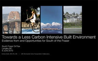
- 1. Towards a Less Carbon Intensive Built Environment Evidence from and Opportunities for South of the Fraser South Fraser OnTrax Langley BC 9 June 2010 Andrew Devlin, BES (Pl.), MA | UBC Bombardier Active Transportation Collaboratory
- 2. Outline • Problem • Challenge • Approach • Trends • Findings • Opportunities & Barriers 2
- 3. Problem
- 4. A changing climate Source: BC Climate Action Plan 4
- 5. A myriad of potential impacts Source: Wordle.net 5
- 6. Challenge
- 7. Emissions by sector Source: BC Climate Action Plan 7
- 8. A focus on transportation Source: BC Climate Action Plan 8
- 9. Limits of the “techno-fix” Projected growth in CO2 emissions from cars and light duty trucks (assuming stringent nationwide vehicle - 45 mpg - and fuel standards - 15% less carbon intensity). Source: Center for Clean Air Policy 9
- 10. A role for the built environment? Source: Frank et al., 2007 Source: Grazi et al., 2008 Seattle, WA The Netherlands 10
- 11. Approach
- 12. What was done • Two studies 1) travel behaviour and 2) travel emissions, and associations with the built environment. • Focus on how nearby land use characteristics where people live influence home- based work activities and non-work activities and associated emissions. • Utilized individual, self-reported travel data from 1999 GVRD Travel Diary Survey. • Travel survey included location (postal code) of where individuals live, work, go to school, where they traveled, and how they got there. Socioeconomic and demographic attributes also self-reported. • Matched residential location of individual’s to corresponding postal code in Metro Vancouver Walkability Index database to assess associations of nearby urban form and accessibility attributes on travel and emissions. 12
- 13. Measuring walkability Walkability = Net residential density + Commercial density + Street connectivity + Land use mix (entropy) Measured for each postal code (1-km network buffer) across Metro Vancouver Source: Frank et al., 2005 13
- 14. Trends
- 15. Neighbourhood walkability Source: van Loon and Frank 2008 15
- 16. Neighbourhood walkability Source: van Loon and Frank 2008 16
- 17. Distance to work Source: Devlin 2010 17
- 18. Distance to nearest centre Source: Devlin 2010 18
- 19. Mean daily distance traveled South of Fraser North of Fraser Metro Vancouver Source: Devlin 2010 19
- 20. Share of distance traveled by mode South of Fraser North of Fraser Metro Vancouver Vehicles Transit Active Transport Source: Devlin 2010 20
- 21. Share of daily trips by mode South of Fraser North of Fraser Metro Vancouver Vehicles Transit Active Transport Source: Devlin and Frank 2009 21
- 22. Use of alternative modes South of Fraser North of Fraser Metro Vancouver Transit Active Transport Source: Devlin 2010 22
- 23. Total daily travel emissions * South of Fraser North of Fraser Trend reflective of population distribution across Metro Vancouver at time of data collection (1999) * From sample population only, n = 2,690 persons, 1999 TransLink Trip Diary Survey Source: Devlin 2010 23
- 24. Daily per-capita travel emissions South of Fraser North of Fraser Metro Vancouver Source: Devlin 2010 24
- 25. Daily travel emissions by activity type South of Fraser North of Fraser Metro Vancouver Work Non-Work Source: Devlin 2010 25
- 26. Findings
- 27. Walking and neighbourhood urban form Built environment characteristics explaining walking in adults Non- Any walk Work/school work/school trip walk trip walk trip Higher residential density +++ +++ +++ Higher street connectivity +++ +++ +++ Higher commercial density +++ +++ +++ Higher mix of land uses ++ + ++ More nearby parks and open spaces +++ + +++ Higher overall neighbourhood walkability +++ ++ +++ NS = not significant, '+' = 95% significant; '++' = 99% significant, '+++' = 99.9% significant Source: Devlin and Frank 2009 27
- 28. Transit and neighbourhood urban form Built environment characteristics explaining transit use in adults Non- Any transit Work/school work/school trip transit trip transit trip Higher residential density ++ + + Higher street connectivity ++ + ++ Higher commercial density +++ NS + Higher mix of land uses ++ ++ NS More nearby parks and open spaces NS NS NS Higher overall neighbourhood walkability ++ ++ ++ NS = not significant, '+' = 95% significant; '++' = 99% significant, '+++' = 99.9% significant Source: Devlin and Frank 2009 28
- 29. Vehicles and neighbourhood urban form Built environment characteristics explaining vehicle use in adults Non- Any vehicle Work/school work/school trip vehicle trip vehicle trip Lower residential density +++ ++ +++ Lower street connectivity +++ +++ +++ Lower commercial density +++ +++ +++ Lower mix of land uses +++ +++ + Few nearby parks and open spaces +++ NS +++ Lower overall neighbourhood walkability +++ +++ +++ NS = not significant, '+' = 95% significant; '++' = 99% significant, '+++' = 99.9% significant Source: Devlin and Frank 2009 29
- 30. Travel behaviour and urban form • Adults living in the most walkable neighbourhoods are over 4 times more likely to report they walked for any home-based trip compared to those living in the least walkable neighbourhoods • Adults living in neighbourhoods with a higher quantity of accessible park and open space are around 3 times more likely to report they walked compared to adults who live in neighbourhoods with very little park and open space. • Adults in the most walkable neighbourhoods drive 57% less than those in the least walkable areas. 30
- 31. Vehicle emissions and urban form Dependent Variables Emissions related to Independent Variables ACTIVITY LOCATION OF VEHICLE KM VEHICLE home-based non- PATTERNS STOPS TRAVELED EMISSIONS AGE work travel and FEMALE -0.092 0.014 0.013 activities PERSONS<18 0.116 0.077 0.041 0.057 VEHICLE ACCESS 0.254 0.243 • Effect of vehicle access is HH INCOME 0.048 0.046 positive and is 93% greater than NEIGHBRHD WALK 0.004 0.122 -0.141 -0.126 neighbourhood walkability. DIST TO CENTRE (SQRT) -0.002 -0.067 0.074 0.072 TRANSIT AVLBLTY (SQRT) 0.003 0.083 -0.069 -0.097 • Effect of neighbourhood % TOURS SIMPLE (SQRT) -0.151 -0.144 walkability is negative and % STOPS NEAR HOME 0.036 -0.191 -0.192 75% greater than regional (SQRT) connectivity. VKT (SQRT) 0.955 R2 0.021 0.049 0.252 0.912 NOTE: Standardized regression coefficients. Estimates interpreted as ‘magnitude of effect’. All coefficients significant at the 95% confidence interval. n = 1,370. Source: Devlin 2010 31
- 32. Vehicle emissions and urban form Dependent Variables Emissions related to Indenpendent Variables ACTIVITY VEHICLE KM VEHICLE home-based work PATTERNS TRAVELED EMISSIONS travel and activities AGE -0.059 0.065 0.042 FEMALE -0.072 -0.022 • Effect of distance to work PERSONS<18 is positive and and over VEHICLE ACCESS 0.067 0.303 0.298 400% greater than HH INCOME 0.064 0.063 neighbourhood walkability. NEIGHBRHD WALK -0.099 -0.097 • Effect of vehicle access is DIST TO WRK/SCHL (SQRT) 0.509 0.500 positive and 200% greater TRANSIT AVLBLTY (SQRT) than neighbourhood TOUR CMPLXTY (LGn) 0.193 0.190 walkability. VKT (SQRT) 0.983 R2 0.007 0.570 0.996 NOTE: Standardized regression coefficients. Estimates interpreted as ‘magnitude of effect’. All coefficients significant at the 95% confidence interval. n = 1,713. Source: Devlin 2010 32
- 33. Summary • The culprit is the commute: 61% of travel emissions South of the Fraser are generated from travel to and from work. • Vehicle of choice: Residents South of the Fraser use a vehicle to travel more than anyone else in Metro Vancouver. Increased vehicle access is positively associated with vehicle use and related emissions. • Location, location, location: The further we live from our places of work (regional accessibility), the more inclined we are to drive, which leads to increased emission levels. • Our backyard: More walkable local neighbourhood urban form characteristics are positively associated with active transportation levels and negatively associated with greenhouse gas emissions related to home-based other travel (e.g. non-work). 33
- 35. A balanced approach • Policies balancing “carrots” (e.g. strong land use regulation, accessible and affordable transit alternatives) and “sticks” (e.g. vehicle, parking, road pricing) required. • Limiting outward growth (e.g. “distance-based” development review; firm growth boundaries) • A focus on increasing regional accessibility, supported by compact, walkable and transit-oriented urban form should be a priority (e.g. the Interurban and other regional transit investment for South of the Fraser). • Reinvest in useable parks and recreational spaces that can double as connectivity pathways 35
- 36. Avoiding the “cookie-cutter” Auto-oriented suburbs like Cloverdale in Surrey: • Encourage redevelopment of shopping malls and big box retail into more mixed-use nodes. • Reduce superfluous parking through appropriate design guidelines. • Support location efficient development around public transit through taxation and financing mechanisms. • Consider rezoning select single-family housing areas to allow modest infill (e.g. basement suites, coach houses, duplexes, triplexes) that may aid to increase densities. 36
- 37. Avoiding the “cookie-cutter” Rural neighbourhoods like Brookswood in Langley: • Channel development and public services into accessible, mixed-use settlements rather than dispersed, poorly connected patterns. • Increase transportation options through community trail development for local trips and bike/transit integration for longer, regional travel. • Explore opportunities for para-transit and other flexible transportation programming. 37
- 38. Barriers to VKT reduction • Densities continue to decrease (beyond urban core); • Vehicle ownership/access increasing (through 2006); • Perceived vs. objective perspectives of time; • Scattered employment trends; • Socio-cultural connections to private vehicle; and • Built environment slow to transform. 38
- 39. Contact Acknowledgments Andrew Devlin, BES (Pl.), MA Dr. Larry Frank, UBC Researcher Josh van Loon, UBC UBC Active Transportation Collaboratory TransLink ajdevlin@interchange.ubc.ca Metro Vancouver http://www.act-trans.ubc.ca/ BC Recreation & Parks Canadian Institute of Planners SSHRC