Downtown & Infill Tax Increment Districts: Strategies for Success
Houghton Falls, Bayfield County WI
1. 0 250 500 750 1,000125
Feet
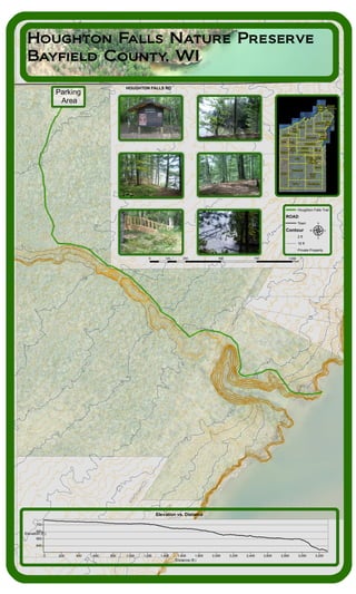
Houghton Falls Nature Preserve
Bayfield County, WI
Elevation vs. Distance
Distance (ft.)
3,2003,0002,8002,6002,4002,2002,0001,8001,6001,4001,2001,0008006004002000
Elevation (ft.)
700
680
660
640
Houghton Falls Trail
ROAD
Town
Contour
2 ft
10 ft
Private Property
µ
Barksdale
Tripp
City of
Washburn
Washburn
Bayview
Bayfield
Russell
City of
Bayfield
BellClover
Port
Wing
Village
of Mason
Orienta
Oulu
Hughes
Iron
River
Pilsen
Keystone
Eileen
Barnes
Delta Mason Kelly
Drummond
Grand
View
Lincoln
Cable Namakagon
Bayfield
- Sand
Island
Russell
- Raspberry
Island
HOUGHTON FALLS RD
Parking
Area