SlideShare une entreprise Scribd logo
1  sur  2
©DHI
4
GROUNDWATER FLOODING
MIKE SHE delivers truly integrated modelling of groundwater,
surface water, recharge and evapotranspiration - all important
aspects of hydrology when your project requires a fully
integrated model. No other tool or combination of tools can
match MIKE SHE in terms of seamless integration of all the
important processes of the hydrological cycle.
MIKE SHE includes 2D overland flow capabilities and full
riverine hydrodynamics (with MIKE 11) delivering a powerful
1D-2D flood modelling tool when evapotranspiration,
infiltration and groundwater are relevant.
For detailed groundwater-surface water interaction studies
(including water quality), MIKE SHE includes 3D, finite
difference groundwater flow, which discharges groundwater
drainage directly to surface water.
An unrivalled dynamic coupling of MIKE SHE with MIKE
URBAN is also available allowing the accurate modelling of
the two-way interaction between pipes in the ground and the
surrounding aquifer. This facilitates the modelling of infiltration
to and leakage from pipes as well as modelling of the potential
side effects of infiltration prevention.
MORPHOLOGY
The primary long term factors affecting river hydrodynamics,
and flood risk, are climate change and urbanisation. However,
the consideration of other factors may also be critical.
Morphological change, for example, is too often limited to the
consideration of scour or silting at structures, and to the
development of river maintenance schemes.
For broad scale sediment transport studies, MIKE 11 may be
sufficient. However, to inform the detailed design of flood
defences or other structures, bank stability assessments, and
to assess the effectiveness and impact of erosion control
measures (hard or soft engineered) on river health and future
habitats (e.g. fish spawning grounds) the MIKE 21 Flexible
Mesh series is preferred. More advanced morphological
modelling - including planform change - is possible using
MIKE 21C (Curvilinear Grid).
The transition from 1D to 2D modelling is streamlined by the
automatic generation of 2D bathymetries from MIKE 11.
MIKE BY DHI DELEGATE PACK - CIWEM SURFACE WATER FLOODING AND MANAGEMENT 2013
DHI Water Environments (UK) Ltd
Davidson House
Forbury Square
Reading, RG1 3EU
United Kingdom
+44 (0)1189 000745 Telephone
mikebydhi.uk@dhigroup.com
www.mikebydhi.com
ABOUT DHI
DHI are the first people you should call when you have a tough challenge to solve in a water
environment. Whether it is a river, a reservoir, an ocean, a coastline, within a city or a factory. Our
world is water, and our knowledge of water environments is second-to-none. It represents 50 years
of dedicated research, and real-life experience from more than 140 countries.
We strive to make this knowledge globally accessible to clients and partners by channelling it
through our local teams and unique software.
So whether you need to save water, share it fairly, improve its quality, quantify its impact or manage
its flow, we can help. Our knowledge, combined with our team’s expertise and the power of our
technology, hold the key to unlocking the right solution.
MINING & MINE WATER MANAGEMENT: A FOCUS ON
FEFLOW
Mine flooding can not only alter
underground hydrogeology, but
also cause the collapse of mine
workings (potentially exacerbating
groundwater related flooding
elsewhere), ground subsidence
and damage to surface structures
both in the mine and in the
surrounding area. FEFLOW can
be used to predict the locations
and severity of flooding within a
mine and to model the long term
performance of flooding control measures, as well as optimise
dewatering works (emergency or long term), in operational and
abandoned mine workings. FEFLOW can also be used to
develop effective early warning systems, to validate remediation
schemes for groundwater contaminated by mining activity, and to
assess the risk of uncontrolled discharge to surface waters of
pollutants mobilised by rising flood waters within the mine.
FEFLOW is our state-of-the-art integrated groundwater software
package for the modelling of fluid flow, transport of dissolved
constituents and heat transport processes in the subsurface.
FEFLOW links with MIKE 11 for groundwater - surface water
interaction problems (river flow).
CLIMATE CHANGE ADAPTATION
DHI has developed a set of Climate
Change Guidelines. For your free copy
please visit climatechange.dhigroup.com
ASSESSING THE IMPACTS OF RURAL LAND MANAGEMENT
CHANGE ON FLOODING AND FLOOD RISK (THE
CATCHMENT APPROACH)
MIKE SHE is a very powerful tool for
assessing the effects of natural flood
management schemes in the UK. The
software has been used extensively for
modelling wetland restoration in upland areas
in different parts of the world.
The effects of tree planting, water meadows, and other riparian
planting can be described by land use changes in the model and
the impacts on evapotranspiration, unsaturated flow and surface
runoff examined. It is also possible to describe the detention of
water in the floodplain (e.g. as a result of tree planting,
landscaping, etc).
The effects of cutting off drains, and altering surface flow routes,
can be modelled using the MIKE SHE 2D Overland Flow module.
Channel restoration and green bank protection can be handled
by coupling to MIKE 11.
Natural flood management has many benefits (habitat creation,
nature conservation, diffuse pollution mitigation, etc) and is of
particular interest in rural rapid response catchments; where it is
not always possible to provide flood defences.
Photo:iStock©ВасилийТороус
©DHI
Traditional approaches to flood risk management in the UK have focussed primarily
on the physics of flood water inundation from rainfall, rivers and the sea. An
understanding of the processes involved is critical in defining the level of flood risk
and in establishing an appropriate level of defence. However, communities are
subjected to a range of additional impacts, over and above the quantity and speed
of flood waters, including for example the extent and persistence of flood waters
contaminated by foul sewerage and fine sediments.
We believe that accurate modelling of flooding risk and its wider impacts is essential
to deliver flood resilient communities. DHI was a pioneer in the development of truly
integrated water modelling software. Today, our software is unrivalled in respect of
flexibility, accuracy and performance; allowing the widest range of flooding and
environmental impacts to be considered.
The MIKE by DHI product family encapsulates more knowledge and covers a wider
range of water modelling needs than any similar products. Our software tools are
used by professionals in 140 countries across all continents, and are available in
many sizes, flavours and languages - and most recently also in the cloud. Getting
access to our global knowledge has never been easier! MIKE by DHI represents
more than 50 years of research and practical experience - right at your fingertips -
making you the expert in water environments.
MIKE FLOOD
MIKE FLOOD is the most complete toolbox for flood modelling available. It includes
a wide selection of 1D and 2D flood simulation engines, enabling you to model
virtually any flood problem. Whether it involves rivers, floodplains, floods in streets,
drainage networks, coastal areas, dam, levee and dike breaches or any
combination of these. Where other tools give up, MIKE FLOOD gives results!
MIKE FLOOD is applicable at any scale from a single parking lot to regional
models. Independent studies show that you can save months of efforts and create
more reliable models by upgrading from standard 1D modelling to MIKE FLOOD!
Typical MIKE FLOOD applications include: -
 Rapid flood assessments
 Flood hazard mapping
 Flood risk analysis for industrial, residential or cultural heritage areas
 Flood contingency planning, for example planning of evacuation routes and
priorities
 Impact assessments of climate change issues
 Flood defence failure studies
 Integrated urban drainage, river and coastal flood modelling
OVERVIEW
RELEVANT SOFTWARE
BENEFITS
State-of-the-art technology under continuous
development.
Professional documentation, training, support
and maintenance.
A range of different licenses to suit every
need.
MIKE by DHI software truly models all
sources of flooding:
MIKE BY DHI DELEGATE PACK - CIWEM SURFACE WATER FLOODING AND MANAGEMENT 2013 PHOTO: ISTOCK © ON-AIR
SURFACE WATER FLOODING AND MANAGEMENT
Application of MIKE by DHI Software to develop integrated solutions to flooding
and its wider impacts
MIKE FLOOD
Urban, riverine and coastal
flood modelling and mapping
MIKE URBAN
Modelling and GIS for water
in urban environments
MIKE 11
River modelling
MIKE 21
2D modelling of coastal and
inland waters
MIKE SHE
Integrated catchment model-
ling and groundwater
FEFLOW
Advanced groundwater
modelling
MIKE 21C
River hydraulics and mor-
phology
Flood Toolbox
ArcGIS based disaster risk
management
REAL TIME
River operations, flood
forecasting and early warning
 Fluvial
 Coastal
Incl. wave overtopping
 Estuarine
 Tsunami
 Groundwater
 Surface water
 Sewer
 Canal
 Reservoir / dam
breach
 Mining
 Flood defence
failure
For a free evaluation of our software please
contact us using the details on Page 4.
©DHI
2
MIKE FLOOD features: -
1D Engines
 1D river network - based on DHI’s classic hydrodynamic
engine for rivers and open channels.
 1D sewer network – based on DHI’s equally classic engine
for sewer and drainage networks.
2D Engines
 Single Grid - the classic rectilinear model. Easy to set up
and easy input/output exchange. Now with parallel
processing.
 Multi-Cell Overland Flow Solver utilising higher resolution
DEM information on a coarser simulation grid. The
simulation speed is much faster, compared to standard
simulation with a fine resolution DEM.
 Flexible Mesh (FM) - maximum flexibility for tailoring grid
resolution within the model. The FM engine supports
parallel processing.
Structures
A range of culverts and weirs can be handled both in the 1D
and the 2D engines. In addition, operational structures can be
included in the 1D networks using add-on modules.
Fully dynamic, fully Integrated flood modelling
The 1D and 2D engines can be coupled to provide full
flexibility and the capability of investigating complex problems.
MIKE FLOOD features a fully dynamic and integrated
modelling approach for coupling of Riverine, Urban and 2D
Overland models depending on your project requirements.
URBAN FLOODING
Today's demand for accuracy often calls for using a 1D pipe
flow model combined with a 2D overland flow model. MIKE
FLOOD offers such a model combination through the coupling
of MIKE URBAN CS (Catchment Systems) and MIKE 21.
MIKE FLOOD efficiently simulates any cause of urban
flooding, including heavy local rainfall, insufficient flow
capacity of storm water inlets or the drainage network, and
flooding caused by overtopping of nearby river or coastal flood
defences.
Urban flooding in MIKE FLOOD is simulated through model
couplings at the location of nodes, pumps, weirs or outlets.
Water is exchanged between the pipe flow model and the
overland flow model through these couplings in a dynamic two
-way process.
Defining the couplings between pipe and overland flow model
as well as launching simulations and visualising results are
supported in the GUI of both MIKE FLOOD and MIKE
URBAN.
RIVERINE FLOODING
MIKE FLOOD is an efficient and flexible tool for river flood
modelling when investigating flood hazards and flood risk from
rising water levels in the river/canal system and/or from high
rainfall intensity in the catchment area.
Flooding can be investigated on multiple scales ranging from
large scale basin areas to local impacts in specific low lying
flood prone areas along the river.
When simulating river flooding, the combination of a 1D open
channel model using MIKE 11 and a 2D overland flow model
using MIKE 21 is typically preferred.
The flexibility of the combined 1D-2D engines provides
numerous opportunities for analysing complex issues such as:
 river conveyance problems due to improper maintenance
of the vegetation
 limited flood storage capacity
 infrastructures crossing the river/floodplain
 operation of hydraulic structures and reservoirs
 dam breaks or levee breaches
 changes in land use
MIKE 11 and MIKE 21 can be coupled either at specific points
or distributed along entire river stretches on either side of the
main river channel.
COASTAL FLOODING
MIKE FLOOD is ideal for efficient and accurate assessment of
coastal flood risks, whether they are related to flooding of
coastal cities and infrastructures, or to inundation of
reclaimed or low lying areas.
The flexibility of MIKE FLOOD components enables
professional modelling of complex and dynamic events due to
ocean storm surges, and the impacts in estuaries, rivers
and drainage canals as well as sewer systems.
MIKE FLOOD offers the possibility to investigate the effects of
coastal protection, such as dikes/polders and tidal gates or
other operational structures in delta areas.
Combined with one of the MIKE wave models (MIKE 21
Spectral Wave or MIKE 21 Boussinesq Wave). MIKE FLOOD
can address all aspects of coastal impacts of storm surge and
inundation.
MIKE BY DHI DELEGATE PACK - CIWEM SURFACE WATER FLOODING AND MANAGEMENT 2013
DYNAMIC FLOOD HAZARD MAPPING
Depending upon the approach adopted
(e.g. the ‘Flood Risks to People’ guidance
from Defra / EA) MIKE FLOOD can utilise
the floodwater depths, velocities, and
land use data to seamlessly calculate
both the debris factor and appropriate
flood hazard rating in each grid cell /
element and at each time step in a
simulation.
USE OF MIKE FLOOD FOR BREACH ASSESSMENTS
MIKE FLOOD includes numerous options for the rapid, dynamic
assessment of breach failures in river and coastal flood defences,
canal embankments and dams (Reservoir Inundation Mapping): -
 Coupled MIKE 11 Dambreak structures
 MIKE FLOOD side structures links
 MIKE FLOOD time varying lateral links
 MIKE 21 time varying bathymetry - Landslide option
 MIKE 21 FM time varying bathymetry - Dynamic bathymetry
 MIKE 21 FM Dike structures
©DHI
3
EXTENDING THE CAPABILITIES OF MIKE FLOOD
For more than a decade, MIKE FLOOD has offered complex
and flexible features for coupling 1D and 2D hydrodynamic
models. Flood extents and flood hazards have been some of
the key issues for flood risk management. These issues will
still be the focus for many modelling applications in the future
however, in order to support wider EU Water Framework
Directive objectives, there will be a need for more detailed
studies; particularly water quality assessments.
MIKE FLOOD now offers the option to simulate the transport
and spreading of pollutants during a flood event through a fully
dynamic coupling of the Advection Dispersion modules of
MIKE 11, MIKE 21, and MIKE URBAN.
Besides water quality considerations, there is also an
increased focus on whole catchment approaches and climate
change adaptation. As long-time developers of water
modelling software, DHI understand and embrace the need for
high quality and high resolution input data for these studies.
MIKE BY DHI DELEGATE PACK - CIWEM SURFACE WATER FLOODING AND MANAGEMENT 2013
USING MIKE FLOOD AD & ECO LAB TO MODEL POLLUTED
FLOOD WATERS AND RIVERINE WATER QUALITY
MIKE FLOOD now includes the option for a fully dynamic 1D-2D
Advection Dispersion coupling, which increases the range of
applications substantially.
The new AD coupling in MIKE FLOOD enables users to simulate
new interesting aspects such as: -
 Floodplain contamination from polluted rivers.
 Impact assessment on river quality from pollutant sources in
flood prone areas during flood events.
 The impact on concentrations of river pollutant in case of a
release from an urban Combined Sewer Overflow.
MIKE FLOOD AD can be further enhanced by ECO Lab for
advanced water quality simulations.
ECO Lab is the complete numerical laboratory for water
quality and ecological modelling. You can develop exactly the
model you need and describe the processes you wish. No
ecological problem is too simple or too complicated for ECO Lab:
 Open Equation solver for coupled ordinary differential
equations.
 Designed for point descriptions of processes of chemistry,
ecology, etc.
 All equations, parameters contained in flexible, portable ECO
Lab templates (use DHI supported templates or create your
own).
 Integrated with DHI’s hydrodynamic models: Currently MIKE
11, MIKE 21 (hence MIKE FLOOD), MIKE 3 & MIKE SHE.
LOCAL AREA WEATHER RADAR FOR URBAN HYDROLOGY
Climate change can be expected to affect prevailing patterns of
precipitation with extreme rain events becoming more frequent
and more intense. This will increase the pressure on water
collection systems and wastewater treatment plants. Warning
and forecasting systems provide necessary tools for authorities
and operators to plan ahead and make the right decisions.
Accurate predictions can be made if sufficient data are available.
However, the greatest uncertainty when modelling the response
of drainage systems to rainfall is the rainfall itself.
The standard approach is to use rainfall measured by one gauge
but traditional rain gauges provide data with low temporal and
spatial resolution. When using rain gauges, it must be assumed
that the rainfall is homogenous over the whole model area, which
may be as large as a whole city. For the prediction of potential
surface water flooding as a result of extreme rain events, this
assumption is not valid.
Weather radars, in contrast to rain gauges, provide high
resolution data over a relatively large area, the equivalent of
many synthetic rain gauges in one installation. However,
dedicated weather radars are expensive. Local Area Weather
Radar (LAWR), developed by DHI from modified marine radar
and using interpretation algorithms, can provide high resolution
rainfall data at a much lower cost. Such systems are already
installed in many cities worldwide. They detect the first raindrop
falling and track the precipitation as it falls. This provides
accurate rainfall data with high spatial resolution, which is
suitable for input to flood warning and forecast models.
LAWR ADVANTAGES AND INTEGRATION
 Distributed rainfall measurements in a spatial resolution
ranging from 500x500 m to 100x100 m with a 5 minute or 1
minute time resolution up to 30 km from the radar
 Online animation of rainfall within the complete LAWR range
 Up to a few hours' forecast (online) of coming rain events for
use in optimisation of sewer and treatment plant capacity
 Fully integrated with MIKE URBAN (from release 2007) which
facilitates the import of LAWR data, visualisation of the event
over the model and its catchments and simulation with fully
distributed rainfall
 LAWR data is supported by the full MIKE by DHI software
suite
The image above shows a rain event imported into MIKE
URBAN. It illustrates a classical problem - only part of the
drainage system is receiving rain. If a user wants to analyse such
an event based on a single gauge several kilometres away it
would yield a very poor result. LAWR data provides the user with
a whole range of new opportunities. It is possible to see the event
move and evolve over the drainage system, and see which
catchments receive the heavy intensities.

Contenu connexe

Plus de Stephen Flood

Effects of time-series data resolution on modelling shoreline change. Avidesh...
Effects of time-series data resolution on modelling shoreline change. Avidesh...Effects of time-series data resolution on modelling shoreline change. Avidesh...
Effects of time-series data resolution on modelling shoreline change. Avidesh...Stephen Flood
 
Using numerical modelling to regulate a growing aquaculture sector. Rebecca S...
Using numerical modelling to regulate a growing aquaculture sector. Rebecca S...Using numerical modelling to regulate a growing aquaculture sector. Rebecca S...
Using numerical modelling to regulate a growing aquaculture sector. Rebecca S...Stephen Flood
 
Catchment-based Flood Risk Assessment & Management, CFRAM, programme. John Ma...
Catchment-based Flood Risk Assessment & Management, CFRAM, programme. John Ma...Catchment-based Flood Risk Assessment & Management, CFRAM, programme. John Ma...
Catchment-based Flood Risk Assessment & Management, CFRAM, programme. John Ma...Stephen Flood
 
Latest Marine developments by DHI. Henrik Kofoed-Hansen, DHI.
Latest Marine developments by DHI. Henrik Kofoed-Hansen, DHI.Latest Marine developments by DHI. Henrik Kofoed-Hansen, DHI.
Latest Marine developments by DHI. Henrik Kofoed-Hansen, DHI.Stephen Flood
 
Some of our recent applications of the MIKE software. Oliver Way, WSP.
Some of our recent applications of the MIKE software. Oliver Way, WSP.Some of our recent applications of the MIKE software. Oliver Way, WSP.
Some of our recent applications of the MIKE software. Oliver Way, WSP.Stephen Flood
 
My experiences of learning to use MIKE. Jonathan Griffiths, ABPmer.
My experiences of learning to use MIKE. Jonathan Griffiths, ABPmer.My experiences of learning to use MIKE. Jonathan Griffiths, ABPmer.
My experiences of learning to use MIKE. Jonathan Griffiths, ABPmer.Stephen Flood
 
Using numerical modelling to regulate a growing aquaculture industry. Ted Sch...
Using numerical modelling to regulate a growing aquaculture industry. Ted Sch...Using numerical modelling to regulate a growing aquaculture industry. Ted Sch...
Using numerical modelling to regulate a growing aquaculture industry. Ted Sch...Stephen Flood
 
Developments in pollution risk forecasting at the Environment Agency. Deborah...
Developments in pollution risk forecasting at the Environment Agency. Deborah...Developments in pollution risk forecasting at the Environment Agency. Deborah...
Developments in pollution risk forecasting at the Environment Agency. Deborah...Stephen Flood
 
An Introduction to the Environment Agency extreme offshore wave, water level ...
An Introduction to the Environment Agency extreme offshore wave, water level ...An Introduction to the Environment Agency extreme offshore wave, water level ...
An Introduction to the Environment Agency extreme offshore wave, water level ...Stephen Flood
 
FAST Danube – Hydraulic and sediment transport modelling with MIKE 21 FM mode...
FAST Danube – Hydraulic and sediment transport modelling with MIKE 21 FM mode...FAST Danube – Hydraulic and sediment transport modelling with MIKE 21 FM mode...
FAST Danube – Hydraulic and sediment transport modelling with MIKE 21 FM mode...Stephen Flood
 
DHI Ireland Symposium 2018
DHI Ireland Symposium 2018DHI Ireland Symposium 2018
DHI Ireland Symposium 2018Stephen Flood
 
DHI UK Symposium 2018
DHI UK Symposium 2018DHI UK Symposium 2018
DHI UK Symposium 2018Stephen Flood
 
DHI UK & Ireland Symposium 2017 Programme
DHI UK & Ireland Symposium 2017 ProgrammeDHI UK & Ireland Symposium 2017 Programme
DHI UK & Ireland Symposium 2017 ProgrammeStephen Flood
 
DHI UK & Ireland Symposium 2017 Announcement Flyer
DHI UK & Ireland Symposium 2017 Announcement FlyerDHI UK & Ireland Symposium 2017 Announcement Flyer
DHI UK & Ireland Symposium 2017 Announcement FlyerStephen Flood
 
Ports & Navigation: Optimise Operability and Reduce Dredging Costs 20-50% wit...
Ports & Navigation: Optimise Operability and Reduce Dredging Costs 20-50% wit...Ports & Navigation: Optimise Operability and Reduce Dredging Costs 20-50% wit...
Ports & Navigation: Optimise Operability and Reduce Dredging Costs 20-50% wit...Stephen Flood
 
Smart Real-time Control of Water Systems
Smart Real-time Control of Water SystemsSmart Real-time Control of Water Systems
Smart Real-time Control of Water SystemsStephen Flood
 
DHI UK - BRIEFING FOR UK AND IRELAND WATER COMPANIES - NO 4 - UDG EDITION - N...
DHI UK - BRIEFING FOR UK AND IRELAND WATER COMPANIES - NO 4 - UDG EDITION - N...DHI UK - BRIEFING FOR UK AND IRELAND WATER COMPANIES - NO 4 - UDG EDITION - N...
DHI UK - BRIEFING FOR UK AND IRELAND WATER COMPANIES - NO 4 - UDG EDITION - N...Stephen Flood
 
DHI UK - BRIEFING FOR UK AND IRELAND WATER COMPANIES - NO 3 - APR 2016
DHI UK - BRIEFING FOR UK AND IRELAND WATER COMPANIES - NO 3 - APR 2016DHI UK - BRIEFING FOR UK AND IRELAND WATER COMPANIES - NO 3 - APR 2016
DHI UK - BRIEFING FOR UK AND IRELAND WATER COMPANIES - NO 3 - APR 2016Stephen Flood
 
Flood Forecasting Technology
Flood Forecasting TechnologyFlood Forecasting Technology
Flood Forecasting TechnologyStephen Flood
 
COURSES & EVENTS CALENDAR 2016 - DHI United Kingdom & Ireland
COURSES & EVENTS CALENDAR 2016 - DHI United Kingdom & IrelandCOURSES & EVENTS CALENDAR 2016 - DHI United Kingdom & Ireland
COURSES & EVENTS CALENDAR 2016 - DHI United Kingdom & IrelandStephen Flood
 

Plus de Stephen Flood (20)

Effects of time-series data resolution on modelling shoreline change. Avidesh...
Effects of time-series data resolution on modelling shoreline change. Avidesh...Effects of time-series data resolution on modelling shoreline change. Avidesh...
Effects of time-series data resolution on modelling shoreline change. Avidesh...
 
Using numerical modelling to regulate a growing aquaculture sector. Rebecca S...
Using numerical modelling to regulate a growing aquaculture sector. Rebecca S...Using numerical modelling to regulate a growing aquaculture sector. Rebecca S...
Using numerical modelling to regulate a growing aquaculture sector. Rebecca S...
 
Catchment-based Flood Risk Assessment & Management, CFRAM, programme. John Ma...
Catchment-based Flood Risk Assessment & Management, CFRAM, programme. John Ma...Catchment-based Flood Risk Assessment & Management, CFRAM, programme. John Ma...
Catchment-based Flood Risk Assessment & Management, CFRAM, programme. John Ma...
 
Latest Marine developments by DHI. Henrik Kofoed-Hansen, DHI.
Latest Marine developments by DHI. Henrik Kofoed-Hansen, DHI.Latest Marine developments by DHI. Henrik Kofoed-Hansen, DHI.
Latest Marine developments by DHI. Henrik Kofoed-Hansen, DHI.
 
Some of our recent applications of the MIKE software. Oliver Way, WSP.
Some of our recent applications of the MIKE software. Oliver Way, WSP.Some of our recent applications of the MIKE software. Oliver Way, WSP.
Some of our recent applications of the MIKE software. Oliver Way, WSP.
 
My experiences of learning to use MIKE. Jonathan Griffiths, ABPmer.
My experiences of learning to use MIKE. Jonathan Griffiths, ABPmer.My experiences of learning to use MIKE. Jonathan Griffiths, ABPmer.
My experiences of learning to use MIKE. Jonathan Griffiths, ABPmer.
 
Using numerical modelling to regulate a growing aquaculture industry. Ted Sch...
Using numerical modelling to regulate a growing aquaculture industry. Ted Sch...Using numerical modelling to regulate a growing aquaculture industry. Ted Sch...
Using numerical modelling to regulate a growing aquaculture industry. Ted Sch...
 
Developments in pollution risk forecasting at the Environment Agency. Deborah...
Developments in pollution risk forecasting at the Environment Agency. Deborah...Developments in pollution risk forecasting at the Environment Agency. Deborah...
Developments in pollution risk forecasting at the Environment Agency. Deborah...
 
An Introduction to the Environment Agency extreme offshore wave, water level ...
An Introduction to the Environment Agency extreme offshore wave, water level ...An Introduction to the Environment Agency extreme offshore wave, water level ...
An Introduction to the Environment Agency extreme offshore wave, water level ...
 
FAST Danube – Hydraulic and sediment transport modelling with MIKE 21 FM mode...
FAST Danube – Hydraulic and sediment transport modelling with MIKE 21 FM mode...FAST Danube – Hydraulic and sediment transport modelling with MIKE 21 FM mode...
FAST Danube – Hydraulic and sediment transport modelling with MIKE 21 FM mode...
 
DHI Ireland Symposium 2018
DHI Ireland Symposium 2018DHI Ireland Symposium 2018
DHI Ireland Symposium 2018
 
DHI UK Symposium 2018
DHI UK Symposium 2018DHI UK Symposium 2018
DHI UK Symposium 2018
 
DHI UK & Ireland Symposium 2017 Programme
DHI UK & Ireland Symposium 2017 ProgrammeDHI UK & Ireland Symposium 2017 Programme
DHI UK & Ireland Symposium 2017 Programme
 
DHI UK & Ireland Symposium 2017 Announcement Flyer
DHI UK & Ireland Symposium 2017 Announcement FlyerDHI UK & Ireland Symposium 2017 Announcement Flyer
DHI UK & Ireland Symposium 2017 Announcement Flyer
 
Ports & Navigation: Optimise Operability and Reduce Dredging Costs 20-50% wit...
Ports & Navigation: Optimise Operability and Reduce Dredging Costs 20-50% wit...Ports & Navigation: Optimise Operability and Reduce Dredging Costs 20-50% wit...
Ports & Navigation: Optimise Operability and Reduce Dredging Costs 20-50% wit...
 
Smart Real-time Control of Water Systems
Smart Real-time Control of Water SystemsSmart Real-time Control of Water Systems
Smart Real-time Control of Water Systems
 
DHI UK - BRIEFING FOR UK AND IRELAND WATER COMPANIES - NO 4 - UDG EDITION - N...
DHI UK - BRIEFING FOR UK AND IRELAND WATER COMPANIES - NO 4 - UDG EDITION - N...DHI UK - BRIEFING FOR UK AND IRELAND WATER COMPANIES - NO 4 - UDG EDITION - N...
DHI UK - BRIEFING FOR UK AND IRELAND WATER COMPANIES - NO 4 - UDG EDITION - N...
 
DHI UK - BRIEFING FOR UK AND IRELAND WATER COMPANIES - NO 3 - APR 2016
DHI UK - BRIEFING FOR UK AND IRELAND WATER COMPANIES - NO 3 - APR 2016DHI UK - BRIEFING FOR UK AND IRELAND WATER COMPANIES - NO 3 - APR 2016
DHI UK - BRIEFING FOR UK AND IRELAND WATER COMPANIES - NO 3 - APR 2016
 
Flood Forecasting Technology
Flood Forecasting TechnologyFlood Forecasting Technology
Flood Forecasting Technology
 
COURSES & EVENTS CALENDAR 2016 - DHI United Kingdom & Ireland
COURSES & EVENTS CALENDAR 2016 - DHI United Kingdom & IrelandCOURSES & EVENTS CALENDAR 2016 - DHI United Kingdom & Ireland
COURSES & EVENTS CALENDAR 2016 - DHI United Kingdom & Ireland
 

Dernier

Histor y of HAM Radio presentation slide
Histor y of HAM Radio presentation slideHistor y of HAM Radio presentation slide
Histor y of HAM Radio presentation slidevu2urc
 
Powerful Google developer tools for immediate impact! (2023-24 C)
Powerful Google developer tools for immediate impact! (2023-24 C)Powerful Google developer tools for immediate impact! (2023-24 C)
Powerful Google developer tools for immediate impact! (2023-24 C)wesley chun
 
GenAI Risks & Security Meetup 01052024.pdf
GenAI Risks & Security Meetup 01052024.pdfGenAI Risks & Security Meetup 01052024.pdf
GenAI Risks & Security Meetup 01052024.pdflior mazor
 
Apidays New York 2024 - The value of a flexible API Management solution for O...
Apidays New York 2024 - The value of a flexible API Management solution for O...Apidays New York 2024 - The value of a flexible API Management solution for O...
Apidays New York 2024 - The value of a flexible API Management solution for O...apidays
 
Scaling API-first – The story of a global engineering organization
Scaling API-first – The story of a global engineering organizationScaling API-first – The story of a global engineering organization
Scaling API-first – The story of a global engineering organizationRadu Cotescu
 
TrustArc Webinar - Unlock the Power of AI-Driven Data Discovery
TrustArc Webinar - Unlock the Power of AI-Driven Data DiscoveryTrustArc Webinar - Unlock the Power of AI-Driven Data Discovery
TrustArc Webinar - Unlock the Power of AI-Driven Data DiscoveryTrustArc
 
presentation ICT roal in 21st century education
presentation ICT roal in 21st century educationpresentation ICT roal in 21st century education
presentation ICT roal in 21st century educationjfdjdjcjdnsjd
 
The 7 Things I Know About Cyber Security After 25 Years | April 2024
The 7 Things I Know About Cyber Security After 25 Years | April 2024The 7 Things I Know About Cyber Security After 25 Years | April 2024
The 7 Things I Know About Cyber Security After 25 Years | April 2024Rafal Los
 
TrustArc Webinar - Stay Ahead of US State Data Privacy Law Developments
TrustArc Webinar - Stay Ahead of US State Data Privacy Law DevelopmentsTrustArc Webinar - Stay Ahead of US State Data Privacy Law Developments
TrustArc Webinar - Stay Ahead of US State Data Privacy Law DevelopmentsTrustArc
 
Tata AIG General Insurance Company - Insurer Innovation Award 2024
Tata AIG General Insurance Company - Insurer Innovation Award 2024Tata AIG General Insurance Company - Insurer Innovation Award 2024
Tata AIG General Insurance Company - Insurer Innovation Award 2024The Digital Insurer
 
How to Troubleshoot Apps for the Modern Connected Worker
How to Troubleshoot Apps for the Modern Connected WorkerHow to Troubleshoot Apps for the Modern Connected Worker
How to Troubleshoot Apps for the Modern Connected WorkerThousandEyes
 
A Year of the Servo Reboot: Where Are We Now?
A Year of the Servo Reboot: Where Are We Now?A Year of the Servo Reboot: Where Are We Now?
A Year of the Servo Reboot: Where Are We Now?Igalia
 
Automating Google Workspace (GWS) & more with Apps Script
Automating Google Workspace (GWS) & more with Apps ScriptAutomating Google Workspace (GWS) & more with Apps Script
Automating Google Workspace (GWS) & more with Apps Scriptwesley chun
 
Strategies for Landing an Oracle DBA Job as a Fresher
Strategies for Landing an Oracle DBA Job as a FresherStrategies for Landing an Oracle DBA Job as a Fresher
Strategies for Landing an Oracle DBA Job as a FresherRemote DBA Services
 
2024: Domino Containers - The Next Step. News from the Domino Container commu...
2024: Domino Containers - The Next Step. News from the Domino Container commu...2024: Domino Containers - The Next Step. News from the Domino Container commu...
2024: Domino Containers - The Next Step. News from the Domino Container commu...Martijn de Jong
 
Connector Corner: Accelerate revenue generation using UiPath API-centric busi...
Connector Corner: Accelerate revenue generation using UiPath API-centric busi...Connector Corner: Accelerate revenue generation using UiPath API-centric busi...
Connector Corner: Accelerate revenue generation using UiPath API-centric busi...DianaGray10
 
Apidays Singapore 2024 - Building Digital Trust in a Digital Economy by Veron...
Apidays Singapore 2024 - Building Digital Trust in a Digital Economy by Veron...Apidays Singapore 2024 - Building Digital Trust in a Digital Economy by Veron...
Apidays Singapore 2024 - Building Digital Trust in a Digital Economy by Veron...apidays
 
A Domino Admins Adventures (Engage 2024)
A Domino Admins Adventures (Engage 2024)A Domino Admins Adventures (Engage 2024)
A Domino Admins Adventures (Engage 2024)Gabriella Davis
 
Strategize a Smooth Tenant-to-tenant Migration and Copilot Takeoff
Strategize a Smooth Tenant-to-tenant Migration and Copilot TakeoffStrategize a Smooth Tenant-to-tenant Migration and Copilot Takeoff
Strategize a Smooth Tenant-to-tenant Migration and Copilot Takeoffsammart93
 

Dernier (20)

Histor y of HAM Radio presentation slide
Histor y of HAM Radio presentation slideHistor y of HAM Radio presentation slide
Histor y of HAM Radio presentation slide
 
Powerful Google developer tools for immediate impact! (2023-24 C)
Powerful Google developer tools for immediate impact! (2023-24 C)Powerful Google developer tools for immediate impact! (2023-24 C)
Powerful Google developer tools for immediate impact! (2023-24 C)
 
GenAI Risks & Security Meetup 01052024.pdf
GenAI Risks & Security Meetup 01052024.pdfGenAI Risks & Security Meetup 01052024.pdf
GenAI Risks & Security Meetup 01052024.pdf
 
Apidays New York 2024 - The value of a flexible API Management solution for O...
Apidays New York 2024 - The value of a flexible API Management solution for O...Apidays New York 2024 - The value of a flexible API Management solution for O...
Apidays New York 2024 - The value of a flexible API Management solution for O...
 
Scaling API-first – The story of a global engineering organization
Scaling API-first – The story of a global engineering organizationScaling API-first – The story of a global engineering organization
Scaling API-first – The story of a global engineering organization
 
TrustArc Webinar - Unlock the Power of AI-Driven Data Discovery
TrustArc Webinar - Unlock the Power of AI-Driven Data DiscoveryTrustArc Webinar - Unlock the Power of AI-Driven Data Discovery
TrustArc Webinar - Unlock the Power of AI-Driven Data Discovery
 
presentation ICT roal in 21st century education
presentation ICT roal in 21st century educationpresentation ICT roal in 21st century education
presentation ICT roal in 21st century education
 
The 7 Things I Know About Cyber Security After 25 Years | April 2024
The 7 Things I Know About Cyber Security After 25 Years | April 2024The 7 Things I Know About Cyber Security After 25 Years | April 2024
The 7 Things I Know About Cyber Security After 25 Years | April 2024
 
TrustArc Webinar - Stay Ahead of US State Data Privacy Law Developments
TrustArc Webinar - Stay Ahead of US State Data Privacy Law DevelopmentsTrustArc Webinar - Stay Ahead of US State Data Privacy Law Developments
TrustArc Webinar - Stay Ahead of US State Data Privacy Law Developments
 
Tata AIG General Insurance Company - Insurer Innovation Award 2024
Tata AIG General Insurance Company - Insurer Innovation Award 2024Tata AIG General Insurance Company - Insurer Innovation Award 2024
Tata AIG General Insurance Company - Insurer Innovation Award 2024
 
How to Troubleshoot Apps for the Modern Connected Worker
How to Troubleshoot Apps for the Modern Connected WorkerHow to Troubleshoot Apps for the Modern Connected Worker
How to Troubleshoot Apps for the Modern Connected Worker
 
A Year of the Servo Reboot: Where Are We Now?
A Year of the Servo Reboot: Where Are We Now?A Year of the Servo Reboot: Where Are We Now?
A Year of the Servo Reboot: Where Are We Now?
 
Automating Google Workspace (GWS) & more with Apps Script
Automating Google Workspace (GWS) & more with Apps ScriptAutomating Google Workspace (GWS) & more with Apps Script
Automating Google Workspace (GWS) & more with Apps Script
 
Strategies for Landing an Oracle DBA Job as a Fresher
Strategies for Landing an Oracle DBA Job as a FresherStrategies for Landing an Oracle DBA Job as a Fresher
Strategies for Landing an Oracle DBA Job as a Fresher
 
2024: Domino Containers - The Next Step. News from the Domino Container commu...
2024: Domino Containers - The Next Step. News from the Domino Container commu...2024: Domino Containers - The Next Step. News from the Domino Container commu...
2024: Domino Containers - The Next Step. News from the Domino Container commu...
 
Connector Corner: Accelerate revenue generation using UiPath API-centric busi...
Connector Corner: Accelerate revenue generation using UiPath API-centric busi...Connector Corner: Accelerate revenue generation using UiPath API-centric busi...
Connector Corner: Accelerate revenue generation using UiPath API-centric busi...
 
Apidays Singapore 2024 - Building Digital Trust in a Digital Economy by Veron...
Apidays Singapore 2024 - Building Digital Trust in a Digital Economy by Veron...Apidays Singapore 2024 - Building Digital Trust in a Digital Economy by Veron...
Apidays Singapore 2024 - Building Digital Trust in a Digital Economy by Veron...
 
A Domino Admins Adventures (Engage 2024)
A Domino Admins Adventures (Engage 2024)A Domino Admins Adventures (Engage 2024)
A Domino Admins Adventures (Engage 2024)
 
+971581248768>> SAFE AND ORIGINAL ABORTION PILLS FOR SALE IN DUBAI AND ABUDHA...
+971581248768>> SAFE AND ORIGINAL ABORTION PILLS FOR SALE IN DUBAI AND ABUDHA...+971581248768>> SAFE AND ORIGINAL ABORTION PILLS FOR SALE IN DUBAI AND ABUDHA...
+971581248768>> SAFE AND ORIGINAL ABORTION PILLS FOR SALE IN DUBAI AND ABUDHA...
 
Strategize a Smooth Tenant-to-tenant Migration and Copilot Takeoff
Strategize a Smooth Tenant-to-tenant Migration and Copilot TakeoffStrategize a Smooth Tenant-to-tenant Migration and Copilot Takeoff
Strategize a Smooth Tenant-to-tenant Migration and Copilot Takeoff
 

CIWEM Surface Water Flooding 2013 - MIKE by DHI Delegate Pack

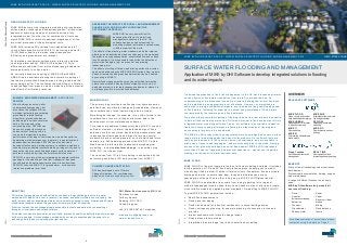
  • 1. ©DHI 4 GROUNDWATER FLOODING MIKE SHE delivers truly integrated modelling of groundwater, surface water, recharge and evapotranspiration - all important aspects of hydrology when your project requires a fully integrated model. No other tool or combination of tools can match MIKE SHE in terms of seamless integration of all the important processes of the hydrological cycle. MIKE SHE includes 2D overland flow capabilities and full riverine hydrodynamics (with MIKE 11) delivering a powerful 1D-2D flood modelling tool when evapotranspiration, infiltration and groundwater are relevant. For detailed groundwater-surface water interaction studies (including water quality), MIKE SHE includes 3D, finite difference groundwater flow, which discharges groundwater drainage directly to surface water. An unrivalled dynamic coupling of MIKE SHE with MIKE URBAN is also available allowing the accurate modelling of the two-way interaction between pipes in the ground and the surrounding aquifer. This facilitates the modelling of infiltration to and leakage from pipes as well as modelling of the potential side effects of infiltration prevention. MORPHOLOGY The primary long term factors affecting river hydrodynamics, and flood risk, are climate change and urbanisation. However, the consideration of other factors may also be critical. Morphological change, for example, is too often limited to the consideration of scour or silting at structures, and to the development of river maintenance schemes. For broad scale sediment transport studies, MIKE 11 may be sufficient. However, to inform the detailed design of flood defences or other structures, bank stability assessments, and to assess the effectiveness and impact of erosion control measures (hard or soft engineered) on river health and future habitats (e.g. fish spawning grounds) the MIKE 21 Flexible Mesh series is preferred. More advanced morphological modelling - including planform change - is possible using MIKE 21C (Curvilinear Grid). The transition from 1D to 2D modelling is streamlined by the automatic generation of 2D bathymetries from MIKE 11. MIKE BY DHI DELEGATE PACK - CIWEM SURFACE WATER FLOODING AND MANAGEMENT 2013 DHI Water Environments (UK) Ltd Davidson House Forbury Square Reading, RG1 3EU United Kingdom +44 (0)1189 000745 Telephone mikebydhi.uk@dhigroup.com www.mikebydhi.com ABOUT DHI DHI are the first people you should call when you have a tough challenge to solve in a water environment. Whether it is a river, a reservoir, an ocean, a coastline, within a city or a factory. Our world is water, and our knowledge of water environments is second-to-none. It represents 50 years of dedicated research, and real-life experience from more than 140 countries. We strive to make this knowledge globally accessible to clients and partners by channelling it through our local teams and unique software. So whether you need to save water, share it fairly, improve its quality, quantify its impact or manage its flow, we can help. Our knowledge, combined with our team’s expertise and the power of our technology, hold the key to unlocking the right solution. MINING & MINE WATER MANAGEMENT: A FOCUS ON FEFLOW Mine flooding can not only alter underground hydrogeology, but also cause the collapse of mine workings (potentially exacerbating groundwater related flooding elsewhere), ground subsidence and damage to surface structures both in the mine and in the surrounding area. FEFLOW can be used to predict the locations and severity of flooding within a mine and to model the long term performance of flooding control measures, as well as optimise dewatering works (emergency or long term), in operational and abandoned mine workings. FEFLOW can also be used to develop effective early warning systems, to validate remediation schemes for groundwater contaminated by mining activity, and to assess the risk of uncontrolled discharge to surface waters of pollutants mobilised by rising flood waters within the mine. FEFLOW is our state-of-the-art integrated groundwater software package for the modelling of fluid flow, transport of dissolved constituents and heat transport processes in the subsurface. FEFLOW links with MIKE 11 for groundwater - surface water interaction problems (river flow). CLIMATE CHANGE ADAPTATION DHI has developed a set of Climate Change Guidelines. For your free copy please visit climatechange.dhigroup.com ASSESSING THE IMPACTS OF RURAL LAND MANAGEMENT CHANGE ON FLOODING AND FLOOD RISK (THE CATCHMENT APPROACH) MIKE SHE is a very powerful tool for assessing the effects of natural flood management schemes in the UK. The software has been used extensively for modelling wetland restoration in upland areas in different parts of the world. The effects of tree planting, water meadows, and other riparian planting can be described by land use changes in the model and the impacts on evapotranspiration, unsaturated flow and surface runoff examined. It is also possible to describe the detention of water in the floodplain (e.g. as a result of tree planting, landscaping, etc). The effects of cutting off drains, and altering surface flow routes, can be modelled using the MIKE SHE 2D Overland Flow module. Channel restoration and green bank protection can be handled by coupling to MIKE 11. Natural flood management has many benefits (habitat creation, nature conservation, diffuse pollution mitigation, etc) and is of particular interest in rural rapid response catchments; where it is not always possible to provide flood defences. Photo:iStock©ВасилийТороус ©DHI Traditional approaches to flood risk management in the UK have focussed primarily on the physics of flood water inundation from rainfall, rivers and the sea. An understanding of the processes involved is critical in defining the level of flood risk and in establishing an appropriate level of defence. However, communities are subjected to a range of additional impacts, over and above the quantity and speed of flood waters, including for example the extent and persistence of flood waters contaminated by foul sewerage and fine sediments. We believe that accurate modelling of flooding risk and its wider impacts is essential to deliver flood resilient communities. DHI was a pioneer in the development of truly integrated water modelling software. Today, our software is unrivalled in respect of flexibility, accuracy and performance; allowing the widest range of flooding and environmental impacts to be considered. The MIKE by DHI product family encapsulates more knowledge and covers a wider range of water modelling needs than any similar products. Our software tools are used by professionals in 140 countries across all continents, and are available in many sizes, flavours and languages - and most recently also in the cloud. Getting access to our global knowledge has never been easier! MIKE by DHI represents more than 50 years of research and practical experience - right at your fingertips - making you the expert in water environments. MIKE FLOOD MIKE FLOOD is the most complete toolbox for flood modelling available. It includes a wide selection of 1D and 2D flood simulation engines, enabling you to model virtually any flood problem. Whether it involves rivers, floodplains, floods in streets, drainage networks, coastal areas, dam, levee and dike breaches or any combination of these. Where other tools give up, MIKE FLOOD gives results! MIKE FLOOD is applicable at any scale from a single parking lot to regional models. Independent studies show that you can save months of efforts and create more reliable models by upgrading from standard 1D modelling to MIKE FLOOD! Typical MIKE FLOOD applications include: -  Rapid flood assessments  Flood hazard mapping  Flood risk analysis for industrial, residential or cultural heritage areas  Flood contingency planning, for example planning of evacuation routes and priorities  Impact assessments of climate change issues  Flood defence failure studies  Integrated urban drainage, river and coastal flood modelling OVERVIEW RELEVANT SOFTWARE BENEFITS State-of-the-art technology under continuous development. Professional documentation, training, support and maintenance. A range of different licenses to suit every need. MIKE by DHI software truly models all sources of flooding: MIKE BY DHI DELEGATE PACK - CIWEM SURFACE WATER FLOODING AND MANAGEMENT 2013 PHOTO: ISTOCK © ON-AIR SURFACE WATER FLOODING AND MANAGEMENT Application of MIKE by DHI Software to develop integrated solutions to flooding and its wider impacts MIKE FLOOD Urban, riverine and coastal flood modelling and mapping MIKE URBAN Modelling and GIS for water in urban environments MIKE 11 River modelling MIKE 21 2D modelling of coastal and inland waters MIKE SHE Integrated catchment model- ling and groundwater FEFLOW Advanced groundwater modelling MIKE 21C River hydraulics and mor- phology Flood Toolbox ArcGIS based disaster risk management REAL TIME River operations, flood forecasting and early warning  Fluvial  Coastal Incl. wave overtopping  Estuarine  Tsunami  Groundwater  Surface water  Sewer  Canal  Reservoir / dam breach  Mining  Flood defence failure For a free evaluation of our software please contact us using the details on Page 4.
  • 2. ©DHI 2 MIKE FLOOD features: - 1D Engines  1D river network - based on DHI’s classic hydrodynamic engine for rivers and open channels.  1D sewer network – based on DHI’s equally classic engine for sewer and drainage networks. 2D Engines  Single Grid - the classic rectilinear model. Easy to set up and easy input/output exchange. Now with parallel processing.  Multi-Cell Overland Flow Solver utilising higher resolution DEM information on a coarser simulation grid. The simulation speed is much faster, compared to standard simulation with a fine resolution DEM.  Flexible Mesh (FM) - maximum flexibility for tailoring grid resolution within the model. The FM engine supports parallel processing. Structures A range of culverts and weirs can be handled both in the 1D and the 2D engines. In addition, operational structures can be included in the 1D networks using add-on modules. Fully dynamic, fully Integrated flood modelling The 1D and 2D engines can be coupled to provide full flexibility and the capability of investigating complex problems. MIKE FLOOD features a fully dynamic and integrated modelling approach for coupling of Riverine, Urban and 2D Overland models depending on your project requirements. URBAN FLOODING Today's demand for accuracy often calls for using a 1D pipe flow model combined with a 2D overland flow model. MIKE FLOOD offers such a model combination through the coupling of MIKE URBAN CS (Catchment Systems) and MIKE 21. MIKE FLOOD efficiently simulates any cause of urban flooding, including heavy local rainfall, insufficient flow capacity of storm water inlets or the drainage network, and flooding caused by overtopping of nearby river or coastal flood defences. Urban flooding in MIKE FLOOD is simulated through model couplings at the location of nodes, pumps, weirs or outlets. Water is exchanged between the pipe flow model and the overland flow model through these couplings in a dynamic two -way process. Defining the couplings between pipe and overland flow model as well as launching simulations and visualising results are supported in the GUI of both MIKE FLOOD and MIKE URBAN. RIVERINE FLOODING MIKE FLOOD is an efficient and flexible tool for river flood modelling when investigating flood hazards and flood risk from rising water levels in the river/canal system and/or from high rainfall intensity in the catchment area. Flooding can be investigated on multiple scales ranging from large scale basin areas to local impacts in specific low lying flood prone areas along the river. When simulating river flooding, the combination of a 1D open channel model using MIKE 11 and a 2D overland flow model using MIKE 21 is typically preferred. The flexibility of the combined 1D-2D engines provides numerous opportunities for analysing complex issues such as:  river conveyance problems due to improper maintenance of the vegetation  limited flood storage capacity  infrastructures crossing the river/floodplain  operation of hydraulic structures and reservoirs  dam breaks or levee breaches  changes in land use MIKE 11 and MIKE 21 can be coupled either at specific points or distributed along entire river stretches on either side of the main river channel. COASTAL FLOODING MIKE FLOOD is ideal for efficient and accurate assessment of coastal flood risks, whether they are related to flooding of coastal cities and infrastructures, or to inundation of reclaimed or low lying areas. The flexibility of MIKE FLOOD components enables professional modelling of complex and dynamic events due to ocean storm surges, and the impacts in estuaries, rivers and drainage canals as well as sewer systems. MIKE FLOOD offers the possibility to investigate the effects of coastal protection, such as dikes/polders and tidal gates or other operational structures in delta areas. Combined with one of the MIKE wave models (MIKE 21 Spectral Wave or MIKE 21 Boussinesq Wave). MIKE FLOOD can address all aspects of coastal impacts of storm surge and inundation. MIKE BY DHI DELEGATE PACK - CIWEM SURFACE WATER FLOODING AND MANAGEMENT 2013 DYNAMIC FLOOD HAZARD MAPPING Depending upon the approach adopted (e.g. the ‘Flood Risks to People’ guidance from Defra / EA) MIKE FLOOD can utilise the floodwater depths, velocities, and land use data to seamlessly calculate both the debris factor and appropriate flood hazard rating in each grid cell / element and at each time step in a simulation. USE OF MIKE FLOOD FOR BREACH ASSESSMENTS MIKE FLOOD includes numerous options for the rapid, dynamic assessment of breach failures in river and coastal flood defences, canal embankments and dams (Reservoir Inundation Mapping): -  Coupled MIKE 11 Dambreak structures  MIKE FLOOD side structures links  MIKE FLOOD time varying lateral links  MIKE 21 time varying bathymetry - Landslide option  MIKE 21 FM time varying bathymetry - Dynamic bathymetry  MIKE 21 FM Dike structures ©DHI 3 EXTENDING THE CAPABILITIES OF MIKE FLOOD For more than a decade, MIKE FLOOD has offered complex and flexible features for coupling 1D and 2D hydrodynamic models. Flood extents and flood hazards have been some of the key issues for flood risk management. These issues will still be the focus for many modelling applications in the future however, in order to support wider EU Water Framework Directive objectives, there will be a need for more detailed studies; particularly water quality assessments. MIKE FLOOD now offers the option to simulate the transport and spreading of pollutants during a flood event through a fully dynamic coupling of the Advection Dispersion modules of MIKE 11, MIKE 21, and MIKE URBAN. Besides water quality considerations, there is also an increased focus on whole catchment approaches and climate change adaptation. As long-time developers of water modelling software, DHI understand and embrace the need for high quality and high resolution input data for these studies. MIKE BY DHI DELEGATE PACK - CIWEM SURFACE WATER FLOODING AND MANAGEMENT 2013 USING MIKE FLOOD AD & ECO LAB TO MODEL POLLUTED FLOOD WATERS AND RIVERINE WATER QUALITY MIKE FLOOD now includes the option for a fully dynamic 1D-2D Advection Dispersion coupling, which increases the range of applications substantially. The new AD coupling in MIKE FLOOD enables users to simulate new interesting aspects such as: -  Floodplain contamination from polluted rivers.  Impact assessment on river quality from pollutant sources in flood prone areas during flood events.  The impact on concentrations of river pollutant in case of a release from an urban Combined Sewer Overflow. MIKE FLOOD AD can be further enhanced by ECO Lab for advanced water quality simulations. ECO Lab is the complete numerical laboratory for water quality and ecological modelling. You can develop exactly the model you need and describe the processes you wish. No ecological problem is too simple or too complicated for ECO Lab:  Open Equation solver for coupled ordinary differential equations.  Designed for point descriptions of processes of chemistry, ecology, etc.  All equations, parameters contained in flexible, portable ECO Lab templates (use DHI supported templates or create your own).  Integrated with DHI’s hydrodynamic models: Currently MIKE 11, MIKE 21 (hence MIKE FLOOD), MIKE 3 & MIKE SHE. LOCAL AREA WEATHER RADAR FOR URBAN HYDROLOGY Climate change can be expected to affect prevailing patterns of precipitation with extreme rain events becoming more frequent and more intense. This will increase the pressure on water collection systems and wastewater treatment plants. Warning and forecasting systems provide necessary tools for authorities and operators to plan ahead and make the right decisions. Accurate predictions can be made if sufficient data are available. However, the greatest uncertainty when modelling the response of drainage systems to rainfall is the rainfall itself. The standard approach is to use rainfall measured by one gauge but traditional rain gauges provide data with low temporal and spatial resolution. When using rain gauges, it must be assumed that the rainfall is homogenous over the whole model area, which may be as large as a whole city. For the prediction of potential surface water flooding as a result of extreme rain events, this assumption is not valid. Weather radars, in contrast to rain gauges, provide high resolution data over a relatively large area, the equivalent of many synthetic rain gauges in one installation. However, dedicated weather radars are expensive. Local Area Weather Radar (LAWR), developed by DHI from modified marine radar and using interpretation algorithms, can provide high resolution rainfall data at a much lower cost. Such systems are already installed in many cities worldwide. They detect the first raindrop falling and track the precipitation as it falls. This provides accurate rainfall data with high spatial resolution, which is suitable for input to flood warning and forecast models. LAWR ADVANTAGES AND INTEGRATION  Distributed rainfall measurements in a spatial resolution ranging from 500x500 m to 100x100 m with a 5 minute or 1 minute time resolution up to 30 km from the radar  Online animation of rainfall within the complete LAWR range  Up to a few hours' forecast (online) of coming rain events for use in optimisation of sewer and treatment plant capacity  Fully integrated with MIKE URBAN (from release 2007) which facilitates the import of LAWR data, visualisation of the event over the model and its catchments and simulation with fully distributed rainfall  LAWR data is supported by the full MIKE by DHI software suite The image above shows a rain event imported into MIKE URBAN. It illustrates a classical problem - only part of the drainage system is receiving rain. If a user wants to analyse such an event based on a single gauge several kilometres away it would yield a very poor result. LAWR data provides the user with a whole range of new opportunities. It is possible to see the event move and evolve over the drainage system, and see which catchments receive the heavy intensities.