SlideShare une entreprise Scribd logo
1  sur  49
Télécharger pour lire hors ligne
NOAKHALI SCIENCE AND TECHNOLOGY UNIVERSITY
Department of
Oceanography
Field Trip Report-2020
Department of Oceanography-NSTU
Sonapur, Noakhali-3814, Bangladesh
Submission Date: 21th August 2020
A field trip report on the academic work in the
Nijhum Dwip, Hatiya Island
Azad Uddin Sojib ASH1718010M
Submitted To
Dr.M.A.M. Siddique (Assistant Professor)
Nazmus Sakib Khan (Assistant Professor)
MD.Sohel Pervez (Assistant Professor)
Razat Suvra Das (Assistant Professor)
Mahfuzur Rahman (Assistant Professor)
Submitted by
1
Acknowledgement
First and foremost, I want to thanksgiving to my supervisor, Dr. Mohammad Abdul
Momin Siddique. grateful for his mentoring, affordability, encouragement, and immense
optimism over the whole time in the field work. his instructions, affable advice, and
support made it possible for me and my group to have completed field trip.
I also grateful to our course coordinator professor Md. Sohel Pazver and also thanks go
out to the Mahfuzur Rahman, Razat Suvra Das and Nazmus sakib sir who are monitoring
in the entire field trip time.
Grateful to my other friends, who helps me and my group entire the sampling in the field
and sometimes in others ways.
2
Executive Summary
The study tried to explore the present status of the plant community with biodiversity
and measured the biological parameter with the physiological parameter by using the
different methods of the many sampling stations of the Nijhum Dwip, Noakhali,
Bangladesh. This study was conducted to assess the biodiversity status and to identify
the different parameters of Nijhum Dwip and the present condition of the benthos with
flora and fauna, causes and effects of biodiversity loss, people participation in
management, and training system for conservation of Nijhum Dwip.
For this purpose, we collect data by using different methods such as multi-probe,
plankton net, PH meter, refractometer, hand auger, Quadrant method, etc., and with
discussion, eyesight visitation, and various types of secondary data. Also, we conducted
a questionnaire survey, and most of the respondents were illiterate 44%, fisherman 46%,
and older 46% based on educational status and occupational status, respectively. From
this study, we have found that 94% of people directly depend on this forest resource, 64%
are people on fisheries.
our study, we identified four species of benthos (Polychaeta sp, Lumbricus terrestris
Ocypode macrocera, Talitridae sp), four species of phytoplankton (such as Anabaena sp,
Coscinodiscus sp, Euglena sp, Nostoc sp), five species of zooplankton (such as Cyclops
vernalis, Diaphanosoma sp, Nauplius sp, Nauplius sp, Rotifer sp), and A total of seven plant
species under five families have been recorded from Nijhum Deep in Intertidal zone such
as Eleusine indica, Zoster marina, Ipomoea aquatic, Enhydra fluctuans, Cenopodium
album, Cynodon dactylon.
3
Table of Content
Appellation Page
Acknowledgement 01
Executive Summary 02
Chapter 01: Introduction
Background of the study 07
Objectives of The Field Trip 07
Field Work Team 08
Time Schedule 08
Chapter 02: Nijhum Dwip
Introduction to Field Site 09
Sampling Site Selection 10
Geographical Location 10
Chapter 03: Methodology
Methodology of the field trip 11-12
Equipment of field work 12-13
Supporting Chemical Reagent 13
Chapter 04: Activities
Activities -01 (Phytoplankton Collection Method)
✓ Aims
✓ Apparatus
✓ Phytoplankton
✓ Geographical Location
✓ Sampling and Collection
✓ Preservation
✓ Identification
✓ Measured Parameters
➢ Temperature
➢ Transparency
➢ Salinity
➢ PH
➢ TDS
➢ Dissolved Oxygen (DO)
14-18
Activities -02 (Zooplankton Collection Method)
✓ Aims
✓ Apparatus
19-22
4
✓ Zooplankton
✓ Geographical Location
✓ Sampling and Collection
✓ Preservation
✓ Identification and Analysis
✓ Measured Parameters
➢ Temperature
➢ Transparency
➢ Salinity
➢ PH
➢ Dissolved Oxygen (DO)
Activities -03 (Inter-tidal Benthos Sample Collection Method)
✓ Aims
✓ Apparatus
✓ Benthos
✓ Intertidal Zone
✓ Sampling site
✓ Sample Collection
✓ Preservation
✓ Identification
23-27
Activities -04 (Assessment of Intertidal Plant Community)
✓ Aims
✓ Apparatus
✓ Plant Community
✓ Intertidal zone plant
✓ Plant biodiversity in Nijhum Dwip
✓ Geographical Location
✓ Materials and Method
✓ Identification
28-32
Activities -05 (Physiological parameters of Tube-well water)
✓ Aims
✓ Apparatus
✓ Procedure and General calibration
✓ Data Collection
✓ Physiological parameters
➢ Salinity
➢ DO
33
5
➢ TDS
➢ Temperature
Activities 06 (Soil Sample Collection with Auger)
✓ Aim
✓ Apparatus
✓ Procedure
✓
34-35
Chapter 05: Conclusion
Conclusion 35
References 37
Field Work Photo Album
Photo Album 38-48
List of Figure
1 Figure 1: (a) Location of Hatiya Upazila in Bangladesh (b) Location of the study
area (c) Study Area map showing major features of Nijhum Dwip island. (Map
1)
2 Figure 2: Figure 2: The methodological flowchart of the study
3 Figure 3: working acetifies
4 Figure 4: Graph showing physiochemical parameters (a) water Temperature, (b)
Dissolved oxygen (DO), (c ) pH measured at the sampling stations.
5 Figure 5: Graph showing physiochemical parameters (c) salinity, (b) Total
Dissolved solis (TDS), (c ) Transparency measured at the sampling stations
6 Figure 3: Study area map for phytoplankton collection (Map 2)
7 Figure 4: Study area map for Zooplankton collection (Map 3)
8 Figure 5: Study area map for Benthos collection, Nijhum Dwip Islands,
Bangladesh (Map 4)
9 Figure 6: Study area map for Plant community collection, Nijhum Dwip Islands,
Bangladesh (Map 5)
10 Figure 7: a) Hand augur, b) how augur works
6
List of Table
1 Table 1: Following table contains list of tools and equipment used during field
work.
2 Table 2: List of Chemicals are presented in the following table.
3 Table 3: List of phytoplankton group are presented in the following table.
4 Table 4: Presenting the list of measured Water Parameters for Phytoplankton in
the following table
5 Table 5: List of zooplankton group are presented in the following table
6 Table 6: Presenting the list of measured Water Parameters for zooplankton in the
following table
7 Table 7: List of benthos in the intertidal zone of Nijhum Dwip, following the table
8 Table 8: List of plant community family are presented in the following table
9 Table 9: List of Physiological parameters are present in the following table.
7
Chapter -01: Introduction
Background of The Study
The department of Oceanography of Noakhali Science and Technology University
(NSTU) includes a course on field work as an academic study course each year. As a part
of our final year study, we got the chance to participate in field work for two days from
2 March 2020 to 3rd March 2020 in Nijhum Dwip located in Hatiya Upazila of Noakhali
District.
Objectives of The Field Trip
Field trips provide better understanding of theoretical and bookish knowledge by
making real world connections. Field trips also offer an opportunity to the students and
teachers to interact outside of the classroom, thus strengthen their bonding with each
other and to improve their social communication and life skills.
The present study conducted in Nijhum Dwip aims:
➢ To learn the techniques of field studying.
➢ To investigate the inter-tidal plant community structure.
➢ To learn how to collect and preserve soil sample using hand augur.
➢ To collect and preserve the benthos sample from the inter-tidal zone.
➢ To collect and preserve sample of phytoplankton and zooplankton.
➢ To learn how to assess different water physiological parameters (e.g., dissolved
oxygen, pH, electrical conductivity).
➢ To identify the collected specimen.
➢ Ecological observation (deforestation, types of plants and biodiversity)
➢ To observe the natural processes occurred in the island
➢ To know physical, socio economic and cultural aspect of the study areas
➢ To know the Lifestyle of the people of coastal Areas.
Field Work Team
The whole team was divided into groups to disburse work. Our group was assigned to
observe and study the physical set up of the island, mudflat and sandflats, inter-tidal
plant community structure, to collect samples for further identification, to collect soil
sample, to assess water quality etc.
8
Time Schedule
Date Time Activities
01/03/2020 6 AM Start our journey from NSTU campus
3 PM Reach in Nijhum Dwip
02/03/2020 9 AM Visit the Nijhum Dwip beach
10 to 2 PM Conducted our field activities
2 to 4 PM Lunch break
4 PM Going to the beach for the enjoyment of natural beauty
03/03/2020 9 AM Visit another field site
9 to 2 PM Conducted our field activities
1 to 3 PM Lunch break
3 PM Visit in the forest
04/03/2020 8 AM We leave our hotel, and set off to return to the NSTU
campus
7 PM We arrive in the NSTU campus and Our field trip is
over
Chapter 02: Nijhum Dwip
Introduction to Field Site
Nijhum Dwip is (literally “the island of silence”) is an accreted island, with a total area of
about 40390 ha, lies in the central coastal zone of Bangladesh, under Hatiya Upazila of
Noakhali District. Following the joint recommendations from ECOFISH, the
International Union for the Conservation of Nature (IUCN) and the Wildlife
Conservation Society (WCS), the Ministry of Fisheries and Livestock Bangladesh,
declared the Nijhum Dwip Marine Reserve/ Marine Protected Area (MPA) in 2019,
through S.R.O. No. 211-Law/2019 dated 23 June 2019 under the provision of clause 28 of
Marine Fisheries Ordinance, 1983. The declared protected area covers 3,188 square
kilometers of estuarine waters at the mouth of the world’s third largest river system: the
Padma- Jamuna Meghna and offshore of the Nijhum Dwip National Park.
9
Population and Livelihood
The population has since increased to about 4500 households with an estimated 30,000
people living in different cluster villages. The literacy rate on the island is very low, at
about 10%. Children below the age of 12 years account for 30% of the total population
and married adults represent about 40%. The lack of sanitation facilities on the island
causes severe problems because none of the households use sanitary latrines. Drinking
water is available from shallow tube wells, which households share at a rate of one well
per 50-75 households.
Climate
The area enjoys a moist tropical maritime climate and rainfall is frequent and heavy
during the monsoon season (May to October) ranging between 140 mm to1040 mm.
Temperature ranges from 16ºC to 33ºC, whereas humidity ranges from 29% to 99% (BBS
2011).
Nijhum Dwip is typically tropical with average annual maximum and minimum
temperatures of 30°C and 21.6°C respectively (BMD 2009). Changes in temperature, even
small changes in water temperature, are expected to exert strong pressure upon fish
ecology (WWF 2005).
The southwest monsoon brings much rainfall from May to September while the northeast
monsoon brings some rain in October and November. About 80-90% of annual rainfall is
confined to the monsoon months (April-October). Annual mean total rainfall has
decreased from 3561mm in 1988 to 3531mm in 2008. Old fishermen have reported
noticeable climate pattern changes include increasing variability in the dates of onset and
end of the rainy season, changes in wind direction, tidal magnitude, rainfall distribution
pattern throughout the season, and an increase in thunderstorm activity.
Sampling Site Selection
Sampling site selection is crucial for an efficient completion of field work. Site selection
is dependent on the type of study we want to conduct. For site selection, a better
understanding of the study area is a must. Sampling site should be easy to access and
suitable for selected task. Our supervisor guided us to select sampling stations for our
field work.
10
Geographical Location
Nijhum Dwip is situated between latitude 22º1´ and 22º6´N and longitude 90º58´ and
91º3´E. Nijhum Dwip is separated from Hatiya by the Moktaria Channel, which is about
700-1200m wide: the island area is only 10 km2 in area. The island is about 4‐5 meters
high from the sea level.
Figure 1: (a) Location of Hatiya Upazila in Bangladesh (b) Location of the study area (c)
Study Area map showing major features of Nijhum Dwip island. (Map 1)
11
Chapter 03: Methodology and Data Collection of the Field Work
Methodology of the field trip
The methodology is the principled theoretical analysis of the process applied to a field of
study. It does not set out to a provide solution but offers the theoretical under planning
for understanding the method. Set of methods called “best practices” can apply to a
specific case. The methodology does not explain a specific method. When a proper study
of methodology, such processes make up a constructive generic framework.
Figure 2: The methodological flowchart of the study
12
Figure 3: The working flowchart of the study
Equipment of field work
Table 1: Following table contains list of tools and equipment used during field work.
Sl.No. Equipment Quantity Usages
01 GPS device 2 Sampling point trace and recording of
the coordinates
02 Plankton Net 2 Net Phytoplankton sampling
03 Refractometer 2 Salinity measurement
04 DO Meter 1 DO measurement
05 Hygrometer 1 Measurement of water vapor in air, in
soil
06 Thermometer 3 Measurement of temperature
07 Secchi Disk 1 Measurement of transference
13
08 Sieve 2 Soil and sand categories
09 Grab Samplers 1 Sediment samples collect from hard
bottoms like sand, gravel, consolidated
marl or clay
10 Bucket 2
11 Plastic Container 50pcs
12 Multi-probe 1 used to measure multiple parameters
such as temperature, dissolved
oxygen, conductivity and pH
13 Ice Box 3
14 pH Meter 3 used to measure pH
15 Dropper 3
16 Hand Auger 1 Obtaining soil samples
Supporting Chemical Reagent
Table 2: List of Chemicals are presented in the following table.
Sl. No. Chemical Quantity
01 Distilled water
02 Formalin 1 bottle
03 Alcohol 1 bottle
14
Chapter 04: Activities
Activities 01: Phytoplankton Sample Collection Method
Aim: Sampling of phytoplankton using plankton net from the surface of a water body on
the coast of Nijhum Dwip Island And measure water parameters.
Apparatus: Plankton Net, Refractometer, DO Meter, Thermometer, Secchi Disk, pH
Meter, Ice Box etc.
Phytoplankton
Phytoplankton are autotrophic organisms. They produce their own food through
photosynthesis. In any ecosystem the prey and the predators are very closely related.
Phytoplankton is one of the important producers of the estuary. At the early stage of life
cycle of almost all the aquatic fauna directly or indirectly feed on phytoplankton. It is the
primary producer and occupied the first position of the food chain. Phytoplankton is
generally considered as the best index of the biological productivity and the nature of
aquatic habitat.
Why need to assess phytoplankton abundance at nijhum dwip
The phytoplankton population represents the biological wealth of a water body,
constituting a vital link in the food chain. Both the qualitative and quantitative abundance
of phytoplankton are of great importance.
Coastal regions are the most productive ecosystem in the world, Nijhum dwip is one of
them and also recognized as Marine Protected Area (MPA). It is full of marine resources,
mainly fisheries. The rate of gross primary productivity is important for assessing the
fisheries yield. For this reason, we investigated on the abundance of phytoplankton there.
Sampling and Collection
1. We decided to collect sample from six stations.
2. We used plankton net.
3. Firstly, we took water from surface layer using one little mug.
4. Then we poured it into plankton net and it filter water. Cod end was closed.
5. After that we collected final water sample caught by cod end.
6. Then we took these samples in plastic bottles and labelled.
7. We also measured environmental parameters such as pH by pH meter, Salinity
by refractometer, temperature by thermometer, TDS, DO.
15
Preservation
We used 10% formalin (Methyl alcohol) to preserve these samples. After that we
transferred these to laboratory for analysis.
Identification
The community of phytoplankton was represented by Anabaena, Coscinodiscus,
Euglena, Nostoc.
Table 3: List of phytoplankton group are presented in the following table.
Group Name Picture
1.Anabaena
Class: Cyanophyceae
Scientific name:
Anabaena sp
2.Coscinodiscus
Class: Coscinodiscophyceae
Scientific name:
Coscinodiscus sp
3.Euglena
Class: Euglenoidea
Scientific name:
Euglena sp
4.Nostoc
Class: Cyanophyceae
Scientific name:
Nostoc sp
16
Measured Parameters
Table 4: Presenting the list of measured Water Parameters for Phytoplankton in the
following table
Parameter Station 1 Station 2 Station3 Station 4 Station 5
GPS Location 22.0466N
90.9771E
22.0498N
90.9751E
22.0541N
90.9729E
22.0560N
90.9736E
22.0580
N
90.9735E
Temperature(0C) 26.5/27 27.7/28.0 29.5/28.5 26.9/26.5 26.7/25.
9
Salinity (ppt) 11 or 11.5 11 or 10 11 or 10 10 or 11 10 or 11
DO (mg/L) 5.61mg/L
(70.1%)
7.81 mg/L
(100%)
7.56 mg/L
(100%)
7.89 or 7.98 7.93 or
8.06
pH 8.3 or 8.4 8.4 or 8.6 8.6 or 8.7 8.6 or 8.7 8.6 or 8.7
TDS (mg/L) 1487 or
1490mg/L
1484 or
1485mg/L
1485 or
1486mg/L
1487 or
1490mg/L
1488 or
1489mg
/L
Transparency 2 or 1.8
inch
3.1 or 3.5 inch 2 or 2.2 inch 2.5 or 2.7 inch 3 or 3.32
inch
17
18
Geographical Location:
Figure 6: Study area map for phytoplankton collection (Map 2)
Activities 02: Zooplankton Collection Method
Aim: Sampling of zooplankton using plankton net from the surface of a water body on
the coast of Nijhum Dwip Island And measure water parameters.
Apparatus: Plankton Net, Refractometer, DO Meter, Thermometer, Secchi Disk, pH
Meter, Ice Box etc.
Zooplankton
The zooplankton assemblage is a sensitive indicator of the ecological status of an aquatic
ecosystem since it can respond to environmental changes with rapid modifications in the
species composition and structure. The zooplankton population can reflect the nature and
potential of any aquatic systems. They are represented by a wide array of taxonomic
groups viz., Protozoa, Cladocera, Copepoda and Rotifer in a freshwater ecosystem that
is often armored by different organs like spines from the predator.
19
Rotifers achieved more significance in freshwater by residing in the littoral, limnetic and
benthic regions. Most of them are cosmopolitan in distribution. They play a significant
role in aquatic food-chain and trophic dynamics in freshwaters because of their common
occurrence, a wide variety of feeding habits and rapid turnover rates, enabling them to
build up substantial populations within short time intervals. The role of rotifers as
bioindicators has been investigated by several researchers. The community composition
and density of rotifers greatly vary with eutrophication. Eutrophication of lakes which
leads to deterioration of aquatic ecosystems has been of great concern around the globe.
Adequate knowledge of the zooplankton communities and their population dynamics
is a major requirement for a better understanding of the life process in a freshwater body
since eutrophication influences zooplankton's composition and productivity.
Sampling and Collection
1. We decided to collect sample from six stations.
2. We used plankton net (90 µm mesh size).
3. Zooplankton samples were collected from a depth of 5-10 cm below the water
surface in the morning hour (7-9 AM), Noon hour (12-2 PM) and after noon
hour (5-7 PM)
4. Samples from different locations and depths may occasionally be combined in
composite samples to reduce sampling effort.
5. Firstly, we took water from surface layer using one little mug.
6. Then we poured it into plankton net and it filter water. Cod end was closed.
7. After that we collected final water sample caught by cod end.
8. Then we took these samples in plastic bottles with 10% formalin on site and
labelled.
9. Then transfer to the ice box and finally conducted in laboratory of
Oceanography, Noakhali Science and Technology University.
10. We also measured environmental parameters such as pH by pH meter, Salinity
by refractometer, temperature by thermometer, TDS, DO.
Preservation
We used 10% formalin (Methyl alcohol) to preserve these samples. After that we
transferred these to laboratory for analysis.
20
Identification and Analysis
Identification of the zooplankton species was conducted in laboratory of Oceanography
department under a phase contrast light microscope at 16×40 and 16×10 magnification
(Model No: XSZ21-05DN, Made in China) with bright field and phase contrast
illumination. Quantitative analysis of zooplankton was done on Sedgewick-Rafter
counting chamber (S-R cell).
Analysis involved transfer of 1 mL sub-sample from each of the samples to the Sedgewick
Rafter counter and counting of cells within 10 squares of the cells, chosen randomly.
The cell counts were used for computing the cell density using the formula where the
zooplankton density was estimated by Stirling:
N= (A×1000×C)/ (V×F×L)
Where, N= no. of plankton cells or units per liter of original water;
A=Total no of plankton counted;
C= Volume of final concentrate of the sample in ml;
V=volume of a field in cubic mm;
F=No. Of fields counted; and
L=Volume of original water in liter
The zooplankton were then identified up to the genus level and enumerated by the
following. The mean number of zooplankton was recorded and expressed numerically
per liter of water of the ocean
Generic status of zooplankton with their different groups recorded from different types
of sampling site during the study period in the Nijhum Dwip.
21
Table 5: List of zooplankton group are presented in the following table
Group Genus Name Species picture
1 Copepoda Cyclops Scientific name:
Cyclops vernalis
2 Cladocera Diaphanosoma Scientific name:
Diaphanosoma sp
3 Crustacean
larva
Nauplius Scientific name:
Nauplius sp
4 Rotifera Brachionus Scientific name:
Brachionus sp
Rotifer Scientific name:
Rotifer sp
Measured Parameters
Table 6: Presenting the list of measured Water Parameters for zooplankton in the
following table
Parameter Station 1 Station 2 Station3 Station 4 Station 5
GPS Location 22.0466N
90.9771E
22.0498N
90.9751E
22.0541N
90.9729E
22.0560N
90.9736E
22.0580N
90.9735E
Temperature(0C) 26.5/27 27.7/28.0 29.5/28.5 26.9/26.5 26.7/25.9
Salinity (ppt) 11 or 11.5 11 or 10 11 or 10 10 or 11 10 or 11
22
DO (mg/L) 5.61mg/L
(70.1%)
7.81 mg/L
(100%)
7.56 mg/L
(100%)
7.89 or 7.98 7.93 or
8.06
pH 8.3 or 8.4 8.4 or 8.6 8.6 or 8.7 8.6 or 8.7 8.6 or 8.7
TDS (mg/L) 1487 or
1490mg/L
1484 or
1485mg/L
1485 or
1486mg/L
1487 or
1490mg/L
1488 or
1489mg/
L
Transparency 2 or 1.8
inch
3.1 or 3.5 inch 2 or 2.2 inch 2.5 or 2.7 inch 3 or 3.32
inch
Geographical Location
Figure 7: Study area map for Zooplankton collection (Map 3)
23
Activities 03: Inter-tidal Benthos Sample Collection Method
Aims: Sampling of benthos using sieve from the top of a sediment body on the coast of
Nijhum Dwip Island.
Apparatus: Sieve, Plastic Container, Ice Box etc.
Benthos
The assemblage of organisms inhabiting the seafloor. Benthic epifauna live upon the
seafloor or upon bottom objects; the so-called infauna live within the sediments of the
seafloor. By far the best-studied benthos are the macrobenthos, those forms larger than 1
mm (0.04 inch), which are dominated by polychaete worms, pelecypods, anthozoans,
echinoderms, sponges, ascidians, and crustaceans. Meiobenthos, those organisms
between 0.1 and 1 mm in size, include polychaetes, pelecypods, copepods, ostracodes,
cumaceans, nematodes, turbellarians, and foraminiferans. The microbenthos, smaller
than 0.1 mm, include bacteria, diatoms, ciliates, amoeba, and flagellates.
Intertidal zone
The intertidal zone (sometimes referred to as the littoral zone) is the area that is
exposed to the air at low tide and underwater at high tide (the area between the low
and high tide lines). This area can include many different types of habitats,
including steep rocky cliffs, sandy beaches, or wetlands.
Organisms in the intertidal zone are adapted to an environment of harsh extremes.
Water is available regularly with the tides but varies from fresh with rain and river
flows to highly saline and dry salt with drying between tidal inundations. The
action of waves can dislodge residents in the intertidal zone. With the intertidal
zone's high exposure to the sun the temperature range can be anything from very
hot with full sun to near freezing in colder climates. Temperature extremes within
some microclimates in the littoral zone can be moderated by local features and
larger plants such as mangroves.
Adaption in the littoral zone is all about making use of nutrients supplied in high
volume on a regular basis from the sea which are actively moved to the zone by
tides and ocean swells. Edges of habitats, in this case the dry sand beach/rocky
shore and the sea, are themselves often significant ecologies.
We have chosen the Intertidial zone in the Nijhum dwip island to collect Benthos to find
out what kind of Benthos community has developed there for tidal variation.
24
Sampling site
Station 1:
It is located at northern part of the Nijhum Dwip Island. It’s GPS reading 2.0466 N -
90.9771 E. Tidal influence is active here. Salinity varied from 11-11.5 ppt and temperature
26.5-27°C. Samples were collected from clay bottom area. It is subjected to high erosion
and water body is turbid.
Station 2:
Its latitude 22.0498N and longitude 90.9751E. Tidal influence is active here. Salinity
varied from 10-11 ppt and temperature range from 27.5-28°C. Samples were collected
from clay bottom area. It is subjected to hig erosion.
Station 3:
Its latitude 22.0541N and longitude 90.9729E. Salinity varied from 10-11 ppt and
temperature varied from 27.5-28°C. Samples were collected from clay bottom area.
Station 4:
Its latitude 22.0560N and longitude 90.9736E. Salinity varied from 10-11 ppt and
temperature varied from 25.5-26.9°C. Samples were collected from clay bottom area.
Station 5:
Its latitude 22.0580N and longitude 90.9735E. Salinity varied from 11-12 ppt and
temperature varied from 25.9-26.7°C. Samples were collected from clay bottom area.
Sample Collection
The Five working stations were selected in different parts of Nijhum Dwip Island. Each
station was divided into three sub-stations (sub-station=01, sub-station=02 and sub-
station=03). Three replicate soil samples were collected from each station with hand
during this study period (March, 2020). Replicate samples were taken from intertidal area
of the stations. The sediment samples were transferred into bucket and mix with water
properly. Then the mixed water passed through a hand-sieve with 0.5 mm mesh. Then
these sieved organisms were taken into plastic bottles and marked over the bottle by a
marker pen.
25
Preservation & Identification
The sieved organism was preserved with other residues in the plastic bottles with 10%
buffered formalin and labeled and then transferred to laboratory at department of
oceanography of the Noakhali Science and Technology University for further analysis. In
the laboratory, small amount of “Rose Bengal” was added to increase visibility of
organisms. For identification, the samples were taken into a round transparent Petri dish
(diameter 15 cm and depth 2 cm) and placed on a white paper background for the easy
contrast of vision. Organisms were sorted and enumerated under major taxa and
preserved in small vials by using small brush or forceps. Binocular microscope with
digital camera was used to identify and capture the image of benthos.
The coarser level (order) of taxonomic data as suggested by Warwik (1988) were analyzed
using the statistical package SPSS v.17 and multivariate data analyzing software,
Plymouth Routines in Marine Ecological Research (PRIMER v.6). Classification and
Ordination (Nonparametric multidimensional scaling, nMDS) were performed by using
Bray-Curtis similarity measure for community analysis.
Table 7: List of benthos in the intertidal zone of Nijhum Dwip, following the table
Group Feature Example
Polychaeta • Metamerically segmented.
• Bilateral symmetry.
• Chitinous setae called parapodia.
• Schizocoelic.
• Closed circulatory system.
• Complete digestive system.
• Respiration through skin, gills or parapodia.
• Nephridia for excretion.
Scientific name:
Polychaeta sp
Oligochaeta • Hermaphroditic.
• Terrestrial or freshwater habitats.
• Segmented body.
• Specialization in structure of alimentary system.
• Specialization in structure of reproductive system.
Scientific name:
Lumbricus terrestris
Crab • Decapod. Almost all crabs are decapods, meaning
they have 10 legs.
• Hard Exoskeleton. The hard “crust” is a defining
characteristic of crabs, lobsters and prawns.
Scientific name:
Ocypode macrocera
26
• Double Antennae. Most crabs have two pairs of
antennae.
• Sideways Walking.
• Land and Water Breathing.
Common
Name: Red Ghost
Crab
Amphipoda Body is typically slender and laterally compressed
Head is fused to the thorax and there is no carapace.
Thorax and abdomen are usually quite distinct.
Compound eyes are sessile
Scientific name:
Talitridae sp
Common Name:
lawn shrimp
Geographical Location
Figure 8: Study area map for Benthos collection, Nijhum Dwip Islands, Bangladesh (Map
4)
27
Activities 04: Assessment of Intertidal Plant Community Structure
Aim: To collect plant sample by using quadrant on the Nijhum Dwip Island.
Apparatus: Quadrant box
Plant Community
Studies on the macrofaunal diversity and seawater quality (in triplicate) from the
intertidal regions of these sites were carried during November 2008 to October 2009. The
entire intertidal belt of each sampling site was subdivided into three vertical zones. The
macrofaunal diversity and distribution in the intertidal belt at each station were studied
during the low tide by quadrat method [18]. Quadrat of 0.25 m2 was laid along the
employed line transect at every 10 m interval on the intertidal region. A minimum of ten
quadrates were laid in a crisscross direction at the intertidal belt to cover the maximum
exposed area. For water quality, previously published data of different seawater quality
parameters were considered.
Intertidal zone plant
The plant which found on the area of the ocean between the high tide and low tide
lines, usually on the beach at the water's edge this plant known intertidal zone plant.
These plants are submerged with water during high tide and exposed to the air
during low tide. The intertidal zone of this island generally combined with mudflats
and sandflats. In Bangladesh an assessment of plant diversity of different national
parks and wildlife sanctuary are already being started (Uddin et al. 1998, Uddin and
Rahman 1999, Uddin et al. 2011, Uddin and Hassan 2004, 2010, Uddin et al. 2013).
There were no assessment records of intertidal plant diversity were found for Nijhum
Dwip except few plant names in the forest management plan. In the present study
an attempt has been made to attain the following objectives: to assess the angiosperm
and gymnosperm plant diversity, to knowing their availability on different zone and
to identify any threat and to suggest some possible conservation measures for the
Nijhum Dwip conservation.
Plant biodiversity in Nijhum Dwip
A total of 13 plant species under five families have been recorded from Nijhum Deep
in Intertidal zone. For each species local name, scientific name, family, habit are
provided (Table 1). Among the species, 5 are represented by shrubs, 8 by herbs.
Poaceae is the largest family in Monocotyledon having 2 species.
28
Geographical Location
Figure 9: Study area map for Plant community collection, Nijhum Dwip Islands,
Bangladesh (Map 5)
Materials and Method
Plant data collections of the study area have been done March, 2020. Quantitative
data collection has been collected from eleven different sampling point on Nijhum
Dwip Island. These sampling point have been selected around 100m. In order to know
the frequency of ground vegetation, data have been collected different three point by
using 1x1m quadrate from the same sampling points. These points have been taken
at a certain distance to get vertical. The collection has been between intertidal zone
included with mud, sand and mangrove sight.
29
Identification
Table 8: List of plant community family are presented in the following table
Family Habit Local
Name
Scientific name Picture
Poaceae Herb Durba
Grass
Cynodon dactylon
Amananthaceae shrubs Bathua Cenopodium
album
Astaraceae Herb Enhydra fluctuans
Convolvulaceae Herb Kalmi
shak
Ipomoea aquatic
30
Zosteraceae Herb Zoster marina
Poaceae Herb chapra Eleusine indica
Plant Community Composition
Shrubs Herbs
31
0 1 2 3
Poaceae
Amananth…
Astaraceae
Convolvul…
Zosteraceae
Distribution of Plant Family
Figure 10: Plant community study using quadrant
method on the Nijhum Dwip
32
Activities 05: Physiological parameters of Tube-well water
Aim: To Evaluate the physiological parameters of tube well water on Nijhum Island.
Apparatus: Multi-probe
Procedure and General calibration:
1. Initially, we were Calibrate within 24 hours prior to sampling, best done before
going out in the field.
2. We Calibrated for each probe for the measuring time (conductivity, pH and
dissolved oxygen).
3. Rinse with deionized (DI) water between each calibration
4. We measured conductivity and then used a calibration solution
5. Then pH, use 2-point calibration that buffers the expected measurement
6. Temperature cannot be calibrated, but is good to do a check against a NIST
certified thermometer to make sure the equipment is working properly.
Data Collection:
Turn on the multiprobe and position the meter in the thalweg (main stream flow); or
along a bank/edge in the flow if the waterbody is too deep or fast; or lower from a bridge.
Ensure the measurements are upstream of other sampling activity, in well mixed water
and avoid disturbing bottom sediments.
Wait 1 - 2 minutes for the values to settle and record them on the data sheet provided.
When finished sampling, make sure the meter is rinsed thoroughly and properly stored
in the cap with a damp sponge or tap water.
Table 9: List of Physiological parameters are present in the following table.
Physiological parameters Sampling station
Salinity (ppt) 11.5
pH 7.7
Eclectic Conductivity (EC) 796.8
Temperature 24.6
33
Activities 06: Soil Sample Collection with Augur
Aim: To collect Soil sample using hand augur from the sand-flat area of Nijhum Dwip.
Figure 7: a) Hand augur, b) how augur works
Apparatus: Hand auger.
This system uses an auger, a series of extension rods, a “T” handle, and a thin-wall tube
sampler. The auger bores a hole to a desired sampling depth and then is withdrawn. The
auger tip is then replaced with a tube core sampler, lowered down the borehole, and
driven into the soil at the completion depth.
The core is then withdrawn and the sample collected. Posthole augers have limited utility
for sample collection, as they are designed more for their ability to cut through fibrous,
rooted areas. Bucket augers are better for direct sample recovery, are fast, and provide a
large volume of sample.
Procedure:
Use the following procedure to collect soil samples with a hand auger:
Insert the auger into the material to be sampled at a 0o to 45o angle from vertical. This
orientation minimizes spillage of the sample from the sampler.
Extraction of samples may require tilting of the sampler. Rotate the auger once or twice
to cut a core of material.
a
b
34
Slowly withdraw the auger, making sure that the slot is facing upward.
An acetate core may be inserted into the auger prior to sampling, if characteristics of the
soils or body of water warrant. By using this technique, an intact core can be extracted.
Transfer the sample into an appropriate sample or homogenization container.
Chapter 05: Conclusion
Conclusion
The field trip is the vast of sagacious practices and it is the consummate way to
appropriately erudite afford. Our study, we identified four species of benthos
(Polychaeta sp, Lumbricus terrestris Ocypode macrocera, Talitridae sp), four species of
phytoplankton (such as Anabaena sp, Coscinodiscus sp, Euglena sp, Nostoc sp), five species
of zooplankton (such as Cyclops vernalis, Diaphanosoma sp, Nauplius sp, Nauplius sp, Rotifer
sp), and A total of seven plant species under five families have been recorded from
Nijhum Deep in Intertidal zone such as Eleusine indica, Zoster marina, Ipomoea aquatic,
Enhydra fluctuans, Cenopodium album, Cynodon dactylon.
35
References
1. Hossain, S., Rahman, M. M., Akter, M., & Bhowmik, S. (2015). Species composition
and abundance of zooplankton population in freshwater pond of Noakhali district,
Bangladesh. World Journal of Fish and Marine Sciences, 7(5), 387-393.
2. Islam, A. (1999). Pholito Matshyo Bijnan. Bangla Academy Dhaka, 1000, 5-10.
3. Xu, Z. L., & Li, C. (2005). Horizontal distribution and dominant species of heteropods
in the East China Sea. Journal of Plankton Research, 27(4), 373-382.
4. Haney, J. F., & Hall, D. J. (1973). Sugar‐coated Daphnia: A preservation technique for
Cladocera 1. Limnology and Oceanography, 18(2), 331-333.
5. Boyd, C. E. (1982). Water quality management for pond fish culture. Elsevier Scientific
Publishing Co.
6. Hossain, M. Y., Jasmine, S., Ibrahim, A. H., Ahmed, Z. F., Ohtomi, J., Fulanda, B., ... &
Wahab, M. A. (2007). A preliminary observation on water quality and plankton of an
earthen fish pond in Bangladesh: recommendations for future studies. Pakistan journal
of biological sciences: PJBS, 10(6), 868-873.
7. Mridula, R. M., & Rajesh, K. M. (2002). Ecology of phytoplankton in the coastal waters
of Mangalore, west coast of India. Bangladesh Journal of Fisheries Research, 6(2), 165-172.
8. Asadujjaman, M., Hossain, M. B., Shamsuddin, M., Amin, M. A., & Azam, A. K. M.
(2012). Occurrence and abundance of macrobenthos of Hatiya and Nijhum Dweep
Islands, Bangladesh. Middle-East J. Sci. Res, 11(2), 184-188.
9. Hossain, M. B., Amin, S. M. N., Asadujjaman, M., & Rahman, S. (2013). Analyses of
macrobenthos of Hatiya and Nijhum Dweep Islands at higher taxonomic
resolution. Journal of Fisheries and Aquatic Science, 8(4), 526.
10. Alam, M. S. (1993). Ecology of the Intertidal Macrobenthos of Halishahar coast,
Chittagong, Bangladesh. Bangladesh Journal for Scientific Research, 15, 335-340.
11. Boyd, C.E.,1982. Water Quality Management of Pond Fish Culture. Elsevier Science
Publisher Company, Amsterdam, Oxford, New York, pp:318
36
12. Hossain. M.Y., S. Jasmine, A.H.M. Ibrahim, Z.E. Ahmed and J. Ohtomi et al.,2007. A
preliminary observation on water quality and plankton of an earthen fish pond in
Bangladesh: Recommendations for future studies. Pak.J.Biol.Sci.,10:868-873.
13. Mridula, R.M. and K.M. Rajesh,2002. Ecology of phytoplankton in the coastal waters
of Mangalore, West coast of India. Bangladesh J.Fish.Res.,6:165-172.
14. Asadujjaman M, Hossain M B, Shamsuddin M, Amin M A, Azam A K M. 2012.
Occurrence and abundance of macrobenthos of Hatiya and Nijhum Dweep Islands,
Bangladesh. Middle-East J. Sci. Res, 11(2): 184–1884.
15. M. Belal Hossain, S.M.N. Amin, M. Asadujjaman and Sharmeen Rahman, 2013.
Analyses of Macrobenthos of Hatiya and Nijhum Dweep Islands at Higher
Taxonomic Resolution. Journal of Fisheries and Aquatic Science, 8: 526-534.
16. Alam, M.S., 1993. Ecology of the Intertidal Macrobenthos of Halishahar coast,
Chittagong, Bangladesh. PhD. Thesis, Department of zoology, University of
Chittagong, Bangladesh, pp: 243.
37
Photo Album
38
39
40
41
42
43
44
45
46
47
End

Contenu connexe

Tendances

Estuarine fisheries n.a.k.
Estuarine fisheries   n.a.k.Estuarine fisheries   n.a.k.
Estuarine fisheries n.a.k.
Kashmeera N.A.
 
Marine protected area (MPAs)
Marine protected area (MPAs)Marine protected area (MPAs)
Marine protected area (MPAs)
Ashish sahu
 
Major domestic environmental problems of bangladesh by syekat
Major domestic environmental problems of bangladesh by syekatMajor domestic environmental problems of bangladesh by syekat
Major domestic environmental problems of bangladesh by syekat
Nazmul Haque Syekat, Noakhai Science & Technology University.
 
Great sundarban of bangladesh
Great sundarban of bangladeshGreat sundarban of bangladesh
Great sundarban of bangladesh
wahidsajol
 

Tendances (20)

Estuarine fisheries n.a.k.
Estuarine fisheries   n.a.k.Estuarine fisheries   n.a.k.
Estuarine fisheries n.a.k.
 
Marine protected area (MPAs)
Marine protected area (MPAs)Marine protected area (MPAs)
Marine protected area (MPAs)
 
A presentation on fisheries management of haor
A presentation on fisheries management of haorA presentation on fisheries management of haor
A presentation on fisheries management of haor
 
Hilsa shad conservation and economic incentives
Hilsa shad conservation andeconomic incentivesHilsa shad conservation andeconomic incentives
Hilsa shad conservation and economic incentives
 
Cox's bazar field work 2017
Cox's bazar field work 2017Cox's bazar field work 2017
Cox's bazar field work 2017
 
Marine resources
Marine  resourcesMarine  resources
Marine resources
 
Major domestic environmental problems of bangladesh by syekat
Major domestic environmental problems of bangladesh by syekatMajor domestic environmental problems of bangladesh by syekat
Major domestic environmental problems of bangladesh by syekat
 
Geomorphic feature Identification at Saint Martin Island’s, Bangladesh
Geomorphic feature Identification at Saint Martin Island’s, BangladeshGeomorphic feature Identification at Saint Martin Island’s, Bangladesh
Geomorphic feature Identification at Saint Martin Island’s, Bangladesh
 
Mangroves
MangrovesMangroves
Mangroves
 
Assignment on fisheries management of haor
Assignment on fisheries management of haorAssignment on fisheries management of haor
Assignment on fisheries management of haor
 
Conservation of mangroves
Conservation of mangroves Conservation of mangroves
Conservation of mangroves
 
Shrimp hatchery
Shrimp hatcheryShrimp hatchery
Shrimp hatchery
 
Water mass
Water massWater mass
Water mass
 
Fishing Ground of Bay of Bengal by Syekat
Fishing Ground of Bay of Bengal by SyekatFishing Ground of Bay of Bengal by Syekat
Fishing Ground of Bay of Bengal by Syekat
 
Vembanad kol
Vembanad kolVembanad kol
Vembanad kol
 
Protection of habitat of corals,mangrooves,seaweeds,sea grass beds
Protection of habitat of corals,mangrooves,seaweeds,sea grass bedsProtection of habitat of corals,mangrooves,seaweeds,sea grass beds
Protection of habitat of corals,mangrooves,seaweeds,sea grass beds
 
Present Status of Floodplain in Bangladesh
Present Status of Floodplain in Bangladesh Present Status of Floodplain in Bangladesh
Present Status of Floodplain in Bangladesh
 
Integrated coastal zone management
Integrated coastal zone managementIntegrated coastal zone management
Integrated coastal zone management
 
Great sundarban of bangladesh
Great sundarban of bangladeshGreat sundarban of bangladesh
Great sundarban of bangladesh
 
A lec 1 an introduction to oceanography
A  lec 1 an introduction to oceanographyA  lec 1 an introduction to oceanography
A lec 1 an introduction to oceanography
 

Similaire à A field trip report on the academic work in the Nijhum Dwip, Hatiya Island

Aquatic weeds diversity of Fatki River in Magura district, Bangladesh
Aquatic weeds diversity of Fatki River in Magura district, BangladeshAquatic weeds diversity of Fatki River in Magura district, Bangladesh
Aquatic weeds diversity of Fatki River in Magura district, Bangladesh
AbdullaAlAsif1
 
Spatiotemporal Analysis of Bacterial Diversity in Sediments
Spatiotemporal Analysis of Bacterial Diversity in SedimentsSpatiotemporal Analysis of Bacterial Diversity in Sediments
Spatiotemporal Analysis of Bacterial Diversity in Sediments
Pijush Basak
 
Short Communication: Molecular identification of White Sea Squirt Didemnum sp...
Short Communication: Molecular identification of White Sea Squirt Didemnum sp...Short Communication: Molecular identification of White Sea Squirt Didemnum sp...
Short Communication: Molecular identification of White Sea Squirt Didemnum sp...
anbiocore
 
Proximate and mineral composition of the long-spined Sea Urchin (Diadema seto...
Proximate and mineral composition of the long-spined Sea Urchin (Diadema seto...Proximate and mineral composition of the long-spined Sea Urchin (Diadema seto...
Proximate and mineral composition of the long-spined Sea Urchin (Diadema seto...
AbdullaAlAsif1
 
OPWALL Project Proposal 2016
OPWALL Project Proposal 2016OPWALL Project Proposal 2016
OPWALL Project Proposal 2016
Kevin Schmidt
 
Qualitative and quantitative analysis of phytoplankton in culture pond of Noa...
Qualitative and quantitative analysis of phytoplankton in culture pond of Noa...Qualitative and quantitative analysis of phytoplankton in culture pond of Noa...
Qualitative and quantitative analysis of phytoplankton in culture pond of Noa...
AbdullaAlAsif1
 
Emad CV May, 2015
Emad CV May, 2015Emad CV May, 2015
Emad CV May, 2015
Emad Hamdy
 
MyctophidFeedingEcology
MyctophidFeedingEcologyMyctophidFeedingEcology
MyctophidFeedingEcology
Walter Conley
 
2014 Vianna et al. Acoustic telemetry validates citizen science for monitorin...
2014 Vianna et al. Acoustic telemetry validates citizen science for monitorin...2014 Vianna et al. Acoustic telemetry validates citizen science for monitorin...
2014 Vianna et al. Acoustic telemetry validates citizen science for monitorin...
Gabriel Maciel de Souza Vianna
 
Abundance Plankton and Analysis Stomach Content and Trophic Level in Makassar...
Abundance Plankton and Analysis Stomach Content and Trophic Level in Makassar...Abundance Plankton and Analysis Stomach Content and Trophic Level in Makassar...
Abundance Plankton and Analysis Stomach Content and Trophic Level in Makassar...
Agriculture Journal IJOEAR
 

Similaire à A field trip report on the academic work in the Nijhum Dwip, Hatiya Island (20)

A field report on the Nijhum Dwip, Hatiya Island
 A field report on the  Nijhum Dwip, Hatiya Island A field report on the  Nijhum Dwip, Hatiya Island
A field report on the Nijhum Dwip, Hatiya Island
 
Stream sci paper
Stream sci paperStream sci paper
Stream sci paper
 
Aquatic weeds diversity of Fatki River in Magura district, Bangladesh
Aquatic weeds diversity of Fatki River in Magura district, BangladeshAquatic weeds diversity of Fatki River in Magura district, Bangladesh
Aquatic weeds diversity of Fatki River in Magura district, Bangladesh
 
Yearly Report Presentation.pptx
Yearly Report Presentation.pptxYearly Report Presentation.pptx
Yearly Report Presentation.pptx
 
Spatiotemporal Analysis of Bacterial Diversity in Sediments
Spatiotemporal Analysis of Bacterial Diversity in SedimentsSpatiotemporal Analysis of Bacterial Diversity in Sediments
Spatiotemporal Analysis of Bacterial Diversity in Sediments
 
Short Communication: Molecular identification of White Sea Squirt Didemnum sp...
Short Communication: Molecular identification of White Sea Squirt Didemnum sp...Short Communication: Molecular identification of White Sea Squirt Didemnum sp...
Short Communication: Molecular identification of White Sea Squirt Didemnum sp...
 
Proximate and mineral composition of the long-spined Sea Urchin (Diadema seto...
Proximate and mineral composition of the long-spined Sea Urchin (Diadema seto...Proximate and mineral composition of the long-spined Sea Urchin (Diadema seto...
Proximate and mineral composition of the long-spined Sea Urchin (Diadema seto...
 
OPWALL Project Proposal 2016
OPWALL Project Proposal 2016OPWALL Project Proposal 2016
OPWALL Project Proposal 2016
 
Qualitative and quantitative analysis of phytoplankton in culture pond of Noa...
Qualitative and quantitative analysis of phytoplankton in culture pond of Noa...Qualitative and quantitative analysis of phytoplankton in culture pond of Noa...
Qualitative and quantitative analysis of phytoplankton in culture pond of Noa...
 
Time of day influences foraging behavior of waterbirds in the Kruger National...
Time of day influences foraging behavior of waterbirds in the Kruger National...Time of day influences foraging behavior of waterbirds in the Kruger National...
Time of day influences foraging behavior of waterbirds in the Kruger National...
 
Effect of some abiotic factors on the growth of Oreochromis niloticus Linnaeu...
Effect of some abiotic factors on the growth of Oreochromis niloticus Linnaeu...Effect of some abiotic factors on the growth of Oreochromis niloticus Linnaeu...
Effect of some abiotic factors on the growth of Oreochromis niloticus Linnaeu...
 
Seasonal Variation of Proximate Composition of Common Seaweeds in Indian Sund...
Seasonal Variation of Proximate Composition of Common Seaweeds in Indian Sund...Seasonal Variation of Proximate Composition of Common Seaweeds in Indian Sund...
Seasonal Variation of Proximate Composition of Common Seaweeds in Indian Sund...
 
PalaniS
PalaniSPalaniS
PalaniS
 
Emad CV May, 2015
Emad CV May, 2015Emad CV May, 2015
Emad CV May, 2015
 
MyctophidFeedingEcology
MyctophidFeedingEcologyMyctophidFeedingEcology
MyctophidFeedingEcology
 
A field assessment on karnafully river estuarine ecology
A field assessment on karnafully river estuarine ecology A field assessment on karnafully river estuarine ecology
A field assessment on karnafully river estuarine ecology
 
2014 Vianna et al. Acoustic telemetry validates citizen science for monitorin...
2014 Vianna et al. Acoustic telemetry validates citizen science for monitorin...2014 Vianna et al. Acoustic telemetry validates citizen science for monitorin...
2014 Vianna et al. Acoustic telemetry validates citizen science for monitorin...
 
Abundance Plankton and Analysis Stomach Content and Trophic Level in Makassar...
Abundance Plankton and Analysis Stomach Content and Trophic Level in Makassar...Abundance Plankton and Analysis Stomach Content and Trophic Level in Makassar...
Abundance Plankton and Analysis Stomach Content and Trophic Level in Makassar...
 
Polychaetes of Gulf of Mannar, South East Coast of India
Polychaetes of Gulf of Mannar, South East Coast of IndiaPolychaetes of Gulf of Mannar, South East Coast of India
Polychaetes of Gulf of Mannar, South East Coast of India
 
Seagrass and Carbon Studies in Indonesian Waters
Seagrass and Carbon Studies in Indonesian WatersSeagrass and Carbon Studies in Indonesian Waters
Seagrass and Carbon Studies in Indonesian Waters
 

Plus de Azad Uddin (Sojib Ahmed)

Plus de Azad Uddin (Sojib Ahmed) (16)

Documents; Role of government, coastal policy, CZM act, national marine sanct...
Documents; Role of government, coastal policy, CZM act, national marine sanct...Documents; Role of government, coastal policy, CZM act, national marine sanct...
Documents; Role of government, coastal policy, CZM act, national marine sanct...
 
Role of government, coastal policy, czm act, of the coastal zone management
Role of government, coastal policy, czm act, of the coastal zone managementRole of government, coastal policy, czm act, of the coastal zone management
Role of government, coastal policy, czm act, of the coastal zone management
 
Protection of coastal wetlands and Protection of coastal waters
Protection of coastal  wetlands and Protection of coastal  watersProtection of coastal  wetlands and Protection of coastal  waters
Protection of coastal wetlands and Protection of coastal waters
 
Law of the sea - handwriting note
Law of the sea - handwriting noteLaw of the sea - handwriting note
Law of the sea - handwriting note
 
statistics for oceanographer .
statistics for oceanographer .statistics for oceanographer .
statistics for oceanographer .
 
Function of coral reef..
Function of coral reef..Function of coral reef..
Function of coral reef..
 
Electronic Navigations: GPS,GPS terms, GPS use and using Waypoints
Electronic Navigations: GPS,GPS terms, GPS use and using WaypointsElectronic Navigations: GPS,GPS terms, GPS use and using Waypoints
Electronic Navigations: GPS,GPS terms, GPS use and using Waypoints
 
Safrty: Personal & Boats safety Equipment, safety procedures & Briefing as we...
Safrty: Personal & Boats safety Equipment, safety procedures & Briefing as we...Safrty: Personal & Boats safety Equipment, safety procedures & Briefing as we...
Safrty: Personal & Boats safety Equipment, safety procedures & Briefing as we...
 
World Weather Types: Equatorial, Tropical, Desert, Mediterranean, Temperate a...
World Weather Types: Equatorial, Tropical, Desert, Mediterranean, Temperate a...World Weather Types: Equatorial, Tropical, Desert, Mediterranean, Temperate a...
World Weather Types: Equatorial, Tropical, Desert, Mediterranean, Temperate a...
 
Literature review of microplastics
Literature review of microplastics Literature review of microplastics
Literature review of microplastics
 
Literature review of chlorella vulgaris
Literature review of chlorella vulgarisLiterature review of chlorella vulgaris
Literature review of chlorella vulgaris
 
Important marine natural products
Important marine natural productsImportant marine natural products
Important marine natural products
 
windmill of kutubdia ait
windmill of  kutubdia aitwindmill of  kutubdia ait
windmill of kutubdia ait
 
Third year field report
Third year field reportThird year field report
Third year field report
 
Heavy metals
Heavy metalsHeavy metals
Heavy metals
 
Fishing gears 10
Fishing gears 10  Fishing gears 10
Fishing gears 10
 

Dernier

case-study-marcopper-disaster in the philippines.pdf
case-study-marcopper-disaster in the philippines.pdfcase-study-marcopper-disaster in the philippines.pdf
case-study-marcopper-disaster in the philippines.pdf
garthraymundo123
 
Disaster risk reduction management Module 4: Preparedness, Prevention and Mit...
Disaster risk reduction management Module 4: Preparedness, Prevention and Mit...Disaster risk reduction management Module 4: Preparedness, Prevention and Mit...
Disaster risk reduction management Module 4: Preparedness, Prevention and Mit...
BrixsonLajara
 

Dernier (20)

Deforestation
DeforestationDeforestation
Deforestation
 
Presentation: Farmer-led climate adaptation - Project launch and overview by ...
Presentation: Farmer-led climate adaptation - Project launch and overview by ...Presentation: Farmer-led climate adaptation - Project launch and overview by ...
Presentation: Farmer-led climate adaptation - Project launch and overview by ...
 
Top Call Girls in Bishnupur 9332606886 High Profile Call Girls You Can Get...
Top Call Girls in Bishnupur   9332606886  High Profile Call Girls You Can Get...Top Call Girls in Bishnupur   9332606886  High Profile Call Girls You Can Get...
Top Call Girls in Bishnupur 9332606886 High Profile Call Girls You Can Get...
 
2024-05-08 Composting at Home 101 for the Rotary Club of Pinecrest.pptx
2024-05-08 Composting at Home 101 for the Rotary Club of Pinecrest.pptx2024-05-08 Composting at Home 101 for the Rotary Club of Pinecrest.pptx
2024-05-08 Composting at Home 101 for the Rotary Club of Pinecrest.pptx
 
Trusted call girls in Fatehabad 9332606886 High Profile Call Girls You Can...
Trusted call girls in Fatehabad   9332606886  High Profile Call Girls You Can...Trusted call girls in Fatehabad   9332606886  High Profile Call Girls You Can...
Trusted call girls in Fatehabad 9332606886 High Profile Call Girls You Can...
 
Hook Up Call Girls Rajgir 9332606886 High Profile Call Girls You Can Get T...
Hook Up Call Girls Rajgir   9332606886  High Profile Call Girls You Can Get T...Hook Up Call Girls Rajgir   9332606886  High Profile Call Girls You Can Get T...
Hook Up Call Girls Rajgir 9332606886 High Profile Call Girls You Can Get T...
 
Test bank for beckmann and ling s obstetrics and gynecology 8th edition by ro...
Test bank for beckmann and ling s obstetrics and gynecology 8th edition by ro...Test bank for beckmann and ling s obstetrics and gynecology 8th edition by ro...
Test bank for beckmann and ling s obstetrics and gynecology 8th edition by ro...
 
Russian Call girl Dubai 0503464457 Dubai Call girls
Russian Call girl Dubai 0503464457 Dubai Call girlsRussian Call girl Dubai 0503464457 Dubai Call girls
Russian Call girl Dubai 0503464457 Dubai Call girls
 
Cyclone Case Study Odisha 1999 Super Cyclone in India.
Cyclone Case Study Odisha 1999 Super Cyclone in India.Cyclone Case Study Odisha 1999 Super Cyclone in India.
Cyclone Case Study Odisha 1999 Super Cyclone in India.
 
Jumping Scales and Producing peripheries.pptx
Jumping Scales and Producing peripheries.pptxJumping Scales and Producing peripheries.pptx
Jumping Scales and Producing peripheries.pptx
 
Water Pollution
Water Pollution Water Pollution
Water Pollution
 
Russian Escort Dubai 0503464457 Dubai Escorts
Russian Escort Dubai 0503464457 Dubai EscortsRussian Escort Dubai 0503464457 Dubai Escorts
Russian Escort Dubai 0503464457 Dubai Escorts
 
case-study-marcopper-disaster in the philippines.pdf
case-study-marcopper-disaster in the philippines.pdfcase-study-marcopper-disaster in the philippines.pdf
case-study-marcopper-disaster in the philippines.pdf
 
RATING SYSTEMS- IGBC, GRIHA, LEED--.pptx
RATING  SYSTEMS- IGBC, GRIHA, LEED--.pptxRATING  SYSTEMS- IGBC, GRIHA, LEED--.pptx
RATING SYSTEMS- IGBC, GRIHA, LEED--.pptx
 
Delivery in 20 Mins Call Girls Dungarpur 9332606886Call Girls Advance Cash O...
Delivery in 20 Mins Call Girls Dungarpur  9332606886Call Girls Advance Cash O...Delivery in 20 Mins Call Girls Dungarpur  9332606886Call Girls Advance Cash O...
Delivery in 20 Mins Call Girls Dungarpur 9332606886Call Girls Advance Cash O...
 
Russian Call girls in Dubai 0508644382 Dubai Call girls
Russian Call girls in Dubai 0508644382 Dubai Call girlsRussian Call girls in Dubai 0508644382 Dubai Call girls
Russian Call girls in Dubai 0508644382 Dubai Call girls
 
Call girl in Ajman 0503464457 Ajman Call girl services
Call girl in Ajman 0503464457 Ajman Call girl servicesCall girl in Ajman 0503464457 Ajman Call girl services
Call girl in Ajman 0503464457 Ajman Call girl services
 
Climate Change
Climate ChangeClimate Change
Climate Change
 
Disaster risk reduction management Module 4: Preparedness, Prevention and Mit...
Disaster risk reduction management Module 4: Preparedness, Prevention and Mit...Disaster risk reduction management Module 4: Preparedness, Prevention and Mit...
Disaster risk reduction management Module 4: Preparedness, Prevention and Mit...
 
Yil Me Hu Summer 2023 Edition - Nisqually Salmon Recovery Newsletter
Yil Me Hu Summer 2023 Edition - Nisqually Salmon Recovery NewsletterYil Me Hu Summer 2023 Edition - Nisqually Salmon Recovery Newsletter
Yil Me Hu Summer 2023 Edition - Nisqually Salmon Recovery Newsletter
 

A field trip report on the academic work in the Nijhum Dwip, Hatiya Island

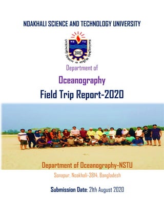
  • 1. NOAKHALI SCIENCE AND TECHNOLOGY UNIVERSITY Department of Oceanography Field Trip Report-2020 Department of Oceanography-NSTU Sonapur, Noakhali-3814, Bangladesh Submission Date: 21th August 2020
  • 2. A field trip report on the academic work in the Nijhum Dwip, Hatiya Island Azad Uddin Sojib ASH1718010M Submitted To Dr.M.A.M. Siddique (Assistant Professor) Nazmus Sakib Khan (Assistant Professor) MD.Sohel Pervez (Assistant Professor) Razat Suvra Das (Assistant Professor) Mahfuzur Rahman (Assistant Professor) Submitted by
  • 3. 1 Acknowledgement First and foremost, I want to thanksgiving to my supervisor, Dr. Mohammad Abdul Momin Siddique. grateful for his mentoring, affordability, encouragement, and immense optimism over the whole time in the field work. his instructions, affable advice, and support made it possible for me and my group to have completed field trip. I also grateful to our course coordinator professor Md. Sohel Pazver and also thanks go out to the Mahfuzur Rahman, Razat Suvra Das and Nazmus sakib sir who are monitoring in the entire field trip time. Grateful to my other friends, who helps me and my group entire the sampling in the field and sometimes in others ways.
  • 4. 2 Executive Summary The study tried to explore the present status of the plant community with biodiversity and measured the biological parameter with the physiological parameter by using the different methods of the many sampling stations of the Nijhum Dwip, Noakhali, Bangladesh. This study was conducted to assess the biodiversity status and to identify the different parameters of Nijhum Dwip and the present condition of the benthos with flora and fauna, causes and effects of biodiversity loss, people participation in management, and training system for conservation of Nijhum Dwip. For this purpose, we collect data by using different methods such as multi-probe, plankton net, PH meter, refractometer, hand auger, Quadrant method, etc., and with discussion, eyesight visitation, and various types of secondary data. Also, we conducted a questionnaire survey, and most of the respondents were illiterate 44%, fisherman 46%, and older 46% based on educational status and occupational status, respectively. From this study, we have found that 94% of people directly depend on this forest resource, 64% are people on fisheries. our study, we identified four species of benthos (Polychaeta sp, Lumbricus terrestris Ocypode macrocera, Talitridae sp), four species of phytoplankton (such as Anabaena sp, Coscinodiscus sp, Euglena sp, Nostoc sp), five species of zooplankton (such as Cyclops vernalis, Diaphanosoma sp, Nauplius sp, Nauplius sp, Rotifer sp), and A total of seven plant species under five families have been recorded from Nijhum Deep in Intertidal zone such as Eleusine indica, Zoster marina, Ipomoea aquatic, Enhydra fluctuans, Cenopodium album, Cynodon dactylon.
  • 5. 3 Table of Content Appellation Page Acknowledgement 01 Executive Summary 02 Chapter 01: Introduction Background of the study 07 Objectives of The Field Trip 07 Field Work Team 08 Time Schedule 08 Chapter 02: Nijhum Dwip Introduction to Field Site 09 Sampling Site Selection 10 Geographical Location 10 Chapter 03: Methodology Methodology of the field trip 11-12 Equipment of field work 12-13 Supporting Chemical Reagent 13 Chapter 04: Activities Activities -01 (Phytoplankton Collection Method) ✓ Aims ✓ Apparatus ✓ Phytoplankton ✓ Geographical Location ✓ Sampling and Collection ✓ Preservation ✓ Identification ✓ Measured Parameters ➢ Temperature ➢ Transparency ➢ Salinity ➢ PH ➢ TDS ➢ Dissolved Oxygen (DO) 14-18 Activities -02 (Zooplankton Collection Method) ✓ Aims ✓ Apparatus 19-22
  • 6. 4 ✓ Zooplankton ✓ Geographical Location ✓ Sampling and Collection ✓ Preservation ✓ Identification and Analysis ✓ Measured Parameters ➢ Temperature ➢ Transparency ➢ Salinity ➢ PH ➢ Dissolved Oxygen (DO) Activities -03 (Inter-tidal Benthos Sample Collection Method) ✓ Aims ✓ Apparatus ✓ Benthos ✓ Intertidal Zone ✓ Sampling site ✓ Sample Collection ✓ Preservation ✓ Identification 23-27 Activities -04 (Assessment of Intertidal Plant Community) ✓ Aims ✓ Apparatus ✓ Plant Community ✓ Intertidal zone plant ✓ Plant biodiversity in Nijhum Dwip ✓ Geographical Location ✓ Materials and Method ✓ Identification 28-32 Activities -05 (Physiological parameters of Tube-well water) ✓ Aims ✓ Apparatus ✓ Procedure and General calibration ✓ Data Collection ✓ Physiological parameters ➢ Salinity ➢ DO 33
  • 7. 5 ➢ TDS ➢ Temperature Activities 06 (Soil Sample Collection with Auger) ✓ Aim ✓ Apparatus ✓ Procedure ✓ 34-35 Chapter 05: Conclusion Conclusion 35 References 37 Field Work Photo Album Photo Album 38-48 List of Figure 1 Figure 1: (a) Location of Hatiya Upazila in Bangladesh (b) Location of the study area (c) Study Area map showing major features of Nijhum Dwip island. (Map 1) 2 Figure 2: Figure 2: The methodological flowchart of the study 3 Figure 3: working acetifies 4 Figure 4: Graph showing physiochemical parameters (a) water Temperature, (b) Dissolved oxygen (DO), (c ) pH measured at the sampling stations. 5 Figure 5: Graph showing physiochemical parameters (c) salinity, (b) Total Dissolved solis (TDS), (c ) Transparency measured at the sampling stations 6 Figure 3: Study area map for phytoplankton collection (Map 2) 7 Figure 4: Study area map for Zooplankton collection (Map 3) 8 Figure 5: Study area map for Benthos collection, Nijhum Dwip Islands, Bangladesh (Map 4) 9 Figure 6: Study area map for Plant community collection, Nijhum Dwip Islands, Bangladesh (Map 5) 10 Figure 7: a) Hand augur, b) how augur works
  • 8. 6 List of Table 1 Table 1: Following table contains list of tools and equipment used during field work. 2 Table 2: List of Chemicals are presented in the following table. 3 Table 3: List of phytoplankton group are presented in the following table. 4 Table 4: Presenting the list of measured Water Parameters for Phytoplankton in the following table 5 Table 5: List of zooplankton group are presented in the following table 6 Table 6: Presenting the list of measured Water Parameters for zooplankton in the following table 7 Table 7: List of benthos in the intertidal zone of Nijhum Dwip, following the table 8 Table 8: List of plant community family are presented in the following table 9 Table 9: List of Physiological parameters are present in the following table.
  • 9. 7 Chapter -01: Introduction Background of The Study The department of Oceanography of Noakhali Science and Technology University (NSTU) includes a course on field work as an academic study course each year. As a part of our final year study, we got the chance to participate in field work for two days from 2 March 2020 to 3rd March 2020 in Nijhum Dwip located in Hatiya Upazila of Noakhali District. Objectives of The Field Trip Field trips provide better understanding of theoretical and bookish knowledge by making real world connections. Field trips also offer an opportunity to the students and teachers to interact outside of the classroom, thus strengthen their bonding with each other and to improve their social communication and life skills. The present study conducted in Nijhum Dwip aims: ➢ To learn the techniques of field studying. ➢ To investigate the inter-tidal plant community structure. ➢ To learn how to collect and preserve soil sample using hand augur. ➢ To collect and preserve the benthos sample from the inter-tidal zone. ➢ To collect and preserve sample of phytoplankton and zooplankton. ➢ To learn how to assess different water physiological parameters (e.g., dissolved oxygen, pH, electrical conductivity). ➢ To identify the collected specimen. ➢ Ecological observation (deforestation, types of plants and biodiversity) ➢ To observe the natural processes occurred in the island ➢ To know physical, socio economic and cultural aspect of the study areas ➢ To know the Lifestyle of the people of coastal Areas. Field Work Team The whole team was divided into groups to disburse work. Our group was assigned to observe and study the physical set up of the island, mudflat and sandflats, inter-tidal plant community structure, to collect samples for further identification, to collect soil sample, to assess water quality etc.
  • 10. 8 Time Schedule Date Time Activities 01/03/2020 6 AM Start our journey from NSTU campus 3 PM Reach in Nijhum Dwip 02/03/2020 9 AM Visit the Nijhum Dwip beach 10 to 2 PM Conducted our field activities 2 to 4 PM Lunch break 4 PM Going to the beach for the enjoyment of natural beauty 03/03/2020 9 AM Visit another field site 9 to 2 PM Conducted our field activities 1 to 3 PM Lunch break 3 PM Visit in the forest 04/03/2020 8 AM We leave our hotel, and set off to return to the NSTU campus 7 PM We arrive in the NSTU campus and Our field trip is over Chapter 02: Nijhum Dwip Introduction to Field Site Nijhum Dwip is (literally “the island of silence”) is an accreted island, with a total area of about 40390 ha, lies in the central coastal zone of Bangladesh, under Hatiya Upazila of Noakhali District. Following the joint recommendations from ECOFISH, the International Union for the Conservation of Nature (IUCN) and the Wildlife Conservation Society (WCS), the Ministry of Fisheries and Livestock Bangladesh, declared the Nijhum Dwip Marine Reserve/ Marine Protected Area (MPA) in 2019, through S.R.O. No. 211-Law/2019 dated 23 June 2019 under the provision of clause 28 of Marine Fisheries Ordinance, 1983. The declared protected area covers 3,188 square kilometers of estuarine waters at the mouth of the world’s third largest river system: the Padma- Jamuna Meghna and offshore of the Nijhum Dwip National Park.
  • 11. 9 Population and Livelihood The population has since increased to about 4500 households with an estimated 30,000 people living in different cluster villages. The literacy rate on the island is very low, at about 10%. Children below the age of 12 years account for 30% of the total population and married adults represent about 40%. The lack of sanitation facilities on the island causes severe problems because none of the households use sanitary latrines. Drinking water is available from shallow tube wells, which households share at a rate of one well per 50-75 households. Climate The area enjoys a moist tropical maritime climate and rainfall is frequent and heavy during the monsoon season (May to October) ranging between 140 mm to1040 mm. Temperature ranges from 16ºC to 33ºC, whereas humidity ranges from 29% to 99% (BBS 2011). Nijhum Dwip is typically tropical with average annual maximum and minimum temperatures of 30°C and 21.6°C respectively (BMD 2009). Changes in temperature, even small changes in water temperature, are expected to exert strong pressure upon fish ecology (WWF 2005). The southwest monsoon brings much rainfall from May to September while the northeast monsoon brings some rain in October and November. About 80-90% of annual rainfall is confined to the monsoon months (April-October). Annual mean total rainfall has decreased from 3561mm in 1988 to 3531mm in 2008. Old fishermen have reported noticeable climate pattern changes include increasing variability in the dates of onset and end of the rainy season, changes in wind direction, tidal magnitude, rainfall distribution pattern throughout the season, and an increase in thunderstorm activity. Sampling Site Selection Sampling site selection is crucial for an efficient completion of field work. Site selection is dependent on the type of study we want to conduct. For site selection, a better understanding of the study area is a must. Sampling site should be easy to access and suitable for selected task. Our supervisor guided us to select sampling stations for our field work.
  • 12. 10 Geographical Location Nijhum Dwip is situated between latitude 22º1´ and 22º6´N and longitude 90º58´ and 91º3´E. Nijhum Dwip is separated from Hatiya by the Moktaria Channel, which is about 700-1200m wide: the island area is only 10 km2 in area. The island is about 4‐5 meters high from the sea level. Figure 1: (a) Location of Hatiya Upazila in Bangladesh (b) Location of the study area (c) Study Area map showing major features of Nijhum Dwip island. (Map 1)
  • 13. 11 Chapter 03: Methodology and Data Collection of the Field Work Methodology of the field trip The methodology is the principled theoretical analysis of the process applied to a field of study. It does not set out to a provide solution but offers the theoretical under planning for understanding the method. Set of methods called “best practices” can apply to a specific case. The methodology does not explain a specific method. When a proper study of methodology, such processes make up a constructive generic framework. Figure 2: The methodological flowchart of the study
  • 14. 12 Figure 3: The working flowchart of the study Equipment of field work Table 1: Following table contains list of tools and equipment used during field work. Sl.No. Equipment Quantity Usages 01 GPS device 2 Sampling point trace and recording of the coordinates 02 Plankton Net 2 Net Phytoplankton sampling 03 Refractometer 2 Salinity measurement 04 DO Meter 1 DO measurement 05 Hygrometer 1 Measurement of water vapor in air, in soil 06 Thermometer 3 Measurement of temperature 07 Secchi Disk 1 Measurement of transference
  • 15. 13 08 Sieve 2 Soil and sand categories 09 Grab Samplers 1 Sediment samples collect from hard bottoms like sand, gravel, consolidated marl or clay 10 Bucket 2 11 Plastic Container 50pcs 12 Multi-probe 1 used to measure multiple parameters such as temperature, dissolved oxygen, conductivity and pH 13 Ice Box 3 14 pH Meter 3 used to measure pH 15 Dropper 3 16 Hand Auger 1 Obtaining soil samples Supporting Chemical Reagent Table 2: List of Chemicals are presented in the following table. Sl. No. Chemical Quantity 01 Distilled water 02 Formalin 1 bottle 03 Alcohol 1 bottle
  • 16. 14 Chapter 04: Activities Activities 01: Phytoplankton Sample Collection Method Aim: Sampling of phytoplankton using plankton net from the surface of a water body on the coast of Nijhum Dwip Island And measure water parameters. Apparatus: Plankton Net, Refractometer, DO Meter, Thermometer, Secchi Disk, pH Meter, Ice Box etc. Phytoplankton Phytoplankton are autotrophic organisms. They produce their own food through photosynthesis. In any ecosystem the prey and the predators are very closely related. Phytoplankton is one of the important producers of the estuary. At the early stage of life cycle of almost all the aquatic fauna directly or indirectly feed on phytoplankton. It is the primary producer and occupied the first position of the food chain. Phytoplankton is generally considered as the best index of the biological productivity and the nature of aquatic habitat. Why need to assess phytoplankton abundance at nijhum dwip The phytoplankton population represents the biological wealth of a water body, constituting a vital link in the food chain. Both the qualitative and quantitative abundance of phytoplankton are of great importance. Coastal regions are the most productive ecosystem in the world, Nijhum dwip is one of them and also recognized as Marine Protected Area (MPA). It is full of marine resources, mainly fisheries. The rate of gross primary productivity is important for assessing the fisheries yield. For this reason, we investigated on the abundance of phytoplankton there. Sampling and Collection 1. We decided to collect sample from six stations. 2. We used plankton net. 3. Firstly, we took water from surface layer using one little mug. 4. Then we poured it into plankton net and it filter water. Cod end was closed. 5. After that we collected final water sample caught by cod end. 6. Then we took these samples in plastic bottles and labelled. 7. We also measured environmental parameters such as pH by pH meter, Salinity by refractometer, temperature by thermometer, TDS, DO.
  • 17. 15 Preservation We used 10% formalin (Methyl alcohol) to preserve these samples. After that we transferred these to laboratory for analysis. Identification The community of phytoplankton was represented by Anabaena, Coscinodiscus, Euglena, Nostoc. Table 3: List of phytoplankton group are presented in the following table. Group Name Picture 1.Anabaena Class: Cyanophyceae Scientific name: Anabaena sp 2.Coscinodiscus Class: Coscinodiscophyceae Scientific name: Coscinodiscus sp 3.Euglena Class: Euglenoidea Scientific name: Euglena sp 4.Nostoc Class: Cyanophyceae Scientific name: Nostoc sp
  • 18. 16 Measured Parameters Table 4: Presenting the list of measured Water Parameters for Phytoplankton in the following table Parameter Station 1 Station 2 Station3 Station 4 Station 5 GPS Location 22.0466N 90.9771E 22.0498N 90.9751E 22.0541N 90.9729E 22.0560N 90.9736E 22.0580 N 90.9735E Temperature(0C) 26.5/27 27.7/28.0 29.5/28.5 26.9/26.5 26.7/25. 9 Salinity (ppt) 11 or 11.5 11 or 10 11 or 10 10 or 11 10 or 11 DO (mg/L) 5.61mg/L (70.1%) 7.81 mg/L (100%) 7.56 mg/L (100%) 7.89 or 7.98 7.93 or 8.06 pH 8.3 or 8.4 8.4 or 8.6 8.6 or 8.7 8.6 or 8.7 8.6 or 8.7 TDS (mg/L) 1487 or 1490mg/L 1484 or 1485mg/L 1485 or 1486mg/L 1487 or 1490mg/L 1488 or 1489mg /L Transparency 2 or 1.8 inch 3.1 or 3.5 inch 2 or 2.2 inch 2.5 or 2.7 inch 3 or 3.32 inch
  • 19. 17
  • 20. 18 Geographical Location: Figure 6: Study area map for phytoplankton collection (Map 2) Activities 02: Zooplankton Collection Method Aim: Sampling of zooplankton using plankton net from the surface of a water body on the coast of Nijhum Dwip Island And measure water parameters. Apparatus: Plankton Net, Refractometer, DO Meter, Thermometer, Secchi Disk, pH Meter, Ice Box etc. Zooplankton The zooplankton assemblage is a sensitive indicator of the ecological status of an aquatic ecosystem since it can respond to environmental changes with rapid modifications in the species composition and structure. The zooplankton population can reflect the nature and potential of any aquatic systems. They are represented by a wide array of taxonomic groups viz., Protozoa, Cladocera, Copepoda and Rotifer in a freshwater ecosystem that is often armored by different organs like spines from the predator.
  • 21. 19 Rotifers achieved more significance in freshwater by residing in the littoral, limnetic and benthic regions. Most of them are cosmopolitan in distribution. They play a significant role in aquatic food-chain and trophic dynamics in freshwaters because of their common occurrence, a wide variety of feeding habits and rapid turnover rates, enabling them to build up substantial populations within short time intervals. The role of rotifers as bioindicators has been investigated by several researchers. The community composition and density of rotifers greatly vary with eutrophication. Eutrophication of lakes which leads to deterioration of aquatic ecosystems has been of great concern around the globe. Adequate knowledge of the zooplankton communities and their population dynamics is a major requirement for a better understanding of the life process in a freshwater body since eutrophication influences zooplankton's composition and productivity. Sampling and Collection 1. We decided to collect sample from six stations. 2. We used plankton net (90 µm mesh size). 3. Zooplankton samples were collected from a depth of 5-10 cm below the water surface in the morning hour (7-9 AM), Noon hour (12-2 PM) and after noon hour (5-7 PM) 4. Samples from different locations and depths may occasionally be combined in composite samples to reduce sampling effort. 5. Firstly, we took water from surface layer using one little mug. 6. Then we poured it into plankton net and it filter water. Cod end was closed. 7. After that we collected final water sample caught by cod end. 8. Then we took these samples in plastic bottles with 10% formalin on site and labelled. 9. Then transfer to the ice box and finally conducted in laboratory of Oceanography, Noakhali Science and Technology University. 10. We also measured environmental parameters such as pH by pH meter, Salinity by refractometer, temperature by thermometer, TDS, DO. Preservation We used 10% formalin (Methyl alcohol) to preserve these samples. After that we transferred these to laboratory for analysis.
  • 22. 20 Identification and Analysis Identification of the zooplankton species was conducted in laboratory of Oceanography department under a phase contrast light microscope at 16×40 and 16×10 magnification (Model No: XSZ21-05DN, Made in China) with bright field and phase contrast illumination. Quantitative analysis of zooplankton was done on Sedgewick-Rafter counting chamber (S-R cell). Analysis involved transfer of 1 mL sub-sample from each of the samples to the Sedgewick Rafter counter and counting of cells within 10 squares of the cells, chosen randomly. The cell counts were used for computing the cell density using the formula where the zooplankton density was estimated by Stirling: N= (A×1000×C)/ (V×F×L) Where, N= no. of plankton cells or units per liter of original water; A=Total no of plankton counted; C= Volume of final concentrate of the sample in ml; V=volume of a field in cubic mm; F=No. Of fields counted; and L=Volume of original water in liter The zooplankton were then identified up to the genus level and enumerated by the following. The mean number of zooplankton was recorded and expressed numerically per liter of water of the ocean Generic status of zooplankton with their different groups recorded from different types of sampling site during the study period in the Nijhum Dwip.
  • 23. 21 Table 5: List of zooplankton group are presented in the following table Group Genus Name Species picture 1 Copepoda Cyclops Scientific name: Cyclops vernalis 2 Cladocera Diaphanosoma Scientific name: Diaphanosoma sp 3 Crustacean larva Nauplius Scientific name: Nauplius sp 4 Rotifera Brachionus Scientific name: Brachionus sp Rotifer Scientific name: Rotifer sp Measured Parameters Table 6: Presenting the list of measured Water Parameters for zooplankton in the following table Parameter Station 1 Station 2 Station3 Station 4 Station 5 GPS Location 22.0466N 90.9771E 22.0498N 90.9751E 22.0541N 90.9729E 22.0560N 90.9736E 22.0580N 90.9735E Temperature(0C) 26.5/27 27.7/28.0 29.5/28.5 26.9/26.5 26.7/25.9 Salinity (ppt) 11 or 11.5 11 or 10 11 or 10 10 or 11 10 or 11
  • 24. 22 DO (mg/L) 5.61mg/L (70.1%) 7.81 mg/L (100%) 7.56 mg/L (100%) 7.89 or 7.98 7.93 or 8.06 pH 8.3 or 8.4 8.4 or 8.6 8.6 or 8.7 8.6 or 8.7 8.6 or 8.7 TDS (mg/L) 1487 or 1490mg/L 1484 or 1485mg/L 1485 or 1486mg/L 1487 or 1490mg/L 1488 or 1489mg/ L Transparency 2 or 1.8 inch 3.1 or 3.5 inch 2 or 2.2 inch 2.5 or 2.7 inch 3 or 3.32 inch Geographical Location Figure 7: Study area map for Zooplankton collection (Map 3)
  • 25. 23 Activities 03: Inter-tidal Benthos Sample Collection Method Aims: Sampling of benthos using sieve from the top of a sediment body on the coast of Nijhum Dwip Island. Apparatus: Sieve, Plastic Container, Ice Box etc. Benthos The assemblage of organisms inhabiting the seafloor. Benthic epifauna live upon the seafloor or upon bottom objects; the so-called infauna live within the sediments of the seafloor. By far the best-studied benthos are the macrobenthos, those forms larger than 1 mm (0.04 inch), which are dominated by polychaete worms, pelecypods, anthozoans, echinoderms, sponges, ascidians, and crustaceans. Meiobenthos, those organisms between 0.1 and 1 mm in size, include polychaetes, pelecypods, copepods, ostracodes, cumaceans, nematodes, turbellarians, and foraminiferans. The microbenthos, smaller than 0.1 mm, include bacteria, diatoms, ciliates, amoeba, and flagellates. Intertidal zone The intertidal zone (sometimes referred to as the littoral zone) is the area that is exposed to the air at low tide and underwater at high tide (the area between the low and high tide lines). This area can include many different types of habitats, including steep rocky cliffs, sandy beaches, or wetlands. Organisms in the intertidal zone are adapted to an environment of harsh extremes. Water is available regularly with the tides but varies from fresh with rain and river flows to highly saline and dry salt with drying between tidal inundations. The action of waves can dislodge residents in the intertidal zone. With the intertidal zone's high exposure to the sun the temperature range can be anything from very hot with full sun to near freezing in colder climates. Temperature extremes within some microclimates in the littoral zone can be moderated by local features and larger plants such as mangroves. Adaption in the littoral zone is all about making use of nutrients supplied in high volume on a regular basis from the sea which are actively moved to the zone by tides and ocean swells. Edges of habitats, in this case the dry sand beach/rocky shore and the sea, are themselves often significant ecologies. We have chosen the Intertidial zone in the Nijhum dwip island to collect Benthos to find out what kind of Benthos community has developed there for tidal variation.
  • 26. 24 Sampling site Station 1: It is located at northern part of the Nijhum Dwip Island. It’s GPS reading 2.0466 N - 90.9771 E. Tidal influence is active here. Salinity varied from 11-11.5 ppt and temperature 26.5-27°C. Samples were collected from clay bottom area. It is subjected to high erosion and water body is turbid. Station 2: Its latitude 22.0498N and longitude 90.9751E. Tidal influence is active here. Salinity varied from 10-11 ppt and temperature range from 27.5-28°C. Samples were collected from clay bottom area. It is subjected to hig erosion. Station 3: Its latitude 22.0541N and longitude 90.9729E. Salinity varied from 10-11 ppt and temperature varied from 27.5-28°C. Samples were collected from clay bottom area. Station 4: Its latitude 22.0560N and longitude 90.9736E. Salinity varied from 10-11 ppt and temperature varied from 25.5-26.9°C. Samples were collected from clay bottom area. Station 5: Its latitude 22.0580N and longitude 90.9735E. Salinity varied from 11-12 ppt and temperature varied from 25.9-26.7°C. Samples were collected from clay bottom area. Sample Collection The Five working stations were selected in different parts of Nijhum Dwip Island. Each station was divided into three sub-stations (sub-station=01, sub-station=02 and sub- station=03). Three replicate soil samples were collected from each station with hand during this study period (March, 2020). Replicate samples were taken from intertidal area of the stations. The sediment samples were transferred into bucket and mix with water properly. Then the mixed water passed through a hand-sieve with 0.5 mm mesh. Then these sieved organisms were taken into plastic bottles and marked over the bottle by a marker pen.
  • 27. 25 Preservation & Identification The sieved organism was preserved with other residues in the plastic bottles with 10% buffered formalin and labeled and then transferred to laboratory at department of oceanography of the Noakhali Science and Technology University for further analysis. In the laboratory, small amount of “Rose Bengal” was added to increase visibility of organisms. For identification, the samples were taken into a round transparent Petri dish (diameter 15 cm and depth 2 cm) and placed on a white paper background for the easy contrast of vision. Organisms were sorted and enumerated under major taxa and preserved in small vials by using small brush or forceps. Binocular microscope with digital camera was used to identify and capture the image of benthos. The coarser level (order) of taxonomic data as suggested by Warwik (1988) were analyzed using the statistical package SPSS v.17 and multivariate data analyzing software, Plymouth Routines in Marine Ecological Research (PRIMER v.6). Classification and Ordination (Nonparametric multidimensional scaling, nMDS) were performed by using Bray-Curtis similarity measure for community analysis. Table 7: List of benthos in the intertidal zone of Nijhum Dwip, following the table Group Feature Example Polychaeta • Metamerically segmented. • Bilateral symmetry. • Chitinous setae called parapodia. • Schizocoelic. • Closed circulatory system. • Complete digestive system. • Respiration through skin, gills or parapodia. • Nephridia for excretion. Scientific name: Polychaeta sp Oligochaeta • Hermaphroditic. • Terrestrial or freshwater habitats. • Segmented body. • Specialization in structure of alimentary system. • Specialization in structure of reproductive system. Scientific name: Lumbricus terrestris Crab • Decapod. Almost all crabs are decapods, meaning they have 10 legs. • Hard Exoskeleton. The hard “crust” is a defining characteristic of crabs, lobsters and prawns. Scientific name: Ocypode macrocera
  • 28. 26 • Double Antennae. Most crabs have two pairs of antennae. • Sideways Walking. • Land and Water Breathing. Common Name: Red Ghost Crab Amphipoda Body is typically slender and laterally compressed Head is fused to the thorax and there is no carapace. Thorax and abdomen are usually quite distinct. Compound eyes are sessile Scientific name: Talitridae sp Common Name: lawn shrimp Geographical Location Figure 8: Study area map for Benthos collection, Nijhum Dwip Islands, Bangladesh (Map 4)
  • 29. 27 Activities 04: Assessment of Intertidal Plant Community Structure Aim: To collect plant sample by using quadrant on the Nijhum Dwip Island. Apparatus: Quadrant box Plant Community Studies on the macrofaunal diversity and seawater quality (in triplicate) from the intertidal regions of these sites were carried during November 2008 to October 2009. The entire intertidal belt of each sampling site was subdivided into three vertical zones. The macrofaunal diversity and distribution in the intertidal belt at each station were studied during the low tide by quadrat method [18]. Quadrat of 0.25 m2 was laid along the employed line transect at every 10 m interval on the intertidal region. A minimum of ten quadrates were laid in a crisscross direction at the intertidal belt to cover the maximum exposed area. For water quality, previously published data of different seawater quality parameters were considered. Intertidal zone plant The plant which found on the area of the ocean between the high tide and low tide lines, usually on the beach at the water's edge this plant known intertidal zone plant. These plants are submerged with water during high tide and exposed to the air during low tide. The intertidal zone of this island generally combined with mudflats and sandflats. In Bangladesh an assessment of plant diversity of different national parks and wildlife sanctuary are already being started (Uddin et al. 1998, Uddin and Rahman 1999, Uddin et al. 2011, Uddin and Hassan 2004, 2010, Uddin et al. 2013). There were no assessment records of intertidal plant diversity were found for Nijhum Dwip except few plant names in the forest management plan. In the present study an attempt has been made to attain the following objectives: to assess the angiosperm and gymnosperm plant diversity, to knowing their availability on different zone and to identify any threat and to suggest some possible conservation measures for the Nijhum Dwip conservation. Plant biodiversity in Nijhum Dwip A total of 13 plant species under five families have been recorded from Nijhum Deep in Intertidal zone. For each species local name, scientific name, family, habit are provided (Table 1). Among the species, 5 are represented by shrubs, 8 by herbs. Poaceae is the largest family in Monocotyledon having 2 species.
  • 30. 28 Geographical Location Figure 9: Study area map for Plant community collection, Nijhum Dwip Islands, Bangladesh (Map 5) Materials and Method Plant data collections of the study area have been done March, 2020. Quantitative data collection has been collected from eleven different sampling point on Nijhum Dwip Island. These sampling point have been selected around 100m. In order to know the frequency of ground vegetation, data have been collected different three point by using 1x1m quadrate from the same sampling points. These points have been taken at a certain distance to get vertical. The collection has been between intertidal zone included with mud, sand and mangrove sight.
  • 31. 29 Identification Table 8: List of plant community family are presented in the following table Family Habit Local Name Scientific name Picture Poaceae Herb Durba Grass Cynodon dactylon Amananthaceae shrubs Bathua Cenopodium album Astaraceae Herb Enhydra fluctuans Convolvulaceae Herb Kalmi shak Ipomoea aquatic
  • 32. 30 Zosteraceae Herb Zoster marina Poaceae Herb chapra Eleusine indica Plant Community Composition Shrubs Herbs
  • 33. 31 0 1 2 3 Poaceae Amananth… Astaraceae Convolvul… Zosteraceae Distribution of Plant Family Figure 10: Plant community study using quadrant method on the Nijhum Dwip
  • 34. 32 Activities 05: Physiological parameters of Tube-well water Aim: To Evaluate the physiological parameters of tube well water on Nijhum Island. Apparatus: Multi-probe Procedure and General calibration: 1. Initially, we were Calibrate within 24 hours prior to sampling, best done before going out in the field. 2. We Calibrated for each probe for the measuring time (conductivity, pH and dissolved oxygen). 3. Rinse with deionized (DI) water between each calibration 4. We measured conductivity and then used a calibration solution 5. Then pH, use 2-point calibration that buffers the expected measurement 6. Temperature cannot be calibrated, but is good to do a check against a NIST certified thermometer to make sure the equipment is working properly. Data Collection: Turn on the multiprobe and position the meter in the thalweg (main stream flow); or along a bank/edge in the flow if the waterbody is too deep or fast; or lower from a bridge. Ensure the measurements are upstream of other sampling activity, in well mixed water and avoid disturbing bottom sediments. Wait 1 - 2 minutes for the values to settle and record them on the data sheet provided. When finished sampling, make sure the meter is rinsed thoroughly and properly stored in the cap with a damp sponge or tap water. Table 9: List of Physiological parameters are present in the following table. Physiological parameters Sampling station Salinity (ppt) 11.5 pH 7.7 Eclectic Conductivity (EC) 796.8 Temperature 24.6
  • 35. 33 Activities 06: Soil Sample Collection with Augur Aim: To collect Soil sample using hand augur from the sand-flat area of Nijhum Dwip. Figure 7: a) Hand augur, b) how augur works Apparatus: Hand auger. This system uses an auger, a series of extension rods, a “T” handle, and a thin-wall tube sampler. The auger bores a hole to a desired sampling depth and then is withdrawn. The auger tip is then replaced with a tube core sampler, lowered down the borehole, and driven into the soil at the completion depth. The core is then withdrawn and the sample collected. Posthole augers have limited utility for sample collection, as they are designed more for their ability to cut through fibrous, rooted areas. Bucket augers are better for direct sample recovery, are fast, and provide a large volume of sample. Procedure: Use the following procedure to collect soil samples with a hand auger: Insert the auger into the material to be sampled at a 0o to 45o angle from vertical. This orientation minimizes spillage of the sample from the sampler. Extraction of samples may require tilting of the sampler. Rotate the auger once or twice to cut a core of material. a b
  • 36. 34 Slowly withdraw the auger, making sure that the slot is facing upward. An acetate core may be inserted into the auger prior to sampling, if characteristics of the soils or body of water warrant. By using this technique, an intact core can be extracted. Transfer the sample into an appropriate sample or homogenization container. Chapter 05: Conclusion Conclusion The field trip is the vast of sagacious practices and it is the consummate way to appropriately erudite afford. Our study, we identified four species of benthos (Polychaeta sp, Lumbricus terrestris Ocypode macrocera, Talitridae sp), four species of phytoplankton (such as Anabaena sp, Coscinodiscus sp, Euglena sp, Nostoc sp), five species of zooplankton (such as Cyclops vernalis, Diaphanosoma sp, Nauplius sp, Nauplius sp, Rotifer sp), and A total of seven plant species under five families have been recorded from Nijhum Deep in Intertidal zone such as Eleusine indica, Zoster marina, Ipomoea aquatic, Enhydra fluctuans, Cenopodium album, Cynodon dactylon.
  • 37. 35 References 1. Hossain, S., Rahman, M. M., Akter, M., & Bhowmik, S. (2015). Species composition and abundance of zooplankton population in freshwater pond of Noakhali district, Bangladesh. World Journal of Fish and Marine Sciences, 7(5), 387-393. 2. Islam, A. (1999). Pholito Matshyo Bijnan. Bangla Academy Dhaka, 1000, 5-10. 3. Xu, Z. L., & Li, C. (2005). Horizontal distribution and dominant species of heteropods in the East China Sea. Journal of Plankton Research, 27(4), 373-382. 4. Haney, J. F., & Hall, D. J. (1973). Sugar‐coated Daphnia: A preservation technique for Cladocera 1. Limnology and Oceanography, 18(2), 331-333. 5. Boyd, C. E. (1982). Water quality management for pond fish culture. Elsevier Scientific Publishing Co. 6. Hossain, M. Y., Jasmine, S., Ibrahim, A. H., Ahmed, Z. F., Ohtomi, J., Fulanda, B., ... & Wahab, M. A. (2007). A preliminary observation on water quality and plankton of an earthen fish pond in Bangladesh: recommendations for future studies. Pakistan journal of biological sciences: PJBS, 10(6), 868-873. 7. Mridula, R. M., & Rajesh, K. M. (2002). Ecology of phytoplankton in the coastal waters of Mangalore, west coast of India. Bangladesh Journal of Fisheries Research, 6(2), 165-172. 8. Asadujjaman, M., Hossain, M. B., Shamsuddin, M., Amin, M. A., & Azam, A. K. M. (2012). Occurrence and abundance of macrobenthos of Hatiya and Nijhum Dweep Islands, Bangladesh. Middle-East J. Sci. Res, 11(2), 184-188. 9. Hossain, M. B., Amin, S. M. N., Asadujjaman, M., & Rahman, S. (2013). Analyses of macrobenthos of Hatiya and Nijhum Dweep Islands at higher taxonomic resolution. Journal of Fisheries and Aquatic Science, 8(4), 526. 10. Alam, M. S. (1993). Ecology of the Intertidal Macrobenthos of Halishahar coast, Chittagong, Bangladesh. Bangladesh Journal for Scientific Research, 15, 335-340. 11. Boyd, C.E.,1982. Water Quality Management of Pond Fish Culture. Elsevier Science Publisher Company, Amsterdam, Oxford, New York, pp:318
  • 38. 36 12. Hossain. M.Y., S. Jasmine, A.H.M. Ibrahim, Z.E. Ahmed and J. Ohtomi et al.,2007. A preliminary observation on water quality and plankton of an earthen fish pond in Bangladesh: Recommendations for future studies. Pak.J.Biol.Sci.,10:868-873. 13. Mridula, R.M. and K.M. Rajesh,2002. Ecology of phytoplankton in the coastal waters of Mangalore, West coast of India. Bangladesh J.Fish.Res.,6:165-172. 14. Asadujjaman M, Hossain M B, Shamsuddin M, Amin M A, Azam A K M. 2012. Occurrence and abundance of macrobenthos of Hatiya and Nijhum Dweep Islands, Bangladesh. Middle-East J. Sci. Res, 11(2): 184–1884. 15. M. Belal Hossain, S.M.N. Amin, M. Asadujjaman and Sharmeen Rahman, 2013. Analyses of Macrobenthos of Hatiya and Nijhum Dweep Islands at Higher Taxonomic Resolution. Journal of Fisheries and Aquatic Science, 8: 526-534. 16. Alam, M.S., 1993. Ecology of the Intertidal Macrobenthos of Halishahar coast, Chittagong, Bangladesh. PhD. Thesis, Department of zoology, University of Chittagong, Bangladesh, pp: 243.
  • 40. 38
  • 41. 39
  • 42. 40
  • 43. 41
  • 44. 42
  • 45. 43
  • 46. 44
  • 47. 45
  • 48. 46