IReact for climate change: predictive mapping
•Télécharger en tant que PPTX, PDF•
2 j'aime•329 vues

This document summarizes the i-React project, which aims to develop an integrated system to support emergency response to natural hazards like floods, wildfires, and heat waves across Europe. The project combines data from various sources like early warning systems, risk models, weather forecasts, historical data, and social media. This data will be integrated into decision support tools and apps to help emergency managers and citizens prepare for and respond to disasters. The project runs from 2016-2019 and is funded by the European Commission. It involves partners from several European countries.

Recommandé
Recommandé
Contenu connexe
Tendances
Tendances (19)
Similaire à IReact for climate change: predictive mapping
Similaire à IReact for climate change: predictive mapping (20)
Plus de Speck&Tech
Plus de Speck&Tech (20)
Dernier
Dernier (20)
IReact for climate change: predictive mapping
- 1. i-React for Climate Change Gabriele Franch, Azra Alikadic, Andrea Gobbi, Cesare Furlanello FBK // MPBA
- 2. EUROPE (1980-2013) 4,443 events 111,211 people killed 33,031,632 people affected 480,398,000,000 € economic damage FROM NATURAL HAZARDS TO DISASTERS
- 3. 6.3 9 20 3 MILLION € COUNTRIES PARTNERS YEARS 2016 2017 2018 2019 FUNDED BY THE EUROPEAN COMMISSION. SECURITY WORK PROGRAMME (DRS-1-2015) 12 SME 3 RESEARCH CENTERS 2 Universities 2 Public Companies/ Institutes 1 UN Body Italy France Spain Germany Finland Austria United Kingdom Norway Serbia
- 4. I-REACTOR DATA SOURCESAND MODELS EU & LOCAL EARLY WARNING SYSTEMS GEOSPATIAL RISK MODELS DECISION SUPPORT SYSTEM MODELS SEASONAL WEATHER FORECAST HISTORICAL DATA SOCIAL MEDIA DATA STREAMS CLIMATE CHANGE MODELS The European Flood danger forecasts (EFAS), European hazard fire maps (EFFIS) will be combined with local early warning systems. I-REACT will implement a system to extract valuable information about ongoing disasters from the messages published on Twitter. Hazard mapping services for floods, fires and heat waves will be combined with exposure and vulnerability to compute risk maps. I-REACT will create a decision support system to suggest to decision makers appropriate actions for disaster risk reduction. I-REACT will analyse available historical data about past emergencies and also store all data generated within the platform to improve future emergencies response. I-REACT will provide information of how average weather conditions are likely to evolve from 6 months (higher resolution) up to 9 months (lower resolution). To asses the long-term impact on floods and wildfires due to climate change, I-REACT models will provide an overview of the general trends and help establishing sites of high risk.
- 5. TO TURN DATA INTOCRUCIAL INFORMATION CROWDSOURCED INFORMATION IMPROVED MAPS HISTORICAL RECORDSEARLY WARNING FORECAST SATELLITE DATA I-REACT will leverage upon the European Earth Observation programme Copernicus that will be a vital resource for I-REACT mapping. Also, Sentinel-1 will provide data to our automatic data chain for flood mapping. The European Flood danger forecasts (EFAS), European hazard fire maps (EFFIS) together with seasonal weather forecast will be integrated with local early warning systems to deliver the most accurate early warning forecast possible. Information from Social Media and reporting from first responders and citizens will add real-time in-field information. The use of drones (UAVs) and wearables with the integration of crowdsourced data with accurate positioning will improve existing maps and produce new nowcast and forecast for emergency response. I-REACT will analyse available historical data about past emergencies and also store all data generated within the platform to improve future emergencies response.
- 6. SOCIAL MEDIA DATA STREAMS UNMANNED AERIAL VEHICLES SEASONAL WEATHER FORECAST EARTH OBSERVATIONS PREPAREDNESSPREVENTION RESPONSE INTEGRATION OF EXISTING SYSTEMS HISTORIAL DATA CITIZENS FIRST RESPONDERS AUTHORITIES DATA PRODUCTS BIG DATA INTEGRATION TECHNOLOGIES STAKEHOLDERS DECISSION SUPPORT SYSTEM PROFESSIONAL APP GNSS WEARABLE AUGMENTED REALITY SMARTPHONE APP WEB INTERFACES I-REACTOR
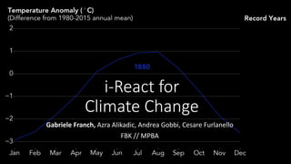
- 7. I-REACT IN A NUTSHELL .
- 8. A HEAT WAVE FORECAST SYSTEM FOR EUROPE • HeatWave: ´´three consecutive days of over- threshold maximum temperature´´ • Model: Heat Wave Magnitude Index (Russo, 2015) • Daily maximum temperatures • 30 years historical data • 14 days forecast • Every day measured temperature • A new FBK Module for iReact • 25 km resolution Russo, Simone and Sillmann, Jana and Fischer, Enrich M. (2015). Top ten European heatwaves since 1950 and their occurrence in the coming decades. Environmental Research Letters, vol. 10, no. 12.
- 9. THIS SUMMER LUCIFER HEAT WAVE STRUCK EUROPE31/7 – 9/8 2017
- 10. FORECAST OF 02-08-2017 DURING LUCIFER + 1 day + 3 day + 5 day
- 11. Tool for emergency alert warnings, because it takes in consideration the complete duration and intensity of heat waves with a valid forecast of 14 days. Applicable also on a local level for emergency warning alerts and for adaptive strategies.
- 12. GEODATASCIENCE IN TRENTINO • From Global EU models to a public repository of all/best climatic data of interest for climate change • Enabling research and new applications
- 13. climatlas.fbk.eu
- 14. DATA 3.5 millions of measures 60 stations in total (38 Meteotrentino, 22 FEM) daily data series starting from 1921 Going towards 100 years of data!
- 15. • FBK infrastructure distributed on two dedicated servers • Migrating to virtual machines at Datacenter InfoTN • Stack software 100% open source UNDER THE HOOD
- 17. Annuale Inverno Primavera Estate Autunno Gennaio Febbraio Marzo Aprile Maggio Giugno Luglio Agosto Settembre Ottobre Novembre Dicembre Climatic maps report the monthly, annual and seasonal distribution of TEMPERATURE for the three climatic reference periods 1961-1990, 1971-2000 and 1981-2010 Spatial algorithm: Optimal Interpolation Resolution: 200 x 200 m
- 18. THANK YOU Gabriele Franch Contact: franch@fbk.eu