SlideShare une entreprise Scribd logo
1  sur  23
Télécharger pour lire hors ligne
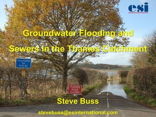
Groundwater Flooding and
Sewers in the Thames Catchment


            Steve Buss
      stevebuss@esinternational.com
Summary

•   Groundwater flooding mechanisms
•   Groundwater flooding in SE England
•   Mapping groundwater flood risk
•   Basement impact assessments in London
•   Groundwater and sewers
Groundwater Flooding Mechanisms
Bedrock (Clearwater) Flooding
                                        1. Ambient conditions in the aquifer: the
                                        water table slopes at a shallow angle and
         Ground surface                 groundwater discharges from a spring line at
                                        the break of slope.
   Water table
                          Spring line


                                        2. After a long period of heavy rainfall, the
                                        water table has risen close to the surface but
                                        the spring line continues to discharge
                                        groundwater, albeit at a higher rate. The
                                        spring line may also have moved up slope.


                                        3. Following further heavy rainfall the water
                                        table can rise to intersect the ground surface
                                        and springs emerge further up the slope.
                                        Alternatively, as there is a very shallow
                                        water table, rainfall cannot percolate the
                                        ground and all rainfall turns to runoff.
Groundwater Flooding via
Permeable Superficial Deposits

                        Normal conditions in the
                        alluvial aquifer: water table
                        slopes gently towards river.


                        River rises: groundwater is
                        forced back into the aquifer,
                        raising levels near the river.
                        Groundwater may move
                        beneath flood defences.

                        River rises further and
                        overtops banks
Recognising Bedrock vs. PSD
Groundwater Flooding
Bedrock                     PSD
• Upper catchment           • Lower/middle catchment
• Driven by high recharge     & coastal aquifers
• Only form of flooding     • Driven by high rainfall
• May feed into fluvial/    • Often a precursor of
  surface water flooding      fluvial/tidal flooding
Groundwater Flooding Mechanisms

                      1965: Mines and heavy
                      industry are active. Mines are
                      dewatered to the deepest level.
                      Concentrations of industry uses
                      unsustainable volumes of
                      groundwater.


                      2012: Mines and heavy
                      industry are gone. Water table
                      has risen in the mines and
                      aquifer. Ochreous discharge
                      results from sulphate-rich mine
                      waters where drifts come to
                      surface. Cellars and
                      underground infrastructure are
                      flooded by rising groundwater
                      beneath former industrial area.
Transient Response to Abstraction
Needed an additional
         50 ML/day to stabilise
         groundwater levels:

         Phase 1: Re-
         commissioning disused
         sources, 20 Ml/day

         Phase 2: Developing
         proven existing boreholes,
         21.5 ML/day

         Phase 3: Private,
         commercial boreholes, 13
GARDIT


         ML/day

         Phase 4: New borehole
         sites in central area, 4.2
         ML/day


                                      www.ukgroundwaterforum.org.uk
Groundwater Flooding
Mechanisms
Groundwater Flooding Mechanisms


                           High : 0.042305


                           Low : -0.0400162
Groundwater flooding in the SE
Mapping
Groundwater
Flooding
Susceptibility
Mapping Groundwater Flooding
Susceptibility


        What about risk?
Methodology (e.g.)
       Water table elevation                            Depth to groundwater


Water table + 20 m > ground surface                   Remove confining layers


                                 Morris, S.E., Cobby, D. and Parkes, A., 2007. Towards groundwater flood risk
                                 mapping. Quarterly Journal of Engineering Geology and Hydrogeology 40, 203-211.

      © ESI Ltd.
Methodology (e.g)

   Remove flood plains


                          Final groundwater emergence map (GEM)
© ESI Ltd.
Sewer Infiltration
Potential for Interaction


Sewer above Till


Sewer within Till


Sewer below Till
Mapping Potential for
Sewer Infiltration
Modelling Groundwater-Sewer
Interaction


                   Ú
                   Û
     Ú
     Û
Modelling Groundwater-Sewer
Interaction
Modelling Groundwater-Sewer
Interaction
                         Aquifer gain
                         (m3/day)
                              -31 - -30

                              -30 - -25

                              -25 - -20

                              -20 - -15

                              -15 - -10

                              -10 - -5

                              -5 - 0

                              0-5

                              5 - 10

                              10 - 15
Summary

• GW flooding occurs frequently in the Thames
  catchment.
  – From Chalk and limestone aquifers
  – Over permeable superficial aquifers
• GW flooding susceptibility may be linked
  intimately with likelihood of sewer infiltration.
• Sewers can be modelled in groundwater models.
  But issues of scale and timescale and data for
  calibration remain.

Contenu connexe

Tendances

importance of shelf edge delta for hydrocarbon exploration
importance of shelf edge delta for hydrocarbon explorationimportance of shelf edge delta for hydrocarbon exploration
importance of shelf edge delta for hydrocarbon explorationAbzal Alpysbayev
 
Interaction of saltwater freshwater in coastal aquifiers
Interaction of saltwater freshwater in coastal aquifiersInteraction of saltwater freshwater in coastal aquifiers
Interaction of saltwater freshwater in coastal aquifiersPutika Ashfar Khoiri
 
floodplain presentation
floodplain presentationfloodplain presentation
floodplain presentationrupankar456
 
Methods of flood control
Methods of flood controlMethods of flood control
Methods of flood controlvivek gami
 
Geographic and Seasonal Distribution of Water Availability in the Sesan Centr...
Geographic and Seasonal Distribution of Water Availability in the Sesan Centr...Geographic and Seasonal Distribution of Water Availability in the Sesan Centr...
Geographic and Seasonal Distribution of Water Availability in the Sesan Centr...CPWF Mekong
 
Term 2 Geography Project
Term 2 Geography ProjectTerm 2 Geography Project
Term 2 Geography ProjectXaven Fu
 
Expert Report on Geologic Hazards in the Karst Regions of Virginia and West V...
Expert Report on Geologic Hazards in the Karst Regions of Virginia and West V...Expert Report on Geologic Hazards in the Karst Regions of Virginia and West V...
Expert Report on Geologic Hazards in the Karst Regions of Virginia and West V...Marcellus Drilling News
 
Riverine Disaster Riverbank Management River Morphology Coping Mechanism o...
Riverine Disaster  Riverbank Management  River Morphology  Coping Mechanism o...Riverine Disaster  Riverbank Management  River Morphology  Coping Mechanism o...
Riverine Disaster Riverbank Management River Morphology Coping Mechanism o...Asif Iqbal
 
Geomorphology and its application to hydrogeology
Geomorphology and its application to hydrogeologyGeomorphology and its application to hydrogeology
Geomorphology and its application to hydrogeologysuchi4
 
Hydrology & Fluvial Geomorphology
Hydrology & Fluvial GeomorphologyHydrology & Fluvial Geomorphology
Hydrology & Fluvial GeomorphologyMalia Damit
 
Ground water| Facts of Ground water
Ground water| Facts of Ground waterGround water| Facts of Ground water
Ground water| Facts of Ground waterMian Muhammad Zafar
 
Nimfopoulos_Milopoulos_Katirtzoglou_2002
Nimfopoulos_Milopoulos_Katirtzoglou_2002Nimfopoulos_Milopoulos_Katirtzoglou_2002
Nimfopoulos_Milopoulos_Katirtzoglou_2002Miltiadis Nimfopoulos
 
Spring hydrogeology and its classification
Spring hydrogeology and its classificationSpring hydrogeology and its classification
Spring hydrogeology and its classificationIndia Water Portal
 
Methods Of Flood Control1274
Methods Of Flood Control1274Methods Of Flood Control1274
Methods Of Flood Control1274whiskeyhj
 

Tendances (20)

importance of shelf edge delta for hydrocarbon exploration
importance of shelf edge delta for hydrocarbon explorationimportance of shelf edge delta for hydrocarbon exploration
importance of shelf edge delta for hydrocarbon exploration
 
Rivers and streams
Rivers and streamsRivers and streams
Rivers and streams
 
Interaction of saltwater freshwater in coastal aquifiers
Interaction of saltwater freshwater in coastal aquifiersInteraction of saltwater freshwater in coastal aquifiers
Interaction of saltwater freshwater in coastal aquifiers
 
floodplain presentation
floodplain presentationfloodplain presentation
floodplain presentation
 
ENV 101 Ch09 lecture ppt_a
ENV 101 Ch09 lecture ppt_aENV 101 Ch09 lecture ppt_a
ENV 101 Ch09 lecture ppt_a
 
Methods of flood control
Methods of flood controlMethods of flood control
Methods of flood control
 
Geographic and Seasonal Distribution of Water Availability in the Sesan Centr...
Geographic and Seasonal Distribution of Water Availability in the Sesan Centr...Geographic and Seasonal Distribution of Water Availability in the Sesan Centr...
Geographic and Seasonal Distribution of Water Availability in the Sesan Centr...
 
Term 2 Geography Project
Term 2 Geography ProjectTerm 2 Geography Project
Term 2 Geography Project
 
Expert Report on Geologic Hazards in the Karst Regions of Virginia and West V...
Expert Report on Geologic Hazards in the Karst Regions of Virginia and West V...Expert Report on Geologic Hazards in the Karst Regions of Virginia and West V...
Expert Report on Geologic Hazards in the Karst Regions of Virginia and West V...
 
Riverine Disaster Riverbank Management River Morphology Coping Mechanism o...
Riverine Disaster  Riverbank Management  River Morphology  Coping Mechanism o...Riverine Disaster  Riverbank Management  River Morphology  Coping Mechanism o...
Riverine Disaster Riverbank Management River Morphology Coping Mechanism o...
 
Geomorphology and its application to hydrogeology
Geomorphology and its application to hydrogeologyGeomorphology and its application to hydrogeology
Geomorphology and its application to hydrogeology
 
ENV 101 Ch08 lecture ppt_a
ENV 101 Ch08 lecture ppt_aENV 101 Ch08 lecture ppt_a
ENV 101 Ch08 lecture ppt_a
 
CAUSES OF FLOOD
CAUSES OF FLOODCAUSES OF FLOOD
CAUSES OF FLOOD
 
Hydrology & Fluvial Geomorphology
Hydrology & Fluvial GeomorphologyHydrology & Fluvial Geomorphology
Hydrology & Fluvial Geomorphology
 
Ground water| Facts of Ground water
Ground water| Facts of Ground waterGround water| Facts of Ground water
Ground water| Facts of Ground water
 
Nimfopoulos_Milopoulos_Katirtzoglou_2002
Nimfopoulos_Milopoulos_Katirtzoglou_2002Nimfopoulos_Milopoulos_Katirtzoglou_2002
Nimfopoulos_Milopoulos_Katirtzoglou_2002
 
Spring hydrogeology and its classification
Spring hydrogeology and its classificationSpring hydrogeology and its classification
Spring hydrogeology and its classification
 
Rivers 3
Rivers 3Rivers 3
Rivers 3
 
Methods Of Flood Control1274
Methods Of Flood Control1274Methods Of Flood Control1274
Methods Of Flood Control1274
 
Sea water intrusion
Sea water intrusion Sea water intrusion
Sea water intrusion
 

Similaire à Groundwater Flooding in Thames Catchment

Natural and Anthropogenic Impacts on Sedimentation
Natural and Anthropogenic Impacts on SedimentationNatural and Anthropogenic Impacts on Sedimentation
Natural and Anthropogenic Impacts on SedimentationAnonymousNetizen
 
Chapter 2 (Watershed Characteristics).pptx
Chapter 2 (Watershed Characteristics).pptxChapter 2 (Watershed Characteristics).pptx
Chapter 2 (Watershed Characteristics).pptxhuseinmuzayen
 
Rivers - George Mather, Chris Hancox, Alex Owen and Michael Soley
Rivers - George Mather, Chris Hancox, Alex Owen and Michael SoleyRivers - George Mather, Chris Hancox, Alex Owen and Michael Soley
Rivers - George Mather, Chris Hancox, Alex Owen and Michael SoleyKeith Phipps
 
Water resarch and ground water
Water resarch and ground waterWater resarch and ground water
Water resarch and ground watervivek gami
 
Eng geology Lec III.pptx
Eng geology Lec III.pptxEng geology Lec III.pptx
Eng geology Lec III.pptxMajzoob1
 
dokumen.tips_lecture-hydrogeology.pdf
dokumen.tips_lecture-hydrogeology.pdfdokumen.tips_lecture-hydrogeology.pdf
dokumen.tips_lecture-hydrogeology.pdfDamilareDanielOlaniy
 
Groundwater occurrence Vertical distribution of groundwater
Groundwater occurrence Vertical distribution of groundwaterGroundwater occurrence Vertical distribution of groundwater
Groundwater occurrence Vertical distribution of groundwaterNaresh Kumar
 
Groundwater occurrence, Rock properties affecting groundwater, Soil classific...
Groundwater occurrence, Rock properties affecting groundwater, Soil classific...Groundwater occurrence, Rock properties affecting groundwater, Soil classific...
Groundwater occurrence, Rock properties affecting groundwater, Soil classific...Naresh Kumar
 
Geology: Water as a Resource
Geology: Water as a ResourceGeology: Water as a Resource
Geology: Water as a ResourceIvy Sabandal
 
WATERSHED NOTES IN BOTH HYDROLOGY AND GEOMORPHOLOGY COURSES.pptx
WATERSHED NOTES IN BOTH HYDROLOGY AND GEOMORPHOLOGY COURSES.pptxWATERSHED NOTES IN BOTH HYDROLOGY AND GEOMORPHOLOGY COURSES.pptx
WATERSHED NOTES IN BOTH HYDROLOGY AND GEOMORPHOLOGY COURSES.pptxFormulaMw
 
Paper 1 revision 29.5.13 bv
Paper 1 revision 29.5.13 bvPaper 1 revision 29.5.13 bv
Paper 1 revision 29.5.13 bvtudorgeog
 

Similaire à Groundwater Flooding in Thames Catchment (20)

Underground water
Underground  waterUnderground  water
Underground water
 
Erosion
ErosionErosion
Erosion
 
Natural and Anthropogenic Impacts on Sedimentation
Natural and Anthropogenic Impacts on SedimentationNatural and Anthropogenic Impacts on Sedimentation
Natural and Anthropogenic Impacts on Sedimentation
 
Ground water
 Ground water Ground water
Ground water
 
Source Of water
Source Of water Source Of water
Source Of water
 
Chapter 2 (Watershed Characteristics).pptx
Chapter 2 (Watershed Characteristics).pptxChapter 2 (Watershed Characteristics).pptx
Chapter 2 (Watershed Characteristics).pptx
 
Rivers - George Mather, Chris Hancox, Alex Owen and Michael Soley
Rivers - George Mather, Chris Hancox, Alex Owen and Michael SoleyRivers - George Mather, Chris Hancox, Alex Owen and Michael Soley
Rivers - George Mather, Chris Hancox, Alex Owen and Michael Soley
 
Water resarch and ground water
Water resarch and ground waterWater resarch and ground water
Water resarch and ground water
 
Eng geology Lec III.pptx
Eng geology Lec III.pptxEng geology Lec III.pptx
Eng geology Lec III.pptx
 
dokumen.tips_lecture-hydrogeology.pdf
dokumen.tips_lecture-hydrogeology.pdfdokumen.tips_lecture-hydrogeology.pdf
dokumen.tips_lecture-hydrogeology.pdf
 
Canal design
Canal designCanal design
Canal design
 
Groundwater occurrence Vertical distribution of groundwater
Groundwater occurrence Vertical distribution of groundwaterGroundwater occurrence Vertical distribution of groundwater
Groundwater occurrence Vertical distribution of groundwater
 
Groundwater occurrence, Rock properties affecting groundwater, Soil classific...
Groundwater occurrence, Rock properties affecting groundwater, Soil classific...Groundwater occurrence, Rock properties affecting groundwater, Soil classific...
Groundwater occurrence, Rock properties affecting groundwater, Soil classific...
 
Geology: Water as a Resource
Geology: Water as a ResourceGeology: Water as a Resource
Geology: Water as a Resource
 
WATERSHED NOTES IN BOTH HYDROLOGY AND GEOMORPHOLOGY COURSES.pptx
WATERSHED NOTES IN BOTH HYDROLOGY AND GEOMORPHOLOGY COURSES.pptxWATERSHED NOTES IN BOTH HYDROLOGY AND GEOMORPHOLOGY COURSES.pptx
WATERSHED NOTES IN BOTH HYDROLOGY AND GEOMORPHOLOGY COURSES.pptx
 
River Erosion and its Associated fetures
River Erosion and its Associated feturesRiver Erosion and its Associated fetures
River Erosion and its Associated fetures
 
Groundwater
GroundwaterGroundwater
Groundwater
 
Paper 1 revision 29.5.13 bv
Paper 1 revision 29.5.13 bvPaper 1 revision 29.5.13 bv
Paper 1 revision 29.5.13 bv
 
sagar725744
sagar725744sagar725744
sagar725744
 
Prsn
PrsnPrsn
Prsn
 

Groundwater Flooding in Thames Catchment

  • 1. Groundwater Flooding and Sewers in the Thames Catchment Steve Buss stevebuss@esinternational.com
  • 2. Summary • Groundwater flooding mechanisms • Groundwater flooding in SE England • Mapping groundwater flood risk • Basement impact assessments in London • Groundwater and sewers
  • 3. Groundwater Flooding Mechanisms Bedrock (Clearwater) Flooding 1. Ambient conditions in the aquifer: the water table slopes at a shallow angle and Ground surface groundwater discharges from a spring line at the break of slope. Water table Spring line 2. After a long period of heavy rainfall, the water table has risen close to the surface but the spring line continues to discharge groundwater, albeit at a higher rate. The spring line may also have moved up slope. 3. Following further heavy rainfall the water table can rise to intersect the ground surface and springs emerge further up the slope. Alternatively, as there is a very shallow water table, rainfall cannot percolate the ground and all rainfall turns to runoff.
  • 4. Groundwater Flooding via Permeable Superficial Deposits Normal conditions in the alluvial aquifer: water table slopes gently towards river. River rises: groundwater is forced back into the aquifer, raising levels near the river. Groundwater may move beneath flood defences. River rises further and overtops banks
  • 5. Recognising Bedrock vs. PSD Groundwater Flooding Bedrock PSD • Upper catchment • Lower/middle catchment • Driven by high recharge & coastal aquifers • Only form of flooding • Driven by high rainfall • May feed into fluvial/ • Often a precursor of surface water flooding fluvial/tidal flooding
  • 6. Groundwater Flooding Mechanisms 1965: Mines and heavy industry are active. Mines are dewatered to the deepest level. Concentrations of industry uses unsustainable volumes of groundwater. 2012: Mines and heavy industry are gone. Water table has risen in the mines and aquifer. Ochreous discharge results from sulphate-rich mine waters where drifts come to surface. Cellars and underground infrastructure are flooded by rising groundwater beneath former industrial area.
  • 7. Transient Response to Abstraction
  • 8. Needed an additional 50 ML/day to stabilise groundwater levels: Phase 1: Re- commissioning disused sources, 20 Ml/day Phase 2: Developing proven existing boreholes, 21.5 ML/day Phase 3: Private, commercial boreholes, 13 GARDIT ML/day Phase 4: New borehole sites in central area, 4.2 ML/day www.ukgroundwaterforum.org.uk
  • 11. Groundwater Flooding Mechanisms High : 0.042305 Low : -0.0400162
  • 15. Methodology (e.g.) Water table elevation Depth to groundwater Water table + 20 m > ground surface Remove confining layers Morris, S.E., Cobby, D. and Parkes, A., 2007. Towards groundwater flood risk mapping. Quarterly Journal of Engineering Geology and Hydrogeology 40, 203-211. © ESI Ltd.
  • 16. Methodology (e.g) Remove flood plains  Final groundwater emergence map (GEM) © ESI Ltd.
  • 18. Potential for Interaction Sewer above Till Sewer within Till Sewer below Till
  • 22. Modelling Groundwater-Sewer Interaction Aquifer gain (m3/day) -31 - -30 -30 - -25 -25 - -20 -20 - -15 -15 - -10 -10 - -5 -5 - 0 0-5 5 - 10 10 - 15
  • 23. Summary • GW flooding occurs frequently in the Thames catchment. – From Chalk and limestone aquifers – Over permeable superficial aquifers • GW flooding susceptibility may be linked intimately with likelihood of sewer infiltration. • Sewers can be modelled in groundwater models. But issues of scale and timescale and data for calibration remain.