Beginners Guide to TikTok for Search - Rachel Pearson - We are Tilt __ Bright...
Project Libya
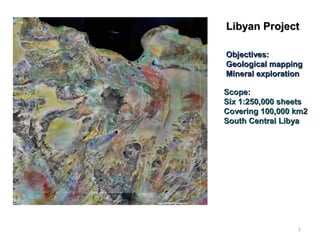
1. Libyan ProjectLibyan Project
Objectives:Objectives:
Geological mappingGeological mapping
Mineral explorationMineral exploration
Scope:Scope:
Six 1:250,000 sheetsSix 1:250,000 sheets
Covering 100,000 km2Covering 100,000 km2
South Central LibyaSouth Central Libya
1
2. The Ben Ghnema granitoid batholitThe Ben Ghnema granitoid batholit
2
3. Boundaries of the
Ben Ghnema batholith
over Landsat image
Granite
•Biotite
•Amphibole – biotite
•Two mica
Leucogranite
Granodiorite - tonalite
Granodiorite
Dolerite
Quartz-syenite
Aplite dykes
White quartz dykes-veins
Pegmatite dykes
Black quartz veins - Silicified
fault zones (auriferous)
Leucogranite dykes
Determined rock types
3
4. The Ben Ghnema batholith granites
outcrop in a system of circular tors
(clusters of boulders) ranging up to 1
km in radius
4
5. Strike of dykes-veins on a:
A.Macro scale (Landsat ETM 7+ reprocessed to emphasis the dykes
and fracture zones) and
B.Micro scale – field photograph.
A B
5
7. Porphyritic biotite granitePorphyritic biotite granite with white and pink feldsparwith white and pink feldspar
All in the same boulderAll in the same boulder
7
11. Ranges of normalized plot of REE in granites,
granodiorites and leucogranites of the
Ben Ghnema batholith.
The Hf - Rb/10 – Ta*3 discrimination diagram for
granitic rocks for the Ben Ghnema batholith. (After
Pearce et al. 1984). (WPG = within plate granites;
VAG = volcanic-arc granites; ORG = ocean-ridge
granites; syn-COLOG = syn-collisional granites).
Some laboratory results - geochemistry
11
13. Some laboratory results - petrology
Biotite granite with amphibole Leucogranite
Granodiorite Black quartz with pyrite and Au
13
14. Auriferous quartz veinsAuriferous quartz veins
•Mainly dark redish brown to black,Mainly dark redish brown to black,
sometimes yellow brownsometimes yellow brown
•Ranging in size from several metersRanging in size from several meters
to 10’s of kilometersto 10’s of kilometers
Details
14
15. Panoramic view of the extension of the dyke from the
previous picture (looking North)
15