2. 2
According to the geological map
of South-West Cameroon the
major part of the Essong licence
is represented with “Roches
paraderivees pro parte: Serie
rubanee” with the following rock
types :
Granulitic gneiss
Leptinite
Enderbites (or alkali charnockite)
Mangerite
Dyke rocks
Banded Iron Formation (BIF –Itabirite)
Six BRGM uranium
occurrences were the
basis for this licence
Of these, only one was
„positive“
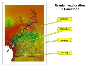
EssongEssong
3. 3
Gamma ray spectromety measurements (K, eU, eTh)
and radon and thorn in soil gas
-10 0 10 20 30 40 50 60 70 80 90
Observed Value
-3
-2
-1
0
1
2
3
4
ExpectedNormalValue
0 7 15 22 30 37 45 52 60 67 74 82
U
0
10
20
30
40
50
60
70
80
90
Noofobs
Geochemical map of eU (ppm)
Probability plot of eUHistogram for eU
Basic conclusions
•High correlation coefficient for eU – K = 0.7
•High spatial correlation between U and K
•Five points with the highest U values (>15 ppm) show
a very high correlation with K (r = 0.9),
•Both an indication of K metasomatism and U vein
type deposit
•All high eU values in regions of charnockite
Geochemical map of K (%)
Geochemical map of Rn in soil (cpm)
Rn vs. eU:
High eU and absence of high Rn is
due to a poor soil coverage and
numerous outcrops in the western
zone.
Scope:
1000 km2
135 gamma-ray spectrometry measurements
45 measurements of Radon and Thoron in soil
gas (large areas represented with swamps)
Essong
4. 4
A part of the equipment used:
•Gamma-ray spectrometers (3)
•Radon- Thoron measurements instruments (2) in
•soil gas
•Radon- Thoron measurements instruments (2) in
•water
•Kappometers for magnetic susceptibility
•Laptops, printers
•GPS
5. 5
Combined geochemical stream sediment survey
Scope:
•Three exploration licenses covering 3000 km2
(two AAR and one Ridgeway Energy)
•ICP-MS for 42 elements
•247 stream sediment samples
Some statistical results
Factor analysis with 9 factors gave the following high loadings per factor
•Factor 1: Base and transition metals
•Factor 2: Mn – Nb – Ti
•Factor 3: U – K – Rb
•Factor 4: Ca – Mg
•Factor 5: Co – Ni
•Factor 6: Ag – Cd
•Factor 7: Ce – La
•Factor 8: Cr
•Factor 9: W
Basic conclusions:
•The association of metals per factor comply well with known geochemical
associations
•The factor score maps show a high spatial correlation with the geology
•High Factor 3 scores are located in or in the vicinity of charnockite in the Eastern part
of the licenses
•A general trend of values from the west to the east also indicate that not all
charnockite is uranium bearing
15. 15
Basic Geology
Major rock units
•Granite
•Granodiorite and diorite
•Gneiss
•Gabbro
•Schist
Minor rock units
•Conglomerates
•Andesite
•Rhyolite
•Syenite
•Amphibolite
•Quartz
Two uranium occurrences
registered by BRGM (both
proved to be negative)
Aprox. 20 km NW of the
Kitongo uranium deposit
500 km2
BantandjeBantandje
16. 16
Gamma ray spectromety measurements (K, eU, eTh)
and radon and thorn in soil gas
No. of measured points with
gamma-ray spectrometry (TC, K,
eU and eTh)
159
No. of measured points for radon
and thoron in soil gas
91
No. of magnetic susceptibility
measurements
87
eU map
eTh mapRn in soil gas
Scope
17. 17
Basic statistics
Correlation matrix
TC K(%) eU(ppm) eTh(ppm) SI
TC 1 0.37 0.68 0.65 0.05
K(%) 0.37 1 0.49 0.38 0.14
eU(ppm) 0.68 0.49 1 0.91 0.08
eTh(ppm) 0.65 0.38 0.91 1 0.06
SI 0.05 0.14 0.08 0.06 1
N Mean Minimum Maximum Std.Dev.
TC (cps) 154 788.97 140 11058 1181.38
K(%) 154 2.91 0 7.2 1.72
eU(ppm) 154 4.44 0 44.5 6.19
eTh(ppm) 154 25.29 1 352.7 50.35
SI 87 6.26 0.04 105 15.75
-5 0 5 10 15 20 25 30 35 40 45 50
U (ppm)
-50
0
50
100
150
200
250
300
350
400
Th(ppm)
-5 0 5 10 15 20 25 30 35 40 45 50
U (ppm)
0
20
40
60
80
100
120
Noofobs
Some statistical data
Scatter plot eU - eTh
Histogram eU(ppm)
Conclusions:
High eTh, low eU
High correlation between eU and eTh
Favorability: low
18. 18
The concentration of high/anomalous
values in or near the zones of the faults is
evident.
Spatial correlationSpatial correlation
eU
Radon Thoron
SRTM