

Recommandé
Contenu connexe
Tendances
Tendances (20)
Similaire à Physical Geography Photo Journal
Similaire à Physical Geography Photo Journal (13)
Dernier
Dernier (20)
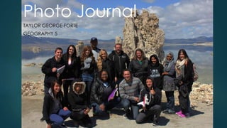
Physical Geography Photo Journal
- 3. Mormon Rocks
- 4. Mormon Rocks Formation Mormon Rocks was created when the North American and Pacific Plates collided along the San Andreas Fault Line.
- 5. Granular Structure Mormon Rocks is composed of sedimentary rock specifically Sandstone. How it looks today is due to the weather. As natural weathering occurs the rock expands and contracts creating holes.
- 6. Stream Bed and San Andreas Rift Mormon Rocks happens to lay in the San Andreas Rift Zone and its stream bed is actually San Andreas’s tilted fault bed.
- 7. Cinder Hill
- 8. Cinder Cone The cinder cone at Cinder hill is in series of volcanoes in the Sierra Nevada's. After an eruption a layer of cinder surrounds the pad of lava that is left of the volcano creating the cinder cones. This gives it its conical shape. The last eruption of the cinder cones was 500 years ago.
- 9. Lava Flows When a volcano erupts, lava spews out of it and covers rocks and the land already there. This creates piles of volcanic rock called lava flows. They are mostly comprised of Basalt.
- 10. Fossils Falls
- 11. Stream Bed This was the stream bed for the Owens River which led to the Owens Falls.
- 12. Fossil Falls When the Owens River and falls dried- up volcanic rock shaped by the water remain this is now known as Fossil Falls
- 13. Metate Holes Metate holes are small pools in the rock that fill up with water organisms such as brine shrimp and tadpoles often grow in these holes.
- 14. Obsidian Flakes Obsidian was created when a volcano erupted and the lava came in contact with the water in the Owens River. This created the volcanic glass obsidian. The Shoshone used the obsidian to create arrowheads to hunt with. Flakes were left behind when the arrowheads were carved
- 15. Petroglyph The petroglyphs were Shoshone drawings on rocks. This one depicts bighorn sheep and a Shaman. Perhaps this drawing is depicting a religious ceremony. We cannot be certain.
- 16. House Rings The house rings were used a foundation for Shoshone teepees. Small and medium sized rocks were used to be easily moved for temporary shelter.
- 17. Field Trip Two
- 18. Diaz Lake
- 19. Diaz Lake When a earthquake struck in 1872 along the Lone Pine Fault, the land sunk down and filled with water. This created what is now known as Diaz Lake, located between the Sierra Nevada and Inyo/White Mountains.
- 20. Lone Pine Fault This is the Lone Pine Fault, located at the base of the Alabama Hills, just behind Diaz Lake. The fault created the lake in an earthquake in 1872.
- 21. Alluvial Fan Alluvial fan on the Inyo/White Mountains photographed from the shore of the Diaz Lake
- 22. Mt. Whitney Interagency Visitors Center
- 23. Mt. Whitney The elevation of Mount Whitney is 14,505 feet. This is the highest peak in the Sierra Nevada mountain range. In the front are the Alabama Hills. Mt. Whitney Alabama Hills
- 24. Inyo-White Mountains The Inyo/Whites have "V" shaped valleys from just rainfall. The stripes formed from the layers of Sedimentary rock.
- 25. Orographic Effect We noticed on that day that the Sierras had snow on them and the Inyo/Whites did not. This was attributed to orographic effect. Clouds were able to lift over the Sierras and bring snow as they gained altitude but the clouds dissipated before reaching the Inyo/Whites.
- 27. Hot Stream Water trickles from the Sierra Nevada Mountains into crack into the earthquake fault. The water goes down low enough to be heated up by the earth’s core, then bubbles back up farther down the mountain.
- 29. Bark Beetle Destruction Some of the trees in the area have had to be cut down due to the destruction of the bark beetle. The beetle eats twisty trails into the bark weekending and eventually killing the trees.
- 30. Mono Lake
- 31. Lake and Islands Mono Lake has two islands in it; the largest being Paoha and the smallest being Negit. Paoha Island is actually about a volcano and the island has only existed for 350 years. Negit Island has existed for 2000 years and is made of volcanic minerals. Negit Island Paoha Island
- 32. Former Shorelines There are three types of shorelines at Mono Lake ancient, pre-diversion, and modern. The ancient shoreline was at 6427 feet above sea level. The shoreline before the Los Angeles stay version in 1941 was 4,300,000 acre-feet at 6417 feet above sea level. The shoreline is marked by wooden walkway that can be taken up when this will wake returns to that level. The modern shoreline is 2.6 acre-feet at 6380 feet above sea level the historical was in 1982 with 2,100,000 acre-feet at 6372 feet above sea level.
- 33. Tufa Tufas are made from calcium carbonate and limestone. They are created underwater with the springs and grow in both groves and towers.
- 34. June Lake Loop
- 35. Grant Lake and Moraines Grant Lake is an reservoir that eventually feeds into the Los Angeles Aqueduct. On two sides of the lake are moraines left from the glaciated valley behind the lake. Moraine
- 36. Silver Lake and Waterfall Sliver Lake is located within the June Lake Scenic Loop. This is a waterfall that feeds into the lake but on this day, the waterfall was frozen over. Waterfall
- 37. Erratic Boulder This perched boulder, or glacial erratic, is located next to the fire station in June Lake Loop. It was carried and deposited here by glacial action.
- 38. Bloody Canyon is a glaciated Valley with moraine sitting in front of it. The glacier carves a valley into the mountain and the debris pushed in front of it is the moraine. Bloody Canyon Glaciated Valley Moraine
- 39. Convict Lake
- 40. The Lake Convict Lake is one of the one within the scenic June Lake Loop. This lake features Paleozoic Metamorphic rock, the oldest rocks in the Sierra Nevada Mountains. Paleozic Metamorphic Rocks
- 42. Internment Camp Model I found this model perched on a book shelf at the Eastern Califronia Museum. It a basic model of an Japanese Internment Camp between 1942 and 1945. It gives you an idea of how a camp would have physically looked like. The signs shows the different internment camps and how many people they housed across the country.
- 44. Manzanar
- 45. Guard Shack Manzanar was a Japanese internment camp during World War II. The land was owned by George Chaffey. This was the largest internment camp in the country and held over 110,000 Japanese- Americans from 1942 until 1945.
- 46. AreaOne of the foundations that is still standing is the stone center of the camp. Along it ran the main road of the camp with the rest of the buildings surrounding area
- 47. In-Transit
- 48. Cucamonga Alluvial Fan Alluvial Fan This Alluvial Fan is located in Rancho Cucamonga, just off the 15 Freeway.
- 49. Solar Power Plant This solar power plant is located near Kramer Junction, off the 395 Highway. This and two other plants are owned by Kramer Junction Company.
- 50. Doppler Radar Tower This and several other Doppler Radar Towers in this area are used to collect data in the atmosphere to make weather predictions.
- 51. Mine Tailings Mine tailings like this are remnants of mining that went on in this area in search of gold and other valuable resources.
- 52. Joshua Tree, Creosote, and Burroweed Grass Joshua Tree Creosote Burroweed Grass
- 54. Owens Dry Lake The Owens Lake was once the biggest lake in the Owens River Valley. In the early 1900’s, the city of Los Angeles started exporting water from the lake into the city by means of the Los Angeles Aqueduct. They ran the lake dry from taking all of it’s water. The soda ash salts on the surface of the now dry lake is used various things.