

Recommandé
Contenu connexe
Tendances
Tendances (20)
Similaire à Flood Report
Similaire à Flood Report (20)
Plus de Vj NiroSh
Plus de Vj NiroSh (20)
Dernier
Dernier (20)
Flood Report
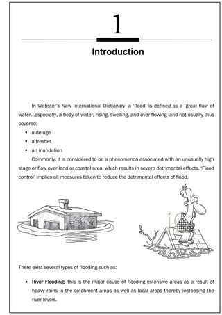
- 1. In Webster’s New International Dictionary, a ‘flood’ is defined as a ‘great flow of water…especially, a body of water, rising, swelling, and over-flowing land not usually thus covered; a deluge a freshet an inundation Commonly, it is considered to be a phenomenon associated with an unusually high stage or flow over land or coastal area, which results in severe detrimental effects. ‘Flood control’ implies all measures taken to reduce the detrimental effects of flood. There exist several types of flooding such as: River Flooding: This is the major cause of flooding extensive areas as a result of heavy rains in the catchment areas as well as local areas thereby increasing the river levels. Introduction
- 2. Flash Floods: This results due to heavy rains in hilly areas which cause local rivers and small streams to rise to dangerous level within a short period of time say 6 to 12 hours. Heavy and continuous rains in local areas can cause flash floods. Urban Flooding: Local heavy rains up to 100 mm or more in a day over the city and larger towns can cause damaging and disruptive flooding due to poor or chocked drainage and rapid runoff. Strom Surge or Tidal Flooding: This results mostly due to tropical disturbances, developing to cyclones and crossing surrounding coastlines. Cyclone induced storm surges have devastating consequences in coastal areas and such surge induced floods may extend many kilometers inland.
- 3. Floods Arising due to Failure of Dam: A large number of large and small dams are constructed to store water for various purposes. Due to poor maintenance and due to exceptionally high precipitation a severe flood may result causing failure of the dam. This causes a surging water front travelling with high velocity causing destruction of properties and loss of life. Floods result from a number of causes as mentioned above. However, one due to heavy and prolonged rainfall is the most frequent one. For systematic studies it is necessary to classify such flood events as Flash floods Single event floods Multiple event floods Seasonal floods
- 4. - Flash floods have sharp peak, the rise and fall are almost equal and rapid. - Single event floods have a single main peak and have more duration than flash floods. - Multiple event flood are caused by more severe complex weather situations where successive flood peaks follow closely. - The floods occurring during rainy season are known as seasonal floods. Excessive snow melt also results in frequent flooding in many countries. Floods not directly connected to rainfall may result due to failure of dam causing thereby sudden escape of huge volume of water stored in the reservoir. When a dam fails it causes severe flooding of the downstream areas resulting in heavy damages and loss of lives. Floods may also result due to landslides, which may temporarily block the water passage and later on gives away as a result of built up pressure etc. The landslides may trigger of due to tectonic movement of earthen surface or instability of soil mass. In nature, the problems associated with floods are diverse and extremely complicated. Floods inundate built-in property, endanger lives, and prolonged high flood stages delay rail and highway traffic. Further, it interferes with efficient drainage and economic use of lands for agricultural or industrial purposes. Due to high rate of flow or runoff from the catchment areas of the streams, there occurs large-scale erosion of lands and consequently to sediment deposition problems downstream. Floods also cause damages to drainage channels, bridge abutments, sewer outfalls and other structures. It further interferes with navigation as well as hydroelectric power generation. In short, floods cause severe strain and hardship to the civilized life of a community. Apart from loss of human lives, economic losses associated with the above combined effects.
- 5. The causes of flooding in all the major river systems, therefore, are more or less the same. They are: (a) Spilling over the banks, resulting in flooding other areas (b) Bank erosion (c) Rising of river beds caused by deposition of silt (d) Changing of the river course from time to time Generally speaking, a quantitative estimate of the losses is rather difficult to provide since the intangible component of the flood losses is a dominating factor. On an average several core people are affected annually and a few hundred lives are lost. Besides, there occur huge losses from the death of domestic animals. Overall several hundred cores worth of property is lost which does not take into account the losses and privations arising out of break-down of communications, disruption of essential services, environmental deterioration, etc. Causes of Flooding and Economic Losses SNOW MELT DAM COLLAPSE
- 6. The expected annual damages are normally computed in probabilistic terms. The procedure followed includes routing of the reaches from the dam site to the downstream control point where the computed discharge is converted to respective elevations using rating curve made at the control point cross section. The inundated areas corresponding to the computed elevation are marked on the map. Nowadays this can be done with the help of data collected through remote sensing and GIS technology. An exhaustive survey is made in the delineated areas for the census of inhabitants, livestock, valuable properties including valuable agricultural lands and the important structures such as bridges, culverts etc. An assessment on the likely damages is made for several flood events and elevation vs annual flood damage curve is plotted. Using long-term historical annual flood series a frequency analysis is carried out and probabilities are assigned to the above flood events observed at the control point. Then a plot between elevation and probability of exceedence is prepared. It is then converted to the plot between probability of exceedence and annual flood damages and non-dimensionalised using the potential damage. T-SUNAMI MONSOON RAIN
- 7. The probabilistic damage curve thus prepared is then used for making financial compensation decision by appropriate authorities. Despite flood hazards mankind has always shown preference to settle near the reaches due to assured supply of water, facility of navigation and fertility of river valleys. A considerable portion of world population lives in areas adjacent to rivers and often becomes victim of misery due to devastating nature of floods. Floods are always a part of mankind’s life throughout the history and extensive literature exists giving accounts of man’s struggle to cope with this natural phenomena. GLOBAL WARMING DEFORESTATION
- 9. Flood management measures can be classified as short-term measures long-term measures The nature and extent of flood damages as well as local conditions determine the measures to be taken up. However, short-term measures are dependent for their effectiveness on long-term measures. Short-term measures These measures are adopted for giving quick results when immediate relief to some pockets or locations is felt necessary and they are respectively: Construction of embankments along the low level banks that are subject to frequent flood spells. Construction of raised platforms for temporary shelter during flood. Dewatering by pumps of flooded pockets, towns when gravity discharge of floodwater is not possible. Construction of floodwalls near congested areas of cities, towns and industrial belts. Flood Management Measures
- 10. Long-term measures Construction of storage reservoirs to moderate the flow peak thereby ensuring regulation of flood downstream. Integrated watershed management in the hilly area catchment, which ensures reduction in surface runoff, erosion and increase of infiltration capacity thereby reducing the impact of flood. Flood forecasts and warning based on hydro-geomorphological studies which can be given with some lead period, thereby ensuring minimization of property loss and loss of human life by shifting them to safer places.
- 11. To reduce losses due to flood the strategies to be followed can be stated as follows: 1) Modify flooding by structural means: Herein the strategies to be followed involves construction of dams, dikes, levees, channel alterations, high flow diversions and land treatment. The main idea is to keep water away from the potential damage areas. 2) Flood forecasting: This is a non-structural measure: Here forecast of flooding is provided at the potential damage points. The population both human as well as livestock and the movable properties are shifted to a safer place if there is a chance of flood damage. Herein the objective is to keep people away from inundated areas. Flood Control Strategies
- 12. 3) Modify susceptibility to flood damage: Regulations are framed to avoid undesirable or unwise rise of flood plains. Necessary steps are taken to modify the impact of flooding through individual or group action designed for assisting people in the preparatory, survival and recovery phase of floods which are namely through education and information on floods, flood insurance, taxation relief, etc. Structural measures The structural measures are aimed to mitigate flood damage by regulating the movement of flood water and these include: Dams, reservoirs and high flow diversions, their purpose is to store flood water temporarily or to divert it from the area to be protected. Channel improvement works to increase the carrying capacity of a river channel and to pass the flood water quickly through the channel reach. Embankments, levees and flood walls to stop the flood water from entering the areas to be protected. Catchment treatments to induce holding of water in the catchment temporarily. Non-structural measures The main idea is to keep the general civil and industrial activities undiminished during flood which can be ensured by flood forecasting warning systems, flood regulation through zoning, emergency plans, modifying building codes, flood proofing, disaster preparedness and assistance.
- 13. Automatic rain gauge stations provide reliable picture of the rainfall events in the basin. Radar data provide details with regard to movement and dynamic characteristics of storms on a large scale. A useful input to the forecast is the meteorological satellite data. Real time forecasts are issued nowadays in many countries including India for important rivers. The data requirements for forecast are for flood arising out of rainfall— rainfall details, catchment details, river geometry, discharge, water, level.
- 14. It would thus be apparent that flood control is and will continue to remain one of the major requirements of a comprehensive water resources development project. Voluminous and extensive literature is available on different methods of flood control. These can be divided mainly under the following categories: a) Detention and storage or use of existing lakes or construction of a number of tanks in the catchments for the purpose of flood moderation. b) Or ring bunds around important towns, properties and estates to prevent flooding. c) (i) Enlargement of existing channels or rivers: Training of rivers to provide local protection at critical points from erosion, scour or flooding by spurs, revetment, dykes, etc. to form artificial cuts to lower the flood level and improve the river regime, widen and deepen the river bed artificially by dredging or by other training measures such as bandalling; groynes, etc. Alleviation of Flooding
- 15. (ii) Construction of by-pass channels on rivers: Natural or artificial flood diversion through subsidiary channels of the parent river or in another river system, to selected depressions, lakes, etc. with the aim of relieving intensity of floods in the main rivers. Flood water can also be diverted by constructing overflow weirs in the flood embankment at a predetermined flow stage. d) By flood plain zoning which is purely an administrative measure. e) By provision of spreading grounds. f) By providing suitable drainage arrangement by installing pumping facilities which comes under drainage engineering. g) Soil conservation measures in the catchments by various known methods. h) Preparation of detailed action plans for mobilisation of the local resources for supervision of embankments during flood, flood relief works and other emergency measures. Further plan for collection of materials such as earth bags, stones, brushwood mattresses to reinforce or add to the protection works including mobilisation of local people for execution of such works. i) Flood forecasting and warning system to keep alert all concerned people in advance and to take timely action for evacuation in case of impending danger.
- 16. The above methods can be used either singly or in combination. This, however, requires knowledge of the capabilities, limitations and relative advantage of such measure singly or in combination. Associated with this is an economic study to determine the potential damages averted by the projected works and whether the benefits justify the cost. Finally this chapter ends by providing the reader the various methods of flood management in a nutshell as proposed by the National Commission on Floods, 1980 in Fig.
- 17. Estimation of design flood is one of the important components of planning, design and operation of water resources projects. Information on flood magnitudes and their frequencies is needed for design of hydraulic structures such as dams, spillways, road and railway bridges, culverts, urban drainage systems, flood plain zoning, and economic evaluation of flood protection projects. According to Pilgrim et al, the estimation of peak flows on small and medium sized plains is generally the common application as they are required for the design of conservation works, etc. Although many different methods are available for estimating floods, the three widely used ones are rational method, US Soil Conservation Service Curve Number method and regional flood frequency methods. Hydrologic design is important for the safety, economy and proper functioning of the hydraulic structure. The purpose of hydrologic design is to estimate the maximum average or minimum flood, which the structure is expected to handle. This estimate has to be made quite accurately in order that the project functions properly. To quote an example, consider the estimation of the spillway design flood. This is a very important preliminary study required to be carried out before the actual design of a dam or detention reservoir is taken in hand. Its importance is heightened by the fact that in any such project there should be a balance between economy and efficiency. Collectively the reservoir and the spillway should be able to accommodate the critical or the worst possible flood conditions (within a specified period depending on the structure) Estimation of Design Flood
- 18. in the catchment—partly by storage in the reservoir resulting in rise of the reservoir level and partly, by spillage through the spillway. At the same time the flood waters released through the spillway should not create flooding down below in the lower reach. Thus, on the whole, a balance is to be worked out between the economy, efficiency in regard to flood moderation and safety, the reservoir capacity and the required spillway capacity. Hence, for designing the spillway, a knowledge is necessary about the maximum intensity of the critical flood, or the ‘design’ flood as it is called, as well as the duration and volume of this flood. The generally adopted methods of flood estimation are based on two types of approaches viz., deterministic and statistical. The deterministic approach is based on the hydro meteorological techniques which requires design storm and the unit hydrograph for catchment. The statistical method is based on the flood frequency analysis using the observed annual maximum peak flood data. Another alternative of estimating the frequency based floods is to carryout frequency of rainfall data and convolute the excess rainfall of the derived frequency with the unit hydrograph or some rainfall run-off model appropriate for the basin. METHODS OF DESIGN FLOOD COMPUTATIONS There are various methods by which the estimate of design flood can be made. Some of them are purely empirical and some are based on statistical analysis of the previous records, apart from the rational methods based on unit hydrograph principle. These are: (i) Observation of the highest flood level or maximum historical flood (ii) Empirical formulae (iii) Enveloping curves (iv) Flood frequency studies (v) Derivation of design flood from storm studies, and (a) Application of unit hydrograph principle, or (b) By application of instantaneous unit hydrograph principle.
- 19. Derivation from Storm Studies and Application of Unit Hydrograph Principle The steps involved in these methods are briefly as follows: 1) Analysis of rainfall versus runoff data for derivation of loss rates under critical conditions. 2) Derivation of unit hydrograph by analysis (or by synthesis, in case data are not available). 3) Derivation of the design storm, and 4) Derivation of design flood flow from the design storm by the application of the rainfall excess increments to the unit hydrograph. Rainfall analysis -- Mass rainfall curves One of the most convenient methods of estimating the intensity and sequence of actual rainfall during past storms at various rain gauge stations in drainage basin is the preparation of ‘mass rainfall curves’. A mass rainfall curve is a plot of accumulated total rainfall up to known time intervals against these time intervals (Fig. 6.1). For stations fitted with recording rain gauges, which automatically maintain a record of rainfall against time, a mass rainfall curve is directly obtained. At ordinary rain gauge stations the rain gauge is not observed continuously but only at certain fixed times each day. Hence, only the total rainfall between two successive observations is known and the variation in its intensity during this period cannot be directly ascertained. However, if there are a number of recording rain gauges dispersed over the area, the mass rainfall curves for non-recording gauges can be interpolated on the basis of the mass rainfall curves of the surrounding recording gauges after making allowance, as far as possible, for factors which might cause the rainfall pattern at such non-recording stations to be different from the neighboring recording stations.
- 20. Having obtained directly and by interpolation, the mass rainfall curves of all the rain gauge stations available in the drainage basin, the next step is to determine the influence area of each, that is to say the area over which the mass rainfall curve obtained at a particular station may be considered to be applicable. A very good method of doing so is to divide up the area into what are known as Thiessen polygons (Fig. 6.2). These are obtained by joining rain gauge stations by straight lines and drawing their perpendicular bisectors, thus dividing the area into a number of polygons. Each such polygon represents the influence area of the station which is located within that polygon. For more accurate analysis it would be necessary to prepare an ‘isohyetal’ map of the area for the storm under investigation (an ‘isohyetal’ is a line joining all the points of equal rainfall over the area) (Fig. 6.3). From the isohyetal map, the weighted average rainfall within each Thiessen polygon can be determined, and this would be a more accurate figure for average rainfall within the polygon area than the rainfall figure at the rain gauge station of the polygon. This refinement, however, is usually not done since the error involved is small in relation to the general accuracy of the assumptions. Figure 6.1
- 22. Figure Derivation of unit hydrograph The theory of the unit hydrograph is based on three fundamental assumptions, viz., that for a particular catchment, (i) the duration of surface runoff from a single interval storm is essentially constant whatever the amount of runoff, (ii) the surface runoff hydrographs resulting from different single-interval storms are proportional to each other, i.e. the distribution of surface runoff is the same for all such storms, and (iii) that the resultant hydrograph from a composite multiple-period storm is obtained by superimposition of the component hydrographs obtained from the precipitations at different intervals. Unit hydrographs can be derived from hydrographs produced either by isolated uniform intensity storms (which seldom occur) or by complex storms. The hydrograph resulting from a known intense storm of some small unit duration is chosen and the groundwater contribution along with the base flow is separated to obtain the total volume of the storm runoff. Groundwater flow is obtained by extension of the groundwater depletion curve beyond A, i.e. the time of beginning of storm runoff. This is shown in Fig. 6.4 which represents the estimate of groundwater discharge as it would have continued, had no rain occurred.
- 23. GENERAL The process of computing the reservoir stage, storage volumes and outflow rates corresponding to a particular hydrograph of inflow is commonly referred to as flood routing. Flood routing studies are required in the design of spillways of reservoirs. The spillway capacity is fixed, taking into consideration the moderation caused by the flood absorption capacity of the reservoir, which is the capacity between the full reservoir and high flood level. The spillway is thus designed for discharging a flood peak at less than the peak of the incoming flood. Looking at it, from another angle, flood routing studies may be used to find out the high flood level, for a given spillway for a design flood. Maximum reservoir elevations, obtained by routing a particular hydrograph through a reservoir reflects the integrated effect of (i) initial reservoir level (ii) rate and volume of inflow into the reservoir (iii) rate of outflow (iv) discharge of regulating outlets, power penstock, and (v) Surcharge storage and rate of overflow. Flood Routing through Reservoirs and Channels
- 24. In flood control reservoirs, flood routing studies are used to arrive at the most economical combination of storage and outflow capacity such that for the design flood, the outflow from the reservoir does not exceed the safe bankful capacity of the downstream channel. In a flood forecasting system flood routing studies are used to compute the probable flood levels with respect to time at downstream points, corresponding to a flood wave entering the valley at an upstream point. BASIC PRINCIPLES OF ROUTING The accumulation of storage in a reservoir or valley depends on the difference between the rates of inflow and outflow, if losses, by seepage and evaporations and direct accretion to storage by precipitation are ignored. If I is the rate of inflow and O, the corresponding rate of outflow at any instant and if ‘dS’ is the storage accumulation in a small-time interval ‘dt’ then dS = (I dt – O dt). The various methods of flood routing essentially aim at a solution of the above one-dimensional mass continuity equation. The usual problem is one of finding the outflow hydrograph corresponding to a given inflow hydrograph. Some of the various methods of flood routing through reservoir
- 25. FUNCTIONS OF SPILLWAYS Spillways are invariably provided in storage dams for safe disposal of the excess water flowing into the reservoir after it has filled up. Spillways may have simple overflow crests or may have controlled crests with gates. The controlled crests permit controlled release of surplus water in excess of the reservoir capacity and convey the same into the river channel below the dam or to any other drainage area in such a manner that the foundations are protected from erosion and scour. Overflow on the dam at floods cannot be allowed unless the downstream face is designed for passing the floods with requisite depth and the bed well protected to take the impact of falling waters. Many failures of dams have been attributed to inadequate spillways capacity with consequent overtopping of bund. In case of earthen dams if the water overtops there is no possibility of saving the dam from failure. Adequate spillway is a very important factor in the design of earthen dams. Thus the object of the spillway design should be to provide a safe and adequate spillway structure at most economical cost, without impairing the safety of the dam. Dam failure due to inadequate spillway capacity may result in heavy loss of life and property. In the hydraulic design of a spillway the following procedure is generally followed: (i) First, hydrological analysis to determine the magnitude of design flood (ii)Thereafter detailed hydraulic analysis. Design of Spillways
- 26. SPILLWAY CLASSIFICATION Spillways may be classified as Controlled crest spillways Uncontrolled crest spillways. In the former case the operations of spillways are controlled by the operation of gates. The uncontrolled or automatic spillway come into action immediately after the water level reaches the crest of the spillway. Typical examples of this type are the ordinary simple weirs provided on small dams or the overflow dams, the siphon spillways and the shaft spillways. By having controlled crest for the spillway the flood lift can be reduced. The gates can be lifted at the onset of floods so that the reservoir is kept low and the flood passed on. As the flood subsides the gates can be lowered and the storage effected.
- 27. TYPES OF SPILLWAYS Nearly all spillways fall into one of six types or are made of combinations of these types. These are: 1) Overfall (free or gated) 2) Side channel 3) Chute or trough 4) Shaft or morning glory 5) Siphon 6) Emergency The over fall type is the most common and is adopted in masonry dams having sufficient crest length to provide the requisite capacity. Over fall spillways with crest gates will act as orifices under partial control of gates and as open crest weirs when full gate openings are made. Chute spillways are commonly adopted for earth dams, whereas the side channel and shaft spillways are most suitable in narrow canyons. The siphon spillways are usually used to provide approximately constant headwater flow under varying flow. Emergency spillway is an auxiliary spillway provided to take care of the possibility of having a flood greater than the spillway design flood.
- 31. Measures of flood control essentially consist of storing water in reservoirs and regulating the flow so that the channel downstream can safely accommodate and carry it. Of all the methods, use of natural reservoirs for detention of flood is most economical. By providing control works for the regulation of outflow and increase of capacities by construction of embankments along those which increases the depth of storage the utility of such reservoirs is greatly increased. Planning of reservoirs is closely related to their operation and both problems should be critically considered. No definite rules can be laid dawn for planning the size of multipurpose reservoirs as much depends on circumstances. However, normally it is possible to reduce the reservoir storage requirements for improved operative technique and more reliable prediction of runoff. The main purposes of the reservoirs are for the following: (i) Flood control (ii) Conservation The aim of flood control storage is to hold over some of the flood water of a river when the discharge rate reaches a stage likely to cause damage to the valley downstream and to release the flood water gradually at a safe rate when the flood recedes. Conservation storage is meant to store the surplus water brought down by a river during Flood Mitigation through Planning of Reservoir Capacities and Operation of Reservoirs
- 32. periods when the natural flow exceeds current demand, and to use this stored water during periods when demand exceeds the natural flow. Conservation may be done for any one or more of the following purposes: (i) irrigation, (ii) hydropower (iii) regulation of low water flow for navigation (iv) public and industrial water supply (v) Recreation, pisciculture, etc. The reservoir may be a single-purpose conservation reservoir or a single-purpose flood control reservoir or a multipurpose reservoir. Multipurpose reservoirs are designed for two or more purposes. The common type of such reservoirs usually have three main objectives to serve i.e. irrigation, power generation and flood control. The purpose of live storage in a reservoir is to guarantee a certain quantity of water usually called safe (confirm) yield with a predetermined reliability. Though sediment is distributed to some extent in the space for live storage, the capacity of live storage is generally taken as the useful storage between the full reservoir level and the minimum drawdown level in the case of power projects, and dead storage in the case of irrigation projects. Flood storage depends on the height at which the maximum water level (MWL), is fixed above the normal conservation level (NCL). The determination of the MWL involves the routing of the design flood through the reservoir and spillway. When the spillway capacity provided is low the flood storage required for moderating a particular flood will be large and vice versa. A higher MWL means greater submergence and hence this aspect has also to be kept in view while fixing the MWL and the flood storage capacity of the reservoir. Apart from above by providing additional storage volume in the reservoir for sediment accumulation over and above the live storage it is ensured that the live storage although it contains sediment will function at full efficiency for an assigned number of years. This volume of storage is referred to as dead storage and is equivalent to the volume of sediment expected to be deposited in the reservoir during the designed life of the structures.
- 33. GENERAL DESIGN FACTORS A. For fixing-up the live storage capacity of a reservoir the following data are needed: (i) Stream flow data for a sufficiently long period at the site. (ii) Evaporation losses from the water spread area of the reservoir and seepage losses and also the recharge into the reservoir when the reservoir is depleting. (iii) The contemplated irrigation, power or water supply demand. (iv) The storage capacity curve at the site. B. For the determination of flood storage capacity at the MWL of the storage the information needed is: (i) Design flood or the inflow hydrograph (ii) The routing of the design flood through the reservoir and the spillway. C. For fixing up the dead storage volume, it is necessary to obtain the sediment yield into a reservoir and for this purpose the information needed are: (i) Result of sediment load measurements of the stream (ii) Sedimentation surveys of the reservoir with similar characteristics.
- 34. Environmental effects of dams and reservoirs Construction of dams and reservoirs will cause a number of environmental effects to mitigate which appropriate action plans are required. The main effects are briefly mentioned or outlined herein. (i) Land losses : Large tracts of agricultural lands, forests or other wild lands are likely to be inundated which can be minimized by careful site selection. It is necessary to consider the value of timber and other mineral resources to be lost and the nonavailabilty of inundated land for agricultural or other purpose in the economic analysis. (ii) Plant and animal life : It is necessary to carryout biotic survey, in order to prevent or minimize plant and animal life extinction by careful site selection. Loss of wild life may be mitigated by creation of a wild life management area elsewhere in the country equivalent to the inundated tract. Animal rescue, replenishment and relocation can be useful. Provision of crossing facilities over canal and others are generally essential. (iii) Fish and other aquatic life : Fish migration will be effected even with the provision of fish passaging facilities. Spawning areas, aquaculture improved fishing methods and marketing may require special attention due to construction of reservoirs. A reduced supply of nutrients downstream and to estuaries may impair fishery productivity. Inter basin transfers may threaten aquatic species by introducing new predators or competitors. (iv) Health problems : Some water related diseases e.g., schistomiasis, malaria, Japanese encephalitis may increase unless precautions or mitigatory measures are undertaken. Vector control, environmental modifications and education of residents may be necessary and it should be incorporated into the project. Proliferation of water hyacinth and water lettuce will impair water quality and increase disease vectors and loss of water through evapotranspiration. The clogging of water surface as a result of weeds will hamper navigation, recreation, fisheries and irrigation. The use of weeds for composting, biogas or fodder needs to be investigated.
- 35. (v) Suitability of water quality for drinking, irrigation, fisheries and other uses both within the reservoirs and downstream need to be addressed. The various issues are: salinity intrusions, water retention time, loss of flushing, increased level of nutrients in the reservoir, pollution due to agricultural leachates, pathogens, industrial effluents etc, raising or contamination of water table and salinization. Inundated vegetation on the bottom of reservoirs decomposes, thereby consuming large volume of oxygen. If thermal stratification occurs, mixing of surface and bottom water is hampered, bottom water then becoming anaerobic. Anaerobic decomposition of organic materials produces noxious gases toxic to aquatic life and harmful to machinery. When such waters are discharged downstream by the dam, fishes may be killed. Multiple level outlets in the dam can prevent discharge of anaerobic water. Conversion of forests to timber before reservoir filling reduces the projects contribution to greenhouse gases. (vi) Erosion : Upstream erosion in the catchment area leads to sedimentation or land slips which may impair storage, so catchment area management be encouraged, increased erosivity of the water on the river bed and structures below the dam including deltaic and coastal changes need to be considered during project preparation.
- 36. (vii) Downstream hydrology : Changes in downstream hydrology can hamper ecosystems dependent on seasonal flooding, including areas important for fisheries, flood plains, lagoons, marshes and mangroves or traditional flood recession agriculture. Hydroelectric and other developments should be concentrated on the same rivers if hydrological risks and other circumstances permit in order to preserve a representative sample of the river in the natural state and it should be considered as a part of the trade of. (viii) Multiple use and other considerations : Multiple use be addressed keeping in view tourism, irrigation, fisheries, bird and other biotic sanctuaries and recreation. Water flow regulation can convert seasonal rivers into perennial waterways, reduce flooding and improve drinking and irrigation. Other aspects that need to be examined are, involuntary settlements, tribal people, riparian rights, cultural property and safety of dams.
- 37. RESERVOIR OPERATION FROM PRACTICAL CONSIDERATIONS In the earlier part of this chapter, the various methods available for determining the overall capacity of the reservoirs are outlined. In actual practice, however, the relationship between supply and demand is complicated and this is taken care of by operation of the reservoir. Fundamentals of reservoir operation has been dealt with before. Additional aspects of reservoir operation is being dealt now. The operation of the reservoir can be done: (i) Based on annual storage capacity to the annual runoff, (ii) Through regulation of reservoir, and (iii) Through spillway gate operation schedules. Apart from that sometimes the reservoirs are operated to ensure maximum or minimum flow. Based on Annual Storage Capacity to the Annual Runoff For the operation of the reservoirs from the consideration of annual storage capacity to the volume of annual runoff, reservoirs have been classified into two groups, i.e. within the year, and carryover or over-the-year reservoirs. Within the year reservoirs are so designed that in normal circumstances they completely fill up and even spill during the flood season and are almost completely depleted in the low-flow season. Here the storage accumulation and storage depletion period can be defined rather accurately (Fig below). As for example, in India, July to September would be the season where storage would increase and the storage would almost always decrease from November to May. For such reservoirs it would be sufficient to divide the year in 2 parts, i.e. June to September and October to May. If, however, the flows are not so markedly cyclic or the water requirements during high-flow season are so substantial that the possibility of storage depletion during the period cannot be ignored, working tables in tabular form should be prepared on monthly basis
- 38. Based on Regulation of Reservoirs From the consideration of regulation of reservoirs this can be classified into the following: (i) Single-purpose reservoirs developed to serve a purpose, say flood control or any other use, such as irrigation, power, navigation, water supply, etc. (ii) Multipurpose reservoirs to serve for a combination of uses with and without provision of flood control space. (iii) A system of reservoirs in series on the main stream or tributaries consisting of a number of single or multipurpose units developed and operated for optimal utilization of the resources of the basin. Single-purpose reservoirs for flood control The operation of flood control reservoirs are mainly governed by the available flood storage capacity, type of outlets, location and nature of areas, damage centers to be protected, flood characteristics, accuracy and ability of flood forecasting and size of the uncontrolled drainage area. It is difficult to evolve a plan of reservoir operation to cover all the complicated situations. Here it is generally based on one of the following criteria:
- 39. (i) Optimum use of available flood control storage during each flood event: Under the above principle the operation aims at reducing damage, by flood stages, at the location to be protected to the maximum extent possible with the flood control storage capacity available at the time of each flood event. The releases accordingly under the plan would obviously be lower than those required for controlling the reservoir design flood. There is also a distinct possibility of having a portion of the flood space occupied upon the occurrence of a heavy subsequent flood. (ii) Based on control of the reservoir design flood: Releases from flood control reservoirs operated on the above concept are made so that the full storage capacity would be utilized only when the flood develops into the reservoir design flood. Since the reservoir design flood is usually an extreme event, regulation of minor and major floods which occur more frequently is less satisfactory. If the protected area lies immediately downstream of the dam the flood control schedule would consist of passing all inflows up to the safe channel capacity and is the same for either of the above-mentioned principles. When there is appreciable uncontrolled drainage area in between the dam and the location to be protected operation under principle shall consist in keeping the discharge at the damage center within the higher permissible stage or to ensure only a minimum contribution from the controlled area when above this storage. Operation under the principle aims at reducing the damage flood stages at the location to be protected to the maximum extent possible with the flood control storage capacity available at the time of each flood event. For this it is essential to have accurate forecast of flood flows into the reservoir and the storm below it for a period of time sufficient to fill and empty reservoir. Conservation reservoir Conservation reservoirs meant for augmentation of river supplies during the lean period are usually operated so that they fill up as early as possible during the monsoon (June to October) when most of the annual runoff is received. All flows, in excess of the requirements of this period are impounded. No spilling of water over the spillway is allowed until the FRL is reached. Should any flood occur when the reservoir is at or near FRL
- 40. releases of flood water shall be so affected as not to exceed the discharges that would have occurred had there been no reservoir. Multipurpose reservoir I. Operation of a multipurpose reservoir shall be governed by the manner in which various uses of the reservoir have been combined in the planning stage. Alterations can bemade with careful analysis of improved combination of various uses. Here separate allocation of capacity has been made for each of the uses in addition to that required for flood control operation. For each of the functions the operation shall follow the principles of respective functions. The storage available for flood control, could also be utilised for generation of secondary power to the extent possible. II. When joint use of some of the storage space or stored water has been envisaged the operation becomes more complicated. While flood control requires low reservoir levels, conservation interests requires, as high a level as is attainable. Thus the requirements are not compatible and a compromise will have to be effected in flood control operations by sacrificing the requirements of the function. In India major floods occur in most rivers during south-west monsoon (July to October). Some parts of the conservation storage is utilized for flood moderation at the early stages of the monsoon. This space has to be filled up for conservation purposes towards the end of the monsoon, progressively as it will not be possible to fill up this space during the post monsoon periods when the flows are insufficient even to meet the current requirements. This will naturally involve some sacrifice of the flood control interests toward the end of the monsoon. Where joint use of some of the stored water is envisaged operation shall be based on the priority of one use over the other, and the compatibility among demands for different uses. System of reservoirs In the preparation of an operational schedule for an integrated system of reservoirs, principles, applicable to the separate units are first applied to the individual ones. Modification of the schedules, so formulated, are then be considered by working out several alternative plans based on the co-ordinated operation and the best one is usually selected. The principal factors being considered are as follows:
- 41. For flood control operation: The basin wise flood condition (rather than the individual sub- basin), the occupancy of flood reserves in each of the reservoirs, distribution of releases among the reservoirs, and bankful stages, at critical location shall be considered simultaneously. Thus if a reduction in outflows is required, it shall be made from the reservoir having the least capacity occupied or has the smaller flood runoff from its drainage area. If an increase in release is possible, it should be made from the reservoir where the percentage occupancy is the highest or relatively a higher flood runoff. Higher releases from reservoirs receiving excessive flood runoff may be thus counter-balanced, particularly in cases of isolated storms, by reducing releases from reservoir receiving relatively lesser runoff. The current water demands for various purposes, the available conservation storage in individual reservoirs and the distribution of releases among the reservoirs, etc. shall be considered to develop a coordinated plan to produce the optimum benefits and minimize water losses due to evaporation and transmission.
- 42. Behavior of River The silt carried by flow is primarily responsible for molding the behavior of rivers. The available energy is balanced by the dissipation due to bed, side and internal friction as well as energy required to transport the sediment. The conditions in the river such as stage, discharge, silt charge change all along the course from day to day and it is seldom that river sections attain equilibrium. Every river tends to develop bends which are characterized by scour and erosion of the concave side and shoaling on the convex end. Once a bend is established the flow tends to make its curvature longer. Studies indicated that particles move from the convex shore to another crossing the intermediate shoals diagonally. Generally, at high water excessive deepening of the pools occurs with marked shoaling at the crossings. The river gradient during the period is more or less uniform resulting in uniform sediment movement. With the drop of high water level, slope variation occurs being flatter in the pools and steeper in the crossing as it acts like a weir. Scouring and transporting action decreases at a rate relatively greater in pools than in shoals. The shoals thus scour, however, the rate of scouring is much smaller than the rate of fall of water surface. Hence, at low water the river shows deterioration when it is to be used for navigation. Flood Mitigation through River Protection and Improvement Works
- 43. River and Hydrographic Surveying Before any scheme can be undertaken it is necessary to conduct survey. Usually an arbitrary point representing the start of a river mouth or confluence is chosen and the distance is scaled on the map along the center line of the river. A line is drawn through each mile or kilometer point at right angles to the river and permanent marker posts are placed on this line on each bank of the river. Further, it is necessary to take cross-sections of the river as well as the land adjoining the river at regular intervals. The maximum interval usually is of the order of 300 m, depending on whether the river is regular or irregular in shape. Cross-sections are taken at right angles to the river at the point of sectioning and distances between sections are measured along the center line of the river. The intervals between sections as well as the intervals between soundings should be constant say about 2 m for smaller to 4 m for bigger rivers. Soundings are taken from the water level. The water level at the last section taken on one day should be taken first the next morning, to obtain the surface fall throughout the length. Cables or pipelines crossing above or below the river should be noted. The sections are required for calculation purpose and should be plotted to the same horizontal and vertical scale in order to determine wetted perimeter. There are two conventions for plotting river sections looking (i) upstream, or (ii) downstream. Under (i), the further upstream section is plotted looking downstream and is placed at the top of the sheet so that the right bank is on the right-hand side of the paper. The other sections are plotted successively under each other. Under (ii), the furthest downstream section is plotted looking upstream and is placed at the bottom of the sheet with the right bank to the left of the paper. The sections are plotted successively above one another. For survey of the land adjoining the river, usually they extend from each bank to the land which is 3 m or more above flood level. In addition to field level at regular intervals across the section, levels should be taken when the line cuts drains, road and railways. Inverts of bridges and culverts in the area are also required. Land section are usually plotted in suitable scale for easy calculation but different vertical and horizontal sections are used to show up the relatively small changes in level.
- 44. River Training for Flood Protection Embankment River training broadly covers all engineering works constructed in a river to guide and confine the flow to the river channel and to control and regulate the river bed configuration for effective and safe movement of floods and sediment. River training for flood protection is generally referred to as high water training. Its main objective is to provide sufficient cross-sectional area for the safe passage of the maximum flood. Embankment for flood protection is one of the earliest engineering achievements of man. Historical records reveal embanking of river Nile by Egyptians. Similarly, the city of Babylon was protected by levees. Other rivers like Euphrates and Tigris in Iraq and Ganges in India present early attempts in leveeing. In India and other countries generally retired embankments were constructed across the spill channels. Discharge capacity Earlier it has been explained how to obtain the cross-sectional shape of river inclusive of flood for river survey. Usually the irregular cross-sectional shape can be approximated into a double expanded channel with side slope as shown in Fig below. By adopting a suitable height of embankment, the capacity of the double channel can be estimated with reasonable accuracy considering it, to be made up of two channels a deep one and a shallow one.
- 45. The shallow channels are usually found to be rougher than the main channel, so the mean in the main channel is greater than the mean velocities in the side channels. In such a case the Manning’s formula may be applied separately to each subsection in determining the mean velocity of the subsection. Then the discharges in the subsections can be computed. The total discharge is, therefore, equal to the sum of these discharges. The mean velocity for the whole channel section is equal to the total discharges divided by the total water area. Ignoring the effect of no uniform velocity distribution in the subsection and considering only the mean velocity V1, V2, V3 corresponding to subsection, viz., ABCK, KCDEFI and IFGH having areas equal to ΔA1, ΔA2, ΔA3, etc. then as per Manning’s formula:
- 46. Bank Protection The lower bank acts as the foundation for supporting the upper bank and is more susceptible to erosion. Recession of bank is caused by the erosion of the lower bank, particularly at the toe. The recession is fast especially when there is sandy substratum below, i.e. sand is washed away by a strong current and the overhanging bank collapse. The upper bank is the portion between the low water and the high water. Action on this is more severe when the current impinges normal to the bank. When the water level rises with increase in the flood stage banks become partially or fully saturated with water. For silt or silt sand the angle of shearing resistance may be as low as 50 per cent of its original values before saturation. If the angle of the sloping surface is steeper than the reduced angle of shearing resistance sloughing may result. Causes of bank recession A bank may fail owing to any or a combination of following causes: (i) Washing away of soil particles of the bank by current or waves and this is called erosion. (ii) Undermining of the toe of the lower bank by currents waves swirls or eddies followed by collapse of overhanging material deprived of support called scour. (iii) Sliding due to the increase of the slope of the bank as a result of erosion and scour. (iv) Sloughing or sliding of slope when saturated with water; this is usually the case during floods of long duration. (v) Sliding due to seepage of water flowing back into the river after the receding of flood; the internal shearing strength is further decreased by the pressure of seepage flow. (vi) Piping in a sub layer due to movement of ground water to the river which carried away sufficient material with it. The way banks fail under (i), (ii) and (iii) may be attributed to direct erosion or scour. Failure under (iv) and (v) may be said to be due to reduction of internal strength, and those under (vi) due to foundation failure. The last three are the result of saturation of seepage of water.
- 47. Bank protection works (i) bank protection works : (a) Slope protection of embankments and upper banks (b) Toe protection of lower bank
- 48. The importance of scientific assessment of flood damage aims at a realistic assessment of the benefit-cost ratio of a flood control scheme. The word ‘control’ in real terms means protection. Assessment of the worth of any flood protection scheme involves a study of applied economics in the sense that annual savings due to a flood control measure in terms of severity, protection of life and property must be evaluated against the cost of construction and maintenance of the engineering structures needed for it. Flood damage can be direct or indirect. These terms are applied in a physical classification of damage. Direct damage results due to physical contact with flood waters whereas the indirect damage results to property or services not touched by flood water but harmed as a result of interrupted trade or diversion of rail or road traffic or other effects of the flood. Economics of Flood Control
- 49. The benefits from flood control are of two kinds (a) Those arising from prevention of flood damage, (b) Those resulting from more intensive use of protected land. Benefits are difficult to assess and generally are not included in estimates of flood control benefits. Intangible benefits of flood control includes saving of lives, reduction in diseases resulting from flood conditions. Although it is difficult to put a monetary value to these intangibles it may be remarked that the death benefits payable under workman’s compensation law may be taken as the economic value of human lives. Average annual benefits may be computed by multiplying the benefits expected by prevention of flooding at a given stage by the probability of occurrence of that stage in any year.
- 50. Thank You