SlideShare une entreprise Scribd logo
1  sur  11
Using climate information to support adaptation
planning and policy-making: A step-by-step guide
A vegetable farmer in Philippi, a suburb of Cape Town, South Africa. Source: FLICKR/KOSMOSELEEVIKE
Make sure you have completed these preliminary steps
before you start
 Conducted a basic vulnerability assessment (Link to guidance=
http://weadapt.org/knowledge-base/vulnerability/guidance-for-assessing-
vulnerability)
 Identified the key climate sensitivities and in particular taking into account the
following?
 livelihoods/ and economic activities?
 Infrastructure and services relied upon for that site?
Why?
• You may not have thought about your problem as a
question yet, but this can be a useful exercise not
least because you can always check back to this
question to see if you are answering it.
How?
• Set out some parameters of your problem by asking
yourself, ‘what do I want to get out of this process’.
Having realistic expectations of the answer is
important at this stage.
Step 1: Define the question
© Micky Aldridge
Step 2: locate the right climate station
3. Navigate to where you are working and look
at what stations are around where your case
study area is located.
1. Go to the Adaptation Layer.
2. Turn on the climate stations by pressing "view
climate stations“.
4. Click on the closest station.
Step 3: Investigate historical records
3. Now you can look at the whole time series of
the historical data recorded at this station,
looking across all the years.
1. Click through into CIP from the weADAPT placemark to
look at more information that lies “behind” this overview.
2. Click on historical monthly data record.
4. Which climate variables are available in
CIP? (Look at the drop-down menu.)
How do these match up with the ones you
wanted to look at, identified in Step 1?
What extremes and patterns do you notice?
Step 4: Investigate future projections
3. Looking at the projections consider; a) is
there a clear direction of change at critical
times of year that most of the models agree
on? b) How much is that change? How wide is
the uncertainty range?
1. Click through to the future climate
scenarios (also referred to as downscaled
projections) for that station.
2. Look at the variables you are interested in and
compare the spread of projections across the
two different emissions scenarios.
4. The default time period of projections displayed is
2040-2060, but you can change these on the slider
bar as relevant to your needs.
Step 5: Check for consistency with
proximal stations
3. Check the historical data for consistency
1. Close the content box to reveal the map
behind it.
2. Look at what other stations are also nearby the
project site (check across the different datasets).
4. Check the future projections. Note, should there be
inconsistencies, there may well be mitigating
circumstances, for example Cape Point station is
located on a peninsula where temperature is heavily
affected by its maritime influences.
Step 6: Analysis
• Look back over the information
you have gathered during Steps 2-
5
• What can you say about the
climate in this place? How might it
change under various future
scenarios, and what this might
mean for those who live and work
there?
• What could be done differently to
adapt to current climate
conditions and prepare for how
these patterns might shift in the
future?
Step 7: Compare with other adaptation studies
• Go back into weADAPT
and search the
Adaptation Layer for
projects elsewhere
tackling similar climate
risks to see:
– What adaptation options
are they testing or
promoting that might be
worth considering as
options in your study or
project?
– Who has experiences of
implementing
adaptation measures
that you might be able
to learn from?
Step 8: Share your work
• Document and share what
you’ve done by adding it to the
weADAPT platform
• The easiest way to do this is
through the QuickShare form
• For guidance on how to share
content via weADAPT go to:
http://weadapt.org/knowledge-
base/guidance/share
Useful links
• To see a how we work through these steps in a case study focussing on
land use management and zoning in a suburb of the city of Cape Town,
South Africa, go to: http://weadapt.org/knowledge-base/using-climate-
information/using-climate-information-case-study
• To view the full climate guidance, go to: http://weadapt.org/knowledge-
base/using-climate-information/guide-to-using-climate-information

Contenu connexe

Plus de weADAPT

KE4CAP Session 3 - Canada s ke4_cap_event___session__3___main_presentation_en
KE4CAP Session 3 - Canada s ke4_cap_event___session__3___main_presentation_enKE4CAP Session 3 - Canada s ke4_cap_event___session__3___main_presentation_en
KE4CAP Session 3 - Canada s ke4_cap_event___session__3___main_presentation_en
weADAPT
 

Plus de weADAPT (20)

Tamara Coger's presentation on locally led adaptation (WRI)
Tamara Coger's presentation on locally led adaptation (WRI)Tamara Coger's presentation on locally led adaptation (WRI)
Tamara Coger's presentation on locally led adaptation (WRI)
 
Dr. Diarmid Campbell-Lendrum's presentation on climate change and health (WHO)
Dr. Diarmid Campbell-Lendrum's presentation on climate change and health (WHO)Dr. Diarmid Campbell-Lendrum's presentation on climate change and health (WHO)
Dr. Diarmid Campbell-Lendrum's presentation on climate change and health (WHO)
 
Dr. Guéladio Cissé's presentation on IPCC findings - Health, Wellbeing and th...
Dr. Guéladio Cissé's presentation on IPCC findings - Health, Wellbeing and th...Dr. Guéladio Cissé's presentation on IPCC findings - Health, Wellbeing and th...
Dr. Guéladio Cissé's presentation on IPCC findings - Health, Wellbeing and th...
 
CCRI Presentation to the Adaptation Action Coalition
CCRI Presentation to the Adaptation Action CoalitionCCRI Presentation to the Adaptation Action Coalition
CCRI Presentation to the Adaptation Action Coalition
 
Water for Resilience Presentation
Water for Resilience PresentationWater for Resilience Presentation
Water for Resilience Presentation
 
Infrastructure and Water: A Focus on Cities and Settlements
Infrastructure and Water: A Focus on Cities and SettlementsInfrastructure and Water: A Focus on Cities and Settlements
Infrastructure and Water: A Focus on Cities and Settlements
 
Dr. Junguo Liu's presentation on IPCC findings Water chapter
Dr. Junguo Liu's presentation on IPCC findings Water chapterDr. Junguo Liu's presentation on IPCC findings Water chapter
Dr. Junguo Liu's presentation on IPCC findings Water chapter
 
Climate change and Mountains in East Africa The Adaptation at Altitude programme
Climate change and Mountains in East Africa The Adaptation at Altitude programmeClimate change and Mountains in East Africa The Adaptation at Altitude programme
Climate change and Mountains in East Africa The Adaptation at Altitude programme
 
Adaptation at Altitude Programme in the South Caucasus (2021)
Adaptation at Altitude Programme in the South Caucasus (2021)Adaptation at Altitude Programme in the South Caucasus (2021)
Adaptation at Altitude Programme in the South Caucasus (2021)
 
The global distribution of mountain adaptation projects by Simon Allen
The global distribution of mountain adaptation projects by Simon AllenThe global distribution of mountain adaptation projects by Simon Allen
The global distribution of mountain adaptation projects by Simon Allen
 
Identifying adaptation solutions with upscaling potential within and beyond m...
Identifying adaptation solutions with upscaling potential within and beyond m...Identifying adaptation solutions with upscaling potential within and beyond m...
Identifying adaptation solutions with upscaling potential within and beyond m...
 
Closing the Adaptation Gap in Mountains by Graham McDowell (2021)
Closing the Adaptation Gap in Mountains by Graham McDowell (2021)Closing the Adaptation Gap in Mountains by Graham McDowell (2021)
Closing the Adaptation Gap in Mountains by Graham McDowell (2021)
 
A whistle-stop tour of lessons learned through KE4CAP
A whistle-stop tour of lessons learned through KE4CAPA whistle-stop tour of lessons learned through KE4CAP
A whistle-stop tour of lessons learned through KE4CAP
 
Exploring the Potential for Linking International and National Platforms in t...
Exploring the Potential for Linking International and National Platforms in t...Exploring the Potential for Linking International and National Platforms in t...
Exploring the Potential for Linking International and National Platforms in t...
 
Plenary discussion 2: Questions from Local Climate Change Adaptation Centers ...
Plenary discussion 2: Questions from Local Climate Change Adaptation Centers ...Plenary discussion 2: Questions from Local Climate Change Adaptation Centers ...
Plenary discussion 2: Questions from Local Climate Change Adaptation Centers ...
 
The role of CAS in enhancing the links between national and local adaptation ...
The role of CAS in enhancing the links between national and local adaptation ...The role of CAS in enhancing the links between national and local adaptation ...
The role of CAS in enhancing the links between national and local adaptation ...
 
An introduction to weADAPT
An introduction to weADAPT An introduction to weADAPT
An introduction to weADAPT
 
KE4CAP Session 3 - Canada s ke4_cap_event___session__3___main_presentation_en
KE4CAP Session 3 - Canada s ke4_cap_event___session__3___main_presentation_enKE4CAP Session 3 - Canada s ke4_cap_event___session__3___main_presentation_en
KE4CAP Session 3 - Canada s ke4_cap_event___session__3___main_presentation_en
 
KE4CAP Session 4 - Pres5 e bilodeau-ke4_cap_canada
KE4CAP Session 4 - Pres5 e bilodeau-ke4_cap_canadaKE4CAP Session 4 - Pres5 e bilodeau-ke4_cap_canada
KE4CAP Session 4 - Pres5 e bilodeau-ke4_cap_canada
 
KE4CAP Session 4 - Pres4 k li-vo_ke4cap_canada
KE4CAP Session 4 - Pres4 k li-vo_ke4cap_canadaKE4CAP Session 4 - Pres4 k li-vo_ke4cap_canada
KE4CAP Session 4 - Pres4 k li-vo_ke4cap_canada
 

Dernier

Why Teams call analytics are critical to your entire business
Why Teams call analytics are critical to your entire businessWhy Teams call analytics are critical to your entire business
Why Teams call analytics are critical to your entire business
panagenda
 

Dernier (20)

2024: Domino Containers - The Next Step. News from the Domino Container commu...
2024: Domino Containers - The Next Step. News from the Domino Container commu...2024: Domino Containers - The Next Step. News from the Domino Container commu...
2024: Domino Containers - The Next Step. News from the Domino Container commu...
 
TrustArc Webinar - Stay Ahead of US State Data Privacy Law Developments
TrustArc Webinar - Stay Ahead of US State Data Privacy Law DevelopmentsTrustArc Webinar - Stay Ahead of US State Data Privacy Law Developments
TrustArc Webinar - Stay Ahead of US State Data Privacy Law Developments
 
A Beginners Guide to Building a RAG App Using Open Source Milvus
A Beginners Guide to Building a RAG App Using Open Source MilvusA Beginners Guide to Building a RAG App Using Open Source Milvus
A Beginners Guide to Building a RAG App Using Open Source Milvus
 
Powerful Google developer tools for immediate impact! (2023-24 C)
Powerful Google developer tools for immediate impact! (2023-24 C)Powerful Google developer tools for immediate impact! (2023-24 C)
Powerful Google developer tools for immediate impact! (2023-24 C)
 
Apidays Singapore 2024 - Modernizing Securities Finance by Madhu Subbu
Apidays Singapore 2024 - Modernizing Securities Finance by Madhu SubbuApidays Singapore 2024 - Modernizing Securities Finance by Madhu Subbu
Apidays Singapore 2024 - Modernizing Securities Finance by Madhu Subbu
 
DBX First Quarter 2024 Investor Presentation
DBX First Quarter 2024 Investor PresentationDBX First Quarter 2024 Investor Presentation
DBX First Quarter 2024 Investor Presentation
 
MS Copilot expands with MS Graph connectors
MS Copilot expands with MS Graph connectorsMS Copilot expands with MS Graph connectors
MS Copilot expands with MS Graph connectors
 
AWS Community Day CPH - Three problems of Terraform
AWS Community Day CPH - Three problems of TerraformAWS Community Day CPH - Three problems of Terraform
AWS Community Day CPH - Three problems of Terraform
 
AXA XL - Insurer Innovation Award Americas 2024
AXA XL - Insurer Innovation Award Americas 2024AXA XL - Insurer Innovation Award Americas 2024
AXA XL - Insurer Innovation Award Americas 2024
 
Automating Google Workspace (GWS) & more with Apps Script
Automating Google Workspace (GWS) & more with Apps ScriptAutomating Google Workspace (GWS) & more with Apps Script
Automating Google Workspace (GWS) & more with Apps Script
 
EMPOWERMENT TECHNOLOGY GRADE 11 QUARTER 2 REVIEWER
EMPOWERMENT TECHNOLOGY GRADE 11 QUARTER 2 REVIEWEREMPOWERMENT TECHNOLOGY GRADE 11 QUARTER 2 REVIEWER
EMPOWERMENT TECHNOLOGY GRADE 11 QUARTER 2 REVIEWER
 
Why Teams call analytics are critical to your entire business
Why Teams call analytics are critical to your entire businessWhy Teams call analytics are critical to your entire business
Why Teams call analytics are critical to your entire business
 
Strategize a Smooth Tenant-to-tenant Migration and Copilot Takeoff
Strategize a Smooth Tenant-to-tenant Migration and Copilot TakeoffStrategize a Smooth Tenant-to-tenant Migration and Copilot Takeoff
Strategize a Smooth Tenant-to-tenant Migration and Copilot Takeoff
 
ICT role in 21st century education and its challenges
ICT role in 21st century education and its challengesICT role in 21st century education and its challenges
ICT role in 21st century education and its challenges
 
Mastering MySQL Database Architecture: Deep Dive into MySQL Shell and MySQL R...
Mastering MySQL Database Architecture: Deep Dive into MySQL Shell and MySQL R...Mastering MySQL Database Architecture: Deep Dive into MySQL Shell and MySQL R...
Mastering MySQL Database Architecture: Deep Dive into MySQL Shell and MySQL R...
 
Navi Mumbai Call Girls 🥰 8617370543 Service Offer VIP Hot Model
Navi Mumbai Call Girls 🥰 8617370543 Service Offer VIP Hot ModelNavi Mumbai Call Girls 🥰 8617370543 Service Offer VIP Hot Model
Navi Mumbai Call Girls 🥰 8617370543 Service Offer VIP Hot Model
 
Apidays New York 2024 - The Good, the Bad and the Governed by David O'Neill, ...
Apidays New York 2024 - The Good, the Bad and the Governed by David O'Neill, ...Apidays New York 2024 - The Good, the Bad and the Governed by David O'Neill, ...
Apidays New York 2024 - The Good, the Bad and the Governed by David O'Neill, ...
 
Axa Assurance Maroc - Insurer Innovation Award 2024
Axa Assurance Maroc - Insurer Innovation Award 2024Axa Assurance Maroc - Insurer Innovation Award 2024
Axa Assurance Maroc - Insurer Innovation Award 2024
 
Exploring the Future Potential of AI-Enabled Smartphone Processors
Exploring the Future Potential of AI-Enabled Smartphone ProcessorsExploring the Future Potential of AI-Enabled Smartphone Processors
Exploring the Future Potential of AI-Enabled Smartphone Processors
 
Strategies for Unlocking Knowledge Management in Microsoft 365 in the Copilot...
Strategies for Unlocking Knowledge Management in Microsoft 365 in the Copilot...Strategies for Unlocking Knowledge Management in Microsoft 365 in the Copilot...
Strategies for Unlocking Knowledge Management in Microsoft 365 in the Copilot...
 

Climate analysis application in Cape Town

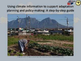
  • 1. Using climate information to support adaptation planning and policy-making: A step-by-step guide A vegetable farmer in Philippi, a suburb of Cape Town, South Africa. Source: FLICKR/KOSMOSELEEVIKE
  • 2. Make sure you have completed these preliminary steps before you start  Conducted a basic vulnerability assessment (Link to guidance= http://weadapt.org/knowledge-base/vulnerability/guidance-for-assessing- vulnerability)  Identified the key climate sensitivities and in particular taking into account the following?  livelihoods/ and economic activities?  Infrastructure and services relied upon for that site?
  • 3. Why? • You may not have thought about your problem as a question yet, but this can be a useful exercise not least because you can always check back to this question to see if you are answering it. How? • Set out some parameters of your problem by asking yourself, ‘what do I want to get out of this process’. Having realistic expectations of the answer is important at this stage. Step 1: Define the question © Micky Aldridge
  • 4. Step 2: locate the right climate station 3. Navigate to where you are working and look at what stations are around where your case study area is located. 1. Go to the Adaptation Layer. 2. Turn on the climate stations by pressing "view climate stations“. 4. Click on the closest station.
  • 5. Step 3: Investigate historical records 3. Now you can look at the whole time series of the historical data recorded at this station, looking across all the years. 1. Click through into CIP from the weADAPT placemark to look at more information that lies “behind” this overview. 2. Click on historical monthly data record. 4. Which climate variables are available in CIP? (Look at the drop-down menu.) How do these match up with the ones you wanted to look at, identified in Step 1? What extremes and patterns do you notice?
  • 6. Step 4: Investigate future projections 3. Looking at the projections consider; a) is there a clear direction of change at critical times of year that most of the models agree on? b) How much is that change? How wide is the uncertainty range? 1. Click through to the future climate scenarios (also referred to as downscaled projections) for that station. 2. Look at the variables you are interested in and compare the spread of projections across the two different emissions scenarios. 4. The default time period of projections displayed is 2040-2060, but you can change these on the slider bar as relevant to your needs.
  • 7. Step 5: Check for consistency with proximal stations 3. Check the historical data for consistency 1. Close the content box to reveal the map behind it. 2. Look at what other stations are also nearby the project site (check across the different datasets). 4. Check the future projections. Note, should there be inconsistencies, there may well be mitigating circumstances, for example Cape Point station is located on a peninsula where temperature is heavily affected by its maritime influences.
  • 8. Step 6: Analysis • Look back over the information you have gathered during Steps 2- 5 • What can you say about the climate in this place? How might it change under various future scenarios, and what this might mean for those who live and work there? • What could be done differently to adapt to current climate conditions and prepare for how these patterns might shift in the future?
  • 9. Step 7: Compare with other adaptation studies • Go back into weADAPT and search the Adaptation Layer for projects elsewhere tackling similar climate risks to see: – What adaptation options are they testing or promoting that might be worth considering as options in your study or project? – Who has experiences of implementing adaptation measures that you might be able to learn from?
  • 10. Step 8: Share your work • Document and share what you’ve done by adding it to the weADAPT platform • The easiest way to do this is through the QuickShare form • For guidance on how to share content via weADAPT go to: http://weadapt.org/knowledge- base/guidance/share
  • 11. Useful links • To see a how we work through these steps in a case study focussing on land use management and zoning in a suburb of the city of Cape Town, South Africa, go to: http://weadapt.org/knowledge-base/using-climate- information/using-climate-information-case-study • To view the full climate guidance, go to: http://weadapt.org/knowledge- base/using-climate-information/guide-to-using-climate-information

Notes de l'éditeur

  1. This presentation describes how weADAPT can be used together with the Climate Information Portal (CIP) to quickly and easily access climate data for many locations across Africa, using an interactive map. By linking the two portals, users are able to see the climate data context as they read about a project, or to find data to support their own research, project planning or policy design in a specific place or area.
  2. You might ask questions such as: When have climate impacts been experienced in the past? What time of year was it (episodes to look at in the climate data)? How often does it happen? What else was happening at that time that compounded the unfavourable climate conditions and made the impacts worse?
  3. For any location, there may be a wide range of climate data available, only some of which are relevant to what you are doing – for example, temperature projections are unlikely to be relevant in gauging future flood risks, but they would be in evaluating future irrigation needs. You should only include climate data and graphs in your reports that help explain the problem you are highlighting, the course of action you propose, and your reasons for selecting certain actions or interventions over other options.
  4. In some cases the closest station in terms of distance is not the most similar. Think about the influence of elevation, mountains, water bodies, forests, etc. when making your station selection. When the rainy periods are – which month gets the most rainfall on average? The average temperature range through the year;What time period data are available for (how far back does the record go, and how recently does it end?). You might like to download the graphic showing historical climate monthly averages so that you can add it to your project documentation, because it gives a good overview of the average climate as it has been in this place over the last few decades. If the station is not close to your project / study site, you might want to add some text drawing attention to the extent that there might be local variability in the climate. The extent of such variability is place-specific, depending on the topography, land cover, proximity to the ocean, etc.While finding the most suitable stations to work with, also check the other placemarks in the area to see what other projects are going on there: Has anyone else already conducted a climate analysis, vulnerability assessment, done an impact assessment or implemented an adaptation plan in the vicinity of your project site and uploaded information about it on weADAPT that you can learn from?
  5. In some cases the closest station in terms of distance is not the most similar. Think about the influence of elevation, mountains, water bodies, forests, etc. when making your station selection. When the rainy periods are – which month gets the most rainfall on average? The average temperature range through the year;What time period data are available for (how far back does the record go, and how recently does it end?). You might like to download the graphic showing historical climate monthly averages so that you can add it to your project documentation, because it gives a good overview of the average climate as it has been in this place over the last few decades. If the station is not close to your project / study site, you might want to add some text drawing attention to the extent that there might be local variability in the climate. The extent of such variability is place-specific, depending on the topography, land cover, proximity to the ocean, etc.While finding the most suitable stations to work with, also check the other placemarks in the area to see what other projects are going on there: Has anyone else already conducted a climate analysis, vulnerability assessment, done an impact assessment or implemented an adaptation plan in the vicinity of your project site and uploaded information about it on weADAPT that you can learn from?
  6. In some cases the closest station in terms of distance is not the most similar. Think about the influence of elevation, mountains, water bodies, forests, etc. when making your station selection. When the rainy periods are – which month gets the most rainfall on average? The average temperature range through the year;What time period data are available for (how far back does the record go, and how recently does it end?). You might like to download the graphic showing historical climate monthly averages so that you can add it to your project documentation, because it gives a good overview of the average climate as it has been in this place over the last few decades. If the station is not close to your project / study site, you might want to add some text drawing attention to the extent that there might be local variability in the climate. The extent of such variability is place-specific, depending on the topography, land cover, proximity to the ocean, etc.While finding the most suitable stations to work with, also check the other placemarks in the area to see what other projects are going on there: Has anyone else already conducted a climate analysis, vulnerability assessment, done an impact assessment or implemented an adaptation plan in the vicinity of your project site and uploaded information about it on weADAPT that you can learn from?
  7. In some cases the closest station in terms of distance is not the most similar. Think about the influence of elevation, mountains, water bodies, forests, etc. when making your station selection. When the rainy periods are – which month gets the most rainfall on average? The average temperature range through the year;What time period data are available for (how far back does the record go, and how recently does it end?). You might like to download the graphic showing historical climate monthly averages so that you can add it to your project documentation, because it gives a good overview of the average climate as it has been in this place over the last few decades. If the station is not close to your project / study site, you might want to add some text drawing attention to the extent that there might be local variability in the climate. The extent of such variability is place-specific, depending on the topography, land cover, proximity to the ocean, etc.While finding the most suitable stations to work with, also check the other placemarks in the area to see what other projects are going on there: Has anyone else already conducted a climate analysis, vulnerability assessment, done an impact assessment or implemented an adaptation plan in the vicinity of your project site and uploaded information about it on weADAPT that you can learn from?
  8. For example, how did they select which option to go for? How did they finance it? How are they monitoring the impacts?
  9. This way, if someone else wants to learn from your experience, or build on it further, they can. And if they need to do a climate assessment for their location, they can look at the steps you’ve followed as an example!