Not the Geography You Remember

If you took a Geography course over 20 years ago, you might recall the subject involving little more than memorizing the locations of continents, countries, cities, as well as climate and cultural facts. In that time, many universities have expanded their geography programs by entering the world of Geographic Information Systems, or GIS for short. In the beginning GIS was an obscure field of specialized hardware, software, and cryptic keyboard commands that allowed a skilled professional to query data to get answers to geographic-based inquiries. Queries, such as the quantity of forested acres within an area, were the beginning of the geographicbased analysis revolution that has since unfolded. But today’s leading geography programs are teaching students more than just the where, what, who, and why of our world, but also bring to the table an interdisciplinary approach to solving today’s local, regional, national, and global problems. Many of these programs are not limited to just universities, now involving the K-12 space, tapping into young people’s minds to unleash innovative ideas in what is now an interdisciplinary field. To maintain a competitive advantage in today’s world, leading countries, companies, and research organizations are embracing these new capabilities and the talent that is available in the marketplace.
Recommandé

Recommandé
Contenu connexe
Tendances
Tendances (20)
Similaire à Not the Geography You Remember
Similaire à Not the Geography You Remember (20)
Plus de Bill Bass
Dernier
Dernier (20)
Not the Geography You Remember
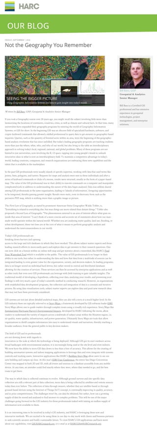
- 1. FRIDAY, SEPTEMBER 7, 2018 Not the Geography You Remember Written by Bill Bass, GISP, Geospatial & Analytics Senior Manager If you took a Geography course over 20 years ago, you might recall the subject involving little more than memorizing the locations of continents, countries, cities, as well as climate and cultural facts. In that time, many universities have expanded their geography programs by entering the world of Geographic Information Systems, or GIS for short. In the beginning GIS was an obscure field of specialized hardware, software, and cryptic keyboard commands that allowed a skilled professional to query data to get answers to geographic-based inquiries. Queries, such as the quantity of forested acres within an area, were the beginning of the geographic- based analysis revolution that has since unfolded. But today’s leading geography programs are teaching students more than just the where, what, who, and why of our world, but also bring to the table an interdisciplinary approach to solving today’s local, regional, national, and global problems. Many of these programs are not limited to just universities, now involving the K-12 space, tapping into young people’s minds to unleash innovative ideas in what is now an interdisciplinary field. To maintain a competitive advantage in today’s world, leading countries, companies, and research organizations are embracing these new capabilities and the talent that is available in the marketplace. In the past GIS professionals were usually islands of specific expertise, working with data that used terms like points, lines, polygons, and rasters. Requests for maps and analysis were sent to these individuals and after a series of keyboard commands or clicks of a mouse, results were returned, usually in the form of a paper-based map. The value of the GIS professional was in their ability to execute commands on a computer and manipulate complicated tools in addition to understanding the nature of the data begin analyzed. Data was seldom shared among GIS professionals in the same organization, leading to ‘islands of information’, foregoing opportunities to be integrated, thereby gaining greater insight. Results were static, even in electronic form such as the pervasive PDF map, which is nothing more than a graphic image or picture. The First Law of Geography, as stated by prominent American-Swiss Geographer Waldo Tobler, is, "Everything is related to everything else, but near things are more related than distant things." Tobler also proposed a Second Law of Geography, "The phenomenon external to an area of interest affects what goes on inside that area of interest.” I can’t think of a more concise and accurate set of statements about how our man- made world operates within the natural world. Whether you are analyzing water quality, land use, flooding, or urban development, these two laws are at the core of what it means to perform geographic analysis and understand the interconnectedness in our world. Today’s GIS professionals are breaking down barriers and opening access to the large and rich databases in which they have worked. This allows subject matter experts and those leading research efforts to more easily query and explore data to get answers to their research questions. One can now click on a feature within an online web map and get statistics about a watershed, like HARC’s Find Your Watershed Tool which is available to the public. The value of GIS professionals is no longer in their ability to use tools, but rather in understanding the data and how that data from a multitude of sources can be integrated leading to even greater value for the organization, society, and decision makers. In leading programs, data is no longer stored on individual hard drives, but rather stored in central and distributed databases allowing for the creation of services. These services can then be accessed by enterprise applications and as well as other tools that even non-GIS professionals can leverage with little training to gain valuable insights. The traditional model of developing a hypothesis, collecting your data, analyzing your results, and presenting your findings is still very much a part of today’s scientific method in conducting research. However, in organizations with established data development programs, the collection and integration of data is a constant and iterative process. By using data visualization tools, subject matter experts can explore data and posit new research ideas that may not have been previously considered. GIS systems are not just about detailed analytical maps, they can also tell a story at a much higher level. In the GIS industry these are typically referred to as Story Maps, a framework developed by GIS software leader ESRI. Story Maps allows one to guide readers through complex issues using a visually rich experience. Story Maps like Summarizing Hurricane Harvey’s Environmental Impacts, developed by HARC following the storm, allow readers to understand the variety of impacts across a multitude of subject areas within the Houston region, i.e. air quality, water quality, infrastructure, and power generation. Ultimately Story Maps are tools that allow organizations to distill complex information into easy to understand visuals and narratives, thereby reaching a broader audience, from the general public to key decision makers. The field of GIS and its professionals are not slowing down with regards to innovation or the scale at which the technology is being deployed. Although GIS got its start outdoors across broad landscapes with environmental analysis, it is increasingly being used at the site level and even indoors. We now have the ability to store GIS data down to less than a foot of accuracy. This allows for the creating of building automation systems and indoor mapping applications to leverage data and even integrate with systems controls and tracking assets. Interactive applications like HARC’s Building Story Map allow users to see our new building and campus up close. At this year’s ESRI User Conference, the entire San Diego Convention Center was mapped in both 2D and 3D, with all events and sessions in a database accessible from any mobile device. At any time, an attendee could find exactly where they were, where they needed to go, and the best route to get there. The way in which data is collected continues to evolve. Although ground surveys and site-specific data collection are still a relevant part of data collection, more data is being collected by satellites and remote sensors today than ever before. The collection of data through sensors, whether they are satellite-based or through ground-based devices using the Internet of Things (IoT) concept, is continually improving in quality, accuracy, and in price competitiveness. The challenges won’t be, can data be obtained, but rather, how can a growing supply of data be stored and analyzed to find answers to complex problems. This will be one of the major challenges going forward in the GIS industry for those professionals tasked with taming an endless supply of information now available to them. It is an interesting time to be involved in today’s GIS industry, and HARC is leveraging these new and innovative methods. We are excited to be using them in our day-to-day work with clients and business partners to seek scientific answers and build a sustainable future. To view HARC’s GIS applications and learn more about our capabilities, visit GIS.HARCresearch.org, or e-mail us at HARCGIS@HARCresearch.org. Bill Bass, GISP Geospatial & AnalyticsGeospatial & Analytics Senior ManagerSenior Manager Bill Bass is a Certified GIS professional and has extensive experience in geospatial technologies, project management, and enterprise solutions. SEEING THE BIGGER PICTURE Using Geographic Information Systems and data to gain insight into today's world. OUR BLOGOUR BLOG