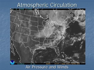
3. Air Pressure
The weight of the
atmosphere
At sea level
1013.2 mb
760 mm of Hg
29.92 in
Greatest at surface
increases with
atmospheric density
Decreases with
altitude
halves every 5.5km
5. Wind
The movement of air under the influence of
pressure.
Winds influenced by three forces
Pressure gradient
Winds move from high pressure to low pressure along a straight
line
Present at both the surface and higher levels of the atmosphere
Coriolis Force
Angular momentum from the rotation of the earth deflects
straight line motion
present at both the surface and higher levels (vertically)
Weakest at the equator and increases with latitude
Friction Force
Opposes motion along the path of motion, independent of
changes in the path
Present at the surface but NOT higher levels
6. Balance of forces produces rotational motion
of winds. For Northern Hemisphere
Clockwise out from high pressure at surface
Clockwise around high, at higher altitudes
Anti-cyclone
Counterclockwise into low pressure at surface
Counterclockwise around low, at higher altitudes
Cyclone
Geostrophic Winds Geostrophic Winds
7. Refer to the animations for:
Coriolis Effect
Wind Patterns
Cyclones and Anticyclones
8. Global Patterns of Pressure
In general:
Low pressure occurs where there is lifting
of the air. Typically carries up moisture.
Lifting mechanisms
Convergent Lifting (ITCZ)
Convectional Lifting (ITCZ)
Frontal Lifting (Subpolar Low)
[Orographic Lifting]
High pressure occurs where air is falling.
Typically very dry air.
9.
10. Equatorial Low Pressure Trough
High insolation causes convectional and
convergent lifting
Provides uplift for Hadley Cells
Intertropical Convergence Zone (ITCZ)
Follows the subsolar point (with lag time)
Trade Winds
Subtropical High Pressure Cells
Downdraft portion of Hadley Cell System
Hot, dry air
Westerlies
Subtropical Jet Stream
Subpolar Low Pressure Cells
Frontal Lifting, Cool moist air
Polar jetstream
11. Polar High Pressure
Polar easterlies
Cold Deserts
Form over continental masses
Canada, Siberia
Antarctica
12.
13.
14.
15.
16.
17. Upper Atmosphere Circulation
Geostrophic wind
Wind flow is parallel to the isobars
Wind shear with surface winds contributes
to cyclone formation, storms
Rossby Waves
Jet Streams
18.
19. Rossby Waves
Form under the
subpolar lows
Create tongues of
cold air
Send cold air to the
lower latitudes
Stronger during the
winter months
Subtropical highs
are at lower
latitudes, exert less
force against the
cold polar
airmasses
20. Jet streams
Bands of rapidly moving air
300 km/h
Form at the intersection of the tropopause and colliding
airmasses
Flattened
160 - 480 km wide, 0.9 - 2.15 km thick
When passing over cyclones, cause rapid uptake of air
(extreme low pressure) and severe weather
Polar jet stream
7600 - 10,700 m altitude
Forms at the subpolar low pressure zone (where
subtropical highs abut the polar highs)
30 – 70o Latitude
Subtropical jet stream
9100 – 13,700 m altitude
Forms where tropical and midlatitude air masses collide
(subtropical high)
20 – 50o Latitude
21.
22. Local Winds
Form in response to
Form in response to
Terrain
Differences in temperature patterns, create localized high
and low pressure systems
Land-Sea breezes
Caused by differences between land-sea heating
Daytime:
Land is hotter than ocean: Low pressure forms over land
Winds flow from the oceans inland
Nighttime
Ocean is warmer than the land: Low pressure forms over ocean
Winds flow from the land out to sea
Mountain-Valley Breezes
Daytime: warm valley air flows upslope
Nighttime: rapid cooling of mountain causes it to flow
downslope
23. Katabatic Winds
Cold air masses that form in upland areas and
move down-slope under the influence of gravity
(not pressure differentials)
Common in Greenland and Antarctica
Also called mistral (French Alps and Rhône Valley),
bora (Adriatic region), taku (Alaska)
Chinook Winds
Occurs when a steep pressure gradient develops
astride a mountain range, with high pressure on
the windward side and low pressure on the
leeward side.
High winds speeds, descending winds are warm
and extremely dry
Chinook (Rockies), Santa Anas (California), Foehn
(Alps)
24.
25. Monsoons
A seasonal variation in wind patterns and rainfall
Summer months characterized by onshore flow of
moisture-laden maritime winds
Extremely high rainfall
ITCZ has passed over the land, drawing in winds
Winter months characterized by offshore flow of dry
continental winds
Very little rainfall
ITCZ has passed back out to sea, Subtropical Highs form over
continents, driving winds out to sea
The seasonal pattern is characterized by marked wet
and dry seasons
Half of the world’s population lives in areas
dominated by monsoons
Developing countries, dependent on agriculture and
rainfall
26.
27.
28.
29. Ocean Currents
Surface Currents
Driven primarily by surface winds
Equatorial currents driven by trade winds
Gyres are rotational currents driven by the subtropical
highs
Western Intensification: As equatorial currents reach
the Western edge of oceans (i.e., the Eastern edge of
continents) water piles up against the shore (up to 15
cm), drives water northward or southward
Gulf Stream and Kuroshio current
Upwelling Currents: When currents flow away from
continents, pulls cooler, deeper water up from below
nutrient rich, prime fisheries
Downwelling Currents: where water accumulates,
some is driven downwards
30. Thermohaline currents
Driven by differences in salinity, density
and temperature
Slow moving (takes 1000 years to
complete a circuit)
Moves enormous quantities of water
Downwelling in the Labrador Sea, due to
cooling
Upwelling in the Indian Ocean and North Pacific
May help to regulate climate, by absorbing
and redistributing heat energy
Global warming my disrupt downwelling
If so, then increased surface heating would
compound global warming (positive feedback)
31. Oscillations
Alternating weakening and
strengthening of high and low pressure
systems that disrupt the general
circulation pattern
Produce droughts and floods
Four identified major oscillations
ENSO
NAO
AO
PDO
32. ENSO (El Niño - Southern Oscillation)
Weakening and reversal of South Pacific equatorial
and subtropical high and low pressure
Affects surface currents, upwelling
El Niño produces warmer ocean temperatures, La
Niña produces colder conditions
Effects (El Niño unless specified otherwise)
Disrupts fisheries off South American coast
Intense hurricanes in the South Pacific
Droughts: Southern Africa, Southern India, Australia,
Phillipines
Floods: USA, Bolivia, Cuba, Ecuador, Peru
El Niño produces more rain in SW US
La Niña produces more rain in the Pacific NW.
33.
34.
35.
36. NAO (North Atlantic Oscillation)
Variations in strength between Icelandic low (subpolar
low) and Azores high (subtropical high)
Positive phase: weakening of low, strengthening of
high
Increased pressure gradient, strong winds (westerlies)
Moderates winters in the US
European winters characterized by storms and high rainfall
Mediterranean areas are drier than usual.
Negative Phase: weakening of pressure gradient
low winds
cold air masses further South
US has cold, snowy winters
Europe has dry, cold winters
Mediterranean areas are wetter than usual
Patterns appear to fluctuate with the AO
37. AO (Arctic Oscillation)
Warm Phase: Lower pressure than normal
over the North Pole, relatively higher
pressures to the south
Milder winters in the Northern Hemisphere
Stronger westerlies
Influx of warm Atlantic water into the Arctic
ocean
Cold Phase: Higher pressure over North
Pole and lower pressure over the Atlantic
Colder winters in Northern Hemisphere
Thickening of sea ice
38. PDO (Pacific Decadal Oscillation)
Longer period of variation than ENSO
PDO: 20-30 years
ENSO: 2-12 years
Variations occur between two regions
Region 1: Northern and Tropical West Pacific
Region 2: Eastern Tropical Pacific, along East Coast of
Central and South America
Positive Phase
Lower than normal temperatures in Region 1 and higher than
normal in Region 2
1977-1990
Negative Phase
Higher than normal temperatures in Region 1, lower than
normal in region 2
1947 – 1977, 1990 – present
Causes dry conditions in the southwestern US
Possibly linked to AO