Seismic Hazard Assessment
•
7 j'aime•2,873 vues

Presentation on Seismic Hazard Assessment at 1st JICA ERAKV Project Seminar

Recommandé
Contenu connexe
Tendances
Tendances (20)
En vedette
En vedette (20)
Similaire à Seismic Hazard Assessment
Similaire à Seismic Hazard Assessment (20)
Dernier
Dernier (20)
Seismic Hazard Assessment
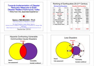
- 1. 1 The project for Assessment of Earthquake Disaster Risk for the Kathmandu valley in Nepal (ERAKV) Seismic Hazard Assessment and Results By Mukunda Bhattarai Seismologist (NSC/DMG) & Fumio Kaneko JICA Project Team First Seminar, “Towards Resilient Kathmandu Valley” September 16, 2016
- 2. 2 Contents Schedule of seismic Hazard Assessment Procedure of Seismic Hazard Assessment Setting of Scenario Earthquakes Development of Ground Model Characteristics of Gorkha Earthquake Assessment Results
- 3. Bedrock layer (3) Evaluation of Bedrock Motion (2) Ground Modelling Deposit Layer Ground Surface Seismic Source Attenuation Equation 3 Response Analysis (1) Setting of Scenario Earthquake (4) Site Response Analysis (5) Seismic Motion at Ground Surface Schematic Image of Seismic Wave Propagation (6) Estimation of Liquefaction & Slope Failure
- 4. Determined after taking into account of comments from Scientific Community 4 Three Scenario Earthquakes (1) Far-Mid Western Nepal Eq., Magnitude = 8.6 (2) Western Nepal Eq., Magnitude = 7.8 (3) Central Nepal South Eq., Magnitude = 7.8 Two Verification Earthquakes (a) Recurrence of the 1934 Bihar-Nepal earthquake, Magnitude = 8.3 (b) Recurrence of the 2015 Gorkha earthquake, Magnitude = 7.8, 7.3 KV Setting of Scenario Earthquakes
- 5. 5 KV SATREPS (Tokyo Univ., DMG) provided the fault model details M=8.6 M=7.8 M=7.8 M=7.8 M=8.3 Largest Aftershock M=7.3 Far-Mid Western Nepal Scenario Eq. Model Western Nepal Scenario Eq. Model Central Nepal South Scenario Eq. Model Gorkha Eq. Model 1934 Eq. Model Magnitude 8.6 7.8 7.8 7.8 8.3 Type Reverse Reverse Reverse Reverse Reverse Scenario Earthquake Verification Earthquake Scenario Earthquake Fault Model Three Scenario Earthquakes and Two Verification Earthquakes (set technically, for disaster management purpose)
- 6. 6 Scenario Earthquake Fault Model (2002) Three Scenario Earthquakes and One Verification Earthquakes (different from 2015 Gorkha earthquake)
- 7. 7 Final-slip distribution of Gorkha earthquale 2015 Gorkha earthquake is different from 2002 Scenario earthquakes, Mid Nepal Earthquake North Bagmati Earthquake
- 8. 8 1. Collect & Produce Ground Information a) Drilling data (449), PS logging (5), b) Geotechnical and Geophysical (Gravity Anomaly) data etc. c) (Produced) Geomorphology map, geological cross sections 2. Conduct Microtremor Measurements for Vs structure a) 210 single points from Ehime University (existing), b) 308 single points, 74 L-shape array, 39 three-points array, c) 5 tripartite large scale array (conducted by this project) Development of Ground Model
- 9. 9 3. Grid size: 250mx250m, 11,934 grids, max depth more than 550m (2002 project: grid size 500mx500m, 2,826 grids, max 100m depth) 4. Geological structures based on geological cross sections, and Vs structures based on array microtremor measurements 5. Ground Model at each grid for ground motion analysis - layer classification, soil type, thickness, Vs, density etc. 6. Preparation of AVS30, Susceptibility maps, Tg, etc. Contd…
- 10. 1. Originally “mountainous area” 2. Gradually settled due to tectonic movement and formed basin 3. <around one million years ago> Kathmandu Valley was turned to “Old Kathmandu Lake” 4. Lake deposits were piled as Tarebhir, Lukundol and Kalimati Layers, etc. 5. <after around 50 thousand year ago> lake water level changes made several terrace faces such as Tokha, Gokarna, Thimi and Patan with each elevation level 6. <around 10 thousand years ago? to nowadays> Lake water flown out from Chobar canyon, and Recently rivers deposit alluvial layers (sub-surface layers) along river, forming alluvial plain, valley plain etc. Brief History of Kathmandu valley 10
- 11. Reflecting surface geology and topography derived from sedimentary environment 11 Based on 1:15,000 aero photos Contd… Geomorphological Map
- 12. Ground softness Map (AVS30) Liquefaction Susceptibility Map Slope Failure Susceptibility Map 12 Seismic zoning Maps Development easy to grasp rough sketch of ground nature
- 13. 13 Chandragiri fault is “active” or not? Tectonic Structure in Kathmandu Valley If active, If generate earthquake, what will happen? Serious condition for Kathmandu.
- 14. • Setting target area and grid size • Setting depth of bedrock distribution (gravity exploration and drilling) • Compiling sub-surface ground layers, • Setting their composition and structure (geomorphological map, geological cross sections etc.) • Surveying Vs value for sub-surface ground layers ( In this project by microtremor measurement) • Adjusting Vs values for each ground layers • Setting ground model (soil column) with numerical values • Modelling factors are Vs, density, width etc. for earthquake response calculation 14 Ground Modelling for Seismic Hazard Assessment
- 15. 15 Rock depth contour by gravity anomaly Rock Surface contour Rock Depth and Rock Surface Contour Bed rock surface shape is originally mountainous area?
- 16. Geological Cross Section Development G-line E-line F-line 16 Lines1-11 A – N lines ERAKV 4th JCC WG1 2016/09/14Produced by this project from geological map, drilling data etc. for 25 sections with interval 2km Rock surface and layer distribution are not simple Many outcrops Kirtipur, Pashupatinath, Swayanbu, hidden ridge at Lalitpur etc.
- 17. Geological Cross Sections E-Line F-Line G-Line Ground Models (soil structure) for Grid System (for around 12,000 grids of 250mx250m, maximum depth more than 550m) Lines1-11 A – N lines ERAKV 4th JCC WG1 2016/09/14
- 18. 18 Array Microtremor sites for Vs structure
- 19. Setting Vs structure of Geological Layer Vs structure for Sub-surface layers are given from the developed relations based on the results of L-shape Microtremor Measurement and Geomorphological units. 19 AM01 AM02 AM03 AM04 AM05 (TU) (IoE) (Thimi) (Tundikhel) (Manohara) 0 f 0 vp 200 0 Th 200 0 vp 170 0 al 180 11 klm 15 klm 20 klm 25 klm 28 lkl 36 klm 290 300 230 45 Tarebhir 50 77 lkl 230 87 Tarebhir 370 410 94 WR 520 103 lkl 119 lkl 116 Tarebhir 128 Tarebhir 130 Tarebhir 134 WR 610 420 390 400 230 250 WR 450 500 275 520 360 WR 580 454 WR 730 Geological Layer Vs (m/sec) Kalimati 250 - 320 Tarebhir 400 - 500 Weathered Rock 600 Determined by Triangle Array Microtremor Survey results with DMG
- 20. 20 Predominant Period of Single Point Microtremor Measurement Longer periods of predominant period of ground for central area
- 21. 21 0 1 2 0 1 2 3 4 5 6 QuaterWaveleng Observed MT 1st Peak Period (sec) dot line 1 dot line 2 solid line 0 1 2 3 4 5 6 0 1 2 3 4 5 6 TransferFunc.1stPeakPeriod(sec) Observed MT 1st Peak Period (sec) Comparison of 1st Peak Period between MT (1st) and Ground Model (1st, transfer fuction) ERAKV 1 ERAKV 2 Kukidome Paudyal ERAKV1 (Array) dot line 1 dot line 2 solid line 0 1 2 3 4 5 6 0 1 2 3 4 5 6 TransferFunc.2ndPeakPeriod(sec) Observed MT 1st Peak Period (sec) Comparison of Peak Period between MT (1st) and Ground Model (2nd, transfer fuction) ERAKV 1 ERAKV 2 Kukidome Paudyal ERAKV1 (Array) dot line 1 dot line 2 solid line 0 1 2 0 QuaterWaveleng 0 1 2 0 1 2 3 4 5 6 QuaterWaveleng Observed MT 1st Peak Period (sec) dot line 1 dot line 2 solid line Tg by Single-Point Microtremor corresponding to First peak, Second peak of Transfer function by SH wave multi-reflection theory using ground models. Predominant Period of Single Point Microtremor Measurement Showing 2 groups of longer period and shorter period
- 22. Predominant Period by ground model 22 Tg (first peak) of Transfer function by SH wave multi reflection theory 0 1 2 3 4 5 0 1 2 3 4 5 6 QuaterWavelengthPeakPeriodatUpperWR Observed MT 1st Peak Period (sec) ERAKV 1 ERAKV 2 Kukidome Paudyal ERAKV1 (Array) dot line 1 dot line 2 solid line 0 1 2 3 4 5 6 0 1 2 3 4 5 6 TransferFunc.1stPeakPeriod(sec) Observed MT 1st Peak Period (sec) Comparison of 1st Peak Period between MT (1st) and Ground Model (1st, transfer fuction) ERAKV 1 ERAKV 2 Kukidome Paudyal ERAKV1 (Array) dot line 1 dot line 2 solid line 2-4 seconds of predominant period of ground for central area corresponding to first peak by ground model
- 23. 0 1 2 0 1 2 3 4 5 6 QuaterWavelen Observed MT 1st Peak Period (sec) dot line 1 dot line 2 solid line 0 1 2 3 4 5 6 0 1 2 3 4 5 6 TransferFunc.1stPeakPeriod(sec) Observed MT 1st Peak Period (sec) Comparison of 1st Peak Period between MT (1st) and Ground Model (1st, transfer fuction) ERAKV 1 ERAKV 2 Kukidome Paudyal ERAKV1 (Array) dot line 1 dot line 2 solid line 0 1 2 3 4 5 6 0 1 2 3 4 5 6 TransferFunc.2ndPeakPeriod(sec) Observed MT 1st Peak Period (sec) Comparison of Peak Period between MT (1st) and Ground Model (2nd, transfer fuction) ERAKV 1 ERAKV 2 Kukidome Paudyal ERAKV1 (Array) dot line 1 dot line 2 solid line 0 1 2 0 1 2 3 4 5 6 QuaterWavelen Observed MT 1st Peak Period (sec) dot line 1 dot line 2 solid line Second Dominant Period by ground model 23 Tg (second peak) of Transfer function by SH wave multi reflection theory 1-1.5 seconds of predominant period of ground for central area corresponding to second peak by ground model
- 24. Ground Model Confirmation 24 0.1 1 10 100 0.1 1 10 H/V Period(sec) H/V of Earthquake Obs. at DMG 20150425 20150426 20150512 Average 0.1 1 10 0.1 1 10 H/V Period (sec) H/V Microtremor at DMG 0.1 1 10 100 0.1 1 10 FourierSpectralRatio Period (sec) DMG/PKI Fourier of Earthquakes 201505120705 20150512073709 Average 0.1 1 10 0.1 1 10 Amplification Period (sec) Amplification by Response Analysis at DMG Records are courtesy of DMG first peakfirst peak second peaksecond peak
- 25. Development of Ground Model 25 Ground Models for Grid System with 250mx250m, and maximum depth more than 550m Predominant Period of the ground calculated from ground model 3 dimensional view S edim ent K lm Lkl T arebhir W R Pashupatinath Kirtipur Lalitpur Madhyapur
- 26. 26 Attenuation Equations (calculation of bedrock motion) Since in Nepal strong motion attenuation equation has not been developed, Among the numerous Attenuation Equations in the World, New 4 equations of NGA (New Generation Attenuation by USGS) are selected. Because NGA equations are popularly used in the world and NGA equations can be utilized many regions of the world with various parameters like fault type, ground condition etc. Therefore, they can be applied to Nepal. 1) Abrahamson N. and W. Silva (2008) 2) Boore D. M. and G. M. Atkinson (2008) 3) Campbell K. W. and Y. Bozorgnia (2008) 4) Chiou B. S.-J. and R. R. Youngs (2008)
- 27. Recent 4 NGAAttenuation Relations 27
- 28. 28 Ground Model for Response Analysis for surface layers
- 29. Input motion at rock surface (Kirtipur: main shock) 29 Ground surface Rock surface
- 30. Amplification/Response of Ground 30 AVS30 (Average Vs) Small Input (amplification moderate) Predominant Period Large Input (amplification singular)
- 31. Singularity of the Gorkha Earthquake 31 PGAs observed values were very less than calculated values observed≪calculated in PGA Ratios are around from 1/5 to 1/3 (main shock), around from 1/3 to2/3 (largest aftershock) Correction Factors are adopted in the project 50 500 1/4 1/2 Observed Calculated PGA(gal) 100 200 2015 Gorkha earthquake Main Shock largest aftershock Ex. Source regions of 1985 Chile and Mexico earthquakes
- 32. (Modification by x1/5) (Modification by x1/2) The 2015 Gorkha Eq. (No Modification by x1/1) The largest aftershock of the 2015 Gorkha Eq. (No Modification by x1/1) The 1934 Bihar-Nepal Eq. (No Modification by x1/1) PGA for Verification Earthquakes (1) 32 Need no correction Adjust to observed
- 33. 33 The 1934 Bihar-Nepal Eq. (Modification by x1/2) The 1934 Bihar-Nepal Eq. (No Modification) The 1934 Bihar-Nepal Eq. (2002 project) Year Total Buildings Population Remarks 1833 7.3-7.7 3,565 29% 296 0.59% 12,500 50,000 Masonry 1934 8.4 55,739 71% 4,296 1.36% 78,750 315,000 Masonry 2015 7.8 91,150 15% 1,713 0.07% 614,777 2,517,023 RC+Masonry 2015 7.8 72,920 39% 1,370 0.18% 188,750 755,000 Masonry Damage to Buildings Deaths (references: Oldham(1883), Rana(1935), UNDP(1994), Bilham(1995, Web), NPC(2015), Ohsumi(2015) , Sapkota(2016) and Bollinger(2016)) PGA for Verification Earthquakes (2) Need no correction compared with actual Damage at the time Tried x1/2 factor, but Smaller than actual damage level due to 1934 EQ
- 34. PGA for Scenario Earthquakes 34 Far-Mid Western Nepal Eq. No Modification by x1/1 Western Nepal Eq. No Modification by x1/1 Central Nepal South Eq. Case 1 : Modification by x1/3 Central Nepal South Eq. Case 2 : Modification by x1/2 Central Nepal South Eq. Case 3 : Modification by X2/3 Central Nepal South Eq. Case 4 : No Modification by x1/1 Similar level of Gorkha EQ PGA will be overestimated
- 35. Comparison of historical earthquake damage in the Kathmandu Valley 35 1934 > 2015~1833 > 2015 largest aftershock 2015 Gorkha (M7.8) 50,984 (8.3%) 40,166 (6.5%) 1,713 (0.1%) 9,024 (0.4%) 614,777 2,517,023 Mid Nepal (M8.0) 53,465 (20.9%) 74,941 (29.3%) 17,695 (1.3%) 146,874 (10.6%) North Bagmati (M6.0) 17,796 (6.9%) 28,345 (11.1%) 2,616 (0.2%) 21,913 (1.6%) KV local (M5.7) 46,596 (18.2%) 68,820 (26.9%) 14,333 (1.0%) 119,066 (8.6%) 1934 Bihar (M8.4) 58,701 (22.9%) 77,773 (30.4%) 19,523 (1.4%) 162,041 (11.7%) Damage of 2015 Gorkha earthquake Current Scenario earthquakes and damage assessment of 2002 project At the time ot 2002 256,203 1,387,826 Earthquakes Damage of Buildings Casualty No. of Buildings Population Heavily Partly Death Injured After JICA, 2002 Year Total Buildings Population Remarks 1833 7.3-7.7 3,565 29% 296 0.59% 12,500 50,000 Masonry 1934 8.4 55,739 71% 4,296 1.36% 78,750 315,000 Masonry 2015 7.8 91,150 15% 1,713 0.07% 614,777 2,517,023 RC+Masonry 2015 7.8 72,920 39% 1,370 0.18% 188,750 755,000 Masonry Damage to Buildings Deaths (references: Oldham(1883), Rana(1935), UNDP(1994), Bilham(1995, Web), NPC(2015), Ohsumi(2015) , Sapkota(2016) and Bollinger(2016))
- 36. Liquefaction history in the Kathmandu Valley during 1934 and 2015 earthquakes 36 Liquefaction sites are locating in Geomorphological units of al, vp, fr, nl For 2015 EQ. 11 locations are identified by J-RAPID, but are small scale and most area Not-liquefied.
- 37. 37 Liquefactionresistanceratio(τl/σ’z)or Equivalentcyclicshearstressratio(τd/σ’z) Corrected N-value (Na) FL (Liquefaction Factor) = (force to liquefy)/(resist liquefaction) FL>1 liquefaction possible FL<1 liquefaction not possible PL = depth weighted (1-FL) Criteria for liquefaction possibility (Architectural Institute of Japan) Judgement of liquefaction possibility PL=0 (O) No possibility 0<PL<=5 (L) Low possibility 5<PL<=15 (M) Moderate possibility 15<PL (H) High possibility (left) Depression at Tundhikel (right) Fissure in the road to Balaju during the 1934 Bihar-Nepal earthquake (Rana, 1935)resist liquefaction forcetoliquefy
- 38. Liquefaction assumption result for verification earthquakes (rainy season) 2015Gorkha EQ Largest Aftershock of 2015Gorkha EQ 1934 Bihar-Nepal EQ 1 Bagmati River drainage (South of Chobar) Distance from River Dry Season Rainy Season 2 lower than 1290m (Valley central) a. within 250m 1m 0m 3 1290-1295m (Valley central) b. 250m - 500m 3m 2m 4 1295-1305m (Valley central) c. More than 500m 5m 4m 5 1305-1325m (Valley central) 6 higher than 1325m (Valley central) al Alluvial Low land (O) fr Former River Course (L) nl Natural Levee (M) vp Valley Plain (H) Area Division Ground Water Level High possibility Geomorphology Judgment of Liquefaction Possibility No possibility Low possibility Moderate possibility 38 Soil Properties are insufficient and they are assumed! Only a few None Some
- 39. Far-Mid Western Nepal Scenario EQ Western Nepal Scenario EQ Central Nepal South Scenario EQ (x1/3) Central Nepal South Scenario EQ (x1/2) Central Nepal South Scenario EQ (x2/3) Central Nepal South Scenario EQ (x1/1) Liquefaction assumption result for Scenario earthquakes (rainy season) 39 Soil Properties are insufficient and they are assumed! Only a fewNone Some Some more More Much Similar level of Gorkha EQ
- 40. 40After Engineering, Environmental Geology Map by DMG, 1998 Slope failure history in Kathmandu Valley
- 41. Concept of earthquake induced slope failure assessment method by Tanaka et al. (1980) Tanaka (1980)’s equation ac = g*(C/γ*h + (cosθ*tanφ- sinθ)) Where ac: critical acceleration including the slide (PGA) g: acceleration of gravity C: cohesion of soil φ:internal friction angle of the layer γ: unit weight of soil θ: angle of slope h: thickness of the sliding layer Failure of road along Bagmati River near Khokana caused by the 2015 Gorkha earthquake (after KUKL) Soil Properties are insufficient! PGA, Soil Properties and slope angle are fundamental factors
- 42. Earthquake induced slope failure assumption result for verification earthquakes Gorkha EQ Largest aftershock of Gorkha EQ 1934 Bihar-Nepal EQ 42 Soil Properties are insufficient and they are assumed! Only a few None Some
- 43. Far-Mid Western Nepal Scenario EQ Western Nepal Scenario EQ Central Nepal South Scenario EQ (x1/3) Central Nepal South Scenario EQ (x1/2) Central Nepal South Scenario EQ (x2/3) Central Nepal South Scenario EQ (x1/1) Earthquake induced slope failure assessment result for scenario earthquakes 43 Soil Properties are insufficient and they are assumed! Only a fewNone Some Some more More Much Similar level of Gorkha EQ
- 44. 1. 2015 Gorkha Earthquake Records and Damage data provided most important information. 2. Setting Scenario Earthquakes discussed with DMG as well as through national and international experts comments. 3. Gorkha Earthquake brought Singular facts, many experts said “Lucky”, in low input motion and soil non-linearity 4. This Project could provide remarkable Soil Modelling data: 1) Detailed Geomorphological map development 2) Geological cross section development provided structure and distribution of geology and soils 3) Array Microtremor measurements provided dynamic properties such as Vs structures of geological layers 4) Detailed modelling for 250mx250m of 11,934 grids, max depth ~550m 5. These results of PGA, PGV, MMI, Sa(T), Liquefaction, Earthquake induced Slope Failure can be used for Seismic Risk Assessment as well as Disaster Management Planning. Output of Seismic Hazard Assessment
- 45. Some observations • This Project focused KV, but Earthquakes affect not only KV. At the same time, western portions, Terai and other regions shall be affected and to be taken care of. • Magnitude of Central Nepal South Scenario earthquake would be overestimated. According to historical experiences, PGA due to the cases of x1/1 or sometimes x2/3 would be overestimated. • Insufficient data often provides rough but more vulnerable output, from disaster management point of views. Especially for liquefaction and slope failure assumption in the Project. • Some remaining issues are expected to be followed and enhanced by SATREPS. • Damage to buildings by Gorkha earthquake were affected some from ground/soil condition, but mainly from building condition. • Need more historical study, basic study and more resources! • Thank you for your cooperation